Thursday, May 31
Get Ahead, Catch Up, and A Teaser
Alan Solomon's LEJOG journey is back on the northward path once more, after completing that little saunter, the TGO Challenge (A two week walk across the wilds of Scotland - pah!)
Telephonic communications have been restored and there's multiple updates on his blog, along with some local colour; And the Queen; Courtesy of your's truly as back room boy
;-)
Meanwhile news that Judy Armstrong's Alpine Challenge has come to an end; But fear not she's decided on a different approach. More details here.
I'm intrigued to understand Judy's change of mind. Her 22 May post states "Lacking the willpower and mental strength for this walk, I have decided to change my plans and not walk around the Alps this year. I find it lonely and uncomfortable in a tent, and look forward to returning to civilisation (people!) at the end of the day. I'm not fond of lugging a 20lb pack about either"
Bearing in mind Judy's prior experience and her unquestionable commitment to this challenge those reasons, whilst undoubtedly very valid, are not something that she did not expect beforehand (see her FAQ)
Judy. If you're reading this - whatever made you amend your challenge (and it's a very brave but sensible move to say No, but always a difficult decision to question a dream) I hope you're OK and getting the right level of enjoyment out of what you are now doing. And please stay positive!
Lighthiker has a few thoughts as well.
And finally (as they say on News at Ten)..........
I'm currently in communication with an established 'name' from the formative years when Outdoor Walking/Camping blossomed in the 1970s.
We've been trading e-mails on the roles and aims of blogging & traditional print media.
During the course of the conversation I'm reminded of the debt we all owe to those that came before. Those who were instrumental in communicating the approach and gear innovations to what we now know as modern backpacking. I hope to bring you more if the person concerned is happy to let it be so. More to come. Hopefully.Labels: books, uk walking blog
Wednesday, May 30
Blog readership patterns
Are you reading this on a Monday or Tuesday?
Chances are, according to my web stats, the majority of you may be.
Looking at my visitors since Jan 1st this year, 50% of you drop by on Sunday to Tuesday, with the great majority calling Monday/Tuesday. I suspect this may be the once a week readers.
But why these days I wonder? Sunday visits I can understand. Something to do as the weekend jollity starts to wind down. Hopefully a brief respite to alleviate thoughts of the dreaded Monday morning workday, a return to being surrounded by four walls.
But Mon/Tues? You can't all be reading this instead of working surely? Or are you?
Anyone care to enlighten me on this one?Labels: blog media
Tuesday, May 29
Mad Max killed Toe Cutter; Or Footloose?
The early 80s; VHS films just making their entry into UK living rooms, and the sight of Kawasaki Z900 motorcycles being unceremoniously trashed, en-mass. A friend of mine, a Z900 junkie adored the film, but can't watch it these days due to the wholesale destruction of what are now Highly Collectible Classic Motorcycles selling for upwards of £4k. And that film trashed a lot of Z900s.
But to my point. Or more like points. Ten of them.
I'm off to the Lakes next week, and have been casually collecting my food store for a few weeks now, new ideas to try out. But more importantly I've also been preparing my bodily bits as well.
Settle down at the back for this is serious stuff. No sniggering!
One of the key areas is naturally the FEET. Painful feet equals a miserable walking experience. Period. You can be the fittest person on the hills, but without comfort down below you're going nowhere. It's pointless spending hours training on a rowing machine if your feet haven't had similar attention. They might be ok for a couple of hours, but the constant thumping steps for a 8 - 10 hour backpack requires a different sort of preparation (My pedometer once estimated 15,000-20,000 steps for a 20 mile walk)
One tip I picked up from my years of running was to prepare for a race well in advance. Pre race night I could expect not to sleep too well, so the advice was to get the shut-eye the night before the final night (hope that makes sense)
Similarly, feet preparation was best done well before the event. And I don't mean the last couple of days either.
While walking, feet injury is occasional, but it tends to happen over a long period of constant (ab)use. Whereas I've totally stripped the skin off two of my toes in a 90 minute 'fun' race, and not even noticed until the trainers came off. Hmm. Oooo, now that's what I call fun. Not.
So pedicure those feet before you go out on the hills. And not the night before. Give them a chance to settle down whilst your still kicking around the local neighbourhood.
Toenails cut short? Ends filed off smooth? There now, that's better. No snaggy nails to rip the ends of your socks, or to cause you increasing pain as those downhill bits come along pushing the tootsies into the boot end, however well laced they were at the top of the descent.
Similarly if you are someone who builds up callouses, and if you walk or run regularly that has to be the case, then work on them to remove any excess. At worst they will rub within you sock/boot and become another hot spot for problems as your journey continues.
'An army marches on its stomach' (Napoleon Bonaparte) Backpackers prefer to use feet.
Don't get mad. Max. But do get toe cut...errr.Labels: Gear
Website counter
Another techie bit. So I'll keep it quick rather than bore the pants off you
If you happen to use the free Statcounter.Com service it's just been upgraded to keep the last 500 items, but you'll need to update the settings on your own account.
I'm out of here.Labels: blog media
Monday, May 28
Want to blog about walking and the great outdoors?
And whilst we're on the subject of Blogging.....
It's all far too easy to get hung up on the mechanics of this media. Slavishly watching the site stats. Trying to work out how to get those punters in. Then we can pack in the day job when we strike that big book & film deal that naturally will come our way due to the incredibly superb content we all provide.
Right?
No of course not.
So here's an article to put it into perspective.
One to reread occasionally to remind you why you started in the first place.
And it wasn't anything to do with filthly lucre now was it?
A sharing of a passion.Labels: blog media
Fiddling about -Blog website management
A bit of site testing over the next few days to see whether it improves the stats coming back in about visitor interest & search activity (You can tell the weather's rubbish can't you!)
Thanks for the tips Paul
....edit.....
And having looked over the tips there's plenty of ideas for anyone whose interested in the mechanics of blog constructiona, hosting, visitor monitoring & getting the word out. More than enough to while away many feckless hours chasing down links and ideas. So here's the relevant starting points:
Search engine ratings
Optimising your website
And the source of most of these goodies - Daily Blog Tips
Nice one Paul - that's my free time down the tube (lol)
....edit.....Labels: blog media
Wanwright -Ridge Walks
As one who hates sweating up the hilly bits, but adores the ridge walking when I get there, I first came across this excellent (and free!) set of simple maps linking the Wainwrights via the ridge a couple of years ago.
Well done Lake District Desktops and a simple idea well executed.
There's a lot of highly useful reference material on this site, which has been around since 2003 and well worth the meander around.
Very handy to download and stick in the back of a map for planning purposes?Labels: Lake District, Trip Planning
Sunday, May 27
My Magic Number
Whoooooo! 10,ooo visitors to this site since I posted the first item on 25 July 2006.
Since then I've made a lot of new friends; A couple of enemies; And been a big hit with certain Nigerian gentleman with money making opportunities;
Thanks to all who drop by and read. I'll try to keep it coming. And who knows, perhaps one day I'll finally settle on a common style approach rather than the outbursts and wild ranting.
But then, a passing voice shouts from my past:
"When the going gets tough, the weird turn pro"; "Buy The Ticket, Take The Ride" Hunter S Thompson
So who knows?
Let's just do it.Labels: blog media
Wainwright on TV
If you happened to have caught the recent short TV series on AW walks, some gossip via the Keswick Mountain Festival, courtesy of Andy from the Lake Landers website. It appears that the BBC have commissioned 6 more programmes on Wainwright walks and ITV have some ideas themselves.
But looking at the audience viewing figures, peaking at 2 million viewers that is hardly surprising. Thos sort of figures far exceed many of the top rated programmes from many of the cable channels.
Digging a bit more into this I've found details of a TV link-up book due out June 2007 to 'accompany the 5 part BBC series of Wainwright Walks, its 6 part sequel, and the 7 part Granada series Wainwright Country'.
I only recall 4 programmes in this year's release, so that might explain the next batch of programmes?
However reading the book's synopsis on Amazon I'm not sure whether some (all?) of this may refer to the original 'Walking with Wainwright' series from the 80s.
Whatever. We are becoming media friendly all of a sudden. What's next? Reality TV with Langdale MRT? A cross between Casualty & Vets in Practice? It's about the only Rescue Service that hasn't been TV'd yet.
It's time is-a-coming surely?Labels: Lake District
The Woody Woodpecker Show

A slight delay to this afternoon's walk in the jaunt as this little fellow seemed disinclined to leave his hiding place, where Mum(Dad?) Greater Spotted Woodpecker kept returning to feed him up.
A good hiding place, out of the wind and rain. But not a place that you'd normally find one of these shy birds.
Which was perched on a concrete bird bath, about 3 foot from my back door, where we're located in the middle of a largish housing estate.
It made getting out outside, without unduly disturbing the Woody family, a little interesting.
Guess the words gone around the local bird populace about the multitude of seed feeders, peanut holders and fat balls in the back garden. Which makes the monthly trip to the seed merchants for super size seed mix all worth while.
And the walk - lovely and wet. Great. It meant I had the New Forest to myself for a few hours.Labels: Miscellaneous
TGO Challenge 2007
Its over and the reports are coming back in via our usual suspects.
Andy Howell seems to have cornered the ultralite brigade (3.8 kg packweight!) and plenty of feedback starting to come through on his site.
Alan's LEJOG venture has taken a TGO Challenge sidetrack
Something for a wet Sunday afternoon's browsing?Labels: TGO Challenge
Mind & Body
Its strange how causality can work.
There's been some positive feedback to my piece on Walking and Mental Health bearing out one of the values many of us find from being outdoors.
And following a thread on an Outdoors Magic thread searching for news on Peewiglet I spotted a link from a commenter on her website to a site called An Turus which describes itself as 'Wilderness Therapy, Adventure Therapy, and Eco-Therapeutic Wilderness Journeys'.
There's an with the intriguing banner "In every walk with nature one receives far more than one seeks"
(and googling that last quote turns up a link to MysticWicks Online Pagan Community and Pagan Forums and Spiritual Sanctuary)
I won't quote the whole of the AT Wilderness Therapy page but its interesting to see just how closely this links in with my original theme. Of course most of us probably don't feel the urge to get involved with a commercial venture to enjoy the benefits. But someone out there sees a demand which they are prepared to fulfil. For instance '......to repeat our The Outdoor Environment as Place for Therapeutic Change residential workshop 22nd – 24th October 2007 ... in Cumbria. This workshop will be the 2nd module of our Certificate Programme'
Fair play to the group who've set this up, but I personally prefer to get my outdoor fix in my own way.
So whilst it continues to rain stair-rods outside, as is has done since early Sunday morning, I've managed to go on a 'missing' person hunt, a view of therapeutic counselling and added touch of paganism good measure.
Funny how these things just seem to link together when you look in their direction.
Right, where's those waterproofs gone. I think the bank holiday weather is here with a vengance.Labels: Mental Health
Friday, May 25
The Perils of Blogging?
With the recent flurry of bad manners exhibited on Outdoors Magic it got me to thinking about the visibility we Bloggers have. And where that could potentially lead.
(BTW the specific OM stuff is sorted now, and the sites normal friendly banter has been resumed. And yes I dobbed the offender in to the rozzers. He made the terminal mistake of getting very boring. But I suspect I wasn't the only, or first OMer to flag the situation)
There's some basic rules any Internet user should normally follow concerning protection of identity, location, and personal matters. Add to that an increased employer sensitivity to be wary of which has lost more than one blogger their income in the past.
For that reason I never disclose my personal details until I am happy with the individual concerned. Even then I will retain elements of my anonymity where necessary; That's not because I'm paranoid, but because my family, friends and employment are only a superficial part of this virtual world. As they've not elected to be involved, (nor indeed have they been asked) I automatically offer them the level of protection & respect that I would expect from them concerning our joint right to privacy.
At times that world can bleed through onto here, due to time frame, personal upheaval or just a general nudge to explain my thought process. But hey, that's life.
So that is why my profile is generalised. My photos mostly exclude identifying faces. And I keep my real world life in a silo, separate from my outdoor/blog personality. I've spent years perfecting that particular trick due to other lifestyle choices not generally understood, or shared by the greater population at large (And no there's no juicy gossip there!)
Personal details, mine or yours, will never be exposed on this site. And are rarely shared outside via e-mail or meet-ups. Unless I'm happy over my safety and the same courtesy is available to those people that I liaise with.
Now I'm a firm believer that there's some sort of benefit from almost everything that happens to me. Sometimes I can't see it at the time, or it may not be the correct thing, but without making mistakes there's no chance to change. To grow with increased self realisation, or sometimes self disillusionment. For without that consciousness what is the human condition?
To date we're pretty damned unique in this limited universe, as we understand it. So best do something with it. Or try to. As far as our limited perspective will permit.
I'm not an optimist by any means. But when surrounded by negativity and blinkered vision I tend to shift to an air of positiveness. Better that than the alternative blackness. All too easy that option.
And as I re-read that section to correct typos I realised there is a lingering issue raised by the walk/mental health post which seems to have lead me into a very introspective pondering today.
Far too deep for my normal wittering; And definitely not what's need to gee us up for the coming bank holiday weekend. But there you go. Events in the normal world influencing my mood without my direct realisation. No comment at present on that. Let's just call it enigmatic. So time to get back on track.
The OM issue showed me just how careless an individual can be in identifying themselves. In this case the person concerned was proud to advertise key personal facts, seemingly oblivious that as the conversation became more odious, such information could have taken on a more threatening relevance for any one of the slighted conversationalists.
And in turn I was waiting for the appearance of unnecessary comments on some of the UK Outdoor Blogs.
We are very public in our web presence, and indeed that's part of the remit that goes with blogging.
We can control certain unwanted elements from third parties, or not, as we see fit. But it's a hassle we can normally live without thank you (And that's not a challenge!)
And as we all know there's an ever increasing audit trail across the web relating to each individual's activity. However lost/deleted old communications may seem. Try and Google you won details when you have a few spare minutes?
So a word of warning. This is a wonderful medium, and has truly revolutionised the ability of an individual to communicate. But like Pandora's Box, be careful how far it's opened, because it carries a responsibility.
Personally I approach said box with a bloody big fly swat whilst wearing midge proof clothing.
Have a good one this holiday.Labels: blog media
OM Roundups
It looks like the Outdoor Magic weekly round-ups are back again, courtesy of Weird Darren's effort.
A choice of blogs and/or podcasts.Labels: blog media
Thursday, May 24
Walking and Mental Health
I spotted this BBC report a few weeks ago, but not had the chance to comment on it until now.
But I'm taking a few minutes break here, being busy presently playing silly sods on an Outdoors Magic thread (find it yourself nosey!) with a man who exhibits little discernible awareness of the outdoors community. Well able to expound certain unassailable views. All his own. All absolutely correct. Naturally. Hmm.
Competitive bullshit has no place on the hills. Taken to it's extreme it can kill the unwary. And normally OM is the same. A little teasing but in this particular case I'm not sure the party concerned gets it. But in this case it's just so easy to generally waste his time.
But I'm getting sidetracked. Back to mental health.
I've found the benefits of walking outdoors essential in my quest to stay sane in a sometimes insane society. I fit into the woodwork, but a bit like the Stainless Steel Rat at times.
"..we must be as stealthy as rats in the wainscoting of their society....now that society is all ferrocrete and stainless steel there are fewer gaps in the joints. It takes a very smart rat indeed to find these openings. Only a stainless steel rat can be at home in this environment..."
During periods of high pressure/stress or just downright disgust at some aspects of modern life I especially take myself outdoors and walk it off. To get back to the real things in life.
Hence my deep appreciation of the hills and what they mean to me per se. Not the peak bagging others enjoy; Nor the endurance marches some expound. Just a movement across the land, and becoming once more at one with it. As far as I feel able. Sometimes I will merely sit on a ridge and watch the clouds pass by as their shadows pattern the hillside, for 2 or 3 hours at a time.
(BTW I'm not sat there cross legged meditating on the meaning of life. It's more like getting up for a brew and smoke every so often. So let's not get too metaphysical here)
I've seen other reports before on the value of walking for depressive moods, so I dug into this one a little more, going back to the source material from the health charity Mind.
The fact I found most riveting (to quote from Mind's report):
"A walk in a country park was compared with a walk in an indoor shopping centre
- 71 per cent reported decreased levels of depression after the green walk
- 22 per cent felt their depression increased after walking through an indoor shopping centre
- 71 per cent said they felt less tense after the green walk
- 50 per cent said their feelings of tension had increased after the shopping centre walk
- 90 per cent had increased self-esteem after the country walk
- 44 per cent said their self-esteem decreased after window shopping in the shopping centre"
So its not the walking per se (though it helps) but the location that has value.
Get outdoors. Soon. And go somewhere green.
Me. I'm back off to OM again with a long poking stick. Will I have to go to the naughty step eventually nurse?Labels: Mental Health
Monday, May 21
What the.........?

A Secret Sunday question, that I meant to ask yesterday.
Why on earth fence off this section of New Forest heathland?
No sites of antiquity. No special SSSI status. No agricultural provision.
Just someone's idea of showing ownership across an expanse of rough heath and bogland. Off into the far distance.
Pointless.
A nice copse of trees the other side though. Looks great for a wildcamp.
Ahem.Labels: New Forest
New Outdoor Blogger
A new welsh wunderkind. Another UK Outdoor Blogger
It's early days yet, but I know of Paul from his website www.wilderness-wales.co.uk and via his posts on uk.rec.walking.
One to watch I hope.
And a great example of how to present a website. The swine.
;-)Labels: blog media, uk walking blog
Sunday, May 20
Secret Sunday - straying away from the flock
There's a bunch of researchers out there somewhere whose main aim in life is to monitor the mass trends of the populations at large. Not an individuals impact, but the broad spectrum across societies. Demographics I think it's called.
Over the years I've had my own peculiar insights at times, usually based my own simple people watching attempts.
A major sporting event? Especially football or tennis finals; Or some nationalistic jingoism courtesy of the press? Then miraculously the roads and towns become quieter. Less roads, less people around. And that includes the outdoor routes.
Today this phenomenon seems to have carried over from yesterday's Cup Final into the area I was walking this afternoon.
Sat with my back resting against a fallen tree. The sun beating down on my face. Not a soul around.
"Think like a sheep. Get treated like a sheep. But think like a sheep dog...."
One of my collies told me that. But then it ran off to fetch a stick, so I'm not putting too great a store in that piece of advice. Not yet.
Labels: New Forest
Saturday, May 19
A change would do you good
I awoke to the sound of Sheryl Crow on the radio early this morning. It's a song I've heard any number of times, and dismissed it sometime ago as a nice tune but not one that especially caught my interest.
But today, as I came to, I lay there listening to the beat and the lyrics.
'A change would do you good'
Indeed. Why not? A good idea.
So instead of my usual Saturday walking haunts, to stretch the dogs legs, and my mind, I decided on something different as I got into the car.
No idea what. Just drive into the New Forest, to a familiar area, and make it up as I go.
The result was a circular route, that started in the middle of one of my other routes, ended up in the middle of no-where, and then a quick leap frog to tag onto another circular route.
Different paths. Even a different direction to travel from normal. And different sights- a field of grazing deer, with one albino in the herd. A very young foal running from sheer exuberance of life. The mare watching on.
'I thought you were singing your heart out to me'
Led Zep on the MP3 player accompanying me as I went. For some reason familiar music today sounding sharper and more evocative than normal.
'Hello it's me, I'm not at home; If you'd like to reach me, leave me alone'
That's if you can even find me. At times I wasn't totally certain where I was supposed to be. Well I knew the area, but as for the precise spot……..familiar side tracks somehow becoming unfamiliar when approached from a different direction, and at speed.
'A change would do you good'
Eventually I ended up at a tea room in Burley sometime later, watching a horde of cyclists leave. A tea garden full of detritus behind in their wake. Oblivious to other forest users it seemed.But another mystery solved - I always wondered where they went to each Saturday.
And in the sun I reflected. Sometimes its good to go and get yourself a little lost.
A change does do you good.Labels: Trip Planning
Thursday, May 17
TGO - Weird Darren - Finale
I managed to speak with Darren yesterday about his recent escapades in the Highlands. There's a brave warts 'n all description on his blog.
A week ago he was an TGO aspirant full of hope and anticipation; Today he's a police incident; Tomorrow - probably a rescue report on one of the Scottish MRT sites; Fame comes in many fickle forms - lol
Alan's LEJOG schedule, temporarily diverted to head east, rather than north, also has a report on the situation.
And then there's Atkoman, stepping in to help out, despite never having met Darren. And finding something positive from that experience as well.
The message that comes shining through is that we 'packers, despite being an independent and largely self sufficient, possibly even cantankerous, set of individuals, know when to dip in and give a hand where it's needed.
A pity that other section of our society don't seem to have learnt that essential lesson. Life could be so much
better.
It looks like Phil 'Super Hero' has quite rightly picked up a nickname that will stay with him for some time to come.
And who reckoned Phil only went on a rescue run to escape the sounds of Darren's persistent vomiting? (only joking guys!)
What a small world it can be with one UK Blogger's acquaintance helping out another. Well perhaps not that small on this particular occasion?
A bad few days that have had a lot of positive outcomes in the end.
Anyone else fancy telling me a GPS has no place on the hills after this?
edit I see Darren's even got a special mention today as an OM news item. He's never going to live that one down! edit Labels: TGO Challenge
Tuesday, May 15
TGO - Weird Darren - Update 2
I've managed to have a quick exchange of SMS text messages with Darren. Basically all's well with him now after a few days of a devilish sounding complaint. The good news is no bones were involved!
Rather than as insult to injury, I'll leave the full blog post to him; But if his is not a solo case it sounds vaguely reminiscent of some reports from the 2006 TGO event with a "mystery illness .......that was quite widespread geographically".
Time will tell on this one. Who'd have thought acclimatisation for Scotland might be a consideration - lol.
And for Darren an chin-up extract from last year's report:
"Those who retired should not feel bad. There is no such word as failure on the Challenge: simply to have entered, done all the planning and taken part is an achievement, and we hope to see you all again"Labels: TGO Challenge
TGO - Weird Darren - Update
TGO - Weird Darren
News that Darren's challenge this year has come to an untimely finish.
There's little news at present beyond what Atkoman has been able to glean (Thanks Duncan), but I'll check my SMS stuff later and see if there's anything more to add.
Darren - if you're reading this .......
1. Hope things are not too despondant
2. Keep away from those foreign nurses
3. Expect some sort of contact soon (Eerr - I think that might not have quite come out quite as I intended)
The things you'll do to spice up your blog posts (lol)Labels: TGO Challenge
Sunday, May 13
Links update
Pretty minor- I've added the mountain weather link, and tagged the UK bloggers currently on the TGOLabels: blog media
Weather reports - On the hill
Atkoman's post today, picks up on his earlier 'lessons-learnt' post about updating a weather report when out on the hills.
As a contrast I thought this might be worth a few lines to help with determining your own approach.
Why Worry?
It's always important to get accurate weather forecasting if you intend wild camping on the hills, especially if you will be staying high for a few days. This mainly comes down to two essentials - wind, which can completely destroy any plans how ever well intended; And rain which can at best can turn a pleasant panoramic stroll into a slog through thick murk, or become dangerous if stream levels start to rise (as this weekend Ten Tors walk illustrated); Or thunder/lightening kicks in - in which case get off that ridge fast!
My approach to the weather has always been phlegmatic. Whatever the forecast, the weather will do whatever it will do, especially at a local level. The Lake District is renown for variation between valleys, and the difference between a good and bad day, weather wise, can be as little as being 3 mile further east, and 500 foot lower. Being the right side of a ridge definitely takes the sting out of a 40 mph wind.
Before I go
I usually start to monitor the mountain weather report for the area I intend to visit, a couple of weeks before departure. That way I can get a feel for the sort of ground I'm likely to find, based on prior conditions (muddy - or arid?) and it also gets me in the right mindset to appreciate that northern and southern weather can vary significantly especially during the summer. T-shirt weather down here, will often be windproof weather in the north.
When I arrive
Once in the area, I'll again check the weather forecast for the next 72 hours before going on the hill, and these are usually available via displays in walking shop windows, at the local Youth Hostel, or the Tourist Information Centre.
Largely speaking the pre and on the spot checks all use the same invaluable feed - the Mountain Weather Information Service (I can't think why I haven't already added a feed to this site, this has been so very useful to me over many years - so that's another update for this site's links)
So suitably prepared, off I trot. But what about when .........
On the Hills
If you choose to carry mobile phone/Internet connect gear, then the same approach is possible, assuming the phone signal is available. My basic Orange Nokia 6101 is net enabled, but after a couple of trials I decided the hassle of single finger typing, and a small screen, made its use as a web browser not really work the effort.
So there's two other options I use - Radio reports and Weather Information Services.
Radio Reports
Most places in the UK will get a reasonable radio signal. In the UK, despite providing a better reception for hilly country, the Long Wave frequency has largely fallen into disuse. Medium Wave has a tendency to slip in and out of signal, and FM once locked on, can provide clear access to a variety of sources, but once away from civilisation is very patchy. Short Wave is a good option to cut through all this.
But the real test is the quality of available information. The BBC Radio 4 weather report prior to the 18:00 news provides a good UK wide forecast with little of the dumbing down that their TV equivalent suffers from these days. But it is very broad, and is only an indication of the country as a whole. So that 40 square mile section you're in might not be covered so well! Good for an overview, but not a lot of use for detail.
And that's where Short Wave loses out as most UK services I've discovered there are BBC related, rather than regional.
One possible exception is the BBC Shipping Forecast (Broadcast pre 18:00. & 00:00) Whilst not land related, its a good indicator of weather pattern movement around the UK, especially for air pressure and wind patterns.
But generally the local stations have a more relevant level of detail, but steer clear of the commercial variety. I've never found one yet that could manage a forecast with any real detail beyond the small urban area they're aimed at. More a 'Take in your washing/Nice day for the beach' approach.
The BBC local service is far superior, especially near coastal regions where sailing forecasts are also available; For the Lakes BBC Radio Cumbria (FM: 95.6, 96.1 &104.1) is your source.
One steadily improving access to such services is via Digital Radio Broadcasting (aka DAB). High up, if I can see any sort of largish conurbation I usually find a crystal clear DAB signal, whereas FM can still be patchy. The plus is a further set off radio stations. The downside - DAB can be very susceptible to any physical movement if the signal is weak. So stay put whilst trying to listen to that forecast!
Again, with the Lakes in mind, if I can see Lake Windemere anywhere in the distance, I'm usually assured of picking up radio stations all the way down to the Liverpool & Merseyside area.
And finally. What if the radio signal is transitory, even after moving around the hillside a little in an attempt to improve it?
Weather Services
Again a perverse feature of hills and frequency bounce is that radio and mobile phone signals get through the mush of landscape in different ways. And mobile reception is even more localised. I reported in to home from Sprinkling Tarn last year, despite this being one of the more hill locked locations. It took about 15 minutes of wandering around before signal strength went from nil to 50%, and back again, in the space of a few footsteps. Whereas the radio reception was poor throughout.
That's where the Weatherline service comes in. As well as providing a website for Lake District 5 day forecasts there's also a telephone service (0870 055 0575) which provides an accurate forecast (from memory) with much more detail, aimed specifically at hill walker needs.
If you carry a satellite phone, now becoming more widely available due to rapidly reducing cost and weight, then then this may be an option that you can rely on.
DIY
And finally. Many GPS units these days now include an altimeter function, and with it the ability to flag air pressure changes, a sure way to spot forthcoming variations in weather patterns. This is another whole area of expertise, including use of wind & cloud movement on the spot. I'd recommend Alan Watts 'Instant Weather Forecasting' for a definitive examination of this. The book is aimed at sailors, but I've never found a better condensed source to help understand DIY forecasting.
So to summarise
- Before I go - Mountain Weather Information Service
- When I'm there - same again, but via local shop/hostel
- On the hill - telephone call to Weatherline with BBC Radio for an more general overview
Fair wind and clear skies.Labels: Fellwalking, Gear, Lake District, Trip Planning
Saturday, May 12
Hamish's Mountain Walk & The TGO
"The TGO Challenge is an annual self-supported walking event across the Highlands of Scotland, west coast to east coast. It started in 1980 and was the brainchild of the well-known writer and mountaineer, Hamish Brown" the TGO website duly informs me.
So it only seems right that in a spirit of solidarity with fellow 'packers' out in mixed conditions over coming weeks, that I'm sat here, dry and warm, slowly working my way through Hamish Brown's "Hamish's Mountain Walk". An account of the first non stop crossing of the Munros in 1974.
There's also a sense of karma involved here. I picked the book up last year when browsing in a charity shop & put it to one side for later. Since then it's just been one of a largish pile to get through. Sometime.
Looking for my next reading fix last week, this one just fell to hand.
At the time I had no idea of HB's outdoor links, and only a vague awareness of his literary output. But based on this I'll be seeking out more in future.
For Hamish can communicate his deep appreciation of the land he passes over, and despite being written 30 years ago, the book has hardly aged in its core values. A love of the hills.
Each time I return to the book I find myself nodding as some phrase of his chimes with my own experience or emotion.
Compared to the last walk/tour book I read, Nicholas Crane's "Two Degrees West" Hamish's is a sheer delight. Whereas Cranes took me the best part of four months to complete; Picking it up, getting bored, and putting it to one side. More a litany of local TIC information leaflets, and pass-thru interviews IMHO.
Two books. Two authors. Two viewpoints.
I'd recommend hunting down a copy of Hamish's book if you haven't come across it already.
Labels: books, TGO Challenge
Friday, May 11
Web site wandering
Every so often I peruse the Web search engines for new outdoor and walking content.
Why? I've plenty of links stored away in my favourite's list already (approx 1,500 at the last count) of which 5% are visited at least once a month.
I really must get a life. But then again I'd rather be on here reading people's thoughts and observations on their lives and experiences rather than (rant mode ON) watch the animated pap that's commonly referred to as British TV these days - and that includes the digital channels that really ram home the potential abuse of my dwindling mental faculties (rant mode OFF). Harrumph.
So coming across the StumbleUpon site was rather like letting a kid loose in a sweet shop, or from our viewpoint more like a walker in Ambleside with a free credit card for the day and a couple of vans standing empty in anticipation.
"StumbleUpon uses ratings to form collaborative opinions on website quality. When you stumble, you will only see pages which friends and like-minded stumblers have recommended. This helps you discover great content you probably wouldn't find using a search engine"
A different approach from the increasingly commercially centred big search engines with the pay-to-list skewed returns. Here's a few that perked my interest and may be of more off-beat interest. But it's worth bookmarking the site just to drop by occasionally and see what's new.
Backpacking - Make you own gear
No, not a Blue Peter fan site. Ideas on self build, or adaption for backpacks, shelters, stoves, cookware (food dehydrator!), sleeping and accessories. All at the cost of your effort and a bit of lateral thinking. I think I'll be trying the condiment container ready for my next trip.
"Alternatives to expensive and/or heavy gear".
Fancy a pair of 'One Ounce Camp Sandals' using that pair of new walking boot inserts thrown to one side in favour of Superfeet? Sneaky.
"Generate a custom packing list for any journey"
I've only played with it a little so far, but its a fun alternative accompanied by comments, ideas and anecdotes. Groovy.
GMaps Pedometer
What is known (or so I believe) as a 'Google Map mash-up'.
Plot your route on the map, and it calculates the route length, as well as count calories. Again a bit of fun, but maybe something more? Read the instructions first though - and it should all fall into place.
Walking meditation
"Walking meditation is meditation in action. When we do walking meditation, we are using the physical, mental, and emotional experiences of walking as the basis of developing greater awareness. Walking meditation is an excellent way of developing our ability to take awareness into our ordinary live"
An alternative explanation of those heightened perceptions & feelings, from a Buddhist/meditative perspective. Recognise any of the symptoms or ideas?
Labels: blog media
Thursday, May 10
TGOers for the off; I think we're alone now
Well that's that then.
After the last few weeks of mild panic and last minute plan changes, peace and quiet. You and me - well we've got the Internet to ourselves at last. Well sort of.
The TGO Challengers are all well on their way to their respective start points, or there already, prepared for the start on Friday 11th.
So I guess that means the outdoor blogging scene (and sales at lightweight specialist retailers) now go very quiet.
For a period at least. Except for those who opt to report as they go. Although the mobile coverage in Scotland may have a little something to say about that.
Naturally after the recent extended period of pre-summer sunshine the weather report for at least the next few days looks particularly crap. Rain, lightning, and a little snow to pepper the experience. Shucks. Just normal hill weather. But I'm sure the two weeks of shared experience will pass in a flash for many. And whatever the weather that experience will be what sticks in the memory. Whatever the outcome of the walk.
Best of luck folks. And a particular pat on the back to Weird Darren, who's been through a lot recently, man flu apart, and is now flying unexpectedly solo, at the last minute. Have faith Darren - I'm sure you've got the will power to see it through to the end. And there's so many new friends that you're about to meet.
And if by chance there's any web based stuff you TGOers want to get to, but for one reason or another can't access, drop me a comment or e-mail and I'll post/e-mail whatever I can if it's of any help. I have no idea what that may be, but the offers there.Labels: TGO Challenge
Tuesday, May 8
Trig Point Bagging
Before the advent of cheaply available GPS technology Triangulation Points (aka Trig Points or Trig Pillars) were the bees knees when it came to the 'Where the hell are we?' question.
For many of us today, they still define the top of a hill, or provide a specific point to aim for. Or just to rest the back against; To keep out of the wind.
The joy of trigs, those lumps of concrete sat patiently attendant in lonely places, is their timelessness. But in reality they are less than 100 years old, and came into being to support the 1935 exercise to accurately map Great Britain.
An abbreviated history of their role can be found in this article by Nicholas Crane (of BBC TV's Map Man fame)
When the Ordinance Survey announced the demise of the trig points back in the 1990s the backlash caused them to think laterally, which turned out quite a wizard idea. For a large organisation - almost unique!
The OS decided to offer adoption of said trig points. And not to exclusive organisations. But to those that cared about them. The walking public at large.
Questions were raised in parliament, answers given, and a code of practice drawn up.
My particular orphan (TP7066 - Woolsbarrow Hill in Wareham Forest, Dorset; SY892925) was formally introduced to my family in July 1994.
Prior to that I'd been a frequent visitor due to its exceptional location on a hill fort overlooking the Purbeck Hills to the south. At that time the surrounding land was covered by pine forest, situated as it is on Forestry Commission property. Over the years logging operations have removed most of the woodland, and with it some of the hidden mystique of this area, especially when one of the many conservancy operations decided to denude the hill top.
But for me it's still a special place. A place I've sat for hours watching the clouds; A place I've introduced to others; Never a place I've stayed overnight, but hey, who knows what the future will bring?
It's by no means the nearest trig point to me, like this (the one with the parrot buried nearby; Don't ask!) or this or this or even this as ideally placed as it is overlooking the sea.
But old '66 has been an old friend over the years. And one that I enjoy returning to again and again to renew old ties.
If you want to find out what's nearest to you I'd suggest starting with Trigpointinguk.com a web-based labour of love, which currently has a database of 7,419 pillars. It's a small percentage of the 750,000 'lower order benchmarks' once used by the OS. A grand start.
Now how far do you think that the idea of depositing dull slabs of grey concrete in lonely places would get today, if it was to come up?Labels: Trig Point Bagging
Lakeland Rescues - the beat goes on
I recall last writing about the increasing number of Lakeland accidents involving the MRT in September 06 and trying to offer some guidance from my limited perspective before then.
It seems like the situation continues to be a problem involving MRT and a lot of worried, or worst still devastated, families.
So with no apology for the repetition, and in the hope that even if one passer-bye to this blog takes in the basic common sense, here's the MRT advice
And worth picking out........
- A map, compass (and the ability to use them) .......should always be carried. If you carry a GPS, at least know how to read your current position
- Be prepared to turn back if conditions are against you
- Do not rely on a mobile phone to get you out of trouble
- It is no disgrace to turn back if you are not certain
Basic common sense really. Be prepared.
"He that fights and runs away, may turn and fight another day; but he that is in battle slain, will never rise to fight again" Tacitus
"He who turns and runs away, may live to fight another day" William Shakespeare.
Labels: Lake District
Monday, May 7
Avon Valley Footpath
I found myself at a bit of a loose end for today's walk. Where to go to avoid the anticipated Bank Holiday crowds, especially with the overcast weather and gusty wind? The New Forest was not high on the list of choices today, and I found myself driving north towards Ringwood, parking near Kingston to pick up the Avon Valley Footpath and head northwards.
The original idea was to have a bit of mooch around an area I'd not been to for a few months, but one that definitely isn't on the normal tourist trail. Not to actually walk anywhere in particular, just to follow my nose and take in the day.
Haskell's Pond (147 028) which I'd not spotted before is already shrinking with the lack of April rainfall. But moving onto the main pond (146 033) there's been a fair bit of work over the winter, opening a once dank and smelly pool of stagnant water into a revelation. And judging by the wildfowl on it, including the venerable grey heron perching on a log, they've given it their vote of confidence as well.
Pity I forgot to take a snap. Doh! Another visit perhaps?
Northwards along the AVP onto the ford (149 035), meaning only to get the dogs some drinking water and a swim. But the fancy took me to carry on, across the fields of lush green meadow grass, alongside the River Avon and finally over the old railway line, now part of the Castlemain Trailway, and on into Ringwood town centre for a quick coffee and cake to share with the pooches. Plus the chance to give them some on-street training on a quieter than normal day.

Coffee slurped. Dogs now settled down to the strangeness of streets and people, we turned around and fled back to the peace and quiet of the meadows. There the only sights being wildfowl, flowers and the wind.

Fifteen swans had watched me on the way north, and the same set were there again on my way south, their nesting area on the far bank relatively safe from man and farmer, only fearful of any foxes in the area.
As I neared the car the only other vehicle I had spotted parked up, sharing the area's solitude, had departed. A pity as the car was wearing the sponsorship banners for Dorset Search & Rescue and I was curious as to their role in this area.
A fruitful journey; A meditative walk; Apart from the town vicinity few people around and despite the muggy picture above a bright day.
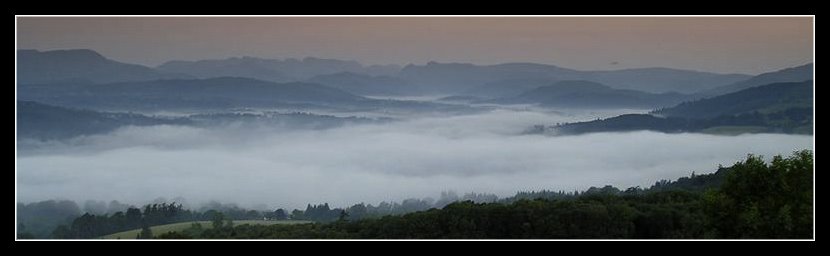
A few drops of rain fell on the car windscreen as I drove off, but hey ho if you don't make the effort you never get the rewards. Whatever the forecast. Labels: walks
Sunday, May 6
New Forest Bank Holiday Crowds
A couple of snapshots from visits to some regular spots revisited this holiday weekend.
The Holmsley Station Tea Rooms. If you spilt a bag of sugar on the floor, the ants would soon be teeming all over it, to scurry off with their booty. If you can picture that, you've got the image of the Tea Room garden in the spring sunshine yesterday afternoon. Replace ants with people. Sugar with scones & clotted cream teas.
Not too sure about the "serious walker" armed with map, compass, twin walking poles and a part filled 60 litre day sack.
Phew. Now that is serious.
Sunday, and over to Secret Corner to escape the crowds. A good plan, but it look like it may have become someone else's secret for entirely different reasons.
It's the first time I've ever come across any other visitors in that area. And it's definitely the first time I've ever spotted cyclists. But just a word of caution if the information has been picked up via this blog.
It's probably best not to leave bright orange cycles leaning against the trees just off the path. And just because the main path has petered out, it doesn't mean that there are no further tracks further on.
So it must have been a bit of a surprise as me and the dogs ambled around the edge of the hillside, and made you both jump a little.
Well when I say a jump, not straight up in the air that is, more of a lateral movement as you dived for your clothes to cover up.
Brave folk - a cheeky wind and all those pine needles on the ground. Ouch. Looked like some good sun tans though.
;-)
And like the gent I am, I bowed my head and made as if I hadn't seen them, for once not shouting a cheery 'Good Day'
Thought it best not to on this occasion. Same for the walk pictures. Ahem. Labels: New Forest
Friday, May 4
Mountain Rescue Teams - BASECAMP
I mentioned last month the MRT Supporter's initiative.
The Basecamp site is now up running, with info on how to join.
Early days yet but i'ts getting there if you want to show your support.Labels: Mountain Resuce Team MRT BASECAMP
Thursday, May 3
TGO Magazine June
What is it with this current crop of outdoors mags?
TGO arrived via postie yesterday, and I'm as similarly as unimpressed as with Trail's offering.
A pity because TGO is at least a 'good read' rather than a cause of distraction when trying to sort the articles out from the cunningly disguised adverts (sic Trail).
Were the editorial team all out on the hills, or is the increasingly distant cover date (2 May recipt for the June issue!) meaning less contemporary content.
- Chris Townsend - nice commitment to duty for the 'Car Camping' article. But this is Chris 'Mr Backpack' Townsend. Poor fellow. Throw him a lifeline?
- Jim Perrin/Mike Harding pieces I actually enjoyed
- Review of single skin tents - interesting
- Deepdale Route was different, but petered out towards the end
- Dave Mycroft - technology convergance- good piece. Too short
But overall it felt like the mag lacked focus. More a generalist Outdoor campsy type mag. Not quite the market niche they've been working so hard towards over the last few issues.
I might even buy 'Country Walking' at this rate to see it's just me becoming getting a pernickity old bugger in the sunny weather. Harrumph.Labels: TGO Magazine
Scribble on a (Harvey) Map
I nicked this from an Outdoors Magic thread, but I'm sure they won't mind as the advice comes straight from Harvey Maps.
"What non-permanent pen might be used to write on Harvey Maps?
Harvey's response:
"Most of our waterproof maps (e.g. the Superwalker) are printed on latex impregnated paper which is stronger than ordinary paper, and waterproof, but otherwise behaves much like ordinary paper. So, as with ordinary paper, you can write on them in pencil and take it off with an ordinary rubber. It is not possible to remove writing put on in biro without also taking the map off.
The maps in our XT40 range (British Mountain Maps and some Route maps), are printed on an untearable, 100% waterproof plastic. You can write on them in pencil and take it off with an ordinary rubber. If you use a biro or spirit pen and try to use white spirit, or similar, to take the writing off, you will take the map image off as well.
Our waterproof maps are not laminated, they are printed on paper which is itself waterproof. Lamination on the other hand puts a film layer on top of the map. With a laminated map, it is possible to write on and wipe the writing off using spirit (e.g. white spirit). This can be useful. The trouble with a laminated map, however, is that it is heavy and bulky"
Thought it worth sharing in case you'd not tripped across the original thread.
Labels: Gear
Wednesday, May 2
Trail Post - Interesting Response
Hhhmmmm. Interesting.
Visits to this site more than doubled following a couple of comments I left on OM concerning the value of Trail's piece on 'Lightweight Lakes'. All looking at this post.
None felt the need to leave a comment. But the interest level leads me to suspect I may have hit a sympathetic nerve.
Discuss?Labels: blog media, Trail Magazine
Hip-pack Competition - Update
The prize arrived today, so I'd better get to sorting the competition fine detail out.
Well as soon as I've worked out where else I'm off to post the UK Blogger meet up in the Lakes next month.
More to come ..............Labels: Hip-pack Competition
Tuesday, May 1
Route planning; Toys, Tests & New Ideas
Oh how we boys do love our toys!
For my June Lakes trip I've been casting my eye over map, reference book and website to work out where to go; What to do.
Two nights of wildcamp are already sorted, as part of the UK Blogger meet-up.
These particular spots have been chosen for ease of access, relative quietness (besides a good chinwag!), views and prior knowledge of camp pitch & water availability. So nothing fancy on this score.
After all the site I chose for a solo camp isn't always one that will meet these criteria for a small number of tents. After a bank holiday evening at Styhead Tarn last year I realised whilst the company of like minded individuals can be good to have, I find it's good to have solitude as a balance. As this spot on Yoke shows from last year.

Whilst trying to find the blog link to this I realised that this trip was prior to starting the blog. As an idyllic trip (blazing sunshine/planned at a couple of days notice) perhaps it was one of the things that prompted me to start this site. I can even recall what I was doing as I took this snap; The memory is so sharp due to the location and timing; Anyway, more of that trip at a later date.......... back to the plot.
I've a few wildcamp spots already on my short list, but unfortunately they are spread rather too far apart for the time I have available. Initially I was looking at some very long days to join them together, but sanity is starting to prevail.
Why am I doing this trip? For the wildcamp; For the hills; For moving over new ground; So why force the pace at the cost of ruining the overall experience? And then there's the weather which can make or ruin an over ambitious trip.
Whatever tops I tick off as I pass are a bonus, but not a necessity. And as this is my first trip north this year, my hill fitness is low, so best to concentrate on a smaller area, possibly even hop a local bus to shorten distance between far apart spots. There's no disgrace in going for the Fun Factor.
Enter map reading & route assessment.
The coverage of my newly purchased Harvey Mountain Series 1:40,000 map is ideal. The only drawback, as I've already commented is the loss of detail compared to the OS 1:25,000 series.
After spending an hour with a second hand £10 flatbed scanner, bought for another use, and some free scan/picture edit software, I've managed to produce some stunningly detailed map sections for the more detailed areas I intend to visit. Trying to find an unnamed tarn on the top a crag with a reputation for cliffs is not something I intend to do without a good certainty of getting it RIGHT FIRST TIME. As a solo walker risk assessment is paramount. No second chances in this case.
A nice side benefit (and I'm talking to the over 40s now. Eyesight eh!) is the level of detail that suddenly leaps out from the scanned map image. I always use the small magnifier on the compass when out on the hill. At home I have a simple magnifying glass. But neither of these begins to approach the level of detail that zooming in on a pc screen can achieve. Stunning.
For instance - that spot pictured above was taken during a 30 hour period when I had only 3 litres of water available. For everything. The fells were in the middle of a serious heatwave. Most of the water sources were dry, or very very dubious.
Tonight, zooming in on the scanned map section immediately revealed a small number of streams, off both sides of the ridge, including a waterfall which would indicate a pretty good chance of a clean water supply. I'd not spotted that on the day, despite scouring the map. But it could have made a lot of difference, and prevented me having to spend the next day resting with the sole purpose of properly rehydrating.
I've considered mapping software to be an interesting toy, but rather too expensive for my use. I rely on maps when I'm out, and have never been happy to print off bits and pieces to take along. The 3D fly through facility has been tempting, but every time I've played with this, for a route I know, it seems over simplistic.
But now that I appear to be contradicting some of that approach, for the specific detail on this trip, I'm starting to question my stance.
If this zoom facility is an example of the level of simplified route planning for potential water sources perhaps it's tipping the balance for me?
I feel a calling coming on to revisit the latest mapping offerings and consider a possible purchase during this year. Something to play with on the next wet rest day in the Keswick/Ambleside outdoor emporiums.
Somehow I suspect I may have at least one of those coming up, despite the current run of early summer sunshine.Labels: Gear, Lake District
All site material © John Hee - ask before you snatch
Telephonic communications have been restored and there's multiple updates on his blog, along with some local colour; And the Queen; Courtesy of your's truly as back room boy
;-)
Meanwhile news that Judy Armstrong's Alpine Challenge has come to an end; But fear not she's decided on a different approach. More details here.
I'm intrigued to understand Judy's change of mind. Her 22 May post states "Lacking the willpower and mental strength for this walk, I have decided to change my plans and not walk around the Alps this year. I find it lonely and uncomfortable in a tent, and look forward to returning to civilisation (people!) at the end of the day. I'm not fond of lugging a 20lb pack about either"
Bearing in mind Judy's prior experience and her unquestionable commitment to this challenge those reasons, whilst undoubtedly very valid, are not something that she did not expect beforehand (see her FAQ)
Judy. If you're reading this - whatever made you amend your challenge (and it's a very brave but sensible move to say No, but always a difficult decision to question a dream) I hope you're OK and getting the right level of enjoyment out of what you are now doing. And please stay positive!
Lighthiker has a few thoughts as well.
And finally (as they say on News at Ten)..........
I'm currently in communication with an established 'name' from the formative years when Outdoor Walking/Camping blossomed in the 1970s.
We've been trading e-mails on the roles and aims of blogging & traditional print media.
During the course of the conversation I'm reminded of the debt we all owe to those that came before. Those who were instrumental in communicating the approach and gear innovations to what we now know as modern backpacking. I hope to bring you more if the person concerned is happy to let it be so. More to come. Hopefully.
Labels: books, uk walking blog
Blog readership patterns
Are you reading this on a Monday or Tuesday?
Chances are, according to my web stats, the majority of you may be.
Looking at my visitors since Jan 1st this year, 50% of you drop by on Sunday to Tuesday, with the great majority calling Monday/Tuesday. I suspect this may be the once a week readers.
But why these days I wonder? Sunday visits I can understand. Something to do as the weekend jollity starts to wind down. Hopefully a brief respite to alleviate thoughts of the dreaded Monday morning workday, a return to being surrounded by four walls.
But Mon/Tues? You can't all be reading this instead of working surely? Or are you?
Anyone care to enlighten me on this one?Labels: blog media
Tuesday, May 29
Mad Max killed Toe Cutter; Or Footloose?
The early 80s; VHS films just making their entry into UK living rooms, and the sight of Kawasaki Z900 motorcycles being unceremoniously trashed, en-mass. A friend of mine, a Z900 junkie adored the film, but can't watch it these days due to the wholesale destruction of what are now Highly Collectible Classic Motorcycles selling for upwards of £4k. And that film trashed a lot of Z900s.
But to my point. Or more like points. Ten of them.
I'm off to the Lakes next week, and have been casually collecting my food store for a few weeks now, new ideas to try out. But more importantly I've also been preparing my bodily bits as well.
Settle down at the back for this is serious stuff. No sniggering!
One of the key areas is naturally the FEET. Painful feet equals a miserable walking experience. Period. You can be the fittest person on the hills, but without comfort down below you're going nowhere. It's pointless spending hours training on a rowing machine if your feet haven't had similar attention. They might be ok for a couple of hours, but the constant thumping steps for a 8 - 10 hour backpack requires a different sort of preparation (My pedometer once estimated 15,000-20,000 steps for a 20 mile walk)
One tip I picked up from my years of running was to prepare for a race well in advance. Pre race night I could expect not to sleep too well, so the advice was to get the shut-eye the night before the final night (hope that makes sense)
Similarly, feet preparation was best done well before the event. And I don't mean the last couple of days either.
While walking, feet injury is occasional, but it tends to happen over a long period of constant (ab)use. Whereas I've totally stripped the skin off two of my toes in a 90 minute 'fun' race, and not even noticed until the trainers came off. Hmm. Oooo, now that's what I call fun. Not.
So pedicure those feet before you go out on the hills. And not the night before. Give them a chance to settle down whilst your still kicking around the local neighbourhood.
Toenails cut short? Ends filed off smooth? There now, that's better. No snaggy nails to rip the ends of your socks, or to cause you increasing pain as those downhill bits come along pushing the tootsies into the boot end, however well laced they were at the top of the descent.
Similarly if you are someone who builds up callouses, and if you walk or run regularly that has to be the case, then work on them to remove any excess. At worst they will rub within you sock/boot and become another hot spot for problems as your journey continues.
'An army marches on its stomach' (Napoleon Bonaparte) Backpackers prefer to use feet.
Don't get mad. Max. But do get toe cut...errr.Labels: Gear
Website counter
Another techie bit. So I'll keep it quick rather than bore the pants off you
If you happen to use the free Statcounter.Com service it's just been upgraded to keep the last 500 items, but you'll need to update the settings on your own account.
I'm out of here.Labels: blog media
Monday, May 28
Want to blog about walking and the great outdoors?
And whilst we're on the subject of Blogging.....
It's all far too easy to get hung up on the mechanics of this media. Slavishly watching the site stats. Trying to work out how to get those punters in. Then we can pack in the day job when we strike that big book & film deal that naturally will come our way due to the incredibly superb content we all provide.
Right?
No of course not.
So here's an article to put it into perspective.
One to reread occasionally to remind you why you started in the first place.
And it wasn't anything to do with filthly lucre now was it?
A sharing of a passion.Labels: blog media
Fiddling about -Blog website management
A bit of site testing over the next few days to see whether it improves the stats coming back in about visitor interest & search activity (You can tell the weather's rubbish can't you!)
Thanks for the tips Paul
....edit.....
And having looked over the tips there's plenty of ideas for anyone whose interested in the mechanics of blog constructiona, hosting, visitor monitoring & getting the word out. More than enough to while away many feckless hours chasing down links and ideas. So here's the relevant starting points:
Search engine ratings
Optimising your website
And the source of most of these goodies - Daily Blog Tips
Nice one Paul - that's my free time down the tube (lol)
....edit.....Labels: blog media
Wanwright -Ridge Walks
As one who hates sweating up the hilly bits, but adores the ridge walking when I get there, I first came across this excellent (and free!) set of simple maps linking the Wainwrights via the ridge a couple of years ago.
Well done Lake District Desktops and a simple idea well executed.
There's a lot of highly useful reference material on this site, which has been around since 2003 and well worth the meander around.
Very handy to download and stick in the back of a map for planning purposes?Labels: Lake District, Trip Planning
Sunday, May 27
My Magic Number
Whoooooo! 10,ooo visitors to this site since I posted the first item on 25 July 2006.
Since then I've made a lot of new friends; A couple of enemies; And been a big hit with certain Nigerian gentleman with money making opportunities;
Thanks to all who drop by and read. I'll try to keep it coming. And who knows, perhaps one day I'll finally settle on a common style approach rather than the outbursts and wild ranting.
But then, a passing voice shouts from my past:
"When the going gets tough, the weird turn pro"; "Buy The Ticket, Take The Ride" Hunter S Thompson
So who knows?
Let's just do it.Labels: blog media
Wainwright on TV
If you happened to have caught the recent short TV series on AW walks, some gossip via the Keswick Mountain Festival, courtesy of Andy from the Lake Landers website. It appears that the BBC have commissioned 6 more programmes on Wainwright walks and ITV have some ideas themselves.
But looking at the audience viewing figures, peaking at 2 million viewers that is hardly surprising. Thos sort of figures far exceed many of the top rated programmes from many of the cable channels.
Digging a bit more into this I've found details of a TV link-up book due out June 2007 to 'accompany the 5 part BBC series of Wainwright Walks, its 6 part sequel, and the 7 part Granada series Wainwright Country'.
I only recall 4 programmes in this year's release, so that might explain the next batch of programmes?
However reading the book's synopsis on Amazon I'm not sure whether some (all?) of this may refer to the original 'Walking with Wainwright' series from the 80s.
Whatever. We are becoming media friendly all of a sudden. What's next? Reality TV with Langdale MRT? A cross between Casualty & Vets in Practice? It's about the only Rescue Service that hasn't been TV'd yet.
It's time is-a-coming surely?Labels: Lake District
The Woody Woodpecker Show
A slight delay to this afternoon's walk in the jaunt as this little fellow seemed disinclined to leave his hiding place, where Mum(Dad?) Greater Spotted Woodpecker kept returning to feed him up.
A good hiding place, out of the wind and rain. But not a place that you'd normally find one of these shy birds.
Which was perched on a concrete bird bath, about 3 foot from my back door, where we're located in the middle of a largish housing estate.
It made getting out outside, without unduly disturbing the Woody family, a little interesting.
Guess the words gone around the local bird populace about the multitude of seed feeders, peanut holders and fat balls in the back garden. Which makes the monthly trip to the seed merchants for super size seed mix all worth while.
And the walk - lovely and wet. Great. It meant I had the New Forest to myself for a few hours.Labels: Miscellaneous
TGO Challenge 2007
Its over and the reports are coming back in via our usual suspects.
Andy Howell seems to have cornered the ultralite brigade (3.8 kg packweight!) and plenty of feedback starting to come through on his site.
Alan's LEJOG venture has taken a TGO Challenge sidetrack
Something for a wet Sunday afternoon's browsing?Labels: TGO Challenge
Mind & Body
Its strange how causality can work.
There's been some positive feedback to my piece on Walking and Mental Health bearing out one of the values many of us find from being outdoors.
And following a thread on an Outdoors Magic thread searching for news on Peewiglet I spotted a link from a commenter on her website to a site called An Turus which describes itself as 'Wilderness Therapy, Adventure Therapy, and Eco-Therapeutic Wilderness Journeys'.
There's an with the intriguing banner "In every walk with nature one receives far more than one seeks"
(and googling that last quote turns up a link to MysticWicks Online Pagan Community and Pagan Forums and Spiritual Sanctuary)
I won't quote the whole of the AT Wilderness Therapy page but its interesting to see just how closely this links in with my original theme. Of course most of us probably don't feel the urge to get involved with a commercial venture to enjoy the benefits. But someone out there sees a demand which they are prepared to fulfil. For instance '......to repeat our The Outdoor Environment as Place for Therapeutic Change residential workshop 22nd – 24th October 2007 ... in Cumbria. This workshop will be the 2nd module of our Certificate Programme'
Fair play to the group who've set this up, but I personally prefer to get my outdoor fix in my own way.
So whilst it continues to rain stair-rods outside, as is has done since early Sunday morning, I've managed to go on a 'missing' person hunt, a view of therapeutic counselling and added touch of paganism good measure.
Funny how these things just seem to link together when you look in their direction.
Right, where's those waterproofs gone. I think the bank holiday weather is here with a vengance.Labels: Mental Health
Friday, May 25
The Perils of Blogging?
With the recent flurry of bad manners exhibited on Outdoors Magic it got me to thinking about the visibility we Bloggers have. And where that could potentially lead.
(BTW the specific OM stuff is sorted now, and the sites normal friendly banter has been resumed. And yes I dobbed the offender in to the rozzers. He made the terminal mistake of getting very boring. But I suspect I wasn't the only, or first OMer to flag the situation)
There's some basic rules any Internet user should normally follow concerning protection of identity, location, and personal matters. Add to that an increased employer sensitivity to be wary of which has lost more than one blogger their income in the past.
For that reason I never disclose my personal details until I am happy with the individual concerned. Even then I will retain elements of my anonymity where necessary; That's not because I'm paranoid, but because my family, friends and employment are only a superficial part of this virtual world. As they've not elected to be involved, (nor indeed have they been asked) I automatically offer them the level of protection & respect that I would expect from them concerning our joint right to privacy.
At times that world can bleed through onto here, due to time frame, personal upheaval or just a general nudge to explain my thought process. But hey, that's life.
So that is why my profile is generalised. My photos mostly exclude identifying faces. And I keep my real world life in a silo, separate from my outdoor/blog personality. I've spent years perfecting that particular trick due to other lifestyle choices not generally understood, or shared by the greater population at large (And no there's no juicy gossip there!)
Personal details, mine or yours, will never be exposed on this site. And are rarely shared outside via e-mail or meet-ups. Unless I'm happy over my safety and the same courtesy is available to those people that I liaise with.
Now I'm a firm believer that there's some sort of benefit from almost everything that happens to me. Sometimes I can't see it at the time, or it may not be the correct thing, but without making mistakes there's no chance to change. To grow with increased self realisation, or sometimes self disillusionment. For without that consciousness what is the human condition?
To date we're pretty damned unique in this limited universe, as we understand it. So best do something with it. Or try to. As far as our limited perspective will permit.
I'm not an optimist by any means. But when surrounded by negativity and blinkered vision I tend to shift to an air of positiveness. Better that than the alternative blackness. All too easy that option.
And as I re-read that section to correct typos I realised there is a lingering issue raised by the walk/mental health post which seems to have lead me into a very introspective pondering today.
Far too deep for my normal wittering; And definitely not what's need to gee us up for the coming bank holiday weekend. But there you go. Events in the normal world influencing my mood without my direct realisation. No comment at present on that. Let's just call it enigmatic. So time to get back on track.
The OM issue showed me just how careless an individual can be in identifying themselves. In this case the person concerned was proud to advertise key personal facts, seemingly oblivious that as the conversation became more odious, such information could have taken on a more threatening relevance for any one of the slighted conversationalists.
And in turn I was waiting for the appearance of unnecessary comments on some of the UK Outdoor Blogs.
We are very public in our web presence, and indeed that's part of the remit that goes with blogging.
We can control certain unwanted elements from third parties, or not, as we see fit. But it's a hassle we can normally live without thank you (And that's not a challenge!)
And as we all know there's an ever increasing audit trail across the web relating to each individual's activity. However lost/deleted old communications may seem. Try and Google you won details when you have a few spare minutes?
So a word of warning. This is a wonderful medium, and has truly revolutionised the ability of an individual to communicate. But like Pandora's Box, be careful how far it's opened, because it carries a responsibility.
Personally I approach said box with a bloody big fly swat whilst wearing midge proof clothing.
Have a good one this holiday.Labels: blog media
OM Roundups
It looks like the Outdoor Magic weekly round-ups are back again, courtesy of Weird Darren's effort.
A choice of blogs and/or podcasts.Labels: blog media
Thursday, May 24
Walking and Mental Health
I spotted this BBC report a few weeks ago, but not had the chance to comment on it until now.
But I'm taking a few minutes break here, being busy presently playing silly sods on an Outdoors Magic thread (find it yourself nosey!) with a man who exhibits little discernible awareness of the outdoors community. Well able to expound certain unassailable views. All his own. All absolutely correct. Naturally. Hmm.
Competitive bullshit has no place on the hills. Taken to it's extreme it can kill the unwary. And normally OM is the same. A little teasing but in this particular case I'm not sure the party concerned gets it. But in this case it's just so easy to generally waste his time.
But I'm getting sidetracked. Back to mental health.
I've found the benefits of walking outdoors essential in my quest to stay sane in a sometimes insane society. I fit into the woodwork, but a bit like the Stainless Steel Rat at times.
"..we must be as stealthy as rats in the wainscoting of their society....now that society is all ferrocrete and stainless steel there are fewer gaps in the joints. It takes a very smart rat indeed to find these openings. Only a stainless steel rat can be at home in this environment..."
During periods of high pressure/stress or just downright disgust at some aspects of modern life I especially take myself outdoors and walk it off. To get back to the real things in life.
Hence my deep appreciation of the hills and what they mean to me per se. Not the peak bagging others enjoy; Nor the endurance marches some expound. Just a movement across the land, and becoming once more at one with it. As far as I feel able. Sometimes I will merely sit on a ridge and watch the clouds pass by as their shadows pattern the hillside, for 2 or 3 hours at a time.
(BTW I'm not sat there cross legged meditating on the meaning of life. It's more like getting up for a brew and smoke every so often. So let's not get too metaphysical here)
I've seen other reports before on the value of walking for depressive moods, so I dug into this one a little more, going back to the source material from the health charity Mind.
The fact I found most riveting (to quote from Mind's report):
"A walk in a country park was compared with a walk in an indoor shopping centre
- 71 per cent reported decreased levels of depression after the green walk
- 22 per cent felt their depression increased after walking through an indoor shopping centre
- 71 per cent said they felt less tense after the green walk
- 50 per cent said their feelings of tension had increased after the shopping centre walk
- 90 per cent had increased self-esteem after the country walk
- 44 per cent said their self-esteem decreased after window shopping in the shopping centre"
So its not the walking per se (though it helps) but the location that has value.
Get outdoors. Soon. And go somewhere green.
Me. I'm back off to OM again with a long poking stick. Will I have to go to the naughty step eventually nurse?Labels: Mental Health
Monday, May 21
What the.........?
A Secret Sunday question, that I meant to ask yesterday.
Why on earth fence off this section of New Forest heathland?
No sites of antiquity. No special SSSI status. No agricultural provision.
Just someone's idea of showing ownership across an expanse of rough heath and bogland. Off into the far distance.
Pointless.
A nice copse of trees the other side though. Looks great for a wildcamp.
Ahem.Labels: New Forest
New Outdoor Blogger
A new welsh wunderkind. Another UK Outdoor Blogger
It's early days yet, but I know of Paul from his website www.wilderness-wales.co.uk and via his posts on uk.rec.walking.
One to watch I hope.
And a great example of how to present a website. The swine.
;-)Labels: blog media, uk walking blog
Sunday, May 20
Secret Sunday - straying away from the flock
There's a bunch of researchers out there somewhere whose main aim in life is to monitor the mass trends of the populations at large. Not an individuals impact, but the broad spectrum across societies. Demographics I think it's called.
Over the years I've had my own peculiar insights at times, usually based my own simple people watching attempts.
A major sporting event? Especially football or tennis finals; Or some nationalistic jingoism courtesy of the press? Then miraculously the roads and towns become quieter. Less roads, less people around. And that includes the outdoor routes.
Today this phenomenon seems to have carried over from yesterday's Cup Final into the area I was walking this afternoon.
Sat with my back resting against a fallen tree. The sun beating down on my face. Not a soul around.
"Think like a sheep. Get treated like a sheep. But think like a sheep dog...."
One of my collies told me that. But then it ran off to fetch a stick, so I'm not putting too great a store in that piece of advice. Not yet.
Labels: New Forest
Saturday, May 19
A change would do you good
I awoke to the sound of Sheryl Crow on the radio early this morning. It's a song I've heard any number of times, and dismissed it sometime ago as a nice tune but not one that especially caught my interest.
But today, as I came to, I lay there listening to the beat and the lyrics.
'A change would do you good'
Indeed. Why not? A good idea.
So instead of my usual Saturday walking haunts, to stretch the dogs legs, and my mind, I decided on something different as I got into the car.
No idea what. Just drive into the New Forest, to a familiar area, and make it up as I go.
The result was a circular route, that started in the middle of one of my other routes, ended up in the middle of no-where, and then a quick leap frog to tag onto another circular route.
Different paths. Even a different direction to travel from normal. And different sights- a field of grazing deer, with one albino in the herd. A very young foal running from sheer exuberance of life. The mare watching on.
'I thought you were singing your heart out to me'
Led Zep on the MP3 player accompanying me as I went. For some reason familiar music today sounding sharper and more evocative than normal.
'Hello it's me, I'm not at home; If you'd like to reach me, leave me alone'
That's if you can even find me. At times I wasn't totally certain where I was supposed to be. Well I knew the area, but as for the precise spot……..familiar side tracks somehow becoming unfamiliar when approached from a different direction, and at speed.
'A change would do you good'
Eventually I ended up at a tea room in Burley sometime later, watching a horde of cyclists leave. A tea garden full of detritus behind in their wake. Oblivious to other forest users it seemed.But another mystery solved - I always wondered where they went to each Saturday.
And in the sun I reflected. Sometimes its good to go and get yourself a little lost.
A change does do you good.Labels: Trip Planning
Thursday, May 17
TGO - Weird Darren - Finale
I managed to speak with Darren yesterday about his recent escapades in the Highlands. There's a brave warts 'n all description on his blog.
A week ago he was an TGO aspirant full of hope and anticipation; Today he's a police incident; Tomorrow - probably a rescue report on one of the Scottish MRT sites; Fame comes in many fickle forms - lol
Alan's LEJOG schedule, temporarily diverted to head east, rather than north, also has a report on the situation.
And then there's Atkoman, stepping in to help out, despite never having met Darren. And finding something positive from that experience as well.
The message that comes shining through is that we 'packers, despite being an independent and largely self sufficient, possibly even cantankerous, set of individuals, know when to dip in and give a hand where it's needed.
A pity that other section of our society don't seem to have learnt that essential lesson. Life could be so much
better.
It looks like Phil 'Super Hero' has quite rightly picked up a nickname that will stay with him for some time to come.
And who reckoned Phil only went on a rescue run to escape the sounds of Darren's persistent vomiting? (only joking guys!)
What a small world it can be with one UK Blogger's acquaintance helping out another. Well perhaps not that small on this particular occasion?
A bad few days that have had a lot of positive outcomes in the end.
Anyone else fancy telling me a GPS has no place on the hills after this?
edit I see Darren's even got a special mention today as an OM news item. He's never going to live that one down! edit Labels: TGO Challenge
Tuesday, May 15
TGO - Weird Darren - Update 2
I've managed to have a quick exchange of SMS text messages with Darren. Basically all's well with him now after a few days of a devilish sounding complaint. The good news is no bones were involved!
Rather than as insult to injury, I'll leave the full blog post to him; But if his is not a solo case it sounds vaguely reminiscent of some reports from the 2006 TGO event with a "mystery illness .......that was quite widespread geographically".
Time will tell on this one. Who'd have thought acclimatisation for Scotland might be a consideration - lol.
And for Darren an chin-up extract from last year's report:
"Those who retired should not feel bad. There is no such word as failure on the Challenge: simply to have entered, done all the planning and taken part is an achievement, and we hope to see you all again"Labels: TGO Challenge
TGO - Weird Darren - Update
TGO - Weird Darren
News that Darren's challenge this year has come to an untimely finish.
There's little news at present beyond what Atkoman has been able to glean (Thanks Duncan), but I'll check my SMS stuff later and see if there's anything more to add.
Darren - if you're reading this .......
1. Hope things are not too despondant
2. Keep away from those foreign nurses
3. Expect some sort of contact soon (Eerr - I think that might not have quite come out quite as I intended)
The things you'll do to spice up your blog posts (lol)Labels: TGO Challenge
Sunday, May 13
Links update
Pretty minor- I've added the mountain weather link, and tagged the UK bloggers currently on the TGOLabels: blog media
Weather reports - On the hill
Atkoman's post today, picks up on his earlier 'lessons-learnt' post about updating a weather report when out on the hills.
As a contrast I thought this might be worth a few lines to help with determining your own approach.
Why Worry?
It's always important to get accurate weather forecasting if you intend wild camping on the hills, especially if you will be staying high for a few days. This mainly comes down to two essentials - wind, which can completely destroy any plans how ever well intended; And rain which can at best can turn a pleasant panoramic stroll into a slog through thick murk, or become dangerous if stream levels start to rise (as this weekend Ten Tors walk illustrated); Or thunder/lightening kicks in - in which case get off that ridge fast!
My approach to the weather has always been phlegmatic. Whatever the forecast, the weather will do whatever it will do, especially at a local level. The Lake District is renown for variation between valleys, and the difference between a good and bad day, weather wise, can be as little as being 3 mile further east, and 500 foot lower. Being the right side of a ridge definitely takes the sting out of a 40 mph wind.
Before I go
I usually start to monitor the mountain weather report for the area I intend to visit, a couple of weeks before departure. That way I can get a feel for the sort of ground I'm likely to find, based on prior conditions (muddy - or arid?) and it also gets me in the right mindset to appreciate that northern and southern weather can vary significantly especially during the summer. T-shirt weather down here, will often be windproof weather in the north.
When I arrive
Once in the area, I'll again check the weather forecast for the next 72 hours before going on the hill, and these are usually available via displays in walking shop windows, at the local Youth Hostel, or the Tourist Information Centre.
Largely speaking the pre and on the spot checks all use the same invaluable feed - the Mountain Weather Information Service (I can't think why I haven't already added a feed to this site, this has been so very useful to me over many years - so that's another update for this site's links)
So suitably prepared, off I trot. But what about when .........
On the Hills
If you choose to carry mobile phone/Internet connect gear, then the same approach is possible, assuming the phone signal is available. My basic Orange Nokia 6101 is net enabled, but after a couple of trials I decided the hassle of single finger typing, and a small screen, made its use as a web browser not really work the effort.
So there's two other options I use - Radio reports and Weather Information Services.
Radio Reports
Most places in the UK will get a reasonable radio signal. In the UK, despite providing a better reception for hilly country, the Long Wave frequency has largely fallen into disuse. Medium Wave has a tendency to slip in and out of signal, and FM once locked on, can provide clear access to a variety of sources, but once away from civilisation is very patchy. Short Wave is a good option to cut through all this.
But the real test is the quality of available information. The BBC Radio 4 weather report prior to the 18:00 news provides a good UK wide forecast with little of the dumbing down that their TV equivalent suffers from these days. But it is very broad, and is only an indication of the country as a whole. So that 40 square mile section you're in might not be covered so well! Good for an overview, but not a lot of use for detail.
And that's where Short Wave loses out as most UK services I've discovered there are BBC related, rather than regional.
One possible exception is the BBC Shipping Forecast (Broadcast pre 18:00. & 00:00) Whilst not land related, its a good indicator of weather pattern movement around the UK, especially for air pressure and wind patterns.
But generally the local stations have a more relevant level of detail, but steer clear of the commercial variety. I've never found one yet that could manage a forecast with any real detail beyond the small urban area they're aimed at. More a 'Take in your washing/Nice day for the beach' approach.
The BBC local service is far superior, especially near coastal regions where sailing forecasts are also available; For the Lakes BBC Radio Cumbria (FM: 95.6, 96.1 &104.1) is your source.
One steadily improving access to such services is via Digital Radio Broadcasting (aka DAB). High up, if I can see any sort of largish conurbation I usually find a crystal clear DAB signal, whereas FM can still be patchy. The plus is a further set off radio stations. The downside - DAB can be very susceptible to any physical movement if the signal is weak. So stay put whilst trying to listen to that forecast!
Again, with the Lakes in mind, if I can see Lake Windemere anywhere in the distance, I'm usually assured of picking up radio stations all the way down to the Liverpool & Merseyside area.
And finally. What if the radio signal is transitory, even after moving around the hillside a little in an attempt to improve it?
Weather Services
Again a perverse feature of hills and frequency bounce is that radio and mobile phone signals get through the mush of landscape in different ways. And mobile reception is even more localised. I reported in to home from Sprinkling Tarn last year, despite this being one of the more hill locked locations. It took about 15 minutes of wandering around before signal strength went from nil to 50%, and back again, in the space of a few footsteps. Whereas the radio reception was poor throughout.
That's where the Weatherline service comes in. As well as providing a website for Lake District 5 day forecasts there's also a telephone service (0870 055 0575) which provides an accurate forecast (from memory) with much more detail, aimed specifically at hill walker needs.
If you carry a satellite phone, now becoming more widely available due to rapidly reducing cost and weight, then then this may be an option that you can rely on.
DIY
And finally. Many GPS units these days now include an altimeter function, and with it the ability to flag air pressure changes, a sure way to spot forthcoming variations in weather patterns. This is another whole area of expertise, including use of wind & cloud movement on the spot. I'd recommend Alan Watts 'Instant Weather Forecasting' for a definitive examination of this. The book is aimed at sailors, but I've never found a better condensed source to help understand DIY forecasting.
So to summarise
- Before I go - Mountain Weather Information Service
- When I'm there - same again, but via local shop/hostel
- On the hill - telephone call to Weatherline with BBC Radio for an more general overview
Fair wind and clear skies.Labels: Fellwalking, Gear, Lake District, Trip Planning
Saturday, May 12
Hamish's Mountain Walk & The TGO
"The TGO Challenge is an annual self-supported walking event across the Highlands of Scotland, west coast to east coast. It started in 1980 and was the brainchild of the well-known writer and mountaineer, Hamish Brown" the TGO website duly informs me.
So it only seems right that in a spirit of solidarity with fellow 'packers' out in mixed conditions over coming weeks, that I'm sat here, dry and warm, slowly working my way through Hamish Brown's "Hamish's Mountain Walk". An account of the first non stop crossing of the Munros in 1974.
There's also a sense of karma involved here. I picked the book up last year when browsing in a charity shop & put it to one side for later. Since then it's just been one of a largish pile to get through. Sometime.
Looking for my next reading fix last week, this one just fell to hand.
At the time I had no idea of HB's outdoor links, and only a vague awareness of his literary output. But based on this I'll be seeking out more in future.
For Hamish can communicate his deep appreciation of the land he passes over, and despite being written 30 years ago, the book has hardly aged in its core values. A love of the hills.
Each time I return to the book I find myself nodding as some phrase of his chimes with my own experience or emotion.
Compared to the last walk/tour book I read, Nicholas Crane's "Two Degrees West" Hamish's is a sheer delight. Whereas Cranes took me the best part of four months to complete; Picking it up, getting bored, and putting it to one side. More a litany of local TIC information leaflets, and pass-thru interviews IMHO.
Two books. Two authors. Two viewpoints.
I'd recommend hunting down a copy of Hamish's book if you haven't come across it already.
Labels: books, TGO Challenge
Friday, May 11
Web site wandering
Every so often I peruse the Web search engines for new outdoor and walking content.
Why? I've plenty of links stored away in my favourite's list already (approx 1,500 at the last count) of which 5% are visited at least once a month.
I really must get a life. But then again I'd rather be on here reading people's thoughts and observations on their lives and experiences rather than (rant mode ON) watch the animated pap that's commonly referred to as British TV these days - and that includes the digital channels that really ram home the potential abuse of my dwindling mental faculties (rant mode OFF). Harrumph.
So coming across the StumbleUpon site was rather like letting a kid loose in a sweet shop, or from our viewpoint more like a walker in Ambleside with a free credit card for the day and a couple of vans standing empty in anticipation.
"StumbleUpon uses ratings to form collaborative opinions on website quality. When you stumble, you will only see pages which friends and like-minded stumblers have recommended. This helps you discover great content you probably wouldn't find using a search engine"
A different approach from the increasingly commercially centred big search engines with the pay-to-list skewed returns. Here's a few that perked my interest and may be of more off-beat interest. But it's worth bookmarking the site just to drop by occasionally and see what's new.
Backpacking - Make you own gear
No, not a Blue Peter fan site. Ideas on self build, or adaption for backpacks, shelters, stoves, cookware (food dehydrator!), sleeping and accessories. All at the cost of your effort and a bit of lateral thinking. I think I'll be trying the condiment container ready for my next trip.
"Alternatives to expensive and/or heavy gear".
Fancy a pair of 'One Ounce Camp Sandals' using that pair of new walking boot inserts thrown to one side in favour of Superfeet? Sneaky.
"Generate a custom packing list for any journey"
I've only played with it a little so far, but its a fun alternative accompanied by comments, ideas and anecdotes. Groovy.
GMaps Pedometer
What is known (or so I believe) as a 'Google Map mash-up'.
Plot your route on the map, and it calculates the route length, as well as count calories. Again a bit of fun, but maybe something more? Read the instructions first though - and it should all fall into place.
Walking meditation
"Walking meditation is meditation in action. When we do walking meditation, we are using the physical, mental, and emotional experiences of walking as the basis of developing greater awareness. Walking meditation is an excellent way of developing our ability to take awareness into our ordinary live"
An alternative explanation of those heightened perceptions & feelings, from a Buddhist/meditative perspective. Recognise any of the symptoms or ideas?
Labels: blog media
Thursday, May 10
TGOers for the off; I think we're alone now
Well that's that then.
After the last few weeks of mild panic and last minute plan changes, peace and quiet. You and me - well we've got the Internet to ourselves at last. Well sort of.
The TGO Challengers are all well on their way to their respective start points, or there already, prepared for the start on Friday 11th.
So I guess that means the outdoor blogging scene (and sales at lightweight specialist retailers) now go very quiet.
For a period at least. Except for those who opt to report as they go. Although the mobile coverage in Scotland may have a little something to say about that.
Naturally after the recent extended period of pre-summer sunshine the weather report for at least the next few days looks particularly crap. Rain, lightning, and a little snow to pepper the experience. Shucks. Just normal hill weather. But I'm sure the two weeks of shared experience will pass in a flash for many. And whatever the weather that experience will be what sticks in the memory. Whatever the outcome of the walk.
Best of luck folks. And a particular pat on the back to Weird Darren, who's been through a lot recently, man flu apart, and is now flying unexpectedly solo, at the last minute. Have faith Darren - I'm sure you've got the will power to see it through to the end. And there's so many new friends that you're about to meet.
And if by chance there's any web based stuff you TGOers want to get to, but for one reason or another can't access, drop me a comment or e-mail and I'll post/e-mail whatever I can if it's of any help. I have no idea what that may be, but the offers there.Labels: TGO Challenge
Tuesday, May 8
Trig Point Bagging
Before the advent of cheaply available GPS technology Triangulation Points (aka Trig Points or Trig Pillars) were the bees knees when it came to the 'Where the hell are we?' question.
For many of us today, they still define the top of a hill, or provide a specific point to aim for. Or just to rest the back against; To keep out of the wind.
The joy of trigs, those lumps of concrete sat patiently attendant in lonely places, is their timelessness. But in reality they are less than 100 years old, and came into being to support the 1935 exercise to accurately map Great Britain.
An abbreviated history of their role can be found in this article by Nicholas Crane (of BBC TV's Map Man fame)
When the Ordinance Survey announced the demise of the trig points back in the 1990s the backlash caused them to think laterally, which turned out quite a wizard idea. For a large organisation - almost unique!
The OS decided to offer adoption of said trig points. And not to exclusive organisations. But to those that cared about them. The walking public at large.
Questions were raised in parliament, answers given, and a code of practice drawn up.
My particular orphan (TP7066 - Woolsbarrow Hill in Wareham Forest, Dorset; SY892925) was formally introduced to my family in July 1994.
Prior to that I'd been a frequent visitor due to its exceptional location on a hill fort overlooking the Purbeck Hills to the south. At that time the surrounding land was covered by pine forest, situated as it is on Forestry Commission property. Over the years logging operations have removed most of the woodland, and with it some of the hidden mystique of this area, especially when one of the many conservancy operations decided to denude the hill top.
But for me it's still a special place. A place I've sat for hours watching the clouds; A place I've introduced to others; Never a place I've stayed overnight, but hey, who knows what the future will bring?
It's by no means the nearest trig point to me, like this (the one with the parrot buried nearby; Don't ask!) or this or this or even this as ideally placed as it is overlooking the sea.
But old '66 has been an old friend over the years. And one that I enjoy returning to again and again to renew old ties.
If you want to find out what's nearest to you I'd suggest starting with Trigpointinguk.com a web-based labour of love, which currently has a database of 7,419 pillars. It's a small percentage of the 750,000 'lower order benchmarks' once used by the OS. A grand start.
Now how far do you think that the idea of depositing dull slabs of grey concrete in lonely places would get today, if it was to come up?Labels: Trig Point Bagging
Lakeland Rescues - the beat goes on
I recall last writing about the increasing number of Lakeland accidents involving the MRT in September 06 and trying to offer some guidance from my limited perspective before then.
It seems like the situation continues to be a problem involving MRT and a lot of worried, or worst still devastated, families.
So with no apology for the repetition, and in the hope that even if one passer-bye to this blog takes in the basic common sense, here's the MRT advice
And worth picking out........
- A map, compass (and the ability to use them) .......should always be carried. If you carry a GPS, at least know how to read your current position
- Be prepared to turn back if conditions are against you
- Do not rely on a mobile phone to get you out of trouble
- It is no disgrace to turn back if you are not certain
Basic common sense really. Be prepared.
"He that fights and runs away, may turn and fight another day; but he that is in battle slain, will never rise to fight again" Tacitus
"He who turns and runs away, may live to fight another day" William Shakespeare.
Labels: Lake District
Monday, May 7
Avon Valley Footpath
I found myself at a bit of a loose end for today's walk. Where to go to avoid the anticipated Bank Holiday crowds, especially with the overcast weather and gusty wind? The New Forest was not high on the list of choices today, and I found myself driving north towards Ringwood, parking near Kingston to pick up the Avon Valley Footpath and head northwards.
The original idea was to have a bit of mooch around an area I'd not been to for a few months, but one that definitely isn't on the normal tourist trail. Not to actually walk anywhere in particular, just to follow my nose and take in the day.
Haskell's Pond (147 028) which I'd not spotted before is already shrinking with the lack of April rainfall. But moving onto the main pond (146 033) there's been a fair bit of work over the winter, opening a once dank and smelly pool of stagnant water into a revelation. And judging by the wildfowl on it, including the venerable grey heron perching on a log, they've given it their vote of confidence as well.
Pity I forgot to take a snap. Doh! Another visit perhaps?
Northwards along the AVP onto the ford (149 035), meaning only to get the dogs some drinking water and a swim. But the fancy took me to carry on, across the fields of lush green meadow grass, alongside the River Avon and finally over the old railway line, now part of the Castlemain Trailway, and on into Ringwood town centre for a quick coffee and cake to share with the pooches. Plus the chance to give them some on-street training on a quieter than normal day.
Coffee slurped. Dogs now settled down to the strangeness of streets and people, we turned around and fled back to the peace and quiet of the meadows. There the only sights being wildfowl, flowers and the wind.
Fifteen swans had watched me on the way north, and the same set were there again on my way south, their nesting area on the far bank relatively safe from man and farmer, only fearful of any foxes in the area.
As I neared the car the only other vehicle I had spotted parked up, sharing the area's solitude, had departed. A pity as the car was wearing the sponsorship banners for Dorset Search & Rescue and I was curious as to their role in this area.
A fruitful journey; A meditative walk; Apart from the town vicinity few people around and despite the muggy picture above a bright day.
A few drops of rain fell on the car windscreen as I drove off, but hey ho if you don't make the effort you never get the rewards. Whatever the forecast. Labels: walks
Sunday, May 6
New Forest Bank Holiday Crowds
A couple of snapshots from visits to some regular spots revisited this holiday weekend.
The Holmsley Station Tea Rooms. If you spilt a bag of sugar on the floor, the ants would soon be teeming all over it, to scurry off with their booty. If you can picture that, you've got the image of the Tea Room garden in the spring sunshine yesterday afternoon. Replace ants with people. Sugar with scones & clotted cream teas.
Not too sure about the "serious walker" armed with map, compass, twin walking poles and a part filled 60 litre day sack.
Phew. Now that is serious.
Sunday, and over to Secret Corner to escape the crowds. A good plan, but it look like it may have become someone else's secret for entirely different reasons.
It's the first time I've ever come across any other visitors in that area. And it's definitely the first time I've ever spotted cyclists. But just a word of caution if the information has been picked up via this blog.
It's probably best not to leave bright orange cycles leaning against the trees just off the path. And just because the main path has petered out, it doesn't mean that there are no further tracks further on.
So it must have been a bit of a surprise as me and the dogs ambled around the edge of the hillside, and made you both jump a little.
Well when I say a jump, not straight up in the air that is, more of a lateral movement as you dived for your clothes to cover up.
Brave folk - a cheeky wind and all those pine needles on the ground. Ouch. Looked like some good sun tans though.
;-)
And like the gent I am, I bowed my head and made as if I hadn't seen them, for once not shouting a cheery 'Good Day'
Thought it best not to on this occasion. Same for the walk pictures. Ahem. Labels: New Forest
Friday, May 4
Mountain Rescue Teams - BASECAMP
I mentioned last month the MRT Supporter's initiative.
The Basecamp site is now up running, with info on how to join.
Early days yet but i'ts getting there if you want to show your support.Labels: Mountain Resuce Team MRT BASECAMP
Thursday, May 3
TGO Magazine June
What is it with this current crop of outdoors mags?
TGO arrived via postie yesterday, and I'm as similarly as unimpressed as with Trail's offering.
A pity because TGO is at least a 'good read' rather than a cause of distraction when trying to sort the articles out from the cunningly disguised adverts (sic Trail).
Were the editorial team all out on the hills, or is the increasingly distant cover date (2 May recipt for the June issue!) meaning less contemporary content.
- Chris Townsend - nice commitment to duty for the 'Car Camping' article. But this is Chris 'Mr Backpack' Townsend. Poor fellow. Throw him a lifeline?
- Jim Perrin/Mike Harding pieces I actually enjoyed
- Review of single skin tents - interesting
- Deepdale Route was different, but petered out towards the end
- Dave Mycroft - technology convergance- good piece. Too short
But overall it felt like the mag lacked focus. More a generalist Outdoor campsy type mag. Not quite the market niche they've been working so hard towards over the last few issues.
I might even buy 'Country Walking' at this rate to see it's just me becoming getting a pernickity old bugger in the sunny weather. Harrumph.Labels: TGO Magazine
Scribble on a (Harvey) Map
I nicked this from an Outdoors Magic thread, but I'm sure they won't mind as the advice comes straight from Harvey Maps.
"What non-permanent pen might be used to write on Harvey Maps?
Harvey's response:
"Most of our waterproof maps (e.g. the Superwalker) are printed on latex impregnated paper which is stronger than ordinary paper, and waterproof, but otherwise behaves much like ordinary paper. So, as with ordinary paper, you can write on them in pencil and take it off with an ordinary rubber. It is not possible to remove writing put on in biro without also taking the map off.
The maps in our XT40 range (British Mountain Maps and some Route maps), are printed on an untearable, 100% waterproof plastic. You can write on them in pencil and take it off with an ordinary rubber. If you use a biro or spirit pen and try to use white spirit, or similar, to take the writing off, you will take the map image off as well.
Our waterproof maps are not laminated, they are printed on paper which is itself waterproof. Lamination on the other hand puts a film layer on top of the map. With a laminated map, it is possible to write on and wipe the writing off using spirit (e.g. white spirit). This can be useful. The trouble with a laminated map, however, is that it is heavy and bulky"
Thought it worth sharing in case you'd not tripped across the original thread.
Labels: Gear
Wednesday, May 2
Trail Post - Interesting Response
Hhhmmmm. Interesting.
Visits to this site more than doubled following a couple of comments I left on OM concerning the value of Trail's piece on 'Lightweight Lakes'. All looking at this post.
None felt the need to leave a comment. But the interest level leads me to suspect I may have hit a sympathetic nerve.
Discuss?Labels: blog media, Trail Magazine
Hip-pack Competition - Update
The prize arrived today, so I'd better get to sorting the competition fine detail out.
Well as soon as I've worked out where else I'm off to post the UK Blogger meet up in the Lakes next month.
More to come ..............Labels: Hip-pack Competition
Tuesday, May 1
Route planning; Toys, Tests & New Ideas
Oh how we boys do love our toys!
For my June Lakes trip I've been casting my eye over map, reference book and website to work out where to go; What to do.
Two nights of wildcamp are already sorted, as part of the UK Blogger meet-up.
These particular spots have been chosen for ease of access, relative quietness (besides a good chinwag!), views and prior knowledge of camp pitch & water availability. So nothing fancy on this score.
After all the site I chose for a solo camp isn't always one that will meet these criteria for a small number of tents. After a bank holiday evening at Styhead Tarn last year I realised whilst the company of like minded individuals can be good to have, I find it's good to have solitude as a balance. As this spot on Yoke shows from last year.
Whilst trying to find the blog link to this I realised that this trip was prior to starting the blog. As an idyllic trip (blazing sunshine/planned at a couple of days notice) perhaps it was one of the things that prompted me to start this site. I can even recall what I was doing as I took this snap; The memory is so sharp due to the location and timing; Anyway, more of that trip at a later date.......... back to the plot.
I've a few wildcamp spots already on my short list, but unfortunately they are spread rather too far apart for the time I have available. Initially I was looking at some very long days to join them together, but sanity is starting to prevail.
Why am I doing this trip? For the wildcamp; For the hills; For moving over new ground; So why force the pace at the cost of ruining the overall experience? And then there's the weather which can make or ruin an over ambitious trip.
Whatever tops I tick off as I pass are a bonus, but not a necessity. And as this is my first trip north this year, my hill fitness is low, so best to concentrate on a smaller area, possibly even hop a local bus to shorten distance between far apart spots. There's no disgrace in going for the Fun Factor.
Enter map reading & route assessment.
The coverage of my newly purchased Harvey Mountain Series 1:40,000 map is ideal. The only drawback, as I've already commented is the loss of detail compared to the OS 1:25,000 series.
After spending an hour with a second hand £10 flatbed scanner, bought for another use, and some free scan/picture edit software, I've managed to produce some stunningly detailed map sections for the more detailed areas I intend to visit. Trying to find an unnamed tarn on the top a crag with a reputation for cliffs is not something I intend to do without a good certainty of getting it RIGHT FIRST TIME. As a solo walker risk assessment is paramount. No second chances in this case.
A nice side benefit (and I'm talking to the over 40s now. Eyesight eh!) is the level of detail that suddenly leaps out from the scanned map image. I always use the small magnifier on the compass when out on the hill. At home I have a simple magnifying glass. But neither of these begins to approach the level of detail that zooming in on a pc screen can achieve. Stunning.
For instance - that spot pictured above was taken during a 30 hour period when I had only 3 litres of water available. For everything. The fells were in the middle of a serious heatwave. Most of the water sources were dry, or very very dubious.
Tonight, zooming in on the scanned map section immediately revealed a small number of streams, off both sides of the ridge, including a waterfall which would indicate a pretty good chance of a clean water supply. I'd not spotted that on the day, despite scouring the map. But it could have made a lot of difference, and prevented me having to spend the next day resting with the sole purpose of properly rehydrating.
I've considered mapping software to be an interesting toy, but rather too expensive for my use. I rely on maps when I'm out, and have never been happy to print off bits and pieces to take along. The 3D fly through facility has been tempting, but every time I've played with this, for a route I know, it seems over simplistic.
But now that I appear to be contradicting some of that approach, for the specific detail on this trip, I'm starting to question my stance.
If this zoom facility is an example of the level of simplified route planning for potential water sources perhaps it's tipping the balance for me?
I feel a calling coming on to revisit the latest mapping offerings and consider a possible purchase during this year. Something to play with on the next wet rest day in the Keswick/Ambleside outdoor emporiums.
Somehow I suspect I may have at least one of those coming up, despite the current run of early summer sunshine.Labels: Gear, Lake District
All site material © John Hee - ask before you snatch
Chances are, according to my web stats, the majority of you may be.
Looking at my visitors since Jan 1st this year, 50% of you drop by on Sunday to Tuesday, with the great majority calling Monday/Tuesday. I suspect this may be the once a week readers.
But why these days I wonder? Sunday visits I can understand. Something to do as the weekend jollity starts to wind down. Hopefully a brief respite to alleviate thoughts of the dreaded Monday morning workday, a return to being surrounded by four walls.
But Mon/Tues? You can't all be reading this instead of working surely? Or are you?
Anyone care to enlighten me on this one?
Labels: blog media
Mad Max killed Toe Cutter; Or Footloose?
The early 80s; VHS films just making their entry into UK living rooms, and the sight of Kawasaki Z900 motorcycles being unceremoniously trashed, en-mass. A friend of mine, a Z900 junkie adored the film, but can't watch it these days due to the wholesale destruction of what are now Highly Collectible Classic Motorcycles selling for upwards of £4k. And that film trashed a lot of Z900s.
But to my point. Or more like points. Ten of them.
I'm off to the Lakes next week, and have been casually collecting my food store for a few weeks now, new ideas to try out. But more importantly I've also been preparing my bodily bits as well.
Settle down at the back for this is serious stuff. No sniggering!
One of the key areas is naturally the FEET. Painful feet equals a miserable walking experience. Period. You can be the fittest person on the hills, but without comfort down below you're going nowhere. It's pointless spending hours training on a rowing machine if your feet haven't had similar attention. They might be ok for a couple of hours, but the constant thumping steps for a 8 - 10 hour backpack requires a different sort of preparation (My pedometer once estimated 15,000-20,000 steps for a 20 mile walk)
One tip I picked up from my years of running was to prepare for a race well in advance. Pre race night I could expect not to sleep too well, so the advice was to get the shut-eye the night before the final night (hope that makes sense)
Similarly, feet preparation was best done well before the event. And I don't mean the last couple of days either.
While walking, feet injury is occasional, but it tends to happen over a long period of constant (ab)use. Whereas I've totally stripped the skin off two of my toes in a 90 minute 'fun' race, and not even noticed until the trainers came off. Hmm. Oooo, now that's what I call fun. Not.
So pedicure those feet before you go out on the hills. And not the night before. Give them a chance to settle down whilst your still kicking around the local neighbourhood.
Toenails cut short? Ends filed off smooth? There now, that's better. No snaggy nails to rip the ends of your socks, or to cause you increasing pain as those downhill bits come along pushing the tootsies into the boot end, however well laced they were at the top of the descent.
Similarly if you are someone who builds up callouses, and if you walk or run regularly that has to be the case, then work on them to remove any excess. At worst they will rub within you sock/boot and become another hot spot for problems as your journey continues.
'An army marches on its stomach' (Napoleon Bonaparte) Backpackers prefer to use feet.
Don't get mad. Max. But do get toe cut...errr.Labels: Gear
Website counter
Another techie bit. So I'll keep it quick rather than bore the pants off you
If you happen to use the free Statcounter.Com service it's just been upgraded to keep the last 500 items, but you'll need to update the settings on your own account.
I'm out of here.Labels: blog media
Monday, May 28
Want to blog about walking and the great outdoors?
And whilst we're on the subject of Blogging.....
It's all far too easy to get hung up on the mechanics of this media. Slavishly watching the site stats. Trying to work out how to get those punters in. Then we can pack in the day job when we strike that big book & film deal that naturally will come our way due to the incredibly superb content we all provide.
Right?
No of course not.
So here's an article to put it into perspective.
One to reread occasionally to remind you why you started in the first place.
And it wasn't anything to do with filthly lucre now was it?
A sharing of a passion.Labels: blog media
Fiddling about -Blog website management
A bit of site testing over the next few days to see whether it improves the stats coming back in about visitor interest & search activity (You can tell the weather's rubbish can't you!)
Thanks for the tips Paul
....edit.....
And having looked over the tips there's plenty of ideas for anyone whose interested in the mechanics of blog constructiona, hosting, visitor monitoring & getting the word out. More than enough to while away many feckless hours chasing down links and ideas. So here's the relevant starting points:
Search engine ratings
Optimising your website
And the source of most of these goodies - Daily Blog Tips
Nice one Paul - that's my free time down the tube (lol)
....edit.....Labels: blog media
Wanwright -Ridge Walks
As one who hates sweating up the hilly bits, but adores the ridge walking when I get there, I first came across this excellent (and free!) set of simple maps linking the Wainwrights via the ridge a couple of years ago.
Well done Lake District Desktops and a simple idea well executed.
There's a lot of highly useful reference material on this site, which has been around since 2003 and well worth the meander around.
Very handy to download and stick in the back of a map for planning purposes?Labels: Lake District, Trip Planning
Sunday, May 27
My Magic Number
Whoooooo! 10,ooo visitors to this site since I posted the first item on 25 July 2006.
Since then I've made a lot of new friends; A couple of enemies; And been a big hit with certain Nigerian gentleman with money making opportunities;
Thanks to all who drop by and read. I'll try to keep it coming. And who knows, perhaps one day I'll finally settle on a common style approach rather than the outbursts and wild ranting.
But then, a passing voice shouts from my past:
"When the going gets tough, the weird turn pro"; "Buy The Ticket, Take The Ride" Hunter S Thompson
So who knows?
Let's just do it.Labels: blog media
Wainwright on TV
If you happened to have caught the recent short TV series on AW walks, some gossip via the Keswick Mountain Festival, courtesy of Andy from the Lake Landers website. It appears that the BBC have commissioned 6 more programmes on Wainwright walks and ITV have some ideas themselves.
But looking at the audience viewing figures, peaking at 2 million viewers that is hardly surprising. Thos sort of figures far exceed many of the top rated programmes from many of the cable channels.
Digging a bit more into this I've found details of a TV link-up book due out June 2007 to 'accompany the 5 part BBC series of Wainwright Walks, its 6 part sequel, and the 7 part Granada series Wainwright Country'.
I only recall 4 programmes in this year's release, so that might explain the next batch of programmes?
However reading the book's synopsis on Amazon I'm not sure whether some (all?) of this may refer to the original 'Walking with Wainwright' series from the 80s.
Whatever. We are becoming media friendly all of a sudden. What's next? Reality TV with Langdale MRT? A cross between Casualty & Vets in Practice? It's about the only Rescue Service that hasn't been TV'd yet.
It's time is-a-coming surely?Labels: Lake District
The Woody Woodpecker Show
A slight delay to this afternoon's walk in the jaunt as this little fellow seemed disinclined to leave his hiding place, where Mum(Dad?) Greater Spotted Woodpecker kept returning to feed him up.
A good hiding place, out of the wind and rain. But not a place that you'd normally find one of these shy birds.
Which was perched on a concrete bird bath, about 3 foot from my back door, where we're located in the middle of a largish housing estate.
It made getting out outside, without unduly disturbing the Woody family, a little interesting.
Guess the words gone around the local bird populace about the multitude of seed feeders, peanut holders and fat balls in the back garden. Which makes the monthly trip to the seed merchants for super size seed mix all worth while.
And the walk - lovely and wet. Great. It meant I had the New Forest to myself for a few hours.Labels: Miscellaneous
TGO Challenge 2007
Its over and the reports are coming back in via our usual suspects.
Andy Howell seems to have cornered the ultralite brigade (3.8 kg packweight!) and plenty of feedback starting to come through on his site.
Alan's LEJOG venture has taken a TGO Challenge sidetrack
Something for a wet Sunday afternoon's browsing?Labels: TGO Challenge
Mind & Body
Its strange how causality can work.
There's been some positive feedback to my piece on Walking and Mental Health bearing out one of the values many of us find from being outdoors.
And following a thread on an Outdoors Magic thread searching for news on Peewiglet I spotted a link from a commenter on her website to a site called An Turus which describes itself as 'Wilderness Therapy, Adventure Therapy, and Eco-Therapeutic Wilderness Journeys'.
There's an with the intriguing banner "In every walk with nature one receives far more than one seeks"
(and googling that last quote turns up a link to MysticWicks Online Pagan Community and Pagan Forums and Spiritual Sanctuary)
I won't quote the whole of the AT Wilderness Therapy page but its interesting to see just how closely this links in with my original theme. Of course most of us probably don't feel the urge to get involved with a commercial venture to enjoy the benefits. But someone out there sees a demand which they are prepared to fulfil. For instance '......to repeat our The Outdoor Environment as Place for Therapeutic Change residential workshop 22nd – 24th October 2007 ... in Cumbria. This workshop will be the 2nd module of our Certificate Programme'
Fair play to the group who've set this up, but I personally prefer to get my outdoor fix in my own way.
So whilst it continues to rain stair-rods outside, as is has done since early Sunday morning, I've managed to go on a 'missing' person hunt, a view of therapeutic counselling and added touch of paganism good measure.
Funny how these things just seem to link together when you look in their direction.
Right, where's those waterproofs gone. I think the bank holiday weather is here with a vengance.Labels: Mental Health
Friday, May 25
The Perils of Blogging?
With the recent flurry of bad manners exhibited on Outdoors Magic it got me to thinking about the visibility we Bloggers have. And where that could potentially lead.
(BTW the specific OM stuff is sorted now, and the sites normal friendly banter has been resumed. And yes I dobbed the offender in to the rozzers. He made the terminal mistake of getting very boring. But I suspect I wasn't the only, or first OMer to flag the situation)
There's some basic rules any Internet user should normally follow concerning protection of identity, location, and personal matters. Add to that an increased employer sensitivity to be wary of which has lost more than one blogger their income in the past.
For that reason I never disclose my personal details until I am happy with the individual concerned. Even then I will retain elements of my anonymity where necessary; That's not because I'm paranoid, but because my family, friends and employment are only a superficial part of this virtual world. As they've not elected to be involved, (nor indeed have they been asked) I automatically offer them the level of protection & respect that I would expect from them concerning our joint right to privacy.
At times that world can bleed through onto here, due to time frame, personal upheaval or just a general nudge to explain my thought process. But hey, that's life.
So that is why my profile is generalised. My photos mostly exclude identifying faces. And I keep my real world life in a silo, separate from my outdoor/blog personality. I've spent years perfecting that particular trick due to other lifestyle choices not generally understood, or shared by the greater population at large (And no there's no juicy gossip there!)
Personal details, mine or yours, will never be exposed on this site. And are rarely shared outside via e-mail or meet-ups. Unless I'm happy over my safety and the same courtesy is available to those people that I liaise with.
Now I'm a firm believer that there's some sort of benefit from almost everything that happens to me. Sometimes I can't see it at the time, or it may not be the correct thing, but without making mistakes there's no chance to change. To grow with increased self realisation, or sometimes self disillusionment. For without that consciousness what is the human condition?
To date we're pretty damned unique in this limited universe, as we understand it. So best do something with it. Or try to. As far as our limited perspective will permit.
I'm not an optimist by any means. But when surrounded by negativity and blinkered vision I tend to shift to an air of positiveness. Better that than the alternative blackness. All too easy that option.
And as I re-read that section to correct typos I realised there is a lingering issue raised by the walk/mental health post which seems to have lead me into a very introspective pondering today.
Far too deep for my normal wittering; And definitely not what's need to gee us up for the coming bank holiday weekend. But there you go. Events in the normal world influencing my mood without my direct realisation. No comment at present on that. Let's just call it enigmatic. So time to get back on track.
The OM issue showed me just how careless an individual can be in identifying themselves. In this case the person concerned was proud to advertise key personal facts, seemingly oblivious that as the conversation became more odious, such information could have taken on a more threatening relevance for any one of the slighted conversationalists.
And in turn I was waiting for the appearance of unnecessary comments on some of the UK Outdoor Blogs.
We are very public in our web presence, and indeed that's part of the remit that goes with blogging.
We can control certain unwanted elements from third parties, or not, as we see fit. But it's a hassle we can normally live without thank you (And that's not a challenge!)
And as we all know there's an ever increasing audit trail across the web relating to each individual's activity. However lost/deleted old communications may seem. Try and Google you won details when you have a few spare minutes?
So a word of warning. This is a wonderful medium, and has truly revolutionised the ability of an individual to communicate. But like Pandora's Box, be careful how far it's opened, because it carries a responsibility.
Personally I approach said box with a bloody big fly swat whilst wearing midge proof clothing.
Have a good one this holiday.Labels: blog media
OM Roundups
It looks like the Outdoor Magic weekly round-ups are back again, courtesy of Weird Darren's effort.
A choice of blogs and/or podcasts.Labels: blog media
Thursday, May 24
Walking and Mental Health
I spotted this BBC report a few weeks ago, but not had the chance to comment on it until now.
But I'm taking a few minutes break here, being busy presently playing silly sods on an Outdoors Magic thread (find it yourself nosey!) with a man who exhibits little discernible awareness of the outdoors community. Well able to expound certain unassailable views. All his own. All absolutely correct. Naturally. Hmm.
Competitive bullshit has no place on the hills. Taken to it's extreme it can kill the unwary. And normally OM is the same. A little teasing but in this particular case I'm not sure the party concerned gets it. But in this case it's just so easy to generally waste his time.
But I'm getting sidetracked. Back to mental health.
I've found the benefits of walking outdoors essential in my quest to stay sane in a sometimes insane society. I fit into the woodwork, but a bit like the Stainless Steel Rat at times.
"..we must be as stealthy as rats in the wainscoting of their society....now that society is all ferrocrete and stainless steel there are fewer gaps in the joints. It takes a very smart rat indeed to find these openings. Only a stainless steel rat can be at home in this environment..."
During periods of high pressure/stress or just downright disgust at some aspects of modern life I especially take myself outdoors and walk it off. To get back to the real things in life.
Hence my deep appreciation of the hills and what they mean to me per se. Not the peak bagging others enjoy; Nor the endurance marches some expound. Just a movement across the land, and becoming once more at one with it. As far as I feel able. Sometimes I will merely sit on a ridge and watch the clouds pass by as their shadows pattern the hillside, for 2 or 3 hours at a time.
(BTW I'm not sat there cross legged meditating on the meaning of life. It's more like getting up for a brew and smoke every so often. So let's not get too metaphysical here)
I've seen other reports before on the value of walking for depressive moods, so I dug into this one a little more, going back to the source material from the health charity Mind.
The fact I found most riveting (to quote from Mind's report):
"A walk in a country park was compared with a walk in an indoor shopping centre
- 71 per cent reported decreased levels of depression after the green walk
- 22 per cent felt their depression increased after walking through an indoor shopping centre
- 71 per cent said they felt less tense after the green walk
- 50 per cent said their feelings of tension had increased after the shopping centre walk
- 90 per cent had increased self-esteem after the country walk
- 44 per cent said their self-esteem decreased after window shopping in the shopping centre"
So its not the walking per se (though it helps) but the location that has value.
Get outdoors. Soon. And go somewhere green.
Me. I'm back off to OM again with a long poking stick. Will I have to go to the naughty step eventually nurse?Labels: Mental Health
Monday, May 21
What the.........?
A Secret Sunday question, that I meant to ask yesterday.
Why on earth fence off this section of New Forest heathland?
No sites of antiquity. No special SSSI status. No agricultural provision.
Just someone's idea of showing ownership across an expanse of rough heath and bogland. Off into the far distance.
Pointless.
A nice copse of trees the other side though. Looks great for a wildcamp.
Ahem.Labels: New Forest
New Outdoor Blogger
A new welsh wunderkind. Another UK Outdoor Blogger
It's early days yet, but I know of Paul from his website www.wilderness-wales.co.uk and via his posts on uk.rec.walking.
One to watch I hope.
And a great example of how to present a website. The swine.
;-)Labels: blog media, uk walking blog
Sunday, May 20
Secret Sunday - straying away from the flock
There's a bunch of researchers out there somewhere whose main aim in life is to monitor the mass trends of the populations at large. Not an individuals impact, but the broad spectrum across societies. Demographics I think it's called.
Over the years I've had my own peculiar insights at times, usually based my own simple people watching attempts.
A major sporting event? Especially football or tennis finals; Or some nationalistic jingoism courtesy of the press? Then miraculously the roads and towns become quieter. Less roads, less people around. And that includes the outdoor routes.
Today this phenomenon seems to have carried over from yesterday's Cup Final into the area I was walking this afternoon.
Sat with my back resting against a fallen tree. The sun beating down on my face. Not a soul around.
"Think like a sheep. Get treated like a sheep. But think like a sheep dog...."
One of my collies told me that. But then it ran off to fetch a stick, so I'm not putting too great a store in that piece of advice. Not yet.
Labels: New Forest
Saturday, May 19
A change would do you good
I awoke to the sound of Sheryl Crow on the radio early this morning. It's a song I've heard any number of times, and dismissed it sometime ago as a nice tune but not one that especially caught my interest.
But today, as I came to, I lay there listening to the beat and the lyrics.
'A change would do you good'
Indeed. Why not? A good idea.
So instead of my usual Saturday walking haunts, to stretch the dogs legs, and my mind, I decided on something different as I got into the car.
No idea what. Just drive into the New Forest, to a familiar area, and make it up as I go.
The result was a circular route, that started in the middle of one of my other routes, ended up in the middle of no-where, and then a quick leap frog to tag onto another circular route.
Different paths. Even a different direction to travel from normal. And different sights- a field of grazing deer, with one albino in the herd. A very young foal running from sheer exuberance of life. The mare watching on.
'I thought you were singing your heart out to me'
Led Zep on the MP3 player accompanying me as I went. For some reason familiar music today sounding sharper and more evocative than normal.
'Hello it's me, I'm not at home; If you'd like to reach me, leave me alone'
That's if you can even find me. At times I wasn't totally certain where I was supposed to be. Well I knew the area, but as for the precise spot……..familiar side tracks somehow becoming unfamiliar when approached from a different direction, and at speed.
'A change would do you good'
Eventually I ended up at a tea room in Burley sometime later, watching a horde of cyclists leave. A tea garden full of detritus behind in their wake. Oblivious to other forest users it seemed.But another mystery solved - I always wondered where they went to each Saturday.
And in the sun I reflected. Sometimes its good to go and get yourself a little lost.
A change does do you good.Labels: Trip Planning
Thursday, May 17
TGO - Weird Darren - Finale
I managed to speak with Darren yesterday about his recent escapades in the Highlands. There's a brave warts 'n all description on his blog.
A week ago he was an TGO aspirant full of hope and anticipation; Today he's a police incident; Tomorrow - probably a rescue report on one of the Scottish MRT sites; Fame comes in many fickle forms - lol
Alan's LEJOG schedule, temporarily diverted to head east, rather than north, also has a report on the situation.
And then there's Atkoman, stepping in to help out, despite never having met Darren. And finding something positive from that experience as well.
The message that comes shining through is that we 'packers, despite being an independent and largely self sufficient, possibly even cantankerous, set of individuals, know when to dip in and give a hand where it's needed.
A pity that other section of our society don't seem to have learnt that essential lesson. Life could be so much
better.
It looks like Phil 'Super Hero' has quite rightly picked up a nickname that will stay with him for some time to come.
And who reckoned Phil only went on a rescue run to escape the sounds of Darren's persistent vomiting? (only joking guys!)
What a small world it can be with one UK Blogger's acquaintance helping out another. Well perhaps not that small on this particular occasion?
A bad few days that have had a lot of positive outcomes in the end.
Anyone else fancy telling me a GPS has no place on the hills after this?
edit I see Darren's even got a special mention today as an OM news item. He's never going to live that one down! edit Labels: TGO Challenge
Tuesday, May 15
TGO - Weird Darren - Update 2
I've managed to have a quick exchange of SMS text messages with Darren. Basically all's well with him now after a few days of a devilish sounding complaint. The good news is no bones were involved!
Rather than as insult to injury, I'll leave the full blog post to him; But if his is not a solo case it sounds vaguely reminiscent of some reports from the 2006 TGO event with a "mystery illness .......that was quite widespread geographically".
Time will tell on this one. Who'd have thought acclimatisation for Scotland might be a consideration - lol.
And for Darren an chin-up extract from last year's report:
"Those who retired should not feel bad. There is no such word as failure on the Challenge: simply to have entered, done all the planning and taken part is an achievement, and we hope to see you all again"Labels: TGO Challenge
TGO - Weird Darren - Update
TGO - Weird Darren
News that Darren's challenge this year has come to an untimely finish.
There's little news at present beyond what Atkoman has been able to glean (Thanks Duncan), but I'll check my SMS stuff later and see if there's anything more to add.
Darren - if you're reading this .......
1. Hope things are not too despondant
2. Keep away from those foreign nurses
3. Expect some sort of contact soon (Eerr - I think that might not have quite come out quite as I intended)
The things you'll do to spice up your blog posts (lol)Labels: TGO Challenge
Sunday, May 13
Links update
Pretty minor- I've added the mountain weather link, and tagged the UK bloggers currently on the TGOLabels: blog media
Weather reports - On the hill
Atkoman's post today, picks up on his earlier 'lessons-learnt' post about updating a weather report when out on the hills.
As a contrast I thought this might be worth a few lines to help with determining your own approach.
Why Worry?
It's always important to get accurate weather forecasting if you intend wild camping on the hills, especially if you will be staying high for a few days. This mainly comes down to two essentials - wind, which can completely destroy any plans how ever well intended; And rain which can at best can turn a pleasant panoramic stroll into a slog through thick murk, or become dangerous if stream levels start to rise (as this weekend Ten Tors walk illustrated); Or thunder/lightening kicks in - in which case get off that ridge fast!
My approach to the weather has always been phlegmatic. Whatever the forecast, the weather will do whatever it will do, especially at a local level. The Lake District is renown for variation between valleys, and the difference between a good and bad day, weather wise, can be as little as being 3 mile further east, and 500 foot lower. Being the right side of a ridge definitely takes the sting out of a 40 mph wind.
Before I go
I usually start to monitor the mountain weather report for the area I intend to visit, a couple of weeks before departure. That way I can get a feel for the sort of ground I'm likely to find, based on prior conditions (muddy - or arid?) and it also gets me in the right mindset to appreciate that northern and southern weather can vary significantly especially during the summer. T-shirt weather down here, will often be windproof weather in the north.
When I arrive
Once in the area, I'll again check the weather forecast for the next 72 hours before going on the hill, and these are usually available via displays in walking shop windows, at the local Youth Hostel, or the Tourist Information Centre.
Largely speaking the pre and on the spot checks all use the same invaluable feed - the Mountain Weather Information Service (I can't think why I haven't already added a feed to this site, this has been so very useful to me over many years - so that's another update for this site's links)
So suitably prepared, off I trot. But what about when .........
On the Hills
If you choose to carry mobile phone/Internet connect gear, then the same approach is possible, assuming the phone signal is available. My basic Orange Nokia 6101 is net enabled, but after a couple of trials I decided the hassle of single finger typing, and a small screen, made its use as a web browser not really work the effort.
So there's two other options I use - Radio reports and Weather Information Services.
Radio Reports
Most places in the UK will get a reasonable radio signal. In the UK, despite providing a better reception for hilly country, the Long Wave frequency has largely fallen into disuse. Medium Wave has a tendency to slip in and out of signal, and FM once locked on, can provide clear access to a variety of sources, but once away from civilisation is very patchy. Short Wave is a good option to cut through all this.
But the real test is the quality of available information. The BBC Radio 4 weather report prior to the 18:00 news provides a good UK wide forecast with little of the dumbing down that their TV equivalent suffers from these days. But it is very broad, and is only an indication of the country as a whole. So that 40 square mile section you're in might not be covered so well! Good for an overview, but not a lot of use for detail.
And that's where Short Wave loses out as most UK services I've discovered there are BBC related, rather than regional.
One possible exception is the BBC Shipping Forecast (Broadcast pre 18:00. & 00:00) Whilst not land related, its a good indicator of weather pattern movement around the UK, especially for air pressure and wind patterns.
But generally the local stations have a more relevant level of detail, but steer clear of the commercial variety. I've never found one yet that could manage a forecast with any real detail beyond the small urban area they're aimed at. More a 'Take in your washing/Nice day for the beach' approach.
The BBC local service is far superior, especially near coastal regions where sailing forecasts are also available; For the Lakes BBC Radio Cumbria (FM: 95.6, 96.1 &104.1) is your source.
One steadily improving access to such services is via Digital Radio Broadcasting (aka DAB). High up, if I can see any sort of largish conurbation I usually find a crystal clear DAB signal, whereas FM can still be patchy. The plus is a further set off radio stations. The downside - DAB can be very susceptible to any physical movement if the signal is weak. So stay put whilst trying to listen to that forecast!
Again, with the Lakes in mind, if I can see Lake Windemere anywhere in the distance, I'm usually assured of picking up radio stations all the way down to the Liverpool & Merseyside area.
And finally. What if the radio signal is transitory, even after moving around the hillside a little in an attempt to improve it?
Weather Services
Again a perverse feature of hills and frequency bounce is that radio and mobile phone signals get through the mush of landscape in different ways. And mobile reception is even more localised. I reported in to home from Sprinkling Tarn last year, despite this being one of the more hill locked locations. It took about 15 minutes of wandering around before signal strength went from nil to 50%, and back again, in the space of a few footsteps. Whereas the radio reception was poor throughout.
That's where the Weatherline service comes in. As well as providing a website for Lake District 5 day forecasts there's also a telephone service (0870 055 0575) which provides an accurate forecast (from memory) with much more detail, aimed specifically at hill walker needs.
If you carry a satellite phone, now becoming more widely available due to rapidly reducing cost and weight, then then this may be an option that you can rely on.
DIY
And finally. Many GPS units these days now include an altimeter function, and with it the ability to flag air pressure changes, a sure way to spot forthcoming variations in weather patterns. This is another whole area of expertise, including use of wind & cloud movement on the spot. I'd recommend Alan Watts 'Instant Weather Forecasting' for a definitive examination of this. The book is aimed at sailors, but I've never found a better condensed source to help understand DIY forecasting.
So to summarise
- Before I go - Mountain Weather Information Service
- When I'm there - same again, but via local shop/hostel
- On the hill - telephone call to Weatherline with BBC Radio for an more general overview
Fair wind and clear skies.Labels: Fellwalking, Gear, Lake District, Trip Planning
Saturday, May 12
Hamish's Mountain Walk & The TGO
"The TGO Challenge is an annual self-supported walking event across the Highlands of Scotland, west coast to east coast. It started in 1980 and was the brainchild of the well-known writer and mountaineer, Hamish Brown" the TGO website duly informs me.
So it only seems right that in a spirit of solidarity with fellow 'packers' out in mixed conditions over coming weeks, that I'm sat here, dry and warm, slowly working my way through Hamish Brown's "Hamish's Mountain Walk". An account of the first non stop crossing of the Munros in 1974.
There's also a sense of karma involved here. I picked the book up last year when browsing in a charity shop & put it to one side for later. Since then it's just been one of a largish pile to get through. Sometime.
Looking for my next reading fix last week, this one just fell to hand.
At the time I had no idea of HB's outdoor links, and only a vague awareness of his literary output. But based on this I'll be seeking out more in future.
For Hamish can communicate his deep appreciation of the land he passes over, and despite being written 30 years ago, the book has hardly aged in its core values. A love of the hills.
Each time I return to the book I find myself nodding as some phrase of his chimes with my own experience or emotion.
Compared to the last walk/tour book I read, Nicholas Crane's "Two Degrees West" Hamish's is a sheer delight. Whereas Cranes took me the best part of four months to complete; Picking it up, getting bored, and putting it to one side. More a litany of local TIC information leaflets, and pass-thru interviews IMHO.
Two books. Two authors. Two viewpoints.
I'd recommend hunting down a copy of Hamish's book if you haven't come across it already.
Labels: books, TGO Challenge
Friday, May 11
Web site wandering
Every so often I peruse the Web search engines for new outdoor and walking content.
Why? I've plenty of links stored away in my favourite's list already (approx 1,500 at the last count) of which 5% are visited at least once a month.
I really must get a life. But then again I'd rather be on here reading people's thoughts and observations on their lives and experiences rather than (rant mode ON) watch the animated pap that's commonly referred to as British TV these days - and that includes the digital channels that really ram home the potential abuse of my dwindling mental faculties (rant mode OFF). Harrumph.
So coming across the StumbleUpon site was rather like letting a kid loose in a sweet shop, or from our viewpoint more like a walker in Ambleside with a free credit card for the day and a couple of vans standing empty in anticipation.
"StumbleUpon uses ratings to form collaborative opinions on website quality. When you stumble, you will only see pages which friends and like-minded stumblers have recommended. This helps you discover great content you probably wouldn't find using a search engine"
A different approach from the increasingly commercially centred big search engines with the pay-to-list skewed returns. Here's a few that perked my interest and may be of more off-beat interest. But it's worth bookmarking the site just to drop by occasionally and see what's new.
Backpacking - Make you own gear
No, not a Blue Peter fan site. Ideas on self build, or adaption for backpacks, shelters, stoves, cookware (food dehydrator!), sleeping and accessories. All at the cost of your effort and a bit of lateral thinking. I think I'll be trying the condiment container ready for my next trip.
"Alternatives to expensive and/or heavy gear".
Fancy a pair of 'One Ounce Camp Sandals' using that pair of new walking boot inserts thrown to one side in favour of Superfeet? Sneaky.
"Generate a custom packing list for any journey"
I've only played with it a little so far, but its a fun alternative accompanied by comments, ideas and anecdotes. Groovy.
GMaps Pedometer
What is known (or so I believe) as a 'Google Map mash-up'.
Plot your route on the map, and it calculates the route length, as well as count calories. Again a bit of fun, but maybe something more? Read the instructions first though - and it should all fall into place.
Walking meditation
"Walking meditation is meditation in action. When we do walking meditation, we are using the physical, mental, and emotional experiences of walking as the basis of developing greater awareness. Walking meditation is an excellent way of developing our ability to take awareness into our ordinary live"
An alternative explanation of those heightened perceptions & feelings, from a Buddhist/meditative perspective. Recognise any of the symptoms or ideas?
Labels: blog media
Thursday, May 10
TGOers for the off; I think we're alone now
Well that's that then.
After the last few weeks of mild panic and last minute plan changes, peace and quiet. You and me - well we've got the Internet to ourselves at last. Well sort of.
The TGO Challengers are all well on their way to their respective start points, or there already, prepared for the start on Friday 11th.
So I guess that means the outdoor blogging scene (and sales at lightweight specialist retailers) now go very quiet.
For a period at least. Except for those who opt to report as they go. Although the mobile coverage in Scotland may have a little something to say about that.
Naturally after the recent extended period of pre-summer sunshine the weather report for at least the next few days looks particularly crap. Rain, lightning, and a little snow to pepper the experience. Shucks. Just normal hill weather. But I'm sure the two weeks of shared experience will pass in a flash for many. And whatever the weather that experience will be what sticks in the memory. Whatever the outcome of the walk.
Best of luck folks. And a particular pat on the back to Weird Darren, who's been through a lot recently, man flu apart, and is now flying unexpectedly solo, at the last minute. Have faith Darren - I'm sure you've got the will power to see it through to the end. And there's so many new friends that you're about to meet.
And if by chance there's any web based stuff you TGOers want to get to, but for one reason or another can't access, drop me a comment or e-mail and I'll post/e-mail whatever I can if it's of any help. I have no idea what that may be, but the offers there.Labels: TGO Challenge
Tuesday, May 8
Trig Point Bagging
Before the advent of cheaply available GPS technology Triangulation Points (aka Trig Points or Trig Pillars) were the bees knees when it came to the 'Where the hell are we?' question.
For many of us today, they still define the top of a hill, or provide a specific point to aim for. Or just to rest the back against; To keep out of the wind.
The joy of trigs, those lumps of concrete sat patiently attendant in lonely places, is their timelessness. But in reality they are less than 100 years old, and came into being to support the 1935 exercise to accurately map Great Britain.
An abbreviated history of their role can be found in this article by Nicholas Crane (of BBC TV's Map Man fame)
When the Ordinance Survey announced the demise of the trig points back in the 1990s the backlash caused them to think laterally, which turned out quite a wizard idea. For a large organisation - almost unique!
The OS decided to offer adoption of said trig points. And not to exclusive organisations. But to those that cared about them. The walking public at large.
Questions were raised in parliament, answers given, and a code of practice drawn up.
My particular orphan (TP7066 - Woolsbarrow Hill in Wareham Forest, Dorset; SY892925) was formally introduced to my family in July 1994.
Prior to that I'd been a frequent visitor due to its exceptional location on a hill fort overlooking the Purbeck Hills to the south. At that time the surrounding land was covered by pine forest, situated as it is on Forestry Commission property. Over the years logging operations have removed most of the woodland, and with it some of the hidden mystique of this area, especially when one of the many conservancy operations decided to denude the hill top.
But for me it's still a special place. A place I've sat for hours watching the clouds; A place I've introduced to others; Never a place I've stayed overnight, but hey, who knows what the future will bring?
It's by no means the nearest trig point to me, like this (the one with the parrot buried nearby; Don't ask!) or this or this or even this as ideally placed as it is overlooking the sea.
But old '66 has been an old friend over the years. And one that I enjoy returning to again and again to renew old ties.
If you want to find out what's nearest to you I'd suggest starting with Trigpointinguk.com a web-based labour of love, which currently has a database of 7,419 pillars. It's a small percentage of the 750,000 'lower order benchmarks' once used by the OS. A grand start.
Now how far do you think that the idea of depositing dull slabs of grey concrete in lonely places would get today, if it was to come up?Labels: Trig Point Bagging
Lakeland Rescues - the beat goes on
I recall last writing about the increasing number of Lakeland accidents involving the MRT in September 06 and trying to offer some guidance from my limited perspective before then.
It seems like the situation continues to be a problem involving MRT and a lot of worried, or worst still devastated, families.
So with no apology for the repetition, and in the hope that even if one passer-bye to this blog takes in the basic common sense, here's the MRT advice
And worth picking out........
- A map, compass (and the ability to use them) .......should always be carried. If you carry a GPS, at least know how to read your current position
- Be prepared to turn back if conditions are against you
- Do not rely on a mobile phone to get you out of trouble
- It is no disgrace to turn back if you are not certain
Basic common sense really. Be prepared.
"He that fights and runs away, may turn and fight another day; but he that is in battle slain, will never rise to fight again" Tacitus
"He who turns and runs away, may live to fight another day" William Shakespeare.
Labels: Lake District
Monday, May 7
Avon Valley Footpath
I found myself at a bit of a loose end for today's walk. Where to go to avoid the anticipated Bank Holiday crowds, especially with the overcast weather and gusty wind? The New Forest was not high on the list of choices today, and I found myself driving north towards Ringwood, parking near Kingston to pick up the Avon Valley Footpath and head northwards.
The original idea was to have a bit of mooch around an area I'd not been to for a few months, but one that definitely isn't on the normal tourist trail. Not to actually walk anywhere in particular, just to follow my nose and take in the day.
Haskell's Pond (147 028) which I'd not spotted before is already shrinking with the lack of April rainfall. But moving onto the main pond (146 033) there's been a fair bit of work over the winter, opening a once dank and smelly pool of stagnant water into a revelation. And judging by the wildfowl on it, including the venerable grey heron perching on a log, they've given it their vote of confidence as well.
Pity I forgot to take a snap. Doh! Another visit perhaps?
Northwards along the AVP onto the ford (149 035), meaning only to get the dogs some drinking water and a swim. But the fancy took me to carry on, across the fields of lush green meadow grass, alongside the River Avon and finally over the old railway line, now part of the Castlemain Trailway, and on into Ringwood town centre for a quick coffee and cake to share with the pooches. Plus the chance to give them some on-street training on a quieter than normal day.
Coffee slurped. Dogs now settled down to the strangeness of streets and people, we turned around and fled back to the peace and quiet of the meadows. There the only sights being wildfowl, flowers and the wind.
Fifteen swans had watched me on the way north, and the same set were there again on my way south, their nesting area on the far bank relatively safe from man and farmer, only fearful of any foxes in the area.
As I neared the car the only other vehicle I had spotted parked up, sharing the area's solitude, had departed. A pity as the car was wearing the sponsorship banners for Dorset Search & Rescue and I was curious as to their role in this area.
A fruitful journey; A meditative walk; Apart from the town vicinity few people around and despite the muggy picture above a bright day.
A few drops of rain fell on the car windscreen as I drove off, but hey ho if you don't make the effort you never get the rewards. Whatever the forecast. Labels: walks
Sunday, May 6
New Forest Bank Holiday Crowds
A couple of snapshots from visits to some regular spots revisited this holiday weekend.
The Holmsley Station Tea Rooms. If you spilt a bag of sugar on the floor, the ants would soon be teeming all over it, to scurry off with their booty. If you can picture that, you've got the image of the Tea Room garden in the spring sunshine yesterday afternoon. Replace ants with people. Sugar with scones & clotted cream teas.
Not too sure about the "serious walker" armed with map, compass, twin walking poles and a part filled 60 litre day sack.
Phew. Now that is serious.
Sunday, and over to Secret Corner to escape the crowds. A good plan, but it look like it may have become someone else's secret for entirely different reasons.
It's the first time I've ever come across any other visitors in that area. And it's definitely the first time I've ever spotted cyclists. But just a word of caution if the information has been picked up via this blog.
It's probably best not to leave bright orange cycles leaning against the trees just off the path. And just because the main path has petered out, it doesn't mean that there are no further tracks further on.
So it must have been a bit of a surprise as me and the dogs ambled around the edge of the hillside, and made you both jump a little.
Well when I say a jump, not straight up in the air that is, more of a lateral movement as you dived for your clothes to cover up.
Brave folk - a cheeky wind and all those pine needles on the ground. Ouch. Looked like some good sun tans though.
;-)
And like the gent I am, I bowed my head and made as if I hadn't seen them, for once not shouting a cheery 'Good Day'
Thought it best not to on this occasion. Same for the walk pictures. Ahem. Labels: New Forest
Friday, May 4
Mountain Rescue Teams - BASECAMP
I mentioned last month the MRT Supporter's initiative.
The Basecamp site is now up running, with info on how to join.
Early days yet but i'ts getting there if you want to show your support.Labels: Mountain Resuce Team MRT BASECAMP
Thursday, May 3
TGO Magazine June
What is it with this current crop of outdoors mags?
TGO arrived via postie yesterday, and I'm as similarly as unimpressed as with Trail's offering.
A pity because TGO is at least a 'good read' rather than a cause of distraction when trying to sort the articles out from the cunningly disguised adverts (sic Trail).
Were the editorial team all out on the hills, or is the increasingly distant cover date (2 May recipt for the June issue!) meaning less contemporary content.
- Chris Townsend - nice commitment to duty for the 'Car Camping' article. But this is Chris 'Mr Backpack' Townsend. Poor fellow. Throw him a lifeline?
- Jim Perrin/Mike Harding pieces I actually enjoyed
- Review of single skin tents - interesting
- Deepdale Route was different, but petered out towards the end
- Dave Mycroft - technology convergance- good piece. Too short
But overall it felt like the mag lacked focus. More a generalist Outdoor campsy type mag. Not quite the market niche they've been working so hard towards over the last few issues.
I might even buy 'Country Walking' at this rate to see it's just me becoming getting a pernickity old bugger in the sunny weather. Harrumph.Labels: TGO Magazine
Scribble on a (Harvey) Map
I nicked this from an Outdoors Magic thread, but I'm sure they won't mind as the advice comes straight from Harvey Maps.
"What non-permanent pen might be used to write on Harvey Maps?
Harvey's response:
"Most of our waterproof maps (e.g. the Superwalker) are printed on latex impregnated paper which is stronger than ordinary paper, and waterproof, but otherwise behaves much like ordinary paper. So, as with ordinary paper, you can write on them in pencil and take it off with an ordinary rubber. It is not possible to remove writing put on in biro without also taking the map off.
The maps in our XT40 range (British Mountain Maps and some Route maps), are printed on an untearable, 100% waterproof plastic. You can write on them in pencil and take it off with an ordinary rubber. If you use a biro or spirit pen and try to use white spirit, or similar, to take the writing off, you will take the map image off as well.
Our waterproof maps are not laminated, they are printed on paper which is itself waterproof. Lamination on the other hand puts a film layer on top of the map. With a laminated map, it is possible to write on and wipe the writing off using spirit (e.g. white spirit). This can be useful. The trouble with a laminated map, however, is that it is heavy and bulky"
Thought it worth sharing in case you'd not tripped across the original thread.
Labels: Gear
Wednesday, May 2
Trail Post - Interesting Response
Hhhmmmm. Interesting.
Visits to this site more than doubled following a couple of comments I left on OM concerning the value of Trail's piece on 'Lightweight Lakes'. All looking at this post.
None felt the need to leave a comment. But the interest level leads me to suspect I may have hit a sympathetic nerve.
Discuss?Labels: blog media, Trail Magazine
Hip-pack Competition - Update
The prize arrived today, so I'd better get to sorting the competition fine detail out.
Well as soon as I've worked out where else I'm off to post the UK Blogger meet up in the Lakes next month.
More to come ..............Labels: Hip-pack Competition
Tuesday, May 1
Route planning; Toys, Tests & New Ideas
Oh how we boys do love our toys!
For my June Lakes trip I've been casting my eye over map, reference book and website to work out where to go; What to do.
Two nights of wildcamp are already sorted, as part of the UK Blogger meet-up.
These particular spots have been chosen for ease of access, relative quietness (besides a good chinwag!), views and prior knowledge of camp pitch & water availability. So nothing fancy on this score.
After all the site I chose for a solo camp isn't always one that will meet these criteria for a small number of tents. After a bank holiday evening at Styhead Tarn last year I realised whilst the company of like minded individuals can be good to have, I find it's good to have solitude as a balance. As this spot on Yoke shows from last year.
Whilst trying to find the blog link to this I realised that this trip was prior to starting the blog. As an idyllic trip (blazing sunshine/planned at a couple of days notice) perhaps it was one of the things that prompted me to start this site. I can even recall what I was doing as I took this snap; The memory is so sharp due to the location and timing; Anyway, more of that trip at a later date.......... back to the plot.
I've a few wildcamp spots already on my short list, but unfortunately they are spread rather too far apart for the time I have available. Initially I was looking at some very long days to join them together, but sanity is starting to prevail.
Why am I doing this trip? For the wildcamp; For the hills; For moving over new ground; So why force the pace at the cost of ruining the overall experience? And then there's the weather which can make or ruin an over ambitious trip.
Whatever tops I tick off as I pass are a bonus, but not a necessity. And as this is my first trip north this year, my hill fitness is low, so best to concentrate on a smaller area, possibly even hop a local bus to shorten distance between far apart spots. There's no disgrace in going for the Fun Factor.
Enter map reading & route assessment.
The coverage of my newly purchased Harvey Mountain Series 1:40,000 map is ideal. The only drawback, as I've already commented is the loss of detail compared to the OS 1:25,000 series.
After spending an hour with a second hand £10 flatbed scanner, bought for another use, and some free scan/picture edit software, I've managed to produce some stunningly detailed map sections for the more detailed areas I intend to visit. Trying to find an unnamed tarn on the top a crag with a reputation for cliffs is not something I intend to do without a good certainty of getting it RIGHT FIRST TIME. As a solo walker risk assessment is paramount. No second chances in this case.
A nice side benefit (and I'm talking to the over 40s now. Eyesight eh!) is the level of detail that suddenly leaps out from the scanned map image. I always use the small magnifier on the compass when out on the hill. At home I have a simple magnifying glass. But neither of these begins to approach the level of detail that zooming in on a pc screen can achieve. Stunning.
For instance - that spot pictured above was taken during a 30 hour period when I had only 3 litres of water available. For everything. The fells were in the middle of a serious heatwave. Most of the water sources were dry, or very very dubious.
Tonight, zooming in on the scanned map section immediately revealed a small number of streams, off both sides of the ridge, including a waterfall which would indicate a pretty good chance of a clean water supply. I'd not spotted that on the day, despite scouring the map. But it could have made a lot of difference, and prevented me having to spend the next day resting with the sole purpose of properly rehydrating.
I've considered mapping software to be an interesting toy, but rather too expensive for my use. I rely on maps when I'm out, and have never been happy to print off bits and pieces to take along. The 3D fly through facility has been tempting, but every time I've played with this, for a route I know, it seems over simplistic.
But now that I appear to be contradicting some of that approach, for the specific detail on this trip, I'm starting to question my stance.
If this zoom facility is an example of the level of simplified route planning for potential water sources perhaps it's tipping the balance for me?
I feel a calling coming on to revisit the latest mapping offerings and consider a possible purchase during this year. Something to play with on the next wet rest day in the Keswick/Ambleside outdoor emporiums.
Somehow I suspect I may have at least one of those coming up, despite the current run of early summer sunshine.Labels: Gear, Lake District
All site material © John Hee - ask before you snatch
But to my point. Or more like points. Ten of them.
I'm off to the Lakes next week, and have been casually collecting my food store for a few weeks now, new ideas to try out. But more importantly I've also been preparing my bodily bits as well.
Settle down at the back for this is serious stuff. No sniggering!
One of the key areas is naturally the FEET. Painful feet equals a miserable walking experience. Period. You can be the fittest person on the hills, but without comfort down below you're going nowhere. It's pointless spending hours training on a rowing machine if your feet haven't had similar attention. They might be ok for a couple of hours, but the constant thumping steps for a 8 - 10 hour backpack requires a different sort of preparation (My pedometer once estimated 15,000-20,000 steps for a 20 mile walk)
One tip I picked up from my years of running was to prepare for a race well in advance. Pre race night I could expect not to sleep too well, so the advice was to get the shut-eye the night before the final night (hope that makes sense)
Similarly, feet preparation was best done well before the event. And I don't mean the last couple of days either.
While walking, feet injury is occasional, but it tends to happen over a long period of constant (ab)use. Whereas I've totally stripped the skin off two of my toes in a 90 minute 'fun' race, and not even noticed until the trainers came off. Hmm. Oooo, now that's what I call fun. Not.
So pedicure those feet before you go out on the hills. And not the night before. Give them a chance to settle down whilst your still kicking around the local neighbourhood.
Toenails cut short? Ends filed off smooth? There now, that's better. No snaggy nails to rip the ends of your socks, or to cause you increasing pain as those downhill bits come along pushing the tootsies into the boot end, however well laced they were at the top of the descent.
Similarly if you are someone who builds up callouses, and if you walk or run regularly that has to be the case, then work on them to remove any excess. At worst they will rub within you sock/boot and become another hot spot for problems as your journey continues.
'An army marches on its stomach' (Napoleon Bonaparte) Backpackers prefer to use feet.
Don't get mad. Max. But do get toe cut...errr.
Labels: Gear
Website counter
Another techie bit. So I'll keep it quick rather than bore the pants off you
If you happen to use the free Statcounter.Com service it's just been upgraded to keep the last 500 items, but you'll need to update the settings on your own account.
I'm out of here.Labels: blog media
Monday, May 28
Want to blog about walking and the great outdoors?
And whilst we're on the subject of Blogging.....
It's all far too easy to get hung up on the mechanics of this media. Slavishly watching the site stats. Trying to work out how to get those punters in. Then we can pack in the day job when we strike that big book & film deal that naturally will come our way due to the incredibly superb content we all provide.
Right?
No of course not.
So here's an article to put it into perspective.
One to reread occasionally to remind you why you started in the first place.
And it wasn't anything to do with filthly lucre now was it?
A sharing of a passion.Labels: blog media
Fiddling about -Blog website management
A bit of site testing over the next few days to see whether it improves the stats coming back in about visitor interest & search activity (You can tell the weather's rubbish can't you!)
Thanks for the tips Paul
....edit.....
And having looked over the tips there's plenty of ideas for anyone whose interested in the mechanics of blog constructiona, hosting, visitor monitoring & getting the word out. More than enough to while away many feckless hours chasing down links and ideas. So here's the relevant starting points:
Search engine ratings
Optimising your website
And the source of most of these goodies - Daily Blog Tips
Nice one Paul - that's my free time down the tube (lol)
....edit.....Labels: blog media
Wanwright -Ridge Walks
As one who hates sweating up the hilly bits, but adores the ridge walking when I get there, I first came across this excellent (and free!) set of simple maps linking the Wainwrights via the ridge a couple of years ago.
Well done Lake District Desktops and a simple idea well executed.
There's a lot of highly useful reference material on this site, which has been around since 2003 and well worth the meander around.
Very handy to download and stick in the back of a map for planning purposes?Labels: Lake District, Trip Planning
Sunday, May 27
My Magic Number
Whoooooo! 10,ooo visitors to this site since I posted the first item on 25 July 2006.
Since then I've made a lot of new friends; A couple of enemies; And been a big hit with certain Nigerian gentleman with money making opportunities;
Thanks to all who drop by and read. I'll try to keep it coming. And who knows, perhaps one day I'll finally settle on a common style approach rather than the outbursts and wild ranting.
But then, a passing voice shouts from my past:
"When the going gets tough, the weird turn pro"; "Buy The Ticket, Take The Ride" Hunter S Thompson
So who knows?
Let's just do it.Labels: blog media
Wainwright on TV
If you happened to have caught the recent short TV series on AW walks, some gossip via the Keswick Mountain Festival, courtesy of Andy from the Lake Landers website. It appears that the BBC have commissioned 6 more programmes on Wainwright walks and ITV have some ideas themselves.
But looking at the audience viewing figures, peaking at 2 million viewers that is hardly surprising. Thos sort of figures far exceed many of the top rated programmes from many of the cable channels.
Digging a bit more into this I've found details of a TV link-up book due out June 2007 to 'accompany the 5 part BBC series of Wainwright Walks, its 6 part sequel, and the 7 part Granada series Wainwright Country'.
I only recall 4 programmes in this year's release, so that might explain the next batch of programmes?
However reading the book's synopsis on Amazon I'm not sure whether some (all?) of this may refer to the original 'Walking with Wainwright' series from the 80s.
Whatever. We are becoming media friendly all of a sudden. What's next? Reality TV with Langdale MRT? A cross between Casualty & Vets in Practice? It's about the only Rescue Service that hasn't been TV'd yet.
It's time is-a-coming surely?Labels: Lake District
The Woody Woodpecker Show
A slight delay to this afternoon's walk in the jaunt as this little fellow seemed disinclined to leave his hiding place, where Mum(Dad?) Greater Spotted Woodpecker kept returning to feed him up.
A good hiding place, out of the wind and rain. But not a place that you'd normally find one of these shy birds.
Which was perched on a concrete bird bath, about 3 foot from my back door, where we're located in the middle of a largish housing estate.
It made getting out outside, without unduly disturbing the Woody family, a little interesting.
Guess the words gone around the local bird populace about the multitude of seed feeders, peanut holders and fat balls in the back garden. Which makes the monthly trip to the seed merchants for super size seed mix all worth while.
And the walk - lovely and wet. Great. It meant I had the New Forest to myself for a few hours.Labels: Miscellaneous
TGO Challenge 2007
Its over and the reports are coming back in via our usual suspects.
Andy Howell seems to have cornered the ultralite brigade (3.8 kg packweight!) and plenty of feedback starting to come through on his site.
Alan's LEJOG venture has taken a TGO Challenge sidetrack
Something for a wet Sunday afternoon's browsing?Labels: TGO Challenge
Mind & Body
Its strange how causality can work.
There's been some positive feedback to my piece on Walking and Mental Health bearing out one of the values many of us find from being outdoors.
And following a thread on an Outdoors Magic thread searching for news on Peewiglet I spotted a link from a commenter on her website to a site called An Turus which describes itself as 'Wilderness Therapy, Adventure Therapy, and Eco-Therapeutic Wilderness Journeys'.
There's an with the intriguing banner "In every walk with nature one receives far more than one seeks"
(and googling that last quote turns up a link to MysticWicks Online Pagan Community and Pagan Forums and Spiritual Sanctuary)
I won't quote the whole of the AT Wilderness Therapy page but its interesting to see just how closely this links in with my original theme. Of course most of us probably don't feel the urge to get involved with a commercial venture to enjoy the benefits. But someone out there sees a demand which they are prepared to fulfil. For instance '......to repeat our The Outdoor Environment as Place for Therapeutic Change residential workshop 22nd – 24th October 2007 ... in Cumbria. This workshop will be the 2nd module of our Certificate Programme'
Fair play to the group who've set this up, but I personally prefer to get my outdoor fix in my own way.
So whilst it continues to rain stair-rods outside, as is has done since early Sunday morning, I've managed to go on a 'missing' person hunt, a view of therapeutic counselling and added touch of paganism good measure.
Funny how these things just seem to link together when you look in their direction.
Right, where's those waterproofs gone. I think the bank holiday weather is here with a vengance.Labels: Mental Health
Friday, May 25
The Perils of Blogging?
With the recent flurry of bad manners exhibited on Outdoors Magic it got me to thinking about the visibility we Bloggers have. And where that could potentially lead.
(BTW the specific OM stuff is sorted now, and the sites normal friendly banter has been resumed. And yes I dobbed the offender in to the rozzers. He made the terminal mistake of getting very boring. But I suspect I wasn't the only, or first OMer to flag the situation)
There's some basic rules any Internet user should normally follow concerning protection of identity, location, and personal matters. Add to that an increased employer sensitivity to be wary of which has lost more than one blogger their income in the past.
For that reason I never disclose my personal details until I am happy with the individual concerned. Even then I will retain elements of my anonymity where necessary; That's not because I'm paranoid, but because my family, friends and employment are only a superficial part of this virtual world. As they've not elected to be involved, (nor indeed have they been asked) I automatically offer them the level of protection & respect that I would expect from them concerning our joint right to privacy.
At times that world can bleed through onto here, due to time frame, personal upheaval or just a general nudge to explain my thought process. But hey, that's life.
So that is why my profile is generalised. My photos mostly exclude identifying faces. And I keep my real world life in a silo, separate from my outdoor/blog personality. I've spent years perfecting that particular trick due to other lifestyle choices not generally understood, or shared by the greater population at large (And no there's no juicy gossip there!)
Personal details, mine or yours, will never be exposed on this site. And are rarely shared outside via e-mail or meet-ups. Unless I'm happy over my safety and the same courtesy is available to those people that I liaise with.
Now I'm a firm believer that there's some sort of benefit from almost everything that happens to me. Sometimes I can't see it at the time, or it may not be the correct thing, but without making mistakes there's no chance to change. To grow with increased self realisation, or sometimes self disillusionment. For without that consciousness what is the human condition?
To date we're pretty damned unique in this limited universe, as we understand it. So best do something with it. Or try to. As far as our limited perspective will permit.
I'm not an optimist by any means. But when surrounded by negativity and blinkered vision I tend to shift to an air of positiveness. Better that than the alternative blackness. All too easy that option.
And as I re-read that section to correct typos I realised there is a lingering issue raised by the walk/mental health post which seems to have lead me into a very introspective pondering today.
Far too deep for my normal wittering; And definitely not what's need to gee us up for the coming bank holiday weekend. But there you go. Events in the normal world influencing my mood without my direct realisation. No comment at present on that. Let's just call it enigmatic. So time to get back on track.
The OM issue showed me just how careless an individual can be in identifying themselves. In this case the person concerned was proud to advertise key personal facts, seemingly oblivious that as the conversation became more odious, such information could have taken on a more threatening relevance for any one of the slighted conversationalists.
And in turn I was waiting for the appearance of unnecessary comments on some of the UK Outdoor Blogs.
We are very public in our web presence, and indeed that's part of the remit that goes with blogging.
We can control certain unwanted elements from third parties, or not, as we see fit. But it's a hassle we can normally live without thank you (And that's not a challenge!)
And as we all know there's an ever increasing audit trail across the web relating to each individual's activity. However lost/deleted old communications may seem. Try and Google you won details when you have a few spare minutes?
So a word of warning. This is a wonderful medium, and has truly revolutionised the ability of an individual to communicate. But like Pandora's Box, be careful how far it's opened, because it carries a responsibility.
Personally I approach said box with a bloody big fly swat whilst wearing midge proof clothing.
Have a good one this holiday.Labels: blog media
OM Roundups
It looks like the Outdoor Magic weekly round-ups are back again, courtesy of Weird Darren's effort.
A choice of blogs and/or podcasts.Labels: blog media
Thursday, May 24
Walking and Mental Health
I spotted this BBC report a few weeks ago, but not had the chance to comment on it until now.
But I'm taking a few minutes break here, being busy presently playing silly sods on an Outdoors Magic thread (find it yourself nosey!) with a man who exhibits little discernible awareness of the outdoors community. Well able to expound certain unassailable views. All his own. All absolutely correct. Naturally. Hmm.
Competitive bullshit has no place on the hills. Taken to it's extreme it can kill the unwary. And normally OM is the same. A little teasing but in this particular case I'm not sure the party concerned gets it. But in this case it's just so easy to generally waste his time.
But I'm getting sidetracked. Back to mental health.
I've found the benefits of walking outdoors essential in my quest to stay sane in a sometimes insane society. I fit into the woodwork, but a bit like the Stainless Steel Rat at times.
"..we must be as stealthy as rats in the wainscoting of their society....now that society is all ferrocrete and stainless steel there are fewer gaps in the joints. It takes a very smart rat indeed to find these openings. Only a stainless steel rat can be at home in this environment..."
During periods of high pressure/stress or just downright disgust at some aspects of modern life I especially take myself outdoors and walk it off. To get back to the real things in life.
Hence my deep appreciation of the hills and what they mean to me per se. Not the peak bagging others enjoy; Nor the endurance marches some expound. Just a movement across the land, and becoming once more at one with it. As far as I feel able. Sometimes I will merely sit on a ridge and watch the clouds pass by as their shadows pattern the hillside, for 2 or 3 hours at a time.
(BTW I'm not sat there cross legged meditating on the meaning of life. It's more like getting up for a brew and smoke every so often. So let's not get too metaphysical here)
I've seen other reports before on the value of walking for depressive moods, so I dug into this one a little more, going back to the source material from the health charity Mind.
The fact I found most riveting (to quote from Mind's report):
"A walk in a country park was compared with a walk in an indoor shopping centre
- 71 per cent reported decreased levels of depression after the green walk
- 22 per cent felt their depression increased after walking through an indoor shopping centre
- 71 per cent said they felt less tense after the green walk
- 50 per cent said their feelings of tension had increased after the shopping centre walk
- 90 per cent had increased self-esteem after the country walk
- 44 per cent said their self-esteem decreased after window shopping in the shopping centre"
So its not the walking per se (though it helps) but the location that has value.
Get outdoors. Soon. And go somewhere green.
Me. I'm back off to OM again with a long poking stick. Will I have to go to the naughty step eventually nurse?Labels: Mental Health
Monday, May 21
What the.........?
A Secret Sunday question, that I meant to ask yesterday.
Why on earth fence off this section of New Forest heathland?
No sites of antiquity. No special SSSI status. No agricultural provision.
Just someone's idea of showing ownership across an expanse of rough heath and bogland. Off into the far distance.
Pointless.
A nice copse of trees the other side though. Looks great for a wildcamp.
Ahem.Labels: New Forest
New Outdoor Blogger
A new welsh wunderkind. Another UK Outdoor Blogger
It's early days yet, but I know of Paul from his website www.wilderness-wales.co.uk and via his posts on uk.rec.walking.
One to watch I hope.
And a great example of how to present a website. The swine.
;-)Labels: blog media, uk walking blog
Sunday, May 20
Secret Sunday - straying away from the flock
There's a bunch of researchers out there somewhere whose main aim in life is to monitor the mass trends of the populations at large. Not an individuals impact, but the broad spectrum across societies. Demographics I think it's called.
Over the years I've had my own peculiar insights at times, usually based my own simple people watching attempts.
A major sporting event? Especially football or tennis finals; Or some nationalistic jingoism courtesy of the press? Then miraculously the roads and towns become quieter. Less roads, less people around. And that includes the outdoor routes.
Today this phenomenon seems to have carried over from yesterday's Cup Final into the area I was walking this afternoon.
Sat with my back resting against a fallen tree. The sun beating down on my face. Not a soul around.
"Think like a sheep. Get treated like a sheep. But think like a sheep dog...."
One of my collies told me that. But then it ran off to fetch a stick, so I'm not putting too great a store in that piece of advice. Not yet.
Labels: New Forest
Saturday, May 19
A change would do you good
I awoke to the sound of Sheryl Crow on the radio early this morning. It's a song I've heard any number of times, and dismissed it sometime ago as a nice tune but not one that especially caught my interest.
But today, as I came to, I lay there listening to the beat and the lyrics.
'A change would do you good'
Indeed. Why not? A good idea.
So instead of my usual Saturday walking haunts, to stretch the dogs legs, and my mind, I decided on something different as I got into the car.
No idea what. Just drive into the New Forest, to a familiar area, and make it up as I go.
The result was a circular route, that started in the middle of one of my other routes, ended up in the middle of no-where, and then a quick leap frog to tag onto another circular route.
Different paths. Even a different direction to travel from normal. And different sights- a field of grazing deer, with one albino in the herd. A very young foal running from sheer exuberance of life. The mare watching on.
'I thought you were singing your heart out to me'
Led Zep on the MP3 player accompanying me as I went. For some reason familiar music today sounding sharper and more evocative than normal.
'Hello it's me, I'm not at home; If you'd like to reach me, leave me alone'
That's if you can even find me. At times I wasn't totally certain where I was supposed to be. Well I knew the area, but as for the precise spot……..familiar side tracks somehow becoming unfamiliar when approached from a different direction, and at speed.
'A change would do you good'
Eventually I ended up at a tea room in Burley sometime later, watching a horde of cyclists leave. A tea garden full of detritus behind in their wake. Oblivious to other forest users it seemed.But another mystery solved - I always wondered where they went to each Saturday.
And in the sun I reflected. Sometimes its good to go and get yourself a little lost.
A change does do you good.Labels: Trip Planning
Thursday, May 17
TGO - Weird Darren - Finale
I managed to speak with Darren yesterday about his recent escapades in the Highlands. There's a brave warts 'n all description on his blog.
A week ago he was an TGO aspirant full of hope and anticipation; Today he's a police incident; Tomorrow - probably a rescue report on one of the Scottish MRT sites; Fame comes in many fickle forms - lol
Alan's LEJOG schedule, temporarily diverted to head east, rather than north, also has a report on the situation.
And then there's Atkoman, stepping in to help out, despite never having met Darren. And finding something positive from that experience as well.
The message that comes shining through is that we 'packers, despite being an independent and largely self sufficient, possibly even cantankerous, set of individuals, know when to dip in and give a hand where it's needed.
A pity that other section of our society don't seem to have learnt that essential lesson. Life could be so much
better.
It looks like Phil 'Super Hero' has quite rightly picked up a nickname that will stay with him for some time to come.
And who reckoned Phil only went on a rescue run to escape the sounds of Darren's persistent vomiting? (only joking guys!)
What a small world it can be with one UK Blogger's acquaintance helping out another. Well perhaps not that small on this particular occasion?
A bad few days that have had a lot of positive outcomes in the end.
Anyone else fancy telling me a GPS has no place on the hills after this?
edit I see Darren's even got a special mention today as an OM news item. He's never going to live that one down! edit Labels: TGO Challenge
Tuesday, May 15
TGO - Weird Darren - Update 2
I've managed to have a quick exchange of SMS text messages with Darren. Basically all's well with him now after a few days of a devilish sounding complaint. The good news is no bones were involved!
Rather than as insult to injury, I'll leave the full blog post to him; But if his is not a solo case it sounds vaguely reminiscent of some reports from the 2006 TGO event with a "mystery illness .......that was quite widespread geographically".
Time will tell on this one. Who'd have thought acclimatisation for Scotland might be a consideration - lol.
And for Darren an chin-up extract from last year's report:
"Those who retired should not feel bad. There is no such word as failure on the Challenge: simply to have entered, done all the planning and taken part is an achievement, and we hope to see you all again"Labels: TGO Challenge
TGO - Weird Darren - Update
TGO - Weird Darren
News that Darren's challenge this year has come to an untimely finish.
There's little news at present beyond what Atkoman has been able to glean (Thanks Duncan), but I'll check my SMS stuff later and see if there's anything more to add.
Darren - if you're reading this .......
1. Hope things are not too despondant
2. Keep away from those foreign nurses
3. Expect some sort of contact soon (Eerr - I think that might not have quite come out quite as I intended)
The things you'll do to spice up your blog posts (lol)Labels: TGO Challenge
Sunday, May 13
Links update
Pretty minor- I've added the mountain weather link, and tagged the UK bloggers currently on the TGOLabels: blog media
Weather reports - On the hill
Atkoman's post today, picks up on his earlier 'lessons-learnt' post about updating a weather report when out on the hills.
As a contrast I thought this might be worth a few lines to help with determining your own approach.
Why Worry?
It's always important to get accurate weather forecasting if you intend wild camping on the hills, especially if you will be staying high for a few days. This mainly comes down to two essentials - wind, which can completely destroy any plans how ever well intended; And rain which can at best can turn a pleasant panoramic stroll into a slog through thick murk, or become dangerous if stream levels start to rise (as this weekend Ten Tors walk illustrated); Or thunder/lightening kicks in - in which case get off that ridge fast!
My approach to the weather has always been phlegmatic. Whatever the forecast, the weather will do whatever it will do, especially at a local level. The Lake District is renown for variation between valleys, and the difference between a good and bad day, weather wise, can be as little as being 3 mile further east, and 500 foot lower. Being the right side of a ridge definitely takes the sting out of a 40 mph wind.
Before I go
I usually start to monitor the mountain weather report for the area I intend to visit, a couple of weeks before departure. That way I can get a feel for the sort of ground I'm likely to find, based on prior conditions (muddy - or arid?) and it also gets me in the right mindset to appreciate that northern and southern weather can vary significantly especially during the summer. T-shirt weather down here, will often be windproof weather in the north.
When I arrive
Once in the area, I'll again check the weather forecast for the next 72 hours before going on the hill, and these are usually available via displays in walking shop windows, at the local Youth Hostel, or the Tourist Information Centre.
Largely speaking the pre and on the spot checks all use the same invaluable feed - the Mountain Weather Information Service (I can't think why I haven't already added a feed to this site, this has been so very useful to me over many years - so that's another update for this site's links)
So suitably prepared, off I trot. But what about when .........
On the Hills
If you choose to carry mobile phone/Internet connect gear, then the same approach is possible, assuming the phone signal is available. My basic Orange Nokia 6101 is net enabled, but after a couple of trials I decided the hassle of single finger typing, and a small screen, made its use as a web browser not really work the effort.
So there's two other options I use - Radio reports and Weather Information Services.
Radio Reports
Most places in the UK will get a reasonable radio signal. In the UK, despite providing a better reception for hilly country, the Long Wave frequency has largely fallen into disuse. Medium Wave has a tendency to slip in and out of signal, and FM once locked on, can provide clear access to a variety of sources, but once away from civilisation is very patchy. Short Wave is a good option to cut through all this.
But the real test is the quality of available information. The BBC Radio 4 weather report prior to the 18:00 news provides a good UK wide forecast with little of the dumbing down that their TV equivalent suffers from these days. But it is very broad, and is only an indication of the country as a whole. So that 40 square mile section you're in might not be covered so well! Good for an overview, but not a lot of use for detail.
And that's where Short Wave loses out as most UK services I've discovered there are BBC related, rather than regional.
One possible exception is the BBC Shipping Forecast (Broadcast pre 18:00. & 00:00) Whilst not land related, its a good indicator of weather pattern movement around the UK, especially for air pressure and wind patterns.
But generally the local stations have a more relevant level of detail, but steer clear of the commercial variety. I've never found one yet that could manage a forecast with any real detail beyond the small urban area they're aimed at. More a 'Take in your washing/Nice day for the beach' approach.
The BBC local service is far superior, especially near coastal regions where sailing forecasts are also available; For the Lakes BBC Radio Cumbria (FM: 95.6, 96.1 &104.1) is your source.
One steadily improving access to such services is via Digital Radio Broadcasting (aka DAB). High up, if I can see any sort of largish conurbation I usually find a crystal clear DAB signal, whereas FM can still be patchy. The plus is a further set off radio stations. The downside - DAB can be very susceptible to any physical movement if the signal is weak. So stay put whilst trying to listen to that forecast!
Again, with the Lakes in mind, if I can see Lake Windemere anywhere in the distance, I'm usually assured of picking up radio stations all the way down to the Liverpool & Merseyside area.
And finally. What if the radio signal is transitory, even after moving around the hillside a little in an attempt to improve it?
Weather Services
Again a perverse feature of hills and frequency bounce is that radio and mobile phone signals get through the mush of landscape in different ways. And mobile reception is even more localised. I reported in to home from Sprinkling Tarn last year, despite this being one of the more hill locked locations. It took about 15 minutes of wandering around before signal strength went from nil to 50%, and back again, in the space of a few footsteps. Whereas the radio reception was poor throughout.
That's where the Weatherline service comes in. As well as providing a website for Lake District 5 day forecasts there's also a telephone service (0870 055 0575) which provides an accurate forecast (from memory) with much more detail, aimed specifically at hill walker needs.
If you carry a satellite phone, now becoming more widely available due to rapidly reducing cost and weight, then then this may be an option that you can rely on.
DIY
And finally. Many GPS units these days now include an altimeter function, and with it the ability to flag air pressure changes, a sure way to spot forthcoming variations in weather patterns. This is another whole area of expertise, including use of wind & cloud movement on the spot. I'd recommend Alan Watts 'Instant Weather Forecasting' for a definitive examination of this. The book is aimed at sailors, but I've never found a better condensed source to help understand DIY forecasting.
So to summarise
- Before I go - Mountain Weather Information Service
- When I'm there - same again, but via local shop/hostel
- On the hill - telephone call to Weatherline with BBC Radio for an more general overview
Fair wind and clear skies.Labels: Fellwalking, Gear, Lake District, Trip Planning
Saturday, May 12
Hamish's Mountain Walk & The TGO
"The TGO Challenge is an annual self-supported walking event across the Highlands of Scotland, west coast to east coast. It started in 1980 and was the brainchild of the well-known writer and mountaineer, Hamish Brown" the TGO website duly informs me.
So it only seems right that in a spirit of solidarity with fellow 'packers' out in mixed conditions over coming weeks, that I'm sat here, dry and warm, slowly working my way through Hamish Brown's "Hamish's Mountain Walk". An account of the first non stop crossing of the Munros in 1974.
There's also a sense of karma involved here. I picked the book up last year when browsing in a charity shop & put it to one side for later. Since then it's just been one of a largish pile to get through. Sometime.
Looking for my next reading fix last week, this one just fell to hand.
At the time I had no idea of HB's outdoor links, and only a vague awareness of his literary output. But based on this I'll be seeking out more in future.
For Hamish can communicate his deep appreciation of the land he passes over, and despite being written 30 years ago, the book has hardly aged in its core values. A love of the hills.
Each time I return to the book I find myself nodding as some phrase of his chimes with my own experience or emotion.
Compared to the last walk/tour book I read, Nicholas Crane's "Two Degrees West" Hamish's is a sheer delight. Whereas Cranes took me the best part of four months to complete; Picking it up, getting bored, and putting it to one side. More a litany of local TIC information leaflets, and pass-thru interviews IMHO.
Two books. Two authors. Two viewpoints.
I'd recommend hunting down a copy of Hamish's book if you haven't come across it already.
Labels: books, TGO Challenge
Friday, May 11
Web site wandering
Every so often I peruse the Web search engines for new outdoor and walking content.
Why? I've plenty of links stored away in my favourite's list already (approx 1,500 at the last count) of which 5% are visited at least once a month.
I really must get a life. But then again I'd rather be on here reading people's thoughts and observations on their lives and experiences rather than (rant mode ON) watch the animated pap that's commonly referred to as British TV these days - and that includes the digital channels that really ram home the potential abuse of my dwindling mental faculties (rant mode OFF). Harrumph.
So coming across the StumbleUpon site was rather like letting a kid loose in a sweet shop, or from our viewpoint more like a walker in Ambleside with a free credit card for the day and a couple of vans standing empty in anticipation.
"StumbleUpon uses ratings to form collaborative opinions on website quality. When you stumble, you will only see pages which friends and like-minded stumblers have recommended. This helps you discover great content you probably wouldn't find using a search engine"
A different approach from the increasingly commercially centred big search engines with the pay-to-list skewed returns. Here's a few that perked my interest and may be of more off-beat interest. But it's worth bookmarking the site just to drop by occasionally and see what's new.
Backpacking - Make you own gear
No, not a Blue Peter fan site. Ideas on self build, or adaption for backpacks, shelters, stoves, cookware (food dehydrator!), sleeping and accessories. All at the cost of your effort and a bit of lateral thinking. I think I'll be trying the condiment container ready for my next trip.
"Alternatives to expensive and/or heavy gear".
Fancy a pair of 'One Ounce Camp Sandals' using that pair of new walking boot inserts thrown to one side in favour of Superfeet? Sneaky.
"Generate a custom packing list for any journey"
I've only played with it a little so far, but its a fun alternative accompanied by comments, ideas and anecdotes. Groovy.
GMaps Pedometer
What is known (or so I believe) as a 'Google Map mash-up'.
Plot your route on the map, and it calculates the route length, as well as count calories. Again a bit of fun, but maybe something more? Read the instructions first though - and it should all fall into place.
Walking meditation
"Walking meditation is meditation in action. When we do walking meditation, we are using the physical, mental, and emotional experiences of walking as the basis of developing greater awareness. Walking meditation is an excellent way of developing our ability to take awareness into our ordinary live"
An alternative explanation of those heightened perceptions & feelings, from a Buddhist/meditative perspective. Recognise any of the symptoms or ideas?
Labels: blog media
Thursday, May 10
TGOers for the off; I think we're alone now
Well that's that then.
After the last few weeks of mild panic and last minute plan changes, peace and quiet. You and me - well we've got the Internet to ourselves at last. Well sort of.
The TGO Challengers are all well on their way to their respective start points, or there already, prepared for the start on Friday 11th.
So I guess that means the outdoor blogging scene (and sales at lightweight specialist retailers) now go very quiet.
For a period at least. Except for those who opt to report as they go. Although the mobile coverage in Scotland may have a little something to say about that.
Naturally after the recent extended period of pre-summer sunshine the weather report for at least the next few days looks particularly crap. Rain, lightning, and a little snow to pepper the experience. Shucks. Just normal hill weather. But I'm sure the two weeks of shared experience will pass in a flash for many. And whatever the weather that experience will be what sticks in the memory. Whatever the outcome of the walk.
Best of luck folks. And a particular pat on the back to Weird Darren, who's been through a lot recently, man flu apart, and is now flying unexpectedly solo, at the last minute. Have faith Darren - I'm sure you've got the will power to see it through to the end. And there's so many new friends that you're about to meet.
And if by chance there's any web based stuff you TGOers want to get to, but for one reason or another can't access, drop me a comment or e-mail and I'll post/e-mail whatever I can if it's of any help. I have no idea what that may be, but the offers there.Labels: TGO Challenge
Tuesday, May 8
Trig Point Bagging
Before the advent of cheaply available GPS technology Triangulation Points (aka Trig Points or Trig Pillars) were the bees knees when it came to the 'Where the hell are we?' question.
For many of us today, they still define the top of a hill, or provide a specific point to aim for. Or just to rest the back against; To keep out of the wind.
The joy of trigs, those lumps of concrete sat patiently attendant in lonely places, is their timelessness. But in reality they are less than 100 years old, and came into being to support the 1935 exercise to accurately map Great Britain.
An abbreviated history of their role can be found in this article by Nicholas Crane (of BBC TV's Map Man fame)
When the Ordinance Survey announced the demise of the trig points back in the 1990s the backlash caused them to think laterally, which turned out quite a wizard idea. For a large organisation - almost unique!
The OS decided to offer adoption of said trig points. And not to exclusive organisations. But to those that cared about them. The walking public at large.
Questions were raised in parliament, answers given, and a code of practice drawn up.
My particular orphan (TP7066 - Woolsbarrow Hill in Wareham Forest, Dorset; SY892925) was formally introduced to my family in July 1994.
Prior to that I'd been a frequent visitor due to its exceptional location on a hill fort overlooking the Purbeck Hills to the south. At that time the surrounding land was covered by pine forest, situated as it is on Forestry Commission property. Over the years logging operations have removed most of the woodland, and with it some of the hidden mystique of this area, especially when one of the many conservancy operations decided to denude the hill top.
But for me it's still a special place. A place I've sat for hours watching the clouds; A place I've introduced to others; Never a place I've stayed overnight, but hey, who knows what the future will bring?
It's by no means the nearest trig point to me, like this (the one with the parrot buried nearby; Don't ask!) or this or this or even this as ideally placed as it is overlooking the sea.
But old '66 has been an old friend over the years. And one that I enjoy returning to again and again to renew old ties.
If you want to find out what's nearest to you I'd suggest starting with Trigpointinguk.com a web-based labour of love, which currently has a database of 7,419 pillars. It's a small percentage of the 750,000 'lower order benchmarks' once used by the OS. A grand start.
Now how far do you think that the idea of depositing dull slabs of grey concrete in lonely places would get today, if it was to come up?Labels: Trig Point Bagging
Lakeland Rescues - the beat goes on
I recall last writing about the increasing number of Lakeland accidents involving the MRT in September 06 and trying to offer some guidance from my limited perspective before then.
It seems like the situation continues to be a problem involving MRT and a lot of worried, or worst still devastated, families.
So with no apology for the repetition, and in the hope that even if one passer-bye to this blog takes in the basic common sense, here's the MRT advice
And worth picking out........
- A map, compass (and the ability to use them) .......should always be carried. If you carry a GPS, at least know how to read your current position
- Be prepared to turn back if conditions are against you
- Do not rely on a mobile phone to get you out of trouble
- It is no disgrace to turn back if you are not certain
Basic common sense really. Be prepared.
"He that fights and runs away, may turn and fight another day; but he that is in battle slain, will never rise to fight again" Tacitus
"He who turns and runs away, may live to fight another day" William Shakespeare.
Labels: Lake District
Monday, May 7
Avon Valley Footpath
I found myself at a bit of a loose end for today's walk. Where to go to avoid the anticipated Bank Holiday crowds, especially with the overcast weather and gusty wind? The New Forest was not high on the list of choices today, and I found myself driving north towards Ringwood, parking near Kingston to pick up the Avon Valley Footpath and head northwards.
The original idea was to have a bit of mooch around an area I'd not been to for a few months, but one that definitely isn't on the normal tourist trail. Not to actually walk anywhere in particular, just to follow my nose and take in the day.
Haskell's Pond (147 028) which I'd not spotted before is already shrinking with the lack of April rainfall. But moving onto the main pond (146 033) there's been a fair bit of work over the winter, opening a once dank and smelly pool of stagnant water into a revelation. And judging by the wildfowl on it, including the venerable grey heron perching on a log, they've given it their vote of confidence as well.
Pity I forgot to take a snap. Doh! Another visit perhaps?
Northwards along the AVP onto the ford (149 035), meaning only to get the dogs some drinking water and a swim. But the fancy took me to carry on, across the fields of lush green meadow grass, alongside the River Avon and finally over the old railway line, now part of the Castlemain Trailway, and on into Ringwood town centre for a quick coffee and cake to share with the pooches. Plus the chance to give them some on-street training on a quieter than normal day.
Coffee slurped. Dogs now settled down to the strangeness of streets and people, we turned around and fled back to the peace and quiet of the meadows. There the only sights being wildfowl, flowers and the wind.
Fifteen swans had watched me on the way north, and the same set were there again on my way south, their nesting area on the far bank relatively safe from man and farmer, only fearful of any foxes in the area.
As I neared the car the only other vehicle I had spotted parked up, sharing the area's solitude, had departed. A pity as the car was wearing the sponsorship banners for Dorset Search & Rescue and I was curious as to their role in this area.
A fruitful journey; A meditative walk; Apart from the town vicinity few people around and despite the muggy picture above a bright day.
A few drops of rain fell on the car windscreen as I drove off, but hey ho if you don't make the effort you never get the rewards. Whatever the forecast. Labels: walks
Sunday, May 6
New Forest Bank Holiday Crowds
A couple of snapshots from visits to some regular spots revisited this holiday weekend.
The Holmsley Station Tea Rooms. If you spilt a bag of sugar on the floor, the ants would soon be teeming all over it, to scurry off with their booty. If you can picture that, you've got the image of the Tea Room garden in the spring sunshine yesterday afternoon. Replace ants with people. Sugar with scones & clotted cream teas.
Not too sure about the "serious walker" armed with map, compass, twin walking poles and a part filled 60 litre day sack.
Phew. Now that is serious.
Sunday, and over to Secret Corner to escape the crowds. A good plan, but it look like it may have become someone else's secret for entirely different reasons.
It's the first time I've ever come across any other visitors in that area. And it's definitely the first time I've ever spotted cyclists. But just a word of caution if the information has been picked up via this blog.
It's probably best not to leave bright orange cycles leaning against the trees just off the path. And just because the main path has petered out, it doesn't mean that there are no further tracks further on.
So it must have been a bit of a surprise as me and the dogs ambled around the edge of the hillside, and made you both jump a little.
Well when I say a jump, not straight up in the air that is, more of a lateral movement as you dived for your clothes to cover up.
Brave folk - a cheeky wind and all those pine needles on the ground. Ouch. Looked like some good sun tans though.
;-)
And like the gent I am, I bowed my head and made as if I hadn't seen them, for once not shouting a cheery 'Good Day'
Thought it best not to on this occasion. Same for the walk pictures. Ahem. Labels: New Forest
Friday, May 4
Mountain Rescue Teams - BASECAMP
I mentioned last month the MRT Supporter's initiative.
The Basecamp site is now up running, with info on how to join.
Early days yet but i'ts getting there if you want to show your support.Labels: Mountain Resuce Team MRT BASECAMP
Thursday, May 3
TGO Magazine June
What is it with this current crop of outdoors mags?
TGO arrived via postie yesterday, and I'm as similarly as unimpressed as with Trail's offering.
A pity because TGO is at least a 'good read' rather than a cause of distraction when trying to sort the articles out from the cunningly disguised adverts (sic Trail).
Were the editorial team all out on the hills, or is the increasingly distant cover date (2 May recipt for the June issue!) meaning less contemporary content.
- Chris Townsend - nice commitment to duty for the 'Car Camping' article. But this is Chris 'Mr Backpack' Townsend. Poor fellow. Throw him a lifeline?
- Jim Perrin/Mike Harding pieces I actually enjoyed
- Review of single skin tents - interesting
- Deepdale Route was different, but petered out towards the end
- Dave Mycroft - technology convergance- good piece. Too short
But overall it felt like the mag lacked focus. More a generalist Outdoor campsy type mag. Not quite the market niche they've been working so hard towards over the last few issues.
I might even buy 'Country Walking' at this rate to see it's just me becoming getting a pernickity old bugger in the sunny weather. Harrumph.Labels: TGO Magazine
Scribble on a (Harvey) Map
I nicked this from an Outdoors Magic thread, but I'm sure they won't mind as the advice comes straight from Harvey Maps.
"What non-permanent pen might be used to write on Harvey Maps?
Harvey's response:
"Most of our waterproof maps (e.g. the Superwalker) are printed on latex impregnated paper which is stronger than ordinary paper, and waterproof, but otherwise behaves much like ordinary paper. So, as with ordinary paper, you can write on them in pencil and take it off with an ordinary rubber. It is not possible to remove writing put on in biro without also taking the map off.
The maps in our XT40 range (British Mountain Maps and some Route maps), are printed on an untearable, 100% waterproof plastic. You can write on them in pencil and take it off with an ordinary rubber. If you use a biro or spirit pen and try to use white spirit, or similar, to take the writing off, you will take the map image off as well.
Our waterproof maps are not laminated, they are printed on paper which is itself waterproof. Lamination on the other hand puts a film layer on top of the map. With a laminated map, it is possible to write on and wipe the writing off using spirit (e.g. white spirit). This can be useful. The trouble with a laminated map, however, is that it is heavy and bulky"
Thought it worth sharing in case you'd not tripped across the original thread.
Labels: Gear
Wednesday, May 2
Trail Post - Interesting Response
Hhhmmmm. Interesting.
Visits to this site more than doubled following a couple of comments I left on OM concerning the value of Trail's piece on 'Lightweight Lakes'. All looking at this post.
None felt the need to leave a comment. But the interest level leads me to suspect I may have hit a sympathetic nerve.
Discuss?Labels: blog media, Trail Magazine
Hip-pack Competition - Update
The prize arrived today, so I'd better get to sorting the competition fine detail out.
Well as soon as I've worked out where else I'm off to post the UK Blogger meet up in the Lakes next month.
More to come ..............Labels: Hip-pack Competition
Tuesday, May 1
Route planning; Toys, Tests & New Ideas
Oh how we boys do love our toys!
For my June Lakes trip I've been casting my eye over map, reference book and website to work out where to go; What to do.
Two nights of wildcamp are already sorted, as part of the UK Blogger meet-up.
These particular spots have been chosen for ease of access, relative quietness (besides a good chinwag!), views and prior knowledge of camp pitch & water availability. So nothing fancy on this score.
After all the site I chose for a solo camp isn't always one that will meet these criteria for a small number of tents. After a bank holiday evening at Styhead Tarn last year I realised whilst the company of like minded individuals can be good to have, I find it's good to have solitude as a balance. As this spot on Yoke shows from last year.
Whilst trying to find the blog link to this I realised that this trip was prior to starting the blog. As an idyllic trip (blazing sunshine/planned at a couple of days notice) perhaps it was one of the things that prompted me to start this site. I can even recall what I was doing as I took this snap; The memory is so sharp due to the location and timing; Anyway, more of that trip at a later date.......... back to the plot.
I've a few wildcamp spots already on my short list, but unfortunately they are spread rather too far apart for the time I have available. Initially I was looking at some very long days to join them together, but sanity is starting to prevail.
Why am I doing this trip? For the wildcamp; For the hills; For moving over new ground; So why force the pace at the cost of ruining the overall experience? And then there's the weather which can make or ruin an over ambitious trip.
Whatever tops I tick off as I pass are a bonus, but not a necessity. And as this is my first trip north this year, my hill fitness is low, so best to concentrate on a smaller area, possibly even hop a local bus to shorten distance between far apart spots. There's no disgrace in going for the Fun Factor.
Enter map reading & route assessment.
The coverage of my newly purchased Harvey Mountain Series 1:40,000 map is ideal. The only drawback, as I've already commented is the loss of detail compared to the OS 1:25,000 series.
After spending an hour with a second hand £10 flatbed scanner, bought for another use, and some free scan/picture edit software, I've managed to produce some stunningly detailed map sections for the more detailed areas I intend to visit. Trying to find an unnamed tarn on the top a crag with a reputation for cliffs is not something I intend to do without a good certainty of getting it RIGHT FIRST TIME. As a solo walker risk assessment is paramount. No second chances in this case.
A nice side benefit (and I'm talking to the over 40s now. Eyesight eh!) is the level of detail that suddenly leaps out from the scanned map image. I always use the small magnifier on the compass when out on the hill. At home I have a simple magnifying glass. But neither of these begins to approach the level of detail that zooming in on a pc screen can achieve. Stunning.
For instance - that spot pictured above was taken during a 30 hour period when I had only 3 litres of water available. For everything. The fells were in the middle of a serious heatwave. Most of the water sources were dry, or very very dubious.
Tonight, zooming in on the scanned map section immediately revealed a small number of streams, off both sides of the ridge, including a waterfall which would indicate a pretty good chance of a clean water supply. I'd not spotted that on the day, despite scouring the map. But it could have made a lot of difference, and prevented me having to spend the next day resting with the sole purpose of properly rehydrating.
I've considered mapping software to be an interesting toy, but rather too expensive for my use. I rely on maps when I'm out, and have never been happy to print off bits and pieces to take along. The 3D fly through facility has been tempting, but every time I've played with this, for a route I know, it seems over simplistic.
But now that I appear to be contradicting some of that approach, for the specific detail on this trip, I'm starting to question my stance.
If this zoom facility is an example of the level of simplified route planning for potential water sources perhaps it's tipping the balance for me?
I feel a calling coming on to revisit the latest mapping offerings and consider a possible purchase during this year. Something to play with on the next wet rest day in the Keswick/Ambleside outdoor emporiums.
Somehow I suspect I may have at least one of those coming up, despite the current run of early summer sunshine.Labels: Gear, Lake District
All site material © John Hee - ask before you snatch
If you happen to use the free Statcounter.Com service it's just been upgraded to keep the last 500 items, but you'll need to update the settings on your own account.
I'm out of here.
Labels: blog media
Want to blog about walking and the great outdoors?
And whilst we're on the subject of Blogging.....
It's all far too easy to get hung up on the mechanics of this media. Slavishly watching the site stats. Trying to work out how to get those punters in. Then we can pack in the day job when we strike that big book & film deal that naturally will come our way due to the incredibly superb content we all provide.
Right?
No of course not.
So here's an article to put it into perspective.
One to reread occasionally to remind you why you started in the first place.
And it wasn't anything to do with filthly lucre now was it?
A sharing of a passion.Labels: blog media
Fiddling about -Blog website management
A bit of site testing over the next few days to see whether it improves the stats coming back in about visitor interest & search activity (You can tell the weather's rubbish can't you!)
Thanks for the tips Paul
....edit.....
And having looked over the tips there's plenty of ideas for anyone whose interested in the mechanics of blog constructiona, hosting, visitor monitoring & getting the word out. More than enough to while away many feckless hours chasing down links and ideas. So here's the relevant starting points:
Search engine ratings
Optimising your website
And the source of most of these goodies - Daily Blog Tips
Nice one Paul - that's my free time down the tube (lol)
....edit.....Labels: blog media
Wanwright -Ridge Walks
As one who hates sweating up the hilly bits, but adores the ridge walking when I get there, I first came across this excellent (and free!) set of simple maps linking the Wainwrights via the ridge a couple of years ago.
Well done Lake District Desktops and a simple idea well executed.
There's a lot of highly useful reference material on this site, which has been around since 2003 and well worth the meander around.
Very handy to download and stick in the back of a map for planning purposes?Labels: Lake District, Trip Planning
Sunday, May 27
My Magic Number
Whoooooo! 10,ooo visitors to this site since I posted the first item on 25 July 2006.
Since then I've made a lot of new friends; A couple of enemies; And been a big hit with certain Nigerian gentleman with money making opportunities;
Thanks to all who drop by and read. I'll try to keep it coming. And who knows, perhaps one day I'll finally settle on a common style approach rather than the outbursts and wild ranting.
But then, a passing voice shouts from my past:
"When the going gets tough, the weird turn pro"; "Buy The Ticket, Take The Ride" Hunter S Thompson
So who knows?
Let's just do it.Labels: blog media
Wainwright on TV
If you happened to have caught the recent short TV series on AW walks, some gossip via the Keswick Mountain Festival, courtesy of Andy from the Lake Landers website. It appears that the BBC have commissioned 6 more programmes on Wainwright walks and ITV have some ideas themselves.
But looking at the audience viewing figures, peaking at 2 million viewers that is hardly surprising. Thos sort of figures far exceed many of the top rated programmes from many of the cable channels.
Digging a bit more into this I've found details of a TV link-up book due out June 2007 to 'accompany the 5 part BBC series of Wainwright Walks, its 6 part sequel, and the 7 part Granada series Wainwright Country'.
I only recall 4 programmes in this year's release, so that might explain the next batch of programmes?
However reading the book's synopsis on Amazon I'm not sure whether some (all?) of this may refer to the original 'Walking with Wainwright' series from the 80s.
Whatever. We are becoming media friendly all of a sudden. What's next? Reality TV with Langdale MRT? A cross between Casualty & Vets in Practice? It's about the only Rescue Service that hasn't been TV'd yet.
It's time is-a-coming surely?Labels: Lake District
The Woody Woodpecker Show
A slight delay to this afternoon's walk in the jaunt as this little fellow seemed disinclined to leave his hiding place, where Mum(Dad?) Greater Spotted Woodpecker kept returning to feed him up.
A good hiding place, out of the wind and rain. But not a place that you'd normally find one of these shy birds.
Which was perched on a concrete bird bath, about 3 foot from my back door, where we're located in the middle of a largish housing estate.
It made getting out outside, without unduly disturbing the Woody family, a little interesting.
Guess the words gone around the local bird populace about the multitude of seed feeders, peanut holders and fat balls in the back garden. Which makes the monthly trip to the seed merchants for super size seed mix all worth while.
And the walk - lovely and wet. Great. It meant I had the New Forest to myself for a few hours.Labels: Miscellaneous
TGO Challenge 2007
Its over and the reports are coming back in via our usual suspects.
Andy Howell seems to have cornered the ultralite brigade (3.8 kg packweight!) and plenty of feedback starting to come through on his site.
Alan's LEJOG venture has taken a TGO Challenge sidetrack
Something for a wet Sunday afternoon's browsing?Labels: TGO Challenge
Mind & Body
Its strange how causality can work.
There's been some positive feedback to my piece on Walking and Mental Health bearing out one of the values many of us find from being outdoors.
And following a thread on an Outdoors Magic thread searching for news on Peewiglet I spotted a link from a commenter on her website to a site called An Turus which describes itself as 'Wilderness Therapy, Adventure Therapy, and Eco-Therapeutic Wilderness Journeys'.
There's an with the intriguing banner "In every walk with nature one receives far more than one seeks"
(and googling that last quote turns up a link to MysticWicks Online Pagan Community and Pagan Forums and Spiritual Sanctuary)
I won't quote the whole of the AT Wilderness Therapy page but its interesting to see just how closely this links in with my original theme. Of course most of us probably don't feel the urge to get involved with a commercial venture to enjoy the benefits. But someone out there sees a demand which they are prepared to fulfil. For instance '......to repeat our The Outdoor Environment as Place for Therapeutic Change residential workshop 22nd – 24th October 2007 ... in Cumbria. This workshop will be the 2nd module of our Certificate Programme'
Fair play to the group who've set this up, but I personally prefer to get my outdoor fix in my own way.
So whilst it continues to rain stair-rods outside, as is has done since early Sunday morning, I've managed to go on a 'missing' person hunt, a view of therapeutic counselling and added touch of paganism good measure.
Funny how these things just seem to link together when you look in their direction.
Right, where's those waterproofs gone. I think the bank holiday weather is here with a vengance.Labels: Mental Health
Friday, May 25
The Perils of Blogging?
With the recent flurry of bad manners exhibited on Outdoors Magic it got me to thinking about the visibility we Bloggers have. And where that could potentially lead.
(BTW the specific OM stuff is sorted now, and the sites normal friendly banter has been resumed. And yes I dobbed the offender in to the rozzers. He made the terminal mistake of getting very boring. But I suspect I wasn't the only, or first OMer to flag the situation)
There's some basic rules any Internet user should normally follow concerning protection of identity, location, and personal matters. Add to that an increased employer sensitivity to be wary of which has lost more than one blogger their income in the past.
For that reason I never disclose my personal details until I am happy with the individual concerned. Even then I will retain elements of my anonymity where necessary; That's not because I'm paranoid, but because my family, friends and employment are only a superficial part of this virtual world. As they've not elected to be involved, (nor indeed have they been asked) I automatically offer them the level of protection & respect that I would expect from them concerning our joint right to privacy.
At times that world can bleed through onto here, due to time frame, personal upheaval or just a general nudge to explain my thought process. But hey, that's life.
So that is why my profile is generalised. My photos mostly exclude identifying faces. And I keep my real world life in a silo, separate from my outdoor/blog personality. I've spent years perfecting that particular trick due to other lifestyle choices not generally understood, or shared by the greater population at large (And no there's no juicy gossip there!)
Personal details, mine or yours, will never be exposed on this site. And are rarely shared outside via e-mail or meet-ups. Unless I'm happy over my safety and the same courtesy is available to those people that I liaise with.
Now I'm a firm believer that there's some sort of benefit from almost everything that happens to me. Sometimes I can't see it at the time, or it may not be the correct thing, but without making mistakes there's no chance to change. To grow with increased self realisation, or sometimes self disillusionment. For without that consciousness what is the human condition?
To date we're pretty damned unique in this limited universe, as we understand it. So best do something with it. Or try to. As far as our limited perspective will permit.
I'm not an optimist by any means. But when surrounded by negativity and blinkered vision I tend to shift to an air of positiveness. Better that than the alternative blackness. All too easy that option.
And as I re-read that section to correct typos I realised there is a lingering issue raised by the walk/mental health post which seems to have lead me into a very introspective pondering today.
Far too deep for my normal wittering; And definitely not what's need to gee us up for the coming bank holiday weekend. But there you go. Events in the normal world influencing my mood without my direct realisation. No comment at present on that. Let's just call it enigmatic. So time to get back on track.
The OM issue showed me just how careless an individual can be in identifying themselves. In this case the person concerned was proud to advertise key personal facts, seemingly oblivious that as the conversation became more odious, such information could have taken on a more threatening relevance for any one of the slighted conversationalists.
And in turn I was waiting for the appearance of unnecessary comments on some of the UK Outdoor Blogs.
We are very public in our web presence, and indeed that's part of the remit that goes with blogging.
We can control certain unwanted elements from third parties, or not, as we see fit. But it's a hassle we can normally live without thank you (And that's not a challenge!)
And as we all know there's an ever increasing audit trail across the web relating to each individual's activity. However lost/deleted old communications may seem. Try and Google you won details when you have a few spare minutes?
So a word of warning. This is a wonderful medium, and has truly revolutionised the ability of an individual to communicate. But like Pandora's Box, be careful how far it's opened, because it carries a responsibility.
Personally I approach said box with a bloody big fly swat whilst wearing midge proof clothing.
Have a good one this holiday.Labels: blog media
OM Roundups
It looks like the Outdoor Magic weekly round-ups are back again, courtesy of Weird Darren's effort.
A choice of blogs and/or podcasts.Labels: blog media
Thursday, May 24
Walking and Mental Health
I spotted this BBC report a few weeks ago, but not had the chance to comment on it until now.
But I'm taking a few minutes break here, being busy presently playing silly sods on an Outdoors Magic thread (find it yourself nosey!) with a man who exhibits little discernible awareness of the outdoors community. Well able to expound certain unassailable views. All his own. All absolutely correct. Naturally. Hmm.
Competitive bullshit has no place on the hills. Taken to it's extreme it can kill the unwary. And normally OM is the same. A little teasing but in this particular case I'm not sure the party concerned gets it. But in this case it's just so easy to generally waste his time.
But I'm getting sidetracked. Back to mental health.
I've found the benefits of walking outdoors essential in my quest to stay sane in a sometimes insane society. I fit into the woodwork, but a bit like the Stainless Steel Rat at times.
"..we must be as stealthy as rats in the wainscoting of their society....now that society is all ferrocrete and stainless steel there are fewer gaps in the joints. It takes a very smart rat indeed to find these openings. Only a stainless steel rat can be at home in this environment..."
During periods of high pressure/stress or just downright disgust at some aspects of modern life I especially take myself outdoors and walk it off. To get back to the real things in life.
Hence my deep appreciation of the hills and what they mean to me per se. Not the peak bagging others enjoy; Nor the endurance marches some expound. Just a movement across the land, and becoming once more at one with it. As far as I feel able. Sometimes I will merely sit on a ridge and watch the clouds pass by as their shadows pattern the hillside, for 2 or 3 hours at a time.
(BTW I'm not sat there cross legged meditating on the meaning of life. It's more like getting up for a brew and smoke every so often. So let's not get too metaphysical here)
I've seen other reports before on the value of walking for depressive moods, so I dug into this one a little more, going back to the source material from the health charity Mind.
The fact I found most riveting (to quote from Mind's report):
"A walk in a country park was compared with a walk in an indoor shopping centre
- 71 per cent reported decreased levels of depression after the green walk
- 22 per cent felt their depression increased after walking through an indoor shopping centre
- 71 per cent said they felt less tense after the green walk
- 50 per cent said their feelings of tension had increased after the shopping centre walk
- 90 per cent had increased self-esteem after the country walk
- 44 per cent said their self-esteem decreased after window shopping in the shopping centre"
So its not the walking per se (though it helps) but the location that has value.
Get outdoors. Soon. And go somewhere green.
Me. I'm back off to OM again with a long poking stick. Will I have to go to the naughty step eventually nurse?Labels: Mental Health
Monday, May 21
What the.........?
A Secret Sunday question, that I meant to ask yesterday.
Why on earth fence off this section of New Forest heathland?
No sites of antiquity. No special SSSI status. No agricultural provision.
Just someone's idea of showing ownership across an expanse of rough heath and bogland. Off into the far distance.
Pointless.
A nice copse of trees the other side though. Looks great for a wildcamp.
Ahem.Labels: New Forest
New Outdoor Blogger
A new welsh wunderkind. Another UK Outdoor Blogger
It's early days yet, but I know of Paul from his website www.wilderness-wales.co.uk and via his posts on uk.rec.walking.
One to watch I hope.
And a great example of how to present a website. The swine.
;-)Labels: blog media, uk walking blog
Sunday, May 20
Secret Sunday - straying away from the flock
There's a bunch of researchers out there somewhere whose main aim in life is to monitor the mass trends of the populations at large. Not an individuals impact, but the broad spectrum across societies. Demographics I think it's called.
Over the years I've had my own peculiar insights at times, usually based my own simple people watching attempts.
A major sporting event? Especially football or tennis finals; Or some nationalistic jingoism courtesy of the press? Then miraculously the roads and towns become quieter. Less roads, less people around. And that includes the outdoor routes.
Today this phenomenon seems to have carried over from yesterday's Cup Final into the area I was walking this afternoon.
Sat with my back resting against a fallen tree. The sun beating down on my face. Not a soul around.
"Think like a sheep. Get treated like a sheep. But think like a sheep dog...."
One of my collies told me that. But then it ran off to fetch a stick, so I'm not putting too great a store in that piece of advice. Not yet.
Labels: New Forest
Saturday, May 19
A change would do you good
I awoke to the sound of Sheryl Crow on the radio early this morning. It's a song I've heard any number of times, and dismissed it sometime ago as a nice tune but not one that especially caught my interest.
But today, as I came to, I lay there listening to the beat and the lyrics.
'A change would do you good'
Indeed. Why not? A good idea.
So instead of my usual Saturday walking haunts, to stretch the dogs legs, and my mind, I decided on something different as I got into the car.
No idea what. Just drive into the New Forest, to a familiar area, and make it up as I go.
The result was a circular route, that started in the middle of one of my other routes, ended up in the middle of no-where, and then a quick leap frog to tag onto another circular route.
Different paths. Even a different direction to travel from normal. And different sights- a field of grazing deer, with one albino in the herd. A very young foal running from sheer exuberance of life. The mare watching on.
'I thought you were singing your heart out to me'
Led Zep on the MP3 player accompanying me as I went. For some reason familiar music today sounding sharper and more evocative than normal.
'Hello it's me, I'm not at home; If you'd like to reach me, leave me alone'
That's if you can even find me. At times I wasn't totally certain where I was supposed to be. Well I knew the area, but as for the precise spot……..familiar side tracks somehow becoming unfamiliar when approached from a different direction, and at speed.
'A change would do you good'
Eventually I ended up at a tea room in Burley sometime later, watching a horde of cyclists leave. A tea garden full of detritus behind in their wake. Oblivious to other forest users it seemed.But another mystery solved - I always wondered where they went to each Saturday.
And in the sun I reflected. Sometimes its good to go and get yourself a little lost.
A change does do you good.Labels: Trip Planning
Thursday, May 17
TGO - Weird Darren - Finale
I managed to speak with Darren yesterday about his recent escapades in the Highlands. There's a brave warts 'n all description on his blog.
A week ago he was an TGO aspirant full of hope and anticipation; Today he's a police incident; Tomorrow - probably a rescue report on one of the Scottish MRT sites; Fame comes in many fickle forms - lol
Alan's LEJOG schedule, temporarily diverted to head east, rather than north, also has a report on the situation.
And then there's Atkoman, stepping in to help out, despite never having met Darren. And finding something positive from that experience as well.
The message that comes shining through is that we 'packers, despite being an independent and largely self sufficient, possibly even cantankerous, set of individuals, know when to dip in and give a hand where it's needed.
A pity that other section of our society don't seem to have learnt that essential lesson. Life could be so much
better.
It looks like Phil 'Super Hero' has quite rightly picked up a nickname that will stay with him for some time to come.
And who reckoned Phil only went on a rescue run to escape the sounds of Darren's persistent vomiting? (only joking guys!)
What a small world it can be with one UK Blogger's acquaintance helping out another. Well perhaps not that small on this particular occasion?
A bad few days that have had a lot of positive outcomes in the end.
Anyone else fancy telling me a GPS has no place on the hills after this?
edit I see Darren's even got a special mention today as an OM news item. He's never going to live that one down! edit Labels: TGO Challenge
Tuesday, May 15
TGO - Weird Darren - Update 2
I've managed to have a quick exchange of SMS text messages with Darren. Basically all's well with him now after a few days of a devilish sounding complaint. The good news is no bones were involved!
Rather than as insult to injury, I'll leave the full blog post to him; But if his is not a solo case it sounds vaguely reminiscent of some reports from the 2006 TGO event with a "mystery illness .......that was quite widespread geographically".
Time will tell on this one. Who'd have thought acclimatisation for Scotland might be a consideration - lol.
And for Darren an chin-up extract from last year's report:
"Those who retired should not feel bad. There is no such word as failure on the Challenge: simply to have entered, done all the planning and taken part is an achievement, and we hope to see you all again"Labels: TGO Challenge
TGO - Weird Darren - Update
TGO - Weird Darren
News that Darren's challenge this year has come to an untimely finish.
There's little news at present beyond what Atkoman has been able to glean (Thanks Duncan), but I'll check my SMS stuff later and see if there's anything more to add.
Darren - if you're reading this .......
1. Hope things are not too despondant
2. Keep away from those foreign nurses
3. Expect some sort of contact soon (Eerr - I think that might not have quite come out quite as I intended)
The things you'll do to spice up your blog posts (lol)Labels: TGO Challenge
Sunday, May 13
Links update
Pretty minor- I've added the mountain weather link, and tagged the UK bloggers currently on the TGOLabels: blog media
Weather reports - On the hill
Atkoman's post today, picks up on his earlier 'lessons-learnt' post about updating a weather report when out on the hills.
As a contrast I thought this might be worth a few lines to help with determining your own approach.
Why Worry?
It's always important to get accurate weather forecasting if you intend wild camping on the hills, especially if you will be staying high for a few days. This mainly comes down to two essentials - wind, which can completely destroy any plans how ever well intended; And rain which can at best can turn a pleasant panoramic stroll into a slog through thick murk, or become dangerous if stream levels start to rise (as this weekend Ten Tors walk illustrated); Or thunder/lightening kicks in - in which case get off that ridge fast!
My approach to the weather has always been phlegmatic. Whatever the forecast, the weather will do whatever it will do, especially at a local level. The Lake District is renown for variation between valleys, and the difference between a good and bad day, weather wise, can be as little as being 3 mile further east, and 500 foot lower. Being the right side of a ridge definitely takes the sting out of a 40 mph wind.
Before I go
I usually start to monitor the mountain weather report for the area I intend to visit, a couple of weeks before departure. That way I can get a feel for the sort of ground I'm likely to find, based on prior conditions (muddy - or arid?) and it also gets me in the right mindset to appreciate that northern and southern weather can vary significantly especially during the summer. T-shirt weather down here, will often be windproof weather in the north.
When I arrive
Once in the area, I'll again check the weather forecast for the next 72 hours before going on the hill, and these are usually available via displays in walking shop windows, at the local Youth Hostel, or the Tourist Information Centre.
Largely speaking the pre and on the spot checks all use the same invaluable feed - the Mountain Weather Information Service (I can't think why I haven't already added a feed to this site, this has been so very useful to me over many years - so that's another update for this site's links)
So suitably prepared, off I trot. But what about when .........
On the Hills
If you choose to carry mobile phone/Internet connect gear, then the same approach is possible, assuming the phone signal is available. My basic Orange Nokia 6101 is net enabled, but after a couple of trials I decided the hassle of single finger typing, and a small screen, made its use as a web browser not really work the effort.
So there's two other options I use - Radio reports and Weather Information Services.
Radio Reports
Most places in the UK will get a reasonable radio signal. In the UK, despite providing a better reception for hilly country, the Long Wave frequency has largely fallen into disuse. Medium Wave has a tendency to slip in and out of signal, and FM once locked on, can provide clear access to a variety of sources, but once away from civilisation is very patchy. Short Wave is a good option to cut through all this.
But the real test is the quality of available information. The BBC Radio 4 weather report prior to the 18:00 news provides a good UK wide forecast with little of the dumbing down that their TV equivalent suffers from these days. But it is very broad, and is only an indication of the country as a whole. So that 40 square mile section you're in might not be covered so well! Good for an overview, but not a lot of use for detail.
And that's where Short Wave loses out as most UK services I've discovered there are BBC related, rather than regional.
One possible exception is the BBC Shipping Forecast (Broadcast pre 18:00. & 00:00) Whilst not land related, its a good indicator of weather pattern movement around the UK, especially for air pressure and wind patterns.
But generally the local stations have a more relevant level of detail, but steer clear of the commercial variety. I've never found one yet that could manage a forecast with any real detail beyond the small urban area they're aimed at. More a 'Take in your washing/Nice day for the beach' approach.
The BBC local service is far superior, especially near coastal regions where sailing forecasts are also available; For the Lakes BBC Radio Cumbria (FM: 95.6, 96.1 &104.1) is your source.
One steadily improving access to such services is via Digital Radio Broadcasting (aka DAB). High up, if I can see any sort of largish conurbation I usually find a crystal clear DAB signal, whereas FM can still be patchy. The plus is a further set off radio stations. The downside - DAB can be very susceptible to any physical movement if the signal is weak. So stay put whilst trying to listen to that forecast!
Again, with the Lakes in mind, if I can see Lake Windemere anywhere in the distance, I'm usually assured of picking up radio stations all the way down to the Liverpool & Merseyside area.
And finally. What if the radio signal is transitory, even after moving around the hillside a little in an attempt to improve it?
Weather Services
Again a perverse feature of hills and frequency bounce is that radio and mobile phone signals get through the mush of landscape in different ways. And mobile reception is even more localised. I reported in to home from Sprinkling Tarn last year, despite this being one of the more hill locked locations. It took about 15 minutes of wandering around before signal strength went from nil to 50%, and back again, in the space of a few footsteps. Whereas the radio reception was poor throughout.
That's where the Weatherline service comes in. As well as providing a website for Lake District 5 day forecasts there's also a telephone service (0870 055 0575) which provides an accurate forecast (from memory) with much more detail, aimed specifically at hill walker needs.
If you carry a satellite phone, now becoming more widely available due to rapidly reducing cost and weight, then then this may be an option that you can rely on.
DIY
And finally. Many GPS units these days now include an altimeter function, and with it the ability to flag air pressure changes, a sure way to spot forthcoming variations in weather patterns. This is another whole area of expertise, including use of wind & cloud movement on the spot. I'd recommend Alan Watts 'Instant Weather Forecasting' for a definitive examination of this. The book is aimed at sailors, but I've never found a better condensed source to help understand DIY forecasting.
So to summarise
- Before I go - Mountain Weather Information Service
- When I'm there - same again, but via local shop/hostel
- On the hill - telephone call to Weatherline with BBC Radio for an more general overview
Fair wind and clear skies.Labels: Fellwalking, Gear, Lake District, Trip Planning
Saturday, May 12
Hamish's Mountain Walk & The TGO
"The TGO Challenge is an annual self-supported walking event across the Highlands of Scotland, west coast to east coast. It started in 1980 and was the brainchild of the well-known writer and mountaineer, Hamish Brown" the TGO website duly informs me.
So it only seems right that in a spirit of solidarity with fellow 'packers' out in mixed conditions over coming weeks, that I'm sat here, dry and warm, slowly working my way through Hamish Brown's "Hamish's Mountain Walk". An account of the first non stop crossing of the Munros in 1974.
There's also a sense of karma involved here. I picked the book up last year when browsing in a charity shop & put it to one side for later. Since then it's just been one of a largish pile to get through. Sometime.
Looking for my next reading fix last week, this one just fell to hand.
At the time I had no idea of HB's outdoor links, and only a vague awareness of his literary output. But based on this I'll be seeking out more in future.
For Hamish can communicate his deep appreciation of the land he passes over, and despite being written 30 years ago, the book has hardly aged in its core values. A love of the hills.
Each time I return to the book I find myself nodding as some phrase of his chimes with my own experience or emotion.
Compared to the last walk/tour book I read, Nicholas Crane's "Two Degrees West" Hamish's is a sheer delight. Whereas Cranes took me the best part of four months to complete; Picking it up, getting bored, and putting it to one side. More a litany of local TIC information leaflets, and pass-thru interviews IMHO.
Two books. Two authors. Two viewpoints.
I'd recommend hunting down a copy of Hamish's book if you haven't come across it already.
Labels: books, TGO Challenge
Friday, May 11
Web site wandering
Every so often I peruse the Web search engines for new outdoor and walking content.
Why? I've plenty of links stored away in my favourite's list already (approx 1,500 at the last count) of which 5% are visited at least once a month.
I really must get a life. But then again I'd rather be on here reading people's thoughts and observations on their lives and experiences rather than (rant mode ON) watch the animated pap that's commonly referred to as British TV these days - and that includes the digital channels that really ram home the potential abuse of my dwindling mental faculties (rant mode OFF). Harrumph.
So coming across the StumbleUpon site was rather like letting a kid loose in a sweet shop, or from our viewpoint more like a walker in Ambleside with a free credit card for the day and a couple of vans standing empty in anticipation.
"StumbleUpon uses ratings to form collaborative opinions on website quality. When you stumble, you will only see pages which friends and like-minded stumblers have recommended. This helps you discover great content you probably wouldn't find using a search engine"
A different approach from the increasingly commercially centred big search engines with the pay-to-list skewed returns. Here's a few that perked my interest and may be of more off-beat interest. But it's worth bookmarking the site just to drop by occasionally and see what's new.
Backpacking - Make you own gear
No, not a Blue Peter fan site. Ideas on self build, or adaption for backpacks, shelters, stoves, cookware (food dehydrator!), sleeping and accessories. All at the cost of your effort and a bit of lateral thinking. I think I'll be trying the condiment container ready for my next trip.
"Alternatives to expensive and/or heavy gear".
Fancy a pair of 'One Ounce Camp Sandals' using that pair of new walking boot inserts thrown to one side in favour of Superfeet? Sneaky.
"Generate a custom packing list for any journey"
I've only played with it a little so far, but its a fun alternative accompanied by comments, ideas and anecdotes. Groovy.
GMaps Pedometer
What is known (or so I believe) as a 'Google Map mash-up'.
Plot your route on the map, and it calculates the route length, as well as count calories. Again a bit of fun, but maybe something more? Read the instructions first though - and it should all fall into place.
Walking meditation
"Walking meditation is meditation in action. When we do walking meditation, we are using the physical, mental, and emotional experiences of walking as the basis of developing greater awareness. Walking meditation is an excellent way of developing our ability to take awareness into our ordinary live"
An alternative explanation of those heightened perceptions & feelings, from a Buddhist/meditative perspective. Recognise any of the symptoms or ideas?
Labels: blog media
Thursday, May 10
TGOers for the off; I think we're alone now
Well that's that then.
After the last few weeks of mild panic and last minute plan changes, peace and quiet. You and me - well we've got the Internet to ourselves at last. Well sort of.
The TGO Challengers are all well on their way to their respective start points, or there already, prepared for the start on Friday 11th.
So I guess that means the outdoor blogging scene (and sales at lightweight specialist retailers) now go very quiet.
For a period at least. Except for those who opt to report as they go. Although the mobile coverage in Scotland may have a little something to say about that.
Naturally after the recent extended period of pre-summer sunshine the weather report for at least the next few days looks particularly crap. Rain, lightning, and a little snow to pepper the experience. Shucks. Just normal hill weather. But I'm sure the two weeks of shared experience will pass in a flash for many. And whatever the weather that experience will be what sticks in the memory. Whatever the outcome of the walk.
Best of luck folks. And a particular pat on the back to Weird Darren, who's been through a lot recently, man flu apart, and is now flying unexpectedly solo, at the last minute. Have faith Darren - I'm sure you've got the will power to see it through to the end. And there's so many new friends that you're about to meet.
And if by chance there's any web based stuff you TGOers want to get to, but for one reason or another can't access, drop me a comment or e-mail and I'll post/e-mail whatever I can if it's of any help. I have no idea what that may be, but the offers there.Labels: TGO Challenge
Tuesday, May 8
Trig Point Bagging
Before the advent of cheaply available GPS technology Triangulation Points (aka Trig Points or Trig Pillars) were the bees knees when it came to the 'Where the hell are we?' question.
For many of us today, they still define the top of a hill, or provide a specific point to aim for. Or just to rest the back against; To keep out of the wind.
The joy of trigs, those lumps of concrete sat patiently attendant in lonely places, is their timelessness. But in reality they are less than 100 years old, and came into being to support the 1935 exercise to accurately map Great Britain.
An abbreviated history of their role can be found in this article by Nicholas Crane (of BBC TV's Map Man fame)
When the Ordinance Survey announced the demise of the trig points back in the 1990s the backlash caused them to think laterally, which turned out quite a wizard idea. For a large organisation - almost unique!
The OS decided to offer adoption of said trig points. And not to exclusive organisations. But to those that cared about them. The walking public at large.
Questions were raised in parliament, answers given, and a code of practice drawn up.
My particular orphan (TP7066 - Woolsbarrow Hill in Wareham Forest, Dorset; SY892925) was formally introduced to my family in July 1994.
Prior to that I'd been a frequent visitor due to its exceptional location on a hill fort overlooking the Purbeck Hills to the south. At that time the surrounding land was covered by pine forest, situated as it is on Forestry Commission property. Over the years logging operations have removed most of the woodland, and with it some of the hidden mystique of this area, especially when one of the many conservancy operations decided to denude the hill top.
But for me it's still a special place. A place I've sat for hours watching the clouds; A place I've introduced to others; Never a place I've stayed overnight, but hey, who knows what the future will bring?
It's by no means the nearest trig point to me, like this (the one with the parrot buried nearby; Don't ask!) or this or this or even this as ideally placed as it is overlooking the sea.
But old '66 has been an old friend over the years. And one that I enjoy returning to again and again to renew old ties.
If you want to find out what's nearest to you I'd suggest starting with Trigpointinguk.com a web-based labour of love, which currently has a database of 7,419 pillars. It's a small percentage of the 750,000 'lower order benchmarks' once used by the OS. A grand start.
Now how far do you think that the idea of depositing dull slabs of grey concrete in lonely places would get today, if it was to come up?Labels: Trig Point Bagging
Lakeland Rescues - the beat goes on
I recall last writing about the increasing number of Lakeland accidents involving the MRT in September 06 and trying to offer some guidance from my limited perspective before then.
It seems like the situation continues to be a problem involving MRT and a lot of worried, or worst still devastated, families.
So with no apology for the repetition, and in the hope that even if one passer-bye to this blog takes in the basic common sense, here's the MRT advice
And worth picking out........
- A map, compass (and the ability to use them) .......should always be carried. If you carry a GPS, at least know how to read your current position
- Be prepared to turn back if conditions are against you
- Do not rely on a mobile phone to get you out of trouble
- It is no disgrace to turn back if you are not certain
Basic common sense really. Be prepared.
"He that fights and runs away, may turn and fight another day; but he that is in battle slain, will never rise to fight again" Tacitus
"He who turns and runs away, may live to fight another day" William Shakespeare.
Labels: Lake District
Monday, May 7
Avon Valley Footpath
I found myself at a bit of a loose end for today's walk. Where to go to avoid the anticipated Bank Holiday crowds, especially with the overcast weather and gusty wind? The New Forest was not high on the list of choices today, and I found myself driving north towards Ringwood, parking near Kingston to pick up the Avon Valley Footpath and head northwards.
The original idea was to have a bit of mooch around an area I'd not been to for a few months, but one that definitely isn't on the normal tourist trail. Not to actually walk anywhere in particular, just to follow my nose and take in the day.
Haskell's Pond (147 028) which I'd not spotted before is already shrinking with the lack of April rainfall. But moving onto the main pond (146 033) there's been a fair bit of work over the winter, opening a once dank and smelly pool of stagnant water into a revelation. And judging by the wildfowl on it, including the venerable grey heron perching on a log, they've given it their vote of confidence as well.
Pity I forgot to take a snap. Doh! Another visit perhaps?
Northwards along the AVP onto the ford (149 035), meaning only to get the dogs some drinking water and a swim. But the fancy took me to carry on, across the fields of lush green meadow grass, alongside the River Avon and finally over the old railway line, now part of the Castlemain Trailway, and on into Ringwood town centre for a quick coffee and cake to share with the pooches. Plus the chance to give them some on-street training on a quieter than normal day.
Coffee slurped. Dogs now settled down to the strangeness of streets and people, we turned around and fled back to the peace and quiet of the meadows. There the only sights being wildfowl, flowers and the wind.
Fifteen swans had watched me on the way north, and the same set were there again on my way south, their nesting area on the far bank relatively safe from man and farmer, only fearful of any foxes in the area.
As I neared the car the only other vehicle I had spotted parked up, sharing the area's solitude, had departed. A pity as the car was wearing the sponsorship banners for Dorset Search & Rescue and I was curious as to their role in this area.
A fruitful journey; A meditative walk; Apart from the town vicinity few people around and despite the muggy picture above a bright day.
A few drops of rain fell on the car windscreen as I drove off, but hey ho if you don't make the effort you never get the rewards. Whatever the forecast. Labels: walks
Sunday, May 6
New Forest Bank Holiday Crowds
A couple of snapshots from visits to some regular spots revisited this holiday weekend.
The Holmsley Station Tea Rooms. If you spilt a bag of sugar on the floor, the ants would soon be teeming all over it, to scurry off with their booty. If you can picture that, you've got the image of the Tea Room garden in the spring sunshine yesterday afternoon. Replace ants with people. Sugar with scones & clotted cream teas.
Not too sure about the "serious walker" armed with map, compass, twin walking poles and a part filled 60 litre day sack.
Phew. Now that is serious.
Sunday, and over to Secret Corner to escape the crowds. A good plan, but it look like it may have become someone else's secret for entirely different reasons.
It's the first time I've ever come across any other visitors in that area. And it's definitely the first time I've ever spotted cyclists. But just a word of caution if the information has been picked up via this blog.
It's probably best not to leave bright orange cycles leaning against the trees just off the path. And just because the main path has petered out, it doesn't mean that there are no further tracks further on.
So it must have been a bit of a surprise as me and the dogs ambled around the edge of the hillside, and made you both jump a little.
Well when I say a jump, not straight up in the air that is, more of a lateral movement as you dived for your clothes to cover up.
Brave folk - a cheeky wind and all those pine needles on the ground. Ouch. Looked like some good sun tans though.
;-)
And like the gent I am, I bowed my head and made as if I hadn't seen them, for once not shouting a cheery 'Good Day'
Thought it best not to on this occasion. Same for the walk pictures. Ahem. Labels: New Forest
Friday, May 4
Mountain Rescue Teams - BASECAMP
I mentioned last month the MRT Supporter's initiative.
The Basecamp site is now up running, with info on how to join.
Early days yet but i'ts getting there if you want to show your support.Labels: Mountain Resuce Team MRT BASECAMP
Thursday, May 3
TGO Magazine June
What is it with this current crop of outdoors mags?
TGO arrived via postie yesterday, and I'm as similarly as unimpressed as with Trail's offering.
A pity because TGO is at least a 'good read' rather than a cause of distraction when trying to sort the articles out from the cunningly disguised adverts (sic Trail).
Were the editorial team all out on the hills, or is the increasingly distant cover date (2 May recipt for the June issue!) meaning less contemporary content.
- Chris Townsend - nice commitment to duty for the 'Car Camping' article. But this is Chris 'Mr Backpack' Townsend. Poor fellow. Throw him a lifeline?
- Jim Perrin/Mike Harding pieces I actually enjoyed
- Review of single skin tents - interesting
- Deepdale Route was different, but petered out towards the end
- Dave Mycroft - technology convergance- good piece. Too short
But overall it felt like the mag lacked focus. More a generalist Outdoor campsy type mag. Not quite the market niche they've been working so hard towards over the last few issues.
I might even buy 'Country Walking' at this rate to see it's just me becoming getting a pernickity old bugger in the sunny weather. Harrumph.Labels: TGO Magazine
Scribble on a (Harvey) Map
I nicked this from an Outdoors Magic thread, but I'm sure they won't mind as the advice comes straight from Harvey Maps.
"What non-permanent pen might be used to write on Harvey Maps?
Harvey's response:
"Most of our waterproof maps (e.g. the Superwalker) are printed on latex impregnated paper which is stronger than ordinary paper, and waterproof, but otherwise behaves much like ordinary paper. So, as with ordinary paper, you can write on them in pencil and take it off with an ordinary rubber. It is not possible to remove writing put on in biro without also taking the map off.
The maps in our XT40 range (British Mountain Maps and some Route maps), are printed on an untearable, 100% waterproof plastic. You can write on them in pencil and take it off with an ordinary rubber. If you use a biro or spirit pen and try to use white spirit, or similar, to take the writing off, you will take the map image off as well.
Our waterproof maps are not laminated, they are printed on paper which is itself waterproof. Lamination on the other hand puts a film layer on top of the map. With a laminated map, it is possible to write on and wipe the writing off using spirit (e.g. white spirit). This can be useful. The trouble with a laminated map, however, is that it is heavy and bulky"
Thought it worth sharing in case you'd not tripped across the original thread.
Labels: Gear
Wednesday, May 2
Trail Post - Interesting Response
Hhhmmmm. Interesting.
Visits to this site more than doubled following a couple of comments I left on OM concerning the value of Trail's piece on 'Lightweight Lakes'. All looking at this post.
None felt the need to leave a comment. But the interest level leads me to suspect I may have hit a sympathetic nerve.
Discuss?Labels: blog media, Trail Magazine
Hip-pack Competition - Update
The prize arrived today, so I'd better get to sorting the competition fine detail out.
Well as soon as I've worked out where else I'm off to post the UK Blogger meet up in the Lakes next month.
More to come ..............Labels: Hip-pack Competition
Tuesday, May 1
Route planning; Toys, Tests & New Ideas
Oh how we boys do love our toys!
For my June Lakes trip I've been casting my eye over map, reference book and website to work out where to go; What to do.
Two nights of wildcamp are already sorted, as part of the UK Blogger meet-up.
These particular spots have been chosen for ease of access, relative quietness (besides a good chinwag!), views and prior knowledge of camp pitch & water availability. So nothing fancy on this score.
After all the site I chose for a solo camp isn't always one that will meet these criteria for a small number of tents. After a bank holiday evening at Styhead Tarn last year I realised whilst the company of like minded individuals can be good to have, I find it's good to have solitude as a balance. As this spot on Yoke shows from last year.
Whilst trying to find the blog link to this I realised that this trip was prior to starting the blog. As an idyllic trip (blazing sunshine/planned at a couple of days notice) perhaps it was one of the things that prompted me to start this site. I can even recall what I was doing as I took this snap; The memory is so sharp due to the location and timing; Anyway, more of that trip at a later date.......... back to the plot.
I've a few wildcamp spots already on my short list, but unfortunately they are spread rather too far apart for the time I have available. Initially I was looking at some very long days to join them together, but sanity is starting to prevail.
Why am I doing this trip? For the wildcamp; For the hills; For moving over new ground; So why force the pace at the cost of ruining the overall experience? And then there's the weather which can make or ruin an over ambitious trip.
Whatever tops I tick off as I pass are a bonus, but not a necessity. And as this is my first trip north this year, my hill fitness is low, so best to concentrate on a smaller area, possibly even hop a local bus to shorten distance between far apart spots. There's no disgrace in going for the Fun Factor.
Enter map reading & route assessment.
The coverage of my newly purchased Harvey Mountain Series 1:40,000 map is ideal. The only drawback, as I've already commented is the loss of detail compared to the OS 1:25,000 series.
After spending an hour with a second hand £10 flatbed scanner, bought for another use, and some free scan/picture edit software, I've managed to produce some stunningly detailed map sections for the more detailed areas I intend to visit. Trying to find an unnamed tarn on the top a crag with a reputation for cliffs is not something I intend to do without a good certainty of getting it RIGHT FIRST TIME. As a solo walker risk assessment is paramount. No second chances in this case.
A nice side benefit (and I'm talking to the over 40s now. Eyesight eh!) is the level of detail that suddenly leaps out from the scanned map image. I always use the small magnifier on the compass when out on the hill. At home I have a simple magnifying glass. But neither of these begins to approach the level of detail that zooming in on a pc screen can achieve. Stunning.
For instance - that spot pictured above was taken during a 30 hour period when I had only 3 litres of water available. For everything. The fells were in the middle of a serious heatwave. Most of the water sources were dry, or very very dubious.
Tonight, zooming in on the scanned map section immediately revealed a small number of streams, off both sides of the ridge, including a waterfall which would indicate a pretty good chance of a clean water supply. I'd not spotted that on the day, despite scouring the map. But it could have made a lot of difference, and prevented me having to spend the next day resting with the sole purpose of properly rehydrating.
I've considered mapping software to be an interesting toy, but rather too expensive for my use. I rely on maps when I'm out, and have never been happy to print off bits and pieces to take along. The 3D fly through facility has been tempting, but every time I've played with this, for a route I know, it seems over simplistic.
But now that I appear to be contradicting some of that approach, for the specific detail on this trip, I'm starting to question my stance.
If this zoom facility is an example of the level of simplified route planning for potential water sources perhaps it's tipping the balance for me?
I feel a calling coming on to revisit the latest mapping offerings and consider a possible purchase during this year. Something to play with on the next wet rest day in the Keswick/Ambleside outdoor emporiums.
Somehow I suspect I may have at least one of those coming up, despite the current run of early summer sunshine.Labels: Gear, Lake District
All site material © John Hee - ask before you snatch
It's all far too easy to get hung up on the mechanics of this media. Slavishly watching the site stats. Trying to work out how to get those punters in. Then we can pack in the day job when we strike that big book & film deal that naturally will come our way due to the incredibly superb content we all provide.
Right?
No of course not.
So here's an article to put it into perspective.
One to reread occasionally to remind you why you started in the first place.
And it wasn't anything to do with filthly lucre now was it?
A sharing of a passion.
Labels: blog media
Fiddling about -Blog website management
A bit of site testing over the next few days to see whether it improves the stats coming back in about visitor interest & search activity (You can tell the weather's rubbish can't you!)
Thanks for the tips Paul
....edit.....
And having looked over the tips there's plenty of ideas for anyone whose interested in the mechanics of blog constructiona, hosting, visitor monitoring & getting the word out. More than enough to while away many feckless hours chasing down links and ideas. So here's the relevant starting points:
Search engine ratings
Optimising your website
And the source of most of these goodies - Daily Blog Tips
Nice one Paul - that's my free time down the tube (lol)
....edit.....Labels: blog media
Wanwright -Ridge Walks
As one who hates sweating up the hilly bits, but adores the ridge walking when I get there, I first came across this excellent (and free!) set of simple maps linking the Wainwrights via the ridge a couple of years ago.
Well done Lake District Desktops and a simple idea well executed.
There's a lot of highly useful reference material on this site, which has been around since 2003 and well worth the meander around.
Very handy to download and stick in the back of a map for planning purposes?Labels: Lake District, Trip Planning
Sunday, May 27
My Magic Number
Whoooooo! 10,ooo visitors to this site since I posted the first item on 25 July 2006.
Since then I've made a lot of new friends; A couple of enemies; And been a big hit with certain Nigerian gentleman with money making opportunities;
Thanks to all who drop by and read. I'll try to keep it coming. And who knows, perhaps one day I'll finally settle on a common style approach rather than the outbursts and wild ranting.
But then, a passing voice shouts from my past:
"When the going gets tough, the weird turn pro"; "Buy The Ticket, Take The Ride" Hunter S Thompson
So who knows?
Let's just do it.Labels: blog media
Wainwright on TV
If you happened to have caught the recent short TV series on AW walks, some gossip via the Keswick Mountain Festival, courtesy of Andy from the Lake Landers website. It appears that the BBC have commissioned 6 more programmes on Wainwright walks and ITV have some ideas themselves.
But looking at the audience viewing figures, peaking at 2 million viewers that is hardly surprising. Thos sort of figures far exceed many of the top rated programmes from many of the cable channels.
Digging a bit more into this I've found details of a TV link-up book due out June 2007 to 'accompany the 5 part BBC series of Wainwright Walks, its 6 part sequel, and the 7 part Granada series Wainwright Country'.
I only recall 4 programmes in this year's release, so that might explain the next batch of programmes?
However reading the book's synopsis on Amazon I'm not sure whether some (all?) of this may refer to the original 'Walking with Wainwright' series from the 80s.
Whatever. We are becoming media friendly all of a sudden. What's next? Reality TV with Langdale MRT? A cross between Casualty & Vets in Practice? It's about the only Rescue Service that hasn't been TV'd yet.
It's time is-a-coming surely?Labels: Lake District
The Woody Woodpecker Show
A slight delay to this afternoon's walk in the jaunt as this little fellow seemed disinclined to leave his hiding place, where Mum(Dad?) Greater Spotted Woodpecker kept returning to feed him up.
A good hiding place, out of the wind and rain. But not a place that you'd normally find one of these shy birds.
Which was perched on a concrete bird bath, about 3 foot from my back door, where we're located in the middle of a largish housing estate.
It made getting out outside, without unduly disturbing the Woody family, a little interesting.
Guess the words gone around the local bird populace about the multitude of seed feeders, peanut holders and fat balls in the back garden. Which makes the monthly trip to the seed merchants for super size seed mix all worth while.
And the walk - lovely and wet. Great. It meant I had the New Forest to myself for a few hours.Labels: Miscellaneous
TGO Challenge 2007
Its over and the reports are coming back in via our usual suspects.
Andy Howell seems to have cornered the ultralite brigade (3.8 kg packweight!) and plenty of feedback starting to come through on his site.
Alan's LEJOG venture has taken a TGO Challenge sidetrack
Something for a wet Sunday afternoon's browsing?Labels: TGO Challenge
Mind & Body
Its strange how causality can work.
There's been some positive feedback to my piece on Walking and Mental Health bearing out one of the values many of us find from being outdoors.
And following a thread on an Outdoors Magic thread searching for news on Peewiglet I spotted a link from a commenter on her website to a site called An Turus which describes itself as 'Wilderness Therapy, Adventure Therapy, and Eco-Therapeutic Wilderness Journeys'.
There's an with the intriguing banner "In every walk with nature one receives far more than one seeks"
(and googling that last quote turns up a link to MysticWicks Online Pagan Community and Pagan Forums and Spiritual Sanctuary)
I won't quote the whole of the AT Wilderness Therapy page but its interesting to see just how closely this links in with my original theme. Of course most of us probably don't feel the urge to get involved with a commercial venture to enjoy the benefits. But someone out there sees a demand which they are prepared to fulfil. For instance '......to repeat our The Outdoor Environment as Place for Therapeutic Change residential workshop 22nd – 24th October 2007 ... in Cumbria. This workshop will be the 2nd module of our Certificate Programme'
Fair play to the group who've set this up, but I personally prefer to get my outdoor fix in my own way.
So whilst it continues to rain stair-rods outside, as is has done since early Sunday morning, I've managed to go on a 'missing' person hunt, a view of therapeutic counselling and added touch of paganism good measure.
Funny how these things just seem to link together when you look in their direction.
Right, where's those waterproofs gone. I think the bank holiday weather is here with a vengance.Labels: Mental Health
Friday, May 25
The Perils of Blogging?
With the recent flurry of bad manners exhibited on Outdoors Magic it got me to thinking about the visibility we Bloggers have. And where that could potentially lead.
(BTW the specific OM stuff is sorted now, and the sites normal friendly banter has been resumed. And yes I dobbed the offender in to the rozzers. He made the terminal mistake of getting very boring. But I suspect I wasn't the only, or first OMer to flag the situation)
There's some basic rules any Internet user should normally follow concerning protection of identity, location, and personal matters. Add to that an increased employer sensitivity to be wary of which has lost more than one blogger their income in the past.
For that reason I never disclose my personal details until I am happy with the individual concerned. Even then I will retain elements of my anonymity where necessary; That's not because I'm paranoid, but because my family, friends and employment are only a superficial part of this virtual world. As they've not elected to be involved, (nor indeed have they been asked) I automatically offer them the level of protection & respect that I would expect from them concerning our joint right to privacy.
At times that world can bleed through onto here, due to time frame, personal upheaval or just a general nudge to explain my thought process. But hey, that's life.
So that is why my profile is generalised. My photos mostly exclude identifying faces. And I keep my real world life in a silo, separate from my outdoor/blog personality. I've spent years perfecting that particular trick due to other lifestyle choices not generally understood, or shared by the greater population at large (And no there's no juicy gossip there!)
Personal details, mine or yours, will never be exposed on this site. And are rarely shared outside via e-mail or meet-ups. Unless I'm happy over my safety and the same courtesy is available to those people that I liaise with.
Now I'm a firm believer that there's some sort of benefit from almost everything that happens to me. Sometimes I can't see it at the time, or it may not be the correct thing, but without making mistakes there's no chance to change. To grow with increased self realisation, or sometimes self disillusionment. For without that consciousness what is the human condition?
To date we're pretty damned unique in this limited universe, as we understand it. So best do something with it. Or try to. As far as our limited perspective will permit.
I'm not an optimist by any means. But when surrounded by negativity and blinkered vision I tend to shift to an air of positiveness. Better that than the alternative blackness. All too easy that option.
And as I re-read that section to correct typos I realised there is a lingering issue raised by the walk/mental health post which seems to have lead me into a very introspective pondering today.
Far too deep for my normal wittering; And definitely not what's need to gee us up for the coming bank holiday weekend. But there you go. Events in the normal world influencing my mood without my direct realisation. No comment at present on that. Let's just call it enigmatic. So time to get back on track.
The OM issue showed me just how careless an individual can be in identifying themselves. In this case the person concerned was proud to advertise key personal facts, seemingly oblivious that as the conversation became more odious, such information could have taken on a more threatening relevance for any one of the slighted conversationalists.
And in turn I was waiting for the appearance of unnecessary comments on some of the UK Outdoor Blogs.
We are very public in our web presence, and indeed that's part of the remit that goes with blogging.
We can control certain unwanted elements from third parties, or not, as we see fit. But it's a hassle we can normally live without thank you (And that's not a challenge!)
And as we all know there's an ever increasing audit trail across the web relating to each individual's activity. However lost/deleted old communications may seem. Try and Google you won details when you have a few spare minutes?
So a word of warning. This is a wonderful medium, and has truly revolutionised the ability of an individual to communicate. But like Pandora's Box, be careful how far it's opened, because it carries a responsibility.
Personally I approach said box with a bloody big fly swat whilst wearing midge proof clothing.
Have a good one this holiday.Labels: blog media
OM Roundups
It looks like the Outdoor Magic weekly round-ups are back again, courtesy of Weird Darren's effort.
A choice of blogs and/or podcasts.Labels: blog media
Thursday, May 24
Walking and Mental Health
I spotted this BBC report a few weeks ago, but not had the chance to comment on it until now.
But I'm taking a few minutes break here, being busy presently playing silly sods on an Outdoors Magic thread (find it yourself nosey!) with a man who exhibits little discernible awareness of the outdoors community. Well able to expound certain unassailable views. All his own. All absolutely correct. Naturally. Hmm.
Competitive bullshit has no place on the hills. Taken to it's extreme it can kill the unwary. And normally OM is the same. A little teasing but in this particular case I'm not sure the party concerned gets it. But in this case it's just so easy to generally waste his time.
But I'm getting sidetracked. Back to mental health.
I've found the benefits of walking outdoors essential in my quest to stay sane in a sometimes insane society. I fit into the woodwork, but a bit like the Stainless Steel Rat at times.
"..we must be as stealthy as rats in the wainscoting of their society....now that society is all ferrocrete and stainless steel there are fewer gaps in the joints. It takes a very smart rat indeed to find these openings. Only a stainless steel rat can be at home in this environment..."
During periods of high pressure/stress or just downright disgust at some aspects of modern life I especially take myself outdoors and walk it off. To get back to the real things in life.
Hence my deep appreciation of the hills and what they mean to me per se. Not the peak bagging others enjoy; Nor the endurance marches some expound. Just a movement across the land, and becoming once more at one with it. As far as I feel able. Sometimes I will merely sit on a ridge and watch the clouds pass by as their shadows pattern the hillside, for 2 or 3 hours at a time.
(BTW I'm not sat there cross legged meditating on the meaning of life. It's more like getting up for a brew and smoke every so often. So let's not get too metaphysical here)
I've seen other reports before on the value of walking for depressive moods, so I dug into this one a little more, going back to the source material from the health charity Mind.
The fact I found most riveting (to quote from Mind's report):
"A walk in a country park was compared with a walk in an indoor shopping centre
- 71 per cent reported decreased levels of depression after the green walk
- 22 per cent felt their depression increased after walking through an indoor shopping centre
- 71 per cent said they felt less tense after the green walk
- 50 per cent said their feelings of tension had increased after the shopping centre walk
- 90 per cent had increased self-esteem after the country walk
- 44 per cent said their self-esteem decreased after window shopping in the shopping centre"
So its not the walking per se (though it helps) but the location that has value.
Get outdoors. Soon. And go somewhere green.
Me. I'm back off to OM again with a long poking stick. Will I have to go to the naughty step eventually nurse?Labels: Mental Health
Monday, May 21
What the.........?
A Secret Sunday question, that I meant to ask yesterday.
Why on earth fence off this section of New Forest heathland?
No sites of antiquity. No special SSSI status. No agricultural provision.
Just someone's idea of showing ownership across an expanse of rough heath and bogland. Off into the far distance.
Pointless.
A nice copse of trees the other side though. Looks great for a wildcamp.
Ahem.Labels: New Forest
New Outdoor Blogger
A new welsh wunderkind. Another UK Outdoor Blogger
It's early days yet, but I know of Paul from his website www.wilderness-wales.co.uk and via his posts on uk.rec.walking.
One to watch I hope.
And a great example of how to present a website. The swine.
;-)Labels: blog media, uk walking blog
Sunday, May 20
Secret Sunday - straying away from the flock
There's a bunch of researchers out there somewhere whose main aim in life is to monitor the mass trends of the populations at large. Not an individuals impact, but the broad spectrum across societies. Demographics I think it's called.
Over the years I've had my own peculiar insights at times, usually based my own simple people watching attempts.
A major sporting event? Especially football or tennis finals; Or some nationalistic jingoism courtesy of the press? Then miraculously the roads and towns become quieter. Less roads, less people around. And that includes the outdoor routes.
Today this phenomenon seems to have carried over from yesterday's Cup Final into the area I was walking this afternoon.
Sat with my back resting against a fallen tree. The sun beating down on my face. Not a soul around.
"Think like a sheep. Get treated like a sheep. But think like a sheep dog...."
One of my collies told me that. But then it ran off to fetch a stick, so I'm not putting too great a store in that piece of advice. Not yet.
Labels: New Forest
Saturday, May 19
A change would do you good
I awoke to the sound of Sheryl Crow on the radio early this morning. It's a song I've heard any number of times, and dismissed it sometime ago as a nice tune but not one that especially caught my interest.
But today, as I came to, I lay there listening to the beat and the lyrics.
'A change would do you good'
Indeed. Why not? A good idea.
So instead of my usual Saturday walking haunts, to stretch the dogs legs, and my mind, I decided on something different as I got into the car.
No idea what. Just drive into the New Forest, to a familiar area, and make it up as I go.
The result was a circular route, that started in the middle of one of my other routes, ended up in the middle of no-where, and then a quick leap frog to tag onto another circular route.
Different paths. Even a different direction to travel from normal. And different sights- a field of grazing deer, with one albino in the herd. A very young foal running from sheer exuberance of life. The mare watching on.
'I thought you were singing your heart out to me'
Led Zep on the MP3 player accompanying me as I went. For some reason familiar music today sounding sharper and more evocative than normal.
'Hello it's me, I'm not at home; If you'd like to reach me, leave me alone'
That's if you can even find me. At times I wasn't totally certain where I was supposed to be. Well I knew the area, but as for the precise spot……..familiar side tracks somehow becoming unfamiliar when approached from a different direction, and at speed.
'A change would do you good'
Eventually I ended up at a tea room in Burley sometime later, watching a horde of cyclists leave. A tea garden full of detritus behind in their wake. Oblivious to other forest users it seemed.But another mystery solved - I always wondered where they went to each Saturday.
And in the sun I reflected. Sometimes its good to go and get yourself a little lost.
A change does do you good.Labels: Trip Planning
Thursday, May 17
TGO - Weird Darren - Finale
I managed to speak with Darren yesterday about his recent escapades in the Highlands. There's a brave warts 'n all description on his blog.
A week ago he was an TGO aspirant full of hope and anticipation; Today he's a police incident; Tomorrow - probably a rescue report on one of the Scottish MRT sites; Fame comes in many fickle forms - lol
Alan's LEJOG schedule, temporarily diverted to head east, rather than north, also has a report on the situation.
And then there's Atkoman, stepping in to help out, despite never having met Darren. And finding something positive from that experience as well.
The message that comes shining through is that we 'packers, despite being an independent and largely self sufficient, possibly even cantankerous, set of individuals, know when to dip in and give a hand where it's needed.
A pity that other section of our society don't seem to have learnt that essential lesson. Life could be so much
better.
It looks like Phil 'Super Hero' has quite rightly picked up a nickname that will stay with him for some time to come.
And who reckoned Phil only went on a rescue run to escape the sounds of Darren's persistent vomiting? (only joking guys!)
What a small world it can be with one UK Blogger's acquaintance helping out another. Well perhaps not that small on this particular occasion?
A bad few days that have had a lot of positive outcomes in the end.
Anyone else fancy telling me a GPS has no place on the hills after this?
edit I see Darren's even got a special mention today as an OM news item. He's never going to live that one down! edit Labels: TGO Challenge
Tuesday, May 15
TGO - Weird Darren - Update 2
I've managed to have a quick exchange of SMS text messages with Darren. Basically all's well with him now after a few days of a devilish sounding complaint. The good news is no bones were involved!
Rather than as insult to injury, I'll leave the full blog post to him; But if his is not a solo case it sounds vaguely reminiscent of some reports from the 2006 TGO event with a "mystery illness .......that was quite widespread geographically".
Time will tell on this one. Who'd have thought acclimatisation for Scotland might be a consideration - lol.
And for Darren an chin-up extract from last year's report:
"Those who retired should not feel bad. There is no such word as failure on the Challenge: simply to have entered, done all the planning and taken part is an achievement, and we hope to see you all again"Labels: TGO Challenge
TGO - Weird Darren - Update
TGO - Weird Darren
News that Darren's challenge this year has come to an untimely finish.
There's little news at present beyond what Atkoman has been able to glean (Thanks Duncan), but I'll check my SMS stuff later and see if there's anything more to add.
Darren - if you're reading this .......
1. Hope things are not too despondant
2. Keep away from those foreign nurses
3. Expect some sort of contact soon (Eerr - I think that might not have quite come out quite as I intended)
The things you'll do to spice up your blog posts (lol)Labels: TGO Challenge
Sunday, May 13
Links update
Pretty minor- I've added the mountain weather link, and tagged the UK bloggers currently on the TGOLabels: blog media
Weather reports - On the hill
Atkoman's post today, picks up on his earlier 'lessons-learnt' post about updating a weather report when out on the hills.
As a contrast I thought this might be worth a few lines to help with determining your own approach.
Why Worry?
It's always important to get accurate weather forecasting if you intend wild camping on the hills, especially if you will be staying high for a few days. This mainly comes down to two essentials - wind, which can completely destroy any plans how ever well intended; And rain which can at best can turn a pleasant panoramic stroll into a slog through thick murk, or become dangerous if stream levels start to rise (as this weekend Ten Tors walk illustrated); Or thunder/lightening kicks in - in which case get off that ridge fast!
My approach to the weather has always been phlegmatic. Whatever the forecast, the weather will do whatever it will do, especially at a local level. The Lake District is renown for variation between valleys, and the difference between a good and bad day, weather wise, can be as little as being 3 mile further east, and 500 foot lower. Being the right side of a ridge definitely takes the sting out of a 40 mph wind.
Before I go
I usually start to monitor the mountain weather report for the area I intend to visit, a couple of weeks before departure. That way I can get a feel for the sort of ground I'm likely to find, based on prior conditions (muddy - or arid?) and it also gets me in the right mindset to appreciate that northern and southern weather can vary significantly especially during the summer. T-shirt weather down here, will often be windproof weather in the north.
When I arrive
Once in the area, I'll again check the weather forecast for the next 72 hours before going on the hill, and these are usually available via displays in walking shop windows, at the local Youth Hostel, or the Tourist Information Centre.
Largely speaking the pre and on the spot checks all use the same invaluable feed - the Mountain Weather Information Service (I can't think why I haven't already added a feed to this site, this has been so very useful to me over many years - so that's another update for this site's links)
So suitably prepared, off I trot. But what about when .........
On the Hills
If you choose to carry mobile phone/Internet connect gear, then the same approach is possible, assuming the phone signal is available. My basic Orange Nokia 6101 is net enabled, but after a couple of trials I decided the hassle of single finger typing, and a small screen, made its use as a web browser not really work the effort.
So there's two other options I use - Radio reports and Weather Information Services.
Radio Reports
Most places in the UK will get a reasonable radio signal. In the UK, despite providing a better reception for hilly country, the Long Wave frequency has largely fallen into disuse. Medium Wave has a tendency to slip in and out of signal, and FM once locked on, can provide clear access to a variety of sources, but once away from civilisation is very patchy. Short Wave is a good option to cut through all this.
But the real test is the quality of available information. The BBC Radio 4 weather report prior to the 18:00 news provides a good UK wide forecast with little of the dumbing down that their TV equivalent suffers from these days. But it is very broad, and is only an indication of the country as a whole. So that 40 square mile section you're in might not be covered so well! Good for an overview, but not a lot of use for detail.
And that's where Short Wave loses out as most UK services I've discovered there are BBC related, rather than regional.
One possible exception is the BBC Shipping Forecast (Broadcast pre 18:00. & 00:00) Whilst not land related, its a good indicator of weather pattern movement around the UK, especially for air pressure and wind patterns.
But generally the local stations have a more relevant level of detail, but steer clear of the commercial variety. I've never found one yet that could manage a forecast with any real detail beyond the small urban area they're aimed at. More a 'Take in your washing/Nice day for the beach' approach.
The BBC local service is far superior, especially near coastal regions where sailing forecasts are also available; For the Lakes BBC Radio Cumbria (FM: 95.6, 96.1 &104.1) is your source.
One steadily improving access to such services is via Digital Radio Broadcasting (aka DAB). High up, if I can see any sort of largish conurbation I usually find a crystal clear DAB signal, whereas FM can still be patchy. The plus is a further set off radio stations. The downside - DAB can be very susceptible to any physical movement if the signal is weak. So stay put whilst trying to listen to that forecast!
Again, with the Lakes in mind, if I can see Lake Windemere anywhere in the distance, I'm usually assured of picking up radio stations all the way down to the Liverpool & Merseyside area.
And finally. What if the radio signal is transitory, even after moving around the hillside a little in an attempt to improve it?
Weather Services
Again a perverse feature of hills and frequency bounce is that radio and mobile phone signals get through the mush of landscape in different ways. And mobile reception is even more localised. I reported in to home from Sprinkling Tarn last year, despite this being one of the more hill locked locations. It took about 15 minutes of wandering around before signal strength went from nil to 50%, and back again, in the space of a few footsteps. Whereas the radio reception was poor throughout.
That's where the Weatherline service comes in. As well as providing a website for Lake District 5 day forecasts there's also a telephone service (0870 055 0575) which provides an accurate forecast (from memory) with much more detail, aimed specifically at hill walker needs.
If you carry a satellite phone, now becoming more widely available due to rapidly reducing cost and weight, then then this may be an option that you can rely on.
DIY
And finally. Many GPS units these days now include an altimeter function, and with it the ability to flag air pressure changes, a sure way to spot forthcoming variations in weather patterns. This is another whole area of expertise, including use of wind & cloud movement on the spot. I'd recommend Alan Watts 'Instant Weather Forecasting' for a definitive examination of this. The book is aimed at sailors, but I've never found a better condensed source to help understand DIY forecasting.
So to summarise
- Before I go - Mountain Weather Information Service
- When I'm there - same again, but via local shop/hostel
- On the hill - telephone call to Weatherline with BBC Radio for an more general overview
Fair wind and clear skies.Labels: Fellwalking, Gear, Lake District, Trip Planning
Saturday, May 12
Hamish's Mountain Walk & The TGO
"The TGO Challenge is an annual self-supported walking event across the Highlands of Scotland, west coast to east coast. It started in 1980 and was the brainchild of the well-known writer and mountaineer, Hamish Brown" the TGO website duly informs me.
So it only seems right that in a spirit of solidarity with fellow 'packers' out in mixed conditions over coming weeks, that I'm sat here, dry and warm, slowly working my way through Hamish Brown's "Hamish's Mountain Walk". An account of the first non stop crossing of the Munros in 1974.
There's also a sense of karma involved here. I picked the book up last year when browsing in a charity shop & put it to one side for later. Since then it's just been one of a largish pile to get through. Sometime.
Looking for my next reading fix last week, this one just fell to hand.
At the time I had no idea of HB's outdoor links, and only a vague awareness of his literary output. But based on this I'll be seeking out more in future.
For Hamish can communicate his deep appreciation of the land he passes over, and despite being written 30 years ago, the book has hardly aged in its core values. A love of the hills.
Each time I return to the book I find myself nodding as some phrase of his chimes with my own experience or emotion.
Compared to the last walk/tour book I read, Nicholas Crane's "Two Degrees West" Hamish's is a sheer delight. Whereas Cranes took me the best part of four months to complete; Picking it up, getting bored, and putting it to one side. More a litany of local TIC information leaflets, and pass-thru interviews IMHO.
Two books. Two authors. Two viewpoints.
I'd recommend hunting down a copy of Hamish's book if you haven't come across it already.
Labels: books, TGO Challenge
Friday, May 11
Web site wandering
Every so often I peruse the Web search engines for new outdoor and walking content.
Why? I've plenty of links stored away in my favourite's list already (approx 1,500 at the last count) of which 5% are visited at least once a month.
I really must get a life. But then again I'd rather be on here reading people's thoughts and observations on their lives and experiences rather than (rant mode ON) watch the animated pap that's commonly referred to as British TV these days - and that includes the digital channels that really ram home the potential abuse of my dwindling mental faculties (rant mode OFF). Harrumph.
So coming across the StumbleUpon site was rather like letting a kid loose in a sweet shop, or from our viewpoint more like a walker in Ambleside with a free credit card for the day and a couple of vans standing empty in anticipation.
"StumbleUpon uses ratings to form collaborative opinions on website quality. When you stumble, you will only see pages which friends and like-minded stumblers have recommended. This helps you discover great content you probably wouldn't find using a search engine"
A different approach from the increasingly commercially centred big search engines with the pay-to-list skewed returns. Here's a few that perked my interest and may be of more off-beat interest. But it's worth bookmarking the site just to drop by occasionally and see what's new.
Backpacking - Make you own gear
No, not a Blue Peter fan site. Ideas on self build, or adaption for backpacks, shelters, stoves, cookware (food dehydrator!), sleeping and accessories. All at the cost of your effort and a bit of lateral thinking. I think I'll be trying the condiment container ready for my next trip.
"Alternatives to expensive and/or heavy gear".
Fancy a pair of 'One Ounce Camp Sandals' using that pair of new walking boot inserts thrown to one side in favour of Superfeet? Sneaky.
"Generate a custom packing list for any journey"
I've only played with it a little so far, but its a fun alternative accompanied by comments, ideas and anecdotes. Groovy.
GMaps Pedometer
What is known (or so I believe) as a 'Google Map mash-up'.
Plot your route on the map, and it calculates the route length, as well as count calories. Again a bit of fun, but maybe something more? Read the instructions first though - and it should all fall into place.
Walking meditation
"Walking meditation is meditation in action. When we do walking meditation, we are using the physical, mental, and emotional experiences of walking as the basis of developing greater awareness. Walking meditation is an excellent way of developing our ability to take awareness into our ordinary live"
An alternative explanation of those heightened perceptions & feelings, from a Buddhist/meditative perspective. Recognise any of the symptoms or ideas?
Labels: blog media
Thursday, May 10
TGOers for the off; I think we're alone now
Well that's that then.
After the last few weeks of mild panic and last minute plan changes, peace and quiet. You and me - well we've got the Internet to ourselves at last. Well sort of.
The TGO Challengers are all well on their way to their respective start points, or there already, prepared for the start on Friday 11th.
So I guess that means the outdoor blogging scene (and sales at lightweight specialist retailers) now go very quiet.
For a period at least. Except for those who opt to report as they go. Although the mobile coverage in Scotland may have a little something to say about that.
Naturally after the recent extended period of pre-summer sunshine the weather report for at least the next few days looks particularly crap. Rain, lightning, and a little snow to pepper the experience. Shucks. Just normal hill weather. But I'm sure the two weeks of shared experience will pass in a flash for many. And whatever the weather that experience will be what sticks in the memory. Whatever the outcome of the walk.
Best of luck folks. And a particular pat on the back to Weird Darren, who's been through a lot recently, man flu apart, and is now flying unexpectedly solo, at the last minute. Have faith Darren - I'm sure you've got the will power to see it through to the end. And there's so many new friends that you're about to meet.
And if by chance there's any web based stuff you TGOers want to get to, but for one reason or another can't access, drop me a comment or e-mail and I'll post/e-mail whatever I can if it's of any help. I have no idea what that may be, but the offers there.Labels: TGO Challenge
Tuesday, May 8
Trig Point Bagging
Before the advent of cheaply available GPS technology Triangulation Points (aka Trig Points or Trig Pillars) were the bees knees when it came to the 'Where the hell are we?' question.
For many of us today, they still define the top of a hill, or provide a specific point to aim for. Or just to rest the back against; To keep out of the wind.
The joy of trigs, those lumps of concrete sat patiently attendant in lonely places, is their timelessness. But in reality they are less than 100 years old, and came into being to support the 1935 exercise to accurately map Great Britain.
An abbreviated history of their role can be found in this article by Nicholas Crane (of BBC TV's Map Man fame)
When the Ordinance Survey announced the demise of the trig points back in the 1990s the backlash caused them to think laterally, which turned out quite a wizard idea. For a large organisation - almost unique!
The OS decided to offer adoption of said trig points. And not to exclusive organisations. But to those that cared about them. The walking public at large.
Questions were raised in parliament, answers given, and a code of practice drawn up.
My particular orphan (TP7066 - Woolsbarrow Hill in Wareham Forest, Dorset; SY892925) was formally introduced to my family in July 1994.
Prior to that I'd been a frequent visitor due to its exceptional location on a hill fort overlooking the Purbeck Hills to the south. At that time the surrounding land was covered by pine forest, situated as it is on Forestry Commission property. Over the years logging operations have removed most of the woodland, and with it some of the hidden mystique of this area, especially when one of the many conservancy operations decided to denude the hill top.
But for me it's still a special place. A place I've sat for hours watching the clouds; A place I've introduced to others; Never a place I've stayed overnight, but hey, who knows what the future will bring?
It's by no means the nearest trig point to me, like this (the one with the parrot buried nearby; Don't ask!) or this or this or even this as ideally placed as it is overlooking the sea.
But old '66 has been an old friend over the years. And one that I enjoy returning to again and again to renew old ties.
If you want to find out what's nearest to you I'd suggest starting with Trigpointinguk.com a web-based labour of love, which currently has a database of 7,419 pillars. It's a small percentage of the 750,000 'lower order benchmarks' once used by the OS. A grand start.
Now how far do you think that the idea of depositing dull slabs of grey concrete in lonely places would get today, if it was to come up?Labels: Trig Point Bagging
Lakeland Rescues - the beat goes on
I recall last writing about the increasing number of Lakeland accidents involving the MRT in September 06 and trying to offer some guidance from my limited perspective before then.
It seems like the situation continues to be a problem involving MRT and a lot of worried, or worst still devastated, families.
So with no apology for the repetition, and in the hope that even if one passer-bye to this blog takes in the basic common sense, here's the MRT advice
And worth picking out........
- A map, compass (and the ability to use them) .......should always be carried. If you carry a GPS, at least know how to read your current position
- Be prepared to turn back if conditions are against you
- Do not rely on a mobile phone to get you out of trouble
- It is no disgrace to turn back if you are not certain
Basic common sense really. Be prepared.
"He that fights and runs away, may turn and fight another day; but he that is in battle slain, will never rise to fight again" Tacitus
"He who turns and runs away, may live to fight another day" William Shakespeare.
Labels: Lake District
Monday, May 7
Avon Valley Footpath
I found myself at a bit of a loose end for today's walk. Where to go to avoid the anticipated Bank Holiday crowds, especially with the overcast weather and gusty wind? The New Forest was not high on the list of choices today, and I found myself driving north towards Ringwood, parking near Kingston to pick up the Avon Valley Footpath and head northwards.
The original idea was to have a bit of mooch around an area I'd not been to for a few months, but one that definitely isn't on the normal tourist trail. Not to actually walk anywhere in particular, just to follow my nose and take in the day.
Haskell's Pond (147 028) which I'd not spotted before is already shrinking with the lack of April rainfall. But moving onto the main pond (146 033) there's been a fair bit of work over the winter, opening a once dank and smelly pool of stagnant water into a revelation. And judging by the wildfowl on it, including the venerable grey heron perching on a log, they've given it their vote of confidence as well.
Pity I forgot to take a snap. Doh! Another visit perhaps?
Northwards along the AVP onto the ford (149 035), meaning only to get the dogs some drinking water and a swim. But the fancy took me to carry on, across the fields of lush green meadow grass, alongside the River Avon and finally over the old railway line, now part of the Castlemain Trailway, and on into Ringwood town centre for a quick coffee and cake to share with the pooches. Plus the chance to give them some on-street training on a quieter than normal day.
Coffee slurped. Dogs now settled down to the strangeness of streets and people, we turned around and fled back to the peace and quiet of the meadows. There the only sights being wildfowl, flowers and the wind.
Fifteen swans had watched me on the way north, and the same set were there again on my way south, their nesting area on the far bank relatively safe from man and farmer, only fearful of any foxes in the area.
As I neared the car the only other vehicle I had spotted parked up, sharing the area's solitude, had departed. A pity as the car was wearing the sponsorship banners for Dorset Search & Rescue and I was curious as to their role in this area.
A fruitful journey; A meditative walk; Apart from the town vicinity few people around and despite the muggy picture above a bright day.
A few drops of rain fell on the car windscreen as I drove off, but hey ho if you don't make the effort you never get the rewards. Whatever the forecast. Labels: walks
Sunday, May 6
New Forest Bank Holiday Crowds
A couple of snapshots from visits to some regular spots revisited this holiday weekend.
The Holmsley Station Tea Rooms. If you spilt a bag of sugar on the floor, the ants would soon be teeming all over it, to scurry off with their booty. If you can picture that, you've got the image of the Tea Room garden in the spring sunshine yesterday afternoon. Replace ants with people. Sugar with scones & clotted cream teas.
Not too sure about the "serious walker" armed with map, compass, twin walking poles and a part filled 60 litre day sack.
Phew. Now that is serious.
Sunday, and over to Secret Corner to escape the crowds. A good plan, but it look like it may have become someone else's secret for entirely different reasons.
It's the first time I've ever come across any other visitors in that area. And it's definitely the first time I've ever spotted cyclists. But just a word of caution if the information has been picked up via this blog.
It's probably best not to leave bright orange cycles leaning against the trees just off the path. And just because the main path has petered out, it doesn't mean that there are no further tracks further on.
So it must have been a bit of a surprise as me and the dogs ambled around the edge of the hillside, and made you both jump a little.
Well when I say a jump, not straight up in the air that is, more of a lateral movement as you dived for your clothes to cover up.
Brave folk - a cheeky wind and all those pine needles on the ground. Ouch. Looked like some good sun tans though.
;-)
And like the gent I am, I bowed my head and made as if I hadn't seen them, for once not shouting a cheery 'Good Day'
Thought it best not to on this occasion. Same for the walk pictures. Ahem. Labels: New Forest
Friday, May 4
Mountain Rescue Teams - BASECAMP
I mentioned last month the MRT Supporter's initiative.
The Basecamp site is now up running, with info on how to join.
Early days yet but i'ts getting there if you want to show your support.Labels: Mountain Resuce Team MRT BASECAMP
Thursday, May 3
TGO Magazine June
What is it with this current crop of outdoors mags?
TGO arrived via postie yesterday, and I'm as similarly as unimpressed as with Trail's offering.
A pity because TGO is at least a 'good read' rather than a cause of distraction when trying to sort the articles out from the cunningly disguised adverts (sic Trail).
Were the editorial team all out on the hills, or is the increasingly distant cover date (2 May recipt for the June issue!) meaning less contemporary content.
- Chris Townsend - nice commitment to duty for the 'Car Camping' article. But this is Chris 'Mr Backpack' Townsend. Poor fellow. Throw him a lifeline?
- Jim Perrin/Mike Harding pieces I actually enjoyed
- Review of single skin tents - interesting
- Deepdale Route was different, but petered out towards the end
- Dave Mycroft - technology convergance- good piece. Too short
But overall it felt like the mag lacked focus. More a generalist Outdoor campsy type mag. Not quite the market niche they've been working so hard towards over the last few issues.
I might even buy 'Country Walking' at this rate to see it's just me becoming getting a pernickity old bugger in the sunny weather. Harrumph.Labels: TGO Magazine
Scribble on a (Harvey) Map
I nicked this from an Outdoors Magic thread, but I'm sure they won't mind as the advice comes straight from Harvey Maps.
"What non-permanent pen might be used to write on Harvey Maps?
Harvey's response:
"Most of our waterproof maps (e.g. the Superwalker) are printed on latex impregnated paper which is stronger than ordinary paper, and waterproof, but otherwise behaves much like ordinary paper. So, as with ordinary paper, you can write on them in pencil and take it off with an ordinary rubber. It is not possible to remove writing put on in biro without also taking the map off.
The maps in our XT40 range (British Mountain Maps and some Route maps), are printed on an untearable, 100% waterproof plastic. You can write on them in pencil and take it off with an ordinary rubber. If you use a biro or spirit pen and try to use white spirit, or similar, to take the writing off, you will take the map image off as well.
Our waterproof maps are not laminated, they are printed on paper which is itself waterproof. Lamination on the other hand puts a film layer on top of the map. With a laminated map, it is possible to write on and wipe the writing off using spirit (e.g. white spirit). This can be useful. The trouble with a laminated map, however, is that it is heavy and bulky"
Thought it worth sharing in case you'd not tripped across the original thread.
Labels: Gear
Wednesday, May 2
Trail Post - Interesting Response
Hhhmmmm. Interesting.
Visits to this site more than doubled following a couple of comments I left on OM concerning the value of Trail's piece on 'Lightweight Lakes'. All looking at this post.
None felt the need to leave a comment. But the interest level leads me to suspect I may have hit a sympathetic nerve.
Discuss?Labels: blog media, Trail Magazine
Hip-pack Competition - Update
The prize arrived today, so I'd better get to sorting the competition fine detail out.
Well as soon as I've worked out where else I'm off to post the UK Blogger meet up in the Lakes next month.
More to come ..............Labels: Hip-pack Competition
Tuesday, May 1
Route planning; Toys, Tests & New Ideas
Oh how we boys do love our toys!
For my June Lakes trip I've been casting my eye over map, reference book and website to work out where to go; What to do.
Two nights of wildcamp are already sorted, as part of the UK Blogger meet-up.
These particular spots have been chosen for ease of access, relative quietness (besides a good chinwag!), views and prior knowledge of camp pitch & water availability. So nothing fancy on this score.
After all the site I chose for a solo camp isn't always one that will meet these criteria for a small number of tents. After a bank holiday evening at Styhead Tarn last year I realised whilst the company of like minded individuals can be good to have, I find it's good to have solitude as a balance. As this spot on Yoke shows from last year.
Whilst trying to find the blog link to this I realised that this trip was prior to starting the blog. As an idyllic trip (blazing sunshine/planned at a couple of days notice) perhaps it was one of the things that prompted me to start this site. I can even recall what I was doing as I took this snap; The memory is so sharp due to the location and timing; Anyway, more of that trip at a later date.......... back to the plot.
I've a few wildcamp spots already on my short list, but unfortunately they are spread rather too far apart for the time I have available. Initially I was looking at some very long days to join them together, but sanity is starting to prevail.
Why am I doing this trip? For the wildcamp; For the hills; For moving over new ground; So why force the pace at the cost of ruining the overall experience? And then there's the weather which can make or ruin an over ambitious trip.
Whatever tops I tick off as I pass are a bonus, but not a necessity. And as this is my first trip north this year, my hill fitness is low, so best to concentrate on a smaller area, possibly even hop a local bus to shorten distance between far apart spots. There's no disgrace in going for the Fun Factor.
Enter map reading & route assessment.
The coverage of my newly purchased Harvey Mountain Series 1:40,000 map is ideal. The only drawback, as I've already commented is the loss of detail compared to the OS 1:25,000 series.
After spending an hour with a second hand £10 flatbed scanner, bought for another use, and some free scan/picture edit software, I've managed to produce some stunningly detailed map sections for the more detailed areas I intend to visit. Trying to find an unnamed tarn on the top a crag with a reputation for cliffs is not something I intend to do without a good certainty of getting it RIGHT FIRST TIME. As a solo walker risk assessment is paramount. No second chances in this case.
A nice side benefit (and I'm talking to the over 40s now. Eyesight eh!) is the level of detail that suddenly leaps out from the scanned map image. I always use the small magnifier on the compass when out on the hill. At home I have a simple magnifying glass. But neither of these begins to approach the level of detail that zooming in on a pc screen can achieve. Stunning.
For instance - that spot pictured above was taken during a 30 hour period when I had only 3 litres of water available. For everything. The fells were in the middle of a serious heatwave. Most of the water sources were dry, or very very dubious.
Tonight, zooming in on the scanned map section immediately revealed a small number of streams, off both sides of the ridge, including a waterfall which would indicate a pretty good chance of a clean water supply. I'd not spotted that on the day, despite scouring the map. But it could have made a lot of difference, and prevented me having to spend the next day resting with the sole purpose of properly rehydrating.
I've considered mapping software to be an interesting toy, but rather too expensive for my use. I rely on maps when I'm out, and have never been happy to print off bits and pieces to take along. The 3D fly through facility has been tempting, but every time I've played with this, for a route I know, it seems over simplistic.
But now that I appear to be contradicting some of that approach, for the specific detail on this trip, I'm starting to question my stance.
If this zoom facility is an example of the level of simplified route planning for potential water sources perhaps it's tipping the balance for me?
I feel a calling coming on to revisit the latest mapping offerings and consider a possible purchase during this year. Something to play with on the next wet rest day in the Keswick/Ambleside outdoor emporiums.
Somehow I suspect I may have at least one of those coming up, despite the current run of early summer sunshine.Labels: Gear, Lake District
All site material © John Hee - ask before you snatch
Thanks for the tips Paul
....edit.....
And having looked over the tips there's plenty of ideas for anyone whose interested in the mechanics of blog constructiona, hosting, visitor monitoring & getting the word out. More than enough to while away many feckless hours chasing down links and ideas. So here's the relevant starting points:
Search engine ratings
Optimising your website
And the source of most of these goodies - Daily Blog Tips
Nice one Paul - that's my free time down the tube (lol)
....edit.....
Labels: blog media
Wanwright -Ridge Walks
As one who hates sweating up the hilly bits, but adores the ridge walking when I get there, I first came across this excellent (and free!) set of simple maps linking the Wainwrights via the ridge a couple of years ago.
Well done Lake District Desktops and a simple idea well executed.
There's a lot of highly useful reference material on this site, which has been around since 2003 and well worth the meander around.
Very handy to download and stick in the back of a map for planning purposes?Labels: Lake District, Trip Planning
Sunday, May 27
My Magic Number
Whoooooo! 10,ooo visitors to this site since I posted the first item on 25 July 2006.
Since then I've made a lot of new friends; A couple of enemies; And been a big hit with certain Nigerian gentleman with money making opportunities;
Thanks to all who drop by and read. I'll try to keep it coming. And who knows, perhaps one day I'll finally settle on a common style approach rather than the outbursts and wild ranting.
But then, a passing voice shouts from my past:
"When the going gets tough, the weird turn pro"; "Buy The Ticket, Take The Ride" Hunter S Thompson
So who knows?
Let's just do it.Labels: blog media
Wainwright on TV
If you happened to have caught the recent short TV series on AW walks, some gossip via the Keswick Mountain Festival, courtesy of Andy from the Lake Landers website. It appears that the BBC have commissioned 6 more programmes on Wainwright walks and ITV have some ideas themselves.
But looking at the audience viewing figures, peaking at 2 million viewers that is hardly surprising. Thos sort of figures far exceed many of the top rated programmes from many of the cable channels.
Digging a bit more into this I've found details of a TV link-up book due out June 2007 to 'accompany the 5 part BBC series of Wainwright Walks, its 6 part sequel, and the 7 part Granada series Wainwright Country'.
I only recall 4 programmes in this year's release, so that might explain the next batch of programmes?
However reading the book's synopsis on Amazon I'm not sure whether some (all?) of this may refer to the original 'Walking with Wainwright' series from the 80s.
Whatever. We are becoming media friendly all of a sudden. What's next? Reality TV with Langdale MRT? A cross between Casualty & Vets in Practice? It's about the only Rescue Service that hasn't been TV'd yet.
It's time is-a-coming surely?Labels: Lake District
The Woody Woodpecker Show
A slight delay to this afternoon's walk in the jaunt as this little fellow seemed disinclined to leave his hiding place, where Mum(Dad?) Greater Spotted Woodpecker kept returning to feed him up.
A good hiding place, out of the wind and rain. But not a place that you'd normally find one of these shy birds.
Which was perched on a concrete bird bath, about 3 foot from my back door, where we're located in the middle of a largish housing estate.
It made getting out outside, without unduly disturbing the Woody family, a little interesting.
Guess the words gone around the local bird populace about the multitude of seed feeders, peanut holders and fat balls in the back garden. Which makes the monthly trip to the seed merchants for super size seed mix all worth while.
And the walk - lovely and wet. Great. It meant I had the New Forest to myself for a few hours.Labels: Miscellaneous
TGO Challenge 2007
Its over and the reports are coming back in via our usual suspects.
Andy Howell seems to have cornered the ultralite brigade (3.8 kg packweight!) and plenty of feedback starting to come through on his site.
Alan's LEJOG venture has taken a TGO Challenge sidetrack
Something for a wet Sunday afternoon's browsing?Labels: TGO Challenge
Mind & Body
Its strange how causality can work.
There's been some positive feedback to my piece on Walking and Mental Health bearing out one of the values many of us find from being outdoors.
And following a thread on an Outdoors Magic thread searching for news on Peewiglet I spotted a link from a commenter on her website to a site called An Turus which describes itself as 'Wilderness Therapy, Adventure Therapy, and Eco-Therapeutic Wilderness Journeys'.
There's an with the intriguing banner "In every walk with nature one receives far more than one seeks"
(and googling that last quote turns up a link to MysticWicks Online Pagan Community and Pagan Forums and Spiritual Sanctuary)
I won't quote the whole of the AT Wilderness Therapy page but its interesting to see just how closely this links in with my original theme. Of course most of us probably don't feel the urge to get involved with a commercial venture to enjoy the benefits. But someone out there sees a demand which they are prepared to fulfil. For instance '......to repeat our The Outdoor Environment as Place for Therapeutic Change residential workshop 22nd – 24th October 2007 ... in Cumbria. This workshop will be the 2nd module of our Certificate Programme'
Fair play to the group who've set this up, but I personally prefer to get my outdoor fix in my own way.
So whilst it continues to rain stair-rods outside, as is has done since early Sunday morning, I've managed to go on a 'missing' person hunt, a view of therapeutic counselling and added touch of paganism good measure.
Funny how these things just seem to link together when you look in their direction.
Right, where's those waterproofs gone. I think the bank holiday weather is here with a vengance.Labels: Mental Health
Friday, May 25
The Perils of Blogging?
With the recent flurry of bad manners exhibited on Outdoors Magic it got me to thinking about the visibility we Bloggers have. And where that could potentially lead.
(BTW the specific OM stuff is sorted now, and the sites normal friendly banter has been resumed. And yes I dobbed the offender in to the rozzers. He made the terminal mistake of getting very boring. But I suspect I wasn't the only, or first OMer to flag the situation)
There's some basic rules any Internet user should normally follow concerning protection of identity, location, and personal matters. Add to that an increased employer sensitivity to be wary of which has lost more than one blogger their income in the past.
For that reason I never disclose my personal details until I am happy with the individual concerned. Even then I will retain elements of my anonymity where necessary; That's not because I'm paranoid, but because my family, friends and employment are only a superficial part of this virtual world. As they've not elected to be involved, (nor indeed have they been asked) I automatically offer them the level of protection & respect that I would expect from them concerning our joint right to privacy.
At times that world can bleed through onto here, due to time frame, personal upheaval or just a general nudge to explain my thought process. But hey, that's life.
So that is why my profile is generalised. My photos mostly exclude identifying faces. And I keep my real world life in a silo, separate from my outdoor/blog personality. I've spent years perfecting that particular trick due to other lifestyle choices not generally understood, or shared by the greater population at large (And no there's no juicy gossip there!)
Personal details, mine or yours, will never be exposed on this site. And are rarely shared outside via e-mail or meet-ups. Unless I'm happy over my safety and the same courtesy is available to those people that I liaise with.
Now I'm a firm believer that there's some sort of benefit from almost everything that happens to me. Sometimes I can't see it at the time, or it may not be the correct thing, but without making mistakes there's no chance to change. To grow with increased self realisation, or sometimes self disillusionment. For without that consciousness what is the human condition?
To date we're pretty damned unique in this limited universe, as we understand it. So best do something with it. Or try to. As far as our limited perspective will permit.
I'm not an optimist by any means. But when surrounded by negativity and blinkered vision I tend to shift to an air of positiveness. Better that than the alternative blackness. All too easy that option.
And as I re-read that section to correct typos I realised there is a lingering issue raised by the walk/mental health post which seems to have lead me into a very introspective pondering today.
Far too deep for my normal wittering; And definitely not what's need to gee us up for the coming bank holiday weekend. But there you go. Events in the normal world influencing my mood without my direct realisation. No comment at present on that. Let's just call it enigmatic. So time to get back on track.
The OM issue showed me just how careless an individual can be in identifying themselves. In this case the person concerned was proud to advertise key personal facts, seemingly oblivious that as the conversation became more odious, such information could have taken on a more threatening relevance for any one of the slighted conversationalists.
And in turn I was waiting for the appearance of unnecessary comments on some of the UK Outdoor Blogs.
We are very public in our web presence, and indeed that's part of the remit that goes with blogging.
We can control certain unwanted elements from third parties, or not, as we see fit. But it's a hassle we can normally live without thank you (And that's not a challenge!)
And as we all know there's an ever increasing audit trail across the web relating to each individual's activity. However lost/deleted old communications may seem. Try and Google you won details when you have a few spare minutes?
So a word of warning. This is a wonderful medium, and has truly revolutionised the ability of an individual to communicate. But like Pandora's Box, be careful how far it's opened, because it carries a responsibility.
Personally I approach said box with a bloody big fly swat whilst wearing midge proof clothing.
Have a good one this holiday.Labels: blog media
OM Roundups
It looks like the Outdoor Magic weekly round-ups are back again, courtesy of Weird Darren's effort.
A choice of blogs and/or podcasts.Labels: blog media
Thursday, May 24
Walking and Mental Health
I spotted this BBC report a few weeks ago, but not had the chance to comment on it until now.
But I'm taking a few minutes break here, being busy presently playing silly sods on an Outdoors Magic thread (find it yourself nosey!) with a man who exhibits little discernible awareness of the outdoors community. Well able to expound certain unassailable views. All his own. All absolutely correct. Naturally. Hmm.
Competitive bullshit has no place on the hills. Taken to it's extreme it can kill the unwary. And normally OM is the same. A little teasing but in this particular case I'm not sure the party concerned gets it. But in this case it's just so easy to generally waste his time.
But I'm getting sidetracked. Back to mental health.
I've found the benefits of walking outdoors essential in my quest to stay sane in a sometimes insane society. I fit into the woodwork, but a bit like the Stainless Steel Rat at times.
"..we must be as stealthy as rats in the wainscoting of their society....now that society is all ferrocrete and stainless steel there are fewer gaps in the joints. It takes a very smart rat indeed to find these openings. Only a stainless steel rat can be at home in this environment..."
During periods of high pressure/stress or just downright disgust at some aspects of modern life I especially take myself outdoors and walk it off. To get back to the real things in life.
Hence my deep appreciation of the hills and what they mean to me per se. Not the peak bagging others enjoy; Nor the endurance marches some expound. Just a movement across the land, and becoming once more at one with it. As far as I feel able. Sometimes I will merely sit on a ridge and watch the clouds pass by as their shadows pattern the hillside, for 2 or 3 hours at a time.
(BTW I'm not sat there cross legged meditating on the meaning of life. It's more like getting up for a brew and smoke every so often. So let's not get too metaphysical here)
I've seen other reports before on the value of walking for depressive moods, so I dug into this one a little more, going back to the source material from the health charity Mind.
The fact I found most riveting (to quote from Mind's report):
"A walk in a country park was compared with a walk in an indoor shopping centre
- 71 per cent reported decreased levels of depression after the green walk
- 22 per cent felt their depression increased after walking through an indoor shopping centre
- 71 per cent said they felt less tense after the green walk
- 50 per cent said their feelings of tension had increased after the shopping centre walk
- 90 per cent had increased self-esteem after the country walk
- 44 per cent said their self-esteem decreased after window shopping in the shopping centre"
So its not the walking per se (though it helps) but the location that has value.
Get outdoors. Soon. And go somewhere green.
Me. I'm back off to OM again with a long poking stick. Will I have to go to the naughty step eventually nurse?Labels: Mental Health
Monday, May 21
What the.........?
A Secret Sunday question, that I meant to ask yesterday.
Why on earth fence off this section of New Forest heathland?
No sites of antiquity. No special SSSI status. No agricultural provision.
Just someone's idea of showing ownership across an expanse of rough heath and bogland. Off into the far distance.
Pointless.
A nice copse of trees the other side though. Looks great for a wildcamp.
Ahem.Labels: New Forest
New Outdoor Blogger
A new welsh wunderkind. Another UK Outdoor Blogger
It's early days yet, but I know of Paul from his website www.wilderness-wales.co.uk and via his posts on uk.rec.walking.
One to watch I hope.
And a great example of how to present a website. The swine.
;-)Labels: blog media, uk walking blog
Sunday, May 20
Secret Sunday - straying away from the flock
There's a bunch of researchers out there somewhere whose main aim in life is to monitor the mass trends of the populations at large. Not an individuals impact, but the broad spectrum across societies. Demographics I think it's called.
Over the years I've had my own peculiar insights at times, usually based my own simple people watching attempts.
A major sporting event? Especially football or tennis finals; Or some nationalistic jingoism courtesy of the press? Then miraculously the roads and towns become quieter. Less roads, less people around. And that includes the outdoor routes.
Today this phenomenon seems to have carried over from yesterday's Cup Final into the area I was walking this afternoon.
Sat with my back resting against a fallen tree. The sun beating down on my face. Not a soul around.
"Think like a sheep. Get treated like a sheep. But think like a sheep dog...."
One of my collies told me that. But then it ran off to fetch a stick, so I'm not putting too great a store in that piece of advice. Not yet.
Labels: New Forest
Saturday, May 19
A change would do you good
I awoke to the sound of Sheryl Crow on the radio early this morning. It's a song I've heard any number of times, and dismissed it sometime ago as a nice tune but not one that especially caught my interest.
But today, as I came to, I lay there listening to the beat and the lyrics.
'A change would do you good'
Indeed. Why not? A good idea.
So instead of my usual Saturday walking haunts, to stretch the dogs legs, and my mind, I decided on something different as I got into the car.
No idea what. Just drive into the New Forest, to a familiar area, and make it up as I go.
The result was a circular route, that started in the middle of one of my other routes, ended up in the middle of no-where, and then a quick leap frog to tag onto another circular route.
Different paths. Even a different direction to travel from normal. And different sights- a field of grazing deer, with one albino in the herd. A very young foal running from sheer exuberance of life. The mare watching on.
'I thought you were singing your heart out to me'
Led Zep on the MP3 player accompanying me as I went. For some reason familiar music today sounding sharper and more evocative than normal.
'Hello it's me, I'm not at home; If you'd like to reach me, leave me alone'
That's if you can even find me. At times I wasn't totally certain where I was supposed to be. Well I knew the area, but as for the precise spot……..familiar side tracks somehow becoming unfamiliar when approached from a different direction, and at speed.
'A change would do you good'
Eventually I ended up at a tea room in Burley sometime later, watching a horde of cyclists leave. A tea garden full of detritus behind in their wake. Oblivious to other forest users it seemed.But another mystery solved - I always wondered where they went to each Saturday.
And in the sun I reflected. Sometimes its good to go and get yourself a little lost.
A change does do you good.Labels: Trip Planning
Thursday, May 17
TGO - Weird Darren - Finale
I managed to speak with Darren yesterday about his recent escapades in the Highlands. There's a brave warts 'n all description on his blog.
A week ago he was an TGO aspirant full of hope and anticipation; Today he's a police incident; Tomorrow - probably a rescue report on one of the Scottish MRT sites; Fame comes in many fickle forms - lol
Alan's LEJOG schedule, temporarily diverted to head east, rather than north, also has a report on the situation.
And then there's Atkoman, stepping in to help out, despite never having met Darren. And finding something positive from that experience as well.
The message that comes shining through is that we 'packers, despite being an independent and largely self sufficient, possibly even cantankerous, set of individuals, know when to dip in and give a hand where it's needed.
A pity that other section of our society don't seem to have learnt that essential lesson. Life could be so much
better.
It looks like Phil 'Super Hero' has quite rightly picked up a nickname that will stay with him for some time to come.
And who reckoned Phil only went on a rescue run to escape the sounds of Darren's persistent vomiting? (only joking guys!)
What a small world it can be with one UK Blogger's acquaintance helping out another. Well perhaps not that small on this particular occasion?
A bad few days that have had a lot of positive outcomes in the end.
Anyone else fancy telling me a GPS has no place on the hills after this?
edit I see Darren's even got a special mention today as an OM news item. He's never going to live that one down! edit Labels: TGO Challenge
Tuesday, May 15
TGO - Weird Darren - Update 2
I've managed to have a quick exchange of SMS text messages with Darren. Basically all's well with him now after a few days of a devilish sounding complaint. The good news is no bones were involved!
Rather than as insult to injury, I'll leave the full blog post to him; But if his is not a solo case it sounds vaguely reminiscent of some reports from the 2006 TGO event with a "mystery illness .......that was quite widespread geographically".
Time will tell on this one. Who'd have thought acclimatisation for Scotland might be a consideration - lol.
And for Darren an chin-up extract from last year's report:
"Those who retired should not feel bad. There is no such word as failure on the Challenge: simply to have entered, done all the planning and taken part is an achievement, and we hope to see you all again"Labels: TGO Challenge
TGO - Weird Darren - Update
TGO - Weird Darren
News that Darren's challenge this year has come to an untimely finish.
There's little news at present beyond what Atkoman has been able to glean (Thanks Duncan), but I'll check my SMS stuff later and see if there's anything more to add.
Darren - if you're reading this .......
1. Hope things are not too despondant
2. Keep away from those foreign nurses
3. Expect some sort of contact soon (Eerr - I think that might not have quite come out quite as I intended)
The things you'll do to spice up your blog posts (lol)Labels: TGO Challenge
Sunday, May 13
Links update
Pretty minor- I've added the mountain weather link, and tagged the UK bloggers currently on the TGOLabels: blog media
Weather reports - On the hill
Atkoman's post today, picks up on his earlier 'lessons-learnt' post about updating a weather report when out on the hills.
As a contrast I thought this might be worth a few lines to help with determining your own approach.
Why Worry?
It's always important to get accurate weather forecasting if you intend wild camping on the hills, especially if you will be staying high for a few days. This mainly comes down to two essentials - wind, which can completely destroy any plans how ever well intended; And rain which can at best can turn a pleasant panoramic stroll into a slog through thick murk, or become dangerous if stream levels start to rise (as this weekend Ten Tors walk illustrated); Or thunder/lightening kicks in - in which case get off that ridge fast!
My approach to the weather has always been phlegmatic. Whatever the forecast, the weather will do whatever it will do, especially at a local level. The Lake District is renown for variation between valleys, and the difference between a good and bad day, weather wise, can be as little as being 3 mile further east, and 500 foot lower. Being the right side of a ridge definitely takes the sting out of a 40 mph wind.
Before I go
I usually start to monitor the mountain weather report for the area I intend to visit, a couple of weeks before departure. That way I can get a feel for the sort of ground I'm likely to find, based on prior conditions (muddy - or arid?) and it also gets me in the right mindset to appreciate that northern and southern weather can vary significantly especially during the summer. T-shirt weather down here, will often be windproof weather in the north.
When I arrive
Once in the area, I'll again check the weather forecast for the next 72 hours before going on the hill, and these are usually available via displays in walking shop windows, at the local Youth Hostel, or the Tourist Information Centre.
Largely speaking the pre and on the spot checks all use the same invaluable feed - the Mountain Weather Information Service (I can't think why I haven't already added a feed to this site, this has been so very useful to me over many years - so that's another update for this site's links)
So suitably prepared, off I trot. But what about when .........
On the Hills
If you choose to carry mobile phone/Internet connect gear, then the same approach is possible, assuming the phone signal is available. My basic Orange Nokia 6101 is net enabled, but after a couple of trials I decided the hassle of single finger typing, and a small screen, made its use as a web browser not really work the effort.
So there's two other options I use - Radio reports and Weather Information Services.
Radio Reports
Most places in the UK will get a reasonable radio signal. In the UK, despite providing a better reception for hilly country, the Long Wave frequency has largely fallen into disuse. Medium Wave has a tendency to slip in and out of signal, and FM once locked on, can provide clear access to a variety of sources, but once away from civilisation is very patchy. Short Wave is a good option to cut through all this.
But the real test is the quality of available information. The BBC Radio 4 weather report prior to the 18:00 news provides a good UK wide forecast with little of the dumbing down that their TV equivalent suffers from these days. But it is very broad, and is only an indication of the country as a whole. So that 40 square mile section you're in might not be covered so well! Good for an overview, but not a lot of use for detail.
And that's where Short Wave loses out as most UK services I've discovered there are BBC related, rather than regional.
One possible exception is the BBC Shipping Forecast (Broadcast pre 18:00. & 00:00) Whilst not land related, its a good indicator of weather pattern movement around the UK, especially for air pressure and wind patterns.
But generally the local stations have a more relevant level of detail, but steer clear of the commercial variety. I've never found one yet that could manage a forecast with any real detail beyond the small urban area they're aimed at. More a 'Take in your washing/Nice day for the beach' approach.
The BBC local service is far superior, especially near coastal regions where sailing forecasts are also available; For the Lakes BBC Radio Cumbria (FM: 95.6, 96.1 &104.1) is your source.
One steadily improving access to such services is via Digital Radio Broadcasting (aka DAB). High up, if I can see any sort of largish conurbation I usually find a crystal clear DAB signal, whereas FM can still be patchy. The plus is a further set off radio stations. The downside - DAB can be very susceptible to any physical movement if the signal is weak. So stay put whilst trying to listen to that forecast!
Again, with the Lakes in mind, if I can see Lake Windemere anywhere in the distance, I'm usually assured of picking up radio stations all the way down to the Liverpool & Merseyside area.
And finally. What if the radio signal is transitory, even after moving around the hillside a little in an attempt to improve it?
Weather Services
Again a perverse feature of hills and frequency bounce is that radio and mobile phone signals get through the mush of landscape in different ways. And mobile reception is even more localised. I reported in to home from Sprinkling Tarn last year, despite this being one of the more hill locked locations. It took about 15 minutes of wandering around before signal strength went from nil to 50%, and back again, in the space of a few footsteps. Whereas the radio reception was poor throughout.
That's where the Weatherline service comes in. As well as providing a website for Lake District 5 day forecasts there's also a telephone service (0870 055 0575) which provides an accurate forecast (from memory) with much more detail, aimed specifically at hill walker needs.
If you carry a satellite phone, now becoming more widely available due to rapidly reducing cost and weight, then then this may be an option that you can rely on.
DIY
And finally. Many GPS units these days now include an altimeter function, and with it the ability to flag air pressure changes, a sure way to spot forthcoming variations in weather patterns. This is another whole area of expertise, including use of wind & cloud movement on the spot. I'd recommend Alan Watts 'Instant Weather Forecasting' for a definitive examination of this. The book is aimed at sailors, but I've never found a better condensed source to help understand DIY forecasting.
So to summarise
- Before I go - Mountain Weather Information Service
- When I'm there - same again, but via local shop/hostel
- On the hill - telephone call to Weatherline with BBC Radio for an more general overview
Fair wind and clear skies.Labels: Fellwalking, Gear, Lake District, Trip Planning
Saturday, May 12
Hamish's Mountain Walk & The TGO
"The TGO Challenge is an annual self-supported walking event across the Highlands of Scotland, west coast to east coast. It started in 1980 and was the brainchild of the well-known writer and mountaineer, Hamish Brown" the TGO website duly informs me.
So it only seems right that in a spirit of solidarity with fellow 'packers' out in mixed conditions over coming weeks, that I'm sat here, dry and warm, slowly working my way through Hamish Brown's "Hamish's Mountain Walk". An account of the first non stop crossing of the Munros in 1974.
There's also a sense of karma involved here. I picked the book up last year when browsing in a charity shop & put it to one side for later. Since then it's just been one of a largish pile to get through. Sometime.
Looking for my next reading fix last week, this one just fell to hand.
At the time I had no idea of HB's outdoor links, and only a vague awareness of his literary output. But based on this I'll be seeking out more in future.
For Hamish can communicate his deep appreciation of the land he passes over, and despite being written 30 years ago, the book has hardly aged in its core values. A love of the hills.
Each time I return to the book I find myself nodding as some phrase of his chimes with my own experience or emotion.
Compared to the last walk/tour book I read, Nicholas Crane's "Two Degrees West" Hamish's is a sheer delight. Whereas Cranes took me the best part of four months to complete; Picking it up, getting bored, and putting it to one side. More a litany of local TIC information leaflets, and pass-thru interviews IMHO.
Two books. Two authors. Two viewpoints.
I'd recommend hunting down a copy of Hamish's book if you haven't come across it already.
Labels: books, TGO Challenge
Friday, May 11
Web site wandering
Every so often I peruse the Web search engines for new outdoor and walking content.
Why? I've plenty of links stored away in my favourite's list already (approx 1,500 at the last count) of which 5% are visited at least once a month.
I really must get a life. But then again I'd rather be on here reading people's thoughts and observations on their lives and experiences rather than (rant mode ON) watch the animated pap that's commonly referred to as British TV these days - and that includes the digital channels that really ram home the potential abuse of my dwindling mental faculties (rant mode OFF). Harrumph.
So coming across the StumbleUpon site was rather like letting a kid loose in a sweet shop, or from our viewpoint more like a walker in Ambleside with a free credit card for the day and a couple of vans standing empty in anticipation.
"StumbleUpon uses ratings to form collaborative opinions on website quality. When you stumble, you will only see pages which friends and like-minded stumblers have recommended. This helps you discover great content you probably wouldn't find using a search engine"
A different approach from the increasingly commercially centred big search engines with the pay-to-list skewed returns. Here's a few that perked my interest and may be of more off-beat interest. But it's worth bookmarking the site just to drop by occasionally and see what's new.
Backpacking - Make you own gear
No, not a Blue Peter fan site. Ideas on self build, or adaption for backpacks, shelters, stoves, cookware (food dehydrator!), sleeping and accessories. All at the cost of your effort and a bit of lateral thinking. I think I'll be trying the condiment container ready for my next trip.
"Alternatives to expensive and/or heavy gear".
Fancy a pair of 'One Ounce Camp Sandals' using that pair of new walking boot inserts thrown to one side in favour of Superfeet? Sneaky.
"Generate a custom packing list for any journey"
I've only played with it a little so far, but its a fun alternative accompanied by comments, ideas and anecdotes. Groovy.
GMaps Pedometer
What is known (or so I believe) as a 'Google Map mash-up'.
Plot your route on the map, and it calculates the route length, as well as count calories. Again a bit of fun, but maybe something more? Read the instructions first though - and it should all fall into place.
Walking meditation
"Walking meditation is meditation in action. When we do walking meditation, we are using the physical, mental, and emotional experiences of walking as the basis of developing greater awareness. Walking meditation is an excellent way of developing our ability to take awareness into our ordinary live"
An alternative explanation of those heightened perceptions & feelings, from a Buddhist/meditative perspective. Recognise any of the symptoms or ideas?
Labels: blog media
Thursday, May 10
TGOers for the off; I think we're alone now
Well that's that then.
After the last few weeks of mild panic and last minute plan changes, peace and quiet. You and me - well we've got the Internet to ourselves at last. Well sort of.
The TGO Challengers are all well on their way to their respective start points, or there already, prepared for the start on Friday 11th.
So I guess that means the outdoor blogging scene (and sales at lightweight specialist retailers) now go very quiet.
For a period at least. Except for those who opt to report as they go. Although the mobile coverage in Scotland may have a little something to say about that.
Naturally after the recent extended period of pre-summer sunshine the weather report for at least the next few days looks particularly crap. Rain, lightning, and a little snow to pepper the experience. Shucks. Just normal hill weather. But I'm sure the two weeks of shared experience will pass in a flash for many. And whatever the weather that experience will be what sticks in the memory. Whatever the outcome of the walk.
Best of luck folks. And a particular pat on the back to Weird Darren, who's been through a lot recently, man flu apart, and is now flying unexpectedly solo, at the last minute. Have faith Darren - I'm sure you've got the will power to see it through to the end. And there's so many new friends that you're about to meet.
And if by chance there's any web based stuff you TGOers want to get to, but for one reason or another can't access, drop me a comment or e-mail and I'll post/e-mail whatever I can if it's of any help. I have no idea what that may be, but the offers there.Labels: TGO Challenge
Tuesday, May 8
Trig Point Bagging
Before the advent of cheaply available GPS technology Triangulation Points (aka Trig Points or Trig Pillars) were the bees knees when it came to the 'Where the hell are we?' question.
For many of us today, they still define the top of a hill, or provide a specific point to aim for. Or just to rest the back against; To keep out of the wind.
The joy of trigs, those lumps of concrete sat patiently attendant in lonely places, is their timelessness. But in reality they are less than 100 years old, and came into being to support the 1935 exercise to accurately map Great Britain.
An abbreviated history of their role can be found in this article by Nicholas Crane (of BBC TV's Map Man fame)
When the Ordinance Survey announced the demise of the trig points back in the 1990s the backlash caused them to think laterally, which turned out quite a wizard idea. For a large organisation - almost unique!
The OS decided to offer adoption of said trig points. And not to exclusive organisations. But to those that cared about them. The walking public at large.
Questions were raised in parliament, answers given, and a code of practice drawn up.
My particular orphan (TP7066 - Woolsbarrow Hill in Wareham Forest, Dorset; SY892925) was formally introduced to my family in July 1994.
Prior to that I'd been a frequent visitor due to its exceptional location on a hill fort overlooking the Purbeck Hills to the south. At that time the surrounding land was covered by pine forest, situated as it is on Forestry Commission property. Over the years logging operations have removed most of the woodland, and with it some of the hidden mystique of this area, especially when one of the many conservancy operations decided to denude the hill top.
But for me it's still a special place. A place I've sat for hours watching the clouds; A place I've introduced to others; Never a place I've stayed overnight, but hey, who knows what the future will bring?
It's by no means the nearest trig point to me, like this (the one with the parrot buried nearby; Don't ask!) or this or this or even this as ideally placed as it is overlooking the sea.
But old '66 has been an old friend over the years. And one that I enjoy returning to again and again to renew old ties.
If you want to find out what's nearest to you I'd suggest starting with Trigpointinguk.com a web-based labour of love, which currently has a database of 7,419 pillars. It's a small percentage of the 750,000 'lower order benchmarks' once used by the OS. A grand start.
Now how far do you think that the idea of depositing dull slabs of grey concrete in lonely places would get today, if it was to come up?Labels: Trig Point Bagging
Lakeland Rescues - the beat goes on
I recall last writing about the increasing number of Lakeland accidents involving the MRT in September 06 and trying to offer some guidance from my limited perspective before then.
It seems like the situation continues to be a problem involving MRT and a lot of worried, or worst still devastated, families.
So with no apology for the repetition, and in the hope that even if one passer-bye to this blog takes in the basic common sense, here's the MRT advice
And worth picking out........
- A map, compass (and the ability to use them) .......should always be carried. If you carry a GPS, at least know how to read your current position
- Be prepared to turn back if conditions are against you
- Do not rely on a mobile phone to get you out of trouble
- It is no disgrace to turn back if you are not certain
Basic common sense really. Be prepared.
"He that fights and runs away, may turn and fight another day; but he that is in battle slain, will never rise to fight again" Tacitus
"He who turns and runs away, may live to fight another day" William Shakespeare.
Labels: Lake District
Monday, May 7
Avon Valley Footpath
I found myself at a bit of a loose end for today's walk. Where to go to avoid the anticipated Bank Holiday crowds, especially with the overcast weather and gusty wind? The New Forest was not high on the list of choices today, and I found myself driving north towards Ringwood, parking near Kingston to pick up the Avon Valley Footpath and head northwards.
The original idea was to have a bit of mooch around an area I'd not been to for a few months, but one that definitely isn't on the normal tourist trail. Not to actually walk anywhere in particular, just to follow my nose and take in the day.
Haskell's Pond (147 028) which I'd not spotted before is already shrinking with the lack of April rainfall. But moving onto the main pond (146 033) there's been a fair bit of work over the winter, opening a once dank and smelly pool of stagnant water into a revelation. And judging by the wildfowl on it, including the venerable grey heron perching on a log, they've given it their vote of confidence as well.
Pity I forgot to take a snap. Doh! Another visit perhaps?
Northwards along the AVP onto the ford (149 035), meaning only to get the dogs some drinking water and a swim. But the fancy took me to carry on, across the fields of lush green meadow grass, alongside the River Avon and finally over the old railway line, now part of the Castlemain Trailway, and on into Ringwood town centre for a quick coffee and cake to share with the pooches. Plus the chance to give them some on-street training on a quieter than normal day.
Coffee slurped. Dogs now settled down to the strangeness of streets and people, we turned around and fled back to the peace and quiet of the meadows. There the only sights being wildfowl, flowers and the wind.
Fifteen swans had watched me on the way north, and the same set were there again on my way south, their nesting area on the far bank relatively safe from man and farmer, only fearful of any foxes in the area.
As I neared the car the only other vehicle I had spotted parked up, sharing the area's solitude, had departed. A pity as the car was wearing the sponsorship banners for Dorset Search & Rescue and I was curious as to their role in this area.
A fruitful journey; A meditative walk; Apart from the town vicinity few people around and despite the muggy picture above a bright day.
A few drops of rain fell on the car windscreen as I drove off, but hey ho if you don't make the effort you never get the rewards. Whatever the forecast. Labels: walks
Sunday, May 6
New Forest Bank Holiday Crowds
A couple of snapshots from visits to some regular spots revisited this holiday weekend.
The Holmsley Station Tea Rooms. If you spilt a bag of sugar on the floor, the ants would soon be teeming all over it, to scurry off with their booty. If you can picture that, you've got the image of the Tea Room garden in the spring sunshine yesterday afternoon. Replace ants with people. Sugar with scones & clotted cream teas.
Not too sure about the "serious walker" armed with map, compass, twin walking poles and a part filled 60 litre day sack.
Phew. Now that is serious.
Sunday, and over to Secret Corner to escape the crowds. A good plan, but it look like it may have become someone else's secret for entirely different reasons.
It's the first time I've ever come across any other visitors in that area. And it's definitely the first time I've ever spotted cyclists. But just a word of caution if the information has been picked up via this blog.
It's probably best not to leave bright orange cycles leaning against the trees just off the path. And just because the main path has petered out, it doesn't mean that there are no further tracks further on.
So it must have been a bit of a surprise as me and the dogs ambled around the edge of the hillside, and made you both jump a little.
Well when I say a jump, not straight up in the air that is, more of a lateral movement as you dived for your clothes to cover up.
Brave folk - a cheeky wind and all those pine needles on the ground. Ouch. Looked like some good sun tans though.
;-)
And like the gent I am, I bowed my head and made as if I hadn't seen them, for once not shouting a cheery 'Good Day'
Thought it best not to on this occasion. Same for the walk pictures. Ahem. Labels: New Forest
Friday, May 4
Mountain Rescue Teams - BASECAMP
I mentioned last month the MRT Supporter's initiative.
The Basecamp site is now up running, with info on how to join.
Early days yet but i'ts getting there if you want to show your support.Labels: Mountain Resuce Team MRT BASECAMP
Thursday, May 3
TGO Magazine June
What is it with this current crop of outdoors mags?
TGO arrived via postie yesterday, and I'm as similarly as unimpressed as with Trail's offering.
A pity because TGO is at least a 'good read' rather than a cause of distraction when trying to sort the articles out from the cunningly disguised adverts (sic Trail).
Were the editorial team all out on the hills, or is the increasingly distant cover date (2 May recipt for the June issue!) meaning less contemporary content.
- Chris Townsend - nice commitment to duty for the 'Car Camping' article. But this is Chris 'Mr Backpack' Townsend. Poor fellow. Throw him a lifeline?
- Jim Perrin/Mike Harding pieces I actually enjoyed
- Review of single skin tents - interesting
- Deepdale Route was different, but petered out towards the end
- Dave Mycroft - technology convergance- good piece. Too short
But overall it felt like the mag lacked focus. More a generalist Outdoor campsy type mag. Not quite the market niche they've been working so hard towards over the last few issues.
I might even buy 'Country Walking' at this rate to see it's just me becoming getting a pernickity old bugger in the sunny weather. Harrumph.Labels: TGO Magazine
Scribble on a (Harvey) Map
I nicked this from an Outdoors Magic thread, but I'm sure they won't mind as the advice comes straight from Harvey Maps.
"What non-permanent pen might be used to write on Harvey Maps?
Harvey's response:
"Most of our waterproof maps (e.g. the Superwalker) are printed on latex impregnated paper which is stronger than ordinary paper, and waterproof, but otherwise behaves much like ordinary paper. So, as with ordinary paper, you can write on them in pencil and take it off with an ordinary rubber. It is not possible to remove writing put on in biro without also taking the map off.
The maps in our XT40 range (British Mountain Maps and some Route maps), are printed on an untearable, 100% waterproof plastic. You can write on them in pencil and take it off with an ordinary rubber. If you use a biro or spirit pen and try to use white spirit, or similar, to take the writing off, you will take the map image off as well.
Our waterproof maps are not laminated, they are printed on paper which is itself waterproof. Lamination on the other hand puts a film layer on top of the map. With a laminated map, it is possible to write on and wipe the writing off using spirit (e.g. white spirit). This can be useful. The trouble with a laminated map, however, is that it is heavy and bulky"
Thought it worth sharing in case you'd not tripped across the original thread.
Labels: Gear
Wednesday, May 2
Trail Post - Interesting Response
Hhhmmmm. Interesting.
Visits to this site more than doubled following a couple of comments I left on OM concerning the value of Trail's piece on 'Lightweight Lakes'. All looking at this post.
None felt the need to leave a comment. But the interest level leads me to suspect I may have hit a sympathetic nerve.
Discuss?Labels: blog media, Trail Magazine
Hip-pack Competition - Update
The prize arrived today, so I'd better get to sorting the competition fine detail out.
Well as soon as I've worked out where else I'm off to post the UK Blogger meet up in the Lakes next month.
More to come ..............Labels: Hip-pack Competition
Tuesday, May 1
Route planning; Toys, Tests & New Ideas
Oh how we boys do love our toys!
For my June Lakes trip I've been casting my eye over map, reference book and website to work out where to go; What to do.
Two nights of wildcamp are already sorted, as part of the UK Blogger meet-up.
These particular spots have been chosen for ease of access, relative quietness (besides a good chinwag!), views and prior knowledge of camp pitch & water availability. So nothing fancy on this score.
After all the site I chose for a solo camp isn't always one that will meet these criteria for a small number of tents. After a bank holiday evening at Styhead Tarn last year I realised whilst the company of like minded individuals can be good to have, I find it's good to have solitude as a balance. As this spot on Yoke shows from last year.
Whilst trying to find the blog link to this I realised that this trip was prior to starting the blog. As an idyllic trip (blazing sunshine/planned at a couple of days notice) perhaps it was one of the things that prompted me to start this site. I can even recall what I was doing as I took this snap; The memory is so sharp due to the location and timing; Anyway, more of that trip at a later date.......... back to the plot.
I've a few wildcamp spots already on my short list, but unfortunately they are spread rather too far apart for the time I have available. Initially I was looking at some very long days to join them together, but sanity is starting to prevail.
Why am I doing this trip? For the wildcamp; For the hills; For moving over new ground; So why force the pace at the cost of ruining the overall experience? And then there's the weather which can make or ruin an over ambitious trip.
Whatever tops I tick off as I pass are a bonus, but not a necessity. And as this is my first trip north this year, my hill fitness is low, so best to concentrate on a smaller area, possibly even hop a local bus to shorten distance between far apart spots. There's no disgrace in going for the Fun Factor.
Enter map reading & route assessment.
The coverage of my newly purchased Harvey Mountain Series 1:40,000 map is ideal. The only drawback, as I've already commented is the loss of detail compared to the OS 1:25,000 series.
After spending an hour with a second hand £10 flatbed scanner, bought for another use, and some free scan/picture edit software, I've managed to produce some stunningly detailed map sections for the more detailed areas I intend to visit. Trying to find an unnamed tarn on the top a crag with a reputation for cliffs is not something I intend to do without a good certainty of getting it RIGHT FIRST TIME. As a solo walker risk assessment is paramount. No second chances in this case.
A nice side benefit (and I'm talking to the over 40s now. Eyesight eh!) is the level of detail that suddenly leaps out from the scanned map image. I always use the small magnifier on the compass when out on the hill. At home I have a simple magnifying glass. But neither of these begins to approach the level of detail that zooming in on a pc screen can achieve. Stunning.
For instance - that spot pictured above was taken during a 30 hour period when I had only 3 litres of water available. For everything. The fells were in the middle of a serious heatwave. Most of the water sources were dry, or very very dubious.
Tonight, zooming in on the scanned map section immediately revealed a small number of streams, off both sides of the ridge, including a waterfall which would indicate a pretty good chance of a clean water supply. I'd not spotted that on the day, despite scouring the map. But it could have made a lot of difference, and prevented me having to spend the next day resting with the sole purpose of properly rehydrating.
I've considered mapping software to be an interesting toy, but rather too expensive for my use. I rely on maps when I'm out, and have never been happy to print off bits and pieces to take along. The 3D fly through facility has been tempting, but every time I've played with this, for a route I know, it seems over simplistic.
But now that I appear to be contradicting some of that approach, for the specific detail on this trip, I'm starting to question my stance.
If this zoom facility is an example of the level of simplified route planning for potential water sources perhaps it's tipping the balance for me?
I feel a calling coming on to revisit the latest mapping offerings and consider a possible purchase during this year. Something to play with on the next wet rest day in the Keswick/Ambleside outdoor emporiums.
Somehow I suspect I may have at least one of those coming up, despite the current run of early summer sunshine.Labels: Gear, Lake District
All site material © John Hee - ask before you snatch
Well done Lake District Desktops and a simple idea well executed.
There's a lot of highly useful reference material on this site, which has been around since 2003 and well worth the meander around.
Very handy to download and stick in the back of a map for planning purposes?
Labels: Lake District, Trip Planning
My Magic Number
Whoooooo! 10,ooo visitors to this site since I posted the first item on 25 July 2006.
Since then I've made a lot of new friends; A couple of enemies; And been a big hit with certain Nigerian gentleman with money making opportunities;
Thanks to all who drop by and read. I'll try to keep it coming. And who knows, perhaps one day I'll finally settle on a common style approach rather than the outbursts and wild ranting.
But then, a passing voice shouts from my past:
"When the going gets tough, the weird turn pro"; "Buy The Ticket, Take The Ride" Hunter S Thompson
So who knows?
Let's just do it.Labels: blog media
Wainwright on TV
If you happened to have caught the recent short TV series on AW walks, some gossip via the Keswick Mountain Festival, courtesy of Andy from the Lake Landers website. It appears that the BBC have commissioned 6 more programmes on Wainwright walks and ITV have some ideas themselves.
But looking at the audience viewing figures, peaking at 2 million viewers that is hardly surprising. Thos sort of figures far exceed many of the top rated programmes from many of the cable channels.
Digging a bit more into this I've found details of a TV link-up book due out June 2007 to 'accompany the 5 part BBC series of Wainwright Walks, its 6 part sequel, and the 7 part Granada series Wainwright Country'.
I only recall 4 programmes in this year's release, so that might explain the next batch of programmes?
However reading the book's synopsis on Amazon I'm not sure whether some (all?) of this may refer to the original 'Walking with Wainwright' series from the 80s.
Whatever. We are becoming media friendly all of a sudden. What's next? Reality TV with Langdale MRT? A cross between Casualty & Vets in Practice? It's about the only Rescue Service that hasn't been TV'd yet.
It's time is-a-coming surely?Labels: Lake District
The Woody Woodpecker Show
A slight delay to this afternoon's walk in the jaunt as this little fellow seemed disinclined to leave his hiding place, where Mum(Dad?) Greater Spotted Woodpecker kept returning to feed him up.
A good hiding place, out of the wind and rain. But not a place that you'd normally find one of these shy birds.
Which was perched on a concrete bird bath, about 3 foot from my back door, where we're located in the middle of a largish housing estate.
It made getting out outside, without unduly disturbing the Woody family, a little interesting.
Guess the words gone around the local bird populace about the multitude of seed feeders, peanut holders and fat balls in the back garden. Which makes the monthly trip to the seed merchants for super size seed mix all worth while.
And the walk - lovely and wet. Great. It meant I had the New Forest to myself for a few hours.Labels: Miscellaneous
TGO Challenge 2007
Its over and the reports are coming back in via our usual suspects.
Andy Howell seems to have cornered the ultralite brigade (3.8 kg packweight!) and plenty of feedback starting to come through on his site.
Alan's LEJOG venture has taken a TGO Challenge sidetrack
Something for a wet Sunday afternoon's browsing?Labels: TGO Challenge
Mind & Body
Its strange how causality can work.
There's been some positive feedback to my piece on Walking and Mental Health bearing out one of the values many of us find from being outdoors.
And following a thread on an Outdoors Magic thread searching for news on Peewiglet I spotted a link from a commenter on her website to a site called An Turus which describes itself as 'Wilderness Therapy, Adventure Therapy, and Eco-Therapeutic Wilderness Journeys'.
There's an with the intriguing banner "In every walk with nature one receives far more than one seeks"
(and googling that last quote turns up a link to MysticWicks Online Pagan Community and Pagan Forums and Spiritual Sanctuary)
I won't quote the whole of the AT Wilderness Therapy page but its interesting to see just how closely this links in with my original theme. Of course most of us probably don't feel the urge to get involved with a commercial venture to enjoy the benefits. But someone out there sees a demand which they are prepared to fulfil. For instance '......to repeat our The Outdoor Environment as Place for Therapeutic Change residential workshop 22nd – 24th October 2007 ... in Cumbria. This workshop will be the 2nd module of our Certificate Programme'
Fair play to the group who've set this up, but I personally prefer to get my outdoor fix in my own way.
So whilst it continues to rain stair-rods outside, as is has done since early Sunday morning, I've managed to go on a 'missing' person hunt, a view of therapeutic counselling and added touch of paganism good measure.
Funny how these things just seem to link together when you look in their direction.
Right, where's those waterproofs gone. I think the bank holiday weather is here with a vengance.Labels: Mental Health
Friday, May 25
The Perils of Blogging?
With the recent flurry of bad manners exhibited on Outdoors Magic it got me to thinking about the visibility we Bloggers have. And where that could potentially lead.
(BTW the specific OM stuff is sorted now, and the sites normal friendly banter has been resumed. And yes I dobbed the offender in to the rozzers. He made the terminal mistake of getting very boring. But I suspect I wasn't the only, or first OMer to flag the situation)
There's some basic rules any Internet user should normally follow concerning protection of identity, location, and personal matters. Add to that an increased employer sensitivity to be wary of which has lost more than one blogger their income in the past.
For that reason I never disclose my personal details until I am happy with the individual concerned. Even then I will retain elements of my anonymity where necessary; That's not because I'm paranoid, but because my family, friends and employment are only a superficial part of this virtual world. As they've not elected to be involved, (nor indeed have they been asked) I automatically offer them the level of protection & respect that I would expect from them concerning our joint right to privacy.
At times that world can bleed through onto here, due to time frame, personal upheaval or just a general nudge to explain my thought process. But hey, that's life.
So that is why my profile is generalised. My photos mostly exclude identifying faces. And I keep my real world life in a silo, separate from my outdoor/blog personality. I've spent years perfecting that particular trick due to other lifestyle choices not generally understood, or shared by the greater population at large (And no there's no juicy gossip there!)
Personal details, mine or yours, will never be exposed on this site. And are rarely shared outside via e-mail or meet-ups. Unless I'm happy over my safety and the same courtesy is available to those people that I liaise with.
Now I'm a firm believer that there's some sort of benefit from almost everything that happens to me. Sometimes I can't see it at the time, or it may not be the correct thing, but without making mistakes there's no chance to change. To grow with increased self realisation, or sometimes self disillusionment. For without that consciousness what is the human condition?
To date we're pretty damned unique in this limited universe, as we understand it. So best do something with it. Or try to. As far as our limited perspective will permit.
I'm not an optimist by any means. But when surrounded by negativity and blinkered vision I tend to shift to an air of positiveness. Better that than the alternative blackness. All too easy that option.
And as I re-read that section to correct typos I realised there is a lingering issue raised by the walk/mental health post which seems to have lead me into a very introspective pondering today.
Far too deep for my normal wittering; And definitely not what's need to gee us up for the coming bank holiday weekend. But there you go. Events in the normal world influencing my mood without my direct realisation. No comment at present on that. Let's just call it enigmatic. So time to get back on track.
The OM issue showed me just how careless an individual can be in identifying themselves. In this case the person concerned was proud to advertise key personal facts, seemingly oblivious that as the conversation became more odious, such information could have taken on a more threatening relevance for any one of the slighted conversationalists.
And in turn I was waiting for the appearance of unnecessary comments on some of the UK Outdoor Blogs.
We are very public in our web presence, and indeed that's part of the remit that goes with blogging.
We can control certain unwanted elements from third parties, or not, as we see fit. But it's a hassle we can normally live without thank you (And that's not a challenge!)
And as we all know there's an ever increasing audit trail across the web relating to each individual's activity. However lost/deleted old communications may seem. Try and Google you won details when you have a few spare minutes?
So a word of warning. This is a wonderful medium, and has truly revolutionised the ability of an individual to communicate. But like Pandora's Box, be careful how far it's opened, because it carries a responsibility.
Personally I approach said box with a bloody big fly swat whilst wearing midge proof clothing.
Have a good one this holiday.Labels: blog media
OM Roundups
It looks like the Outdoor Magic weekly round-ups are back again, courtesy of Weird Darren's effort.
A choice of blogs and/or podcasts.Labels: blog media
Thursday, May 24
Walking and Mental Health
I spotted this BBC report a few weeks ago, but not had the chance to comment on it until now.
But I'm taking a few minutes break here, being busy presently playing silly sods on an Outdoors Magic thread (find it yourself nosey!) with a man who exhibits little discernible awareness of the outdoors community. Well able to expound certain unassailable views. All his own. All absolutely correct. Naturally. Hmm.
Competitive bullshit has no place on the hills. Taken to it's extreme it can kill the unwary. And normally OM is the same. A little teasing but in this particular case I'm not sure the party concerned gets it. But in this case it's just so easy to generally waste his time.
But I'm getting sidetracked. Back to mental health.
I've found the benefits of walking outdoors essential in my quest to stay sane in a sometimes insane society. I fit into the woodwork, but a bit like the Stainless Steel Rat at times.
"..we must be as stealthy as rats in the wainscoting of their society....now that society is all ferrocrete and stainless steel there are fewer gaps in the joints. It takes a very smart rat indeed to find these openings. Only a stainless steel rat can be at home in this environment..."
During periods of high pressure/stress or just downright disgust at some aspects of modern life I especially take myself outdoors and walk it off. To get back to the real things in life.
Hence my deep appreciation of the hills and what they mean to me per se. Not the peak bagging others enjoy; Nor the endurance marches some expound. Just a movement across the land, and becoming once more at one with it. As far as I feel able. Sometimes I will merely sit on a ridge and watch the clouds pass by as their shadows pattern the hillside, for 2 or 3 hours at a time.
(BTW I'm not sat there cross legged meditating on the meaning of life. It's more like getting up for a brew and smoke every so often. So let's not get too metaphysical here)
I've seen other reports before on the value of walking for depressive moods, so I dug into this one a little more, going back to the source material from the health charity Mind.
The fact I found most riveting (to quote from Mind's report):
"A walk in a country park was compared with a walk in an indoor shopping centre
- 71 per cent reported decreased levels of depression after the green walk
- 22 per cent felt their depression increased after walking through an indoor shopping centre
- 71 per cent said they felt less tense after the green walk
- 50 per cent said their feelings of tension had increased after the shopping centre walk
- 90 per cent had increased self-esteem after the country walk
- 44 per cent said their self-esteem decreased after window shopping in the shopping centre"
So its not the walking per se (though it helps) but the location that has value.
Get outdoors. Soon. And go somewhere green.
Me. I'm back off to OM again with a long poking stick. Will I have to go to the naughty step eventually nurse?Labels: Mental Health
Monday, May 21
What the.........?
A Secret Sunday question, that I meant to ask yesterday.
Why on earth fence off this section of New Forest heathland?
No sites of antiquity. No special SSSI status. No agricultural provision.
Just someone's idea of showing ownership across an expanse of rough heath and bogland. Off into the far distance.
Pointless.
A nice copse of trees the other side though. Looks great for a wildcamp.
Ahem.Labels: New Forest
New Outdoor Blogger
A new welsh wunderkind. Another UK Outdoor Blogger
It's early days yet, but I know of Paul from his website www.wilderness-wales.co.uk and via his posts on uk.rec.walking.
One to watch I hope.
And a great example of how to present a website. The swine.
;-)Labels: blog media, uk walking blog
Sunday, May 20
Secret Sunday - straying away from the flock
There's a bunch of researchers out there somewhere whose main aim in life is to monitor the mass trends of the populations at large. Not an individuals impact, but the broad spectrum across societies. Demographics I think it's called.
Over the years I've had my own peculiar insights at times, usually based my own simple people watching attempts.
A major sporting event? Especially football or tennis finals; Or some nationalistic jingoism courtesy of the press? Then miraculously the roads and towns become quieter. Less roads, less people around. And that includes the outdoor routes.
Today this phenomenon seems to have carried over from yesterday's Cup Final into the area I was walking this afternoon.
Sat with my back resting against a fallen tree. The sun beating down on my face. Not a soul around.
"Think like a sheep. Get treated like a sheep. But think like a sheep dog...."
One of my collies told me that. But then it ran off to fetch a stick, so I'm not putting too great a store in that piece of advice. Not yet.
Labels: New Forest
Saturday, May 19
A change would do you good
I awoke to the sound of Sheryl Crow on the radio early this morning. It's a song I've heard any number of times, and dismissed it sometime ago as a nice tune but not one that especially caught my interest.
But today, as I came to, I lay there listening to the beat and the lyrics.
'A change would do you good'
Indeed. Why not? A good idea.
So instead of my usual Saturday walking haunts, to stretch the dogs legs, and my mind, I decided on something different as I got into the car.
No idea what. Just drive into the New Forest, to a familiar area, and make it up as I go.
The result was a circular route, that started in the middle of one of my other routes, ended up in the middle of no-where, and then a quick leap frog to tag onto another circular route.
Different paths. Even a different direction to travel from normal. And different sights- a field of grazing deer, with one albino in the herd. A very young foal running from sheer exuberance of life. The mare watching on.
'I thought you were singing your heart out to me'
Led Zep on the MP3 player accompanying me as I went. For some reason familiar music today sounding sharper and more evocative than normal.
'Hello it's me, I'm not at home; If you'd like to reach me, leave me alone'
That's if you can even find me. At times I wasn't totally certain where I was supposed to be. Well I knew the area, but as for the precise spot……..familiar side tracks somehow becoming unfamiliar when approached from a different direction, and at speed.
'A change would do you good'
Eventually I ended up at a tea room in Burley sometime later, watching a horde of cyclists leave. A tea garden full of detritus behind in their wake. Oblivious to other forest users it seemed.But another mystery solved - I always wondered where they went to each Saturday.
And in the sun I reflected. Sometimes its good to go and get yourself a little lost.
A change does do you good.Labels: Trip Planning
Thursday, May 17
TGO - Weird Darren - Finale
I managed to speak with Darren yesterday about his recent escapades in the Highlands. There's a brave warts 'n all description on his blog.
A week ago he was an TGO aspirant full of hope and anticipation; Today he's a police incident; Tomorrow - probably a rescue report on one of the Scottish MRT sites; Fame comes in many fickle forms - lol
Alan's LEJOG schedule, temporarily diverted to head east, rather than north, also has a report on the situation.
And then there's Atkoman, stepping in to help out, despite never having met Darren. And finding something positive from that experience as well.
The message that comes shining through is that we 'packers, despite being an independent and largely self sufficient, possibly even cantankerous, set of individuals, know when to dip in and give a hand where it's needed.
A pity that other section of our society don't seem to have learnt that essential lesson. Life could be so much
better.
It looks like Phil 'Super Hero' has quite rightly picked up a nickname that will stay with him for some time to come.
And who reckoned Phil only went on a rescue run to escape the sounds of Darren's persistent vomiting? (only joking guys!)
What a small world it can be with one UK Blogger's acquaintance helping out another. Well perhaps not that small on this particular occasion?
A bad few days that have had a lot of positive outcomes in the end.
Anyone else fancy telling me a GPS has no place on the hills after this?
edit I see Darren's even got a special mention today as an OM news item. He's never going to live that one down! edit Labels: TGO Challenge
Tuesday, May 15
TGO - Weird Darren - Update 2
I've managed to have a quick exchange of SMS text messages with Darren. Basically all's well with him now after a few days of a devilish sounding complaint. The good news is no bones were involved!
Rather than as insult to injury, I'll leave the full blog post to him; But if his is not a solo case it sounds vaguely reminiscent of some reports from the 2006 TGO event with a "mystery illness .......that was quite widespread geographically".
Time will tell on this one. Who'd have thought acclimatisation for Scotland might be a consideration - lol.
And for Darren an chin-up extract from last year's report:
"Those who retired should not feel bad. There is no such word as failure on the Challenge: simply to have entered, done all the planning and taken part is an achievement, and we hope to see you all again"Labels: TGO Challenge
TGO - Weird Darren - Update
TGO - Weird Darren
News that Darren's challenge this year has come to an untimely finish.
There's little news at present beyond what Atkoman has been able to glean (Thanks Duncan), but I'll check my SMS stuff later and see if there's anything more to add.
Darren - if you're reading this .......
1. Hope things are not too despondant
2. Keep away from those foreign nurses
3. Expect some sort of contact soon (Eerr - I think that might not have quite come out quite as I intended)
The things you'll do to spice up your blog posts (lol)Labels: TGO Challenge
Sunday, May 13
Links update
Pretty minor- I've added the mountain weather link, and tagged the UK bloggers currently on the TGOLabels: blog media
Weather reports - On the hill
Atkoman's post today, picks up on his earlier 'lessons-learnt' post about updating a weather report when out on the hills.
As a contrast I thought this might be worth a few lines to help with determining your own approach.
Why Worry?
It's always important to get accurate weather forecasting if you intend wild camping on the hills, especially if you will be staying high for a few days. This mainly comes down to two essentials - wind, which can completely destroy any plans how ever well intended; And rain which can at best can turn a pleasant panoramic stroll into a slog through thick murk, or become dangerous if stream levels start to rise (as this weekend Ten Tors walk illustrated); Or thunder/lightening kicks in - in which case get off that ridge fast!
My approach to the weather has always been phlegmatic. Whatever the forecast, the weather will do whatever it will do, especially at a local level. The Lake District is renown for variation between valleys, and the difference between a good and bad day, weather wise, can be as little as being 3 mile further east, and 500 foot lower. Being the right side of a ridge definitely takes the sting out of a 40 mph wind.
Before I go
I usually start to monitor the mountain weather report for the area I intend to visit, a couple of weeks before departure. That way I can get a feel for the sort of ground I'm likely to find, based on prior conditions (muddy - or arid?) and it also gets me in the right mindset to appreciate that northern and southern weather can vary significantly especially during the summer. T-shirt weather down here, will often be windproof weather in the north.
When I arrive
Once in the area, I'll again check the weather forecast for the next 72 hours before going on the hill, and these are usually available via displays in walking shop windows, at the local Youth Hostel, or the Tourist Information Centre.
Largely speaking the pre and on the spot checks all use the same invaluable feed - the Mountain Weather Information Service (I can't think why I haven't already added a feed to this site, this has been so very useful to me over many years - so that's another update for this site's links)
So suitably prepared, off I trot. But what about when .........
On the Hills
If you choose to carry mobile phone/Internet connect gear, then the same approach is possible, assuming the phone signal is available. My basic Orange Nokia 6101 is net enabled, but after a couple of trials I decided the hassle of single finger typing, and a small screen, made its use as a web browser not really work the effort.
So there's two other options I use - Radio reports and Weather Information Services.
Radio Reports
Most places in the UK will get a reasonable radio signal. In the UK, despite providing a better reception for hilly country, the Long Wave frequency has largely fallen into disuse. Medium Wave has a tendency to slip in and out of signal, and FM once locked on, can provide clear access to a variety of sources, but once away from civilisation is very patchy. Short Wave is a good option to cut through all this.
But the real test is the quality of available information. The BBC Radio 4 weather report prior to the 18:00 news provides a good UK wide forecast with little of the dumbing down that their TV equivalent suffers from these days. But it is very broad, and is only an indication of the country as a whole. So that 40 square mile section you're in might not be covered so well! Good for an overview, but not a lot of use for detail.
And that's where Short Wave loses out as most UK services I've discovered there are BBC related, rather than regional.
One possible exception is the BBC Shipping Forecast (Broadcast pre 18:00. & 00:00) Whilst not land related, its a good indicator of weather pattern movement around the UK, especially for air pressure and wind patterns.
But generally the local stations have a more relevant level of detail, but steer clear of the commercial variety. I've never found one yet that could manage a forecast with any real detail beyond the small urban area they're aimed at. More a 'Take in your washing/Nice day for the beach' approach.
The BBC local service is far superior, especially near coastal regions where sailing forecasts are also available; For the Lakes BBC Radio Cumbria (FM: 95.6, 96.1 &104.1) is your source.
One steadily improving access to such services is via Digital Radio Broadcasting (aka DAB). High up, if I can see any sort of largish conurbation I usually find a crystal clear DAB signal, whereas FM can still be patchy. The plus is a further set off radio stations. The downside - DAB can be very susceptible to any physical movement if the signal is weak. So stay put whilst trying to listen to that forecast!
Again, with the Lakes in mind, if I can see Lake Windemere anywhere in the distance, I'm usually assured of picking up radio stations all the way down to the Liverpool & Merseyside area.
And finally. What if the radio signal is transitory, even after moving around the hillside a little in an attempt to improve it?
Weather Services
Again a perverse feature of hills and frequency bounce is that radio and mobile phone signals get through the mush of landscape in different ways. And mobile reception is even more localised. I reported in to home from Sprinkling Tarn last year, despite this being one of the more hill locked locations. It took about 15 minutes of wandering around before signal strength went from nil to 50%, and back again, in the space of a few footsteps. Whereas the radio reception was poor throughout.
That's where the Weatherline service comes in. As well as providing a website for Lake District 5 day forecasts there's also a telephone service (0870 055 0575) which provides an accurate forecast (from memory) with much more detail, aimed specifically at hill walker needs.
If you carry a satellite phone, now becoming more widely available due to rapidly reducing cost and weight, then then this may be an option that you can rely on.
DIY
And finally. Many GPS units these days now include an altimeter function, and with it the ability to flag air pressure changes, a sure way to spot forthcoming variations in weather patterns. This is another whole area of expertise, including use of wind & cloud movement on the spot. I'd recommend Alan Watts 'Instant Weather Forecasting' for a definitive examination of this. The book is aimed at sailors, but I've never found a better condensed source to help understand DIY forecasting.
So to summarise
- Before I go - Mountain Weather Information Service
- When I'm there - same again, but via local shop/hostel
- On the hill - telephone call to Weatherline with BBC Radio for an more general overview
Fair wind and clear skies.Labels: Fellwalking, Gear, Lake District, Trip Planning
Saturday, May 12
Hamish's Mountain Walk & The TGO
"The TGO Challenge is an annual self-supported walking event across the Highlands of Scotland, west coast to east coast. It started in 1980 and was the brainchild of the well-known writer and mountaineer, Hamish Brown" the TGO website duly informs me.
So it only seems right that in a spirit of solidarity with fellow 'packers' out in mixed conditions over coming weeks, that I'm sat here, dry and warm, slowly working my way through Hamish Brown's "Hamish's Mountain Walk". An account of the first non stop crossing of the Munros in 1974.
There's also a sense of karma involved here. I picked the book up last year when browsing in a charity shop & put it to one side for later. Since then it's just been one of a largish pile to get through. Sometime.
Looking for my next reading fix last week, this one just fell to hand.
At the time I had no idea of HB's outdoor links, and only a vague awareness of his literary output. But based on this I'll be seeking out more in future.
For Hamish can communicate his deep appreciation of the land he passes over, and despite being written 30 years ago, the book has hardly aged in its core values. A love of the hills.
Each time I return to the book I find myself nodding as some phrase of his chimes with my own experience or emotion.
Compared to the last walk/tour book I read, Nicholas Crane's "Two Degrees West" Hamish's is a sheer delight. Whereas Cranes took me the best part of four months to complete; Picking it up, getting bored, and putting it to one side. More a litany of local TIC information leaflets, and pass-thru interviews IMHO.
Two books. Two authors. Two viewpoints.
I'd recommend hunting down a copy of Hamish's book if you haven't come across it already.
Labels: books, TGO Challenge
Friday, May 11
Web site wandering
Every so often I peruse the Web search engines for new outdoor and walking content.
Why? I've plenty of links stored away in my favourite's list already (approx 1,500 at the last count) of which 5% are visited at least once a month.
I really must get a life. But then again I'd rather be on here reading people's thoughts and observations on their lives and experiences rather than (rant mode ON) watch the animated pap that's commonly referred to as British TV these days - and that includes the digital channels that really ram home the potential abuse of my dwindling mental faculties (rant mode OFF). Harrumph.
So coming across the StumbleUpon site was rather like letting a kid loose in a sweet shop, or from our viewpoint more like a walker in Ambleside with a free credit card for the day and a couple of vans standing empty in anticipation.
"StumbleUpon uses ratings to form collaborative opinions on website quality. When you stumble, you will only see pages which friends and like-minded stumblers have recommended. This helps you discover great content you probably wouldn't find using a search engine"
A different approach from the increasingly commercially centred big search engines with the pay-to-list skewed returns. Here's a few that perked my interest and may be of more off-beat interest. But it's worth bookmarking the site just to drop by occasionally and see what's new.
Backpacking - Make you own gear
No, not a Blue Peter fan site. Ideas on self build, or adaption for backpacks, shelters, stoves, cookware (food dehydrator!), sleeping and accessories. All at the cost of your effort and a bit of lateral thinking. I think I'll be trying the condiment container ready for my next trip.
"Alternatives to expensive and/or heavy gear".
Fancy a pair of 'One Ounce Camp Sandals' using that pair of new walking boot inserts thrown to one side in favour of Superfeet? Sneaky.
"Generate a custom packing list for any journey"
I've only played with it a little so far, but its a fun alternative accompanied by comments, ideas and anecdotes. Groovy.
GMaps Pedometer
What is known (or so I believe) as a 'Google Map mash-up'.
Plot your route on the map, and it calculates the route length, as well as count calories. Again a bit of fun, but maybe something more? Read the instructions first though - and it should all fall into place.
Walking meditation
"Walking meditation is meditation in action. When we do walking meditation, we are using the physical, mental, and emotional experiences of walking as the basis of developing greater awareness. Walking meditation is an excellent way of developing our ability to take awareness into our ordinary live"
An alternative explanation of those heightened perceptions & feelings, from a Buddhist/meditative perspective. Recognise any of the symptoms or ideas?
Labels: blog media
Thursday, May 10
TGOers for the off; I think we're alone now
Well that's that then.
After the last few weeks of mild panic and last minute plan changes, peace and quiet. You and me - well we've got the Internet to ourselves at last. Well sort of.
The TGO Challengers are all well on their way to their respective start points, or there already, prepared for the start on Friday 11th.
So I guess that means the outdoor blogging scene (and sales at lightweight specialist retailers) now go very quiet.
For a period at least. Except for those who opt to report as they go. Although the mobile coverage in Scotland may have a little something to say about that.
Naturally after the recent extended period of pre-summer sunshine the weather report for at least the next few days looks particularly crap. Rain, lightning, and a little snow to pepper the experience. Shucks. Just normal hill weather. But I'm sure the two weeks of shared experience will pass in a flash for many. And whatever the weather that experience will be what sticks in the memory. Whatever the outcome of the walk.
Best of luck folks. And a particular pat on the back to Weird Darren, who's been through a lot recently, man flu apart, and is now flying unexpectedly solo, at the last minute. Have faith Darren - I'm sure you've got the will power to see it through to the end. And there's so many new friends that you're about to meet.
And if by chance there's any web based stuff you TGOers want to get to, but for one reason or another can't access, drop me a comment or e-mail and I'll post/e-mail whatever I can if it's of any help. I have no idea what that may be, but the offers there.Labels: TGO Challenge
Tuesday, May 8
Trig Point Bagging
Before the advent of cheaply available GPS technology Triangulation Points (aka Trig Points or Trig Pillars) were the bees knees when it came to the 'Where the hell are we?' question.
For many of us today, they still define the top of a hill, or provide a specific point to aim for. Or just to rest the back against; To keep out of the wind.
The joy of trigs, those lumps of concrete sat patiently attendant in lonely places, is their timelessness. But in reality they are less than 100 years old, and came into being to support the 1935 exercise to accurately map Great Britain.
An abbreviated history of their role can be found in this article by Nicholas Crane (of BBC TV's Map Man fame)
When the Ordinance Survey announced the demise of the trig points back in the 1990s the backlash caused them to think laterally, which turned out quite a wizard idea. For a large organisation - almost unique!
The OS decided to offer adoption of said trig points. And not to exclusive organisations. But to those that cared about them. The walking public at large.
Questions were raised in parliament, answers given, and a code of practice drawn up.
My particular orphan (TP7066 - Woolsbarrow Hill in Wareham Forest, Dorset; SY892925) was formally introduced to my family in July 1994.
Prior to that I'd been a frequent visitor due to its exceptional location on a hill fort overlooking the Purbeck Hills to the south. At that time the surrounding land was covered by pine forest, situated as it is on Forestry Commission property. Over the years logging operations have removed most of the woodland, and with it some of the hidden mystique of this area, especially when one of the many conservancy operations decided to denude the hill top.
But for me it's still a special place. A place I've sat for hours watching the clouds; A place I've introduced to others; Never a place I've stayed overnight, but hey, who knows what the future will bring?
It's by no means the nearest trig point to me, like this (the one with the parrot buried nearby; Don't ask!) or this or this or even this as ideally placed as it is overlooking the sea.
But old '66 has been an old friend over the years. And one that I enjoy returning to again and again to renew old ties.
If you want to find out what's nearest to you I'd suggest starting with Trigpointinguk.com a web-based labour of love, which currently has a database of 7,419 pillars. It's a small percentage of the 750,000 'lower order benchmarks' once used by the OS. A grand start.
Now how far do you think that the idea of depositing dull slabs of grey concrete in lonely places would get today, if it was to come up?Labels: Trig Point Bagging
Lakeland Rescues - the beat goes on
I recall last writing about the increasing number of Lakeland accidents involving the MRT in September 06 and trying to offer some guidance from my limited perspective before then.
It seems like the situation continues to be a problem involving MRT and a lot of worried, or worst still devastated, families.
So with no apology for the repetition, and in the hope that even if one passer-bye to this blog takes in the basic common sense, here's the MRT advice
And worth picking out........
- A map, compass (and the ability to use them) .......should always be carried. If you carry a GPS, at least know how to read your current position
- Be prepared to turn back if conditions are against you
- Do not rely on a mobile phone to get you out of trouble
- It is no disgrace to turn back if you are not certain
Basic common sense really. Be prepared.
"He that fights and runs away, may turn and fight another day; but he that is in battle slain, will never rise to fight again" Tacitus
"He who turns and runs away, may live to fight another day" William Shakespeare.
Labels: Lake District
Monday, May 7
Avon Valley Footpath
I found myself at a bit of a loose end for today's walk. Where to go to avoid the anticipated Bank Holiday crowds, especially with the overcast weather and gusty wind? The New Forest was not high on the list of choices today, and I found myself driving north towards Ringwood, parking near Kingston to pick up the Avon Valley Footpath and head northwards.
The original idea was to have a bit of mooch around an area I'd not been to for a few months, but one that definitely isn't on the normal tourist trail. Not to actually walk anywhere in particular, just to follow my nose and take in the day.
Haskell's Pond (147 028) which I'd not spotted before is already shrinking with the lack of April rainfall. But moving onto the main pond (146 033) there's been a fair bit of work over the winter, opening a once dank and smelly pool of stagnant water into a revelation. And judging by the wildfowl on it, including the venerable grey heron perching on a log, they've given it their vote of confidence as well.
Pity I forgot to take a snap. Doh! Another visit perhaps?
Northwards along the AVP onto the ford (149 035), meaning only to get the dogs some drinking water and a swim. But the fancy took me to carry on, across the fields of lush green meadow grass, alongside the River Avon and finally over the old railway line, now part of the Castlemain Trailway, and on into Ringwood town centre for a quick coffee and cake to share with the pooches. Plus the chance to give them some on-street training on a quieter than normal day.
Coffee slurped. Dogs now settled down to the strangeness of streets and people, we turned around and fled back to the peace and quiet of the meadows. There the only sights being wildfowl, flowers and the wind.
Fifteen swans had watched me on the way north, and the same set were there again on my way south, their nesting area on the far bank relatively safe from man and farmer, only fearful of any foxes in the area.
As I neared the car the only other vehicle I had spotted parked up, sharing the area's solitude, had departed. A pity as the car was wearing the sponsorship banners for Dorset Search & Rescue and I was curious as to their role in this area.
A fruitful journey; A meditative walk; Apart from the town vicinity few people around and despite the muggy picture above a bright day.
A few drops of rain fell on the car windscreen as I drove off, but hey ho if you don't make the effort you never get the rewards. Whatever the forecast. Labels: walks
Sunday, May 6
New Forest Bank Holiday Crowds
A couple of snapshots from visits to some regular spots revisited this holiday weekend.
The Holmsley Station Tea Rooms. If you spilt a bag of sugar on the floor, the ants would soon be teeming all over it, to scurry off with their booty. If you can picture that, you've got the image of the Tea Room garden in the spring sunshine yesterday afternoon. Replace ants with people. Sugar with scones & clotted cream teas.
Not too sure about the "serious walker" armed with map, compass, twin walking poles and a part filled 60 litre day sack.
Phew. Now that is serious.
Sunday, and over to Secret Corner to escape the crowds. A good plan, but it look like it may have become someone else's secret for entirely different reasons.
It's the first time I've ever come across any other visitors in that area. And it's definitely the first time I've ever spotted cyclists. But just a word of caution if the information has been picked up via this blog.
It's probably best not to leave bright orange cycles leaning against the trees just off the path. And just because the main path has petered out, it doesn't mean that there are no further tracks further on.
So it must have been a bit of a surprise as me and the dogs ambled around the edge of the hillside, and made you both jump a little.
Well when I say a jump, not straight up in the air that is, more of a lateral movement as you dived for your clothes to cover up.
Brave folk - a cheeky wind and all those pine needles on the ground. Ouch. Looked like some good sun tans though.
;-)
And like the gent I am, I bowed my head and made as if I hadn't seen them, for once not shouting a cheery 'Good Day'
Thought it best not to on this occasion. Same for the walk pictures. Ahem. Labels: New Forest
Friday, May 4
Mountain Rescue Teams - BASECAMP
I mentioned last month the MRT Supporter's initiative.
The Basecamp site is now up running, with info on how to join.
Early days yet but i'ts getting there if you want to show your support.Labels: Mountain Resuce Team MRT BASECAMP
Thursday, May 3
TGO Magazine June
What is it with this current crop of outdoors mags?
TGO arrived via postie yesterday, and I'm as similarly as unimpressed as with Trail's offering.
A pity because TGO is at least a 'good read' rather than a cause of distraction when trying to sort the articles out from the cunningly disguised adverts (sic Trail).
Were the editorial team all out on the hills, or is the increasingly distant cover date (2 May recipt for the June issue!) meaning less contemporary content.
- Chris Townsend - nice commitment to duty for the 'Car Camping' article. But this is Chris 'Mr Backpack' Townsend. Poor fellow. Throw him a lifeline?
- Jim Perrin/Mike Harding pieces I actually enjoyed
- Review of single skin tents - interesting
- Deepdale Route was different, but petered out towards the end
- Dave Mycroft - technology convergance- good piece. Too short
But overall it felt like the mag lacked focus. More a generalist Outdoor campsy type mag. Not quite the market niche they've been working so hard towards over the last few issues.
I might even buy 'Country Walking' at this rate to see it's just me becoming getting a pernickity old bugger in the sunny weather. Harrumph.Labels: TGO Magazine
Scribble on a (Harvey) Map
I nicked this from an Outdoors Magic thread, but I'm sure they won't mind as the advice comes straight from Harvey Maps.
"What non-permanent pen might be used to write on Harvey Maps?
Harvey's response:
"Most of our waterproof maps (e.g. the Superwalker) are printed on latex impregnated paper which is stronger than ordinary paper, and waterproof, but otherwise behaves much like ordinary paper. So, as with ordinary paper, you can write on them in pencil and take it off with an ordinary rubber. It is not possible to remove writing put on in biro without also taking the map off.
The maps in our XT40 range (British Mountain Maps and some Route maps), are printed on an untearable, 100% waterproof plastic. You can write on them in pencil and take it off with an ordinary rubber. If you use a biro or spirit pen and try to use white spirit, or similar, to take the writing off, you will take the map image off as well.
Our waterproof maps are not laminated, they are printed on paper which is itself waterproof. Lamination on the other hand puts a film layer on top of the map. With a laminated map, it is possible to write on and wipe the writing off using spirit (e.g. white spirit). This can be useful. The trouble with a laminated map, however, is that it is heavy and bulky"
Thought it worth sharing in case you'd not tripped across the original thread.
Labels: Gear
Wednesday, May 2
Trail Post - Interesting Response
Hhhmmmm. Interesting.
Visits to this site more than doubled following a couple of comments I left on OM concerning the value of Trail's piece on 'Lightweight Lakes'. All looking at this post.
None felt the need to leave a comment. But the interest level leads me to suspect I may have hit a sympathetic nerve.
Discuss?Labels: blog media, Trail Magazine
Hip-pack Competition - Update
The prize arrived today, so I'd better get to sorting the competition fine detail out.
Well as soon as I've worked out where else I'm off to post the UK Blogger meet up in the Lakes next month.
More to come ..............Labels: Hip-pack Competition
Tuesday, May 1
Route planning; Toys, Tests & New Ideas
Oh how we boys do love our toys!
For my June Lakes trip I've been casting my eye over map, reference book and website to work out where to go; What to do.
Two nights of wildcamp are already sorted, as part of the UK Blogger meet-up.
These particular spots have been chosen for ease of access, relative quietness (besides a good chinwag!), views and prior knowledge of camp pitch & water availability. So nothing fancy on this score.
After all the site I chose for a solo camp isn't always one that will meet these criteria for a small number of tents. After a bank holiday evening at Styhead Tarn last year I realised whilst the company of like minded individuals can be good to have, I find it's good to have solitude as a balance. As this spot on Yoke shows from last year.
Whilst trying to find the blog link to this I realised that this trip was prior to starting the blog. As an idyllic trip (blazing sunshine/planned at a couple of days notice) perhaps it was one of the things that prompted me to start this site. I can even recall what I was doing as I took this snap; The memory is so sharp due to the location and timing; Anyway, more of that trip at a later date.......... back to the plot.
I've a few wildcamp spots already on my short list, but unfortunately they are spread rather too far apart for the time I have available. Initially I was looking at some very long days to join them together, but sanity is starting to prevail.
Why am I doing this trip? For the wildcamp; For the hills; For moving over new ground; So why force the pace at the cost of ruining the overall experience? And then there's the weather which can make or ruin an over ambitious trip.
Whatever tops I tick off as I pass are a bonus, but not a necessity. And as this is my first trip north this year, my hill fitness is low, so best to concentrate on a smaller area, possibly even hop a local bus to shorten distance between far apart spots. There's no disgrace in going for the Fun Factor.
Enter map reading & route assessment.
The coverage of my newly purchased Harvey Mountain Series 1:40,000 map is ideal. The only drawback, as I've already commented is the loss of detail compared to the OS 1:25,000 series.
After spending an hour with a second hand £10 flatbed scanner, bought for another use, and some free scan/picture edit software, I've managed to produce some stunningly detailed map sections for the more detailed areas I intend to visit. Trying to find an unnamed tarn on the top a crag with a reputation for cliffs is not something I intend to do without a good certainty of getting it RIGHT FIRST TIME. As a solo walker risk assessment is paramount. No second chances in this case.
A nice side benefit (and I'm talking to the over 40s now. Eyesight eh!) is the level of detail that suddenly leaps out from the scanned map image. I always use the small magnifier on the compass when out on the hill. At home I have a simple magnifying glass. But neither of these begins to approach the level of detail that zooming in on a pc screen can achieve. Stunning.
For instance - that spot pictured above was taken during a 30 hour period when I had only 3 litres of water available. For everything. The fells were in the middle of a serious heatwave. Most of the water sources were dry, or very very dubious.
Tonight, zooming in on the scanned map section immediately revealed a small number of streams, off both sides of the ridge, including a waterfall which would indicate a pretty good chance of a clean water supply. I'd not spotted that on the day, despite scouring the map. But it could have made a lot of difference, and prevented me having to spend the next day resting with the sole purpose of properly rehydrating.
I've considered mapping software to be an interesting toy, but rather too expensive for my use. I rely on maps when I'm out, and have never been happy to print off bits and pieces to take along. The 3D fly through facility has been tempting, but every time I've played with this, for a route I know, it seems over simplistic.
But now that I appear to be contradicting some of that approach, for the specific detail on this trip, I'm starting to question my stance.
If this zoom facility is an example of the level of simplified route planning for potential water sources perhaps it's tipping the balance for me?
I feel a calling coming on to revisit the latest mapping offerings and consider a possible purchase during this year. Something to play with on the next wet rest day in the Keswick/Ambleside outdoor emporiums.
Somehow I suspect I may have at least one of those coming up, despite the current run of early summer sunshine.Labels: Gear, Lake District
All site material © John Hee - ask before you snatch
Since then I've made a lot of new friends; A couple of enemies; And been a big hit with certain Nigerian gentleman with money making opportunities;
Thanks to all who drop by and read. I'll try to keep it coming. And who knows, perhaps one day I'll finally settle on a common style approach rather than the outbursts and wild ranting.
But then, a passing voice shouts from my past:
"When the going gets tough, the weird turn pro"; "Buy The Ticket, Take The Ride" Hunter S Thompson
So who knows?
Let's just do it.
Labels: blog media
Wainwright on TV
If you happened to have caught the recent short TV series on AW walks, some gossip via the Keswick Mountain Festival, courtesy of Andy from the Lake Landers website. It appears that the BBC have commissioned 6 more programmes on Wainwright walks and ITV have some ideas themselves.
But looking at the audience viewing figures, peaking at 2 million viewers that is hardly surprising. Thos sort of figures far exceed many of the top rated programmes from many of the cable channels.
Digging a bit more into this I've found details of a TV link-up book due out June 2007 to 'accompany the 5 part BBC series of Wainwright Walks, its 6 part sequel, and the 7 part Granada series Wainwright Country'.
I only recall 4 programmes in this year's release, so that might explain the next batch of programmes?
However reading the book's synopsis on Amazon I'm not sure whether some (all?) of this may refer to the original 'Walking with Wainwright' series from the 80s.
Whatever. We are becoming media friendly all of a sudden. What's next? Reality TV with Langdale MRT? A cross between Casualty & Vets in Practice? It's about the only Rescue Service that hasn't been TV'd yet.
It's time is-a-coming surely?Labels: Lake District
The Woody Woodpecker Show
A slight delay to this afternoon's walk in the jaunt as this little fellow seemed disinclined to leave his hiding place, where Mum(Dad?) Greater Spotted Woodpecker kept returning to feed him up.
A good hiding place, out of the wind and rain. But not a place that you'd normally find one of these shy birds.
Which was perched on a concrete bird bath, about 3 foot from my back door, where we're located in the middle of a largish housing estate.
It made getting out outside, without unduly disturbing the Woody family, a little interesting.
Guess the words gone around the local bird populace about the multitude of seed feeders, peanut holders and fat balls in the back garden. Which makes the monthly trip to the seed merchants for super size seed mix all worth while.
And the walk - lovely and wet. Great. It meant I had the New Forest to myself for a few hours.Labels: Miscellaneous
TGO Challenge 2007
Its over and the reports are coming back in via our usual suspects.
Andy Howell seems to have cornered the ultralite brigade (3.8 kg packweight!) and plenty of feedback starting to come through on his site.
Alan's LEJOG venture has taken a TGO Challenge sidetrack
Something for a wet Sunday afternoon's browsing?Labels: TGO Challenge
Mind & Body
Its strange how causality can work.
There's been some positive feedback to my piece on Walking and Mental Health bearing out one of the values many of us find from being outdoors.
And following a thread on an Outdoors Magic thread searching for news on Peewiglet I spotted a link from a commenter on her website to a site called An Turus which describes itself as 'Wilderness Therapy, Adventure Therapy, and Eco-Therapeutic Wilderness Journeys'.
There's an with the intriguing banner "In every walk with nature one receives far more than one seeks"
(and googling that last quote turns up a link to MysticWicks Online Pagan Community and Pagan Forums and Spiritual Sanctuary)
I won't quote the whole of the AT Wilderness Therapy page but its interesting to see just how closely this links in with my original theme. Of course most of us probably don't feel the urge to get involved with a commercial venture to enjoy the benefits. But someone out there sees a demand which they are prepared to fulfil. For instance '......to repeat our The Outdoor Environment as Place for Therapeutic Change residential workshop 22nd – 24th October 2007 ... in Cumbria. This workshop will be the 2nd module of our Certificate Programme'
Fair play to the group who've set this up, but I personally prefer to get my outdoor fix in my own way.
So whilst it continues to rain stair-rods outside, as is has done since early Sunday morning, I've managed to go on a 'missing' person hunt, a view of therapeutic counselling and added touch of paganism good measure.
Funny how these things just seem to link together when you look in their direction.
Right, where's those waterproofs gone. I think the bank holiday weather is here with a vengance.Labels: Mental Health
Friday, May 25
The Perils of Blogging?
With the recent flurry of bad manners exhibited on Outdoors Magic it got me to thinking about the visibility we Bloggers have. And where that could potentially lead.
(BTW the specific OM stuff is sorted now, and the sites normal friendly banter has been resumed. And yes I dobbed the offender in to the rozzers. He made the terminal mistake of getting very boring. But I suspect I wasn't the only, or first OMer to flag the situation)
There's some basic rules any Internet user should normally follow concerning protection of identity, location, and personal matters. Add to that an increased employer sensitivity to be wary of which has lost more than one blogger their income in the past.
For that reason I never disclose my personal details until I am happy with the individual concerned. Even then I will retain elements of my anonymity where necessary; That's not because I'm paranoid, but because my family, friends and employment are only a superficial part of this virtual world. As they've not elected to be involved, (nor indeed have they been asked) I automatically offer them the level of protection & respect that I would expect from them concerning our joint right to privacy.
At times that world can bleed through onto here, due to time frame, personal upheaval or just a general nudge to explain my thought process. But hey, that's life.
So that is why my profile is generalised. My photos mostly exclude identifying faces. And I keep my real world life in a silo, separate from my outdoor/blog personality. I've spent years perfecting that particular trick due to other lifestyle choices not generally understood, or shared by the greater population at large (And no there's no juicy gossip there!)
Personal details, mine or yours, will never be exposed on this site. And are rarely shared outside via e-mail or meet-ups. Unless I'm happy over my safety and the same courtesy is available to those people that I liaise with.
Now I'm a firm believer that there's some sort of benefit from almost everything that happens to me. Sometimes I can't see it at the time, or it may not be the correct thing, but without making mistakes there's no chance to change. To grow with increased self realisation, or sometimes self disillusionment. For without that consciousness what is the human condition?
To date we're pretty damned unique in this limited universe, as we understand it. So best do something with it. Or try to. As far as our limited perspective will permit.
I'm not an optimist by any means. But when surrounded by negativity and blinkered vision I tend to shift to an air of positiveness. Better that than the alternative blackness. All too easy that option.
And as I re-read that section to correct typos I realised there is a lingering issue raised by the walk/mental health post which seems to have lead me into a very introspective pondering today.
Far too deep for my normal wittering; And definitely not what's need to gee us up for the coming bank holiday weekend. But there you go. Events in the normal world influencing my mood without my direct realisation. No comment at present on that. Let's just call it enigmatic. So time to get back on track.
The OM issue showed me just how careless an individual can be in identifying themselves. In this case the person concerned was proud to advertise key personal facts, seemingly oblivious that as the conversation became more odious, such information could have taken on a more threatening relevance for any one of the slighted conversationalists.
And in turn I was waiting for the appearance of unnecessary comments on some of the UK Outdoor Blogs.
We are very public in our web presence, and indeed that's part of the remit that goes with blogging.
We can control certain unwanted elements from third parties, or not, as we see fit. But it's a hassle we can normally live without thank you (And that's not a challenge!)
And as we all know there's an ever increasing audit trail across the web relating to each individual's activity. However lost/deleted old communications may seem. Try and Google you won details when you have a few spare minutes?
So a word of warning. This is a wonderful medium, and has truly revolutionised the ability of an individual to communicate. But like Pandora's Box, be careful how far it's opened, because it carries a responsibility.
Personally I approach said box with a bloody big fly swat whilst wearing midge proof clothing.
Have a good one this holiday.Labels: blog media
OM Roundups
It looks like the Outdoor Magic weekly round-ups are back again, courtesy of Weird Darren's effort.
A choice of blogs and/or podcasts.Labels: blog media
Thursday, May 24
Walking and Mental Health
I spotted this BBC report a few weeks ago, but not had the chance to comment on it until now.
But I'm taking a few minutes break here, being busy presently playing silly sods on an Outdoors Magic thread (find it yourself nosey!) with a man who exhibits little discernible awareness of the outdoors community. Well able to expound certain unassailable views. All his own. All absolutely correct. Naturally. Hmm.
Competitive bullshit has no place on the hills. Taken to it's extreme it can kill the unwary. And normally OM is the same. A little teasing but in this particular case I'm not sure the party concerned gets it. But in this case it's just so easy to generally waste his time.
But I'm getting sidetracked. Back to mental health.
I've found the benefits of walking outdoors essential in my quest to stay sane in a sometimes insane society. I fit into the woodwork, but a bit like the Stainless Steel Rat at times.
"..we must be as stealthy as rats in the wainscoting of their society....now that society is all ferrocrete and stainless steel there are fewer gaps in the joints. It takes a very smart rat indeed to find these openings. Only a stainless steel rat can be at home in this environment..."
During periods of high pressure/stress or just downright disgust at some aspects of modern life I especially take myself outdoors and walk it off. To get back to the real things in life.
Hence my deep appreciation of the hills and what they mean to me per se. Not the peak bagging others enjoy; Nor the endurance marches some expound. Just a movement across the land, and becoming once more at one with it. As far as I feel able. Sometimes I will merely sit on a ridge and watch the clouds pass by as their shadows pattern the hillside, for 2 or 3 hours at a time.
(BTW I'm not sat there cross legged meditating on the meaning of life. It's more like getting up for a brew and smoke every so often. So let's not get too metaphysical here)
I've seen other reports before on the value of walking for depressive moods, so I dug into this one a little more, going back to the source material from the health charity Mind.
The fact I found most riveting (to quote from Mind's report):
"A walk in a country park was compared with a walk in an indoor shopping centre
- 71 per cent reported decreased levels of depression after the green walk
- 22 per cent felt their depression increased after walking through an indoor shopping centre
- 71 per cent said they felt less tense after the green walk
- 50 per cent said their feelings of tension had increased after the shopping centre walk
- 90 per cent had increased self-esteem after the country walk
- 44 per cent said their self-esteem decreased after window shopping in the shopping centre"
So its not the walking per se (though it helps) but the location that has value.
Get outdoors. Soon. And go somewhere green.
Me. I'm back off to OM again with a long poking stick. Will I have to go to the naughty step eventually nurse?Labels: Mental Health
Monday, May 21
What the.........?
A Secret Sunday question, that I meant to ask yesterday.
Why on earth fence off this section of New Forest heathland?
No sites of antiquity. No special SSSI status. No agricultural provision.
Just someone's idea of showing ownership across an expanse of rough heath and bogland. Off into the far distance.
Pointless.
A nice copse of trees the other side though. Looks great for a wildcamp.
Ahem.Labels: New Forest
New Outdoor Blogger
A new welsh wunderkind. Another UK Outdoor Blogger
It's early days yet, but I know of Paul from his website www.wilderness-wales.co.uk and via his posts on uk.rec.walking.
One to watch I hope.
And a great example of how to present a website. The swine.
;-)Labels: blog media, uk walking blog
Sunday, May 20
Secret Sunday - straying away from the flock
There's a bunch of researchers out there somewhere whose main aim in life is to monitor the mass trends of the populations at large. Not an individuals impact, but the broad spectrum across societies. Demographics I think it's called.
Over the years I've had my own peculiar insights at times, usually based my own simple people watching attempts.
A major sporting event? Especially football or tennis finals; Or some nationalistic jingoism courtesy of the press? Then miraculously the roads and towns become quieter. Less roads, less people around. And that includes the outdoor routes.
Today this phenomenon seems to have carried over from yesterday's Cup Final into the area I was walking this afternoon.
Sat with my back resting against a fallen tree. The sun beating down on my face. Not a soul around.
"Think like a sheep. Get treated like a sheep. But think like a sheep dog...."
One of my collies told me that. But then it ran off to fetch a stick, so I'm not putting too great a store in that piece of advice. Not yet.
Labels: New Forest
Saturday, May 19
A change would do you good
I awoke to the sound of Sheryl Crow on the radio early this morning. It's a song I've heard any number of times, and dismissed it sometime ago as a nice tune but not one that especially caught my interest.
But today, as I came to, I lay there listening to the beat and the lyrics.
'A change would do you good'
Indeed. Why not? A good idea.
So instead of my usual Saturday walking haunts, to stretch the dogs legs, and my mind, I decided on something different as I got into the car.
No idea what. Just drive into the New Forest, to a familiar area, and make it up as I go.
The result was a circular route, that started in the middle of one of my other routes, ended up in the middle of no-where, and then a quick leap frog to tag onto another circular route.
Different paths. Even a different direction to travel from normal. And different sights- a field of grazing deer, with one albino in the herd. A very young foal running from sheer exuberance of life. The mare watching on.
'I thought you were singing your heart out to me'
Led Zep on the MP3 player accompanying me as I went. For some reason familiar music today sounding sharper and more evocative than normal.
'Hello it's me, I'm not at home; If you'd like to reach me, leave me alone'
That's if you can even find me. At times I wasn't totally certain where I was supposed to be. Well I knew the area, but as for the precise spot……..familiar side tracks somehow becoming unfamiliar when approached from a different direction, and at speed.
'A change would do you good'
Eventually I ended up at a tea room in Burley sometime later, watching a horde of cyclists leave. A tea garden full of detritus behind in their wake. Oblivious to other forest users it seemed.But another mystery solved - I always wondered where they went to each Saturday.
And in the sun I reflected. Sometimes its good to go and get yourself a little lost.
A change does do you good.Labels: Trip Planning
Thursday, May 17
TGO - Weird Darren - Finale
I managed to speak with Darren yesterday about his recent escapades in the Highlands. There's a brave warts 'n all description on his blog.
A week ago he was an TGO aspirant full of hope and anticipation; Today he's a police incident; Tomorrow - probably a rescue report on one of the Scottish MRT sites; Fame comes in many fickle forms - lol
Alan's LEJOG schedule, temporarily diverted to head east, rather than north, also has a report on the situation.
And then there's Atkoman, stepping in to help out, despite never having met Darren. And finding something positive from that experience as well.
The message that comes shining through is that we 'packers, despite being an independent and largely self sufficient, possibly even cantankerous, set of individuals, know when to dip in and give a hand where it's needed.
A pity that other section of our society don't seem to have learnt that essential lesson. Life could be so much
better.
It looks like Phil 'Super Hero' has quite rightly picked up a nickname that will stay with him for some time to come.
And who reckoned Phil only went on a rescue run to escape the sounds of Darren's persistent vomiting? (only joking guys!)
What a small world it can be with one UK Blogger's acquaintance helping out another. Well perhaps not that small on this particular occasion?
A bad few days that have had a lot of positive outcomes in the end.
Anyone else fancy telling me a GPS has no place on the hills after this?
edit I see Darren's even got a special mention today as an OM news item. He's never going to live that one down! edit Labels: TGO Challenge
Tuesday, May 15
TGO - Weird Darren - Update 2
I've managed to have a quick exchange of SMS text messages with Darren. Basically all's well with him now after a few days of a devilish sounding complaint. The good news is no bones were involved!
Rather than as insult to injury, I'll leave the full blog post to him; But if his is not a solo case it sounds vaguely reminiscent of some reports from the 2006 TGO event with a "mystery illness .......that was quite widespread geographically".
Time will tell on this one. Who'd have thought acclimatisation for Scotland might be a consideration - lol.
And for Darren an chin-up extract from last year's report:
"Those who retired should not feel bad. There is no such word as failure on the Challenge: simply to have entered, done all the planning and taken part is an achievement, and we hope to see you all again"Labels: TGO Challenge
TGO - Weird Darren - Update
TGO - Weird Darren
News that Darren's challenge this year has come to an untimely finish.
There's little news at present beyond what Atkoman has been able to glean (Thanks Duncan), but I'll check my SMS stuff later and see if there's anything more to add.
Darren - if you're reading this .......
1. Hope things are not too despondant
2. Keep away from those foreign nurses
3. Expect some sort of contact soon (Eerr - I think that might not have quite come out quite as I intended)
The things you'll do to spice up your blog posts (lol)Labels: TGO Challenge
Sunday, May 13
Links update
Pretty minor- I've added the mountain weather link, and tagged the UK bloggers currently on the TGOLabels: blog media
Weather reports - On the hill
Atkoman's post today, picks up on his earlier 'lessons-learnt' post about updating a weather report when out on the hills.
As a contrast I thought this might be worth a few lines to help with determining your own approach.
Why Worry?
It's always important to get accurate weather forecasting if you intend wild camping on the hills, especially if you will be staying high for a few days. This mainly comes down to two essentials - wind, which can completely destroy any plans how ever well intended; And rain which can at best can turn a pleasant panoramic stroll into a slog through thick murk, or become dangerous if stream levels start to rise (as this weekend Ten Tors walk illustrated); Or thunder/lightening kicks in - in which case get off that ridge fast!
My approach to the weather has always been phlegmatic. Whatever the forecast, the weather will do whatever it will do, especially at a local level. The Lake District is renown for variation between valleys, and the difference between a good and bad day, weather wise, can be as little as being 3 mile further east, and 500 foot lower. Being the right side of a ridge definitely takes the sting out of a 40 mph wind.
Before I go
I usually start to monitor the mountain weather report for the area I intend to visit, a couple of weeks before departure. That way I can get a feel for the sort of ground I'm likely to find, based on prior conditions (muddy - or arid?) and it also gets me in the right mindset to appreciate that northern and southern weather can vary significantly especially during the summer. T-shirt weather down here, will often be windproof weather in the north.
When I arrive
Once in the area, I'll again check the weather forecast for the next 72 hours before going on the hill, and these are usually available via displays in walking shop windows, at the local Youth Hostel, or the Tourist Information Centre.
Largely speaking the pre and on the spot checks all use the same invaluable feed - the Mountain Weather Information Service (I can't think why I haven't already added a feed to this site, this has been so very useful to me over many years - so that's another update for this site's links)
So suitably prepared, off I trot. But what about when .........
On the Hills
If you choose to carry mobile phone/Internet connect gear, then the same approach is possible, assuming the phone signal is available. My basic Orange Nokia 6101 is net enabled, but after a couple of trials I decided the hassle of single finger typing, and a small screen, made its use as a web browser not really work the effort.
So there's two other options I use - Radio reports and Weather Information Services.
Radio Reports
Most places in the UK will get a reasonable radio signal. In the UK, despite providing a better reception for hilly country, the Long Wave frequency has largely fallen into disuse. Medium Wave has a tendency to slip in and out of signal, and FM once locked on, can provide clear access to a variety of sources, but once away from civilisation is very patchy. Short Wave is a good option to cut through all this.
But the real test is the quality of available information. The BBC Radio 4 weather report prior to the 18:00 news provides a good UK wide forecast with little of the dumbing down that their TV equivalent suffers from these days. But it is very broad, and is only an indication of the country as a whole. So that 40 square mile section you're in might not be covered so well! Good for an overview, but not a lot of use for detail.
And that's where Short Wave loses out as most UK services I've discovered there are BBC related, rather than regional.
One possible exception is the BBC Shipping Forecast (Broadcast pre 18:00. & 00:00) Whilst not land related, its a good indicator of weather pattern movement around the UK, especially for air pressure and wind patterns.
But generally the local stations have a more relevant level of detail, but steer clear of the commercial variety. I've never found one yet that could manage a forecast with any real detail beyond the small urban area they're aimed at. More a 'Take in your washing/Nice day for the beach' approach.
The BBC local service is far superior, especially near coastal regions where sailing forecasts are also available; For the Lakes BBC Radio Cumbria (FM: 95.6, 96.1 &104.1) is your source.
One steadily improving access to such services is via Digital Radio Broadcasting (aka DAB). High up, if I can see any sort of largish conurbation I usually find a crystal clear DAB signal, whereas FM can still be patchy. The plus is a further set off radio stations. The downside - DAB can be very susceptible to any physical movement if the signal is weak. So stay put whilst trying to listen to that forecast!
Again, with the Lakes in mind, if I can see Lake Windemere anywhere in the distance, I'm usually assured of picking up radio stations all the way down to the Liverpool & Merseyside area.
And finally. What if the radio signal is transitory, even after moving around the hillside a little in an attempt to improve it?
Weather Services
Again a perverse feature of hills and frequency bounce is that radio and mobile phone signals get through the mush of landscape in different ways. And mobile reception is even more localised. I reported in to home from Sprinkling Tarn last year, despite this being one of the more hill locked locations. It took about 15 minutes of wandering around before signal strength went from nil to 50%, and back again, in the space of a few footsteps. Whereas the radio reception was poor throughout.
That's where the Weatherline service comes in. As well as providing a website for Lake District 5 day forecasts there's also a telephone service (0870 055 0575) which provides an accurate forecast (from memory) with much more detail, aimed specifically at hill walker needs.
If you carry a satellite phone, now becoming more widely available due to rapidly reducing cost and weight, then then this may be an option that you can rely on.
DIY
And finally. Many GPS units these days now include an altimeter function, and with it the ability to flag air pressure changes, a sure way to spot forthcoming variations in weather patterns. This is another whole area of expertise, including use of wind & cloud movement on the spot. I'd recommend Alan Watts 'Instant Weather Forecasting' for a definitive examination of this. The book is aimed at sailors, but I've never found a better condensed source to help understand DIY forecasting.
So to summarise
- Before I go - Mountain Weather Information Service
- When I'm there - same again, but via local shop/hostel
- On the hill - telephone call to Weatherline with BBC Radio for an more general overview
Fair wind and clear skies.Labels: Fellwalking, Gear, Lake District, Trip Planning
Saturday, May 12
Hamish's Mountain Walk & The TGO
"The TGO Challenge is an annual self-supported walking event across the Highlands of Scotland, west coast to east coast. It started in 1980 and was the brainchild of the well-known writer and mountaineer, Hamish Brown" the TGO website duly informs me.
So it only seems right that in a spirit of solidarity with fellow 'packers' out in mixed conditions over coming weeks, that I'm sat here, dry and warm, slowly working my way through Hamish Brown's "Hamish's Mountain Walk". An account of the first non stop crossing of the Munros in 1974.
There's also a sense of karma involved here. I picked the book up last year when browsing in a charity shop & put it to one side for later. Since then it's just been one of a largish pile to get through. Sometime.
Looking for my next reading fix last week, this one just fell to hand.
At the time I had no idea of HB's outdoor links, and only a vague awareness of his literary output. But based on this I'll be seeking out more in future.
For Hamish can communicate his deep appreciation of the land he passes over, and despite being written 30 years ago, the book has hardly aged in its core values. A love of the hills.
Each time I return to the book I find myself nodding as some phrase of his chimes with my own experience or emotion.
Compared to the last walk/tour book I read, Nicholas Crane's "Two Degrees West" Hamish's is a sheer delight. Whereas Cranes took me the best part of four months to complete; Picking it up, getting bored, and putting it to one side. More a litany of local TIC information leaflets, and pass-thru interviews IMHO.
Two books. Two authors. Two viewpoints.
I'd recommend hunting down a copy of Hamish's book if you haven't come across it already.
Labels: books, TGO Challenge
Friday, May 11
Web site wandering
Every so often I peruse the Web search engines for new outdoor and walking content.
Why? I've plenty of links stored away in my favourite's list already (approx 1,500 at the last count) of which 5% are visited at least once a month.
I really must get a life. But then again I'd rather be on here reading people's thoughts and observations on their lives and experiences rather than (rant mode ON) watch the animated pap that's commonly referred to as British TV these days - and that includes the digital channels that really ram home the potential abuse of my dwindling mental faculties (rant mode OFF). Harrumph.
So coming across the StumbleUpon site was rather like letting a kid loose in a sweet shop, or from our viewpoint more like a walker in Ambleside with a free credit card for the day and a couple of vans standing empty in anticipation.
"StumbleUpon uses ratings to form collaborative opinions on website quality. When you stumble, you will only see pages which friends and like-minded stumblers have recommended. This helps you discover great content you probably wouldn't find using a search engine"
A different approach from the increasingly commercially centred big search engines with the pay-to-list skewed returns. Here's a few that perked my interest and may be of more off-beat interest. But it's worth bookmarking the site just to drop by occasionally and see what's new.
Backpacking - Make you own gear
No, not a Blue Peter fan site. Ideas on self build, or adaption for backpacks, shelters, stoves, cookware (food dehydrator!), sleeping and accessories. All at the cost of your effort and a bit of lateral thinking. I think I'll be trying the condiment container ready for my next trip.
"Alternatives to expensive and/or heavy gear".
Fancy a pair of 'One Ounce Camp Sandals' using that pair of new walking boot inserts thrown to one side in favour of Superfeet? Sneaky.
"Generate a custom packing list for any journey"
I've only played with it a little so far, but its a fun alternative accompanied by comments, ideas and anecdotes. Groovy.
GMaps Pedometer
What is known (or so I believe) as a 'Google Map mash-up'.
Plot your route on the map, and it calculates the route length, as well as count calories. Again a bit of fun, but maybe something more? Read the instructions first though - and it should all fall into place.
Walking meditation
"Walking meditation is meditation in action. When we do walking meditation, we are using the physical, mental, and emotional experiences of walking as the basis of developing greater awareness. Walking meditation is an excellent way of developing our ability to take awareness into our ordinary live"
An alternative explanation of those heightened perceptions & feelings, from a Buddhist/meditative perspective. Recognise any of the symptoms or ideas?
Labels: blog media
Thursday, May 10
TGOers for the off; I think we're alone now
Well that's that then.
After the last few weeks of mild panic and last minute plan changes, peace and quiet. You and me - well we've got the Internet to ourselves at last. Well sort of.
The TGO Challengers are all well on their way to their respective start points, or there already, prepared for the start on Friday 11th.
So I guess that means the outdoor blogging scene (and sales at lightweight specialist retailers) now go very quiet.
For a period at least. Except for those who opt to report as they go. Although the mobile coverage in Scotland may have a little something to say about that.
Naturally after the recent extended period of pre-summer sunshine the weather report for at least the next few days looks particularly crap. Rain, lightning, and a little snow to pepper the experience. Shucks. Just normal hill weather. But I'm sure the two weeks of shared experience will pass in a flash for many. And whatever the weather that experience will be what sticks in the memory. Whatever the outcome of the walk.
Best of luck folks. And a particular pat on the back to Weird Darren, who's been through a lot recently, man flu apart, and is now flying unexpectedly solo, at the last minute. Have faith Darren - I'm sure you've got the will power to see it through to the end. And there's so many new friends that you're about to meet.
And if by chance there's any web based stuff you TGOers want to get to, but for one reason or another can't access, drop me a comment or e-mail and I'll post/e-mail whatever I can if it's of any help. I have no idea what that may be, but the offers there.Labels: TGO Challenge
Tuesday, May 8
Trig Point Bagging
Before the advent of cheaply available GPS technology Triangulation Points (aka Trig Points or Trig Pillars) were the bees knees when it came to the 'Where the hell are we?' question.
For many of us today, they still define the top of a hill, or provide a specific point to aim for. Or just to rest the back against; To keep out of the wind.
The joy of trigs, those lumps of concrete sat patiently attendant in lonely places, is their timelessness. But in reality they are less than 100 years old, and came into being to support the 1935 exercise to accurately map Great Britain.
An abbreviated history of their role can be found in this article by Nicholas Crane (of BBC TV's Map Man fame)
When the Ordinance Survey announced the demise of the trig points back in the 1990s the backlash caused them to think laterally, which turned out quite a wizard idea. For a large organisation - almost unique!
The OS decided to offer adoption of said trig points. And not to exclusive organisations. But to those that cared about them. The walking public at large.
Questions were raised in parliament, answers given, and a code of practice drawn up.
My particular orphan (TP7066 - Woolsbarrow Hill in Wareham Forest, Dorset; SY892925) was formally introduced to my family in July 1994.
Prior to that I'd been a frequent visitor due to its exceptional location on a hill fort overlooking the Purbeck Hills to the south. At that time the surrounding land was covered by pine forest, situated as it is on Forestry Commission property. Over the years logging operations have removed most of the woodland, and with it some of the hidden mystique of this area, especially when one of the many conservancy operations decided to denude the hill top.
But for me it's still a special place. A place I've sat for hours watching the clouds; A place I've introduced to others; Never a place I've stayed overnight, but hey, who knows what the future will bring?
It's by no means the nearest trig point to me, like this (the one with the parrot buried nearby; Don't ask!) or this or this or even this as ideally placed as it is overlooking the sea.
But old '66 has been an old friend over the years. And one that I enjoy returning to again and again to renew old ties.
If you want to find out what's nearest to you I'd suggest starting with Trigpointinguk.com a web-based labour of love, which currently has a database of 7,419 pillars. It's a small percentage of the 750,000 'lower order benchmarks' once used by the OS. A grand start.
Now how far do you think that the idea of depositing dull slabs of grey concrete in lonely places would get today, if it was to come up?Labels: Trig Point Bagging
Lakeland Rescues - the beat goes on
I recall last writing about the increasing number of Lakeland accidents involving the MRT in September 06 and trying to offer some guidance from my limited perspective before then.
It seems like the situation continues to be a problem involving MRT and a lot of worried, or worst still devastated, families.
So with no apology for the repetition, and in the hope that even if one passer-bye to this blog takes in the basic common sense, here's the MRT advice
And worth picking out........
- A map, compass (and the ability to use them) .......should always be carried. If you carry a GPS, at least know how to read your current position
- Be prepared to turn back if conditions are against you
- Do not rely on a mobile phone to get you out of trouble
- It is no disgrace to turn back if you are not certain
Basic common sense really. Be prepared.
"He that fights and runs away, may turn and fight another day; but he that is in battle slain, will never rise to fight again" Tacitus
"He who turns and runs away, may live to fight another day" William Shakespeare.
Labels: Lake District
Monday, May 7
Avon Valley Footpath
I found myself at a bit of a loose end for today's walk. Where to go to avoid the anticipated Bank Holiday crowds, especially with the overcast weather and gusty wind? The New Forest was not high on the list of choices today, and I found myself driving north towards Ringwood, parking near Kingston to pick up the Avon Valley Footpath and head northwards.
The original idea was to have a bit of mooch around an area I'd not been to for a few months, but one that definitely isn't on the normal tourist trail. Not to actually walk anywhere in particular, just to follow my nose and take in the day.
Haskell's Pond (147 028) which I'd not spotted before is already shrinking with the lack of April rainfall. But moving onto the main pond (146 033) there's been a fair bit of work over the winter, opening a once dank and smelly pool of stagnant water into a revelation. And judging by the wildfowl on it, including the venerable grey heron perching on a log, they've given it their vote of confidence as well.
Pity I forgot to take a snap. Doh! Another visit perhaps?
Northwards along the AVP onto the ford (149 035), meaning only to get the dogs some drinking water and a swim. But the fancy took me to carry on, across the fields of lush green meadow grass, alongside the River Avon and finally over the old railway line, now part of the Castlemain Trailway, and on into Ringwood town centre for a quick coffee and cake to share with the pooches. Plus the chance to give them some on-street training on a quieter than normal day.
Coffee slurped. Dogs now settled down to the strangeness of streets and people, we turned around and fled back to the peace and quiet of the meadows. There the only sights being wildfowl, flowers and the wind.
Fifteen swans had watched me on the way north, and the same set were there again on my way south, their nesting area on the far bank relatively safe from man and farmer, only fearful of any foxes in the area.
As I neared the car the only other vehicle I had spotted parked up, sharing the area's solitude, had departed. A pity as the car was wearing the sponsorship banners for Dorset Search & Rescue and I was curious as to their role in this area.
A fruitful journey; A meditative walk; Apart from the town vicinity few people around and despite the muggy picture above a bright day.
A few drops of rain fell on the car windscreen as I drove off, but hey ho if you don't make the effort you never get the rewards. Whatever the forecast. Labels: walks
Sunday, May 6
New Forest Bank Holiday Crowds
A couple of snapshots from visits to some regular spots revisited this holiday weekend.
The Holmsley Station Tea Rooms. If you spilt a bag of sugar on the floor, the ants would soon be teeming all over it, to scurry off with their booty. If you can picture that, you've got the image of the Tea Room garden in the spring sunshine yesterday afternoon. Replace ants with people. Sugar with scones & clotted cream teas.
Not too sure about the "serious walker" armed with map, compass, twin walking poles and a part filled 60 litre day sack.
Phew. Now that is serious.
Sunday, and over to Secret Corner to escape the crowds. A good plan, but it look like it may have become someone else's secret for entirely different reasons.
It's the first time I've ever come across any other visitors in that area. And it's definitely the first time I've ever spotted cyclists. But just a word of caution if the information has been picked up via this blog.
It's probably best not to leave bright orange cycles leaning against the trees just off the path. And just because the main path has petered out, it doesn't mean that there are no further tracks further on.
So it must have been a bit of a surprise as me and the dogs ambled around the edge of the hillside, and made you both jump a little.
Well when I say a jump, not straight up in the air that is, more of a lateral movement as you dived for your clothes to cover up.
Brave folk - a cheeky wind and all those pine needles on the ground. Ouch. Looked like some good sun tans though.
;-)
And like the gent I am, I bowed my head and made as if I hadn't seen them, for once not shouting a cheery 'Good Day'
Thought it best not to on this occasion. Same for the walk pictures. Ahem. Labels: New Forest
Friday, May 4
Mountain Rescue Teams - BASECAMP
I mentioned last month the MRT Supporter's initiative.
The Basecamp site is now up running, with info on how to join.
Early days yet but i'ts getting there if you want to show your support.Labels: Mountain Resuce Team MRT BASECAMP
Thursday, May 3
TGO Magazine June
What is it with this current crop of outdoors mags?
TGO arrived via postie yesterday, and I'm as similarly as unimpressed as with Trail's offering.
A pity because TGO is at least a 'good read' rather than a cause of distraction when trying to sort the articles out from the cunningly disguised adverts (sic Trail).
Were the editorial team all out on the hills, or is the increasingly distant cover date (2 May recipt for the June issue!) meaning less contemporary content.
- Chris Townsend - nice commitment to duty for the 'Car Camping' article. But this is Chris 'Mr Backpack' Townsend. Poor fellow. Throw him a lifeline?
- Jim Perrin/Mike Harding pieces I actually enjoyed
- Review of single skin tents - interesting
- Deepdale Route was different, but petered out towards the end
- Dave Mycroft - technology convergance- good piece. Too short
But overall it felt like the mag lacked focus. More a generalist Outdoor campsy type mag. Not quite the market niche they've been working so hard towards over the last few issues.
I might even buy 'Country Walking' at this rate to see it's just me becoming getting a pernickity old bugger in the sunny weather. Harrumph.Labels: TGO Magazine
Scribble on a (Harvey) Map
I nicked this from an Outdoors Magic thread, but I'm sure they won't mind as the advice comes straight from Harvey Maps.
"What non-permanent pen might be used to write on Harvey Maps?
Harvey's response:
"Most of our waterproof maps (e.g. the Superwalker) are printed on latex impregnated paper which is stronger than ordinary paper, and waterproof, but otherwise behaves much like ordinary paper. So, as with ordinary paper, you can write on them in pencil and take it off with an ordinary rubber. It is not possible to remove writing put on in biro without also taking the map off.
The maps in our XT40 range (British Mountain Maps and some Route maps), are printed on an untearable, 100% waterproof plastic. You can write on them in pencil and take it off with an ordinary rubber. If you use a biro or spirit pen and try to use white spirit, or similar, to take the writing off, you will take the map image off as well.
Our waterproof maps are not laminated, they are printed on paper which is itself waterproof. Lamination on the other hand puts a film layer on top of the map. With a laminated map, it is possible to write on and wipe the writing off using spirit (e.g. white spirit). This can be useful. The trouble with a laminated map, however, is that it is heavy and bulky"
Thought it worth sharing in case you'd not tripped across the original thread.
Labels: Gear
Wednesday, May 2
Trail Post - Interesting Response
Hhhmmmm. Interesting.
Visits to this site more than doubled following a couple of comments I left on OM concerning the value of Trail's piece on 'Lightweight Lakes'. All looking at this post.
None felt the need to leave a comment. But the interest level leads me to suspect I may have hit a sympathetic nerve.
Discuss?Labels: blog media, Trail Magazine
Hip-pack Competition - Update
The prize arrived today, so I'd better get to sorting the competition fine detail out.
Well as soon as I've worked out where else I'm off to post the UK Blogger meet up in the Lakes next month.
More to come ..............Labels: Hip-pack Competition
Tuesday, May 1
Route planning; Toys, Tests & New Ideas
Oh how we boys do love our toys!
For my June Lakes trip I've been casting my eye over map, reference book and website to work out where to go; What to do.
Two nights of wildcamp are already sorted, as part of the UK Blogger meet-up.
These particular spots have been chosen for ease of access, relative quietness (besides a good chinwag!), views and prior knowledge of camp pitch & water availability. So nothing fancy on this score.
After all the site I chose for a solo camp isn't always one that will meet these criteria for a small number of tents. After a bank holiday evening at Styhead Tarn last year I realised whilst the company of like minded individuals can be good to have, I find it's good to have solitude as a balance. As this spot on Yoke shows from last year.
Whilst trying to find the blog link to this I realised that this trip was prior to starting the blog. As an idyllic trip (blazing sunshine/planned at a couple of days notice) perhaps it was one of the things that prompted me to start this site. I can even recall what I was doing as I took this snap; The memory is so sharp due to the location and timing; Anyway, more of that trip at a later date.......... back to the plot.
I've a few wildcamp spots already on my short list, but unfortunately they are spread rather too far apart for the time I have available. Initially I was looking at some very long days to join them together, but sanity is starting to prevail.
Why am I doing this trip? For the wildcamp; For the hills; For moving over new ground; So why force the pace at the cost of ruining the overall experience? And then there's the weather which can make or ruin an over ambitious trip.
Whatever tops I tick off as I pass are a bonus, but not a necessity. And as this is my first trip north this year, my hill fitness is low, so best to concentrate on a smaller area, possibly even hop a local bus to shorten distance between far apart spots. There's no disgrace in going for the Fun Factor.
Enter map reading & route assessment.
The coverage of my newly purchased Harvey Mountain Series 1:40,000 map is ideal. The only drawback, as I've already commented is the loss of detail compared to the OS 1:25,000 series.
After spending an hour with a second hand £10 flatbed scanner, bought for another use, and some free scan/picture edit software, I've managed to produce some stunningly detailed map sections for the more detailed areas I intend to visit. Trying to find an unnamed tarn on the top a crag with a reputation for cliffs is not something I intend to do without a good certainty of getting it RIGHT FIRST TIME. As a solo walker risk assessment is paramount. No second chances in this case.
A nice side benefit (and I'm talking to the over 40s now. Eyesight eh!) is the level of detail that suddenly leaps out from the scanned map image. I always use the small magnifier on the compass when out on the hill. At home I have a simple magnifying glass. But neither of these begins to approach the level of detail that zooming in on a pc screen can achieve. Stunning.
For instance - that spot pictured above was taken during a 30 hour period when I had only 3 litres of water available. For everything. The fells were in the middle of a serious heatwave. Most of the water sources were dry, or very very dubious.
Tonight, zooming in on the scanned map section immediately revealed a small number of streams, off both sides of the ridge, including a waterfall which would indicate a pretty good chance of a clean water supply. I'd not spotted that on the day, despite scouring the map. But it could have made a lot of difference, and prevented me having to spend the next day resting with the sole purpose of properly rehydrating.
I've considered mapping software to be an interesting toy, but rather too expensive for my use. I rely on maps when I'm out, and have never been happy to print off bits and pieces to take along. The 3D fly through facility has been tempting, but every time I've played with this, for a route I know, it seems over simplistic.
But now that I appear to be contradicting some of that approach, for the specific detail on this trip, I'm starting to question my stance.
If this zoom facility is an example of the level of simplified route planning for potential water sources perhaps it's tipping the balance for me?
I feel a calling coming on to revisit the latest mapping offerings and consider a possible purchase during this year. Something to play with on the next wet rest day in the Keswick/Ambleside outdoor emporiums.
Somehow I suspect I may have at least one of those coming up, despite the current run of early summer sunshine.Labels: Gear, Lake District
All site material © John Hee - ask before you snatch
But looking at the audience viewing figures, peaking at 2 million viewers that is hardly surprising. Thos sort of figures far exceed many of the top rated programmes from many of the cable channels.
Digging a bit more into this I've found details of a TV link-up book due out June 2007 to 'accompany the 5 part BBC series of Wainwright Walks, its 6 part sequel, and the 7 part Granada series Wainwright Country'.
I only recall 4 programmes in this year's release, so that might explain the next batch of programmes?
However reading the book's synopsis on Amazon I'm not sure whether some (all?) of this may refer to the original 'Walking with Wainwright' series from the 80s.
Whatever. We are becoming media friendly all of a sudden. What's next? Reality TV with Langdale MRT? A cross between Casualty & Vets in Practice? It's about the only Rescue Service that hasn't been TV'd yet.
It's time is-a-coming surely?
Labels: Lake District
The Woody Woodpecker Show
A slight delay to this afternoon's walk in the jaunt as this little fellow seemed disinclined to leave his hiding place, where Mum(Dad?) Greater Spotted Woodpecker kept returning to feed him up.
A good hiding place, out of the wind and rain. But not a place that you'd normally find one of these shy birds.
Which was perched on a concrete bird bath, about 3 foot from my back door, where we're located in the middle of a largish housing estate.
It made getting out outside, without unduly disturbing the Woody family, a little interesting.
Guess the words gone around the local bird populace about the multitude of seed feeders, peanut holders and fat balls in the back garden. Which makes the monthly trip to the seed merchants for super size seed mix all worth while.
And the walk - lovely and wet. Great. It meant I had the New Forest to myself for a few hours.Labels: Miscellaneous
TGO Challenge 2007
Its over and the reports are coming back in via our usual suspects.
Andy Howell seems to have cornered the ultralite brigade (3.8 kg packweight!) and plenty of feedback starting to come through on his site.
Alan's LEJOG venture has taken a TGO Challenge sidetrack
Something for a wet Sunday afternoon's browsing?Labels: TGO Challenge
Mind & Body
Its strange how causality can work.
There's been some positive feedback to my piece on Walking and Mental Health bearing out one of the values many of us find from being outdoors.
And following a thread on an Outdoors Magic thread searching for news on Peewiglet I spotted a link from a commenter on her website to a site called An Turus which describes itself as 'Wilderness Therapy, Adventure Therapy, and Eco-Therapeutic Wilderness Journeys'.
There's an with the intriguing banner "In every walk with nature one receives far more than one seeks"
(and googling that last quote turns up a link to MysticWicks Online Pagan Community and Pagan Forums and Spiritual Sanctuary)
I won't quote the whole of the AT Wilderness Therapy page but its interesting to see just how closely this links in with my original theme. Of course most of us probably don't feel the urge to get involved with a commercial venture to enjoy the benefits. But someone out there sees a demand which they are prepared to fulfil. For instance '......to repeat our The Outdoor Environment as Place for Therapeutic Change residential workshop 22nd – 24th October 2007 ... in Cumbria. This workshop will be the 2nd module of our Certificate Programme'
Fair play to the group who've set this up, but I personally prefer to get my outdoor fix in my own way.
So whilst it continues to rain stair-rods outside, as is has done since early Sunday morning, I've managed to go on a 'missing' person hunt, a view of therapeutic counselling and added touch of paganism good measure.
Funny how these things just seem to link together when you look in their direction.
Right, where's those waterproofs gone. I think the bank holiday weather is here with a vengance.Labels: Mental Health
Friday, May 25
The Perils of Blogging?
With the recent flurry of bad manners exhibited on Outdoors Magic it got me to thinking about the visibility we Bloggers have. And where that could potentially lead.
(BTW the specific OM stuff is sorted now, and the sites normal friendly banter has been resumed. And yes I dobbed the offender in to the rozzers. He made the terminal mistake of getting very boring. But I suspect I wasn't the only, or first OMer to flag the situation)
There's some basic rules any Internet user should normally follow concerning protection of identity, location, and personal matters. Add to that an increased employer sensitivity to be wary of which has lost more than one blogger their income in the past.
For that reason I never disclose my personal details until I am happy with the individual concerned. Even then I will retain elements of my anonymity where necessary; That's not because I'm paranoid, but because my family, friends and employment are only a superficial part of this virtual world. As they've not elected to be involved, (nor indeed have they been asked) I automatically offer them the level of protection & respect that I would expect from them concerning our joint right to privacy.
At times that world can bleed through onto here, due to time frame, personal upheaval or just a general nudge to explain my thought process. But hey, that's life.
So that is why my profile is generalised. My photos mostly exclude identifying faces. And I keep my real world life in a silo, separate from my outdoor/blog personality. I've spent years perfecting that particular trick due to other lifestyle choices not generally understood, or shared by the greater population at large (And no there's no juicy gossip there!)
Personal details, mine or yours, will never be exposed on this site. And are rarely shared outside via e-mail or meet-ups. Unless I'm happy over my safety and the same courtesy is available to those people that I liaise with.
Now I'm a firm believer that there's some sort of benefit from almost everything that happens to me. Sometimes I can't see it at the time, or it may not be the correct thing, but without making mistakes there's no chance to change. To grow with increased self realisation, or sometimes self disillusionment. For without that consciousness what is the human condition?
To date we're pretty damned unique in this limited universe, as we understand it. So best do something with it. Or try to. As far as our limited perspective will permit.
I'm not an optimist by any means. But when surrounded by negativity and blinkered vision I tend to shift to an air of positiveness. Better that than the alternative blackness. All too easy that option.
And as I re-read that section to correct typos I realised there is a lingering issue raised by the walk/mental health post which seems to have lead me into a very introspective pondering today.
Far too deep for my normal wittering; And definitely not what's need to gee us up for the coming bank holiday weekend. But there you go. Events in the normal world influencing my mood without my direct realisation. No comment at present on that. Let's just call it enigmatic. So time to get back on track.
The OM issue showed me just how careless an individual can be in identifying themselves. In this case the person concerned was proud to advertise key personal facts, seemingly oblivious that as the conversation became more odious, such information could have taken on a more threatening relevance for any one of the slighted conversationalists.
And in turn I was waiting for the appearance of unnecessary comments on some of the UK Outdoor Blogs.
We are very public in our web presence, and indeed that's part of the remit that goes with blogging.
We can control certain unwanted elements from third parties, or not, as we see fit. But it's a hassle we can normally live without thank you (And that's not a challenge!)
And as we all know there's an ever increasing audit trail across the web relating to each individual's activity. However lost/deleted old communications may seem. Try and Google you won details when you have a few spare minutes?
So a word of warning. This is a wonderful medium, and has truly revolutionised the ability of an individual to communicate. But like Pandora's Box, be careful how far it's opened, because it carries a responsibility.
Personally I approach said box with a bloody big fly swat whilst wearing midge proof clothing.
Have a good one this holiday.Labels: blog media
OM Roundups
It looks like the Outdoor Magic weekly round-ups are back again, courtesy of Weird Darren's effort.
A choice of blogs and/or podcasts.Labels: blog media
Thursday, May 24
Walking and Mental Health
I spotted this BBC report a few weeks ago, but not had the chance to comment on it until now.
But I'm taking a few minutes break here, being busy presently playing silly sods on an Outdoors Magic thread (find it yourself nosey!) with a man who exhibits little discernible awareness of the outdoors community. Well able to expound certain unassailable views. All his own. All absolutely correct. Naturally. Hmm.
Competitive bullshit has no place on the hills. Taken to it's extreme it can kill the unwary. And normally OM is the same. A little teasing but in this particular case I'm not sure the party concerned gets it. But in this case it's just so easy to generally waste his time.
But I'm getting sidetracked. Back to mental health.
I've found the benefits of walking outdoors essential in my quest to stay sane in a sometimes insane society. I fit into the woodwork, but a bit like the Stainless Steel Rat at times.
"..we must be as stealthy as rats in the wainscoting of their society....now that society is all ferrocrete and stainless steel there are fewer gaps in the joints. It takes a very smart rat indeed to find these openings. Only a stainless steel rat can be at home in this environment..."
During periods of high pressure/stress or just downright disgust at some aspects of modern life I especially take myself outdoors and walk it off. To get back to the real things in life.
Hence my deep appreciation of the hills and what they mean to me per se. Not the peak bagging others enjoy; Nor the endurance marches some expound. Just a movement across the land, and becoming once more at one with it. As far as I feel able. Sometimes I will merely sit on a ridge and watch the clouds pass by as their shadows pattern the hillside, for 2 or 3 hours at a time.
(BTW I'm not sat there cross legged meditating on the meaning of life. It's more like getting up for a brew and smoke every so often. So let's not get too metaphysical here)
I've seen other reports before on the value of walking for depressive moods, so I dug into this one a little more, going back to the source material from the health charity Mind.
The fact I found most riveting (to quote from Mind's report):
"A walk in a country park was compared with a walk in an indoor shopping centre
- 71 per cent reported decreased levels of depression after the green walk
- 22 per cent felt their depression increased after walking through an indoor shopping centre
- 71 per cent said they felt less tense after the green walk
- 50 per cent said their feelings of tension had increased after the shopping centre walk
- 90 per cent had increased self-esteem after the country walk
- 44 per cent said their self-esteem decreased after window shopping in the shopping centre"
So its not the walking per se (though it helps) but the location that has value.
Get outdoors. Soon. And go somewhere green.
Me. I'm back off to OM again with a long poking stick. Will I have to go to the naughty step eventually nurse?Labels: Mental Health
Monday, May 21
What the.........?
A Secret Sunday question, that I meant to ask yesterday.
Why on earth fence off this section of New Forest heathland?
No sites of antiquity. No special SSSI status. No agricultural provision.
Just someone's idea of showing ownership across an expanse of rough heath and bogland. Off into the far distance.
Pointless.
A nice copse of trees the other side though. Looks great for a wildcamp.
Ahem.Labels: New Forest
New Outdoor Blogger
A new welsh wunderkind. Another UK Outdoor Blogger
It's early days yet, but I know of Paul from his website www.wilderness-wales.co.uk and via his posts on uk.rec.walking.
One to watch I hope.
And a great example of how to present a website. The swine.
;-)Labels: blog media, uk walking blog
Sunday, May 20
Secret Sunday - straying away from the flock
There's a bunch of researchers out there somewhere whose main aim in life is to monitor the mass trends of the populations at large. Not an individuals impact, but the broad spectrum across societies. Demographics I think it's called.
Over the years I've had my own peculiar insights at times, usually based my own simple people watching attempts.
A major sporting event? Especially football or tennis finals; Or some nationalistic jingoism courtesy of the press? Then miraculously the roads and towns become quieter. Less roads, less people around. And that includes the outdoor routes.
Today this phenomenon seems to have carried over from yesterday's Cup Final into the area I was walking this afternoon.
Sat with my back resting against a fallen tree. The sun beating down on my face. Not a soul around.
"Think like a sheep. Get treated like a sheep. But think like a sheep dog...."
One of my collies told me that. But then it ran off to fetch a stick, so I'm not putting too great a store in that piece of advice. Not yet.
Labels: New Forest
Saturday, May 19
A change would do you good
I awoke to the sound of Sheryl Crow on the radio early this morning. It's a song I've heard any number of times, and dismissed it sometime ago as a nice tune but not one that especially caught my interest.
But today, as I came to, I lay there listening to the beat and the lyrics.
'A change would do you good'
Indeed. Why not? A good idea.
So instead of my usual Saturday walking haunts, to stretch the dogs legs, and my mind, I decided on something different as I got into the car.
No idea what. Just drive into the New Forest, to a familiar area, and make it up as I go.
The result was a circular route, that started in the middle of one of my other routes, ended up in the middle of no-where, and then a quick leap frog to tag onto another circular route.
Different paths. Even a different direction to travel from normal. And different sights- a field of grazing deer, with one albino in the herd. A very young foal running from sheer exuberance of life. The mare watching on.
'I thought you were singing your heart out to me'
Led Zep on the MP3 player accompanying me as I went. For some reason familiar music today sounding sharper and more evocative than normal.
'Hello it's me, I'm not at home; If you'd like to reach me, leave me alone'
That's if you can even find me. At times I wasn't totally certain where I was supposed to be. Well I knew the area, but as for the precise spot……..familiar side tracks somehow becoming unfamiliar when approached from a different direction, and at speed.
'A change would do you good'
Eventually I ended up at a tea room in Burley sometime later, watching a horde of cyclists leave. A tea garden full of detritus behind in their wake. Oblivious to other forest users it seemed.But another mystery solved - I always wondered where they went to each Saturday.
And in the sun I reflected. Sometimes its good to go and get yourself a little lost.
A change does do you good.Labels: Trip Planning
Thursday, May 17
TGO - Weird Darren - Finale
I managed to speak with Darren yesterday about his recent escapades in the Highlands. There's a brave warts 'n all description on his blog.
A week ago he was an TGO aspirant full of hope and anticipation; Today he's a police incident; Tomorrow - probably a rescue report on one of the Scottish MRT sites; Fame comes in many fickle forms - lol
Alan's LEJOG schedule, temporarily diverted to head east, rather than north, also has a report on the situation.
And then there's Atkoman, stepping in to help out, despite never having met Darren. And finding something positive from that experience as well.
The message that comes shining through is that we 'packers, despite being an independent and largely self sufficient, possibly even cantankerous, set of individuals, know when to dip in and give a hand where it's needed.
A pity that other section of our society don't seem to have learnt that essential lesson. Life could be so much
better.
It looks like Phil 'Super Hero' has quite rightly picked up a nickname that will stay with him for some time to come.
And who reckoned Phil only went on a rescue run to escape the sounds of Darren's persistent vomiting? (only joking guys!)
What a small world it can be with one UK Blogger's acquaintance helping out another. Well perhaps not that small on this particular occasion?
A bad few days that have had a lot of positive outcomes in the end.
Anyone else fancy telling me a GPS has no place on the hills after this?
edit I see Darren's even got a special mention today as an OM news item. He's never going to live that one down! edit Labels: TGO Challenge
Tuesday, May 15
TGO - Weird Darren - Update 2
I've managed to have a quick exchange of SMS text messages with Darren. Basically all's well with him now after a few days of a devilish sounding complaint. The good news is no bones were involved!
Rather than as insult to injury, I'll leave the full blog post to him; But if his is not a solo case it sounds vaguely reminiscent of some reports from the 2006 TGO event with a "mystery illness .......that was quite widespread geographically".
Time will tell on this one. Who'd have thought acclimatisation for Scotland might be a consideration - lol.
And for Darren an chin-up extract from last year's report:
"Those who retired should not feel bad. There is no such word as failure on the Challenge: simply to have entered, done all the planning and taken part is an achievement, and we hope to see you all again"Labels: TGO Challenge
TGO - Weird Darren - Update
TGO - Weird Darren
News that Darren's challenge this year has come to an untimely finish.
There's little news at present beyond what Atkoman has been able to glean (Thanks Duncan), but I'll check my SMS stuff later and see if there's anything more to add.
Darren - if you're reading this .......
1. Hope things are not too despondant
2. Keep away from those foreign nurses
3. Expect some sort of contact soon (Eerr - I think that might not have quite come out quite as I intended)
The things you'll do to spice up your blog posts (lol)Labels: TGO Challenge
Sunday, May 13
Links update
Pretty minor- I've added the mountain weather link, and tagged the UK bloggers currently on the TGOLabels: blog media
Weather reports - On the hill
Atkoman's post today, picks up on his earlier 'lessons-learnt' post about updating a weather report when out on the hills.
As a contrast I thought this might be worth a few lines to help with determining your own approach.
Why Worry?
It's always important to get accurate weather forecasting if you intend wild camping on the hills, especially if you will be staying high for a few days. This mainly comes down to two essentials - wind, which can completely destroy any plans how ever well intended; And rain which can at best can turn a pleasant panoramic stroll into a slog through thick murk, or become dangerous if stream levels start to rise (as this weekend Ten Tors walk illustrated); Or thunder/lightening kicks in - in which case get off that ridge fast!
My approach to the weather has always been phlegmatic. Whatever the forecast, the weather will do whatever it will do, especially at a local level. The Lake District is renown for variation between valleys, and the difference between a good and bad day, weather wise, can be as little as being 3 mile further east, and 500 foot lower. Being the right side of a ridge definitely takes the sting out of a 40 mph wind.
Before I go
I usually start to monitor the mountain weather report for the area I intend to visit, a couple of weeks before departure. That way I can get a feel for the sort of ground I'm likely to find, based on prior conditions (muddy - or arid?) and it also gets me in the right mindset to appreciate that northern and southern weather can vary significantly especially during the summer. T-shirt weather down here, will often be windproof weather in the north.
When I arrive
Once in the area, I'll again check the weather forecast for the next 72 hours before going on the hill, and these are usually available via displays in walking shop windows, at the local Youth Hostel, or the Tourist Information Centre.
Largely speaking the pre and on the spot checks all use the same invaluable feed - the Mountain Weather Information Service (I can't think why I haven't already added a feed to this site, this has been so very useful to me over many years - so that's another update for this site's links)
So suitably prepared, off I trot. But what about when .........
On the Hills
If you choose to carry mobile phone/Internet connect gear, then the same approach is possible, assuming the phone signal is available. My basic Orange Nokia 6101 is net enabled, but after a couple of trials I decided the hassle of single finger typing, and a small screen, made its use as a web browser not really work the effort.
So there's two other options I use - Radio reports and Weather Information Services.
Radio Reports
Most places in the UK will get a reasonable radio signal. In the UK, despite providing a better reception for hilly country, the Long Wave frequency has largely fallen into disuse. Medium Wave has a tendency to slip in and out of signal, and FM once locked on, can provide clear access to a variety of sources, but once away from civilisation is very patchy. Short Wave is a good option to cut through all this.
But the real test is the quality of available information. The BBC Radio 4 weather report prior to the 18:00 news provides a good UK wide forecast with little of the dumbing down that their TV equivalent suffers from these days. But it is very broad, and is only an indication of the country as a whole. So that 40 square mile section you're in might not be covered so well! Good for an overview, but not a lot of use for detail.
And that's where Short Wave loses out as most UK services I've discovered there are BBC related, rather than regional.
One possible exception is the BBC Shipping Forecast (Broadcast pre 18:00. & 00:00) Whilst not land related, its a good indicator of weather pattern movement around the UK, especially for air pressure and wind patterns.
But generally the local stations have a more relevant level of detail, but steer clear of the commercial variety. I've never found one yet that could manage a forecast with any real detail beyond the small urban area they're aimed at. More a 'Take in your washing/Nice day for the beach' approach.
The BBC local service is far superior, especially near coastal regions where sailing forecasts are also available; For the Lakes BBC Radio Cumbria (FM: 95.6, 96.1 &104.1) is your source.
One steadily improving access to such services is via Digital Radio Broadcasting (aka DAB). High up, if I can see any sort of largish conurbation I usually find a crystal clear DAB signal, whereas FM can still be patchy. The plus is a further set off radio stations. The downside - DAB can be very susceptible to any physical movement if the signal is weak. So stay put whilst trying to listen to that forecast!
Again, with the Lakes in mind, if I can see Lake Windemere anywhere in the distance, I'm usually assured of picking up radio stations all the way down to the Liverpool & Merseyside area.
And finally. What if the radio signal is transitory, even after moving around the hillside a little in an attempt to improve it?
Weather Services
Again a perverse feature of hills and frequency bounce is that radio and mobile phone signals get through the mush of landscape in different ways. And mobile reception is even more localised. I reported in to home from Sprinkling Tarn last year, despite this being one of the more hill locked locations. It took about 15 minutes of wandering around before signal strength went from nil to 50%, and back again, in the space of a few footsteps. Whereas the radio reception was poor throughout.
That's where the Weatherline service comes in. As well as providing a website for Lake District 5 day forecasts there's also a telephone service (0870 055 0575) which provides an accurate forecast (from memory) with much more detail, aimed specifically at hill walker needs.
If you carry a satellite phone, now becoming more widely available due to rapidly reducing cost and weight, then then this may be an option that you can rely on.
DIY
And finally. Many GPS units these days now include an altimeter function, and with it the ability to flag air pressure changes, a sure way to spot forthcoming variations in weather patterns. This is another whole area of expertise, including use of wind & cloud movement on the spot. I'd recommend Alan Watts 'Instant Weather Forecasting' for a definitive examination of this. The book is aimed at sailors, but I've never found a better condensed source to help understand DIY forecasting.
So to summarise
- Before I go - Mountain Weather Information Service
- When I'm there - same again, but via local shop/hostel
- On the hill - telephone call to Weatherline with BBC Radio for an more general overview
Fair wind and clear skies.Labels: Fellwalking, Gear, Lake District, Trip Planning
Saturday, May 12
Hamish's Mountain Walk & The TGO
"The TGO Challenge is an annual self-supported walking event across the Highlands of Scotland, west coast to east coast. It started in 1980 and was the brainchild of the well-known writer and mountaineer, Hamish Brown" the TGO website duly informs me.
So it only seems right that in a spirit of solidarity with fellow 'packers' out in mixed conditions over coming weeks, that I'm sat here, dry and warm, slowly working my way through Hamish Brown's "Hamish's Mountain Walk". An account of the first non stop crossing of the Munros in 1974.
There's also a sense of karma involved here. I picked the book up last year when browsing in a charity shop & put it to one side for later. Since then it's just been one of a largish pile to get through. Sometime.
Looking for my next reading fix last week, this one just fell to hand.
At the time I had no idea of HB's outdoor links, and only a vague awareness of his literary output. But based on this I'll be seeking out more in future.
For Hamish can communicate his deep appreciation of the land he passes over, and despite being written 30 years ago, the book has hardly aged in its core values. A love of the hills.
Each time I return to the book I find myself nodding as some phrase of his chimes with my own experience or emotion.
Compared to the last walk/tour book I read, Nicholas Crane's "Two Degrees West" Hamish's is a sheer delight. Whereas Cranes took me the best part of four months to complete; Picking it up, getting bored, and putting it to one side. More a litany of local TIC information leaflets, and pass-thru interviews IMHO.
Two books. Two authors. Two viewpoints.
I'd recommend hunting down a copy of Hamish's book if you haven't come across it already.
Labels: books, TGO Challenge
Friday, May 11
Web site wandering
Every so often I peruse the Web search engines for new outdoor and walking content.
Why? I've plenty of links stored away in my favourite's list already (approx 1,500 at the last count) of which 5% are visited at least once a month.
I really must get a life. But then again I'd rather be on here reading people's thoughts and observations on their lives and experiences rather than (rant mode ON) watch the animated pap that's commonly referred to as British TV these days - and that includes the digital channels that really ram home the potential abuse of my dwindling mental faculties (rant mode OFF). Harrumph.
So coming across the StumbleUpon site was rather like letting a kid loose in a sweet shop, or from our viewpoint more like a walker in Ambleside with a free credit card for the day and a couple of vans standing empty in anticipation.
"StumbleUpon uses ratings to form collaborative opinions on website quality. When you stumble, you will only see pages which friends and like-minded stumblers have recommended. This helps you discover great content you probably wouldn't find using a search engine"
A different approach from the increasingly commercially centred big search engines with the pay-to-list skewed returns. Here's a few that perked my interest and may be of more off-beat interest. But it's worth bookmarking the site just to drop by occasionally and see what's new.
Backpacking - Make you own gear
No, not a Blue Peter fan site. Ideas on self build, or adaption for backpacks, shelters, stoves, cookware (food dehydrator!), sleeping and accessories. All at the cost of your effort and a bit of lateral thinking. I think I'll be trying the condiment container ready for my next trip.
"Alternatives to expensive and/or heavy gear".
Fancy a pair of 'One Ounce Camp Sandals' using that pair of new walking boot inserts thrown to one side in favour of Superfeet? Sneaky.
"Generate a custom packing list for any journey"
I've only played with it a little so far, but its a fun alternative accompanied by comments, ideas and anecdotes. Groovy.
GMaps Pedometer
What is known (or so I believe) as a 'Google Map mash-up'.
Plot your route on the map, and it calculates the route length, as well as count calories. Again a bit of fun, but maybe something more? Read the instructions first though - and it should all fall into place.
Walking meditation
"Walking meditation is meditation in action. When we do walking meditation, we are using the physical, mental, and emotional experiences of walking as the basis of developing greater awareness. Walking meditation is an excellent way of developing our ability to take awareness into our ordinary live"
An alternative explanation of those heightened perceptions & feelings, from a Buddhist/meditative perspective. Recognise any of the symptoms or ideas?
Labels: blog media
Thursday, May 10
TGOers for the off; I think we're alone now
Well that's that then.
After the last few weeks of mild panic and last minute plan changes, peace and quiet. You and me - well we've got the Internet to ourselves at last. Well sort of.
The TGO Challengers are all well on their way to their respective start points, or there already, prepared for the start on Friday 11th.
So I guess that means the outdoor blogging scene (and sales at lightweight specialist retailers) now go very quiet.
For a period at least. Except for those who opt to report as they go. Although the mobile coverage in Scotland may have a little something to say about that.
Naturally after the recent extended period of pre-summer sunshine the weather report for at least the next few days looks particularly crap. Rain, lightning, and a little snow to pepper the experience. Shucks. Just normal hill weather. But I'm sure the two weeks of shared experience will pass in a flash for many. And whatever the weather that experience will be what sticks in the memory. Whatever the outcome of the walk.
Best of luck folks. And a particular pat on the back to Weird Darren, who's been through a lot recently, man flu apart, and is now flying unexpectedly solo, at the last minute. Have faith Darren - I'm sure you've got the will power to see it through to the end. And there's so many new friends that you're about to meet.
And if by chance there's any web based stuff you TGOers want to get to, but for one reason or another can't access, drop me a comment or e-mail and I'll post/e-mail whatever I can if it's of any help. I have no idea what that may be, but the offers there.Labels: TGO Challenge
Tuesday, May 8
Trig Point Bagging
Before the advent of cheaply available GPS technology Triangulation Points (aka Trig Points or Trig Pillars) were the bees knees when it came to the 'Where the hell are we?' question.
For many of us today, they still define the top of a hill, or provide a specific point to aim for. Or just to rest the back against; To keep out of the wind.
The joy of trigs, those lumps of concrete sat patiently attendant in lonely places, is their timelessness. But in reality they are less than 100 years old, and came into being to support the 1935 exercise to accurately map Great Britain.
An abbreviated history of their role can be found in this article by Nicholas Crane (of BBC TV's Map Man fame)
When the Ordinance Survey announced the demise of the trig points back in the 1990s the backlash caused them to think laterally, which turned out quite a wizard idea. For a large organisation - almost unique!
The OS decided to offer adoption of said trig points. And not to exclusive organisations. But to those that cared about them. The walking public at large.
Questions were raised in parliament, answers given, and a code of practice drawn up.
My particular orphan (TP7066 - Woolsbarrow Hill in Wareham Forest, Dorset; SY892925) was formally introduced to my family in July 1994.
Prior to that I'd been a frequent visitor due to its exceptional location on a hill fort overlooking the Purbeck Hills to the south. At that time the surrounding land was covered by pine forest, situated as it is on Forestry Commission property. Over the years logging operations have removed most of the woodland, and with it some of the hidden mystique of this area, especially when one of the many conservancy operations decided to denude the hill top.
But for me it's still a special place. A place I've sat for hours watching the clouds; A place I've introduced to others; Never a place I've stayed overnight, but hey, who knows what the future will bring?
It's by no means the nearest trig point to me, like this (the one with the parrot buried nearby; Don't ask!) or this or this or even this as ideally placed as it is overlooking the sea.
But old '66 has been an old friend over the years. And one that I enjoy returning to again and again to renew old ties.
If you want to find out what's nearest to you I'd suggest starting with Trigpointinguk.com a web-based labour of love, which currently has a database of 7,419 pillars. It's a small percentage of the 750,000 'lower order benchmarks' once used by the OS. A grand start.
Now how far do you think that the idea of depositing dull slabs of grey concrete in lonely places would get today, if it was to come up?Labels: Trig Point Bagging
Lakeland Rescues - the beat goes on
I recall last writing about the increasing number of Lakeland accidents involving the MRT in September 06 and trying to offer some guidance from my limited perspective before then.
It seems like the situation continues to be a problem involving MRT and a lot of worried, or worst still devastated, families.
So with no apology for the repetition, and in the hope that even if one passer-bye to this blog takes in the basic common sense, here's the MRT advice
And worth picking out........
- A map, compass (and the ability to use them) .......should always be carried. If you carry a GPS, at least know how to read your current position
- Be prepared to turn back if conditions are against you
- Do not rely on a mobile phone to get you out of trouble
- It is no disgrace to turn back if you are not certain
Basic common sense really. Be prepared.
"He that fights and runs away, may turn and fight another day; but he that is in battle slain, will never rise to fight again" Tacitus
"He who turns and runs away, may live to fight another day" William Shakespeare.
Labels: Lake District
Monday, May 7
Avon Valley Footpath
I found myself at a bit of a loose end for today's walk. Where to go to avoid the anticipated Bank Holiday crowds, especially with the overcast weather and gusty wind? The New Forest was not high on the list of choices today, and I found myself driving north towards Ringwood, parking near Kingston to pick up the Avon Valley Footpath and head northwards.
The original idea was to have a bit of mooch around an area I'd not been to for a few months, but one that definitely isn't on the normal tourist trail. Not to actually walk anywhere in particular, just to follow my nose and take in the day.
Haskell's Pond (147 028) which I'd not spotted before is already shrinking with the lack of April rainfall. But moving onto the main pond (146 033) there's been a fair bit of work over the winter, opening a once dank and smelly pool of stagnant water into a revelation. And judging by the wildfowl on it, including the venerable grey heron perching on a log, they've given it their vote of confidence as well.
Pity I forgot to take a snap. Doh! Another visit perhaps?
Northwards along the AVP onto the ford (149 035), meaning only to get the dogs some drinking water and a swim. But the fancy took me to carry on, across the fields of lush green meadow grass, alongside the River Avon and finally over the old railway line, now part of the Castlemain Trailway, and on into Ringwood town centre for a quick coffee and cake to share with the pooches. Plus the chance to give them some on-street training on a quieter than normal day.
Coffee slurped. Dogs now settled down to the strangeness of streets and people, we turned around and fled back to the peace and quiet of the meadows. There the only sights being wildfowl, flowers and the wind.
Fifteen swans had watched me on the way north, and the same set were there again on my way south, their nesting area on the far bank relatively safe from man and farmer, only fearful of any foxes in the area.
As I neared the car the only other vehicle I had spotted parked up, sharing the area's solitude, had departed. A pity as the car was wearing the sponsorship banners for Dorset Search & Rescue and I was curious as to their role in this area.
A fruitful journey; A meditative walk; Apart from the town vicinity few people around and despite the muggy picture above a bright day.
A few drops of rain fell on the car windscreen as I drove off, but hey ho if you don't make the effort you never get the rewards. Whatever the forecast. Labels: walks
Sunday, May 6
New Forest Bank Holiday Crowds
A couple of snapshots from visits to some regular spots revisited this holiday weekend.
The Holmsley Station Tea Rooms. If you spilt a bag of sugar on the floor, the ants would soon be teeming all over it, to scurry off with their booty. If you can picture that, you've got the image of the Tea Room garden in the spring sunshine yesterday afternoon. Replace ants with people. Sugar with scones & clotted cream teas.
Not too sure about the "serious walker" armed with map, compass, twin walking poles and a part filled 60 litre day sack.
Phew. Now that is serious.
Sunday, and over to Secret Corner to escape the crowds. A good plan, but it look like it may have become someone else's secret for entirely different reasons.
It's the first time I've ever come across any other visitors in that area. And it's definitely the first time I've ever spotted cyclists. But just a word of caution if the information has been picked up via this blog.
It's probably best not to leave bright orange cycles leaning against the trees just off the path. And just because the main path has petered out, it doesn't mean that there are no further tracks further on.
So it must have been a bit of a surprise as me and the dogs ambled around the edge of the hillside, and made you both jump a little.
Well when I say a jump, not straight up in the air that is, more of a lateral movement as you dived for your clothes to cover up.
Brave folk - a cheeky wind and all those pine needles on the ground. Ouch. Looked like some good sun tans though.
;-)
And like the gent I am, I bowed my head and made as if I hadn't seen them, for once not shouting a cheery 'Good Day'
Thought it best not to on this occasion. Same for the walk pictures. Ahem. Labels: New Forest
Friday, May 4
Mountain Rescue Teams - BASECAMP
I mentioned last month the MRT Supporter's initiative.
The Basecamp site is now up running, with info on how to join.
Early days yet but i'ts getting there if you want to show your support.Labels: Mountain Resuce Team MRT BASECAMP
Thursday, May 3
TGO Magazine June
What is it with this current crop of outdoors mags?
TGO arrived via postie yesterday, and I'm as similarly as unimpressed as with Trail's offering.
A pity because TGO is at least a 'good read' rather than a cause of distraction when trying to sort the articles out from the cunningly disguised adverts (sic Trail).
Were the editorial team all out on the hills, or is the increasingly distant cover date (2 May recipt for the June issue!) meaning less contemporary content.
- Chris Townsend - nice commitment to duty for the 'Car Camping' article. But this is Chris 'Mr Backpack' Townsend. Poor fellow. Throw him a lifeline?
- Jim Perrin/Mike Harding pieces I actually enjoyed
- Review of single skin tents - interesting
- Deepdale Route was different, but petered out towards the end
- Dave Mycroft - technology convergance- good piece. Too short
But overall it felt like the mag lacked focus. More a generalist Outdoor campsy type mag. Not quite the market niche they've been working so hard towards over the last few issues.
I might even buy 'Country Walking' at this rate to see it's just me becoming getting a pernickity old bugger in the sunny weather. Harrumph.Labels: TGO Magazine
Scribble on a (Harvey) Map
I nicked this from an Outdoors Magic thread, but I'm sure they won't mind as the advice comes straight from Harvey Maps.
"What non-permanent pen might be used to write on Harvey Maps?
Harvey's response:
"Most of our waterproof maps (e.g. the Superwalker) are printed on latex impregnated paper which is stronger than ordinary paper, and waterproof, but otherwise behaves much like ordinary paper. So, as with ordinary paper, you can write on them in pencil and take it off with an ordinary rubber. It is not possible to remove writing put on in biro without also taking the map off.
The maps in our XT40 range (British Mountain Maps and some Route maps), are printed on an untearable, 100% waterproof plastic. You can write on them in pencil and take it off with an ordinary rubber. If you use a biro or spirit pen and try to use white spirit, or similar, to take the writing off, you will take the map image off as well.
Our waterproof maps are not laminated, they are printed on paper which is itself waterproof. Lamination on the other hand puts a film layer on top of the map. With a laminated map, it is possible to write on and wipe the writing off using spirit (e.g. white spirit). This can be useful. The trouble with a laminated map, however, is that it is heavy and bulky"
Thought it worth sharing in case you'd not tripped across the original thread.
Labels: Gear
Wednesday, May 2
Trail Post - Interesting Response
Hhhmmmm. Interesting.
Visits to this site more than doubled following a couple of comments I left on OM concerning the value of Trail's piece on 'Lightweight Lakes'. All looking at this post.
None felt the need to leave a comment. But the interest level leads me to suspect I may have hit a sympathetic nerve.
Discuss?Labels: blog media, Trail Magazine
Hip-pack Competition - Update
The prize arrived today, so I'd better get to sorting the competition fine detail out.
Well as soon as I've worked out where else I'm off to post the UK Blogger meet up in the Lakes next month.
More to come ..............Labels: Hip-pack Competition
Tuesday, May 1
Route planning; Toys, Tests & New Ideas
Oh how we boys do love our toys!
For my June Lakes trip I've been casting my eye over map, reference book and website to work out where to go; What to do.
Two nights of wildcamp are already sorted, as part of the UK Blogger meet-up.
These particular spots have been chosen for ease of access, relative quietness (besides a good chinwag!), views and prior knowledge of camp pitch & water availability. So nothing fancy on this score.
After all the site I chose for a solo camp isn't always one that will meet these criteria for a small number of tents. After a bank holiday evening at Styhead Tarn last year I realised whilst the company of like minded individuals can be good to have, I find it's good to have solitude as a balance. As this spot on Yoke shows from last year.
Whilst trying to find the blog link to this I realised that this trip was prior to starting the blog. As an idyllic trip (blazing sunshine/planned at a couple of days notice) perhaps it was one of the things that prompted me to start this site. I can even recall what I was doing as I took this snap; The memory is so sharp due to the location and timing; Anyway, more of that trip at a later date.......... back to the plot.
I've a few wildcamp spots already on my short list, but unfortunately they are spread rather too far apart for the time I have available. Initially I was looking at some very long days to join them together, but sanity is starting to prevail.
Why am I doing this trip? For the wildcamp; For the hills; For moving over new ground; So why force the pace at the cost of ruining the overall experience? And then there's the weather which can make or ruin an over ambitious trip.
Whatever tops I tick off as I pass are a bonus, but not a necessity. And as this is my first trip north this year, my hill fitness is low, so best to concentrate on a smaller area, possibly even hop a local bus to shorten distance between far apart spots. There's no disgrace in going for the Fun Factor.
Enter map reading & route assessment.
The coverage of my newly purchased Harvey Mountain Series 1:40,000 map is ideal. The only drawback, as I've already commented is the loss of detail compared to the OS 1:25,000 series.
After spending an hour with a second hand £10 flatbed scanner, bought for another use, and some free scan/picture edit software, I've managed to produce some stunningly detailed map sections for the more detailed areas I intend to visit. Trying to find an unnamed tarn on the top a crag with a reputation for cliffs is not something I intend to do without a good certainty of getting it RIGHT FIRST TIME. As a solo walker risk assessment is paramount. No second chances in this case.
A nice side benefit (and I'm talking to the over 40s now. Eyesight eh!) is the level of detail that suddenly leaps out from the scanned map image. I always use the small magnifier on the compass when out on the hill. At home I have a simple magnifying glass. But neither of these begins to approach the level of detail that zooming in on a pc screen can achieve. Stunning.
For instance - that spot pictured above was taken during a 30 hour period when I had only 3 litres of water available. For everything. The fells were in the middle of a serious heatwave. Most of the water sources were dry, or very very dubious.
Tonight, zooming in on the scanned map section immediately revealed a small number of streams, off both sides of the ridge, including a waterfall which would indicate a pretty good chance of a clean water supply. I'd not spotted that on the day, despite scouring the map. But it could have made a lot of difference, and prevented me having to spend the next day resting with the sole purpose of properly rehydrating.
I've considered mapping software to be an interesting toy, but rather too expensive for my use. I rely on maps when I'm out, and have never been happy to print off bits and pieces to take along. The 3D fly through facility has been tempting, but every time I've played with this, for a route I know, it seems over simplistic.
But now that I appear to be contradicting some of that approach, for the specific detail on this trip, I'm starting to question my stance.
If this zoom facility is an example of the level of simplified route planning for potential water sources perhaps it's tipping the balance for me?
I feel a calling coming on to revisit the latest mapping offerings and consider a possible purchase during this year. Something to play with on the next wet rest day in the Keswick/Ambleside outdoor emporiums.
Somehow I suspect I may have at least one of those coming up, despite the current run of early summer sunshine.Labels: Gear, Lake District
All site material © John Hee - ask before you snatch

A slight delay to this afternoon's walk in the jaunt as this little fellow seemed disinclined to leave his hiding place, where Mum(Dad?) Greater Spotted Woodpecker kept returning to feed him up.
A good hiding place, out of the wind and rain. But not a place that you'd normally find one of these shy birds.
Which was perched on a concrete bird bath, about 3 foot from my back door, where we're located in the middle of a largish housing estate.
It made getting out outside, without unduly disturbing the Woody family, a little interesting.
Guess the words gone around the local bird populace about the multitude of seed feeders, peanut holders and fat balls in the back garden. Which makes the monthly trip to the seed merchants for super size seed mix all worth while.
And the walk - lovely and wet. Great. It meant I had the New Forest to myself for a few hours.
Labels: Miscellaneous
TGO Challenge 2007
Its over and the reports are coming back in via our usual suspects.
Andy Howell seems to have cornered the ultralite brigade (3.8 kg packweight!) and plenty of feedback starting to come through on his site.
Alan's LEJOG venture has taken a TGO Challenge sidetrack
Something for a wet Sunday afternoon's browsing?Labels: TGO Challenge
Mind & Body
Its strange how causality can work.
There's been some positive feedback to my piece on Walking and Mental Health bearing out one of the values many of us find from being outdoors.
And following a thread on an Outdoors Magic thread searching for news on Peewiglet I spotted a link from a commenter on her website to a site called An Turus which describes itself as 'Wilderness Therapy, Adventure Therapy, and Eco-Therapeutic Wilderness Journeys'.
There's an with the intriguing banner "In every walk with nature one receives far more than one seeks"
(and googling that last quote turns up a link to MysticWicks Online Pagan Community and Pagan Forums and Spiritual Sanctuary)
I won't quote the whole of the AT Wilderness Therapy page but its interesting to see just how closely this links in with my original theme. Of course most of us probably don't feel the urge to get involved with a commercial venture to enjoy the benefits. But someone out there sees a demand which they are prepared to fulfil. For instance '......to repeat our The Outdoor Environment as Place for Therapeutic Change residential workshop 22nd – 24th October 2007 ... in Cumbria. This workshop will be the 2nd module of our Certificate Programme'
Fair play to the group who've set this up, but I personally prefer to get my outdoor fix in my own way.
So whilst it continues to rain stair-rods outside, as is has done since early Sunday morning, I've managed to go on a 'missing' person hunt, a view of therapeutic counselling and added touch of paganism good measure.
Funny how these things just seem to link together when you look in their direction.
Right, where's those waterproofs gone. I think the bank holiday weather is here with a vengance.Labels: Mental Health
Friday, May 25
The Perils of Blogging?
With the recent flurry of bad manners exhibited on Outdoors Magic it got me to thinking about the visibility we Bloggers have. And where that could potentially lead.
(BTW the specific OM stuff is sorted now, and the sites normal friendly banter has been resumed. And yes I dobbed the offender in to the rozzers. He made the terminal mistake of getting very boring. But I suspect I wasn't the only, or first OMer to flag the situation)
There's some basic rules any Internet user should normally follow concerning protection of identity, location, and personal matters. Add to that an increased employer sensitivity to be wary of which has lost more than one blogger their income in the past.
For that reason I never disclose my personal details until I am happy with the individual concerned. Even then I will retain elements of my anonymity where necessary; That's not because I'm paranoid, but because my family, friends and employment are only a superficial part of this virtual world. As they've not elected to be involved, (nor indeed have they been asked) I automatically offer them the level of protection & respect that I would expect from them concerning our joint right to privacy.
At times that world can bleed through onto here, due to time frame, personal upheaval or just a general nudge to explain my thought process. But hey, that's life.
So that is why my profile is generalised. My photos mostly exclude identifying faces. And I keep my real world life in a silo, separate from my outdoor/blog personality. I've spent years perfecting that particular trick due to other lifestyle choices not generally understood, or shared by the greater population at large (And no there's no juicy gossip there!)
Personal details, mine or yours, will never be exposed on this site. And are rarely shared outside via e-mail or meet-ups. Unless I'm happy over my safety and the same courtesy is available to those people that I liaise with.
Now I'm a firm believer that there's some sort of benefit from almost everything that happens to me. Sometimes I can't see it at the time, or it may not be the correct thing, but without making mistakes there's no chance to change. To grow with increased self realisation, or sometimes self disillusionment. For without that consciousness what is the human condition?
To date we're pretty damned unique in this limited universe, as we understand it. So best do something with it. Or try to. As far as our limited perspective will permit.
I'm not an optimist by any means. But when surrounded by negativity and blinkered vision I tend to shift to an air of positiveness. Better that than the alternative blackness. All too easy that option.
And as I re-read that section to correct typos I realised there is a lingering issue raised by the walk/mental health post which seems to have lead me into a very introspective pondering today.
Far too deep for my normal wittering; And definitely not what's need to gee us up for the coming bank holiday weekend. But there you go. Events in the normal world influencing my mood without my direct realisation. No comment at present on that. Let's just call it enigmatic. So time to get back on track.
The OM issue showed me just how careless an individual can be in identifying themselves. In this case the person concerned was proud to advertise key personal facts, seemingly oblivious that as the conversation became more odious, such information could have taken on a more threatening relevance for any one of the slighted conversationalists.
And in turn I was waiting for the appearance of unnecessary comments on some of the UK Outdoor Blogs.
We are very public in our web presence, and indeed that's part of the remit that goes with blogging.
We can control certain unwanted elements from third parties, or not, as we see fit. But it's a hassle we can normally live without thank you (And that's not a challenge!)
And as we all know there's an ever increasing audit trail across the web relating to each individual's activity. However lost/deleted old communications may seem. Try and Google you won details when you have a few spare minutes?
So a word of warning. This is a wonderful medium, and has truly revolutionised the ability of an individual to communicate. But like Pandora's Box, be careful how far it's opened, because it carries a responsibility.
Personally I approach said box with a bloody big fly swat whilst wearing midge proof clothing.
Have a good one this holiday.Labels: blog media
OM Roundups
It looks like the Outdoor Magic weekly round-ups are back again, courtesy of Weird Darren's effort.
A choice of blogs and/or podcasts.Labels: blog media
Thursday, May 24
Walking and Mental Health
I spotted this BBC report a few weeks ago, but not had the chance to comment on it until now.
But I'm taking a few minutes break here, being busy presently playing silly sods on an Outdoors Magic thread (find it yourself nosey!) with a man who exhibits little discernible awareness of the outdoors community. Well able to expound certain unassailable views. All his own. All absolutely correct. Naturally. Hmm.
Competitive bullshit has no place on the hills. Taken to it's extreme it can kill the unwary. And normally OM is the same. A little teasing but in this particular case I'm not sure the party concerned gets it. But in this case it's just so easy to generally waste his time.
But I'm getting sidetracked. Back to mental health.
I've found the benefits of walking outdoors essential in my quest to stay sane in a sometimes insane society. I fit into the woodwork, but a bit like the Stainless Steel Rat at times.
"..we must be as stealthy as rats in the wainscoting of their society....now that society is all ferrocrete and stainless steel there are fewer gaps in the joints. It takes a very smart rat indeed to find these openings. Only a stainless steel rat can be at home in this environment..."
During periods of high pressure/stress or just downright disgust at some aspects of modern life I especially take myself outdoors and walk it off. To get back to the real things in life.
Hence my deep appreciation of the hills and what they mean to me per se. Not the peak bagging others enjoy; Nor the endurance marches some expound. Just a movement across the land, and becoming once more at one with it. As far as I feel able. Sometimes I will merely sit on a ridge and watch the clouds pass by as their shadows pattern the hillside, for 2 or 3 hours at a time.
(BTW I'm not sat there cross legged meditating on the meaning of life. It's more like getting up for a brew and smoke every so often. So let's not get too metaphysical here)
I've seen other reports before on the value of walking for depressive moods, so I dug into this one a little more, going back to the source material from the health charity Mind.
The fact I found most riveting (to quote from Mind's report):
"A walk in a country park was compared with a walk in an indoor shopping centre
- 71 per cent reported decreased levels of depression after the green walk
- 22 per cent felt their depression increased after walking through an indoor shopping centre
- 71 per cent said they felt less tense after the green walk
- 50 per cent said their feelings of tension had increased after the shopping centre walk
- 90 per cent had increased self-esteem after the country walk
- 44 per cent said their self-esteem decreased after window shopping in the shopping centre"
So its not the walking per se (though it helps) but the location that has value.
Get outdoors. Soon. And go somewhere green.
Me. I'm back off to OM again with a long poking stick. Will I have to go to the naughty step eventually nurse?Labels: Mental Health
Monday, May 21
What the.........?
A Secret Sunday question, that I meant to ask yesterday.
Why on earth fence off this section of New Forest heathland?
No sites of antiquity. No special SSSI status. No agricultural provision.
Just someone's idea of showing ownership across an expanse of rough heath and bogland. Off into the far distance.
Pointless.
A nice copse of trees the other side though. Looks great for a wildcamp.
Ahem.Labels: New Forest
New Outdoor Blogger
A new welsh wunderkind. Another UK Outdoor Blogger
It's early days yet, but I know of Paul from his website www.wilderness-wales.co.uk and via his posts on uk.rec.walking.
One to watch I hope.
And a great example of how to present a website. The swine.
;-)Labels: blog media, uk walking blog
Sunday, May 20
Secret Sunday - straying away from the flock
There's a bunch of researchers out there somewhere whose main aim in life is to monitor the mass trends of the populations at large. Not an individuals impact, but the broad spectrum across societies. Demographics I think it's called.
Over the years I've had my own peculiar insights at times, usually based my own simple people watching attempts.
A major sporting event? Especially football or tennis finals; Or some nationalistic jingoism courtesy of the press? Then miraculously the roads and towns become quieter. Less roads, less people around. And that includes the outdoor routes.
Today this phenomenon seems to have carried over from yesterday's Cup Final into the area I was walking this afternoon.
Sat with my back resting against a fallen tree. The sun beating down on my face. Not a soul around.
"Think like a sheep. Get treated like a sheep. But think like a sheep dog...."
One of my collies told me that. But then it ran off to fetch a stick, so I'm not putting too great a store in that piece of advice. Not yet.
Labels: New Forest
Saturday, May 19
A change would do you good
I awoke to the sound of Sheryl Crow on the radio early this morning. It's a song I've heard any number of times, and dismissed it sometime ago as a nice tune but not one that especially caught my interest.
But today, as I came to, I lay there listening to the beat and the lyrics.
'A change would do you good'
Indeed. Why not? A good idea.
So instead of my usual Saturday walking haunts, to stretch the dogs legs, and my mind, I decided on something different as I got into the car.
No idea what. Just drive into the New Forest, to a familiar area, and make it up as I go.
The result was a circular route, that started in the middle of one of my other routes, ended up in the middle of no-where, and then a quick leap frog to tag onto another circular route.
Different paths. Even a different direction to travel from normal. And different sights- a field of grazing deer, with one albino in the herd. A very young foal running from sheer exuberance of life. The mare watching on.
'I thought you were singing your heart out to me'
Led Zep on the MP3 player accompanying me as I went. For some reason familiar music today sounding sharper and more evocative than normal.
'Hello it's me, I'm not at home; If you'd like to reach me, leave me alone'
That's if you can even find me. At times I wasn't totally certain where I was supposed to be. Well I knew the area, but as for the precise spot……..familiar side tracks somehow becoming unfamiliar when approached from a different direction, and at speed.
'A change would do you good'
Eventually I ended up at a tea room in Burley sometime later, watching a horde of cyclists leave. A tea garden full of detritus behind in their wake. Oblivious to other forest users it seemed.But another mystery solved - I always wondered where they went to each Saturday.
And in the sun I reflected. Sometimes its good to go and get yourself a little lost.
A change does do you good.Labels: Trip Planning
Thursday, May 17
TGO - Weird Darren - Finale
I managed to speak with Darren yesterday about his recent escapades in the Highlands. There's a brave warts 'n all description on his blog.
A week ago he was an TGO aspirant full of hope and anticipation; Today he's a police incident; Tomorrow - probably a rescue report on one of the Scottish MRT sites; Fame comes in many fickle forms - lol
Alan's LEJOG schedule, temporarily diverted to head east, rather than north, also has a report on the situation.
And then there's Atkoman, stepping in to help out, despite never having met Darren. And finding something positive from that experience as well.
The message that comes shining through is that we 'packers, despite being an independent and largely self sufficient, possibly even cantankerous, set of individuals, know when to dip in and give a hand where it's needed.
A pity that other section of our society don't seem to have learnt that essential lesson. Life could be so much
better.
It looks like Phil 'Super Hero' has quite rightly picked up a nickname that will stay with him for some time to come.
And who reckoned Phil only went on a rescue run to escape the sounds of Darren's persistent vomiting? (only joking guys!)
What a small world it can be with one UK Blogger's acquaintance helping out another. Well perhaps not that small on this particular occasion?
A bad few days that have had a lot of positive outcomes in the end.
Anyone else fancy telling me a GPS has no place on the hills after this?
edit I see Darren's even got a special mention today as an OM news item. He's never going to live that one down! edit Labels: TGO Challenge
Tuesday, May 15
TGO - Weird Darren - Update 2
I've managed to have a quick exchange of SMS text messages with Darren. Basically all's well with him now after a few days of a devilish sounding complaint. The good news is no bones were involved!
Rather than as insult to injury, I'll leave the full blog post to him; But if his is not a solo case it sounds vaguely reminiscent of some reports from the 2006 TGO event with a "mystery illness .......that was quite widespread geographically".
Time will tell on this one. Who'd have thought acclimatisation for Scotland might be a consideration - lol.
And for Darren an chin-up extract from last year's report:
"Those who retired should not feel bad. There is no such word as failure on the Challenge: simply to have entered, done all the planning and taken part is an achievement, and we hope to see you all again"Labels: TGO Challenge
TGO - Weird Darren - Update
TGO - Weird Darren
News that Darren's challenge this year has come to an untimely finish.
There's little news at present beyond what Atkoman has been able to glean (Thanks Duncan), but I'll check my SMS stuff later and see if there's anything more to add.
Darren - if you're reading this .......
1. Hope things are not too despondant
2. Keep away from those foreign nurses
3. Expect some sort of contact soon (Eerr - I think that might not have quite come out quite as I intended)
The things you'll do to spice up your blog posts (lol)Labels: TGO Challenge
Sunday, May 13
Links update
Pretty minor- I've added the mountain weather link, and tagged the UK bloggers currently on the TGOLabels: blog media
Weather reports - On the hill
Atkoman's post today, picks up on his earlier 'lessons-learnt' post about updating a weather report when out on the hills.
As a contrast I thought this might be worth a few lines to help with determining your own approach.
Why Worry?
It's always important to get accurate weather forecasting if you intend wild camping on the hills, especially if you will be staying high for a few days. This mainly comes down to two essentials - wind, which can completely destroy any plans how ever well intended; And rain which can at best can turn a pleasant panoramic stroll into a slog through thick murk, or become dangerous if stream levels start to rise (as this weekend Ten Tors walk illustrated); Or thunder/lightening kicks in - in which case get off that ridge fast!
My approach to the weather has always been phlegmatic. Whatever the forecast, the weather will do whatever it will do, especially at a local level. The Lake District is renown for variation between valleys, and the difference between a good and bad day, weather wise, can be as little as being 3 mile further east, and 500 foot lower. Being the right side of a ridge definitely takes the sting out of a 40 mph wind.
Before I go
I usually start to monitor the mountain weather report for the area I intend to visit, a couple of weeks before departure. That way I can get a feel for the sort of ground I'm likely to find, based on prior conditions (muddy - or arid?) and it also gets me in the right mindset to appreciate that northern and southern weather can vary significantly especially during the summer. T-shirt weather down here, will often be windproof weather in the north.
When I arrive
Once in the area, I'll again check the weather forecast for the next 72 hours before going on the hill, and these are usually available via displays in walking shop windows, at the local Youth Hostel, or the Tourist Information Centre.
Largely speaking the pre and on the spot checks all use the same invaluable feed - the Mountain Weather Information Service (I can't think why I haven't already added a feed to this site, this has been so very useful to me over many years - so that's another update for this site's links)
So suitably prepared, off I trot. But what about when .........
On the Hills
If you choose to carry mobile phone/Internet connect gear, then the same approach is possible, assuming the phone signal is available. My basic Orange Nokia 6101 is net enabled, but after a couple of trials I decided the hassle of single finger typing, and a small screen, made its use as a web browser not really work the effort.
So there's two other options I use - Radio reports and Weather Information Services.
Radio Reports
Most places in the UK will get a reasonable radio signal. In the UK, despite providing a better reception for hilly country, the Long Wave frequency has largely fallen into disuse. Medium Wave has a tendency to slip in and out of signal, and FM once locked on, can provide clear access to a variety of sources, but once away from civilisation is very patchy. Short Wave is a good option to cut through all this.
But the real test is the quality of available information. The BBC Radio 4 weather report prior to the 18:00 news provides a good UK wide forecast with little of the dumbing down that their TV equivalent suffers from these days. But it is very broad, and is only an indication of the country as a whole. So that 40 square mile section you're in might not be covered so well! Good for an overview, but not a lot of use for detail.
And that's where Short Wave loses out as most UK services I've discovered there are BBC related, rather than regional.
One possible exception is the BBC Shipping Forecast (Broadcast pre 18:00. & 00:00) Whilst not land related, its a good indicator of weather pattern movement around the UK, especially for air pressure and wind patterns.
But generally the local stations have a more relevant level of detail, but steer clear of the commercial variety. I've never found one yet that could manage a forecast with any real detail beyond the small urban area they're aimed at. More a 'Take in your washing/Nice day for the beach' approach.
The BBC local service is far superior, especially near coastal regions where sailing forecasts are also available; For the Lakes BBC Radio Cumbria (FM: 95.6, 96.1 &104.1) is your source.
One steadily improving access to such services is via Digital Radio Broadcasting (aka DAB). High up, if I can see any sort of largish conurbation I usually find a crystal clear DAB signal, whereas FM can still be patchy. The plus is a further set off radio stations. The downside - DAB can be very susceptible to any physical movement if the signal is weak. So stay put whilst trying to listen to that forecast!
Again, with the Lakes in mind, if I can see Lake Windemere anywhere in the distance, I'm usually assured of picking up radio stations all the way down to the Liverpool & Merseyside area.
And finally. What if the radio signal is transitory, even after moving around the hillside a little in an attempt to improve it?
Weather Services
Again a perverse feature of hills and frequency bounce is that radio and mobile phone signals get through the mush of landscape in different ways. And mobile reception is even more localised. I reported in to home from Sprinkling Tarn last year, despite this being one of the more hill locked locations. It took about 15 minutes of wandering around before signal strength went from nil to 50%, and back again, in the space of a few footsteps. Whereas the radio reception was poor throughout.
That's where the Weatherline service comes in. As well as providing a website for Lake District 5 day forecasts there's also a telephone service (0870 055 0575) which provides an accurate forecast (from memory) with much more detail, aimed specifically at hill walker needs.
If you carry a satellite phone, now becoming more widely available due to rapidly reducing cost and weight, then then this may be an option that you can rely on.
DIY
And finally. Many GPS units these days now include an altimeter function, and with it the ability to flag air pressure changes, a sure way to spot forthcoming variations in weather patterns. This is another whole area of expertise, including use of wind & cloud movement on the spot. I'd recommend Alan Watts 'Instant Weather Forecasting' for a definitive examination of this. The book is aimed at sailors, but I've never found a better condensed source to help understand DIY forecasting.
So to summarise
- Before I go - Mountain Weather Information Service
- When I'm there - same again, but via local shop/hostel
- On the hill - telephone call to Weatherline with BBC Radio for an more general overview
Fair wind and clear skies.Labels: Fellwalking, Gear, Lake District, Trip Planning
Saturday, May 12
Hamish's Mountain Walk & The TGO
"The TGO Challenge is an annual self-supported walking event across the Highlands of Scotland, west coast to east coast. It started in 1980 and was the brainchild of the well-known writer and mountaineer, Hamish Brown" the TGO website duly informs me.
So it only seems right that in a spirit of solidarity with fellow 'packers' out in mixed conditions over coming weeks, that I'm sat here, dry and warm, slowly working my way through Hamish Brown's "Hamish's Mountain Walk". An account of the first non stop crossing of the Munros in 1974.
There's also a sense of karma involved here. I picked the book up last year when browsing in a charity shop & put it to one side for later. Since then it's just been one of a largish pile to get through. Sometime.
Looking for my next reading fix last week, this one just fell to hand.
At the time I had no idea of HB's outdoor links, and only a vague awareness of his literary output. But based on this I'll be seeking out more in future.
For Hamish can communicate his deep appreciation of the land he passes over, and despite being written 30 years ago, the book has hardly aged in its core values. A love of the hills.
Each time I return to the book I find myself nodding as some phrase of his chimes with my own experience or emotion.
Compared to the last walk/tour book I read, Nicholas Crane's "Two Degrees West" Hamish's is a sheer delight. Whereas Cranes took me the best part of four months to complete; Picking it up, getting bored, and putting it to one side. More a litany of local TIC information leaflets, and pass-thru interviews IMHO.
Two books. Two authors. Two viewpoints.
I'd recommend hunting down a copy of Hamish's book if you haven't come across it already.
Labels: books, TGO Challenge
Friday, May 11
Web site wandering
Every so often I peruse the Web search engines for new outdoor and walking content.
Why? I've plenty of links stored away in my favourite's list already (approx 1,500 at the last count) of which 5% are visited at least once a month.
I really must get a life. But then again I'd rather be on here reading people's thoughts and observations on their lives and experiences rather than (rant mode ON) watch the animated pap that's commonly referred to as British TV these days - and that includes the digital channels that really ram home the potential abuse of my dwindling mental faculties (rant mode OFF). Harrumph.
So coming across the StumbleUpon site was rather like letting a kid loose in a sweet shop, or from our viewpoint more like a walker in Ambleside with a free credit card for the day and a couple of vans standing empty in anticipation.
"StumbleUpon uses ratings to form collaborative opinions on website quality. When you stumble, you will only see pages which friends and like-minded stumblers have recommended. This helps you discover great content you probably wouldn't find using a search engine"
A different approach from the increasingly commercially centred big search engines with the pay-to-list skewed returns. Here's a few that perked my interest and may be of more off-beat interest. But it's worth bookmarking the site just to drop by occasionally and see what's new.
Backpacking - Make you own gear
No, not a Blue Peter fan site. Ideas on self build, or adaption for backpacks, shelters, stoves, cookware (food dehydrator!), sleeping and accessories. All at the cost of your effort and a bit of lateral thinking. I think I'll be trying the condiment container ready for my next trip.
"Alternatives to expensive and/or heavy gear".
Fancy a pair of 'One Ounce Camp Sandals' using that pair of new walking boot inserts thrown to one side in favour of Superfeet? Sneaky.
"Generate a custom packing list for any journey"
I've only played with it a little so far, but its a fun alternative accompanied by comments, ideas and anecdotes. Groovy.
GMaps Pedometer
What is known (or so I believe) as a 'Google Map mash-up'.
Plot your route on the map, and it calculates the route length, as well as count calories. Again a bit of fun, but maybe something more? Read the instructions first though - and it should all fall into place.
Walking meditation
"Walking meditation is meditation in action. When we do walking meditation, we are using the physical, mental, and emotional experiences of walking as the basis of developing greater awareness. Walking meditation is an excellent way of developing our ability to take awareness into our ordinary live"
An alternative explanation of those heightened perceptions & feelings, from a Buddhist/meditative perspective. Recognise any of the symptoms or ideas?
Labels: blog media
Thursday, May 10
TGOers for the off; I think we're alone now
Well that's that then.
After the last few weeks of mild panic and last minute plan changes, peace and quiet. You and me - well we've got the Internet to ourselves at last. Well sort of.
The TGO Challengers are all well on their way to their respective start points, or there already, prepared for the start on Friday 11th.
So I guess that means the outdoor blogging scene (and sales at lightweight specialist retailers) now go very quiet.
For a period at least. Except for those who opt to report as they go. Although the mobile coverage in Scotland may have a little something to say about that.
Naturally after the recent extended period of pre-summer sunshine the weather report for at least the next few days looks particularly crap. Rain, lightning, and a little snow to pepper the experience. Shucks. Just normal hill weather. But I'm sure the two weeks of shared experience will pass in a flash for many. And whatever the weather that experience will be what sticks in the memory. Whatever the outcome of the walk.
Best of luck folks. And a particular pat on the back to Weird Darren, who's been through a lot recently, man flu apart, and is now flying unexpectedly solo, at the last minute. Have faith Darren - I'm sure you've got the will power to see it through to the end. And there's so many new friends that you're about to meet.
And if by chance there's any web based stuff you TGOers want to get to, but for one reason or another can't access, drop me a comment or e-mail and I'll post/e-mail whatever I can if it's of any help. I have no idea what that may be, but the offers there.Labels: TGO Challenge
Tuesday, May 8
Trig Point Bagging
Before the advent of cheaply available GPS technology Triangulation Points (aka Trig Points or Trig Pillars) were the bees knees when it came to the 'Where the hell are we?' question.
For many of us today, they still define the top of a hill, or provide a specific point to aim for. Or just to rest the back against; To keep out of the wind.
The joy of trigs, those lumps of concrete sat patiently attendant in lonely places, is their timelessness. But in reality they are less than 100 years old, and came into being to support the 1935 exercise to accurately map Great Britain.
An abbreviated history of their role can be found in this article by Nicholas Crane (of BBC TV's Map Man fame)
When the Ordinance Survey announced the demise of the trig points back in the 1990s the backlash caused them to think laterally, which turned out quite a wizard idea. For a large organisation - almost unique!
The OS decided to offer adoption of said trig points. And not to exclusive organisations. But to those that cared about them. The walking public at large.
Questions were raised in parliament, answers given, and a code of practice drawn up.
My particular orphan (TP7066 - Woolsbarrow Hill in Wareham Forest, Dorset; SY892925) was formally introduced to my family in July 1994.
Prior to that I'd been a frequent visitor due to its exceptional location on a hill fort overlooking the Purbeck Hills to the south. At that time the surrounding land was covered by pine forest, situated as it is on Forestry Commission property. Over the years logging operations have removed most of the woodland, and with it some of the hidden mystique of this area, especially when one of the many conservancy operations decided to denude the hill top.
But for me it's still a special place. A place I've sat for hours watching the clouds; A place I've introduced to others; Never a place I've stayed overnight, but hey, who knows what the future will bring?
It's by no means the nearest trig point to me, like this (the one with the parrot buried nearby; Don't ask!) or this or this or even this as ideally placed as it is overlooking the sea.
But old '66 has been an old friend over the years. And one that I enjoy returning to again and again to renew old ties.
If you want to find out what's nearest to you I'd suggest starting with Trigpointinguk.com a web-based labour of love, which currently has a database of 7,419 pillars. It's a small percentage of the 750,000 'lower order benchmarks' once used by the OS. A grand start.
Now how far do you think that the idea of depositing dull slabs of grey concrete in lonely places would get today, if it was to come up?Labels: Trig Point Bagging
Lakeland Rescues - the beat goes on
I recall last writing about the increasing number of Lakeland accidents involving the MRT in September 06 and trying to offer some guidance from my limited perspective before then.
It seems like the situation continues to be a problem involving MRT and a lot of worried, or worst still devastated, families.
So with no apology for the repetition, and in the hope that even if one passer-bye to this blog takes in the basic common sense, here's the MRT advice
And worth picking out........
- A map, compass (and the ability to use them) .......should always be carried. If you carry a GPS, at least know how to read your current position
- Be prepared to turn back if conditions are against you
- Do not rely on a mobile phone to get you out of trouble
- It is no disgrace to turn back if you are not certain
Basic common sense really. Be prepared.
"He that fights and runs away, may turn and fight another day; but he that is in battle slain, will never rise to fight again" Tacitus
"He who turns and runs away, may live to fight another day" William Shakespeare.
Labels: Lake District
Monday, May 7
Avon Valley Footpath
I found myself at a bit of a loose end for today's walk. Where to go to avoid the anticipated Bank Holiday crowds, especially with the overcast weather and gusty wind? The New Forest was not high on the list of choices today, and I found myself driving north towards Ringwood, parking near Kingston to pick up the Avon Valley Footpath and head northwards.
The original idea was to have a bit of mooch around an area I'd not been to for a few months, but one that definitely isn't on the normal tourist trail. Not to actually walk anywhere in particular, just to follow my nose and take in the day.
Haskell's Pond (147 028) which I'd not spotted before is already shrinking with the lack of April rainfall. But moving onto the main pond (146 033) there's been a fair bit of work over the winter, opening a once dank and smelly pool of stagnant water into a revelation. And judging by the wildfowl on it, including the venerable grey heron perching on a log, they've given it their vote of confidence as well.
Pity I forgot to take a snap. Doh! Another visit perhaps?
Northwards along the AVP onto the ford (149 035), meaning only to get the dogs some drinking water and a swim. But the fancy took me to carry on, across the fields of lush green meadow grass, alongside the River Avon and finally over the old railway line, now part of the Castlemain Trailway, and on into Ringwood town centre for a quick coffee and cake to share with the pooches. Plus the chance to give them some on-street training on a quieter than normal day.
Coffee slurped. Dogs now settled down to the strangeness of streets and people, we turned around and fled back to the peace and quiet of the meadows. There the only sights being wildfowl, flowers and the wind.
Fifteen swans had watched me on the way north, and the same set were there again on my way south, their nesting area on the far bank relatively safe from man and farmer, only fearful of any foxes in the area.
As I neared the car the only other vehicle I had spotted parked up, sharing the area's solitude, had departed. A pity as the car was wearing the sponsorship banners for Dorset Search & Rescue and I was curious as to their role in this area.
A fruitful journey; A meditative walk; Apart from the town vicinity few people around and despite the muggy picture above a bright day.
A few drops of rain fell on the car windscreen as I drove off, but hey ho if you don't make the effort you never get the rewards. Whatever the forecast. Labels: walks
Sunday, May 6
New Forest Bank Holiday Crowds
A couple of snapshots from visits to some regular spots revisited this holiday weekend.
The Holmsley Station Tea Rooms. If you spilt a bag of sugar on the floor, the ants would soon be teeming all over it, to scurry off with their booty. If you can picture that, you've got the image of the Tea Room garden in the spring sunshine yesterday afternoon. Replace ants with people. Sugar with scones & clotted cream teas.
Not too sure about the "serious walker" armed with map, compass, twin walking poles and a part filled 60 litre day sack.
Phew. Now that is serious.
Sunday, and over to Secret Corner to escape the crowds. A good plan, but it look like it may have become someone else's secret for entirely different reasons.
It's the first time I've ever come across any other visitors in that area. And it's definitely the first time I've ever spotted cyclists. But just a word of caution if the information has been picked up via this blog.
It's probably best not to leave bright orange cycles leaning against the trees just off the path. And just because the main path has petered out, it doesn't mean that there are no further tracks further on.
So it must have been a bit of a surprise as me and the dogs ambled around the edge of the hillside, and made you both jump a little.
Well when I say a jump, not straight up in the air that is, more of a lateral movement as you dived for your clothes to cover up.
Brave folk - a cheeky wind and all those pine needles on the ground. Ouch. Looked like some good sun tans though.
;-)
And like the gent I am, I bowed my head and made as if I hadn't seen them, for once not shouting a cheery 'Good Day'
Thought it best not to on this occasion. Same for the walk pictures. Ahem. Labels: New Forest
Friday, May 4
Mountain Rescue Teams - BASECAMP
I mentioned last month the MRT Supporter's initiative.
The Basecamp site is now up running, with info on how to join.
Early days yet but i'ts getting there if you want to show your support.Labels: Mountain Resuce Team MRT BASECAMP
Thursday, May 3
TGO Magazine June
What is it with this current crop of outdoors mags?
TGO arrived via postie yesterday, and I'm as similarly as unimpressed as with Trail's offering.
A pity because TGO is at least a 'good read' rather than a cause of distraction when trying to sort the articles out from the cunningly disguised adverts (sic Trail).
Were the editorial team all out on the hills, or is the increasingly distant cover date (2 May recipt for the June issue!) meaning less contemporary content.
- Chris Townsend - nice commitment to duty for the 'Car Camping' article. But this is Chris 'Mr Backpack' Townsend. Poor fellow. Throw him a lifeline?
- Jim Perrin/Mike Harding pieces I actually enjoyed
- Review of single skin tents - interesting
- Deepdale Route was different, but petered out towards the end
- Dave Mycroft - technology convergance- good piece. Too short
But overall it felt like the mag lacked focus. More a generalist Outdoor campsy type mag. Not quite the market niche they've been working so hard towards over the last few issues.
I might even buy 'Country Walking' at this rate to see it's just me becoming getting a pernickity old bugger in the sunny weather. Harrumph.Labels: TGO Magazine
Scribble on a (Harvey) Map
I nicked this from an Outdoors Magic thread, but I'm sure they won't mind as the advice comes straight from Harvey Maps.
"What non-permanent pen might be used to write on Harvey Maps?
Harvey's response:
"Most of our waterproof maps (e.g. the Superwalker) are printed on latex impregnated paper which is stronger than ordinary paper, and waterproof, but otherwise behaves much like ordinary paper. So, as with ordinary paper, you can write on them in pencil and take it off with an ordinary rubber. It is not possible to remove writing put on in biro without also taking the map off.
The maps in our XT40 range (British Mountain Maps and some Route maps), are printed on an untearable, 100% waterproof plastic. You can write on them in pencil and take it off with an ordinary rubber. If you use a biro or spirit pen and try to use white spirit, or similar, to take the writing off, you will take the map image off as well.
Our waterproof maps are not laminated, they are printed on paper which is itself waterproof. Lamination on the other hand puts a film layer on top of the map. With a laminated map, it is possible to write on and wipe the writing off using spirit (e.g. white spirit). This can be useful. The trouble with a laminated map, however, is that it is heavy and bulky"
Thought it worth sharing in case you'd not tripped across the original thread.
Labels: Gear
Wednesday, May 2
Trail Post - Interesting Response
Hhhmmmm. Interesting.
Visits to this site more than doubled following a couple of comments I left on OM concerning the value of Trail's piece on 'Lightweight Lakes'. All looking at this post.
None felt the need to leave a comment. But the interest level leads me to suspect I may have hit a sympathetic nerve.
Discuss?Labels: blog media, Trail Magazine
Hip-pack Competition - Update
The prize arrived today, so I'd better get to sorting the competition fine detail out.
Well as soon as I've worked out where else I'm off to post the UK Blogger meet up in the Lakes next month.
More to come ..............Labels: Hip-pack Competition
Tuesday, May 1
Route planning; Toys, Tests & New Ideas
Oh how we boys do love our toys!
For my June Lakes trip I've been casting my eye over map, reference book and website to work out where to go; What to do.
Two nights of wildcamp are already sorted, as part of the UK Blogger meet-up.
These particular spots have been chosen for ease of access, relative quietness (besides a good chinwag!), views and prior knowledge of camp pitch & water availability. So nothing fancy on this score.
After all the site I chose for a solo camp isn't always one that will meet these criteria for a small number of tents. After a bank holiday evening at Styhead Tarn last year I realised whilst the company of like minded individuals can be good to have, I find it's good to have solitude as a balance. As this spot on Yoke shows from last year.
Whilst trying to find the blog link to this I realised that this trip was prior to starting the blog. As an idyllic trip (blazing sunshine/planned at a couple of days notice) perhaps it was one of the things that prompted me to start this site. I can even recall what I was doing as I took this snap; The memory is so sharp due to the location and timing; Anyway, more of that trip at a later date.......... back to the plot.
I've a few wildcamp spots already on my short list, but unfortunately they are spread rather too far apart for the time I have available. Initially I was looking at some very long days to join them together, but sanity is starting to prevail.
Why am I doing this trip? For the wildcamp; For the hills; For moving over new ground; So why force the pace at the cost of ruining the overall experience? And then there's the weather which can make or ruin an over ambitious trip.
Whatever tops I tick off as I pass are a bonus, but not a necessity. And as this is my first trip north this year, my hill fitness is low, so best to concentrate on a smaller area, possibly even hop a local bus to shorten distance between far apart spots. There's no disgrace in going for the Fun Factor.
Enter map reading & route assessment.
The coverage of my newly purchased Harvey Mountain Series 1:40,000 map is ideal. The only drawback, as I've already commented is the loss of detail compared to the OS 1:25,000 series.
After spending an hour with a second hand £10 flatbed scanner, bought for another use, and some free scan/picture edit software, I've managed to produce some stunningly detailed map sections for the more detailed areas I intend to visit. Trying to find an unnamed tarn on the top a crag with a reputation for cliffs is not something I intend to do without a good certainty of getting it RIGHT FIRST TIME. As a solo walker risk assessment is paramount. No second chances in this case.
A nice side benefit (and I'm talking to the over 40s now. Eyesight eh!) is the level of detail that suddenly leaps out from the scanned map image. I always use the small magnifier on the compass when out on the hill. At home I have a simple magnifying glass. But neither of these begins to approach the level of detail that zooming in on a pc screen can achieve. Stunning.
For instance - that spot pictured above was taken during a 30 hour period when I had only 3 litres of water available. For everything. The fells were in the middle of a serious heatwave. Most of the water sources were dry, or very very dubious.
Tonight, zooming in on the scanned map section immediately revealed a small number of streams, off both sides of the ridge, including a waterfall which would indicate a pretty good chance of a clean water supply. I'd not spotted that on the day, despite scouring the map. But it could have made a lot of difference, and prevented me having to spend the next day resting with the sole purpose of properly rehydrating.
I've considered mapping software to be an interesting toy, but rather too expensive for my use. I rely on maps when I'm out, and have never been happy to print off bits and pieces to take along. The 3D fly through facility has been tempting, but every time I've played with this, for a route I know, it seems over simplistic.
But now that I appear to be contradicting some of that approach, for the specific detail on this trip, I'm starting to question my stance.
If this zoom facility is an example of the level of simplified route planning for potential water sources perhaps it's tipping the balance for me?
I feel a calling coming on to revisit the latest mapping offerings and consider a possible purchase during this year. Something to play with on the next wet rest day in the Keswick/Ambleside outdoor emporiums.
Somehow I suspect I may have at least one of those coming up, despite the current run of early summer sunshine.Labels: Gear, Lake District
All site material © John Hee - ask before you snatch
Andy Howell seems to have cornered the ultralite brigade (3.8 kg packweight!) and plenty of feedback starting to come through on his site.
Alan's LEJOG venture has taken a TGO Challenge sidetrack
Something for a wet Sunday afternoon's browsing?
Labels: TGO Challenge
Mind & Body
Its strange how causality can work.
There's been some positive feedback to my piece on Walking and Mental Health bearing out one of the values many of us find from being outdoors.
And following a thread on an Outdoors Magic thread searching for news on Peewiglet I spotted a link from a commenter on her website to a site called An Turus which describes itself as 'Wilderness Therapy, Adventure Therapy, and Eco-Therapeutic Wilderness Journeys'.
There's an with the intriguing banner "In every walk with nature one receives far more than one seeks"
(and googling that last quote turns up a link to MysticWicks Online Pagan Community and Pagan Forums and Spiritual Sanctuary)
I won't quote the whole of the AT Wilderness Therapy page but its interesting to see just how closely this links in with my original theme. Of course most of us probably don't feel the urge to get involved with a commercial venture to enjoy the benefits. But someone out there sees a demand which they are prepared to fulfil. For instance '......to repeat our The Outdoor Environment as Place for Therapeutic Change residential workshop 22nd – 24th October 2007 ... in Cumbria. This workshop will be the 2nd module of our Certificate Programme'
Fair play to the group who've set this up, but I personally prefer to get my outdoor fix in my own way.
So whilst it continues to rain stair-rods outside, as is has done since early Sunday morning, I've managed to go on a 'missing' person hunt, a view of therapeutic counselling and added touch of paganism good measure.
Funny how these things just seem to link together when you look in their direction.
Right, where's those waterproofs gone. I think the bank holiday weather is here with a vengance.Labels: Mental Health
Friday, May 25
The Perils of Blogging?
With the recent flurry of bad manners exhibited on Outdoors Magic it got me to thinking about the visibility we Bloggers have. And where that could potentially lead.
(BTW the specific OM stuff is sorted now, and the sites normal friendly banter has been resumed. And yes I dobbed the offender in to the rozzers. He made the terminal mistake of getting very boring. But I suspect I wasn't the only, or first OMer to flag the situation)
There's some basic rules any Internet user should normally follow concerning protection of identity, location, and personal matters. Add to that an increased employer sensitivity to be wary of which has lost more than one blogger their income in the past.
For that reason I never disclose my personal details until I am happy with the individual concerned. Even then I will retain elements of my anonymity where necessary; That's not because I'm paranoid, but because my family, friends and employment are only a superficial part of this virtual world. As they've not elected to be involved, (nor indeed have they been asked) I automatically offer them the level of protection & respect that I would expect from them concerning our joint right to privacy.
At times that world can bleed through onto here, due to time frame, personal upheaval or just a general nudge to explain my thought process. But hey, that's life.
So that is why my profile is generalised. My photos mostly exclude identifying faces. And I keep my real world life in a silo, separate from my outdoor/blog personality. I've spent years perfecting that particular trick due to other lifestyle choices not generally understood, or shared by the greater population at large (And no there's no juicy gossip there!)
Personal details, mine or yours, will never be exposed on this site. And are rarely shared outside via e-mail or meet-ups. Unless I'm happy over my safety and the same courtesy is available to those people that I liaise with.
Now I'm a firm believer that there's some sort of benefit from almost everything that happens to me. Sometimes I can't see it at the time, or it may not be the correct thing, but without making mistakes there's no chance to change. To grow with increased self realisation, or sometimes self disillusionment. For without that consciousness what is the human condition?
To date we're pretty damned unique in this limited universe, as we understand it. So best do something with it. Or try to. As far as our limited perspective will permit.
I'm not an optimist by any means. But when surrounded by negativity and blinkered vision I tend to shift to an air of positiveness. Better that than the alternative blackness. All too easy that option.
And as I re-read that section to correct typos I realised there is a lingering issue raised by the walk/mental health post which seems to have lead me into a very introspective pondering today.
Far too deep for my normal wittering; And definitely not what's need to gee us up for the coming bank holiday weekend. But there you go. Events in the normal world influencing my mood without my direct realisation. No comment at present on that. Let's just call it enigmatic. So time to get back on track.
The OM issue showed me just how careless an individual can be in identifying themselves. In this case the person concerned was proud to advertise key personal facts, seemingly oblivious that as the conversation became more odious, such information could have taken on a more threatening relevance for any one of the slighted conversationalists.
And in turn I was waiting for the appearance of unnecessary comments on some of the UK Outdoor Blogs.
We are very public in our web presence, and indeed that's part of the remit that goes with blogging.
We can control certain unwanted elements from third parties, or not, as we see fit. But it's a hassle we can normally live without thank you (And that's not a challenge!)
And as we all know there's an ever increasing audit trail across the web relating to each individual's activity. However lost/deleted old communications may seem. Try and Google you won details when you have a few spare minutes?
So a word of warning. This is a wonderful medium, and has truly revolutionised the ability of an individual to communicate. But like Pandora's Box, be careful how far it's opened, because it carries a responsibility.
Personally I approach said box with a bloody big fly swat whilst wearing midge proof clothing.
Have a good one this holiday.Labels: blog media
OM Roundups
It looks like the Outdoor Magic weekly round-ups are back again, courtesy of Weird Darren's effort.
A choice of blogs and/or podcasts.Labels: blog media
Thursday, May 24
Walking and Mental Health
I spotted this BBC report a few weeks ago, but not had the chance to comment on it until now.
But I'm taking a few minutes break here, being busy presently playing silly sods on an Outdoors Magic thread (find it yourself nosey!) with a man who exhibits little discernible awareness of the outdoors community. Well able to expound certain unassailable views. All his own. All absolutely correct. Naturally. Hmm.
Competitive bullshit has no place on the hills. Taken to it's extreme it can kill the unwary. And normally OM is the same. A little teasing but in this particular case I'm not sure the party concerned gets it. But in this case it's just so easy to generally waste his time.
But I'm getting sidetracked. Back to mental health.
I've found the benefits of walking outdoors essential in my quest to stay sane in a sometimes insane society. I fit into the woodwork, but a bit like the Stainless Steel Rat at times.
"..we must be as stealthy as rats in the wainscoting of their society....now that society is all ferrocrete and stainless steel there are fewer gaps in the joints. It takes a very smart rat indeed to find these openings. Only a stainless steel rat can be at home in this environment..."
During periods of high pressure/stress or just downright disgust at some aspects of modern life I especially take myself outdoors and walk it off. To get back to the real things in life.
Hence my deep appreciation of the hills and what they mean to me per se. Not the peak bagging others enjoy; Nor the endurance marches some expound. Just a movement across the land, and becoming once more at one with it. As far as I feel able. Sometimes I will merely sit on a ridge and watch the clouds pass by as their shadows pattern the hillside, for 2 or 3 hours at a time.
(BTW I'm not sat there cross legged meditating on the meaning of life. It's more like getting up for a brew and smoke every so often. So let's not get too metaphysical here)
I've seen other reports before on the value of walking for depressive moods, so I dug into this one a little more, going back to the source material from the health charity Mind.
The fact I found most riveting (to quote from Mind's report):
"A walk in a country park was compared with a walk in an indoor shopping centre
- 71 per cent reported decreased levels of depression after the green walk
- 22 per cent felt their depression increased after walking through an indoor shopping centre
- 71 per cent said they felt less tense after the green walk
- 50 per cent said their feelings of tension had increased after the shopping centre walk
- 90 per cent had increased self-esteem after the country walk
- 44 per cent said their self-esteem decreased after window shopping in the shopping centre"
So its not the walking per se (though it helps) but the location that has value.
Get outdoors. Soon. And go somewhere green.
Me. I'm back off to OM again with a long poking stick. Will I have to go to the naughty step eventually nurse?Labels: Mental Health
Monday, May 21
What the.........?
A Secret Sunday question, that I meant to ask yesterday.
Why on earth fence off this section of New Forest heathland?
No sites of antiquity. No special SSSI status. No agricultural provision.
Just someone's idea of showing ownership across an expanse of rough heath and bogland. Off into the far distance.
Pointless.
A nice copse of trees the other side though. Looks great for a wildcamp.
Ahem.Labels: New Forest
New Outdoor Blogger
A new welsh wunderkind. Another UK Outdoor Blogger
It's early days yet, but I know of Paul from his website www.wilderness-wales.co.uk and via his posts on uk.rec.walking.
One to watch I hope.
And a great example of how to present a website. The swine.
;-)Labels: blog media, uk walking blog
Sunday, May 20
Secret Sunday - straying away from the flock
There's a bunch of researchers out there somewhere whose main aim in life is to monitor the mass trends of the populations at large. Not an individuals impact, but the broad spectrum across societies. Demographics I think it's called.
Over the years I've had my own peculiar insights at times, usually based my own simple people watching attempts.
A major sporting event? Especially football or tennis finals; Or some nationalistic jingoism courtesy of the press? Then miraculously the roads and towns become quieter. Less roads, less people around. And that includes the outdoor routes.
Today this phenomenon seems to have carried over from yesterday's Cup Final into the area I was walking this afternoon.
Sat with my back resting against a fallen tree. The sun beating down on my face. Not a soul around.
"Think like a sheep. Get treated like a sheep. But think like a sheep dog...."
One of my collies told me that. But then it ran off to fetch a stick, so I'm not putting too great a store in that piece of advice. Not yet.
Labels: New Forest
Saturday, May 19
A change would do you good
I awoke to the sound of Sheryl Crow on the radio early this morning. It's a song I've heard any number of times, and dismissed it sometime ago as a nice tune but not one that especially caught my interest.
But today, as I came to, I lay there listening to the beat and the lyrics.
'A change would do you good'
Indeed. Why not? A good idea.
So instead of my usual Saturday walking haunts, to stretch the dogs legs, and my mind, I decided on something different as I got into the car.
No idea what. Just drive into the New Forest, to a familiar area, and make it up as I go.
The result was a circular route, that started in the middle of one of my other routes, ended up in the middle of no-where, and then a quick leap frog to tag onto another circular route.
Different paths. Even a different direction to travel from normal. And different sights- a field of grazing deer, with one albino in the herd. A very young foal running from sheer exuberance of life. The mare watching on.
'I thought you were singing your heart out to me'
Led Zep on the MP3 player accompanying me as I went. For some reason familiar music today sounding sharper and more evocative than normal.
'Hello it's me, I'm not at home; If you'd like to reach me, leave me alone'
That's if you can even find me. At times I wasn't totally certain where I was supposed to be. Well I knew the area, but as for the precise spot……..familiar side tracks somehow becoming unfamiliar when approached from a different direction, and at speed.
'A change would do you good'
Eventually I ended up at a tea room in Burley sometime later, watching a horde of cyclists leave. A tea garden full of detritus behind in their wake. Oblivious to other forest users it seemed.But another mystery solved - I always wondered where they went to each Saturday.
And in the sun I reflected. Sometimes its good to go and get yourself a little lost.
A change does do you good.Labels: Trip Planning
Thursday, May 17
TGO - Weird Darren - Finale
I managed to speak with Darren yesterday about his recent escapades in the Highlands. There's a brave warts 'n all description on his blog.
A week ago he was an TGO aspirant full of hope and anticipation; Today he's a police incident; Tomorrow - probably a rescue report on one of the Scottish MRT sites; Fame comes in many fickle forms - lol
Alan's LEJOG schedule, temporarily diverted to head east, rather than north, also has a report on the situation.
And then there's Atkoman, stepping in to help out, despite never having met Darren. And finding something positive from that experience as well.
The message that comes shining through is that we 'packers, despite being an independent and largely self sufficient, possibly even cantankerous, set of individuals, know when to dip in and give a hand where it's needed.
A pity that other section of our society don't seem to have learnt that essential lesson. Life could be so much
better.
It looks like Phil 'Super Hero' has quite rightly picked up a nickname that will stay with him for some time to come.
And who reckoned Phil only went on a rescue run to escape the sounds of Darren's persistent vomiting? (only joking guys!)
What a small world it can be with one UK Blogger's acquaintance helping out another. Well perhaps not that small on this particular occasion?
A bad few days that have had a lot of positive outcomes in the end.
Anyone else fancy telling me a GPS has no place on the hills after this?
edit I see Darren's even got a special mention today as an OM news item. He's never going to live that one down! edit Labels: TGO Challenge
Tuesday, May 15
TGO - Weird Darren - Update 2
I've managed to have a quick exchange of SMS text messages with Darren. Basically all's well with him now after a few days of a devilish sounding complaint. The good news is no bones were involved!
Rather than as insult to injury, I'll leave the full blog post to him; But if his is not a solo case it sounds vaguely reminiscent of some reports from the 2006 TGO event with a "mystery illness .......that was quite widespread geographically".
Time will tell on this one. Who'd have thought acclimatisation for Scotland might be a consideration - lol.
And for Darren an chin-up extract from last year's report:
"Those who retired should not feel bad. There is no such word as failure on the Challenge: simply to have entered, done all the planning and taken part is an achievement, and we hope to see you all again"Labels: TGO Challenge
TGO - Weird Darren - Update
TGO - Weird Darren
News that Darren's challenge this year has come to an untimely finish.
There's little news at present beyond what Atkoman has been able to glean (Thanks Duncan), but I'll check my SMS stuff later and see if there's anything more to add.
Darren - if you're reading this .......
1. Hope things are not too despondant
2. Keep away from those foreign nurses
3. Expect some sort of contact soon (Eerr - I think that might not have quite come out quite as I intended)
The things you'll do to spice up your blog posts (lol)Labels: TGO Challenge
Sunday, May 13
Links update
Pretty minor- I've added the mountain weather link, and tagged the UK bloggers currently on the TGOLabels: blog media
Weather reports - On the hill
Atkoman's post today, picks up on his earlier 'lessons-learnt' post about updating a weather report when out on the hills.
As a contrast I thought this might be worth a few lines to help with determining your own approach.
Why Worry?
It's always important to get accurate weather forecasting if you intend wild camping on the hills, especially if you will be staying high for a few days. This mainly comes down to two essentials - wind, which can completely destroy any plans how ever well intended; And rain which can at best can turn a pleasant panoramic stroll into a slog through thick murk, or become dangerous if stream levels start to rise (as this weekend Ten Tors walk illustrated); Or thunder/lightening kicks in - in which case get off that ridge fast!
My approach to the weather has always been phlegmatic. Whatever the forecast, the weather will do whatever it will do, especially at a local level. The Lake District is renown for variation between valleys, and the difference between a good and bad day, weather wise, can be as little as being 3 mile further east, and 500 foot lower. Being the right side of a ridge definitely takes the sting out of a 40 mph wind.
Before I go
I usually start to monitor the mountain weather report for the area I intend to visit, a couple of weeks before departure. That way I can get a feel for the sort of ground I'm likely to find, based on prior conditions (muddy - or arid?) and it also gets me in the right mindset to appreciate that northern and southern weather can vary significantly especially during the summer. T-shirt weather down here, will often be windproof weather in the north.
When I arrive
Once in the area, I'll again check the weather forecast for the next 72 hours before going on the hill, and these are usually available via displays in walking shop windows, at the local Youth Hostel, or the Tourist Information Centre.
Largely speaking the pre and on the spot checks all use the same invaluable feed - the Mountain Weather Information Service (I can't think why I haven't already added a feed to this site, this has been so very useful to me over many years - so that's another update for this site's links)
So suitably prepared, off I trot. But what about when .........
On the Hills
If you choose to carry mobile phone/Internet connect gear, then the same approach is possible, assuming the phone signal is available. My basic Orange Nokia 6101 is net enabled, but after a couple of trials I decided the hassle of single finger typing, and a small screen, made its use as a web browser not really work the effort.
So there's two other options I use - Radio reports and Weather Information Services.
Radio Reports
Most places in the UK will get a reasonable radio signal. In the UK, despite providing a better reception for hilly country, the Long Wave frequency has largely fallen into disuse. Medium Wave has a tendency to slip in and out of signal, and FM once locked on, can provide clear access to a variety of sources, but once away from civilisation is very patchy. Short Wave is a good option to cut through all this.
But the real test is the quality of available information. The BBC Radio 4 weather report prior to the 18:00 news provides a good UK wide forecast with little of the dumbing down that their TV equivalent suffers from these days. But it is very broad, and is only an indication of the country as a whole. So that 40 square mile section you're in might not be covered so well! Good for an overview, but not a lot of use for detail.
And that's where Short Wave loses out as most UK services I've discovered there are BBC related, rather than regional.
One possible exception is the BBC Shipping Forecast (Broadcast pre 18:00. & 00:00) Whilst not land related, its a good indicator of weather pattern movement around the UK, especially for air pressure and wind patterns.
But generally the local stations have a more relevant level of detail, but steer clear of the commercial variety. I've never found one yet that could manage a forecast with any real detail beyond the small urban area they're aimed at. More a 'Take in your washing/Nice day for the beach' approach.
The BBC local service is far superior, especially near coastal regions where sailing forecasts are also available; For the Lakes BBC Radio Cumbria (FM: 95.6, 96.1 &104.1) is your source.
One steadily improving access to such services is via Digital Radio Broadcasting (aka DAB). High up, if I can see any sort of largish conurbation I usually find a crystal clear DAB signal, whereas FM can still be patchy. The plus is a further set off radio stations. The downside - DAB can be very susceptible to any physical movement if the signal is weak. So stay put whilst trying to listen to that forecast!
Again, with the Lakes in mind, if I can see Lake Windemere anywhere in the distance, I'm usually assured of picking up radio stations all the way down to the Liverpool & Merseyside area.
And finally. What if the radio signal is transitory, even after moving around the hillside a little in an attempt to improve it?
Weather Services
Again a perverse feature of hills and frequency bounce is that radio and mobile phone signals get through the mush of landscape in different ways. And mobile reception is even more localised. I reported in to home from Sprinkling Tarn last year, despite this being one of the more hill locked locations. It took about 15 minutes of wandering around before signal strength went from nil to 50%, and back again, in the space of a few footsteps. Whereas the radio reception was poor throughout.
That's where the Weatherline service comes in. As well as providing a website for Lake District 5 day forecasts there's also a telephone service (0870 055 0575) which provides an accurate forecast (from memory) with much more detail, aimed specifically at hill walker needs.
If you carry a satellite phone, now becoming more widely available due to rapidly reducing cost and weight, then then this may be an option that you can rely on.
DIY
And finally. Many GPS units these days now include an altimeter function, and with it the ability to flag air pressure changes, a sure way to spot forthcoming variations in weather patterns. This is another whole area of expertise, including use of wind & cloud movement on the spot. I'd recommend Alan Watts 'Instant Weather Forecasting' for a definitive examination of this. The book is aimed at sailors, but I've never found a better condensed source to help understand DIY forecasting.
So to summarise
- Before I go - Mountain Weather Information Service
- When I'm there - same again, but via local shop/hostel
- On the hill - telephone call to Weatherline with BBC Radio for an more general overview
Fair wind and clear skies.Labels: Fellwalking, Gear, Lake District, Trip Planning
Saturday, May 12
Hamish's Mountain Walk & The TGO
"The TGO Challenge is an annual self-supported walking event across the Highlands of Scotland, west coast to east coast. It started in 1980 and was the brainchild of the well-known writer and mountaineer, Hamish Brown" the TGO website duly informs me.
So it only seems right that in a spirit of solidarity with fellow 'packers' out in mixed conditions over coming weeks, that I'm sat here, dry and warm, slowly working my way through Hamish Brown's "Hamish's Mountain Walk". An account of the first non stop crossing of the Munros in 1974.
There's also a sense of karma involved here. I picked the book up last year when browsing in a charity shop & put it to one side for later. Since then it's just been one of a largish pile to get through. Sometime.
Looking for my next reading fix last week, this one just fell to hand.
At the time I had no idea of HB's outdoor links, and only a vague awareness of his literary output. But based on this I'll be seeking out more in future.
For Hamish can communicate his deep appreciation of the land he passes over, and despite being written 30 years ago, the book has hardly aged in its core values. A love of the hills.
Each time I return to the book I find myself nodding as some phrase of his chimes with my own experience or emotion.
Compared to the last walk/tour book I read, Nicholas Crane's "Two Degrees West" Hamish's is a sheer delight. Whereas Cranes took me the best part of four months to complete; Picking it up, getting bored, and putting it to one side. More a litany of local TIC information leaflets, and pass-thru interviews IMHO.
Two books. Two authors. Two viewpoints.
I'd recommend hunting down a copy of Hamish's book if you haven't come across it already.
Labels: books, TGO Challenge
Friday, May 11
Web site wandering
Every so often I peruse the Web search engines for new outdoor and walking content.
Why? I've plenty of links stored away in my favourite's list already (approx 1,500 at the last count) of which 5% are visited at least once a month.
I really must get a life. But then again I'd rather be on here reading people's thoughts and observations on their lives and experiences rather than (rant mode ON) watch the animated pap that's commonly referred to as British TV these days - and that includes the digital channels that really ram home the potential abuse of my dwindling mental faculties (rant mode OFF). Harrumph.
So coming across the StumbleUpon site was rather like letting a kid loose in a sweet shop, or from our viewpoint more like a walker in Ambleside with a free credit card for the day and a couple of vans standing empty in anticipation.
"StumbleUpon uses ratings to form collaborative opinions on website quality. When you stumble, you will only see pages which friends and like-minded stumblers have recommended. This helps you discover great content you probably wouldn't find using a search engine"
A different approach from the increasingly commercially centred big search engines with the pay-to-list skewed returns. Here's a few that perked my interest and may be of more off-beat interest. But it's worth bookmarking the site just to drop by occasionally and see what's new.
Backpacking - Make you own gear
No, not a Blue Peter fan site. Ideas on self build, or adaption for backpacks, shelters, stoves, cookware (food dehydrator!), sleeping and accessories. All at the cost of your effort and a bit of lateral thinking. I think I'll be trying the condiment container ready for my next trip.
"Alternatives to expensive and/or heavy gear".
Fancy a pair of 'One Ounce Camp Sandals' using that pair of new walking boot inserts thrown to one side in favour of Superfeet? Sneaky.
"Generate a custom packing list for any journey"
I've only played with it a little so far, but its a fun alternative accompanied by comments, ideas and anecdotes. Groovy.
GMaps Pedometer
What is known (or so I believe) as a 'Google Map mash-up'.
Plot your route on the map, and it calculates the route length, as well as count calories. Again a bit of fun, but maybe something more? Read the instructions first though - and it should all fall into place.
Walking meditation
"Walking meditation is meditation in action. When we do walking meditation, we are using the physical, mental, and emotional experiences of walking as the basis of developing greater awareness. Walking meditation is an excellent way of developing our ability to take awareness into our ordinary live"
An alternative explanation of those heightened perceptions & feelings, from a Buddhist/meditative perspective. Recognise any of the symptoms or ideas?
Labels: blog media
Thursday, May 10
TGOers for the off; I think we're alone now
Well that's that then.
After the last few weeks of mild panic and last minute plan changes, peace and quiet. You and me - well we've got the Internet to ourselves at last. Well sort of.
The TGO Challengers are all well on their way to their respective start points, or there already, prepared for the start on Friday 11th.
So I guess that means the outdoor blogging scene (and sales at lightweight specialist retailers) now go very quiet.
For a period at least. Except for those who opt to report as they go. Although the mobile coverage in Scotland may have a little something to say about that.
Naturally after the recent extended period of pre-summer sunshine the weather report for at least the next few days looks particularly crap. Rain, lightning, and a little snow to pepper the experience. Shucks. Just normal hill weather. But I'm sure the two weeks of shared experience will pass in a flash for many. And whatever the weather that experience will be what sticks in the memory. Whatever the outcome of the walk.
Best of luck folks. And a particular pat on the back to Weird Darren, who's been through a lot recently, man flu apart, and is now flying unexpectedly solo, at the last minute. Have faith Darren - I'm sure you've got the will power to see it through to the end. And there's so many new friends that you're about to meet.
And if by chance there's any web based stuff you TGOers want to get to, but for one reason or another can't access, drop me a comment or e-mail and I'll post/e-mail whatever I can if it's of any help. I have no idea what that may be, but the offers there.Labels: TGO Challenge
Tuesday, May 8
Trig Point Bagging
Before the advent of cheaply available GPS technology Triangulation Points (aka Trig Points or Trig Pillars) were the bees knees when it came to the 'Where the hell are we?' question.
For many of us today, they still define the top of a hill, or provide a specific point to aim for. Or just to rest the back against; To keep out of the wind.
The joy of trigs, those lumps of concrete sat patiently attendant in lonely places, is their timelessness. But in reality they are less than 100 years old, and came into being to support the 1935 exercise to accurately map Great Britain.
An abbreviated history of their role can be found in this article by Nicholas Crane (of BBC TV's Map Man fame)
When the Ordinance Survey announced the demise of the trig points back in the 1990s the backlash caused them to think laterally, which turned out quite a wizard idea. For a large organisation - almost unique!
The OS decided to offer adoption of said trig points. And not to exclusive organisations. But to those that cared about them. The walking public at large.
Questions were raised in parliament, answers given, and a code of practice drawn up.
My particular orphan (TP7066 - Woolsbarrow Hill in Wareham Forest, Dorset; SY892925) was formally introduced to my family in July 1994.
Prior to that I'd been a frequent visitor due to its exceptional location on a hill fort overlooking the Purbeck Hills to the south. At that time the surrounding land was covered by pine forest, situated as it is on Forestry Commission property. Over the years logging operations have removed most of the woodland, and with it some of the hidden mystique of this area, especially when one of the many conservancy operations decided to denude the hill top.
But for me it's still a special place. A place I've sat for hours watching the clouds; A place I've introduced to others; Never a place I've stayed overnight, but hey, who knows what the future will bring?
It's by no means the nearest trig point to me, like this (the one with the parrot buried nearby; Don't ask!) or this or this or even this as ideally placed as it is overlooking the sea.
But old '66 has been an old friend over the years. And one that I enjoy returning to again and again to renew old ties.
If you want to find out what's nearest to you I'd suggest starting with Trigpointinguk.com a web-based labour of love, which currently has a database of 7,419 pillars. It's a small percentage of the 750,000 'lower order benchmarks' once used by the OS. A grand start.
Now how far do you think that the idea of depositing dull slabs of grey concrete in lonely places would get today, if it was to come up?Labels: Trig Point Bagging
Lakeland Rescues - the beat goes on
I recall last writing about the increasing number of Lakeland accidents involving the MRT in September 06 and trying to offer some guidance from my limited perspective before then.
It seems like the situation continues to be a problem involving MRT and a lot of worried, or worst still devastated, families.
So with no apology for the repetition, and in the hope that even if one passer-bye to this blog takes in the basic common sense, here's the MRT advice
And worth picking out........
- A map, compass (and the ability to use them) .......should always be carried. If you carry a GPS, at least know how to read your current position
- Be prepared to turn back if conditions are against you
- Do not rely on a mobile phone to get you out of trouble
- It is no disgrace to turn back if you are not certain
Basic common sense really. Be prepared.
"He that fights and runs away, may turn and fight another day; but he that is in battle slain, will never rise to fight again" Tacitus
"He who turns and runs away, may live to fight another day" William Shakespeare.
Labels: Lake District
Monday, May 7
Avon Valley Footpath
I found myself at a bit of a loose end for today's walk. Where to go to avoid the anticipated Bank Holiday crowds, especially with the overcast weather and gusty wind? The New Forest was not high on the list of choices today, and I found myself driving north towards Ringwood, parking near Kingston to pick up the Avon Valley Footpath and head northwards.
The original idea was to have a bit of mooch around an area I'd not been to for a few months, but one that definitely isn't on the normal tourist trail. Not to actually walk anywhere in particular, just to follow my nose and take in the day.
Haskell's Pond (147 028) which I'd not spotted before is already shrinking with the lack of April rainfall. But moving onto the main pond (146 033) there's been a fair bit of work over the winter, opening a once dank and smelly pool of stagnant water into a revelation. And judging by the wildfowl on it, including the venerable grey heron perching on a log, they've given it their vote of confidence as well.
Pity I forgot to take a snap. Doh! Another visit perhaps?
Northwards along the AVP onto the ford (149 035), meaning only to get the dogs some drinking water and a swim. But the fancy took me to carry on, across the fields of lush green meadow grass, alongside the River Avon and finally over the old railway line, now part of the Castlemain Trailway, and on into Ringwood town centre for a quick coffee and cake to share with the pooches. Plus the chance to give them some on-street training on a quieter than normal day.
Coffee slurped. Dogs now settled down to the strangeness of streets and people, we turned around and fled back to the peace and quiet of the meadows. There the only sights being wildfowl, flowers and the wind.
Fifteen swans had watched me on the way north, and the same set were there again on my way south, their nesting area on the far bank relatively safe from man and farmer, only fearful of any foxes in the area.
As I neared the car the only other vehicle I had spotted parked up, sharing the area's solitude, had departed. A pity as the car was wearing the sponsorship banners for Dorset Search & Rescue and I was curious as to their role in this area.
A fruitful journey; A meditative walk; Apart from the town vicinity few people around and despite the muggy picture above a bright day.
A few drops of rain fell on the car windscreen as I drove off, but hey ho if you don't make the effort you never get the rewards. Whatever the forecast. Labels: walks
Sunday, May 6
New Forest Bank Holiday Crowds
A couple of snapshots from visits to some regular spots revisited this holiday weekend.
The Holmsley Station Tea Rooms. If you spilt a bag of sugar on the floor, the ants would soon be teeming all over it, to scurry off with their booty. If you can picture that, you've got the image of the Tea Room garden in the spring sunshine yesterday afternoon. Replace ants with people. Sugar with scones & clotted cream teas.
Not too sure about the "serious walker" armed with map, compass, twin walking poles and a part filled 60 litre day sack.
Phew. Now that is serious.
Sunday, and over to Secret Corner to escape the crowds. A good plan, but it look like it may have become someone else's secret for entirely different reasons.
It's the first time I've ever come across any other visitors in that area. And it's definitely the first time I've ever spotted cyclists. But just a word of caution if the information has been picked up via this blog.
It's probably best not to leave bright orange cycles leaning against the trees just off the path. And just because the main path has petered out, it doesn't mean that there are no further tracks further on.
So it must have been a bit of a surprise as me and the dogs ambled around the edge of the hillside, and made you both jump a little.
Well when I say a jump, not straight up in the air that is, more of a lateral movement as you dived for your clothes to cover up.
Brave folk - a cheeky wind and all those pine needles on the ground. Ouch. Looked like some good sun tans though.
;-)
And like the gent I am, I bowed my head and made as if I hadn't seen them, for once not shouting a cheery 'Good Day'
Thought it best not to on this occasion. Same for the walk pictures. Ahem. Labels: New Forest
Friday, May 4
Mountain Rescue Teams - BASECAMP
I mentioned last month the MRT Supporter's initiative.
The Basecamp site is now up running, with info on how to join.
Early days yet but i'ts getting there if you want to show your support.Labels: Mountain Resuce Team MRT BASECAMP
Thursday, May 3
TGO Magazine June
What is it with this current crop of outdoors mags?
TGO arrived via postie yesterday, and I'm as similarly as unimpressed as with Trail's offering.
A pity because TGO is at least a 'good read' rather than a cause of distraction when trying to sort the articles out from the cunningly disguised adverts (sic Trail).
Were the editorial team all out on the hills, or is the increasingly distant cover date (2 May recipt for the June issue!) meaning less contemporary content.
- Chris Townsend - nice commitment to duty for the 'Car Camping' article. But this is Chris 'Mr Backpack' Townsend. Poor fellow. Throw him a lifeline?
- Jim Perrin/Mike Harding pieces I actually enjoyed
- Review of single skin tents - interesting
- Deepdale Route was different, but petered out towards the end
- Dave Mycroft - technology convergance- good piece. Too short
But overall it felt like the mag lacked focus. More a generalist Outdoor campsy type mag. Not quite the market niche they've been working so hard towards over the last few issues.
I might even buy 'Country Walking' at this rate to see it's just me becoming getting a pernickity old bugger in the sunny weather. Harrumph.Labels: TGO Magazine
Scribble on a (Harvey) Map
I nicked this from an Outdoors Magic thread, but I'm sure they won't mind as the advice comes straight from Harvey Maps.
"What non-permanent pen might be used to write on Harvey Maps?
Harvey's response:
"Most of our waterproof maps (e.g. the Superwalker) are printed on latex impregnated paper which is stronger than ordinary paper, and waterproof, but otherwise behaves much like ordinary paper. So, as with ordinary paper, you can write on them in pencil and take it off with an ordinary rubber. It is not possible to remove writing put on in biro without also taking the map off.
The maps in our XT40 range (British Mountain Maps and some Route maps), are printed on an untearable, 100% waterproof plastic. You can write on them in pencil and take it off with an ordinary rubber. If you use a biro or spirit pen and try to use white spirit, or similar, to take the writing off, you will take the map image off as well.
Our waterproof maps are not laminated, they are printed on paper which is itself waterproof. Lamination on the other hand puts a film layer on top of the map. With a laminated map, it is possible to write on and wipe the writing off using spirit (e.g. white spirit). This can be useful. The trouble with a laminated map, however, is that it is heavy and bulky"
Thought it worth sharing in case you'd not tripped across the original thread.
Labels: Gear
Wednesday, May 2
Trail Post - Interesting Response
Hhhmmmm. Interesting.
Visits to this site more than doubled following a couple of comments I left on OM concerning the value of Trail's piece on 'Lightweight Lakes'. All looking at this post.
None felt the need to leave a comment. But the interest level leads me to suspect I may have hit a sympathetic nerve.
Discuss?Labels: blog media, Trail Magazine
Hip-pack Competition - Update
The prize arrived today, so I'd better get to sorting the competition fine detail out.
Well as soon as I've worked out where else I'm off to post the UK Blogger meet up in the Lakes next month.
More to come ..............Labels: Hip-pack Competition
Tuesday, May 1
Route planning; Toys, Tests & New Ideas
Oh how we boys do love our toys!
For my June Lakes trip I've been casting my eye over map, reference book and website to work out where to go; What to do.
Two nights of wildcamp are already sorted, as part of the UK Blogger meet-up.
These particular spots have been chosen for ease of access, relative quietness (besides a good chinwag!), views and prior knowledge of camp pitch & water availability. So nothing fancy on this score.
After all the site I chose for a solo camp isn't always one that will meet these criteria for a small number of tents. After a bank holiday evening at Styhead Tarn last year I realised whilst the company of like minded individuals can be good to have, I find it's good to have solitude as a balance. As this spot on Yoke shows from last year.
Whilst trying to find the blog link to this I realised that this trip was prior to starting the blog. As an idyllic trip (blazing sunshine/planned at a couple of days notice) perhaps it was one of the things that prompted me to start this site. I can even recall what I was doing as I took this snap; The memory is so sharp due to the location and timing; Anyway, more of that trip at a later date.......... back to the plot.
I've a few wildcamp spots already on my short list, but unfortunately they are spread rather too far apart for the time I have available. Initially I was looking at some very long days to join them together, but sanity is starting to prevail.
Why am I doing this trip? For the wildcamp; For the hills; For moving over new ground; So why force the pace at the cost of ruining the overall experience? And then there's the weather which can make or ruin an over ambitious trip.
Whatever tops I tick off as I pass are a bonus, but not a necessity. And as this is my first trip north this year, my hill fitness is low, so best to concentrate on a smaller area, possibly even hop a local bus to shorten distance between far apart spots. There's no disgrace in going for the Fun Factor.
Enter map reading & route assessment.
The coverage of my newly purchased Harvey Mountain Series 1:40,000 map is ideal. The only drawback, as I've already commented is the loss of detail compared to the OS 1:25,000 series.
After spending an hour with a second hand £10 flatbed scanner, bought for another use, and some free scan/picture edit software, I've managed to produce some stunningly detailed map sections for the more detailed areas I intend to visit. Trying to find an unnamed tarn on the top a crag with a reputation for cliffs is not something I intend to do without a good certainty of getting it RIGHT FIRST TIME. As a solo walker risk assessment is paramount. No second chances in this case.
A nice side benefit (and I'm talking to the over 40s now. Eyesight eh!) is the level of detail that suddenly leaps out from the scanned map image. I always use the small magnifier on the compass when out on the hill. At home I have a simple magnifying glass. But neither of these begins to approach the level of detail that zooming in on a pc screen can achieve. Stunning.
For instance - that spot pictured above was taken during a 30 hour period when I had only 3 litres of water available. For everything. The fells were in the middle of a serious heatwave. Most of the water sources were dry, or very very dubious.
Tonight, zooming in on the scanned map section immediately revealed a small number of streams, off both sides of the ridge, including a waterfall which would indicate a pretty good chance of a clean water supply. I'd not spotted that on the day, despite scouring the map. But it could have made a lot of difference, and prevented me having to spend the next day resting with the sole purpose of properly rehydrating.
I've considered mapping software to be an interesting toy, but rather too expensive for my use. I rely on maps when I'm out, and have never been happy to print off bits and pieces to take along. The 3D fly through facility has been tempting, but every time I've played with this, for a route I know, it seems over simplistic.
But now that I appear to be contradicting some of that approach, for the specific detail on this trip, I'm starting to question my stance.
If this zoom facility is an example of the level of simplified route planning for potential water sources perhaps it's tipping the balance for me?
I feel a calling coming on to revisit the latest mapping offerings and consider a possible purchase during this year. Something to play with on the next wet rest day in the Keswick/Ambleside outdoor emporiums.
Somehow I suspect I may have at least one of those coming up, despite the current run of early summer sunshine.Labels: Gear, Lake District
All site material © John Hee - ask before you snatch
There's been some positive feedback to my piece on Walking and Mental Health bearing out one of the values many of us find from being outdoors.
And following a thread on an Outdoors Magic thread searching for news on Peewiglet I spotted a link from a commenter on her website to a site called An Turus which describes itself as 'Wilderness Therapy, Adventure Therapy, and Eco-Therapeutic Wilderness Journeys'.
There's an with the intriguing banner "In every walk with nature one receives far more than one seeks"
(and googling that last quote turns up a link to MysticWicks Online Pagan Community and Pagan Forums and Spiritual Sanctuary)
I won't quote the whole of the AT Wilderness Therapy page but its interesting to see just how closely this links in with my original theme. Of course most of us probably don't feel the urge to get involved with a commercial venture to enjoy the benefits. But someone out there sees a demand which they are prepared to fulfil. For instance '......to repeat our The Outdoor Environment as Place for Therapeutic Change residential workshop 22nd – 24th October 2007 ... in Cumbria. This workshop will be the 2nd module of our Certificate Programme'
Fair play to the group who've set this up, but I personally prefer to get my outdoor fix in my own way.
So whilst it continues to rain stair-rods outside, as is has done since early Sunday morning, I've managed to go on a 'missing' person hunt, a view of therapeutic counselling and added touch of paganism good measure.
Funny how these things just seem to link together when you look in their direction.
Right, where's those waterproofs gone. I think the bank holiday weather is here with a vengance.
Labels: Mental Health
The Perils of Blogging?
With the recent flurry of bad manners exhibited on Outdoors Magic it got me to thinking about the visibility we Bloggers have. And where that could potentially lead.
(BTW the specific OM stuff is sorted now, and the sites normal friendly banter has been resumed. And yes I dobbed the offender in to the rozzers. He made the terminal mistake of getting very boring. But I suspect I wasn't the only, or first OMer to flag the situation)
There's some basic rules any Internet user should normally follow concerning protection of identity, location, and personal matters. Add to that an increased employer sensitivity to be wary of which has lost more than one blogger their income in the past.
For that reason I never disclose my personal details until I am happy with the individual concerned. Even then I will retain elements of my anonymity where necessary; That's not because I'm paranoid, but because my family, friends and employment are only a superficial part of this virtual world. As they've not elected to be involved, (nor indeed have they been asked) I automatically offer them the level of protection & respect that I would expect from them concerning our joint right to privacy.
At times that world can bleed through onto here, due to time frame, personal upheaval or just a general nudge to explain my thought process. But hey, that's life.
So that is why my profile is generalised. My photos mostly exclude identifying faces. And I keep my real world life in a silo, separate from my outdoor/blog personality. I've spent years perfecting that particular trick due to other lifestyle choices not generally understood, or shared by the greater population at large (And no there's no juicy gossip there!)
Personal details, mine or yours, will never be exposed on this site. And are rarely shared outside via e-mail or meet-ups. Unless I'm happy over my safety and the same courtesy is available to those people that I liaise with.
Now I'm a firm believer that there's some sort of benefit from almost everything that happens to me. Sometimes I can't see it at the time, or it may not be the correct thing, but without making mistakes there's no chance to change. To grow with increased self realisation, or sometimes self disillusionment. For without that consciousness what is the human condition?
To date we're pretty damned unique in this limited universe, as we understand it. So best do something with it. Or try to. As far as our limited perspective will permit.
I'm not an optimist by any means. But when surrounded by negativity and blinkered vision I tend to shift to an air of positiveness. Better that than the alternative blackness. All too easy that option.
And as I re-read that section to correct typos I realised there is a lingering issue raised by the walk/mental health post which seems to have lead me into a very introspective pondering today.
Far too deep for my normal wittering; And definitely not what's need to gee us up for the coming bank holiday weekend. But there you go. Events in the normal world influencing my mood without my direct realisation. No comment at present on that. Let's just call it enigmatic. So time to get back on track.
The OM issue showed me just how careless an individual can be in identifying themselves. In this case the person concerned was proud to advertise key personal facts, seemingly oblivious that as the conversation became more odious, such information could have taken on a more threatening relevance for any one of the slighted conversationalists.
And in turn I was waiting for the appearance of unnecessary comments on some of the UK Outdoor Blogs.
We are very public in our web presence, and indeed that's part of the remit that goes with blogging.
We can control certain unwanted elements from third parties, or not, as we see fit. But it's a hassle we can normally live without thank you (And that's not a challenge!)
And as we all know there's an ever increasing audit trail across the web relating to each individual's activity. However lost/deleted old communications may seem. Try and Google you won details when you have a few spare minutes?
So a word of warning. This is a wonderful medium, and has truly revolutionised the ability of an individual to communicate. But like Pandora's Box, be careful how far it's opened, because it carries a responsibility.
Personally I approach said box with a bloody big fly swat whilst wearing midge proof clothing.
Have a good one this holiday.Labels: blog media
OM Roundups
It looks like the Outdoor Magic weekly round-ups are back again, courtesy of Weird Darren's effort.
A choice of blogs and/or podcasts.Labels: blog media
Thursday, May 24
Walking and Mental Health
I spotted this BBC report a few weeks ago, but not had the chance to comment on it until now.
But I'm taking a few minutes break here, being busy presently playing silly sods on an Outdoors Magic thread (find it yourself nosey!) with a man who exhibits little discernible awareness of the outdoors community. Well able to expound certain unassailable views. All his own. All absolutely correct. Naturally. Hmm.
Competitive bullshit has no place on the hills. Taken to it's extreme it can kill the unwary. And normally OM is the same. A little teasing but in this particular case I'm not sure the party concerned gets it. But in this case it's just so easy to generally waste his time.
But I'm getting sidetracked. Back to mental health.
I've found the benefits of walking outdoors essential in my quest to stay sane in a sometimes insane society. I fit into the woodwork, but a bit like the Stainless Steel Rat at times.
"..we must be as stealthy as rats in the wainscoting of their society....now that society is all ferrocrete and stainless steel there are fewer gaps in the joints. It takes a very smart rat indeed to find these openings. Only a stainless steel rat can be at home in this environment..."
During periods of high pressure/stress or just downright disgust at some aspects of modern life I especially take myself outdoors and walk it off. To get back to the real things in life.
Hence my deep appreciation of the hills and what they mean to me per se. Not the peak bagging others enjoy; Nor the endurance marches some expound. Just a movement across the land, and becoming once more at one with it. As far as I feel able. Sometimes I will merely sit on a ridge and watch the clouds pass by as their shadows pattern the hillside, for 2 or 3 hours at a time.
(BTW I'm not sat there cross legged meditating on the meaning of life. It's more like getting up for a brew and smoke every so often. So let's not get too metaphysical here)
I've seen other reports before on the value of walking for depressive moods, so I dug into this one a little more, going back to the source material from the health charity Mind.
The fact I found most riveting (to quote from Mind's report):
"A walk in a country park was compared with a walk in an indoor shopping centre
- 71 per cent reported decreased levels of depression after the green walk
- 22 per cent felt their depression increased after walking through an indoor shopping centre
- 71 per cent said they felt less tense after the green walk
- 50 per cent said their feelings of tension had increased after the shopping centre walk
- 90 per cent had increased self-esteem after the country walk
- 44 per cent said their self-esteem decreased after window shopping in the shopping centre"
So its not the walking per se (though it helps) but the location that has value.
Get outdoors. Soon. And go somewhere green.
Me. I'm back off to OM again with a long poking stick. Will I have to go to the naughty step eventually nurse?Labels: Mental Health
Monday, May 21
What the.........?
A Secret Sunday question, that I meant to ask yesterday.
Why on earth fence off this section of New Forest heathland?
No sites of antiquity. No special SSSI status. No agricultural provision.
Just someone's idea of showing ownership across an expanse of rough heath and bogland. Off into the far distance.
Pointless.
A nice copse of trees the other side though. Looks great for a wildcamp.
Ahem.Labels: New Forest
New Outdoor Blogger
A new welsh wunderkind. Another UK Outdoor Blogger
It's early days yet, but I know of Paul from his website www.wilderness-wales.co.uk and via his posts on uk.rec.walking.
One to watch I hope.
And a great example of how to present a website. The swine.
;-)Labels: blog media, uk walking blog
Sunday, May 20
Secret Sunday - straying away from the flock
There's a bunch of researchers out there somewhere whose main aim in life is to monitor the mass trends of the populations at large. Not an individuals impact, but the broad spectrum across societies. Demographics I think it's called.
Over the years I've had my own peculiar insights at times, usually based my own simple people watching attempts.
A major sporting event? Especially football or tennis finals; Or some nationalistic jingoism courtesy of the press? Then miraculously the roads and towns become quieter. Less roads, less people around. And that includes the outdoor routes.
Today this phenomenon seems to have carried over from yesterday's Cup Final into the area I was walking this afternoon.
Sat with my back resting against a fallen tree. The sun beating down on my face. Not a soul around.
"Think like a sheep. Get treated like a sheep. But think like a sheep dog...."
One of my collies told me that. But then it ran off to fetch a stick, so I'm not putting too great a store in that piece of advice. Not yet.
Labels: New Forest
Saturday, May 19
A change would do you good
I awoke to the sound of Sheryl Crow on the radio early this morning. It's a song I've heard any number of times, and dismissed it sometime ago as a nice tune but not one that especially caught my interest.
But today, as I came to, I lay there listening to the beat and the lyrics.
'A change would do you good'
Indeed. Why not? A good idea.
So instead of my usual Saturday walking haunts, to stretch the dogs legs, and my mind, I decided on something different as I got into the car.
No idea what. Just drive into the New Forest, to a familiar area, and make it up as I go.
The result was a circular route, that started in the middle of one of my other routes, ended up in the middle of no-where, and then a quick leap frog to tag onto another circular route.
Different paths. Even a different direction to travel from normal. And different sights- a field of grazing deer, with one albino in the herd. A very young foal running from sheer exuberance of life. The mare watching on.
'I thought you were singing your heart out to me'
Led Zep on the MP3 player accompanying me as I went. For some reason familiar music today sounding sharper and more evocative than normal.
'Hello it's me, I'm not at home; If you'd like to reach me, leave me alone'
That's if you can even find me. At times I wasn't totally certain where I was supposed to be. Well I knew the area, but as for the precise spot……..familiar side tracks somehow becoming unfamiliar when approached from a different direction, and at speed.
'A change would do you good'
Eventually I ended up at a tea room in Burley sometime later, watching a horde of cyclists leave. A tea garden full of detritus behind in their wake. Oblivious to other forest users it seemed.But another mystery solved - I always wondered where they went to each Saturday.
And in the sun I reflected. Sometimes its good to go and get yourself a little lost.
A change does do you good.Labels: Trip Planning
Thursday, May 17
TGO - Weird Darren - Finale
I managed to speak with Darren yesterday about his recent escapades in the Highlands. There's a brave warts 'n all description on his blog.
A week ago he was an TGO aspirant full of hope and anticipation; Today he's a police incident; Tomorrow - probably a rescue report on one of the Scottish MRT sites; Fame comes in many fickle forms - lol
Alan's LEJOG schedule, temporarily diverted to head east, rather than north, also has a report on the situation.
And then there's Atkoman, stepping in to help out, despite never having met Darren. And finding something positive from that experience as well.
The message that comes shining through is that we 'packers, despite being an independent and largely self sufficient, possibly even cantankerous, set of individuals, know when to dip in and give a hand where it's needed.
A pity that other section of our society don't seem to have learnt that essential lesson. Life could be so much
better.
It looks like Phil 'Super Hero' has quite rightly picked up a nickname that will stay with him for some time to come.
And who reckoned Phil only went on a rescue run to escape the sounds of Darren's persistent vomiting? (only joking guys!)
What a small world it can be with one UK Blogger's acquaintance helping out another. Well perhaps not that small on this particular occasion?
A bad few days that have had a lot of positive outcomes in the end.
Anyone else fancy telling me a GPS has no place on the hills after this?
edit I see Darren's even got a special mention today as an OM news item. He's never going to live that one down! edit Labels: TGO Challenge
Tuesday, May 15
TGO - Weird Darren - Update 2
I've managed to have a quick exchange of SMS text messages with Darren. Basically all's well with him now after a few days of a devilish sounding complaint. The good news is no bones were involved!
Rather than as insult to injury, I'll leave the full blog post to him; But if his is not a solo case it sounds vaguely reminiscent of some reports from the 2006 TGO event with a "mystery illness .......that was quite widespread geographically".
Time will tell on this one. Who'd have thought acclimatisation for Scotland might be a consideration - lol.
And for Darren an chin-up extract from last year's report:
"Those who retired should not feel bad. There is no such word as failure on the Challenge: simply to have entered, done all the planning and taken part is an achievement, and we hope to see you all again"Labels: TGO Challenge
TGO - Weird Darren - Update
TGO - Weird Darren
News that Darren's challenge this year has come to an untimely finish.
There's little news at present beyond what Atkoman has been able to glean (Thanks Duncan), but I'll check my SMS stuff later and see if there's anything more to add.
Darren - if you're reading this .......
1. Hope things are not too despondant
2. Keep away from those foreign nurses
3. Expect some sort of contact soon (Eerr - I think that might not have quite come out quite as I intended)
The things you'll do to spice up your blog posts (lol)Labels: TGO Challenge
Sunday, May 13
Links update
Pretty minor- I've added the mountain weather link, and tagged the UK bloggers currently on the TGOLabels: blog media
Weather reports - On the hill
Atkoman's post today, picks up on his earlier 'lessons-learnt' post about updating a weather report when out on the hills.
As a contrast I thought this might be worth a few lines to help with determining your own approach.
Why Worry?
It's always important to get accurate weather forecasting if you intend wild camping on the hills, especially if you will be staying high for a few days. This mainly comes down to two essentials - wind, which can completely destroy any plans how ever well intended; And rain which can at best can turn a pleasant panoramic stroll into a slog through thick murk, or become dangerous if stream levels start to rise (as this weekend Ten Tors walk illustrated); Or thunder/lightening kicks in - in which case get off that ridge fast!
My approach to the weather has always been phlegmatic. Whatever the forecast, the weather will do whatever it will do, especially at a local level. The Lake District is renown for variation between valleys, and the difference between a good and bad day, weather wise, can be as little as being 3 mile further east, and 500 foot lower. Being the right side of a ridge definitely takes the sting out of a 40 mph wind.
Before I go
I usually start to monitor the mountain weather report for the area I intend to visit, a couple of weeks before departure. That way I can get a feel for the sort of ground I'm likely to find, based on prior conditions (muddy - or arid?) and it also gets me in the right mindset to appreciate that northern and southern weather can vary significantly especially during the summer. T-shirt weather down here, will often be windproof weather in the north.
When I arrive
Once in the area, I'll again check the weather forecast for the next 72 hours before going on the hill, and these are usually available via displays in walking shop windows, at the local Youth Hostel, or the Tourist Information Centre.
Largely speaking the pre and on the spot checks all use the same invaluable feed - the Mountain Weather Information Service (I can't think why I haven't already added a feed to this site, this has been so very useful to me over many years - so that's another update for this site's links)
So suitably prepared, off I trot. But what about when .........
On the Hills
If you choose to carry mobile phone/Internet connect gear, then the same approach is possible, assuming the phone signal is available. My basic Orange Nokia 6101 is net enabled, but after a couple of trials I decided the hassle of single finger typing, and a small screen, made its use as a web browser not really work the effort.
So there's two other options I use - Radio reports and Weather Information Services.
Radio Reports
Most places in the UK will get a reasonable radio signal. In the UK, despite providing a better reception for hilly country, the Long Wave frequency has largely fallen into disuse. Medium Wave has a tendency to slip in and out of signal, and FM once locked on, can provide clear access to a variety of sources, but once away from civilisation is very patchy. Short Wave is a good option to cut through all this.
But the real test is the quality of available information. The BBC Radio 4 weather report prior to the 18:00 news provides a good UK wide forecast with little of the dumbing down that their TV equivalent suffers from these days. But it is very broad, and is only an indication of the country as a whole. So that 40 square mile section you're in might not be covered so well! Good for an overview, but not a lot of use for detail.
And that's where Short Wave loses out as most UK services I've discovered there are BBC related, rather than regional.
One possible exception is the BBC Shipping Forecast (Broadcast pre 18:00. & 00:00) Whilst not land related, its a good indicator of weather pattern movement around the UK, especially for air pressure and wind patterns.
But generally the local stations have a more relevant level of detail, but steer clear of the commercial variety. I've never found one yet that could manage a forecast with any real detail beyond the small urban area they're aimed at. More a 'Take in your washing/Nice day for the beach' approach.
The BBC local service is far superior, especially near coastal regions where sailing forecasts are also available; For the Lakes BBC Radio Cumbria (FM: 95.6, 96.1 &104.1) is your source.
One steadily improving access to such services is via Digital Radio Broadcasting (aka DAB). High up, if I can see any sort of largish conurbation I usually find a crystal clear DAB signal, whereas FM can still be patchy. The plus is a further set off radio stations. The downside - DAB can be very susceptible to any physical movement if the signal is weak. So stay put whilst trying to listen to that forecast!
Again, with the Lakes in mind, if I can see Lake Windemere anywhere in the distance, I'm usually assured of picking up radio stations all the way down to the Liverpool & Merseyside area.
And finally. What if the radio signal is transitory, even after moving around the hillside a little in an attempt to improve it?
Weather Services
Again a perverse feature of hills and frequency bounce is that radio and mobile phone signals get through the mush of landscape in different ways. And mobile reception is even more localised. I reported in to home from Sprinkling Tarn last year, despite this being one of the more hill locked locations. It took about 15 minutes of wandering around before signal strength went from nil to 50%, and back again, in the space of a few footsteps. Whereas the radio reception was poor throughout.
That's where the Weatherline service comes in. As well as providing a website for Lake District 5 day forecasts there's also a telephone service (0870 055 0575) which provides an accurate forecast (from memory) with much more detail, aimed specifically at hill walker needs.
If you carry a satellite phone, now becoming more widely available due to rapidly reducing cost and weight, then then this may be an option that you can rely on.
DIY
And finally. Many GPS units these days now include an altimeter function, and with it the ability to flag air pressure changes, a sure way to spot forthcoming variations in weather patterns. This is another whole area of expertise, including use of wind & cloud movement on the spot. I'd recommend Alan Watts 'Instant Weather Forecasting' for a definitive examination of this. The book is aimed at sailors, but I've never found a better condensed source to help understand DIY forecasting.
So to summarise
- Before I go - Mountain Weather Information Service
- When I'm there - same again, but via local shop/hostel
- On the hill - telephone call to Weatherline with BBC Radio for an more general overview
Fair wind and clear skies.Labels: Fellwalking, Gear, Lake District, Trip Planning
Saturday, May 12
Hamish's Mountain Walk & The TGO
"The TGO Challenge is an annual self-supported walking event across the Highlands of Scotland, west coast to east coast. It started in 1980 and was the brainchild of the well-known writer and mountaineer, Hamish Brown" the TGO website duly informs me.
So it only seems right that in a spirit of solidarity with fellow 'packers' out in mixed conditions over coming weeks, that I'm sat here, dry and warm, slowly working my way through Hamish Brown's "Hamish's Mountain Walk". An account of the first non stop crossing of the Munros in 1974.
There's also a sense of karma involved here. I picked the book up last year when browsing in a charity shop & put it to one side for later. Since then it's just been one of a largish pile to get through. Sometime.
Looking for my next reading fix last week, this one just fell to hand.
At the time I had no idea of HB's outdoor links, and only a vague awareness of his literary output. But based on this I'll be seeking out more in future.
For Hamish can communicate his deep appreciation of the land he passes over, and despite being written 30 years ago, the book has hardly aged in its core values. A love of the hills.
Each time I return to the book I find myself nodding as some phrase of his chimes with my own experience or emotion.
Compared to the last walk/tour book I read, Nicholas Crane's "Two Degrees West" Hamish's is a sheer delight. Whereas Cranes took me the best part of four months to complete; Picking it up, getting bored, and putting it to one side. More a litany of local TIC information leaflets, and pass-thru interviews IMHO.
Two books. Two authors. Two viewpoints.
I'd recommend hunting down a copy of Hamish's book if you haven't come across it already.
Labels: books, TGO Challenge
Friday, May 11
Web site wandering
Every so often I peruse the Web search engines for new outdoor and walking content.
Why? I've plenty of links stored away in my favourite's list already (approx 1,500 at the last count) of which 5% are visited at least once a month.
I really must get a life. But then again I'd rather be on here reading people's thoughts and observations on their lives and experiences rather than (rant mode ON) watch the animated pap that's commonly referred to as British TV these days - and that includes the digital channels that really ram home the potential abuse of my dwindling mental faculties (rant mode OFF). Harrumph.
So coming across the StumbleUpon site was rather like letting a kid loose in a sweet shop, or from our viewpoint more like a walker in Ambleside with a free credit card for the day and a couple of vans standing empty in anticipation.
"StumbleUpon uses ratings to form collaborative opinions on website quality. When you stumble, you will only see pages which friends and like-minded stumblers have recommended. This helps you discover great content you probably wouldn't find using a search engine"
A different approach from the increasingly commercially centred big search engines with the pay-to-list skewed returns. Here's a few that perked my interest and may be of more off-beat interest. But it's worth bookmarking the site just to drop by occasionally and see what's new.
Backpacking - Make you own gear
No, not a Blue Peter fan site. Ideas on self build, or adaption for backpacks, shelters, stoves, cookware (food dehydrator!), sleeping and accessories. All at the cost of your effort and a bit of lateral thinking. I think I'll be trying the condiment container ready for my next trip.
"Alternatives to expensive and/or heavy gear".
Fancy a pair of 'One Ounce Camp Sandals' using that pair of new walking boot inserts thrown to one side in favour of Superfeet? Sneaky.
"Generate a custom packing list for any journey"
I've only played with it a little so far, but its a fun alternative accompanied by comments, ideas and anecdotes. Groovy.
GMaps Pedometer
What is known (or so I believe) as a 'Google Map mash-up'.
Plot your route on the map, and it calculates the route length, as well as count calories. Again a bit of fun, but maybe something more? Read the instructions first though - and it should all fall into place.
Walking meditation
"Walking meditation is meditation in action. When we do walking meditation, we are using the physical, mental, and emotional experiences of walking as the basis of developing greater awareness. Walking meditation is an excellent way of developing our ability to take awareness into our ordinary live"
An alternative explanation of those heightened perceptions & feelings, from a Buddhist/meditative perspective. Recognise any of the symptoms or ideas?
Labels: blog media
Thursday, May 10
TGOers for the off; I think we're alone now
Well that's that then.
After the last few weeks of mild panic and last minute plan changes, peace and quiet. You and me - well we've got the Internet to ourselves at last. Well sort of.
The TGO Challengers are all well on their way to their respective start points, or there already, prepared for the start on Friday 11th.
So I guess that means the outdoor blogging scene (and sales at lightweight specialist retailers) now go very quiet.
For a period at least. Except for those who opt to report as they go. Although the mobile coverage in Scotland may have a little something to say about that.
Naturally after the recent extended period of pre-summer sunshine the weather report for at least the next few days looks particularly crap. Rain, lightning, and a little snow to pepper the experience. Shucks. Just normal hill weather. But I'm sure the two weeks of shared experience will pass in a flash for many. And whatever the weather that experience will be what sticks in the memory. Whatever the outcome of the walk.
Best of luck folks. And a particular pat on the back to Weird Darren, who's been through a lot recently, man flu apart, and is now flying unexpectedly solo, at the last minute. Have faith Darren - I'm sure you've got the will power to see it through to the end. And there's so many new friends that you're about to meet.
And if by chance there's any web based stuff you TGOers want to get to, but for one reason or another can't access, drop me a comment or e-mail and I'll post/e-mail whatever I can if it's of any help. I have no idea what that may be, but the offers there.Labels: TGO Challenge
Tuesday, May 8
Trig Point Bagging
Before the advent of cheaply available GPS technology Triangulation Points (aka Trig Points or Trig Pillars) were the bees knees when it came to the 'Where the hell are we?' question.
For many of us today, they still define the top of a hill, or provide a specific point to aim for. Or just to rest the back against; To keep out of the wind.
The joy of trigs, those lumps of concrete sat patiently attendant in lonely places, is their timelessness. But in reality they are less than 100 years old, and came into being to support the 1935 exercise to accurately map Great Britain.
An abbreviated history of their role can be found in this article by Nicholas Crane (of BBC TV's Map Man fame)
When the Ordinance Survey announced the demise of the trig points back in the 1990s the backlash caused them to think laterally, which turned out quite a wizard idea. For a large organisation - almost unique!
The OS decided to offer adoption of said trig points. And not to exclusive organisations. But to those that cared about them. The walking public at large.
Questions were raised in parliament, answers given, and a code of practice drawn up.
My particular orphan (TP7066 - Woolsbarrow Hill in Wareham Forest, Dorset; SY892925) was formally introduced to my family in July 1994.
Prior to that I'd been a frequent visitor due to its exceptional location on a hill fort overlooking the Purbeck Hills to the south. At that time the surrounding land was covered by pine forest, situated as it is on Forestry Commission property. Over the years logging operations have removed most of the woodland, and with it some of the hidden mystique of this area, especially when one of the many conservancy operations decided to denude the hill top.
But for me it's still a special place. A place I've sat for hours watching the clouds; A place I've introduced to others; Never a place I've stayed overnight, but hey, who knows what the future will bring?
It's by no means the nearest trig point to me, like this (the one with the parrot buried nearby; Don't ask!) or this or this or even this as ideally placed as it is overlooking the sea.
But old '66 has been an old friend over the years. And one that I enjoy returning to again and again to renew old ties.
If you want to find out what's nearest to you I'd suggest starting with Trigpointinguk.com a web-based labour of love, which currently has a database of 7,419 pillars. It's a small percentage of the 750,000 'lower order benchmarks' once used by the OS. A grand start.
Now how far do you think that the idea of depositing dull slabs of grey concrete in lonely places would get today, if it was to come up?Labels: Trig Point Bagging
Lakeland Rescues - the beat goes on
I recall last writing about the increasing number of Lakeland accidents involving the MRT in September 06 and trying to offer some guidance from my limited perspective before then.
It seems like the situation continues to be a problem involving MRT and a lot of worried, or worst still devastated, families.
So with no apology for the repetition, and in the hope that even if one passer-bye to this blog takes in the basic common sense, here's the MRT advice
And worth picking out........
- A map, compass (and the ability to use them) .......should always be carried. If you carry a GPS, at least know how to read your current position
- Be prepared to turn back if conditions are against you
- Do not rely on a mobile phone to get you out of trouble
- It is no disgrace to turn back if you are not certain
Basic common sense really. Be prepared.
"He that fights and runs away, may turn and fight another day; but he that is in battle slain, will never rise to fight again" Tacitus
"He who turns and runs away, may live to fight another day" William Shakespeare.
Labels: Lake District
Monday, May 7
Avon Valley Footpath
I found myself at a bit of a loose end for today's walk. Where to go to avoid the anticipated Bank Holiday crowds, especially with the overcast weather and gusty wind? The New Forest was not high on the list of choices today, and I found myself driving north towards Ringwood, parking near Kingston to pick up the Avon Valley Footpath and head northwards.
The original idea was to have a bit of mooch around an area I'd not been to for a few months, but one that definitely isn't on the normal tourist trail. Not to actually walk anywhere in particular, just to follow my nose and take in the day.
Haskell's Pond (147 028) which I'd not spotted before is already shrinking with the lack of April rainfall. But moving onto the main pond (146 033) there's been a fair bit of work over the winter, opening a once dank and smelly pool of stagnant water into a revelation. And judging by the wildfowl on it, including the venerable grey heron perching on a log, they've given it their vote of confidence as well.
Pity I forgot to take a snap. Doh! Another visit perhaps?
Northwards along the AVP onto the ford (149 035), meaning only to get the dogs some drinking water and a swim. But the fancy took me to carry on, across the fields of lush green meadow grass, alongside the River Avon and finally over the old railway line, now part of the Castlemain Trailway, and on into Ringwood town centre for a quick coffee and cake to share with the pooches. Plus the chance to give them some on-street training on a quieter than normal day.
Coffee slurped. Dogs now settled down to the strangeness of streets and people, we turned around and fled back to the peace and quiet of the meadows. There the only sights being wildfowl, flowers and the wind.
Fifteen swans had watched me on the way north, and the same set were there again on my way south, their nesting area on the far bank relatively safe from man and farmer, only fearful of any foxes in the area.
As I neared the car the only other vehicle I had spotted parked up, sharing the area's solitude, had departed. A pity as the car was wearing the sponsorship banners for Dorset Search & Rescue and I was curious as to their role in this area.
A fruitful journey; A meditative walk; Apart from the town vicinity few people around and despite the muggy picture above a bright day.
A few drops of rain fell on the car windscreen as I drove off, but hey ho if you don't make the effort you never get the rewards. Whatever the forecast. Labels: walks
Sunday, May 6
New Forest Bank Holiday Crowds
A couple of snapshots from visits to some regular spots revisited this holiday weekend.
The Holmsley Station Tea Rooms. If you spilt a bag of sugar on the floor, the ants would soon be teeming all over it, to scurry off with their booty. If you can picture that, you've got the image of the Tea Room garden in the spring sunshine yesterday afternoon. Replace ants with people. Sugar with scones & clotted cream teas.
Not too sure about the "serious walker" armed with map, compass, twin walking poles and a part filled 60 litre day sack.
Phew. Now that is serious.
Sunday, and over to Secret Corner to escape the crowds. A good plan, but it look like it may have become someone else's secret for entirely different reasons.
It's the first time I've ever come across any other visitors in that area. And it's definitely the first time I've ever spotted cyclists. But just a word of caution if the information has been picked up via this blog.
It's probably best not to leave bright orange cycles leaning against the trees just off the path. And just because the main path has petered out, it doesn't mean that there are no further tracks further on.
So it must have been a bit of a surprise as me and the dogs ambled around the edge of the hillside, and made you both jump a little.
Well when I say a jump, not straight up in the air that is, more of a lateral movement as you dived for your clothes to cover up.
Brave folk - a cheeky wind and all those pine needles on the ground. Ouch. Looked like some good sun tans though.
;-)
And like the gent I am, I bowed my head and made as if I hadn't seen them, for once not shouting a cheery 'Good Day'
Thought it best not to on this occasion. Same for the walk pictures. Ahem. Labels: New Forest
Friday, May 4
Mountain Rescue Teams - BASECAMP
I mentioned last month the MRT Supporter's initiative.
The Basecamp site is now up running, with info on how to join.
Early days yet but i'ts getting there if you want to show your support.Labels: Mountain Resuce Team MRT BASECAMP
Thursday, May 3
TGO Magazine June
What is it with this current crop of outdoors mags?
TGO arrived via postie yesterday, and I'm as similarly as unimpressed as with Trail's offering.
A pity because TGO is at least a 'good read' rather than a cause of distraction when trying to sort the articles out from the cunningly disguised adverts (sic Trail).
Were the editorial team all out on the hills, or is the increasingly distant cover date (2 May recipt for the June issue!) meaning less contemporary content.
- Chris Townsend - nice commitment to duty for the 'Car Camping' article. But this is Chris 'Mr Backpack' Townsend. Poor fellow. Throw him a lifeline?
- Jim Perrin/Mike Harding pieces I actually enjoyed
- Review of single skin tents - interesting
- Deepdale Route was different, but petered out towards the end
- Dave Mycroft - technology convergance- good piece. Too short
But overall it felt like the mag lacked focus. More a generalist Outdoor campsy type mag. Not quite the market niche they've been working so hard towards over the last few issues.
I might even buy 'Country Walking' at this rate to see it's just me becoming getting a pernickity old bugger in the sunny weather. Harrumph.Labels: TGO Magazine
Scribble on a (Harvey) Map
I nicked this from an Outdoors Magic thread, but I'm sure they won't mind as the advice comes straight from Harvey Maps.
"What non-permanent pen might be used to write on Harvey Maps?
Harvey's response:
"Most of our waterproof maps (e.g. the Superwalker) are printed on latex impregnated paper which is stronger than ordinary paper, and waterproof, but otherwise behaves much like ordinary paper. So, as with ordinary paper, you can write on them in pencil and take it off with an ordinary rubber. It is not possible to remove writing put on in biro without also taking the map off.
The maps in our XT40 range (British Mountain Maps and some Route maps), are printed on an untearable, 100% waterproof plastic. You can write on them in pencil and take it off with an ordinary rubber. If you use a biro or spirit pen and try to use white spirit, or similar, to take the writing off, you will take the map image off as well.
Our waterproof maps are not laminated, they are printed on paper which is itself waterproof. Lamination on the other hand puts a film layer on top of the map. With a laminated map, it is possible to write on and wipe the writing off using spirit (e.g. white spirit). This can be useful. The trouble with a laminated map, however, is that it is heavy and bulky"
Thought it worth sharing in case you'd not tripped across the original thread.
Labels: Gear
Wednesday, May 2
Trail Post - Interesting Response
Hhhmmmm. Interesting.
Visits to this site more than doubled following a couple of comments I left on OM concerning the value of Trail's piece on 'Lightweight Lakes'. All looking at this post.
None felt the need to leave a comment. But the interest level leads me to suspect I may have hit a sympathetic nerve.
Discuss?Labels: blog media, Trail Magazine
Hip-pack Competition - Update
The prize arrived today, so I'd better get to sorting the competition fine detail out.
Well as soon as I've worked out where else I'm off to post the UK Blogger meet up in the Lakes next month.
More to come ..............Labels: Hip-pack Competition
Tuesday, May 1
Route planning; Toys, Tests & New Ideas
Oh how we boys do love our toys!
For my June Lakes trip I've been casting my eye over map, reference book and website to work out where to go; What to do.
Two nights of wildcamp are already sorted, as part of the UK Blogger meet-up.
These particular spots have been chosen for ease of access, relative quietness (besides a good chinwag!), views and prior knowledge of camp pitch & water availability. So nothing fancy on this score.
After all the site I chose for a solo camp isn't always one that will meet these criteria for a small number of tents. After a bank holiday evening at Styhead Tarn last year I realised whilst the company of like minded individuals can be good to have, I find it's good to have solitude as a balance. As this spot on Yoke shows from last year.
Whilst trying to find the blog link to this I realised that this trip was prior to starting the blog. As an idyllic trip (blazing sunshine/planned at a couple of days notice) perhaps it was one of the things that prompted me to start this site. I can even recall what I was doing as I took this snap; The memory is so sharp due to the location and timing; Anyway, more of that trip at a later date.......... back to the plot.
I've a few wildcamp spots already on my short list, but unfortunately they are spread rather too far apart for the time I have available. Initially I was looking at some very long days to join them together, but sanity is starting to prevail.
Why am I doing this trip? For the wildcamp; For the hills; For moving over new ground; So why force the pace at the cost of ruining the overall experience? And then there's the weather which can make or ruin an over ambitious trip.
Whatever tops I tick off as I pass are a bonus, but not a necessity. And as this is my first trip north this year, my hill fitness is low, so best to concentrate on a smaller area, possibly even hop a local bus to shorten distance between far apart spots. There's no disgrace in going for the Fun Factor.
Enter map reading & route assessment.
The coverage of my newly purchased Harvey Mountain Series 1:40,000 map is ideal. The only drawback, as I've already commented is the loss of detail compared to the OS 1:25,000 series.
After spending an hour with a second hand £10 flatbed scanner, bought for another use, and some free scan/picture edit software, I've managed to produce some stunningly detailed map sections for the more detailed areas I intend to visit. Trying to find an unnamed tarn on the top a crag with a reputation for cliffs is not something I intend to do without a good certainty of getting it RIGHT FIRST TIME. As a solo walker risk assessment is paramount. No second chances in this case.
A nice side benefit (and I'm talking to the over 40s now. Eyesight eh!) is the level of detail that suddenly leaps out from the scanned map image. I always use the small magnifier on the compass when out on the hill. At home I have a simple magnifying glass. But neither of these begins to approach the level of detail that zooming in on a pc screen can achieve. Stunning.
For instance - that spot pictured above was taken during a 30 hour period when I had only 3 litres of water available. For everything. The fells were in the middle of a serious heatwave. Most of the water sources were dry, or very very dubious.
Tonight, zooming in on the scanned map section immediately revealed a small number of streams, off both sides of the ridge, including a waterfall which would indicate a pretty good chance of a clean water supply. I'd not spotted that on the day, despite scouring the map. But it could have made a lot of difference, and prevented me having to spend the next day resting with the sole purpose of properly rehydrating.
I've considered mapping software to be an interesting toy, but rather too expensive for my use. I rely on maps when I'm out, and have never been happy to print off bits and pieces to take along. The 3D fly through facility has been tempting, but every time I've played with this, for a route I know, it seems over simplistic.
But now that I appear to be contradicting some of that approach, for the specific detail on this trip, I'm starting to question my stance.
If this zoom facility is an example of the level of simplified route planning for potential water sources perhaps it's tipping the balance for me?
I feel a calling coming on to revisit the latest mapping offerings and consider a possible purchase during this year. Something to play with on the next wet rest day in the Keswick/Ambleside outdoor emporiums.
Somehow I suspect I may have at least one of those coming up, despite the current run of early summer sunshine.Labels: Gear, Lake District
All site material © John Hee - ask before you snatch
(BTW the specific OM stuff is sorted now, and the sites normal friendly banter has been resumed. And yes I dobbed the offender in to the rozzers. He made the terminal mistake of getting very boring. But I suspect I wasn't the only, or first OMer to flag the situation)
There's some basic rules any Internet user should normally follow concerning protection of identity, location, and personal matters. Add to that an increased employer sensitivity to be wary of which has lost more than one blogger their income in the past.
For that reason I never disclose my personal details until I am happy with the individual concerned. Even then I will retain elements of my anonymity where necessary; That's not because I'm paranoid, but because my family, friends and employment are only a superficial part of this virtual world. As they've not elected to be involved, (nor indeed have they been asked) I automatically offer them the level of protection & respect that I would expect from them concerning our joint right to privacy.
At times that world can bleed through onto here, due to time frame, personal upheaval or just a general nudge to explain my thought process. But hey, that's life.
So that is why my profile is generalised. My photos mostly exclude identifying faces. And I keep my real world life in a silo, separate from my outdoor/blog personality. I've spent years perfecting that particular trick due to other lifestyle choices not generally understood, or shared by the greater population at large (And no there's no juicy gossip there!)
Personal details, mine or yours, will never be exposed on this site. And are rarely shared outside via e-mail or meet-ups. Unless I'm happy over my safety and the same courtesy is available to those people that I liaise with.
Now I'm a firm believer that there's some sort of benefit from almost everything that happens to me. Sometimes I can't see it at the time, or it may not be the correct thing, but without making mistakes there's no chance to change. To grow with increased self realisation, or sometimes self disillusionment. For without that consciousness what is the human condition?
To date we're pretty damned unique in this limited universe, as we understand it. So best do something with it. Or try to. As far as our limited perspective will permit.
I'm not an optimist by any means. But when surrounded by negativity and blinkered vision I tend to shift to an air of positiveness. Better that than the alternative blackness. All too easy that option.
And as I re-read that section to correct typos I realised there is a lingering issue raised by the walk/mental health post which seems to have lead me into a very introspective pondering today.
Far too deep for my normal wittering; And definitely not what's need to gee us up for the coming bank holiday weekend. But there you go. Events in the normal world influencing my mood without my direct realisation. No comment at present on that. Let's just call it enigmatic. So time to get back on track.
The OM issue showed me just how careless an individual can be in identifying themselves. In this case the person concerned was proud to advertise key personal facts, seemingly oblivious that as the conversation became more odious, such information could have taken on a more threatening relevance for any one of the slighted conversationalists.
And in turn I was waiting for the appearance of unnecessary comments on some of the UK Outdoor Blogs.
We are very public in our web presence, and indeed that's part of the remit that goes with blogging.
We can control certain unwanted elements from third parties, or not, as we see fit. But it's a hassle we can normally live without thank you (And that's not a challenge!)
And as we all know there's an ever increasing audit trail across the web relating to each individual's activity. However lost/deleted old communications may seem. Try and Google you won details when you have a few spare minutes?
So a word of warning. This is a wonderful medium, and has truly revolutionised the ability of an individual to communicate. But like Pandora's Box, be careful how far it's opened, because it carries a responsibility.
Personally I approach said box with a bloody big fly swat whilst wearing midge proof clothing.
Have a good one this holiday.
Labels: blog media
OM Roundups
It looks like the Outdoor Magic weekly round-ups are back again, courtesy of Weird Darren's effort.
A choice of blogs and/or podcasts.Labels: blog media
Thursday, May 24
Walking and Mental Health
I spotted this BBC report a few weeks ago, but not had the chance to comment on it until now.
But I'm taking a few minutes break here, being busy presently playing silly sods on an Outdoors Magic thread (find it yourself nosey!) with a man who exhibits little discernible awareness of the outdoors community. Well able to expound certain unassailable views. All his own. All absolutely correct. Naturally. Hmm.
Competitive bullshit has no place on the hills. Taken to it's extreme it can kill the unwary. And normally OM is the same. A little teasing but in this particular case I'm not sure the party concerned gets it. But in this case it's just so easy to generally waste his time.
But I'm getting sidetracked. Back to mental health.
I've found the benefits of walking outdoors essential in my quest to stay sane in a sometimes insane society. I fit into the woodwork, but a bit like the Stainless Steel Rat at times.
"..we must be as stealthy as rats in the wainscoting of their society....now that society is all ferrocrete and stainless steel there are fewer gaps in the joints. It takes a very smart rat indeed to find these openings. Only a stainless steel rat can be at home in this environment..."
During periods of high pressure/stress or just downright disgust at some aspects of modern life I especially take myself outdoors and walk it off. To get back to the real things in life.
Hence my deep appreciation of the hills and what they mean to me per se. Not the peak bagging others enjoy; Nor the endurance marches some expound. Just a movement across the land, and becoming once more at one with it. As far as I feel able. Sometimes I will merely sit on a ridge and watch the clouds pass by as their shadows pattern the hillside, for 2 or 3 hours at a time.
(BTW I'm not sat there cross legged meditating on the meaning of life. It's more like getting up for a brew and smoke every so often. So let's not get too metaphysical here)
I've seen other reports before on the value of walking for depressive moods, so I dug into this one a little more, going back to the source material from the health charity Mind.
The fact I found most riveting (to quote from Mind's report):
"A walk in a country park was compared with a walk in an indoor shopping centre
- 71 per cent reported decreased levels of depression after the green walk
- 22 per cent felt their depression increased after walking through an indoor shopping centre
- 71 per cent said they felt less tense after the green walk
- 50 per cent said their feelings of tension had increased after the shopping centre walk
- 90 per cent had increased self-esteem after the country walk
- 44 per cent said their self-esteem decreased after window shopping in the shopping centre"
So its not the walking per se (though it helps) but the location that has value.
Get outdoors. Soon. And go somewhere green.
Me. I'm back off to OM again with a long poking stick. Will I have to go to the naughty step eventually nurse?Labels: Mental Health
Monday, May 21
What the.........?
A Secret Sunday question, that I meant to ask yesterday.
Why on earth fence off this section of New Forest heathland?
No sites of antiquity. No special SSSI status. No agricultural provision.
Just someone's idea of showing ownership across an expanse of rough heath and bogland. Off into the far distance.
Pointless.
A nice copse of trees the other side though. Looks great for a wildcamp.
Ahem.Labels: New Forest
New Outdoor Blogger
A new welsh wunderkind. Another UK Outdoor Blogger
It's early days yet, but I know of Paul from his website www.wilderness-wales.co.uk and via his posts on uk.rec.walking.
One to watch I hope.
And a great example of how to present a website. The swine.
;-)Labels: blog media, uk walking blog
Sunday, May 20
Secret Sunday - straying away from the flock
There's a bunch of researchers out there somewhere whose main aim in life is to monitor the mass trends of the populations at large. Not an individuals impact, but the broad spectrum across societies. Demographics I think it's called.
Over the years I've had my own peculiar insights at times, usually based my own simple people watching attempts.
A major sporting event? Especially football or tennis finals; Or some nationalistic jingoism courtesy of the press? Then miraculously the roads and towns become quieter. Less roads, less people around. And that includes the outdoor routes.
Today this phenomenon seems to have carried over from yesterday's Cup Final into the area I was walking this afternoon.
Sat with my back resting against a fallen tree. The sun beating down on my face. Not a soul around.
"Think like a sheep. Get treated like a sheep. But think like a sheep dog...."
One of my collies told me that. But then it ran off to fetch a stick, so I'm not putting too great a store in that piece of advice. Not yet.
Labels: New Forest
Saturday, May 19
A change would do you good
I awoke to the sound of Sheryl Crow on the radio early this morning. It's a song I've heard any number of times, and dismissed it sometime ago as a nice tune but not one that especially caught my interest.
But today, as I came to, I lay there listening to the beat and the lyrics.
'A change would do you good'
Indeed. Why not? A good idea.
So instead of my usual Saturday walking haunts, to stretch the dogs legs, and my mind, I decided on something different as I got into the car.
No idea what. Just drive into the New Forest, to a familiar area, and make it up as I go.
The result was a circular route, that started in the middle of one of my other routes, ended up in the middle of no-where, and then a quick leap frog to tag onto another circular route.
Different paths. Even a different direction to travel from normal. And different sights- a field of grazing deer, with one albino in the herd. A very young foal running from sheer exuberance of life. The mare watching on.
'I thought you were singing your heart out to me'
Led Zep on the MP3 player accompanying me as I went. For some reason familiar music today sounding sharper and more evocative than normal.
'Hello it's me, I'm not at home; If you'd like to reach me, leave me alone'
That's if you can even find me. At times I wasn't totally certain where I was supposed to be. Well I knew the area, but as for the precise spot……..familiar side tracks somehow becoming unfamiliar when approached from a different direction, and at speed.
'A change would do you good'
Eventually I ended up at a tea room in Burley sometime later, watching a horde of cyclists leave. A tea garden full of detritus behind in their wake. Oblivious to other forest users it seemed.But another mystery solved - I always wondered where they went to each Saturday.
And in the sun I reflected. Sometimes its good to go and get yourself a little lost.
A change does do you good.Labels: Trip Planning
Thursday, May 17
TGO - Weird Darren - Finale
I managed to speak with Darren yesterday about his recent escapades in the Highlands. There's a brave warts 'n all description on his blog.
A week ago he was an TGO aspirant full of hope and anticipation; Today he's a police incident; Tomorrow - probably a rescue report on one of the Scottish MRT sites; Fame comes in many fickle forms - lol
Alan's LEJOG schedule, temporarily diverted to head east, rather than north, also has a report on the situation.
And then there's Atkoman, stepping in to help out, despite never having met Darren. And finding something positive from that experience as well.
The message that comes shining through is that we 'packers, despite being an independent and largely self sufficient, possibly even cantankerous, set of individuals, know when to dip in and give a hand where it's needed.
A pity that other section of our society don't seem to have learnt that essential lesson. Life could be so much
better.
It looks like Phil 'Super Hero' has quite rightly picked up a nickname that will stay with him for some time to come.
And who reckoned Phil only went on a rescue run to escape the sounds of Darren's persistent vomiting? (only joking guys!)
What a small world it can be with one UK Blogger's acquaintance helping out another. Well perhaps not that small on this particular occasion?
A bad few days that have had a lot of positive outcomes in the end.
Anyone else fancy telling me a GPS has no place on the hills after this?
edit I see Darren's even got a special mention today as an OM news item. He's never going to live that one down! edit Labels: TGO Challenge
Tuesday, May 15
TGO - Weird Darren - Update 2
I've managed to have a quick exchange of SMS text messages with Darren. Basically all's well with him now after a few days of a devilish sounding complaint. The good news is no bones were involved!
Rather than as insult to injury, I'll leave the full blog post to him; But if his is not a solo case it sounds vaguely reminiscent of some reports from the 2006 TGO event with a "mystery illness .......that was quite widespread geographically".
Time will tell on this one. Who'd have thought acclimatisation for Scotland might be a consideration - lol.
And for Darren an chin-up extract from last year's report:
"Those who retired should not feel bad. There is no such word as failure on the Challenge: simply to have entered, done all the planning and taken part is an achievement, and we hope to see you all again"Labels: TGO Challenge
TGO - Weird Darren - Update
TGO - Weird Darren
News that Darren's challenge this year has come to an untimely finish.
There's little news at present beyond what Atkoman has been able to glean (Thanks Duncan), but I'll check my SMS stuff later and see if there's anything more to add.
Darren - if you're reading this .......
1. Hope things are not too despondant
2. Keep away from those foreign nurses
3. Expect some sort of contact soon (Eerr - I think that might not have quite come out quite as I intended)
The things you'll do to spice up your blog posts (lol)Labels: TGO Challenge
Sunday, May 13
Links update
Pretty minor- I've added the mountain weather link, and tagged the UK bloggers currently on the TGOLabels: blog media
Weather reports - On the hill
Atkoman's post today, picks up on his earlier 'lessons-learnt' post about updating a weather report when out on the hills.
As a contrast I thought this might be worth a few lines to help with determining your own approach.
Why Worry?
It's always important to get accurate weather forecasting if you intend wild camping on the hills, especially if you will be staying high for a few days. This mainly comes down to two essentials - wind, which can completely destroy any plans how ever well intended; And rain which can at best can turn a pleasant panoramic stroll into a slog through thick murk, or become dangerous if stream levels start to rise (as this weekend Ten Tors walk illustrated); Or thunder/lightening kicks in - in which case get off that ridge fast!
My approach to the weather has always been phlegmatic. Whatever the forecast, the weather will do whatever it will do, especially at a local level. The Lake District is renown for variation between valleys, and the difference between a good and bad day, weather wise, can be as little as being 3 mile further east, and 500 foot lower. Being the right side of a ridge definitely takes the sting out of a 40 mph wind.
Before I go
I usually start to monitor the mountain weather report for the area I intend to visit, a couple of weeks before departure. That way I can get a feel for the sort of ground I'm likely to find, based on prior conditions (muddy - or arid?) and it also gets me in the right mindset to appreciate that northern and southern weather can vary significantly especially during the summer. T-shirt weather down here, will often be windproof weather in the north.
When I arrive
Once in the area, I'll again check the weather forecast for the next 72 hours before going on the hill, and these are usually available via displays in walking shop windows, at the local Youth Hostel, or the Tourist Information Centre.
Largely speaking the pre and on the spot checks all use the same invaluable feed - the Mountain Weather Information Service (I can't think why I haven't already added a feed to this site, this has been so very useful to me over many years - so that's another update for this site's links)
So suitably prepared, off I trot. But what about when .........
On the Hills
If you choose to carry mobile phone/Internet connect gear, then the same approach is possible, assuming the phone signal is available. My basic Orange Nokia 6101 is net enabled, but after a couple of trials I decided the hassle of single finger typing, and a small screen, made its use as a web browser not really work the effort.
So there's two other options I use - Radio reports and Weather Information Services.
Radio Reports
Most places in the UK will get a reasonable radio signal. In the UK, despite providing a better reception for hilly country, the Long Wave frequency has largely fallen into disuse. Medium Wave has a tendency to slip in and out of signal, and FM once locked on, can provide clear access to a variety of sources, but once away from civilisation is very patchy. Short Wave is a good option to cut through all this.
But the real test is the quality of available information. The BBC Radio 4 weather report prior to the 18:00 news provides a good UK wide forecast with little of the dumbing down that their TV equivalent suffers from these days. But it is very broad, and is only an indication of the country as a whole. So that 40 square mile section you're in might not be covered so well! Good for an overview, but not a lot of use for detail.
And that's where Short Wave loses out as most UK services I've discovered there are BBC related, rather than regional.
One possible exception is the BBC Shipping Forecast (Broadcast pre 18:00. & 00:00) Whilst not land related, its a good indicator of weather pattern movement around the UK, especially for air pressure and wind patterns.
But generally the local stations have a more relevant level of detail, but steer clear of the commercial variety. I've never found one yet that could manage a forecast with any real detail beyond the small urban area they're aimed at. More a 'Take in your washing/Nice day for the beach' approach.
The BBC local service is far superior, especially near coastal regions where sailing forecasts are also available; For the Lakes BBC Radio Cumbria (FM: 95.6, 96.1 &104.1) is your source.
One steadily improving access to such services is via Digital Radio Broadcasting (aka DAB). High up, if I can see any sort of largish conurbation I usually find a crystal clear DAB signal, whereas FM can still be patchy. The plus is a further set off radio stations. The downside - DAB can be very susceptible to any physical movement if the signal is weak. So stay put whilst trying to listen to that forecast!
Again, with the Lakes in mind, if I can see Lake Windemere anywhere in the distance, I'm usually assured of picking up radio stations all the way down to the Liverpool & Merseyside area.
And finally. What if the radio signal is transitory, even after moving around the hillside a little in an attempt to improve it?
Weather Services
Again a perverse feature of hills and frequency bounce is that radio and mobile phone signals get through the mush of landscape in different ways. And mobile reception is even more localised. I reported in to home from Sprinkling Tarn last year, despite this being one of the more hill locked locations. It took about 15 minutes of wandering around before signal strength went from nil to 50%, and back again, in the space of a few footsteps. Whereas the radio reception was poor throughout.
That's where the Weatherline service comes in. As well as providing a website for Lake District 5 day forecasts there's also a telephone service (0870 055 0575) which provides an accurate forecast (from memory) with much more detail, aimed specifically at hill walker needs.
If you carry a satellite phone, now becoming more widely available due to rapidly reducing cost and weight, then then this may be an option that you can rely on.
DIY
And finally. Many GPS units these days now include an altimeter function, and with it the ability to flag air pressure changes, a sure way to spot forthcoming variations in weather patterns. This is another whole area of expertise, including use of wind & cloud movement on the spot. I'd recommend Alan Watts 'Instant Weather Forecasting' for a definitive examination of this. The book is aimed at sailors, but I've never found a better condensed source to help understand DIY forecasting.
So to summarise
- Before I go - Mountain Weather Information Service
- When I'm there - same again, but via local shop/hostel
- On the hill - telephone call to Weatherline with BBC Radio for an more general overview
Fair wind and clear skies.Labels: Fellwalking, Gear, Lake District, Trip Planning
Saturday, May 12
Hamish's Mountain Walk & The TGO
"The TGO Challenge is an annual self-supported walking event across the Highlands of Scotland, west coast to east coast. It started in 1980 and was the brainchild of the well-known writer and mountaineer, Hamish Brown" the TGO website duly informs me.
So it only seems right that in a spirit of solidarity with fellow 'packers' out in mixed conditions over coming weeks, that I'm sat here, dry and warm, slowly working my way through Hamish Brown's "Hamish's Mountain Walk". An account of the first non stop crossing of the Munros in 1974.
There's also a sense of karma involved here. I picked the book up last year when browsing in a charity shop & put it to one side for later. Since then it's just been one of a largish pile to get through. Sometime.
Looking for my next reading fix last week, this one just fell to hand.
At the time I had no idea of HB's outdoor links, and only a vague awareness of his literary output. But based on this I'll be seeking out more in future.
For Hamish can communicate his deep appreciation of the land he passes over, and despite being written 30 years ago, the book has hardly aged in its core values. A love of the hills.
Each time I return to the book I find myself nodding as some phrase of his chimes with my own experience or emotion.
Compared to the last walk/tour book I read, Nicholas Crane's "Two Degrees West" Hamish's is a sheer delight. Whereas Cranes took me the best part of four months to complete; Picking it up, getting bored, and putting it to one side. More a litany of local TIC information leaflets, and pass-thru interviews IMHO.
Two books. Two authors. Two viewpoints.
I'd recommend hunting down a copy of Hamish's book if you haven't come across it already.
Labels: books, TGO Challenge
Friday, May 11
Web site wandering
Every so often I peruse the Web search engines for new outdoor and walking content.
Why? I've plenty of links stored away in my favourite's list already (approx 1,500 at the last count) of which 5% are visited at least once a month.
I really must get a life. But then again I'd rather be on here reading people's thoughts and observations on their lives and experiences rather than (rant mode ON) watch the animated pap that's commonly referred to as British TV these days - and that includes the digital channels that really ram home the potential abuse of my dwindling mental faculties (rant mode OFF). Harrumph.
So coming across the StumbleUpon site was rather like letting a kid loose in a sweet shop, or from our viewpoint more like a walker in Ambleside with a free credit card for the day and a couple of vans standing empty in anticipation.
"StumbleUpon uses ratings to form collaborative opinions on website quality. When you stumble, you will only see pages which friends and like-minded stumblers have recommended. This helps you discover great content you probably wouldn't find using a search engine"
A different approach from the increasingly commercially centred big search engines with the pay-to-list skewed returns. Here's a few that perked my interest and may be of more off-beat interest. But it's worth bookmarking the site just to drop by occasionally and see what's new.
Backpacking - Make you own gear
No, not a Blue Peter fan site. Ideas on self build, or adaption for backpacks, shelters, stoves, cookware (food dehydrator!), sleeping and accessories. All at the cost of your effort and a bit of lateral thinking. I think I'll be trying the condiment container ready for my next trip.
"Alternatives to expensive and/or heavy gear".
Fancy a pair of 'One Ounce Camp Sandals' using that pair of new walking boot inserts thrown to one side in favour of Superfeet? Sneaky.
"Generate a custom packing list for any journey"
I've only played with it a little so far, but its a fun alternative accompanied by comments, ideas and anecdotes. Groovy.
GMaps Pedometer
What is known (or so I believe) as a 'Google Map mash-up'.
Plot your route on the map, and it calculates the route length, as well as count calories. Again a bit of fun, but maybe something more? Read the instructions first though - and it should all fall into place.
Walking meditation
"Walking meditation is meditation in action. When we do walking meditation, we are using the physical, mental, and emotional experiences of walking as the basis of developing greater awareness. Walking meditation is an excellent way of developing our ability to take awareness into our ordinary live"
An alternative explanation of those heightened perceptions & feelings, from a Buddhist/meditative perspective. Recognise any of the symptoms or ideas?
Labels: blog media
Thursday, May 10
TGOers for the off; I think we're alone now
Well that's that then.
After the last few weeks of mild panic and last minute plan changes, peace and quiet. You and me - well we've got the Internet to ourselves at last. Well sort of.
The TGO Challengers are all well on their way to their respective start points, or there already, prepared for the start on Friday 11th.
So I guess that means the outdoor blogging scene (and sales at lightweight specialist retailers) now go very quiet.
For a period at least. Except for those who opt to report as they go. Although the mobile coverage in Scotland may have a little something to say about that.
Naturally after the recent extended period of pre-summer sunshine the weather report for at least the next few days looks particularly crap. Rain, lightning, and a little snow to pepper the experience. Shucks. Just normal hill weather. But I'm sure the two weeks of shared experience will pass in a flash for many. And whatever the weather that experience will be what sticks in the memory. Whatever the outcome of the walk.
Best of luck folks. And a particular pat on the back to Weird Darren, who's been through a lot recently, man flu apart, and is now flying unexpectedly solo, at the last minute. Have faith Darren - I'm sure you've got the will power to see it through to the end. And there's so many new friends that you're about to meet.
And if by chance there's any web based stuff you TGOers want to get to, but for one reason or another can't access, drop me a comment or e-mail and I'll post/e-mail whatever I can if it's of any help. I have no idea what that may be, but the offers there.Labels: TGO Challenge
Tuesday, May 8
Trig Point Bagging
Before the advent of cheaply available GPS technology Triangulation Points (aka Trig Points or Trig Pillars) were the bees knees when it came to the 'Where the hell are we?' question.
For many of us today, they still define the top of a hill, or provide a specific point to aim for. Or just to rest the back against; To keep out of the wind.
The joy of trigs, those lumps of concrete sat patiently attendant in lonely places, is their timelessness. But in reality they are less than 100 years old, and came into being to support the 1935 exercise to accurately map Great Britain.
An abbreviated history of their role can be found in this article by Nicholas Crane (of BBC TV's Map Man fame)
When the Ordinance Survey announced the demise of the trig points back in the 1990s the backlash caused them to think laterally, which turned out quite a wizard idea. For a large organisation - almost unique!
The OS decided to offer adoption of said trig points. And not to exclusive organisations. But to those that cared about them. The walking public at large.
Questions were raised in parliament, answers given, and a code of practice drawn up.
My particular orphan (TP7066 - Woolsbarrow Hill in Wareham Forest, Dorset; SY892925) was formally introduced to my family in July 1994.
Prior to that I'd been a frequent visitor due to its exceptional location on a hill fort overlooking the Purbeck Hills to the south. At that time the surrounding land was covered by pine forest, situated as it is on Forestry Commission property. Over the years logging operations have removed most of the woodland, and with it some of the hidden mystique of this area, especially when one of the many conservancy operations decided to denude the hill top.
But for me it's still a special place. A place I've sat for hours watching the clouds; A place I've introduced to others; Never a place I've stayed overnight, but hey, who knows what the future will bring?
It's by no means the nearest trig point to me, like this (the one with the parrot buried nearby; Don't ask!) or this or this or even this as ideally placed as it is overlooking the sea.
But old '66 has been an old friend over the years. And one that I enjoy returning to again and again to renew old ties.
If you want to find out what's nearest to you I'd suggest starting with Trigpointinguk.com a web-based labour of love, which currently has a database of 7,419 pillars. It's a small percentage of the 750,000 'lower order benchmarks' once used by the OS. A grand start.
Now how far do you think that the idea of depositing dull slabs of grey concrete in lonely places would get today, if it was to come up?Labels: Trig Point Bagging
Lakeland Rescues - the beat goes on
I recall last writing about the increasing number of Lakeland accidents involving the MRT in September 06 and trying to offer some guidance from my limited perspective before then.
It seems like the situation continues to be a problem involving MRT and a lot of worried, or worst still devastated, families.
So with no apology for the repetition, and in the hope that even if one passer-bye to this blog takes in the basic common sense, here's the MRT advice
And worth picking out........
- A map, compass (and the ability to use them) .......should always be carried. If you carry a GPS, at least know how to read your current position
- Be prepared to turn back if conditions are against you
- Do not rely on a mobile phone to get you out of trouble
- It is no disgrace to turn back if you are not certain
Basic common sense really. Be prepared.
"He that fights and runs away, may turn and fight another day; but he that is in battle slain, will never rise to fight again" Tacitus
"He who turns and runs away, may live to fight another day" William Shakespeare.
Labels: Lake District
Monday, May 7
Avon Valley Footpath
I found myself at a bit of a loose end for today's walk. Where to go to avoid the anticipated Bank Holiday crowds, especially with the overcast weather and gusty wind? The New Forest was not high on the list of choices today, and I found myself driving north towards Ringwood, parking near Kingston to pick up the Avon Valley Footpath and head northwards.
The original idea was to have a bit of mooch around an area I'd not been to for a few months, but one that definitely isn't on the normal tourist trail. Not to actually walk anywhere in particular, just to follow my nose and take in the day.
Haskell's Pond (147 028) which I'd not spotted before is already shrinking with the lack of April rainfall. But moving onto the main pond (146 033) there's been a fair bit of work over the winter, opening a once dank and smelly pool of stagnant water into a revelation. And judging by the wildfowl on it, including the venerable grey heron perching on a log, they've given it their vote of confidence as well.
Pity I forgot to take a snap. Doh! Another visit perhaps?
Northwards along the AVP onto the ford (149 035), meaning only to get the dogs some drinking water and a swim. But the fancy took me to carry on, across the fields of lush green meadow grass, alongside the River Avon and finally over the old railway line, now part of the Castlemain Trailway, and on into Ringwood town centre for a quick coffee and cake to share with the pooches. Plus the chance to give them some on-street training on a quieter than normal day.
Coffee slurped. Dogs now settled down to the strangeness of streets and people, we turned around and fled back to the peace and quiet of the meadows. There the only sights being wildfowl, flowers and the wind.
Fifteen swans had watched me on the way north, and the same set were there again on my way south, their nesting area on the far bank relatively safe from man and farmer, only fearful of any foxes in the area.
As I neared the car the only other vehicle I had spotted parked up, sharing the area's solitude, had departed. A pity as the car was wearing the sponsorship banners for Dorset Search & Rescue and I was curious as to their role in this area.
A fruitful journey; A meditative walk; Apart from the town vicinity few people around and despite the muggy picture above a bright day.
A few drops of rain fell on the car windscreen as I drove off, but hey ho if you don't make the effort you never get the rewards. Whatever the forecast. Labels: walks
Sunday, May 6
New Forest Bank Holiday Crowds
A couple of snapshots from visits to some regular spots revisited this holiday weekend.
The Holmsley Station Tea Rooms. If you spilt a bag of sugar on the floor, the ants would soon be teeming all over it, to scurry off with their booty. If you can picture that, you've got the image of the Tea Room garden in the spring sunshine yesterday afternoon. Replace ants with people. Sugar with scones & clotted cream teas.
Not too sure about the "serious walker" armed with map, compass, twin walking poles and a part filled 60 litre day sack.
Phew. Now that is serious.
Sunday, and over to Secret Corner to escape the crowds. A good plan, but it look like it may have become someone else's secret for entirely different reasons.
It's the first time I've ever come across any other visitors in that area. And it's definitely the first time I've ever spotted cyclists. But just a word of caution if the information has been picked up via this blog.
It's probably best not to leave bright orange cycles leaning against the trees just off the path. And just because the main path has petered out, it doesn't mean that there are no further tracks further on.
So it must have been a bit of a surprise as me and the dogs ambled around the edge of the hillside, and made you both jump a little.
Well when I say a jump, not straight up in the air that is, more of a lateral movement as you dived for your clothes to cover up.
Brave folk - a cheeky wind and all those pine needles on the ground. Ouch. Looked like some good sun tans though.
;-)
And like the gent I am, I bowed my head and made as if I hadn't seen them, for once not shouting a cheery 'Good Day'
Thought it best not to on this occasion. Same for the walk pictures. Ahem. Labels: New Forest
Friday, May 4
Mountain Rescue Teams - BASECAMP
I mentioned last month the MRT Supporter's initiative.
The Basecamp site is now up running, with info on how to join.
Early days yet but i'ts getting there if you want to show your support.Labels: Mountain Resuce Team MRT BASECAMP
Thursday, May 3
TGO Magazine June
What is it with this current crop of outdoors mags?
TGO arrived via postie yesterday, and I'm as similarly as unimpressed as with Trail's offering.
A pity because TGO is at least a 'good read' rather than a cause of distraction when trying to sort the articles out from the cunningly disguised adverts (sic Trail).
Were the editorial team all out on the hills, or is the increasingly distant cover date (2 May recipt for the June issue!) meaning less contemporary content.
- Chris Townsend - nice commitment to duty for the 'Car Camping' article. But this is Chris 'Mr Backpack' Townsend. Poor fellow. Throw him a lifeline?
- Jim Perrin/Mike Harding pieces I actually enjoyed
- Review of single skin tents - interesting
- Deepdale Route was different, but petered out towards the end
- Dave Mycroft - technology convergance- good piece. Too short
But overall it felt like the mag lacked focus. More a generalist Outdoor campsy type mag. Not quite the market niche they've been working so hard towards over the last few issues.
I might even buy 'Country Walking' at this rate to see it's just me becoming getting a pernickity old bugger in the sunny weather. Harrumph.Labels: TGO Magazine
Scribble on a (Harvey) Map
I nicked this from an Outdoors Magic thread, but I'm sure they won't mind as the advice comes straight from Harvey Maps.
"What non-permanent pen might be used to write on Harvey Maps?
Harvey's response:
"Most of our waterproof maps (e.g. the Superwalker) are printed on latex impregnated paper which is stronger than ordinary paper, and waterproof, but otherwise behaves much like ordinary paper. So, as with ordinary paper, you can write on them in pencil and take it off with an ordinary rubber. It is not possible to remove writing put on in biro without also taking the map off.
The maps in our XT40 range (British Mountain Maps and some Route maps), are printed on an untearable, 100% waterproof plastic. You can write on them in pencil and take it off with an ordinary rubber. If you use a biro or spirit pen and try to use white spirit, or similar, to take the writing off, you will take the map image off as well.
Our waterproof maps are not laminated, they are printed on paper which is itself waterproof. Lamination on the other hand puts a film layer on top of the map. With a laminated map, it is possible to write on and wipe the writing off using spirit (e.g. white spirit). This can be useful. The trouble with a laminated map, however, is that it is heavy and bulky"
Thought it worth sharing in case you'd not tripped across the original thread.
Labels: Gear
Wednesday, May 2
Trail Post - Interesting Response
Hhhmmmm. Interesting.
Visits to this site more than doubled following a couple of comments I left on OM concerning the value of Trail's piece on 'Lightweight Lakes'. All looking at this post.
None felt the need to leave a comment. But the interest level leads me to suspect I may have hit a sympathetic nerve.
Discuss?Labels: blog media, Trail Magazine
Hip-pack Competition - Update
The prize arrived today, so I'd better get to sorting the competition fine detail out.
Well as soon as I've worked out where else I'm off to post the UK Blogger meet up in the Lakes next month.
More to come ..............Labels: Hip-pack Competition
Tuesday, May 1
Route planning; Toys, Tests & New Ideas
Oh how we boys do love our toys!
For my June Lakes trip I've been casting my eye over map, reference book and website to work out where to go; What to do.
Two nights of wildcamp are already sorted, as part of the UK Blogger meet-up.
These particular spots have been chosen for ease of access, relative quietness (besides a good chinwag!), views and prior knowledge of camp pitch & water availability. So nothing fancy on this score.
After all the site I chose for a solo camp isn't always one that will meet these criteria for a small number of tents. After a bank holiday evening at Styhead Tarn last year I realised whilst the company of like minded individuals can be good to have, I find it's good to have solitude as a balance. As this spot on Yoke shows from last year.
Whilst trying to find the blog link to this I realised that this trip was prior to starting the blog. As an idyllic trip (blazing sunshine/planned at a couple of days notice) perhaps it was one of the things that prompted me to start this site. I can even recall what I was doing as I took this snap; The memory is so sharp due to the location and timing; Anyway, more of that trip at a later date.......... back to the plot.
I've a few wildcamp spots already on my short list, but unfortunately they are spread rather too far apart for the time I have available. Initially I was looking at some very long days to join them together, but sanity is starting to prevail.
Why am I doing this trip? For the wildcamp; For the hills; For moving over new ground; So why force the pace at the cost of ruining the overall experience? And then there's the weather which can make or ruin an over ambitious trip.
Whatever tops I tick off as I pass are a bonus, but not a necessity. And as this is my first trip north this year, my hill fitness is low, so best to concentrate on a smaller area, possibly even hop a local bus to shorten distance between far apart spots. There's no disgrace in going for the Fun Factor.
Enter map reading & route assessment.
The coverage of my newly purchased Harvey Mountain Series 1:40,000 map is ideal. The only drawback, as I've already commented is the loss of detail compared to the OS 1:25,000 series.
After spending an hour with a second hand £10 flatbed scanner, bought for another use, and some free scan/picture edit software, I've managed to produce some stunningly detailed map sections for the more detailed areas I intend to visit. Trying to find an unnamed tarn on the top a crag with a reputation for cliffs is not something I intend to do without a good certainty of getting it RIGHT FIRST TIME. As a solo walker risk assessment is paramount. No second chances in this case.
A nice side benefit (and I'm talking to the over 40s now. Eyesight eh!) is the level of detail that suddenly leaps out from the scanned map image. I always use the small magnifier on the compass when out on the hill. At home I have a simple magnifying glass. But neither of these begins to approach the level of detail that zooming in on a pc screen can achieve. Stunning.
For instance - that spot pictured above was taken during a 30 hour period when I had only 3 litres of water available. For everything. The fells were in the middle of a serious heatwave. Most of the water sources were dry, or very very dubious.
Tonight, zooming in on the scanned map section immediately revealed a small number of streams, off both sides of the ridge, including a waterfall which would indicate a pretty good chance of a clean water supply. I'd not spotted that on the day, despite scouring the map. But it could have made a lot of difference, and prevented me having to spend the next day resting with the sole purpose of properly rehydrating.
I've considered mapping software to be an interesting toy, but rather too expensive for my use. I rely on maps when I'm out, and have never been happy to print off bits and pieces to take along. The 3D fly through facility has been tempting, but every time I've played with this, for a route I know, it seems over simplistic.
But now that I appear to be contradicting some of that approach, for the specific detail on this trip, I'm starting to question my stance.
If this zoom facility is an example of the level of simplified route planning for potential water sources perhaps it's tipping the balance for me?
I feel a calling coming on to revisit the latest mapping offerings and consider a possible purchase during this year. Something to play with on the next wet rest day in the Keswick/Ambleside outdoor emporiums.
Somehow I suspect I may have at least one of those coming up, despite the current run of early summer sunshine.Labels: Gear, Lake District
All site material © John Hee - ask before you snatch
A choice of blogs and/or podcasts.
Labels: blog media
Walking and Mental Health
I spotted this BBC report a few weeks ago, but not had the chance to comment on it until now.
But I'm taking a few minutes break here, being busy presently playing silly sods on an Outdoors Magic thread (find it yourself nosey!) with a man who exhibits little discernible awareness of the outdoors community. Well able to expound certain unassailable views. All his own. All absolutely correct. Naturally. Hmm.
Competitive bullshit has no place on the hills. Taken to it's extreme it can kill the unwary. And normally OM is the same. A little teasing but in this particular case I'm not sure the party concerned gets it. But in this case it's just so easy to generally waste his time.
But I'm getting sidetracked. Back to mental health.
I've found the benefits of walking outdoors essential in my quest to stay sane in a sometimes insane society. I fit into the woodwork, but a bit like the Stainless Steel Rat at times.
"..we must be as stealthy as rats in the wainscoting of their society....now that society is all ferrocrete and stainless steel there are fewer gaps in the joints. It takes a very smart rat indeed to find these openings. Only a stainless steel rat can be at home in this environment..."
During periods of high pressure/stress or just downright disgust at some aspects of modern life I especially take myself outdoors and walk it off. To get back to the real things in life.
Hence my deep appreciation of the hills and what they mean to me per se. Not the peak bagging others enjoy; Nor the endurance marches some expound. Just a movement across the land, and becoming once more at one with it. As far as I feel able. Sometimes I will merely sit on a ridge and watch the clouds pass by as their shadows pattern the hillside, for 2 or 3 hours at a time.
(BTW I'm not sat there cross legged meditating on the meaning of life. It's more like getting up for a brew and smoke every so often. So let's not get too metaphysical here)
I've seen other reports before on the value of walking for depressive moods, so I dug into this one a little more, going back to the source material from the health charity Mind.
The fact I found most riveting (to quote from Mind's report):
"A walk in a country park was compared with a walk in an indoor shopping centre
- 71 per cent reported decreased levels of depression after the green walk
- 22 per cent felt their depression increased after walking through an indoor shopping centre
- 71 per cent said they felt less tense after the green walk
- 50 per cent said their feelings of tension had increased after the shopping centre walk
- 90 per cent had increased self-esteem after the country walk
- 44 per cent said their self-esteem decreased after window shopping in the shopping centre"
So its not the walking per se (though it helps) but the location that has value.
Get outdoors. Soon. And go somewhere green.
Me. I'm back off to OM again with a long poking stick. Will I have to go to the naughty step eventually nurse?Labels: Mental Health
Monday, May 21
What the.........?
A Secret Sunday question, that I meant to ask yesterday.
Why on earth fence off this section of New Forest heathland?
No sites of antiquity. No special SSSI status. No agricultural provision.
Just someone's idea of showing ownership across an expanse of rough heath and bogland. Off into the far distance.
Pointless.
A nice copse of trees the other side though. Looks great for a wildcamp.
Ahem.Labels: New Forest
New Outdoor Blogger
A new welsh wunderkind. Another UK Outdoor Blogger
It's early days yet, but I know of Paul from his website www.wilderness-wales.co.uk and via his posts on uk.rec.walking.
One to watch I hope.
And a great example of how to present a website. The swine.
;-)Labels: blog media, uk walking blog
Sunday, May 20
Secret Sunday - straying away from the flock
There's a bunch of researchers out there somewhere whose main aim in life is to monitor the mass trends of the populations at large. Not an individuals impact, but the broad spectrum across societies. Demographics I think it's called.
Over the years I've had my own peculiar insights at times, usually based my own simple people watching attempts.
A major sporting event? Especially football or tennis finals; Or some nationalistic jingoism courtesy of the press? Then miraculously the roads and towns become quieter. Less roads, less people around. And that includes the outdoor routes.
Today this phenomenon seems to have carried over from yesterday's Cup Final into the area I was walking this afternoon.
Sat with my back resting against a fallen tree. The sun beating down on my face. Not a soul around.
"Think like a sheep. Get treated like a sheep. But think like a sheep dog...."
One of my collies told me that. But then it ran off to fetch a stick, so I'm not putting too great a store in that piece of advice. Not yet.
Labels: New Forest
Saturday, May 19
A change would do you good
I awoke to the sound of Sheryl Crow on the radio early this morning. It's a song I've heard any number of times, and dismissed it sometime ago as a nice tune but not one that especially caught my interest.
But today, as I came to, I lay there listening to the beat and the lyrics.
'A change would do you good'
Indeed. Why not? A good idea.
So instead of my usual Saturday walking haunts, to stretch the dogs legs, and my mind, I decided on something different as I got into the car.
No idea what. Just drive into the New Forest, to a familiar area, and make it up as I go.
The result was a circular route, that started in the middle of one of my other routes, ended up in the middle of no-where, and then a quick leap frog to tag onto another circular route.
Different paths. Even a different direction to travel from normal. And different sights- a field of grazing deer, with one albino in the herd. A very young foal running from sheer exuberance of life. The mare watching on.
'I thought you were singing your heart out to me'
Led Zep on the MP3 player accompanying me as I went. For some reason familiar music today sounding sharper and more evocative than normal.
'Hello it's me, I'm not at home; If you'd like to reach me, leave me alone'
That's if you can even find me. At times I wasn't totally certain where I was supposed to be. Well I knew the area, but as for the precise spot……..familiar side tracks somehow becoming unfamiliar when approached from a different direction, and at speed.
'A change would do you good'
Eventually I ended up at a tea room in Burley sometime later, watching a horde of cyclists leave. A tea garden full of detritus behind in their wake. Oblivious to other forest users it seemed.But another mystery solved - I always wondered where they went to each Saturday.
And in the sun I reflected. Sometimes its good to go and get yourself a little lost.
A change does do you good.Labels: Trip Planning
Thursday, May 17
TGO - Weird Darren - Finale
I managed to speak with Darren yesterday about his recent escapades in the Highlands. There's a brave warts 'n all description on his blog.
A week ago he was an TGO aspirant full of hope and anticipation; Today he's a police incident; Tomorrow - probably a rescue report on one of the Scottish MRT sites; Fame comes in many fickle forms - lol
Alan's LEJOG schedule, temporarily diverted to head east, rather than north, also has a report on the situation.
And then there's Atkoman, stepping in to help out, despite never having met Darren. And finding something positive from that experience as well.
The message that comes shining through is that we 'packers, despite being an independent and largely self sufficient, possibly even cantankerous, set of individuals, know when to dip in and give a hand where it's needed.
A pity that other section of our society don't seem to have learnt that essential lesson. Life could be so much
better.
It looks like Phil 'Super Hero' has quite rightly picked up a nickname that will stay with him for some time to come.
And who reckoned Phil only went on a rescue run to escape the sounds of Darren's persistent vomiting? (only joking guys!)
What a small world it can be with one UK Blogger's acquaintance helping out another. Well perhaps not that small on this particular occasion?
A bad few days that have had a lot of positive outcomes in the end.
Anyone else fancy telling me a GPS has no place on the hills after this?
edit I see Darren's even got a special mention today as an OM news item. He's never going to live that one down! edit Labels: TGO Challenge
Tuesday, May 15
TGO - Weird Darren - Update 2
I've managed to have a quick exchange of SMS text messages with Darren. Basically all's well with him now after a few days of a devilish sounding complaint. The good news is no bones were involved!
Rather than as insult to injury, I'll leave the full blog post to him; But if his is not a solo case it sounds vaguely reminiscent of some reports from the 2006 TGO event with a "mystery illness .......that was quite widespread geographically".
Time will tell on this one. Who'd have thought acclimatisation for Scotland might be a consideration - lol.
And for Darren an chin-up extract from last year's report:
"Those who retired should not feel bad. There is no such word as failure on the Challenge: simply to have entered, done all the planning and taken part is an achievement, and we hope to see you all again"Labels: TGO Challenge
TGO - Weird Darren - Update
TGO - Weird Darren
News that Darren's challenge this year has come to an untimely finish.
There's little news at present beyond what Atkoman has been able to glean (Thanks Duncan), but I'll check my SMS stuff later and see if there's anything more to add.
Darren - if you're reading this .......
1. Hope things are not too despondant
2. Keep away from those foreign nurses
3. Expect some sort of contact soon (Eerr - I think that might not have quite come out quite as I intended)
The things you'll do to spice up your blog posts (lol)Labels: TGO Challenge
Sunday, May 13
Links update
Pretty minor- I've added the mountain weather link, and tagged the UK bloggers currently on the TGOLabels: blog media
Weather reports - On the hill
Atkoman's post today, picks up on his earlier 'lessons-learnt' post about updating a weather report when out on the hills.
As a contrast I thought this might be worth a few lines to help with determining your own approach.
Why Worry?
It's always important to get accurate weather forecasting if you intend wild camping on the hills, especially if you will be staying high for a few days. This mainly comes down to two essentials - wind, which can completely destroy any plans how ever well intended; And rain which can at best can turn a pleasant panoramic stroll into a slog through thick murk, or become dangerous if stream levels start to rise (as this weekend Ten Tors walk illustrated); Or thunder/lightening kicks in - in which case get off that ridge fast!
My approach to the weather has always been phlegmatic. Whatever the forecast, the weather will do whatever it will do, especially at a local level. The Lake District is renown for variation between valleys, and the difference between a good and bad day, weather wise, can be as little as being 3 mile further east, and 500 foot lower. Being the right side of a ridge definitely takes the sting out of a 40 mph wind.
Before I go
I usually start to monitor the mountain weather report for the area I intend to visit, a couple of weeks before departure. That way I can get a feel for the sort of ground I'm likely to find, based on prior conditions (muddy - or arid?) and it also gets me in the right mindset to appreciate that northern and southern weather can vary significantly especially during the summer. T-shirt weather down here, will often be windproof weather in the north.
When I arrive
Once in the area, I'll again check the weather forecast for the next 72 hours before going on the hill, and these are usually available via displays in walking shop windows, at the local Youth Hostel, or the Tourist Information Centre.
Largely speaking the pre and on the spot checks all use the same invaluable feed - the Mountain Weather Information Service (I can't think why I haven't already added a feed to this site, this has been so very useful to me over many years - so that's another update for this site's links)
So suitably prepared, off I trot. But what about when .........
On the Hills
If you choose to carry mobile phone/Internet connect gear, then the same approach is possible, assuming the phone signal is available. My basic Orange Nokia 6101 is net enabled, but after a couple of trials I decided the hassle of single finger typing, and a small screen, made its use as a web browser not really work the effort.
So there's two other options I use - Radio reports and Weather Information Services.
Radio Reports
Most places in the UK will get a reasonable radio signal. In the UK, despite providing a better reception for hilly country, the Long Wave frequency has largely fallen into disuse. Medium Wave has a tendency to slip in and out of signal, and FM once locked on, can provide clear access to a variety of sources, but once away from civilisation is very patchy. Short Wave is a good option to cut through all this.
But the real test is the quality of available information. The BBC Radio 4 weather report prior to the 18:00 news provides a good UK wide forecast with little of the dumbing down that their TV equivalent suffers from these days. But it is very broad, and is only an indication of the country as a whole. So that 40 square mile section you're in might not be covered so well! Good for an overview, but not a lot of use for detail.
And that's where Short Wave loses out as most UK services I've discovered there are BBC related, rather than regional.
One possible exception is the BBC Shipping Forecast (Broadcast pre 18:00. & 00:00) Whilst not land related, its a good indicator of weather pattern movement around the UK, especially for air pressure and wind patterns.
But generally the local stations have a more relevant level of detail, but steer clear of the commercial variety. I've never found one yet that could manage a forecast with any real detail beyond the small urban area they're aimed at. More a 'Take in your washing/Nice day for the beach' approach.
The BBC local service is far superior, especially near coastal regions where sailing forecasts are also available; For the Lakes BBC Radio Cumbria (FM: 95.6, 96.1 &104.1) is your source.
One steadily improving access to such services is via Digital Radio Broadcasting (aka DAB). High up, if I can see any sort of largish conurbation I usually find a crystal clear DAB signal, whereas FM can still be patchy. The plus is a further set off radio stations. The downside - DAB can be very susceptible to any physical movement if the signal is weak. So stay put whilst trying to listen to that forecast!
Again, with the Lakes in mind, if I can see Lake Windemere anywhere in the distance, I'm usually assured of picking up radio stations all the way down to the Liverpool & Merseyside area.
And finally. What if the radio signal is transitory, even after moving around the hillside a little in an attempt to improve it?
Weather Services
Again a perverse feature of hills and frequency bounce is that radio and mobile phone signals get through the mush of landscape in different ways. And mobile reception is even more localised. I reported in to home from Sprinkling Tarn last year, despite this being one of the more hill locked locations. It took about 15 minutes of wandering around before signal strength went from nil to 50%, and back again, in the space of a few footsteps. Whereas the radio reception was poor throughout.
That's where the Weatherline service comes in. As well as providing a website for Lake District 5 day forecasts there's also a telephone service (0870 055 0575) which provides an accurate forecast (from memory) with much more detail, aimed specifically at hill walker needs.
If you carry a satellite phone, now becoming more widely available due to rapidly reducing cost and weight, then then this may be an option that you can rely on.
DIY
And finally. Many GPS units these days now include an altimeter function, and with it the ability to flag air pressure changes, a sure way to spot forthcoming variations in weather patterns. This is another whole area of expertise, including use of wind & cloud movement on the spot. I'd recommend Alan Watts 'Instant Weather Forecasting' for a definitive examination of this. The book is aimed at sailors, but I've never found a better condensed source to help understand DIY forecasting.
So to summarise
- Before I go - Mountain Weather Information Service
- When I'm there - same again, but via local shop/hostel
- On the hill - telephone call to Weatherline with BBC Radio for an more general overview
Fair wind and clear skies.Labels: Fellwalking, Gear, Lake District, Trip Planning
Saturday, May 12
Hamish's Mountain Walk & The TGO
"The TGO Challenge is an annual self-supported walking event across the Highlands of Scotland, west coast to east coast. It started in 1980 and was the brainchild of the well-known writer and mountaineer, Hamish Brown" the TGO website duly informs me.
So it only seems right that in a spirit of solidarity with fellow 'packers' out in mixed conditions over coming weeks, that I'm sat here, dry and warm, slowly working my way through Hamish Brown's "Hamish's Mountain Walk". An account of the first non stop crossing of the Munros in 1974.
There's also a sense of karma involved here. I picked the book up last year when browsing in a charity shop & put it to one side for later. Since then it's just been one of a largish pile to get through. Sometime.
Looking for my next reading fix last week, this one just fell to hand.
At the time I had no idea of HB's outdoor links, and only a vague awareness of his literary output. But based on this I'll be seeking out more in future.
For Hamish can communicate his deep appreciation of the land he passes over, and despite being written 30 years ago, the book has hardly aged in its core values. A love of the hills.
Each time I return to the book I find myself nodding as some phrase of his chimes with my own experience or emotion.
Compared to the last walk/tour book I read, Nicholas Crane's "Two Degrees West" Hamish's is a sheer delight. Whereas Cranes took me the best part of four months to complete; Picking it up, getting bored, and putting it to one side. More a litany of local TIC information leaflets, and pass-thru interviews IMHO.
Two books. Two authors. Two viewpoints.
I'd recommend hunting down a copy of Hamish's book if you haven't come across it already.
Labels: books, TGO Challenge
Friday, May 11
Web site wandering
Every so often I peruse the Web search engines for new outdoor and walking content.
Why? I've plenty of links stored away in my favourite's list already (approx 1,500 at the last count) of which 5% are visited at least once a month.
I really must get a life. But then again I'd rather be on here reading people's thoughts and observations on their lives and experiences rather than (rant mode ON) watch the animated pap that's commonly referred to as British TV these days - and that includes the digital channels that really ram home the potential abuse of my dwindling mental faculties (rant mode OFF). Harrumph.
So coming across the StumbleUpon site was rather like letting a kid loose in a sweet shop, or from our viewpoint more like a walker in Ambleside with a free credit card for the day and a couple of vans standing empty in anticipation.
"StumbleUpon uses ratings to form collaborative opinions on website quality. When you stumble, you will only see pages which friends and like-minded stumblers have recommended. This helps you discover great content you probably wouldn't find using a search engine"
A different approach from the increasingly commercially centred big search engines with the pay-to-list skewed returns. Here's a few that perked my interest and may be of more off-beat interest. But it's worth bookmarking the site just to drop by occasionally and see what's new.
Backpacking - Make you own gear
No, not a Blue Peter fan site. Ideas on self build, or adaption for backpacks, shelters, stoves, cookware (food dehydrator!), sleeping and accessories. All at the cost of your effort and a bit of lateral thinking. I think I'll be trying the condiment container ready for my next trip.
"Alternatives to expensive and/or heavy gear".
Fancy a pair of 'One Ounce Camp Sandals' using that pair of new walking boot inserts thrown to one side in favour of Superfeet? Sneaky.
"Generate a custom packing list for any journey"
I've only played with it a little so far, but its a fun alternative accompanied by comments, ideas and anecdotes. Groovy.
GMaps Pedometer
What is known (or so I believe) as a 'Google Map mash-up'.
Plot your route on the map, and it calculates the route length, as well as count calories. Again a bit of fun, but maybe something more? Read the instructions first though - and it should all fall into place.
Walking meditation
"Walking meditation is meditation in action. When we do walking meditation, we are using the physical, mental, and emotional experiences of walking as the basis of developing greater awareness. Walking meditation is an excellent way of developing our ability to take awareness into our ordinary live"
An alternative explanation of those heightened perceptions & feelings, from a Buddhist/meditative perspective. Recognise any of the symptoms or ideas?
Labels: blog media
Thursday, May 10
TGOers for the off; I think we're alone now
Well that's that then.
After the last few weeks of mild panic and last minute plan changes, peace and quiet. You and me - well we've got the Internet to ourselves at last. Well sort of.
The TGO Challengers are all well on their way to their respective start points, or there already, prepared for the start on Friday 11th.
So I guess that means the outdoor blogging scene (and sales at lightweight specialist retailers) now go very quiet.
For a period at least. Except for those who opt to report as they go. Although the mobile coverage in Scotland may have a little something to say about that.
Naturally after the recent extended period of pre-summer sunshine the weather report for at least the next few days looks particularly crap. Rain, lightning, and a little snow to pepper the experience. Shucks. Just normal hill weather. But I'm sure the two weeks of shared experience will pass in a flash for many. And whatever the weather that experience will be what sticks in the memory. Whatever the outcome of the walk.
Best of luck folks. And a particular pat on the back to Weird Darren, who's been through a lot recently, man flu apart, and is now flying unexpectedly solo, at the last minute. Have faith Darren - I'm sure you've got the will power to see it through to the end. And there's so many new friends that you're about to meet.
And if by chance there's any web based stuff you TGOers want to get to, but for one reason or another can't access, drop me a comment or e-mail and I'll post/e-mail whatever I can if it's of any help. I have no idea what that may be, but the offers there.Labels: TGO Challenge
Tuesday, May 8
Trig Point Bagging
Before the advent of cheaply available GPS technology Triangulation Points (aka Trig Points or Trig Pillars) were the bees knees when it came to the 'Where the hell are we?' question.
For many of us today, they still define the top of a hill, or provide a specific point to aim for. Or just to rest the back against; To keep out of the wind.
The joy of trigs, those lumps of concrete sat patiently attendant in lonely places, is their timelessness. But in reality they are less than 100 years old, and came into being to support the 1935 exercise to accurately map Great Britain.
An abbreviated history of their role can be found in this article by Nicholas Crane (of BBC TV's Map Man fame)
When the Ordinance Survey announced the demise of the trig points back in the 1990s the backlash caused them to think laterally, which turned out quite a wizard idea. For a large organisation - almost unique!
The OS decided to offer adoption of said trig points. And not to exclusive organisations. But to those that cared about them. The walking public at large.
Questions were raised in parliament, answers given, and a code of practice drawn up.
My particular orphan (TP7066 - Woolsbarrow Hill in Wareham Forest, Dorset; SY892925) was formally introduced to my family in July 1994.
Prior to that I'd been a frequent visitor due to its exceptional location on a hill fort overlooking the Purbeck Hills to the south. At that time the surrounding land was covered by pine forest, situated as it is on Forestry Commission property. Over the years logging operations have removed most of the woodland, and with it some of the hidden mystique of this area, especially when one of the many conservancy operations decided to denude the hill top.
But for me it's still a special place. A place I've sat for hours watching the clouds; A place I've introduced to others; Never a place I've stayed overnight, but hey, who knows what the future will bring?
It's by no means the nearest trig point to me, like this (the one with the parrot buried nearby; Don't ask!) or this or this or even this as ideally placed as it is overlooking the sea.
But old '66 has been an old friend over the years. And one that I enjoy returning to again and again to renew old ties.
If you want to find out what's nearest to you I'd suggest starting with Trigpointinguk.com a web-based labour of love, which currently has a database of 7,419 pillars. It's a small percentage of the 750,000 'lower order benchmarks' once used by the OS. A grand start.
Now how far do you think that the idea of depositing dull slabs of grey concrete in lonely places would get today, if it was to come up?Labels: Trig Point Bagging
Lakeland Rescues - the beat goes on
I recall last writing about the increasing number of Lakeland accidents involving the MRT in September 06 and trying to offer some guidance from my limited perspective before then.
It seems like the situation continues to be a problem involving MRT and a lot of worried, or worst still devastated, families.
So with no apology for the repetition, and in the hope that even if one passer-bye to this blog takes in the basic common sense, here's the MRT advice
And worth picking out........
- A map, compass (and the ability to use them) .......should always be carried. If you carry a GPS, at least know how to read your current position
- Be prepared to turn back if conditions are against you
- Do not rely on a mobile phone to get you out of trouble
- It is no disgrace to turn back if you are not certain
Basic common sense really. Be prepared.
"He that fights and runs away, may turn and fight another day; but he that is in battle slain, will never rise to fight again" Tacitus
"He who turns and runs away, may live to fight another day" William Shakespeare.
Labels: Lake District
Monday, May 7
Avon Valley Footpath
I found myself at a bit of a loose end for today's walk. Where to go to avoid the anticipated Bank Holiday crowds, especially with the overcast weather and gusty wind? The New Forest was not high on the list of choices today, and I found myself driving north towards Ringwood, parking near Kingston to pick up the Avon Valley Footpath and head northwards.
The original idea was to have a bit of mooch around an area I'd not been to for a few months, but one that definitely isn't on the normal tourist trail. Not to actually walk anywhere in particular, just to follow my nose and take in the day.
Haskell's Pond (147 028) which I'd not spotted before is already shrinking with the lack of April rainfall. But moving onto the main pond (146 033) there's been a fair bit of work over the winter, opening a once dank and smelly pool of stagnant water into a revelation. And judging by the wildfowl on it, including the venerable grey heron perching on a log, they've given it their vote of confidence as well.
Pity I forgot to take a snap. Doh! Another visit perhaps?
Northwards along the AVP onto the ford (149 035), meaning only to get the dogs some drinking water and a swim. But the fancy took me to carry on, across the fields of lush green meadow grass, alongside the River Avon and finally over the old railway line, now part of the Castlemain Trailway, and on into Ringwood town centre for a quick coffee and cake to share with the pooches. Plus the chance to give them some on-street training on a quieter than normal day.
Coffee slurped. Dogs now settled down to the strangeness of streets and people, we turned around and fled back to the peace and quiet of the meadows. There the only sights being wildfowl, flowers and the wind.
Fifteen swans had watched me on the way north, and the same set were there again on my way south, their nesting area on the far bank relatively safe from man and farmer, only fearful of any foxes in the area.
As I neared the car the only other vehicle I had spotted parked up, sharing the area's solitude, had departed. A pity as the car was wearing the sponsorship banners for Dorset Search & Rescue and I was curious as to their role in this area.
A fruitful journey; A meditative walk; Apart from the town vicinity few people around and despite the muggy picture above a bright day.
A few drops of rain fell on the car windscreen as I drove off, but hey ho if you don't make the effort you never get the rewards. Whatever the forecast. Labels: walks
Sunday, May 6
New Forest Bank Holiday Crowds
A couple of snapshots from visits to some regular spots revisited this holiday weekend.
The Holmsley Station Tea Rooms. If you spilt a bag of sugar on the floor, the ants would soon be teeming all over it, to scurry off with their booty. If you can picture that, you've got the image of the Tea Room garden in the spring sunshine yesterday afternoon. Replace ants with people. Sugar with scones & clotted cream teas.
Not too sure about the "serious walker" armed with map, compass, twin walking poles and a part filled 60 litre day sack.
Phew. Now that is serious.
Sunday, and over to Secret Corner to escape the crowds. A good plan, but it look like it may have become someone else's secret for entirely different reasons.
It's the first time I've ever come across any other visitors in that area. And it's definitely the first time I've ever spotted cyclists. But just a word of caution if the information has been picked up via this blog.
It's probably best not to leave bright orange cycles leaning against the trees just off the path. And just because the main path has petered out, it doesn't mean that there are no further tracks further on.
So it must have been a bit of a surprise as me and the dogs ambled around the edge of the hillside, and made you both jump a little.
Well when I say a jump, not straight up in the air that is, more of a lateral movement as you dived for your clothes to cover up.
Brave folk - a cheeky wind and all those pine needles on the ground. Ouch. Looked like some good sun tans though.
;-)
And like the gent I am, I bowed my head and made as if I hadn't seen them, for once not shouting a cheery 'Good Day'
Thought it best not to on this occasion. Same for the walk pictures. Ahem. Labels: New Forest
Friday, May 4
Mountain Rescue Teams - BASECAMP
I mentioned last month the MRT Supporter's initiative.
The Basecamp site is now up running, with info on how to join.
Early days yet but i'ts getting there if you want to show your support.Labels: Mountain Resuce Team MRT BASECAMP
Thursday, May 3
TGO Magazine June
What is it with this current crop of outdoors mags?
TGO arrived via postie yesterday, and I'm as similarly as unimpressed as with Trail's offering.
A pity because TGO is at least a 'good read' rather than a cause of distraction when trying to sort the articles out from the cunningly disguised adverts (sic Trail).
Were the editorial team all out on the hills, or is the increasingly distant cover date (2 May recipt for the June issue!) meaning less contemporary content.
- Chris Townsend - nice commitment to duty for the 'Car Camping' article. But this is Chris 'Mr Backpack' Townsend. Poor fellow. Throw him a lifeline?
- Jim Perrin/Mike Harding pieces I actually enjoyed
- Review of single skin tents - interesting
- Deepdale Route was different, but petered out towards the end
- Dave Mycroft - technology convergance- good piece. Too short
But overall it felt like the mag lacked focus. More a generalist Outdoor campsy type mag. Not quite the market niche they've been working so hard towards over the last few issues.
I might even buy 'Country Walking' at this rate to see it's just me becoming getting a pernickity old bugger in the sunny weather. Harrumph.Labels: TGO Magazine
Scribble on a (Harvey) Map
I nicked this from an Outdoors Magic thread, but I'm sure they won't mind as the advice comes straight from Harvey Maps.
"What non-permanent pen might be used to write on Harvey Maps?
Harvey's response:
"Most of our waterproof maps (e.g. the Superwalker) are printed on latex impregnated paper which is stronger than ordinary paper, and waterproof, but otherwise behaves much like ordinary paper. So, as with ordinary paper, you can write on them in pencil and take it off with an ordinary rubber. It is not possible to remove writing put on in biro without also taking the map off.
The maps in our XT40 range (British Mountain Maps and some Route maps), are printed on an untearable, 100% waterproof plastic. You can write on them in pencil and take it off with an ordinary rubber. If you use a biro or spirit pen and try to use white spirit, or similar, to take the writing off, you will take the map image off as well.
Our waterproof maps are not laminated, they are printed on paper which is itself waterproof. Lamination on the other hand puts a film layer on top of the map. With a laminated map, it is possible to write on and wipe the writing off using spirit (e.g. white spirit). This can be useful. The trouble with a laminated map, however, is that it is heavy and bulky"
Thought it worth sharing in case you'd not tripped across the original thread.
Labels: Gear
Wednesday, May 2
Trail Post - Interesting Response
Hhhmmmm. Interesting.
Visits to this site more than doubled following a couple of comments I left on OM concerning the value of Trail's piece on 'Lightweight Lakes'. All looking at this post.
None felt the need to leave a comment. But the interest level leads me to suspect I may have hit a sympathetic nerve.
Discuss?Labels: blog media, Trail Magazine
Hip-pack Competition - Update
The prize arrived today, so I'd better get to sorting the competition fine detail out.
Well as soon as I've worked out where else I'm off to post the UK Blogger meet up in the Lakes next month.
More to come ..............Labels: Hip-pack Competition
Tuesday, May 1
Route planning; Toys, Tests & New Ideas
Oh how we boys do love our toys!
For my June Lakes trip I've been casting my eye over map, reference book and website to work out where to go; What to do.
Two nights of wildcamp are already sorted, as part of the UK Blogger meet-up.
These particular spots have been chosen for ease of access, relative quietness (besides a good chinwag!), views and prior knowledge of camp pitch & water availability. So nothing fancy on this score.
After all the site I chose for a solo camp isn't always one that will meet these criteria for a small number of tents. After a bank holiday evening at Styhead Tarn last year I realised whilst the company of like minded individuals can be good to have, I find it's good to have solitude as a balance. As this spot on Yoke shows from last year.
Whilst trying to find the blog link to this I realised that this trip was prior to starting the blog. As an idyllic trip (blazing sunshine/planned at a couple of days notice) perhaps it was one of the things that prompted me to start this site. I can even recall what I was doing as I took this snap; The memory is so sharp due to the location and timing; Anyway, more of that trip at a later date.......... back to the plot.
I've a few wildcamp spots already on my short list, but unfortunately they are spread rather too far apart for the time I have available. Initially I was looking at some very long days to join them together, but sanity is starting to prevail.
Why am I doing this trip? For the wildcamp; For the hills; For moving over new ground; So why force the pace at the cost of ruining the overall experience? And then there's the weather which can make or ruin an over ambitious trip.
Whatever tops I tick off as I pass are a bonus, but not a necessity. And as this is my first trip north this year, my hill fitness is low, so best to concentrate on a smaller area, possibly even hop a local bus to shorten distance between far apart spots. There's no disgrace in going for the Fun Factor.
Enter map reading & route assessment.
The coverage of my newly purchased Harvey Mountain Series 1:40,000 map is ideal. The only drawback, as I've already commented is the loss of detail compared to the OS 1:25,000 series.
After spending an hour with a second hand £10 flatbed scanner, bought for another use, and some free scan/picture edit software, I've managed to produce some stunningly detailed map sections for the more detailed areas I intend to visit. Trying to find an unnamed tarn on the top a crag with a reputation for cliffs is not something I intend to do without a good certainty of getting it RIGHT FIRST TIME. As a solo walker risk assessment is paramount. No second chances in this case.
A nice side benefit (and I'm talking to the over 40s now. Eyesight eh!) is the level of detail that suddenly leaps out from the scanned map image. I always use the small magnifier on the compass when out on the hill. At home I have a simple magnifying glass. But neither of these begins to approach the level of detail that zooming in on a pc screen can achieve. Stunning.
For instance - that spot pictured above was taken during a 30 hour period when I had only 3 litres of water available. For everything. The fells were in the middle of a serious heatwave. Most of the water sources were dry, or very very dubious.
Tonight, zooming in on the scanned map section immediately revealed a small number of streams, off both sides of the ridge, including a waterfall which would indicate a pretty good chance of a clean water supply. I'd not spotted that on the day, despite scouring the map. But it could have made a lot of difference, and prevented me having to spend the next day resting with the sole purpose of properly rehydrating.
I've considered mapping software to be an interesting toy, but rather too expensive for my use. I rely on maps when I'm out, and have never been happy to print off bits and pieces to take along. The 3D fly through facility has been tempting, but every time I've played with this, for a route I know, it seems over simplistic.
But now that I appear to be contradicting some of that approach, for the specific detail on this trip, I'm starting to question my stance.
If this zoom facility is an example of the level of simplified route planning for potential water sources perhaps it's tipping the balance for me?
I feel a calling coming on to revisit the latest mapping offerings and consider a possible purchase during this year. Something to play with on the next wet rest day in the Keswick/Ambleside outdoor emporiums.
Somehow I suspect I may have at least one of those coming up, despite the current run of early summer sunshine.Labels: Gear, Lake District
All site material © John Hee - ask before you snatch
But I'm taking a few minutes break here, being busy presently playing silly sods on an Outdoors Magic thread (find it yourself nosey!) with a man who exhibits little discernible awareness of the outdoors community. Well able to expound certain unassailable views. All his own. All absolutely correct. Naturally. Hmm.
Competitive bullshit has no place on the hills. Taken to it's extreme it can kill the unwary. And normally OM is the same. A little teasing but in this particular case I'm not sure the party concerned gets it. But in this case it's just so easy to generally waste his time.
But I'm getting sidetracked. Back to mental health.
I've found the benefits of walking outdoors essential in my quest to stay sane in a sometimes insane society. I fit into the woodwork, but a bit like the Stainless Steel Rat at times.
"..we must be as stealthy as rats in the wainscoting of their society....now that society is all ferrocrete and stainless steel there are fewer gaps in the joints. It takes a very smart rat indeed to find these openings. Only a stainless steel rat can be at home in this environment..."
During periods of high pressure/stress or just downright disgust at some aspects of modern life I especially take myself outdoors and walk it off. To get back to the real things in life.
Hence my deep appreciation of the hills and what they mean to me per se. Not the peak bagging others enjoy; Nor the endurance marches some expound. Just a movement across the land, and becoming once more at one with it. As far as I feel able. Sometimes I will merely sit on a ridge and watch the clouds pass by as their shadows pattern the hillside, for 2 or 3 hours at a time.
(BTW I'm not sat there cross legged meditating on the meaning of life. It's more like getting up for a brew and smoke every so often. So let's not get too metaphysical here)
I've seen other reports before on the value of walking for depressive moods, so I dug into this one a little more, going back to the source material from the health charity Mind.
The fact I found most riveting (to quote from Mind's report):
"A walk in a country park was compared with a walk in an indoor shopping centre
- 71 per cent reported decreased levels of depression after the green walk
- 22 per cent felt their depression increased after walking through an indoor shopping centre
- 71 per cent said they felt less tense after the green walk
- 50 per cent said their feelings of tension had increased after the shopping centre walk
- 90 per cent had increased self-esteem after the country walk
- 44 per cent said their self-esteem decreased after window shopping in the shopping centre"
Get outdoors. Soon. And go somewhere green.
Me. I'm back off to OM again with a long poking stick. Will I have to go to the naughty step eventually nurse?
Labels: Mental Health
What the.........?
A Secret Sunday question, that I meant to ask yesterday.
Why on earth fence off this section of New Forest heathland?
No sites of antiquity. No special SSSI status. No agricultural provision.
Just someone's idea of showing ownership across an expanse of rough heath and bogland. Off into the far distance.
Pointless.
A nice copse of trees the other side though. Looks great for a wildcamp.
Ahem.Labels: New Forest
New Outdoor Blogger
A new welsh wunderkind. Another UK Outdoor Blogger
It's early days yet, but I know of Paul from his website www.wilderness-wales.co.uk and via his posts on uk.rec.walking.
One to watch I hope.
And a great example of how to present a website. The swine.
;-)Labels: blog media, uk walking blog
Sunday, May 20
Secret Sunday - straying away from the flock
There's a bunch of researchers out there somewhere whose main aim in life is to monitor the mass trends of the populations at large. Not an individuals impact, but the broad spectrum across societies. Demographics I think it's called.
Over the years I've had my own peculiar insights at times, usually based my own simple people watching attempts.
A major sporting event? Especially football or tennis finals; Or some nationalistic jingoism courtesy of the press? Then miraculously the roads and towns become quieter. Less roads, less people around. And that includes the outdoor routes.
Today this phenomenon seems to have carried over from yesterday's Cup Final into the area I was walking this afternoon.
Sat with my back resting against a fallen tree. The sun beating down on my face. Not a soul around.
"Think like a sheep. Get treated like a sheep. But think like a sheep dog...."
One of my collies told me that. But then it ran off to fetch a stick, so I'm not putting too great a store in that piece of advice. Not yet.
Labels: New Forest
Saturday, May 19
A change would do you good
I awoke to the sound of Sheryl Crow on the radio early this morning. It's a song I've heard any number of times, and dismissed it sometime ago as a nice tune but not one that especially caught my interest.
But today, as I came to, I lay there listening to the beat and the lyrics.
'A change would do you good'
Indeed. Why not? A good idea.
So instead of my usual Saturday walking haunts, to stretch the dogs legs, and my mind, I decided on something different as I got into the car.
No idea what. Just drive into the New Forest, to a familiar area, and make it up as I go.
The result was a circular route, that started in the middle of one of my other routes, ended up in the middle of no-where, and then a quick leap frog to tag onto another circular route.
Different paths. Even a different direction to travel from normal. And different sights- a field of grazing deer, with one albino in the herd. A very young foal running from sheer exuberance of life. The mare watching on.
'I thought you were singing your heart out to me'
Led Zep on the MP3 player accompanying me as I went. For some reason familiar music today sounding sharper and more evocative than normal.
'Hello it's me, I'm not at home; If you'd like to reach me, leave me alone'
That's if you can even find me. At times I wasn't totally certain where I was supposed to be. Well I knew the area, but as for the precise spot……..familiar side tracks somehow becoming unfamiliar when approached from a different direction, and at speed.
'A change would do you good'
Eventually I ended up at a tea room in Burley sometime later, watching a horde of cyclists leave. A tea garden full of detritus behind in their wake. Oblivious to other forest users it seemed.But another mystery solved - I always wondered where they went to each Saturday.
And in the sun I reflected. Sometimes its good to go and get yourself a little lost.
A change does do you good.Labels: Trip Planning
Thursday, May 17
TGO - Weird Darren - Finale
I managed to speak with Darren yesterday about his recent escapades in the Highlands. There's a brave warts 'n all description on his blog.
A week ago he was an TGO aspirant full of hope and anticipation; Today he's a police incident; Tomorrow - probably a rescue report on one of the Scottish MRT sites; Fame comes in many fickle forms - lol
Alan's LEJOG schedule, temporarily diverted to head east, rather than north, also has a report on the situation.
And then there's Atkoman, stepping in to help out, despite never having met Darren. And finding something positive from that experience as well.
The message that comes shining through is that we 'packers, despite being an independent and largely self sufficient, possibly even cantankerous, set of individuals, know when to dip in and give a hand where it's needed.
A pity that other section of our society don't seem to have learnt that essential lesson. Life could be so much
better.
It looks like Phil 'Super Hero' has quite rightly picked up a nickname that will stay with him for some time to come.
And who reckoned Phil only went on a rescue run to escape the sounds of Darren's persistent vomiting? (only joking guys!)
What a small world it can be with one UK Blogger's acquaintance helping out another. Well perhaps not that small on this particular occasion?
A bad few days that have had a lot of positive outcomes in the end.
Anyone else fancy telling me a GPS has no place on the hills after this?
edit I see Darren's even got a special mention today as an OM news item. He's never going to live that one down! edit Labels: TGO Challenge
Tuesday, May 15
TGO - Weird Darren - Update 2
I've managed to have a quick exchange of SMS text messages with Darren. Basically all's well with him now after a few days of a devilish sounding complaint. The good news is no bones were involved!
Rather than as insult to injury, I'll leave the full blog post to him; But if his is not a solo case it sounds vaguely reminiscent of some reports from the 2006 TGO event with a "mystery illness .......that was quite widespread geographically".
Time will tell on this one. Who'd have thought acclimatisation for Scotland might be a consideration - lol.
And for Darren an chin-up extract from last year's report:
"Those who retired should not feel bad. There is no such word as failure on the Challenge: simply to have entered, done all the planning and taken part is an achievement, and we hope to see you all again"Labels: TGO Challenge
TGO - Weird Darren - Update
TGO - Weird Darren
News that Darren's challenge this year has come to an untimely finish.
There's little news at present beyond what Atkoman has been able to glean (Thanks Duncan), but I'll check my SMS stuff later and see if there's anything more to add.
Darren - if you're reading this .......
1. Hope things are not too despondant
2. Keep away from those foreign nurses
3. Expect some sort of contact soon (Eerr - I think that might not have quite come out quite as I intended)
The things you'll do to spice up your blog posts (lol)Labels: TGO Challenge
Sunday, May 13
Links update
Pretty minor- I've added the mountain weather link, and tagged the UK bloggers currently on the TGOLabels: blog media
Weather reports - On the hill
Atkoman's post today, picks up on his earlier 'lessons-learnt' post about updating a weather report when out on the hills.
As a contrast I thought this might be worth a few lines to help with determining your own approach.
Why Worry?
It's always important to get accurate weather forecasting if you intend wild camping on the hills, especially if you will be staying high for a few days. This mainly comes down to two essentials - wind, which can completely destroy any plans how ever well intended; And rain which can at best can turn a pleasant panoramic stroll into a slog through thick murk, or become dangerous if stream levels start to rise (as this weekend Ten Tors walk illustrated); Or thunder/lightening kicks in - in which case get off that ridge fast!
My approach to the weather has always been phlegmatic. Whatever the forecast, the weather will do whatever it will do, especially at a local level. The Lake District is renown for variation between valleys, and the difference between a good and bad day, weather wise, can be as little as being 3 mile further east, and 500 foot lower. Being the right side of a ridge definitely takes the sting out of a 40 mph wind.
Before I go
I usually start to monitor the mountain weather report for the area I intend to visit, a couple of weeks before departure. That way I can get a feel for the sort of ground I'm likely to find, based on prior conditions (muddy - or arid?) and it also gets me in the right mindset to appreciate that northern and southern weather can vary significantly especially during the summer. T-shirt weather down here, will often be windproof weather in the north.
When I arrive
Once in the area, I'll again check the weather forecast for the next 72 hours before going on the hill, and these are usually available via displays in walking shop windows, at the local Youth Hostel, or the Tourist Information Centre.
Largely speaking the pre and on the spot checks all use the same invaluable feed - the Mountain Weather Information Service (I can't think why I haven't already added a feed to this site, this has been so very useful to me over many years - so that's another update for this site's links)
So suitably prepared, off I trot. But what about when .........
On the Hills
If you choose to carry mobile phone/Internet connect gear, then the same approach is possible, assuming the phone signal is available. My basic Orange Nokia 6101 is net enabled, but after a couple of trials I decided the hassle of single finger typing, and a small screen, made its use as a web browser not really work the effort.
So there's two other options I use - Radio reports and Weather Information Services.
Radio Reports
Most places in the UK will get a reasonable radio signal. In the UK, despite providing a better reception for hilly country, the Long Wave frequency has largely fallen into disuse. Medium Wave has a tendency to slip in and out of signal, and FM once locked on, can provide clear access to a variety of sources, but once away from civilisation is very patchy. Short Wave is a good option to cut through all this.
But the real test is the quality of available information. The BBC Radio 4 weather report prior to the 18:00 news provides a good UK wide forecast with little of the dumbing down that their TV equivalent suffers from these days. But it is very broad, and is only an indication of the country as a whole. So that 40 square mile section you're in might not be covered so well! Good for an overview, but not a lot of use for detail.
And that's where Short Wave loses out as most UK services I've discovered there are BBC related, rather than regional.
One possible exception is the BBC Shipping Forecast (Broadcast pre 18:00. & 00:00) Whilst not land related, its a good indicator of weather pattern movement around the UK, especially for air pressure and wind patterns.
But generally the local stations have a more relevant level of detail, but steer clear of the commercial variety. I've never found one yet that could manage a forecast with any real detail beyond the small urban area they're aimed at. More a 'Take in your washing/Nice day for the beach' approach.
The BBC local service is far superior, especially near coastal regions where sailing forecasts are also available; For the Lakes BBC Radio Cumbria (FM: 95.6, 96.1 &104.1) is your source.
One steadily improving access to such services is via Digital Radio Broadcasting (aka DAB). High up, if I can see any sort of largish conurbation I usually find a crystal clear DAB signal, whereas FM can still be patchy. The plus is a further set off radio stations. The downside - DAB can be very susceptible to any physical movement if the signal is weak. So stay put whilst trying to listen to that forecast!
Again, with the Lakes in mind, if I can see Lake Windemere anywhere in the distance, I'm usually assured of picking up radio stations all the way down to the Liverpool & Merseyside area.
And finally. What if the radio signal is transitory, even after moving around the hillside a little in an attempt to improve it?
Weather Services
Again a perverse feature of hills and frequency bounce is that radio and mobile phone signals get through the mush of landscape in different ways. And mobile reception is even more localised. I reported in to home from Sprinkling Tarn last year, despite this being one of the more hill locked locations. It took about 15 minutes of wandering around before signal strength went from nil to 50%, and back again, in the space of a few footsteps. Whereas the radio reception was poor throughout.
That's where the Weatherline service comes in. As well as providing a website for Lake District 5 day forecasts there's also a telephone service (0870 055 0575) which provides an accurate forecast (from memory) with much more detail, aimed specifically at hill walker needs.
If you carry a satellite phone, now becoming more widely available due to rapidly reducing cost and weight, then then this may be an option that you can rely on.
DIY
And finally. Many GPS units these days now include an altimeter function, and with it the ability to flag air pressure changes, a sure way to spot forthcoming variations in weather patterns. This is another whole area of expertise, including use of wind & cloud movement on the spot. I'd recommend Alan Watts 'Instant Weather Forecasting' for a definitive examination of this. The book is aimed at sailors, but I've never found a better condensed source to help understand DIY forecasting.
So to summarise
- Before I go - Mountain Weather Information Service
- When I'm there - same again, but via local shop/hostel
- On the hill - telephone call to Weatherline with BBC Radio for an more general overview
Fair wind and clear skies.Labels: Fellwalking, Gear, Lake District, Trip Planning
Saturday, May 12
Hamish's Mountain Walk & The TGO
"The TGO Challenge is an annual self-supported walking event across the Highlands of Scotland, west coast to east coast. It started in 1980 and was the brainchild of the well-known writer and mountaineer, Hamish Brown" the TGO website duly informs me.
So it only seems right that in a spirit of solidarity with fellow 'packers' out in mixed conditions over coming weeks, that I'm sat here, dry and warm, slowly working my way through Hamish Brown's "Hamish's Mountain Walk". An account of the first non stop crossing of the Munros in 1974.
There's also a sense of karma involved here. I picked the book up last year when browsing in a charity shop & put it to one side for later. Since then it's just been one of a largish pile to get through. Sometime.
Looking for my next reading fix last week, this one just fell to hand.
At the time I had no idea of HB's outdoor links, and only a vague awareness of his literary output. But based on this I'll be seeking out more in future.
For Hamish can communicate his deep appreciation of the land he passes over, and despite being written 30 years ago, the book has hardly aged in its core values. A love of the hills.
Each time I return to the book I find myself nodding as some phrase of his chimes with my own experience or emotion.
Compared to the last walk/tour book I read, Nicholas Crane's "Two Degrees West" Hamish's is a sheer delight. Whereas Cranes took me the best part of four months to complete; Picking it up, getting bored, and putting it to one side. More a litany of local TIC information leaflets, and pass-thru interviews IMHO.
Two books. Two authors. Two viewpoints.
I'd recommend hunting down a copy of Hamish's book if you haven't come across it already.
Labels: books, TGO Challenge
Friday, May 11
Web site wandering
Every so often I peruse the Web search engines for new outdoor and walking content.
Why? I've plenty of links stored away in my favourite's list already (approx 1,500 at the last count) of which 5% are visited at least once a month.
I really must get a life. But then again I'd rather be on here reading people's thoughts and observations on their lives and experiences rather than (rant mode ON) watch the animated pap that's commonly referred to as British TV these days - and that includes the digital channels that really ram home the potential abuse of my dwindling mental faculties (rant mode OFF). Harrumph.
So coming across the StumbleUpon site was rather like letting a kid loose in a sweet shop, or from our viewpoint more like a walker in Ambleside with a free credit card for the day and a couple of vans standing empty in anticipation.
"StumbleUpon uses ratings to form collaborative opinions on website quality. When you stumble, you will only see pages which friends and like-minded stumblers have recommended. This helps you discover great content you probably wouldn't find using a search engine"
A different approach from the increasingly commercially centred big search engines with the pay-to-list skewed returns. Here's a few that perked my interest and may be of more off-beat interest. But it's worth bookmarking the site just to drop by occasionally and see what's new.
Backpacking - Make you own gear
No, not a Blue Peter fan site. Ideas on self build, or adaption for backpacks, shelters, stoves, cookware (food dehydrator!), sleeping and accessories. All at the cost of your effort and a bit of lateral thinking. I think I'll be trying the condiment container ready for my next trip.
"Alternatives to expensive and/or heavy gear".
Fancy a pair of 'One Ounce Camp Sandals' using that pair of new walking boot inserts thrown to one side in favour of Superfeet? Sneaky.
"Generate a custom packing list for any journey"
I've only played with it a little so far, but its a fun alternative accompanied by comments, ideas and anecdotes. Groovy.
GMaps Pedometer
What is known (or so I believe) as a 'Google Map mash-up'.
Plot your route on the map, and it calculates the route length, as well as count calories. Again a bit of fun, but maybe something more? Read the instructions first though - and it should all fall into place.
Walking meditation
"Walking meditation is meditation in action. When we do walking meditation, we are using the physical, mental, and emotional experiences of walking as the basis of developing greater awareness. Walking meditation is an excellent way of developing our ability to take awareness into our ordinary live"
An alternative explanation of those heightened perceptions & feelings, from a Buddhist/meditative perspective. Recognise any of the symptoms or ideas?
Labels: blog media
Thursday, May 10
TGOers for the off; I think we're alone now
Well that's that then.
After the last few weeks of mild panic and last minute plan changes, peace and quiet. You and me - well we've got the Internet to ourselves at last. Well sort of.
The TGO Challengers are all well on their way to their respective start points, or there already, prepared for the start on Friday 11th.
So I guess that means the outdoor blogging scene (and sales at lightweight specialist retailers) now go very quiet.
For a period at least. Except for those who opt to report as they go. Although the mobile coverage in Scotland may have a little something to say about that.
Naturally after the recent extended period of pre-summer sunshine the weather report for at least the next few days looks particularly crap. Rain, lightning, and a little snow to pepper the experience. Shucks. Just normal hill weather. But I'm sure the two weeks of shared experience will pass in a flash for many. And whatever the weather that experience will be what sticks in the memory. Whatever the outcome of the walk.
Best of luck folks. And a particular pat on the back to Weird Darren, who's been through a lot recently, man flu apart, and is now flying unexpectedly solo, at the last minute. Have faith Darren - I'm sure you've got the will power to see it through to the end. And there's so many new friends that you're about to meet.
And if by chance there's any web based stuff you TGOers want to get to, but for one reason or another can't access, drop me a comment or e-mail and I'll post/e-mail whatever I can if it's of any help. I have no idea what that may be, but the offers there.Labels: TGO Challenge
Tuesday, May 8
Trig Point Bagging
Before the advent of cheaply available GPS technology Triangulation Points (aka Trig Points or Trig Pillars) were the bees knees when it came to the 'Where the hell are we?' question.
For many of us today, they still define the top of a hill, or provide a specific point to aim for. Or just to rest the back against; To keep out of the wind.
The joy of trigs, those lumps of concrete sat patiently attendant in lonely places, is their timelessness. But in reality they are less than 100 years old, and came into being to support the 1935 exercise to accurately map Great Britain.
An abbreviated history of their role can be found in this article by Nicholas Crane (of BBC TV's Map Man fame)
When the Ordinance Survey announced the demise of the trig points back in the 1990s the backlash caused them to think laterally, which turned out quite a wizard idea. For a large organisation - almost unique!
The OS decided to offer adoption of said trig points. And not to exclusive organisations. But to those that cared about them. The walking public at large.
Questions were raised in parliament, answers given, and a code of practice drawn up.
My particular orphan (TP7066 - Woolsbarrow Hill in Wareham Forest, Dorset; SY892925) was formally introduced to my family in July 1994.
Prior to that I'd been a frequent visitor due to its exceptional location on a hill fort overlooking the Purbeck Hills to the south. At that time the surrounding land was covered by pine forest, situated as it is on Forestry Commission property. Over the years logging operations have removed most of the woodland, and with it some of the hidden mystique of this area, especially when one of the many conservancy operations decided to denude the hill top.
But for me it's still a special place. A place I've sat for hours watching the clouds; A place I've introduced to others; Never a place I've stayed overnight, but hey, who knows what the future will bring?
It's by no means the nearest trig point to me, like this (the one with the parrot buried nearby; Don't ask!) or this or this or even this as ideally placed as it is overlooking the sea.
But old '66 has been an old friend over the years. And one that I enjoy returning to again and again to renew old ties.
If you want to find out what's nearest to you I'd suggest starting with Trigpointinguk.com a web-based labour of love, which currently has a database of 7,419 pillars. It's a small percentage of the 750,000 'lower order benchmarks' once used by the OS. A grand start.
Now how far do you think that the idea of depositing dull slabs of grey concrete in lonely places would get today, if it was to come up?Labels: Trig Point Bagging
Lakeland Rescues - the beat goes on
I recall last writing about the increasing number of Lakeland accidents involving the MRT in September 06 and trying to offer some guidance from my limited perspective before then.
It seems like the situation continues to be a problem involving MRT and a lot of worried, or worst still devastated, families.
So with no apology for the repetition, and in the hope that even if one passer-bye to this blog takes in the basic common sense, here's the MRT advice
And worth picking out........
- A map, compass (and the ability to use them) .......should always be carried. If you carry a GPS, at least know how to read your current position
- Be prepared to turn back if conditions are against you
- Do not rely on a mobile phone to get you out of trouble
- It is no disgrace to turn back if you are not certain
Basic common sense really. Be prepared.
"He that fights and runs away, may turn and fight another day; but he that is in battle slain, will never rise to fight again" Tacitus
"He who turns and runs away, may live to fight another day" William Shakespeare.
Labels: Lake District
Monday, May 7
Avon Valley Footpath
I found myself at a bit of a loose end for today's walk. Where to go to avoid the anticipated Bank Holiday crowds, especially with the overcast weather and gusty wind? The New Forest was not high on the list of choices today, and I found myself driving north towards Ringwood, parking near Kingston to pick up the Avon Valley Footpath and head northwards.
The original idea was to have a bit of mooch around an area I'd not been to for a few months, but one that definitely isn't on the normal tourist trail. Not to actually walk anywhere in particular, just to follow my nose and take in the day.
Haskell's Pond (147 028) which I'd not spotted before is already shrinking with the lack of April rainfall. But moving onto the main pond (146 033) there's been a fair bit of work over the winter, opening a once dank and smelly pool of stagnant water into a revelation. And judging by the wildfowl on it, including the venerable grey heron perching on a log, they've given it their vote of confidence as well.
Pity I forgot to take a snap. Doh! Another visit perhaps?
Northwards along the AVP onto the ford (149 035), meaning only to get the dogs some drinking water and a swim. But the fancy took me to carry on, across the fields of lush green meadow grass, alongside the River Avon and finally over the old railway line, now part of the Castlemain Trailway, and on into Ringwood town centre for a quick coffee and cake to share with the pooches. Plus the chance to give them some on-street training on a quieter than normal day.
Coffee slurped. Dogs now settled down to the strangeness of streets and people, we turned around and fled back to the peace and quiet of the meadows. There the only sights being wildfowl, flowers and the wind.
Fifteen swans had watched me on the way north, and the same set were there again on my way south, their nesting area on the far bank relatively safe from man and farmer, only fearful of any foxes in the area.
As I neared the car the only other vehicle I had spotted parked up, sharing the area's solitude, had departed. A pity as the car was wearing the sponsorship banners for Dorset Search & Rescue and I was curious as to their role in this area.
A fruitful journey; A meditative walk; Apart from the town vicinity few people around and despite the muggy picture above a bright day.
A few drops of rain fell on the car windscreen as I drove off, but hey ho if you don't make the effort you never get the rewards. Whatever the forecast. Labels: walks
Sunday, May 6
New Forest Bank Holiday Crowds
A couple of snapshots from visits to some regular spots revisited this holiday weekend.
The Holmsley Station Tea Rooms. If you spilt a bag of sugar on the floor, the ants would soon be teeming all over it, to scurry off with their booty. If you can picture that, you've got the image of the Tea Room garden in the spring sunshine yesterday afternoon. Replace ants with people. Sugar with scones & clotted cream teas.
Not too sure about the "serious walker" armed with map, compass, twin walking poles and a part filled 60 litre day sack.
Phew. Now that is serious.
Sunday, and over to Secret Corner to escape the crowds. A good plan, but it look like it may have become someone else's secret for entirely different reasons.
It's the first time I've ever come across any other visitors in that area. And it's definitely the first time I've ever spotted cyclists. But just a word of caution if the information has been picked up via this blog.
It's probably best not to leave bright orange cycles leaning against the trees just off the path. And just because the main path has petered out, it doesn't mean that there are no further tracks further on.
So it must have been a bit of a surprise as me and the dogs ambled around the edge of the hillside, and made you both jump a little.
Well when I say a jump, not straight up in the air that is, more of a lateral movement as you dived for your clothes to cover up.
Brave folk - a cheeky wind and all those pine needles on the ground. Ouch. Looked like some good sun tans though.
;-)
And like the gent I am, I bowed my head and made as if I hadn't seen them, for once not shouting a cheery 'Good Day'
Thought it best not to on this occasion. Same for the walk pictures. Ahem. Labels: New Forest
Friday, May 4
Mountain Rescue Teams - BASECAMP
I mentioned last month the MRT Supporter's initiative.
The Basecamp site is now up running, with info on how to join.
Early days yet but i'ts getting there if you want to show your support.Labels: Mountain Resuce Team MRT BASECAMP
Thursday, May 3
TGO Magazine June
What is it with this current crop of outdoors mags?
TGO arrived via postie yesterday, and I'm as similarly as unimpressed as with Trail's offering.
A pity because TGO is at least a 'good read' rather than a cause of distraction when trying to sort the articles out from the cunningly disguised adverts (sic Trail).
Were the editorial team all out on the hills, or is the increasingly distant cover date (2 May recipt for the June issue!) meaning less contemporary content.
- Chris Townsend - nice commitment to duty for the 'Car Camping' article. But this is Chris 'Mr Backpack' Townsend. Poor fellow. Throw him a lifeline?
- Jim Perrin/Mike Harding pieces I actually enjoyed
- Review of single skin tents - interesting
- Deepdale Route was different, but petered out towards the end
- Dave Mycroft - technology convergance- good piece. Too short
But overall it felt like the mag lacked focus. More a generalist Outdoor campsy type mag. Not quite the market niche they've been working so hard towards over the last few issues.
I might even buy 'Country Walking' at this rate to see it's just me becoming getting a pernickity old bugger in the sunny weather. Harrumph.Labels: TGO Magazine
Scribble on a (Harvey) Map
I nicked this from an Outdoors Magic thread, but I'm sure they won't mind as the advice comes straight from Harvey Maps.
"What non-permanent pen might be used to write on Harvey Maps?
Harvey's response:
"Most of our waterproof maps (e.g. the Superwalker) are printed on latex impregnated paper which is stronger than ordinary paper, and waterproof, but otherwise behaves much like ordinary paper. So, as with ordinary paper, you can write on them in pencil and take it off with an ordinary rubber. It is not possible to remove writing put on in biro without also taking the map off.
The maps in our XT40 range (British Mountain Maps and some Route maps), are printed on an untearable, 100% waterproof plastic. You can write on them in pencil and take it off with an ordinary rubber. If you use a biro or spirit pen and try to use white spirit, or similar, to take the writing off, you will take the map image off as well.
Our waterproof maps are not laminated, they are printed on paper which is itself waterproof. Lamination on the other hand puts a film layer on top of the map. With a laminated map, it is possible to write on and wipe the writing off using spirit (e.g. white spirit). This can be useful. The trouble with a laminated map, however, is that it is heavy and bulky"
Thought it worth sharing in case you'd not tripped across the original thread.
Labels: Gear
Wednesday, May 2
Trail Post - Interesting Response
Hhhmmmm. Interesting.
Visits to this site more than doubled following a couple of comments I left on OM concerning the value of Trail's piece on 'Lightweight Lakes'. All looking at this post.
None felt the need to leave a comment. But the interest level leads me to suspect I may have hit a sympathetic nerve.
Discuss?Labels: blog media, Trail Magazine
Hip-pack Competition - Update
The prize arrived today, so I'd better get to sorting the competition fine detail out.
Well as soon as I've worked out where else I'm off to post the UK Blogger meet up in the Lakes next month.
More to come ..............Labels: Hip-pack Competition
Tuesday, May 1
Route planning; Toys, Tests & New Ideas
Oh how we boys do love our toys!
For my June Lakes trip I've been casting my eye over map, reference book and website to work out where to go; What to do.
Two nights of wildcamp are already sorted, as part of the UK Blogger meet-up.
These particular spots have been chosen for ease of access, relative quietness (besides a good chinwag!), views and prior knowledge of camp pitch & water availability. So nothing fancy on this score.
After all the site I chose for a solo camp isn't always one that will meet these criteria for a small number of tents. After a bank holiday evening at Styhead Tarn last year I realised whilst the company of like minded individuals can be good to have, I find it's good to have solitude as a balance. As this spot on Yoke shows from last year.
Whilst trying to find the blog link to this I realised that this trip was prior to starting the blog. As an idyllic trip (blazing sunshine/planned at a couple of days notice) perhaps it was one of the things that prompted me to start this site. I can even recall what I was doing as I took this snap; The memory is so sharp due to the location and timing; Anyway, more of that trip at a later date.......... back to the plot.
I've a few wildcamp spots already on my short list, but unfortunately they are spread rather too far apart for the time I have available. Initially I was looking at some very long days to join them together, but sanity is starting to prevail.
Why am I doing this trip? For the wildcamp; For the hills; For moving over new ground; So why force the pace at the cost of ruining the overall experience? And then there's the weather which can make or ruin an over ambitious trip.
Whatever tops I tick off as I pass are a bonus, but not a necessity. And as this is my first trip north this year, my hill fitness is low, so best to concentrate on a smaller area, possibly even hop a local bus to shorten distance between far apart spots. There's no disgrace in going for the Fun Factor.
Enter map reading & route assessment.
The coverage of my newly purchased Harvey Mountain Series 1:40,000 map is ideal. The only drawback, as I've already commented is the loss of detail compared to the OS 1:25,000 series.
After spending an hour with a second hand £10 flatbed scanner, bought for another use, and some free scan/picture edit software, I've managed to produce some stunningly detailed map sections for the more detailed areas I intend to visit. Trying to find an unnamed tarn on the top a crag with a reputation for cliffs is not something I intend to do without a good certainty of getting it RIGHT FIRST TIME. As a solo walker risk assessment is paramount. No second chances in this case.
A nice side benefit (and I'm talking to the over 40s now. Eyesight eh!) is the level of detail that suddenly leaps out from the scanned map image. I always use the small magnifier on the compass when out on the hill. At home I have a simple magnifying glass. But neither of these begins to approach the level of detail that zooming in on a pc screen can achieve. Stunning.
For instance - that spot pictured above was taken during a 30 hour period when I had only 3 litres of water available. For everything. The fells were in the middle of a serious heatwave. Most of the water sources were dry, or very very dubious.
Tonight, zooming in on the scanned map section immediately revealed a small number of streams, off both sides of the ridge, including a waterfall which would indicate a pretty good chance of a clean water supply. I'd not spotted that on the day, despite scouring the map. But it could have made a lot of difference, and prevented me having to spend the next day resting with the sole purpose of properly rehydrating.
I've considered mapping software to be an interesting toy, but rather too expensive for my use. I rely on maps when I'm out, and have never been happy to print off bits and pieces to take along. The 3D fly through facility has been tempting, but every time I've played with this, for a route I know, it seems over simplistic.
But now that I appear to be contradicting some of that approach, for the specific detail on this trip, I'm starting to question my stance.
If this zoom facility is an example of the level of simplified route planning for potential water sources perhaps it's tipping the balance for me?
I feel a calling coming on to revisit the latest mapping offerings and consider a possible purchase during this year. Something to play with on the next wet rest day in the Keswick/Ambleside outdoor emporiums.
Somehow I suspect I may have at least one of those coming up, despite the current run of early summer sunshine.Labels: Gear, Lake District
All site material © John Hee - ask before you snatch

A Secret Sunday question, that I meant to ask yesterday.
Why on earth fence off this section of New Forest heathland?
No sites of antiquity. No special SSSI status. No agricultural provision.
Just someone's idea of showing ownership across an expanse of rough heath and bogland. Off into the far distance.
Pointless.
A nice copse of trees the other side though. Looks great for a wildcamp.
Ahem.
Labels: New Forest
New Outdoor Blogger
A new welsh wunderkind. Another UK Outdoor Blogger
It's early days yet, but I know of Paul from his website www.wilderness-wales.co.uk and via his posts on uk.rec.walking.
One to watch I hope.
And a great example of how to present a website. The swine.
;-)Labels: blog media, uk walking blog
Sunday, May 20
Secret Sunday - straying away from the flock
There's a bunch of researchers out there somewhere whose main aim in life is to monitor the mass trends of the populations at large. Not an individuals impact, but the broad spectrum across societies. Demographics I think it's called.
Over the years I've had my own peculiar insights at times, usually based my own simple people watching attempts.
A major sporting event? Especially football or tennis finals; Or some nationalistic jingoism courtesy of the press? Then miraculously the roads and towns become quieter. Less roads, less people around. And that includes the outdoor routes.
Today this phenomenon seems to have carried over from yesterday's Cup Final into the area I was walking this afternoon.
Sat with my back resting against a fallen tree. The sun beating down on my face. Not a soul around.
"Think like a sheep. Get treated like a sheep. But think like a sheep dog...."
One of my collies told me that. But then it ran off to fetch a stick, so I'm not putting too great a store in that piece of advice. Not yet.
Labels: New Forest
Saturday, May 19
A change would do you good
I awoke to the sound of Sheryl Crow on the radio early this morning. It's a song I've heard any number of times, and dismissed it sometime ago as a nice tune but not one that especially caught my interest.
But today, as I came to, I lay there listening to the beat and the lyrics.
'A change would do you good'
Indeed. Why not? A good idea.
So instead of my usual Saturday walking haunts, to stretch the dogs legs, and my mind, I decided on something different as I got into the car.
No idea what. Just drive into the New Forest, to a familiar area, and make it up as I go.
The result was a circular route, that started in the middle of one of my other routes, ended up in the middle of no-where, and then a quick leap frog to tag onto another circular route.
Different paths. Even a different direction to travel from normal. And different sights- a field of grazing deer, with one albino in the herd. A very young foal running from sheer exuberance of life. The mare watching on.
'I thought you were singing your heart out to me'
Led Zep on the MP3 player accompanying me as I went. For some reason familiar music today sounding sharper and more evocative than normal.
'Hello it's me, I'm not at home; If you'd like to reach me, leave me alone'
That's if you can even find me. At times I wasn't totally certain where I was supposed to be. Well I knew the area, but as for the precise spot……..familiar side tracks somehow becoming unfamiliar when approached from a different direction, and at speed.
'A change would do you good'
Eventually I ended up at a tea room in Burley sometime later, watching a horde of cyclists leave. A tea garden full of detritus behind in their wake. Oblivious to other forest users it seemed.But another mystery solved - I always wondered where they went to each Saturday.
And in the sun I reflected. Sometimes its good to go and get yourself a little lost.
A change does do you good.Labels: Trip Planning
Thursday, May 17
TGO - Weird Darren - Finale
I managed to speak with Darren yesterday about his recent escapades in the Highlands. There's a brave warts 'n all description on his blog.
A week ago he was an TGO aspirant full of hope and anticipation; Today he's a police incident; Tomorrow - probably a rescue report on one of the Scottish MRT sites; Fame comes in many fickle forms - lol
Alan's LEJOG schedule, temporarily diverted to head east, rather than north, also has a report on the situation.
And then there's Atkoman, stepping in to help out, despite never having met Darren. And finding something positive from that experience as well.
The message that comes shining through is that we 'packers, despite being an independent and largely self sufficient, possibly even cantankerous, set of individuals, know when to dip in and give a hand where it's needed.
A pity that other section of our society don't seem to have learnt that essential lesson. Life could be so much
better.
It looks like Phil 'Super Hero' has quite rightly picked up a nickname that will stay with him for some time to come.
And who reckoned Phil only went on a rescue run to escape the sounds of Darren's persistent vomiting? (only joking guys!)
What a small world it can be with one UK Blogger's acquaintance helping out another. Well perhaps not that small on this particular occasion?
A bad few days that have had a lot of positive outcomes in the end.
Anyone else fancy telling me a GPS has no place on the hills after this?
edit I see Darren's even got a special mention today as an OM news item. He's never going to live that one down! edit Labels: TGO Challenge
Tuesday, May 15
TGO - Weird Darren - Update 2
I've managed to have a quick exchange of SMS text messages with Darren. Basically all's well with him now after a few days of a devilish sounding complaint. The good news is no bones were involved!
Rather than as insult to injury, I'll leave the full blog post to him; But if his is not a solo case it sounds vaguely reminiscent of some reports from the 2006 TGO event with a "mystery illness .......that was quite widespread geographically".
Time will tell on this one. Who'd have thought acclimatisation for Scotland might be a consideration - lol.
And for Darren an chin-up extract from last year's report:
"Those who retired should not feel bad. There is no such word as failure on the Challenge: simply to have entered, done all the planning and taken part is an achievement, and we hope to see you all again"Labels: TGO Challenge
TGO - Weird Darren - Update
TGO - Weird Darren
News that Darren's challenge this year has come to an untimely finish.
There's little news at present beyond what Atkoman has been able to glean (Thanks Duncan), but I'll check my SMS stuff later and see if there's anything more to add.
Darren - if you're reading this .......
1. Hope things are not too despondant
2. Keep away from those foreign nurses
3. Expect some sort of contact soon (Eerr - I think that might not have quite come out quite as I intended)
The things you'll do to spice up your blog posts (lol)Labels: TGO Challenge
Sunday, May 13
Links update
Pretty minor- I've added the mountain weather link, and tagged the UK bloggers currently on the TGOLabels: blog media
Weather reports - On the hill
Atkoman's post today, picks up on his earlier 'lessons-learnt' post about updating a weather report when out on the hills.
As a contrast I thought this might be worth a few lines to help with determining your own approach.
Why Worry?
It's always important to get accurate weather forecasting if you intend wild camping on the hills, especially if you will be staying high for a few days. This mainly comes down to two essentials - wind, which can completely destroy any plans how ever well intended; And rain which can at best can turn a pleasant panoramic stroll into a slog through thick murk, or become dangerous if stream levels start to rise (as this weekend Ten Tors walk illustrated); Or thunder/lightening kicks in - in which case get off that ridge fast!
My approach to the weather has always been phlegmatic. Whatever the forecast, the weather will do whatever it will do, especially at a local level. The Lake District is renown for variation between valleys, and the difference between a good and bad day, weather wise, can be as little as being 3 mile further east, and 500 foot lower. Being the right side of a ridge definitely takes the sting out of a 40 mph wind.
Before I go
I usually start to monitor the mountain weather report for the area I intend to visit, a couple of weeks before departure. That way I can get a feel for the sort of ground I'm likely to find, based on prior conditions (muddy - or arid?) and it also gets me in the right mindset to appreciate that northern and southern weather can vary significantly especially during the summer. T-shirt weather down here, will often be windproof weather in the north.
When I arrive
Once in the area, I'll again check the weather forecast for the next 72 hours before going on the hill, and these are usually available via displays in walking shop windows, at the local Youth Hostel, or the Tourist Information Centre.
Largely speaking the pre and on the spot checks all use the same invaluable feed - the Mountain Weather Information Service (I can't think why I haven't already added a feed to this site, this has been so very useful to me over many years - so that's another update for this site's links)
So suitably prepared, off I trot. But what about when .........
On the Hills
If you choose to carry mobile phone/Internet connect gear, then the same approach is possible, assuming the phone signal is available. My basic Orange Nokia 6101 is net enabled, but after a couple of trials I decided the hassle of single finger typing, and a small screen, made its use as a web browser not really work the effort.
So there's two other options I use - Radio reports and Weather Information Services.
Radio Reports
Most places in the UK will get a reasonable radio signal. In the UK, despite providing a better reception for hilly country, the Long Wave frequency has largely fallen into disuse. Medium Wave has a tendency to slip in and out of signal, and FM once locked on, can provide clear access to a variety of sources, but once away from civilisation is very patchy. Short Wave is a good option to cut through all this.
But the real test is the quality of available information. The BBC Radio 4 weather report prior to the 18:00 news provides a good UK wide forecast with little of the dumbing down that their TV equivalent suffers from these days. But it is very broad, and is only an indication of the country as a whole. So that 40 square mile section you're in might not be covered so well! Good for an overview, but not a lot of use for detail.
And that's where Short Wave loses out as most UK services I've discovered there are BBC related, rather than regional.
One possible exception is the BBC Shipping Forecast (Broadcast pre 18:00. & 00:00) Whilst not land related, its a good indicator of weather pattern movement around the UK, especially for air pressure and wind patterns.
But generally the local stations have a more relevant level of detail, but steer clear of the commercial variety. I've never found one yet that could manage a forecast with any real detail beyond the small urban area they're aimed at. More a 'Take in your washing/Nice day for the beach' approach.
The BBC local service is far superior, especially near coastal regions where sailing forecasts are also available; For the Lakes BBC Radio Cumbria (FM: 95.6, 96.1 &104.1) is your source.
One steadily improving access to such services is via Digital Radio Broadcasting (aka DAB). High up, if I can see any sort of largish conurbation I usually find a crystal clear DAB signal, whereas FM can still be patchy. The plus is a further set off radio stations. The downside - DAB can be very susceptible to any physical movement if the signal is weak. So stay put whilst trying to listen to that forecast!
Again, with the Lakes in mind, if I can see Lake Windemere anywhere in the distance, I'm usually assured of picking up radio stations all the way down to the Liverpool & Merseyside area.
And finally. What if the radio signal is transitory, even after moving around the hillside a little in an attempt to improve it?
Weather Services
Again a perverse feature of hills and frequency bounce is that radio and mobile phone signals get through the mush of landscape in different ways. And mobile reception is even more localised. I reported in to home from Sprinkling Tarn last year, despite this being one of the more hill locked locations. It took about 15 minutes of wandering around before signal strength went from nil to 50%, and back again, in the space of a few footsteps. Whereas the radio reception was poor throughout.
That's where the Weatherline service comes in. As well as providing a website for Lake District 5 day forecasts there's also a telephone service (0870 055 0575) which provides an accurate forecast (from memory) with much more detail, aimed specifically at hill walker needs.
If you carry a satellite phone, now becoming more widely available due to rapidly reducing cost and weight, then then this may be an option that you can rely on.
DIY
And finally. Many GPS units these days now include an altimeter function, and with it the ability to flag air pressure changes, a sure way to spot forthcoming variations in weather patterns. This is another whole area of expertise, including use of wind & cloud movement on the spot. I'd recommend Alan Watts 'Instant Weather Forecasting' for a definitive examination of this. The book is aimed at sailors, but I've never found a better condensed source to help understand DIY forecasting.
So to summarise
- Before I go - Mountain Weather Information Service
- When I'm there - same again, but via local shop/hostel
- On the hill - telephone call to Weatherline with BBC Radio for an more general overview
Fair wind and clear skies.Labels: Fellwalking, Gear, Lake District, Trip Planning
Saturday, May 12
Hamish's Mountain Walk & The TGO
"The TGO Challenge is an annual self-supported walking event across the Highlands of Scotland, west coast to east coast. It started in 1980 and was the brainchild of the well-known writer and mountaineer, Hamish Brown" the TGO website duly informs me.
So it only seems right that in a spirit of solidarity with fellow 'packers' out in mixed conditions over coming weeks, that I'm sat here, dry and warm, slowly working my way through Hamish Brown's "Hamish's Mountain Walk". An account of the first non stop crossing of the Munros in 1974.
There's also a sense of karma involved here. I picked the book up last year when browsing in a charity shop & put it to one side for later. Since then it's just been one of a largish pile to get through. Sometime.
Looking for my next reading fix last week, this one just fell to hand.
At the time I had no idea of HB's outdoor links, and only a vague awareness of his literary output. But based on this I'll be seeking out more in future.
For Hamish can communicate his deep appreciation of the land he passes over, and despite being written 30 years ago, the book has hardly aged in its core values. A love of the hills.
Each time I return to the book I find myself nodding as some phrase of his chimes with my own experience or emotion.
Compared to the last walk/tour book I read, Nicholas Crane's "Two Degrees West" Hamish's is a sheer delight. Whereas Cranes took me the best part of four months to complete; Picking it up, getting bored, and putting it to one side. More a litany of local TIC information leaflets, and pass-thru interviews IMHO.
Two books. Two authors. Two viewpoints.
I'd recommend hunting down a copy of Hamish's book if you haven't come across it already.
Labels: books, TGO Challenge
Friday, May 11
Web site wandering
Every so often I peruse the Web search engines for new outdoor and walking content.
Why? I've plenty of links stored away in my favourite's list already (approx 1,500 at the last count) of which 5% are visited at least once a month.
I really must get a life. But then again I'd rather be on here reading people's thoughts and observations on their lives and experiences rather than (rant mode ON) watch the animated pap that's commonly referred to as British TV these days - and that includes the digital channels that really ram home the potential abuse of my dwindling mental faculties (rant mode OFF). Harrumph.
So coming across the StumbleUpon site was rather like letting a kid loose in a sweet shop, or from our viewpoint more like a walker in Ambleside with a free credit card for the day and a couple of vans standing empty in anticipation.
"StumbleUpon uses ratings to form collaborative opinions on website quality. When you stumble, you will only see pages which friends and like-minded stumblers have recommended. This helps you discover great content you probably wouldn't find using a search engine"
A different approach from the increasingly commercially centred big search engines with the pay-to-list skewed returns. Here's a few that perked my interest and may be of more off-beat interest. But it's worth bookmarking the site just to drop by occasionally and see what's new.
Backpacking - Make you own gear
No, not a Blue Peter fan site. Ideas on self build, or adaption for backpacks, shelters, stoves, cookware (food dehydrator!), sleeping and accessories. All at the cost of your effort and a bit of lateral thinking. I think I'll be trying the condiment container ready for my next trip.
"Alternatives to expensive and/or heavy gear".
Fancy a pair of 'One Ounce Camp Sandals' using that pair of new walking boot inserts thrown to one side in favour of Superfeet? Sneaky.
"Generate a custom packing list for any journey"
I've only played with it a little so far, but its a fun alternative accompanied by comments, ideas and anecdotes. Groovy.
GMaps Pedometer
What is known (or so I believe) as a 'Google Map mash-up'.
Plot your route on the map, and it calculates the route length, as well as count calories. Again a bit of fun, but maybe something more? Read the instructions first though - and it should all fall into place.
Walking meditation
"Walking meditation is meditation in action. When we do walking meditation, we are using the physical, mental, and emotional experiences of walking as the basis of developing greater awareness. Walking meditation is an excellent way of developing our ability to take awareness into our ordinary live"
An alternative explanation of those heightened perceptions & feelings, from a Buddhist/meditative perspective. Recognise any of the symptoms or ideas?
Labels: blog media
Thursday, May 10
TGOers for the off; I think we're alone now
Well that's that then.
After the last few weeks of mild panic and last minute plan changes, peace and quiet. You and me - well we've got the Internet to ourselves at last. Well sort of.
The TGO Challengers are all well on their way to their respective start points, or there already, prepared for the start on Friday 11th.
So I guess that means the outdoor blogging scene (and sales at lightweight specialist retailers) now go very quiet.
For a period at least. Except for those who opt to report as they go. Although the mobile coverage in Scotland may have a little something to say about that.
Naturally after the recent extended period of pre-summer sunshine the weather report for at least the next few days looks particularly crap. Rain, lightning, and a little snow to pepper the experience. Shucks. Just normal hill weather. But I'm sure the two weeks of shared experience will pass in a flash for many. And whatever the weather that experience will be what sticks in the memory. Whatever the outcome of the walk.
Best of luck folks. And a particular pat on the back to Weird Darren, who's been through a lot recently, man flu apart, and is now flying unexpectedly solo, at the last minute. Have faith Darren - I'm sure you've got the will power to see it through to the end. And there's so many new friends that you're about to meet.
And if by chance there's any web based stuff you TGOers want to get to, but for one reason or another can't access, drop me a comment or e-mail and I'll post/e-mail whatever I can if it's of any help. I have no idea what that may be, but the offers there.Labels: TGO Challenge
Tuesday, May 8
Trig Point Bagging
Before the advent of cheaply available GPS technology Triangulation Points (aka Trig Points or Trig Pillars) were the bees knees when it came to the 'Where the hell are we?' question.
For many of us today, they still define the top of a hill, or provide a specific point to aim for. Or just to rest the back against; To keep out of the wind.
The joy of trigs, those lumps of concrete sat patiently attendant in lonely places, is their timelessness. But in reality they are less than 100 years old, and came into being to support the 1935 exercise to accurately map Great Britain.
An abbreviated history of their role can be found in this article by Nicholas Crane (of BBC TV's Map Man fame)
When the Ordinance Survey announced the demise of the trig points back in the 1990s the backlash caused them to think laterally, which turned out quite a wizard idea. For a large organisation - almost unique!
The OS decided to offer adoption of said trig points. And not to exclusive organisations. But to those that cared about them. The walking public at large.
Questions were raised in parliament, answers given, and a code of practice drawn up.
My particular orphan (TP7066 - Woolsbarrow Hill in Wareham Forest, Dorset; SY892925) was formally introduced to my family in July 1994.
Prior to that I'd been a frequent visitor due to its exceptional location on a hill fort overlooking the Purbeck Hills to the south. At that time the surrounding land was covered by pine forest, situated as it is on Forestry Commission property. Over the years logging operations have removed most of the woodland, and with it some of the hidden mystique of this area, especially when one of the many conservancy operations decided to denude the hill top.
But for me it's still a special place. A place I've sat for hours watching the clouds; A place I've introduced to others; Never a place I've stayed overnight, but hey, who knows what the future will bring?
It's by no means the nearest trig point to me, like this (the one with the parrot buried nearby; Don't ask!) or this or this or even this as ideally placed as it is overlooking the sea.
But old '66 has been an old friend over the years. And one that I enjoy returning to again and again to renew old ties.
If you want to find out what's nearest to you I'd suggest starting with Trigpointinguk.com a web-based labour of love, which currently has a database of 7,419 pillars. It's a small percentage of the 750,000 'lower order benchmarks' once used by the OS. A grand start.
Now how far do you think that the idea of depositing dull slabs of grey concrete in lonely places would get today, if it was to come up?Labels: Trig Point Bagging
Lakeland Rescues - the beat goes on
I recall last writing about the increasing number of Lakeland accidents involving the MRT in September 06 and trying to offer some guidance from my limited perspective before then.
It seems like the situation continues to be a problem involving MRT and a lot of worried, or worst still devastated, families.
So with no apology for the repetition, and in the hope that even if one passer-bye to this blog takes in the basic common sense, here's the MRT advice
And worth picking out........
- A map, compass (and the ability to use them) .......should always be carried. If you carry a GPS, at least know how to read your current position
- Be prepared to turn back if conditions are against you
- Do not rely on a mobile phone to get you out of trouble
- It is no disgrace to turn back if you are not certain
Basic common sense really. Be prepared.
"He that fights and runs away, may turn and fight another day; but he that is in battle slain, will never rise to fight again" Tacitus
"He who turns and runs away, may live to fight another day" William Shakespeare.
Labels: Lake District
Monday, May 7
Avon Valley Footpath
I found myself at a bit of a loose end for today's walk. Where to go to avoid the anticipated Bank Holiday crowds, especially with the overcast weather and gusty wind? The New Forest was not high on the list of choices today, and I found myself driving north towards Ringwood, parking near Kingston to pick up the Avon Valley Footpath and head northwards.
The original idea was to have a bit of mooch around an area I'd not been to for a few months, but one that definitely isn't on the normal tourist trail. Not to actually walk anywhere in particular, just to follow my nose and take in the day.
Haskell's Pond (147 028) which I'd not spotted before is already shrinking with the lack of April rainfall. But moving onto the main pond (146 033) there's been a fair bit of work over the winter, opening a once dank and smelly pool of stagnant water into a revelation. And judging by the wildfowl on it, including the venerable grey heron perching on a log, they've given it their vote of confidence as well.
Pity I forgot to take a snap. Doh! Another visit perhaps?
Northwards along the AVP onto the ford (149 035), meaning only to get the dogs some drinking water and a swim. But the fancy took me to carry on, across the fields of lush green meadow grass, alongside the River Avon and finally over the old railway line, now part of the Castlemain Trailway, and on into Ringwood town centre for a quick coffee and cake to share with the pooches. Plus the chance to give them some on-street training on a quieter than normal day.
Coffee slurped. Dogs now settled down to the strangeness of streets and people, we turned around and fled back to the peace and quiet of the meadows. There the only sights being wildfowl, flowers and the wind.
Fifteen swans had watched me on the way north, and the same set were there again on my way south, their nesting area on the far bank relatively safe from man and farmer, only fearful of any foxes in the area.
As I neared the car the only other vehicle I had spotted parked up, sharing the area's solitude, had departed. A pity as the car was wearing the sponsorship banners for Dorset Search & Rescue and I was curious as to their role in this area.
A fruitful journey; A meditative walk; Apart from the town vicinity few people around and despite the muggy picture above a bright day.
A few drops of rain fell on the car windscreen as I drove off, but hey ho if you don't make the effort you never get the rewards. Whatever the forecast. Labels: walks
Sunday, May 6
New Forest Bank Holiday Crowds
A couple of snapshots from visits to some regular spots revisited this holiday weekend.
The Holmsley Station Tea Rooms. If you spilt a bag of sugar on the floor, the ants would soon be teeming all over it, to scurry off with their booty. If you can picture that, you've got the image of the Tea Room garden in the spring sunshine yesterday afternoon. Replace ants with people. Sugar with scones & clotted cream teas.
Not too sure about the "serious walker" armed with map, compass, twin walking poles and a part filled 60 litre day sack.
Phew. Now that is serious.
Sunday, and over to Secret Corner to escape the crowds. A good plan, but it look like it may have become someone else's secret for entirely different reasons.
It's the first time I've ever come across any other visitors in that area. And it's definitely the first time I've ever spotted cyclists. But just a word of caution if the information has been picked up via this blog.
It's probably best not to leave bright orange cycles leaning against the trees just off the path. And just because the main path has petered out, it doesn't mean that there are no further tracks further on.
So it must have been a bit of a surprise as me and the dogs ambled around the edge of the hillside, and made you both jump a little.
Well when I say a jump, not straight up in the air that is, more of a lateral movement as you dived for your clothes to cover up.
Brave folk - a cheeky wind and all those pine needles on the ground. Ouch. Looked like some good sun tans though.
;-)
And like the gent I am, I bowed my head and made as if I hadn't seen them, for once not shouting a cheery 'Good Day'
Thought it best not to on this occasion. Same for the walk pictures. Ahem. Labels: New Forest
Friday, May 4
Mountain Rescue Teams - BASECAMP
I mentioned last month the MRT Supporter's initiative.
The Basecamp site is now up running, with info on how to join.
Early days yet but i'ts getting there if you want to show your support.Labels: Mountain Resuce Team MRT BASECAMP
Thursday, May 3
TGO Magazine June
What is it with this current crop of outdoors mags?
TGO arrived via postie yesterday, and I'm as similarly as unimpressed as with Trail's offering.
A pity because TGO is at least a 'good read' rather than a cause of distraction when trying to sort the articles out from the cunningly disguised adverts (sic Trail).
Were the editorial team all out on the hills, or is the increasingly distant cover date (2 May recipt for the June issue!) meaning less contemporary content.
- Chris Townsend - nice commitment to duty for the 'Car Camping' article. But this is Chris 'Mr Backpack' Townsend. Poor fellow. Throw him a lifeline?
- Jim Perrin/Mike Harding pieces I actually enjoyed
- Review of single skin tents - interesting
- Deepdale Route was different, but petered out towards the end
- Dave Mycroft - technology convergance- good piece. Too short
But overall it felt like the mag lacked focus. More a generalist Outdoor campsy type mag. Not quite the market niche they've been working so hard towards over the last few issues.
I might even buy 'Country Walking' at this rate to see it's just me becoming getting a pernickity old bugger in the sunny weather. Harrumph.Labels: TGO Magazine
Scribble on a (Harvey) Map
I nicked this from an Outdoors Magic thread, but I'm sure they won't mind as the advice comes straight from Harvey Maps.
"What non-permanent pen might be used to write on Harvey Maps?
Harvey's response:
"Most of our waterproof maps (e.g. the Superwalker) are printed on latex impregnated paper which is stronger than ordinary paper, and waterproof, but otherwise behaves much like ordinary paper. So, as with ordinary paper, you can write on them in pencil and take it off with an ordinary rubber. It is not possible to remove writing put on in biro without also taking the map off.
The maps in our XT40 range (British Mountain Maps and some Route maps), are printed on an untearable, 100% waterproof plastic. You can write on them in pencil and take it off with an ordinary rubber. If you use a biro or spirit pen and try to use white spirit, or similar, to take the writing off, you will take the map image off as well.
Our waterproof maps are not laminated, they are printed on paper which is itself waterproof. Lamination on the other hand puts a film layer on top of the map. With a laminated map, it is possible to write on and wipe the writing off using spirit (e.g. white spirit). This can be useful. The trouble with a laminated map, however, is that it is heavy and bulky"
Thought it worth sharing in case you'd not tripped across the original thread.
Labels: Gear
Wednesday, May 2
Trail Post - Interesting Response
Hhhmmmm. Interesting.
Visits to this site more than doubled following a couple of comments I left on OM concerning the value of Trail's piece on 'Lightweight Lakes'. All looking at this post.
None felt the need to leave a comment. But the interest level leads me to suspect I may have hit a sympathetic nerve.
Discuss?Labels: blog media, Trail Magazine
Hip-pack Competition - Update
The prize arrived today, so I'd better get to sorting the competition fine detail out.
Well as soon as I've worked out where else I'm off to post the UK Blogger meet up in the Lakes next month.
More to come ..............Labels: Hip-pack Competition
Tuesday, May 1
Route planning; Toys, Tests & New Ideas
Oh how we boys do love our toys!
For my June Lakes trip I've been casting my eye over map, reference book and website to work out where to go; What to do.
Two nights of wildcamp are already sorted, as part of the UK Blogger meet-up.
These particular spots have been chosen for ease of access, relative quietness (besides a good chinwag!), views and prior knowledge of camp pitch & water availability. So nothing fancy on this score.
After all the site I chose for a solo camp isn't always one that will meet these criteria for a small number of tents. After a bank holiday evening at Styhead Tarn last year I realised whilst the company of like minded individuals can be good to have, I find it's good to have solitude as a balance. As this spot on Yoke shows from last year.
Whilst trying to find the blog link to this I realised that this trip was prior to starting the blog. As an idyllic trip (blazing sunshine/planned at a couple of days notice) perhaps it was one of the things that prompted me to start this site. I can even recall what I was doing as I took this snap; The memory is so sharp due to the location and timing; Anyway, more of that trip at a later date.......... back to the plot.
I've a few wildcamp spots already on my short list, but unfortunately they are spread rather too far apart for the time I have available. Initially I was looking at some very long days to join them together, but sanity is starting to prevail.
Why am I doing this trip? For the wildcamp; For the hills; For moving over new ground; So why force the pace at the cost of ruining the overall experience? And then there's the weather which can make or ruin an over ambitious trip.
Whatever tops I tick off as I pass are a bonus, but not a necessity. And as this is my first trip north this year, my hill fitness is low, so best to concentrate on a smaller area, possibly even hop a local bus to shorten distance between far apart spots. There's no disgrace in going for the Fun Factor.
Enter map reading & route assessment.
The coverage of my newly purchased Harvey Mountain Series 1:40,000 map is ideal. The only drawback, as I've already commented is the loss of detail compared to the OS 1:25,000 series.
After spending an hour with a second hand £10 flatbed scanner, bought for another use, and some free scan/picture edit software, I've managed to produce some stunningly detailed map sections for the more detailed areas I intend to visit. Trying to find an unnamed tarn on the top a crag with a reputation for cliffs is not something I intend to do without a good certainty of getting it RIGHT FIRST TIME. As a solo walker risk assessment is paramount. No second chances in this case.
A nice side benefit (and I'm talking to the over 40s now. Eyesight eh!) is the level of detail that suddenly leaps out from the scanned map image. I always use the small magnifier on the compass when out on the hill. At home I have a simple magnifying glass. But neither of these begins to approach the level of detail that zooming in on a pc screen can achieve. Stunning.
For instance - that spot pictured above was taken during a 30 hour period when I had only 3 litres of water available. For everything. The fells were in the middle of a serious heatwave. Most of the water sources were dry, or very very dubious.
Tonight, zooming in on the scanned map section immediately revealed a small number of streams, off both sides of the ridge, including a waterfall which would indicate a pretty good chance of a clean water supply. I'd not spotted that on the day, despite scouring the map. But it could have made a lot of difference, and prevented me having to spend the next day resting with the sole purpose of properly rehydrating.
I've considered mapping software to be an interesting toy, but rather too expensive for my use. I rely on maps when I'm out, and have never been happy to print off bits and pieces to take along. The 3D fly through facility has been tempting, but every time I've played with this, for a route I know, it seems over simplistic.
But now that I appear to be contradicting some of that approach, for the specific detail on this trip, I'm starting to question my stance.
If this zoom facility is an example of the level of simplified route planning for potential water sources perhaps it's tipping the balance for me?
I feel a calling coming on to revisit the latest mapping offerings and consider a possible purchase during this year. Something to play with on the next wet rest day in the Keswick/Ambleside outdoor emporiums.
Somehow I suspect I may have at least one of those coming up, despite the current run of early summer sunshine.Labels: Gear, Lake District
All site material © John Hee - ask before you snatch
It's early days yet, but I know of Paul from his website www.wilderness-wales.co.uk and via his posts on uk.rec.walking.
One to watch I hope.
And a great example of how to present a website. The swine.
;-)
Labels: blog media, uk walking blog
Secret Sunday - straying away from the flock
There's a bunch of researchers out there somewhere whose main aim in life is to monitor the mass trends of the populations at large. Not an individuals impact, but the broad spectrum across societies. Demographics I think it's called.
Over the years I've had my own peculiar insights at times, usually based my own simple people watching attempts.
A major sporting event? Especially football or tennis finals; Or some nationalistic jingoism courtesy of the press? Then miraculously the roads and towns become quieter. Less roads, less people around. And that includes the outdoor routes.
Today this phenomenon seems to have carried over from yesterday's Cup Final into the area I was walking this afternoon.
Sat with my back resting against a fallen tree. The sun beating down on my face. Not a soul around.
"Think like a sheep. Get treated like a sheep. But think like a sheep dog...."
One of my collies told me that. But then it ran off to fetch a stick, so I'm not putting too great a store in that piece of advice. Not yet.
Labels: New Forest
Saturday, May 19
A change would do you good
I awoke to the sound of Sheryl Crow on the radio early this morning. It's a song I've heard any number of times, and dismissed it sometime ago as a nice tune but not one that especially caught my interest.
But today, as I came to, I lay there listening to the beat and the lyrics.
'A change would do you good'
Indeed. Why not? A good idea.
So instead of my usual Saturday walking haunts, to stretch the dogs legs, and my mind, I decided on something different as I got into the car.
No idea what. Just drive into the New Forest, to a familiar area, and make it up as I go.
The result was a circular route, that started in the middle of one of my other routes, ended up in the middle of no-where, and then a quick leap frog to tag onto another circular route.
Different paths. Even a different direction to travel from normal. And different sights- a field of grazing deer, with one albino in the herd. A very young foal running from sheer exuberance of life. The mare watching on.
'I thought you were singing your heart out to me'
Led Zep on the MP3 player accompanying me as I went. For some reason familiar music today sounding sharper and more evocative than normal.
'Hello it's me, I'm not at home; If you'd like to reach me, leave me alone'
That's if you can even find me. At times I wasn't totally certain where I was supposed to be. Well I knew the area, but as for the precise spot……..familiar side tracks somehow becoming unfamiliar when approached from a different direction, and at speed.
'A change would do you good'
Eventually I ended up at a tea room in Burley sometime later, watching a horde of cyclists leave. A tea garden full of detritus behind in their wake. Oblivious to other forest users it seemed.But another mystery solved - I always wondered where they went to each Saturday.
And in the sun I reflected. Sometimes its good to go and get yourself a little lost.
A change does do you good.Labels: Trip Planning
Thursday, May 17
TGO - Weird Darren - Finale
I managed to speak with Darren yesterday about his recent escapades in the Highlands. There's a brave warts 'n all description on his blog.
A week ago he was an TGO aspirant full of hope and anticipation; Today he's a police incident; Tomorrow - probably a rescue report on one of the Scottish MRT sites; Fame comes in many fickle forms - lol
Alan's LEJOG schedule, temporarily diverted to head east, rather than north, also has a report on the situation.
And then there's Atkoman, stepping in to help out, despite never having met Darren. And finding something positive from that experience as well.
The message that comes shining through is that we 'packers, despite being an independent and largely self sufficient, possibly even cantankerous, set of individuals, know when to dip in and give a hand where it's needed.
A pity that other section of our society don't seem to have learnt that essential lesson. Life could be so much
better.
It looks like Phil 'Super Hero' has quite rightly picked up a nickname that will stay with him for some time to come.
And who reckoned Phil only went on a rescue run to escape the sounds of Darren's persistent vomiting? (only joking guys!)
What a small world it can be with one UK Blogger's acquaintance helping out another. Well perhaps not that small on this particular occasion?
A bad few days that have had a lot of positive outcomes in the end.
Anyone else fancy telling me a GPS has no place on the hills after this?
edit I see Darren's even got a special mention today as an OM news item. He's never going to live that one down! edit Labels: TGO Challenge
Tuesday, May 15
TGO - Weird Darren - Update 2
I've managed to have a quick exchange of SMS text messages with Darren. Basically all's well with him now after a few days of a devilish sounding complaint. The good news is no bones were involved!
Rather than as insult to injury, I'll leave the full blog post to him; But if his is not a solo case it sounds vaguely reminiscent of some reports from the 2006 TGO event with a "mystery illness .......that was quite widespread geographically".
Time will tell on this one. Who'd have thought acclimatisation for Scotland might be a consideration - lol.
And for Darren an chin-up extract from last year's report:
"Those who retired should not feel bad. There is no such word as failure on the Challenge: simply to have entered, done all the planning and taken part is an achievement, and we hope to see you all again"Labels: TGO Challenge
TGO - Weird Darren - Update
TGO - Weird Darren
News that Darren's challenge this year has come to an untimely finish.
There's little news at present beyond what Atkoman has been able to glean (Thanks Duncan), but I'll check my SMS stuff later and see if there's anything more to add.
Darren - if you're reading this .......
1. Hope things are not too despondant
2. Keep away from those foreign nurses
3. Expect some sort of contact soon (Eerr - I think that might not have quite come out quite as I intended)
The things you'll do to spice up your blog posts (lol)Labels: TGO Challenge
Sunday, May 13
Links update
Pretty minor- I've added the mountain weather link, and tagged the UK bloggers currently on the TGOLabels: blog media
Weather reports - On the hill
Atkoman's post today, picks up on his earlier 'lessons-learnt' post about updating a weather report when out on the hills.
As a contrast I thought this might be worth a few lines to help with determining your own approach.
Why Worry?
It's always important to get accurate weather forecasting if you intend wild camping on the hills, especially if you will be staying high for a few days. This mainly comes down to two essentials - wind, which can completely destroy any plans how ever well intended; And rain which can at best can turn a pleasant panoramic stroll into a slog through thick murk, or become dangerous if stream levels start to rise (as this weekend Ten Tors walk illustrated); Or thunder/lightening kicks in - in which case get off that ridge fast!
My approach to the weather has always been phlegmatic. Whatever the forecast, the weather will do whatever it will do, especially at a local level. The Lake District is renown for variation between valleys, and the difference between a good and bad day, weather wise, can be as little as being 3 mile further east, and 500 foot lower. Being the right side of a ridge definitely takes the sting out of a 40 mph wind.
Before I go
I usually start to monitor the mountain weather report for the area I intend to visit, a couple of weeks before departure. That way I can get a feel for the sort of ground I'm likely to find, based on prior conditions (muddy - or arid?) and it also gets me in the right mindset to appreciate that northern and southern weather can vary significantly especially during the summer. T-shirt weather down here, will often be windproof weather in the north.
When I arrive
Once in the area, I'll again check the weather forecast for the next 72 hours before going on the hill, and these are usually available via displays in walking shop windows, at the local Youth Hostel, or the Tourist Information Centre.
Largely speaking the pre and on the spot checks all use the same invaluable feed - the Mountain Weather Information Service (I can't think why I haven't already added a feed to this site, this has been so very useful to me over many years - so that's another update for this site's links)
So suitably prepared, off I trot. But what about when .........
On the Hills
If you choose to carry mobile phone/Internet connect gear, then the same approach is possible, assuming the phone signal is available. My basic Orange Nokia 6101 is net enabled, but after a couple of trials I decided the hassle of single finger typing, and a small screen, made its use as a web browser not really work the effort.
So there's two other options I use - Radio reports and Weather Information Services.
Radio Reports
Most places in the UK will get a reasonable radio signal. In the UK, despite providing a better reception for hilly country, the Long Wave frequency has largely fallen into disuse. Medium Wave has a tendency to slip in and out of signal, and FM once locked on, can provide clear access to a variety of sources, but once away from civilisation is very patchy. Short Wave is a good option to cut through all this.
But the real test is the quality of available information. The BBC Radio 4 weather report prior to the 18:00 news provides a good UK wide forecast with little of the dumbing down that their TV equivalent suffers from these days. But it is very broad, and is only an indication of the country as a whole. So that 40 square mile section you're in might not be covered so well! Good for an overview, but not a lot of use for detail.
And that's where Short Wave loses out as most UK services I've discovered there are BBC related, rather than regional.
One possible exception is the BBC Shipping Forecast (Broadcast pre 18:00. & 00:00) Whilst not land related, its a good indicator of weather pattern movement around the UK, especially for air pressure and wind patterns.
But generally the local stations have a more relevant level of detail, but steer clear of the commercial variety. I've never found one yet that could manage a forecast with any real detail beyond the small urban area they're aimed at. More a 'Take in your washing/Nice day for the beach' approach.
The BBC local service is far superior, especially near coastal regions where sailing forecasts are also available; For the Lakes BBC Radio Cumbria (FM: 95.6, 96.1 &104.1) is your source.
One steadily improving access to such services is via Digital Radio Broadcasting (aka DAB). High up, if I can see any sort of largish conurbation I usually find a crystal clear DAB signal, whereas FM can still be patchy. The plus is a further set off radio stations. The downside - DAB can be very susceptible to any physical movement if the signal is weak. So stay put whilst trying to listen to that forecast!
Again, with the Lakes in mind, if I can see Lake Windemere anywhere in the distance, I'm usually assured of picking up radio stations all the way down to the Liverpool & Merseyside area.
And finally. What if the radio signal is transitory, even after moving around the hillside a little in an attempt to improve it?
Weather Services
Again a perverse feature of hills and frequency bounce is that radio and mobile phone signals get through the mush of landscape in different ways. And mobile reception is even more localised. I reported in to home from Sprinkling Tarn last year, despite this being one of the more hill locked locations. It took about 15 minutes of wandering around before signal strength went from nil to 50%, and back again, in the space of a few footsteps. Whereas the radio reception was poor throughout.
That's where the Weatherline service comes in. As well as providing a website for Lake District 5 day forecasts there's also a telephone service (0870 055 0575) which provides an accurate forecast (from memory) with much more detail, aimed specifically at hill walker needs.
If you carry a satellite phone, now becoming more widely available due to rapidly reducing cost and weight, then then this may be an option that you can rely on.
DIY
And finally. Many GPS units these days now include an altimeter function, and with it the ability to flag air pressure changes, a sure way to spot forthcoming variations in weather patterns. This is another whole area of expertise, including use of wind & cloud movement on the spot. I'd recommend Alan Watts 'Instant Weather Forecasting' for a definitive examination of this. The book is aimed at sailors, but I've never found a better condensed source to help understand DIY forecasting.
So to summarise
- Before I go - Mountain Weather Information Service
- When I'm there - same again, but via local shop/hostel
- On the hill - telephone call to Weatherline with BBC Radio for an more general overview
Fair wind and clear skies.Labels: Fellwalking, Gear, Lake District, Trip Planning
Saturday, May 12
Hamish's Mountain Walk & The TGO
"The TGO Challenge is an annual self-supported walking event across the Highlands of Scotland, west coast to east coast. It started in 1980 and was the brainchild of the well-known writer and mountaineer, Hamish Brown" the TGO website duly informs me.
So it only seems right that in a spirit of solidarity with fellow 'packers' out in mixed conditions over coming weeks, that I'm sat here, dry and warm, slowly working my way through Hamish Brown's "Hamish's Mountain Walk". An account of the first non stop crossing of the Munros in 1974.
There's also a sense of karma involved here. I picked the book up last year when browsing in a charity shop & put it to one side for later. Since then it's just been one of a largish pile to get through. Sometime.
Looking for my next reading fix last week, this one just fell to hand.
At the time I had no idea of HB's outdoor links, and only a vague awareness of his literary output. But based on this I'll be seeking out more in future.
For Hamish can communicate his deep appreciation of the land he passes over, and despite being written 30 years ago, the book has hardly aged in its core values. A love of the hills.
Each time I return to the book I find myself nodding as some phrase of his chimes with my own experience or emotion.
Compared to the last walk/tour book I read, Nicholas Crane's "Two Degrees West" Hamish's is a sheer delight. Whereas Cranes took me the best part of four months to complete; Picking it up, getting bored, and putting it to one side. More a litany of local TIC information leaflets, and pass-thru interviews IMHO.
Two books. Two authors. Two viewpoints.
I'd recommend hunting down a copy of Hamish's book if you haven't come across it already.
Labels: books, TGO Challenge
Friday, May 11
Web site wandering
Every so often I peruse the Web search engines for new outdoor and walking content.
Why? I've plenty of links stored away in my favourite's list already (approx 1,500 at the last count) of which 5% are visited at least once a month.
I really must get a life. But then again I'd rather be on here reading people's thoughts and observations on their lives and experiences rather than (rant mode ON) watch the animated pap that's commonly referred to as British TV these days - and that includes the digital channels that really ram home the potential abuse of my dwindling mental faculties (rant mode OFF). Harrumph.
So coming across the StumbleUpon site was rather like letting a kid loose in a sweet shop, or from our viewpoint more like a walker in Ambleside with a free credit card for the day and a couple of vans standing empty in anticipation.
"StumbleUpon uses ratings to form collaborative opinions on website quality. When you stumble, you will only see pages which friends and like-minded stumblers have recommended. This helps you discover great content you probably wouldn't find using a search engine"
A different approach from the increasingly commercially centred big search engines with the pay-to-list skewed returns. Here's a few that perked my interest and may be of more off-beat interest. But it's worth bookmarking the site just to drop by occasionally and see what's new.
Backpacking - Make you own gear
No, not a Blue Peter fan site. Ideas on self build, or adaption for backpacks, shelters, stoves, cookware (food dehydrator!), sleeping and accessories. All at the cost of your effort and a bit of lateral thinking. I think I'll be trying the condiment container ready for my next trip.
"Alternatives to expensive and/or heavy gear".
Fancy a pair of 'One Ounce Camp Sandals' using that pair of new walking boot inserts thrown to one side in favour of Superfeet? Sneaky.
"Generate a custom packing list for any journey"
I've only played with it a little so far, but its a fun alternative accompanied by comments, ideas and anecdotes. Groovy.
GMaps Pedometer
What is known (or so I believe) as a 'Google Map mash-up'.
Plot your route on the map, and it calculates the route length, as well as count calories. Again a bit of fun, but maybe something more? Read the instructions first though - and it should all fall into place.
Walking meditation
"Walking meditation is meditation in action. When we do walking meditation, we are using the physical, mental, and emotional experiences of walking as the basis of developing greater awareness. Walking meditation is an excellent way of developing our ability to take awareness into our ordinary live"
An alternative explanation of those heightened perceptions & feelings, from a Buddhist/meditative perspective. Recognise any of the symptoms or ideas?
Labels: blog media
Thursday, May 10
TGOers for the off; I think we're alone now
Well that's that then.
After the last few weeks of mild panic and last minute plan changes, peace and quiet. You and me - well we've got the Internet to ourselves at last. Well sort of.
The TGO Challengers are all well on their way to their respective start points, or there already, prepared for the start on Friday 11th.
So I guess that means the outdoor blogging scene (and sales at lightweight specialist retailers) now go very quiet.
For a period at least. Except for those who opt to report as they go. Although the mobile coverage in Scotland may have a little something to say about that.
Naturally after the recent extended period of pre-summer sunshine the weather report for at least the next few days looks particularly crap. Rain, lightning, and a little snow to pepper the experience. Shucks. Just normal hill weather. But I'm sure the two weeks of shared experience will pass in a flash for many. And whatever the weather that experience will be what sticks in the memory. Whatever the outcome of the walk.
Best of luck folks. And a particular pat on the back to Weird Darren, who's been through a lot recently, man flu apart, and is now flying unexpectedly solo, at the last minute. Have faith Darren - I'm sure you've got the will power to see it through to the end. And there's so many new friends that you're about to meet.
And if by chance there's any web based stuff you TGOers want to get to, but for one reason or another can't access, drop me a comment or e-mail and I'll post/e-mail whatever I can if it's of any help. I have no idea what that may be, but the offers there.Labels: TGO Challenge
Tuesday, May 8
Trig Point Bagging
Before the advent of cheaply available GPS technology Triangulation Points (aka Trig Points or Trig Pillars) were the bees knees when it came to the 'Where the hell are we?' question.
For many of us today, they still define the top of a hill, or provide a specific point to aim for. Or just to rest the back against; To keep out of the wind.
The joy of trigs, those lumps of concrete sat patiently attendant in lonely places, is their timelessness. But in reality they are less than 100 years old, and came into being to support the 1935 exercise to accurately map Great Britain.
An abbreviated history of their role can be found in this article by Nicholas Crane (of BBC TV's Map Man fame)
When the Ordinance Survey announced the demise of the trig points back in the 1990s the backlash caused them to think laterally, which turned out quite a wizard idea. For a large organisation - almost unique!
The OS decided to offer adoption of said trig points. And not to exclusive organisations. But to those that cared about them. The walking public at large.
Questions were raised in parliament, answers given, and a code of practice drawn up.
My particular orphan (TP7066 - Woolsbarrow Hill in Wareham Forest, Dorset; SY892925) was formally introduced to my family in July 1994.
Prior to that I'd been a frequent visitor due to its exceptional location on a hill fort overlooking the Purbeck Hills to the south. At that time the surrounding land was covered by pine forest, situated as it is on Forestry Commission property. Over the years logging operations have removed most of the woodland, and with it some of the hidden mystique of this area, especially when one of the many conservancy operations decided to denude the hill top.
But for me it's still a special place. A place I've sat for hours watching the clouds; A place I've introduced to others; Never a place I've stayed overnight, but hey, who knows what the future will bring?
It's by no means the nearest trig point to me, like this (the one with the parrot buried nearby; Don't ask!) or this or this or even this as ideally placed as it is overlooking the sea.
But old '66 has been an old friend over the years. And one that I enjoy returning to again and again to renew old ties.
If you want to find out what's nearest to you I'd suggest starting with Trigpointinguk.com a web-based labour of love, which currently has a database of 7,419 pillars. It's a small percentage of the 750,000 'lower order benchmarks' once used by the OS. A grand start.
Now how far do you think that the idea of depositing dull slabs of grey concrete in lonely places would get today, if it was to come up?Labels: Trig Point Bagging
Lakeland Rescues - the beat goes on
I recall last writing about the increasing number of Lakeland accidents involving the MRT in September 06 and trying to offer some guidance from my limited perspective before then.
It seems like the situation continues to be a problem involving MRT and a lot of worried, or worst still devastated, families.
So with no apology for the repetition, and in the hope that even if one passer-bye to this blog takes in the basic common sense, here's the MRT advice
And worth picking out........
- A map, compass (and the ability to use them) .......should always be carried. If you carry a GPS, at least know how to read your current position
- Be prepared to turn back if conditions are against you
- Do not rely on a mobile phone to get you out of trouble
- It is no disgrace to turn back if you are not certain
Basic common sense really. Be prepared.
"He that fights and runs away, may turn and fight another day; but he that is in battle slain, will never rise to fight again" Tacitus
"He who turns and runs away, may live to fight another day" William Shakespeare.
Labels: Lake District
Monday, May 7
Avon Valley Footpath
I found myself at a bit of a loose end for today's walk. Where to go to avoid the anticipated Bank Holiday crowds, especially with the overcast weather and gusty wind? The New Forest was not high on the list of choices today, and I found myself driving north towards Ringwood, parking near Kingston to pick up the Avon Valley Footpath and head northwards.
The original idea was to have a bit of mooch around an area I'd not been to for a few months, but one that definitely isn't on the normal tourist trail. Not to actually walk anywhere in particular, just to follow my nose and take in the day.
Haskell's Pond (147 028) which I'd not spotted before is already shrinking with the lack of April rainfall. But moving onto the main pond (146 033) there's been a fair bit of work over the winter, opening a once dank and smelly pool of stagnant water into a revelation. And judging by the wildfowl on it, including the venerable grey heron perching on a log, they've given it their vote of confidence as well.
Pity I forgot to take a snap. Doh! Another visit perhaps?
Northwards along the AVP onto the ford (149 035), meaning only to get the dogs some drinking water and a swim. But the fancy took me to carry on, across the fields of lush green meadow grass, alongside the River Avon and finally over the old railway line, now part of the Castlemain Trailway, and on into Ringwood town centre for a quick coffee and cake to share with the pooches. Plus the chance to give them some on-street training on a quieter than normal day.
Coffee slurped. Dogs now settled down to the strangeness of streets and people, we turned around and fled back to the peace and quiet of the meadows. There the only sights being wildfowl, flowers and the wind.
Fifteen swans had watched me on the way north, and the same set were there again on my way south, their nesting area on the far bank relatively safe from man and farmer, only fearful of any foxes in the area.
As I neared the car the only other vehicle I had spotted parked up, sharing the area's solitude, had departed. A pity as the car was wearing the sponsorship banners for Dorset Search & Rescue and I was curious as to their role in this area.
A fruitful journey; A meditative walk; Apart from the town vicinity few people around and despite the muggy picture above a bright day.
A few drops of rain fell on the car windscreen as I drove off, but hey ho if you don't make the effort you never get the rewards. Whatever the forecast. Labels: walks
Sunday, May 6
New Forest Bank Holiday Crowds
A couple of snapshots from visits to some regular spots revisited this holiday weekend.
The Holmsley Station Tea Rooms. If you spilt a bag of sugar on the floor, the ants would soon be teeming all over it, to scurry off with their booty. If you can picture that, you've got the image of the Tea Room garden in the spring sunshine yesterday afternoon. Replace ants with people. Sugar with scones & clotted cream teas.
Not too sure about the "serious walker" armed with map, compass, twin walking poles and a part filled 60 litre day sack.
Phew. Now that is serious.
Sunday, and over to Secret Corner to escape the crowds. A good plan, but it look like it may have become someone else's secret for entirely different reasons.
It's the first time I've ever come across any other visitors in that area. And it's definitely the first time I've ever spotted cyclists. But just a word of caution if the information has been picked up via this blog.
It's probably best not to leave bright orange cycles leaning against the trees just off the path. And just because the main path has petered out, it doesn't mean that there are no further tracks further on.
So it must have been a bit of a surprise as me and the dogs ambled around the edge of the hillside, and made you both jump a little.
Well when I say a jump, not straight up in the air that is, more of a lateral movement as you dived for your clothes to cover up.
Brave folk - a cheeky wind and all those pine needles on the ground. Ouch. Looked like some good sun tans though.
;-)
And like the gent I am, I bowed my head and made as if I hadn't seen them, for once not shouting a cheery 'Good Day'
Thought it best not to on this occasion. Same for the walk pictures. Ahem. Labels: New Forest
Friday, May 4
Mountain Rescue Teams - BASECAMP
I mentioned last month the MRT Supporter's initiative.
The Basecamp site is now up running, with info on how to join.
Early days yet but i'ts getting there if you want to show your support.Labels: Mountain Resuce Team MRT BASECAMP
Thursday, May 3
TGO Magazine June
What is it with this current crop of outdoors mags?
TGO arrived via postie yesterday, and I'm as similarly as unimpressed as with Trail's offering.
A pity because TGO is at least a 'good read' rather than a cause of distraction when trying to sort the articles out from the cunningly disguised adverts (sic Trail).
Were the editorial team all out on the hills, or is the increasingly distant cover date (2 May recipt for the June issue!) meaning less contemporary content.
- Chris Townsend - nice commitment to duty for the 'Car Camping' article. But this is Chris 'Mr Backpack' Townsend. Poor fellow. Throw him a lifeline?
- Jim Perrin/Mike Harding pieces I actually enjoyed
- Review of single skin tents - interesting
- Deepdale Route was different, but petered out towards the end
- Dave Mycroft - technology convergance- good piece. Too short
But overall it felt like the mag lacked focus. More a generalist Outdoor campsy type mag. Not quite the market niche they've been working so hard towards over the last few issues.
I might even buy 'Country Walking' at this rate to see it's just me becoming getting a pernickity old bugger in the sunny weather. Harrumph.Labels: TGO Magazine
Scribble on a (Harvey) Map
I nicked this from an Outdoors Magic thread, but I'm sure they won't mind as the advice comes straight from Harvey Maps.
"What non-permanent pen might be used to write on Harvey Maps?
Harvey's response:
"Most of our waterproof maps (e.g. the Superwalker) are printed on latex impregnated paper which is stronger than ordinary paper, and waterproof, but otherwise behaves much like ordinary paper. So, as with ordinary paper, you can write on them in pencil and take it off with an ordinary rubber. It is not possible to remove writing put on in biro without also taking the map off.
The maps in our XT40 range (British Mountain Maps and some Route maps), are printed on an untearable, 100% waterproof plastic. You can write on them in pencil and take it off with an ordinary rubber. If you use a biro or spirit pen and try to use white spirit, or similar, to take the writing off, you will take the map image off as well.
Our waterproof maps are not laminated, they are printed on paper which is itself waterproof. Lamination on the other hand puts a film layer on top of the map. With a laminated map, it is possible to write on and wipe the writing off using spirit (e.g. white spirit). This can be useful. The trouble with a laminated map, however, is that it is heavy and bulky"
Thought it worth sharing in case you'd not tripped across the original thread.
Labels: Gear
Wednesday, May 2
Trail Post - Interesting Response
Hhhmmmm. Interesting.
Visits to this site more than doubled following a couple of comments I left on OM concerning the value of Trail's piece on 'Lightweight Lakes'. All looking at this post.
None felt the need to leave a comment. But the interest level leads me to suspect I may have hit a sympathetic nerve.
Discuss?Labels: blog media, Trail Magazine
Hip-pack Competition - Update
The prize arrived today, so I'd better get to sorting the competition fine detail out.
Well as soon as I've worked out where else I'm off to post the UK Blogger meet up in the Lakes next month.
More to come ..............Labels: Hip-pack Competition
Tuesday, May 1
Route planning; Toys, Tests & New Ideas
Oh how we boys do love our toys!
For my June Lakes trip I've been casting my eye over map, reference book and website to work out where to go; What to do.
Two nights of wildcamp are already sorted, as part of the UK Blogger meet-up.
These particular spots have been chosen for ease of access, relative quietness (besides a good chinwag!), views and prior knowledge of camp pitch & water availability. So nothing fancy on this score.
After all the site I chose for a solo camp isn't always one that will meet these criteria for a small number of tents. After a bank holiday evening at Styhead Tarn last year I realised whilst the company of like minded individuals can be good to have, I find it's good to have solitude as a balance. As this spot on Yoke shows from last year.
Whilst trying to find the blog link to this I realised that this trip was prior to starting the blog. As an idyllic trip (blazing sunshine/planned at a couple of days notice) perhaps it was one of the things that prompted me to start this site. I can even recall what I was doing as I took this snap; The memory is so sharp due to the location and timing; Anyway, more of that trip at a later date.......... back to the plot.
I've a few wildcamp spots already on my short list, but unfortunately they are spread rather too far apart for the time I have available. Initially I was looking at some very long days to join them together, but sanity is starting to prevail.
Why am I doing this trip? For the wildcamp; For the hills; For moving over new ground; So why force the pace at the cost of ruining the overall experience? And then there's the weather which can make or ruin an over ambitious trip.
Whatever tops I tick off as I pass are a bonus, but not a necessity. And as this is my first trip north this year, my hill fitness is low, so best to concentrate on a smaller area, possibly even hop a local bus to shorten distance between far apart spots. There's no disgrace in going for the Fun Factor.
Enter map reading & route assessment.
The coverage of my newly purchased Harvey Mountain Series 1:40,000 map is ideal. The only drawback, as I've already commented is the loss of detail compared to the OS 1:25,000 series.
After spending an hour with a second hand £10 flatbed scanner, bought for another use, and some free scan/picture edit software, I've managed to produce some stunningly detailed map sections for the more detailed areas I intend to visit. Trying to find an unnamed tarn on the top a crag with a reputation for cliffs is not something I intend to do without a good certainty of getting it RIGHT FIRST TIME. As a solo walker risk assessment is paramount. No second chances in this case.
A nice side benefit (and I'm talking to the over 40s now. Eyesight eh!) is the level of detail that suddenly leaps out from the scanned map image. I always use the small magnifier on the compass when out on the hill. At home I have a simple magnifying glass. But neither of these begins to approach the level of detail that zooming in on a pc screen can achieve. Stunning.
For instance - that spot pictured above was taken during a 30 hour period when I had only 3 litres of water available. For everything. The fells were in the middle of a serious heatwave. Most of the water sources were dry, or very very dubious.
Tonight, zooming in on the scanned map section immediately revealed a small number of streams, off both sides of the ridge, including a waterfall which would indicate a pretty good chance of a clean water supply. I'd not spotted that on the day, despite scouring the map. But it could have made a lot of difference, and prevented me having to spend the next day resting with the sole purpose of properly rehydrating.
I've considered mapping software to be an interesting toy, but rather too expensive for my use. I rely on maps when I'm out, and have never been happy to print off bits and pieces to take along. The 3D fly through facility has been tempting, but every time I've played with this, for a route I know, it seems over simplistic.
But now that I appear to be contradicting some of that approach, for the specific detail on this trip, I'm starting to question my stance.
If this zoom facility is an example of the level of simplified route planning for potential water sources perhaps it's tipping the balance for me?
I feel a calling coming on to revisit the latest mapping offerings and consider a possible purchase during this year. Something to play with on the next wet rest day in the Keswick/Ambleside outdoor emporiums.
Somehow I suspect I may have at least one of those coming up, despite the current run of early summer sunshine.Labels: Gear, Lake District
All site material © John Hee - ask before you snatch
Over the years I've had my own peculiar insights at times, usually based my own simple people watching attempts.
A major sporting event? Especially football or tennis finals; Or some nationalistic jingoism courtesy of the press? Then miraculously the roads and towns become quieter. Less roads, less people around. And that includes the outdoor routes.
Today this phenomenon seems to have carried over from yesterday's Cup Final into the area I was walking this afternoon.
Sat with my back resting against a fallen tree. The sun beating down on my face. Not a soul around.
"Think like a sheep. Get treated like a sheep. But think like a sheep dog...."
One of my collies told me that. But then it ran off to fetch a stick, so I'm not putting too great a store in that piece of advice. Not yet.
Labels: New Forest
A change would do you good
I awoke to the sound of Sheryl Crow on the radio early this morning. It's a song I've heard any number of times, and dismissed it sometime ago as a nice tune but not one that especially caught my interest.
But today, as I came to, I lay there listening to the beat and the lyrics.
'A change would do you good'
Indeed. Why not? A good idea.
So instead of my usual Saturday walking haunts, to stretch the dogs legs, and my mind, I decided on something different as I got into the car.
No idea what. Just drive into the New Forest, to a familiar area, and make it up as I go.
The result was a circular route, that started in the middle of one of my other routes, ended up in the middle of no-where, and then a quick leap frog to tag onto another circular route.
Different paths. Even a different direction to travel from normal. And different sights- a field of grazing deer, with one albino in the herd. A very young foal running from sheer exuberance of life. The mare watching on.
'I thought you were singing your heart out to me'
Led Zep on the MP3 player accompanying me as I went. For some reason familiar music today sounding sharper and more evocative than normal.
'Hello it's me, I'm not at home; If you'd like to reach me, leave me alone'
That's if you can even find me. At times I wasn't totally certain where I was supposed to be. Well I knew the area, but as for the precise spot……..familiar side tracks somehow becoming unfamiliar when approached from a different direction, and at speed.
'A change would do you good'
Eventually I ended up at a tea room in Burley sometime later, watching a horde of cyclists leave. A tea garden full of detritus behind in their wake. Oblivious to other forest users it seemed.But another mystery solved - I always wondered where they went to each Saturday.
And in the sun I reflected. Sometimes its good to go and get yourself a little lost.
A change does do you good.Labels: Trip Planning
Thursday, May 17
TGO - Weird Darren - Finale
I managed to speak with Darren yesterday about his recent escapades in the Highlands. There's a brave warts 'n all description on his blog.
A week ago he was an TGO aspirant full of hope and anticipation; Today he's a police incident; Tomorrow - probably a rescue report on one of the Scottish MRT sites; Fame comes in many fickle forms - lol
Alan's LEJOG schedule, temporarily diverted to head east, rather than north, also has a report on the situation.
And then there's Atkoman, stepping in to help out, despite never having met Darren. And finding something positive from that experience as well.
The message that comes shining through is that we 'packers, despite being an independent and largely self sufficient, possibly even cantankerous, set of individuals, know when to dip in and give a hand where it's needed.
A pity that other section of our society don't seem to have learnt that essential lesson. Life could be so much
better.
It looks like Phil 'Super Hero' has quite rightly picked up a nickname that will stay with him for some time to come.
And who reckoned Phil only went on a rescue run to escape the sounds of Darren's persistent vomiting? (only joking guys!)
What a small world it can be with one UK Blogger's acquaintance helping out another. Well perhaps not that small on this particular occasion?
A bad few days that have had a lot of positive outcomes in the end.
Anyone else fancy telling me a GPS has no place on the hills after this?
edit I see Darren's even got a special mention today as an OM news item. He's never going to live that one down! edit Labels: TGO Challenge
Tuesday, May 15
TGO - Weird Darren - Update 2
I've managed to have a quick exchange of SMS text messages with Darren. Basically all's well with him now after a few days of a devilish sounding complaint. The good news is no bones were involved!
Rather than as insult to injury, I'll leave the full blog post to him; But if his is not a solo case it sounds vaguely reminiscent of some reports from the 2006 TGO event with a "mystery illness .......that was quite widespread geographically".
Time will tell on this one. Who'd have thought acclimatisation for Scotland might be a consideration - lol.
And for Darren an chin-up extract from last year's report:
"Those who retired should not feel bad. There is no such word as failure on the Challenge: simply to have entered, done all the planning and taken part is an achievement, and we hope to see you all again"Labels: TGO Challenge
TGO - Weird Darren - Update
TGO - Weird Darren
News that Darren's challenge this year has come to an untimely finish.
There's little news at present beyond what Atkoman has been able to glean (Thanks Duncan), but I'll check my SMS stuff later and see if there's anything more to add.
Darren - if you're reading this .......
1. Hope things are not too despondant
2. Keep away from those foreign nurses
3. Expect some sort of contact soon (Eerr - I think that might not have quite come out quite as I intended)
The things you'll do to spice up your blog posts (lol)Labels: TGO Challenge
Sunday, May 13
Links update
Pretty minor- I've added the mountain weather link, and tagged the UK bloggers currently on the TGOLabels: blog media
Weather reports - On the hill
Atkoman's post today, picks up on his earlier 'lessons-learnt' post about updating a weather report when out on the hills.
As a contrast I thought this might be worth a few lines to help with determining your own approach.
Why Worry?
It's always important to get accurate weather forecasting if you intend wild camping on the hills, especially if you will be staying high for a few days. This mainly comes down to two essentials - wind, which can completely destroy any plans how ever well intended; And rain which can at best can turn a pleasant panoramic stroll into a slog through thick murk, or become dangerous if stream levels start to rise (as this weekend Ten Tors walk illustrated); Or thunder/lightening kicks in - in which case get off that ridge fast!
My approach to the weather has always been phlegmatic. Whatever the forecast, the weather will do whatever it will do, especially at a local level. The Lake District is renown for variation between valleys, and the difference between a good and bad day, weather wise, can be as little as being 3 mile further east, and 500 foot lower. Being the right side of a ridge definitely takes the sting out of a 40 mph wind.
Before I go
I usually start to monitor the mountain weather report for the area I intend to visit, a couple of weeks before departure. That way I can get a feel for the sort of ground I'm likely to find, based on prior conditions (muddy - or arid?) and it also gets me in the right mindset to appreciate that northern and southern weather can vary significantly especially during the summer. T-shirt weather down here, will often be windproof weather in the north.
When I arrive
Once in the area, I'll again check the weather forecast for the next 72 hours before going on the hill, and these are usually available via displays in walking shop windows, at the local Youth Hostel, or the Tourist Information Centre.
Largely speaking the pre and on the spot checks all use the same invaluable feed - the Mountain Weather Information Service (I can't think why I haven't already added a feed to this site, this has been so very useful to me over many years - so that's another update for this site's links)
So suitably prepared, off I trot. But what about when .........
On the Hills
If you choose to carry mobile phone/Internet connect gear, then the same approach is possible, assuming the phone signal is available. My basic Orange Nokia 6101 is net enabled, but after a couple of trials I decided the hassle of single finger typing, and a small screen, made its use as a web browser not really work the effort.
So there's two other options I use - Radio reports and Weather Information Services.
Radio Reports
Most places in the UK will get a reasonable radio signal. In the UK, despite providing a better reception for hilly country, the Long Wave frequency has largely fallen into disuse. Medium Wave has a tendency to slip in and out of signal, and FM once locked on, can provide clear access to a variety of sources, but once away from civilisation is very patchy. Short Wave is a good option to cut through all this.
But the real test is the quality of available information. The BBC Radio 4 weather report prior to the 18:00 news provides a good UK wide forecast with little of the dumbing down that their TV equivalent suffers from these days. But it is very broad, and is only an indication of the country as a whole. So that 40 square mile section you're in might not be covered so well! Good for an overview, but not a lot of use for detail.
And that's where Short Wave loses out as most UK services I've discovered there are BBC related, rather than regional.
One possible exception is the BBC Shipping Forecast (Broadcast pre 18:00. & 00:00) Whilst not land related, its a good indicator of weather pattern movement around the UK, especially for air pressure and wind patterns.
But generally the local stations have a more relevant level of detail, but steer clear of the commercial variety. I've never found one yet that could manage a forecast with any real detail beyond the small urban area they're aimed at. More a 'Take in your washing/Nice day for the beach' approach.
The BBC local service is far superior, especially near coastal regions where sailing forecasts are also available; For the Lakes BBC Radio Cumbria (FM: 95.6, 96.1 &104.1) is your source.
One steadily improving access to such services is via Digital Radio Broadcasting (aka DAB). High up, if I can see any sort of largish conurbation I usually find a crystal clear DAB signal, whereas FM can still be patchy. The plus is a further set off radio stations. The downside - DAB can be very susceptible to any physical movement if the signal is weak. So stay put whilst trying to listen to that forecast!
Again, with the Lakes in mind, if I can see Lake Windemere anywhere in the distance, I'm usually assured of picking up radio stations all the way down to the Liverpool & Merseyside area.
And finally. What if the radio signal is transitory, even after moving around the hillside a little in an attempt to improve it?
Weather Services
Again a perverse feature of hills and frequency bounce is that radio and mobile phone signals get through the mush of landscape in different ways. And mobile reception is even more localised. I reported in to home from Sprinkling Tarn last year, despite this being one of the more hill locked locations. It took about 15 minutes of wandering around before signal strength went from nil to 50%, and back again, in the space of a few footsteps. Whereas the radio reception was poor throughout.
That's where the Weatherline service comes in. As well as providing a website for Lake District 5 day forecasts there's also a telephone service (0870 055 0575) which provides an accurate forecast (from memory) with much more detail, aimed specifically at hill walker needs.
If you carry a satellite phone, now becoming more widely available due to rapidly reducing cost and weight, then then this may be an option that you can rely on.
DIY
And finally. Many GPS units these days now include an altimeter function, and with it the ability to flag air pressure changes, a sure way to spot forthcoming variations in weather patterns. This is another whole area of expertise, including use of wind & cloud movement on the spot. I'd recommend Alan Watts 'Instant Weather Forecasting' for a definitive examination of this. The book is aimed at sailors, but I've never found a better condensed source to help understand DIY forecasting.
So to summarise
- Before I go - Mountain Weather Information Service
- When I'm there - same again, but via local shop/hostel
- On the hill - telephone call to Weatherline with BBC Radio for an more general overview
Fair wind and clear skies.Labels: Fellwalking, Gear, Lake District, Trip Planning
Saturday, May 12
Hamish's Mountain Walk & The TGO
"The TGO Challenge is an annual self-supported walking event across the Highlands of Scotland, west coast to east coast. It started in 1980 and was the brainchild of the well-known writer and mountaineer, Hamish Brown" the TGO website duly informs me.
So it only seems right that in a spirit of solidarity with fellow 'packers' out in mixed conditions over coming weeks, that I'm sat here, dry and warm, slowly working my way through Hamish Brown's "Hamish's Mountain Walk". An account of the first non stop crossing of the Munros in 1974.
There's also a sense of karma involved here. I picked the book up last year when browsing in a charity shop & put it to one side for later. Since then it's just been one of a largish pile to get through. Sometime.
Looking for my next reading fix last week, this one just fell to hand.
At the time I had no idea of HB's outdoor links, and only a vague awareness of his literary output. But based on this I'll be seeking out more in future.
For Hamish can communicate his deep appreciation of the land he passes over, and despite being written 30 years ago, the book has hardly aged in its core values. A love of the hills.
Each time I return to the book I find myself nodding as some phrase of his chimes with my own experience or emotion.
Compared to the last walk/tour book I read, Nicholas Crane's "Two Degrees West" Hamish's is a sheer delight. Whereas Cranes took me the best part of four months to complete; Picking it up, getting bored, and putting it to one side. More a litany of local TIC information leaflets, and pass-thru interviews IMHO.
Two books. Two authors. Two viewpoints.
I'd recommend hunting down a copy of Hamish's book if you haven't come across it already.
Labels: books, TGO Challenge
Friday, May 11
Web site wandering
Every so often I peruse the Web search engines for new outdoor and walking content.
Why? I've plenty of links stored away in my favourite's list already (approx 1,500 at the last count) of which 5% are visited at least once a month.
I really must get a life. But then again I'd rather be on here reading people's thoughts and observations on their lives and experiences rather than (rant mode ON) watch the animated pap that's commonly referred to as British TV these days - and that includes the digital channels that really ram home the potential abuse of my dwindling mental faculties (rant mode OFF). Harrumph.
So coming across the StumbleUpon site was rather like letting a kid loose in a sweet shop, or from our viewpoint more like a walker in Ambleside with a free credit card for the day and a couple of vans standing empty in anticipation.
"StumbleUpon uses ratings to form collaborative opinions on website quality. When you stumble, you will only see pages which friends and like-minded stumblers have recommended. This helps you discover great content you probably wouldn't find using a search engine"
A different approach from the increasingly commercially centred big search engines with the pay-to-list skewed returns. Here's a few that perked my interest and may be of more off-beat interest. But it's worth bookmarking the site just to drop by occasionally and see what's new.
Backpacking - Make you own gear
No, not a Blue Peter fan site. Ideas on self build, or adaption for backpacks, shelters, stoves, cookware (food dehydrator!), sleeping and accessories. All at the cost of your effort and a bit of lateral thinking. I think I'll be trying the condiment container ready for my next trip.
"Alternatives to expensive and/or heavy gear".
Fancy a pair of 'One Ounce Camp Sandals' using that pair of new walking boot inserts thrown to one side in favour of Superfeet? Sneaky.
"Generate a custom packing list for any journey"
I've only played with it a little so far, but its a fun alternative accompanied by comments, ideas and anecdotes. Groovy.
GMaps Pedometer
What is known (or so I believe) as a 'Google Map mash-up'.
Plot your route on the map, and it calculates the route length, as well as count calories. Again a bit of fun, but maybe something more? Read the instructions first though - and it should all fall into place.
Walking meditation
"Walking meditation is meditation in action. When we do walking meditation, we are using the physical, mental, and emotional experiences of walking as the basis of developing greater awareness. Walking meditation is an excellent way of developing our ability to take awareness into our ordinary live"
An alternative explanation of those heightened perceptions & feelings, from a Buddhist/meditative perspective. Recognise any of the symptoms or ideas?
Labels: blog media
Thursday, May 10
TGOers for the off; I think we're alone now
Well that's that then.
After the last few weeks of mild panic and last minute plan changes, peace and quiet. You and me - well we've got the Internet to ourselves at last. Well sort of.
The TGO Challengers are all well on their way to their respective start points, or there already, prepared for the start on Friday 11th.
So I guess that means the outdoor blogging scene (and sales at lightweight specialist retailers) now go very quiet.
For a period at least. Except for those who opt to report as they go. Although the mobile coverage in Scotland may have a little something to say about that.
Naturally after the recent extended period of pre-summer sunshine the weather report for at least the next few days looks particularly crap. Rain, lightning, and a little snow to pepper the experience. Shucks. Just normal hill weather. But I'm sure the two weeks of shared experience will pass in a flash for many. And whatever the weather that experience will be what sticks in the memory. Whatever the outcome of the walk.
Best of luck folks. And a particular pat on the back to Weird Darren, who's been through a lot recently, man flu apart, and is now flying unexpectedly solo, at the last minute. Have faith Darren - I'm sure you've got the will power to see it through to the end. And there's so many new friends that you're about to meet.
And if by chance there's any web based stuff you TGOers want to get to, but for one reason or another can't access, drop me a comment or e-mail and I'll post/e-mail whatever I can if it's of any help. I have no idea what that may be, but the offers there.Labels: TGO Challenge
Tuesday, May 8
Trig Point Bagging
Before the advent of cheaply available GPS technology Triangulation Points (aka Trig Points or Trig Pillars) were the bees knees when it came to the 'Where the hell are we?' question.
For many of us today, they still define the top of a hill, or provide a specific point to aim for. Or just to rest the back against; To keep out of the wind.
The joy of trigs, those lumps of concrete sat patiently attendant in lonely places, is their timelessness. But in reality they are less than 100 years old, and came into being to support the 1935 exercise to accurately map Great Britain.
An abbreviated history of their role can be found in this article by Nicholas Crane (of BBC TV's Map Man fame)
When the Ordinance Survey announced the demise of the trig points back in the 1990s the backlash caused them to think laterally, which turned out quite a wizard idea. For a large organisation - almost unique!
The OS decided to offer adoption of said trig points. And not to exclusive organisations. But to those that cared about them. The walking public at large.
Questions were raised in parliament, answers given, and a code of practice drawn up.
My particular orphan (TP7066 - Woolsbarrow Hill in Wareham Forest, Dorset; SY892925) was formally introduced to my family in July 1994.
Prior to that I'd been a frequent visitor due to its exceptional location on a hill fort overlooking the Purbeck Hills to the south. At that time the surrounding land was covered by pine forest, situated as it is on Forestry Commission property. Over the years logging operations have removed most of the woodland, and with it some of the hidden mystique of this area, especially when one of the many conservancy operations decided to denude the hill top.
But for me it's still a special place. A place I've sat for hours watching the clouds; A place I've introduced to others; Never a place I've stayed overnight, but hey, who knows what the future will bring?
It's by no means the nearest trig point to me, like this (the one with the parrot buried nearby; Don't ask!) or this or this or even this as ideally placed as it is overlooking the sea.
But old '66 has been an old friend over the years. And one that I enjoy returning to again and again to renew old ties.
If you want to find out what's nearest to you I'd suggest starting with Trigpointinguk.com a web-based labour of love, which currently has a database of 7,419 pillars. It's a small percentage of the 750,000 'lower order benchmarks' once used by the OS. A grand start.
Now how far do you think that the idea of depositing dull slabs of grey concrete in lonely places would get today, if it was to come up?Labels: Trig Point Bagging
Lakeland Rescues - the beat goes on
I recall last writing about the increasing number of Lakeland accidents involving the MRT in September 06 and trying to offer some guidance from my limited perspective before then.
It seems like the situation continues to be a problem involving MRT and a lot of worried, or worst still devastated, families.
So with no apology for the repetition, and in the hope that even if one passer-bye to this blog takes in the basic common sense, here's the MRT advice
And worth picking out........
- A map, compass (and the ability to use them) .......should always be carried. If you carry a GPS, at least know how to read your current position
- Be prepared to turn back if conditions are against you
- Do not rely on a mobile phone to get you out of trouble
- It is no disgrace to turn back if you are not certain
Basic common sense really. Be prepared.
"He that fights and runs away, may turn and fight another day; but he that is in battle slain, will never rise to fight again" Tacitus
"He who turns and runs away, may live to fight another day" William Shakespeare.
Labels: Lake District
Monday, May 7
Avon Valley Footpath
I found myself at a bit of a loose end for today's walk. Where to go to avoid the anticipated Bank Holiday crowds, especially with the overcast weather and gusty wind? The New Forest was not high on the list of choices today, and I found myself driving north towards Ringwood, parking near Kingston to pick up the Avon Valley Footpath and head northwards.
The original idea was to have a bit of mooch around an area I'd not been to for a few months, but one that definitely isn't on the normal tourist trail. Not to actually walk anywhere in particular, just to follow my nose and take in the day.
Haskell's Pond (147 028) which I'd not spotted before is already shrinking with the lack of April rainfall. But moving onto the main pond (146 033) there's been a fair bit of work over the winter, opening a once dank and smelly pool of stagnant water into a revelation. And judging by the wildfowl on it, including the venerable grey heron perching on a log, they've given it their vote of confidence as well.
Pity I forgot to take a snap. Doh! Another visit perhaps?
Northwards along the AVP onto the ford (149 035), meaning only to get the dogs some drinking water and a swim. But the fancy took me to carry on, across the fields of lush green meadow grass, alongside the River Avon and finally over the old railway line, now part of the Castlemain Trailway, and on into Ringwood town centre for a quick coffee and cake to share with the pooches. Plus the chance to give them some on-street training on a quieter than normal day.
Coffee slurped. Dogs now settled down to the strangeness of streets and people, we turned around and fled back to the peace and quiet of the meadows. There the only sights being wildfowl, flowers and the wind.
Fifteen swans had watched me on the way north, and the same set were there again on my way south, their nesting area on the far bank relatively safe from man and farmer, only fearful of any foxes in the area.
As I neared the car the only other vehicle I had spotted parked up, sharing the area's solitude, had departed. A pity as the car was wearing the sponsorship banners for Dorset Search & Rescue and I was curious as to their role in this area.
A fruitful journey; A meditative walk; Apart from the town vicinity few people around and despite the muggy picture above a bright day.
A few drops of rain fell on the car windscreen as I drove off, but hey ho if you don't make the effort you never get the rewards. Whatever the forecast. Labels: walks
Sunday, May 6
New Forest Bank Holiday Crowds
A couple of snapshots from visits to some regular spots revisited this holiday weekend.
The Holmsley Station Tea Rooms. If you spilt a bag of sugar on the floor, the ants would soon be teeming all over it, to scurry off with their booty. If you can picture that, you've got the image of the Tea Room garden in the spring sunshine yesterday afternoon. Replace ants with people. Sugar with scones & clotted cream teas.
Not too sure about the "serious walker" armed with map, compass, twin walking poles and a part filled 60 litre day sack.
Phew. Now that is serious.
Sunday, and over to Secret Corner to escape the crowds. A good plan, but it look like it may have become someone else's secret for entirely different reasons.
It's the first time I've ever come across any other visitors in that area. And it's definitely the first time I've ever spotted cyclists. But just a word of caution if the information has been picked up via this blog.
It's probably best not to leave bright orange cycles leaning against the trees just off the path. And just because the main path has petered out, it doesn't mean that there are no further tracks further on.
So it must have been a bit of a surprise as me and the dogs ambled around the edge of the hillside, and made you both jump a little.
Well when I say a jump, not straight up in the air that is, more of a lateral movement as you dived for your clothes to cover up.
Brave folk - a cheeky wind and all those pine needles on the ground. Ouch. Looked like some good sun tans though.
;-)
And like the gent I am, I bowed my head and made as if I hadn't seen them, for once not shouting a cheery 'Good Day'
Thought it best not to on this occasion. Same for the walk pictures. Ahem. Labels: New Forest
Friday, May 4
Mountain Rescue Teams - BASECAMP
I mentioned last month the MRT Supporter's initiative.
The Basecamp site is now up running, with info on how to join.
Early days yet but i'ts getting there if you want to show your support.Labels: Mountain Resuce Team MRT BASECAMP
Thursday, May 3
TGO Magazine June
What is it with this current crop of outdoors mags?
TGO arrived via postie yesterday, and I'm as similarly as unimpressed as with Trail's offering.
A pity because TGO is at least a 'good read' rather than a cause of distraction when trying to sort the articles out from the cunningly disguised adverts (sic Trail).
Were the editorial team all out on the hills, or is the increasingly distant cover date (2 May recipt for the June issue!) meaning less contemporary content.
- Chris Townsend - nice commitment to duty for the 'Car Camping' article. But this is Chris 'Mr Backpack' Townsend. Poor fellow. Throw him a lifeline?
- Jim Perrin/Mike Harding pieces I actually enjoyed
- Review of single skin tents - interesting
- Deepdale Route was different, but petered out towards the end
- Dave Mycroft - technology convergance- good piece. Too short
But overall it felt like the mag lacked focus. More a generalist Outdoor campsy type mag. Not quite the market niche they've been working so hard towards over the last few issues.
I might even buy 'Country Walking' at this rate to see it's just me becoming getting a pernickity old bugger in the sunny weather. Harrumph.Labels: TGO Magazine
Scribble on a (Harvey) Map
I nicked this from an Outdoors Magic thread, but I'm sure they won't mind as the advice comes straight from Harvey Maps.
"What non-permanent pen might be used to write on Harvey Maps?
Harvey's response:
"Most of our waterproof maps (e.g. the Superwalker) are printed on latex impregnated paper which is stronger than ordinary paper, and waterproof, but otherwise behaves much like ordinary paper. So, as with ordinary paper, you can write on them in pencil and take it off with an ordinary rubber. It is not possible to remove writing put on in biro without also taking the map off.
The maps in our XT40 range (British Mountain Maps and some Route maps), are printed on an untearable, 100% waterproof plastic. You can write on them in pencil and take it off with an ordinary rubber. If you use a biro or spirit pen and try to use white spirit, or similar, to take the writing off, you will take the map image off as well.
Our waterproof maps are not laminated, they are printed on paper which is itself waterproof. Lamination on the other hand puts a film layer on top of the map. With a laminated map, it is possible to write on and wipe the writing off using spirit (e.g. white spirit). This can be useful. The trouble with a laminated map, however, is that it is heavy and bulky"
Thought it worth sharing in case you'd not tripped across the original thread.
Labels: Gear
Wednesday, May 2
Trail Post - Interesting Response
Hhhmmmm. Interesting.
Visits to this site more than doubled following a couple of comments I left on OM concerning the value of Trail's piece on 'Lightweight Lakes'. All looking at this post.
None felt the need to leave a comment. But the interest level leads me to suspect I may have hit a sympathetic nerve.
Discuss?Labels: blog media, Trail Magazine
Hip-pack Competition - Update
The prize arrived today, so I'd better get to sorting the competition fine detail out.
Well as soon as I've worked out where else I'm off to post the UK Blogger meet up in the Lakes next month.
More to come ..............Labels: Hip-pack Competition
Tuesday, May 1
Route planning; Toys, Tests & New Ideas
Oh how we boys do love our toys!
For my June Lakes trip I've been casting my eye over map, reference book and website to work out where to go; What to do.
Two nights of wildcamp are already sorted, as part of the UK Blogger meet-up.
These particular spots have been chosen for ease of access, relative quietness (besides a good chinwag!), views and prior knowledge of camp pitch & water availability. So nothing fancy on this score.
After all the site I chose for a solo camp isn't always one that will meet these criteria for a small number of tents. After a bank holiday evening at Styhead Tarn last year I realised whilst the company of like minded individuals can be good to have, I find it's good to have solitude as a balance. As this spot on Yoke shows from last year.
Whilst trying to find the blog link to this I realised that this trip was prior to starting the blog. As an idyllic trip (blazing sunshine/planned at a couple of days notice) perhaps it was one of the things that prompted me to start this site. I can even recall what I was doing as I took this snap; The memory is so sharp due to the location and timing; Anyway, more of that trip at a later date.......... back to the plot.
I've a few wildcamp spots already on my short list, but unfortunately they are spread rather too far apart for the time I have available. Initially I was looking at some very long days to join them together, but sanity is starting to prevail.
Why am I doing this trip? For the wildcamp; For the hills; For moving over new ground; So why force the pace at the cost of ruining the overall experience? And then there's the weather which can make or ruin an over ambitious trip.
Whatever tops I tick off as I pass are a bonus, but not a necessity. And as this is my first trip north this year, my hill fitness is low, so best to concentrate on a smaller area, possibly even hop a local bus to shorten distance between far apart spots. There's no disgrace in going for the Fun Factor.
Enter map reading & route assessment.
The coverage of my newly purchased Harvey Mountain Series 1:40,000 map is ideal. The only drawback, as I've already commented is the loss of detail compared to the OS 1:25,000 series.
After spending an hour with a second hand £10 flatbed scanner, bought for another use, and some free scan/picture edit software, I've managed to produce some stunningly detailed map sections for the more detailed areas I intend to visit. Trying to find an unnamed tarn on the top a crag with a reputation for cliffs is not something I intend to do without a good certainty of getting it RIGHT FIRST TIME. As a solo walker risk assessment is paramount. No second chances in this case.
A nice side benefit (and I'm talking to the over 40s now. Eyesight eh!) is the level of detail that suddenly leaps out from the scanned map image. I always use the small magnifier on the compass when out on the hill. At home I have a simple magnifying glass. But neither of these begins to approach the level of detail that zooming in on a pc screen can achieve. Stunning.
For instance - that spot pictured above was taken during a 30 hour period when I had only 3 litres of water available. For everything. The fells were in the middle of a serious heatwave. Most of the water sources were dry, or very very dubious.
Tonight, zooming in on the scanned map section immediately revealed a small number of streams, off both sides of the ridge, including a waterfall which would indicate a pretty good chance of a clean water supply. I'd not spotted that on the day, despite scouring the map. But it could have made a lot of difference, and prevented me having to spend the next day resting with the sole purpose of properly rehydrating.
I've considered mapping software to be an interesting toy, but rather too expensive for my use. I rely on maps when I'm out, and have never been happy to print off bits and pieces to take along. The 3D fly through facility has been tempting, but every time I've played with this, for a route I know, it seems over simplistic.
But now that I appear to be contradicting some of that approach, for the specific detail on this trip, I'm starting to question my stance.
If this zoom facility is an example of the level of simplified route planning for potential water sources perhaps it's tipping the balance for me?
I feel a calling coming on to revisit the latest mapping offerings and consider a possible purchase during this year. Something to play with on the next wet rest day in the Keswick/Ambleside outdoor emporiums.
Somehow I suspect I may have at least one of those coming up, despite the current run of early summer sunshine.Labels: Gear, Lake District
All site material © John Hee - ask before you snatch
But today, as I came to, I lay there listening to the beat and the lyrics.
'A change would do you good'
Indeed. Why not? A good idea.
So instead of my usual Saturday walking haunts, to stretch the dogs legs, and my mind, I decided on something different as I got into the car.
No idea what. Just drive into the New Forest, to a familiar area, and make it up as I go.
The result was a circular route, that started in the middle of one of my other routes, ended up in the middle of no-where, and then a quick leap frog to tag onto another circular route.
Different paths. Even a different direction to travel from normal. And different sights- a field of grazing deer, with one albino in the herd. A very young foal running from sheer exuberance of life. The mare watching on.
'I thought you were singing your heart out to me'
Led Zep on the MP3 player accompanying me as I went. For some reason familiar music today sounding sharper and more evocative than normal.
'Hello it's me, I'm not at home; If you'd like to reach me, leave me alone'
That's if you can even find me. At times I wasn't totally certain where I was supposed to be. Well I knew the area, but as for the precise spot……..familiar side tracks somehow becoming unfamiliar when approached from a different direction, and at speed.
'A change would do you good'
Eventually I ended up at a tea room in Burley sometime later, watching a horde of cyclists leave. A tea garden full of detritus behind in their wake. Oblivious to other forest users it seemed.But another mystery solved - I always wondered where they went to each Saturday.
And in the sun I reflected. Sometimes its good to go and get yourself a little lost.
A change does do you good.
Labels: Trip Planning
TGO - Weird Darren - Finale
I managed to speak with Darren yesterday about his recent escapades in the Highlands. There's a brave warts 'n all description on his blog.
A week ago he was an TGO aspirant full of hope and anticipation; Today he's a police incident; Tomorrow - probably a rescue report on one of the Scottish MRT sites; Fame comes in many fickle forms - lol
Alan's LEJOG schedule, temporarily diverted to head east, rather than north, also has a report on the situation.
And then there's Atkoman, stepping in to help out, despite never having met Darren. And finding something positive from that experience as well.
The message that comes shining through is that we 'packers, despite being an independent and largely self sufficient, possibly even cantankerous, set of individuals, know when to dip in and give a hand where it's needed.
A pity that other section of our society don't seem to have learnt that essential lesson. Life could be so much
better.
It looks like Phil 'Super Hero' has quite rightly picked up a nickname that will stay with him for some time to come.
And who reckoned Phil only went on a rescue run to escape the sounds of Darren's persistent vomiting? (only joking guys!)
What a small world it can be with one UK Blogger's acquaintance helping out another. Well perhaps not that small on this particular occasion?
A bad few days that have had a lot of positive outcomes in the end.
Anyone else fancy telling me a GPS has no place on the hills after this?
edit I see Darren's even got a special mention today as an OM news item. He's never going to live that one down! edit Labels: TGO Challenge
Tuesday, May 15
TGO - Weird Darren - Update 2
I've managed to have a quick exchange of SMS text messages with Darren. Basically all's well with him now after a few days of a devilish sounding complaint. The good news is no bones were involved!
Rather than as insult to injury, I'll leave the full blog post to him; But if his is not a solo case it sounds vaguely reminiscent of some reports from the 2006 TGO event with a "mystery illness .......that was quite widespread geographically".
Time will tell on this one. Who'd have thought acclimatisation for Scotland might be a consideration - lol.
And for Darren an chin-up extract from last year's report:
"Those who retired should not feel bad. There is no such word as failure on the Challenge: simply to have entered, done all the planning and taken part is an achievement, and we hope to see you all again"Labels: TGO Challenge
TGO - Weird Darren - Update
TGO - Weird Darren
News that Darren's challenge this year has come to an untimely finish.
There's little news at present beyond what Atkoman has been able to glean (Thanks Duncan), but I'll check my SMS stuff later and see if there's anything more to add.
Darren - if you're reading this .......
1. Hope things are not too despondant
2. Keep away from those foreign nurses
3. Expect some sort of contact soon (Eerr - I think that might not have quite come out quite as I intended)
The things you'll do to spice up your blog posts (lol)Labels: TGO Challenge
Sunday, May 13
Links update
Pretty minor- I've added the mountain weather link, and tagged the UK bloggers currently on the TGOLabels: blog media
Weather reports - On the hill
Atkoman's post today, picks up on his earlier 'lessons-learnt' post about updating a weather report when out on the hills.
As a contrast I thought this might be worth a few lines to help with determining your own approach.
Why Worry?
It's always important to get accurate weather forecasting if you intend wild camping on the hills, especially if you will be staying high for a few days. This mainly comes down to two essentials - wind, which can completely destroy any plans how ever well intended; And rain which can at best can turn a pleasant panoramic stroll into a slog through thick murk, or become dangerous if stream levels start to rise (as this weekend Ten Tors walk illustrated); Or thunder/lightening kicks in - in which case get off that ridge fast!
My approach to the weather has always been phlegmatic. Whatever the forecast, the weather will do whatever it will do, especially at a local level. The Lake District is renown for variation between valleys, and the difference between a good and bad day, weather wise, can be as little as being 3 mile further east, and 500 foot lower. Being the right side of a ridge definitely takes the sting out of a 40 mph wind.
Before I go
I usually start to monitor the mountain weather report for the area I intend to visit, a couple of weeks before departure. That way I can get a feel for the sort of ground I'm likely to find, based on prior conditions (muddy - or arid?) and it also gets me in the right mindset to appreciate that northern and southern weather can vary significantly especially during the summer. T-shirt weather down here, will often be windproof weather in the north.
When I arrive
Once in the area, I'll again check the weather forecast for the next 72 hours before going on the hill, and these are usually available via displays in walking shop windows, at the local Youth Hostel, or the Tourist Information Centre.
Largely speaking the pre and on the spot checks all use the same invaluable feed - the Mountain Weather Information Service (I can't think why I haven't already added a feed to this site, this has been so very useful to me over many years - so that's another update for this site's links)
So suitably prepared, off I trot. But what about when .........
On the Hills
If you choose to carry mobile phone/Internet connect gear, then the same approach is possible, assuming the phone signal is available. My basic Orange Nokia 6101 is net enabled, but after a couple of trials I decided the hassle of single finger typing, and a small screen, made its use as a web browser not really work the effort.
So there's two other options I use - Radio reports and Weather Information Services.
Radio Reports
Most places in the UK will get a reasonable radio signal. In the UK, despite providing a better reception for hilly country, the Long Wave frequency has largely fallen into disuse. Medium Wave has a tendency to slip in and out of signal, and FM once locked on, can provide clear access to a variety of sources, but once away from civilisation is very patchy. Short Wave is a good option to cut through all this.
But the real test is the quality of available information. The BBC Radio 4 weather report prior to the 18:00 news provides a good UK wide forecast with little of the dumbing down that their TV equivalent suffers from these days. But it is very broad, and is only an indication of the country as a whole. So that 40 square mile section you're in might not be covered so well! Good for an overview, but not a lot of use for detail.
And that's where Short Wave loses out as most UK services I've discovered there are BBC related, rather than regional.
One possible exception is the BBC Shipping Forecast (Broadcast pre 18:00. & 00:00) Whilst not land related, its a good indicator of weather pattern movement around the UK, especially for air pressure and wind patterns.
But generally the local stations have a more relevant level of detail, but steer clear of the commercial variety. I've never found one yet that could manage a forecast with any real detail beyond the small urban area they're aimed at. More a 'Take in your washing/Nice day for the beach' approach.
The BBC local service is far superior, especially near coastal regions where sailing forecasts are also available; For the Lakes BBC Radio Cumbria (FM: 95.6, 96.1 &104.1) is your source.
One steadily improving access to such services is via Digital Radio Broadcasting (aka DAB). High up, if I can see any sort of largish conurbation I usually find a crystal clear DAB signal, whereas FM can still be patchy. The plus is a further set off radio stations. The downside - DAB can be very susceptible to any physical movement if the signal is weak. So stay put whilst trying to listen to that forecast!
Again, with the Lakes in mind, if I can see Lake Windemere anywhere in the distance, I'm usually assured of picking up radio stations all the way down to the Liverpool & Merseyside area.
And finally. What if the radio signal is transitory, even after moving around the hillside a little in an attempt to improve it?
Weather Services
Again a perverse feature of hills and frequency bounce is that radio and mobile phone signals get through the mush of landscape in different ways. And mobile reception is even more localised. I reported in to home from Sprinkling Tarn last year, despite this being one of the more hill locked locations. It took about 15 minutes of wandering around before signal strength went from nil to 50%, and back again, in the space of a few footsteps. Whereas the radio reception was poor throughout.
That's where the Weatherline service comes in. As well as providing a website for Lake District 5 day forecasts there's also a telephone service (0870 055 0575) which provides an accurate forecast (from memory) with much more detail, aimed specifically at hill walker needs.
If you carry a satellite phone, now becoming more widely available due to rapidly reducing cost and weight, then then this may be an option that you can rely on.
DIY
And finally. Many GPS units these days now include an altimeter function, and with it the ability to flag air pressure changes, a sure way to spot forthcoming variations in weather patterns. This is another whole area of expertise, including use of wind & cloud movement on the spot. I'd recommend Alan Watts 'Instant Weather Forecasting' for a definitive examination of this. The book is aimed at sailors, but I've never found a better condensed source to help understand DIY forecasting.
So to summarise
- Before I go - Mountain Weather Information Service
- When I'm there - same again, but via local shop/hostel
- On the hill - telephone call to Weatherline with BBC Radio for an more general overview
Fair wind and clear skies.Labels: Fellwalking, Gear, Lake District, Trip Planning
Saturday, May 12
Hamish's Mountain Walk & The TGO
"The TGO Challenge is an annual self-supported walking event across the Highlands of Scotland, west coast to east coast. It started in 1980 and was the brainchild of the well-known writer and mountaineer, Hamish Brown" the TGO website duly informs me.
So it only seems right that in a spirit of solidarity with fellow 'packers' out in mixed conditions over coming weeks, that I'm sat here, dry and warm, slowly working my way through Hamish Brown's "Hamish's Mountain Walk". An account of the first non stop crossing of the Munros in 1974.
There's also a sense of karma involved here. I picked the book up last year when browsing in a charity shop & put it to one side for later. Since then it's just been one of a largish pile to get through. Sometime.
Looking for my next reading fix last week, this one just fell to hand.
At the time I had no idea of HB's outdoor links, and only a vague awareness of his literary output. But based on this I'll be seeking out more in future.
For Hamish can communicate his deep appreciation of the land he passes over, and despite being written 30 years ago, the book has hardly aged in its core values. A love of the hills.
Each time I return to the book I find myself nodding as some phrase of his chimes with my own experience or emotion.
Compared to the last walk/tour book I read, Nicholas Crane's "Two Degrees West" Hamish's is a sheer delight. Whereas Cranes took me the best part of four months to complete; Picking it up, getting bored, and putting it to one side. More a litany of local TIC information leaflets, and pass-thru interviews IMHO.
Two books. Two authors. Two viewpoints.
I'd recommend hunting down a copy of Hamish's book if you haven't come across it already.
Labels: books, TGO Challenge
Friday, May 11
Web site wandering
Every so often I peruse the Web search engines for new outdoor and walking content.
Why? I've plenty of links stored away in my favourite's list already (approx 1,500 at the last count) of which 5% are visited at least once a month.
I really must get a life. But then again I'd rather be on here reading people's thoughts and observations on their lives and experiences rather than (rant mode ON) watch the animated pap that's commonly referred to as British TV these days - and that includes the digital channels that really ram home the potential abuse of my dwindling mental faculties (rant mode OFF). Harrumph.
So coming across the StumbleUpon site was rather like letting a kid loose in a sweet shop, or from our viewpoint more like a walker in Ambleside with a free credit card for the day and a couple of vans standing empty in anticipation.
"StumbleUpon uses ratings to form collaborative opinions on website quality. When you stumble, you will only see pages which friends and like-minded stumblers have recommended. This helps you discover great content you probably wouldn't find using a search engine"
A different approach from the increasingly commercially centred big search engines with the pay-to-list skewed returns. Here's a few that perked my interest and may be of more off-beat interest. But it's worth bookmarking the site just to drop by occasionally and see what's new.
Backpacking - Make you own gear
No, not a Blue Peter fan site. Ideas on self build, or adaption for backpacks, shelters, stoves, cookware (food dehydrator!), sleeping and accessories. All at the cost of your effort and a bit of lateral thinking. I think I'll be trying the condiment container ready for my next trip.
"Alternatives to expensive and/or heavy gear".
Fancy a pair of 'One Ounce Camp Sandals' using that pair of new walking boot inserts thrown to one side in favour of Superfeet? Sneaky.
"Generate a custom packing list for any journey"
I've only played with it a little so far, but its a fun alternative accompanied by comments, ideas and anecdotes. Groovy.
GMaps Pedometer
What is known (or so I believe) as a 'Google Map mash-up'.
Plot your route on the map, and it calculates the route length, as well as count calories. Again a bit of fun, but maybe something more? Read the instructions first though - and it should all fall into place.
Walking meditation
"Walking meditation is meditation in action. When we do walking meditation, we are using the physical, mental, and emotional experiences of walking as the basis of developing greater awareness. Walking meditation is an excellent way of developing our ability to take awareness into our ordinary live"
An alternative explanation of those heightened perceptions & feelings, from a Buddhist/meditative perspective. Recognise any of the symptoms or ideas?
Labels: blog media
Thursday, May 10
TGOers for the off; I think we're alone now
Well that's that then.
After the last few weeks of mild panic and last minute plan changes, peace and quiet. You and me - well we've got the Internet to ourselves at last. Well sort of.
The TGO Challengers are all well on their way to their respective start points, or there already, prepared for the start on Friday 11th.
So I guess that means the outdoor blogging scene (and sales at lightweight specialist retailers) now go very quiet.
For a period at least. Except for those who opt to report as they go. Although the mobile coverage in Scotland may have a little something to say about that.
Naturally after the recent extended period of pre-summer sunshine the weather report for at least the next few days looks particularly crap. Rain, lightning, and a little snow to pepper the experience. Shucks. Just normal hill weather. But I'm sure the two weeks of shared experience will pass in a flash for many. And whatever the weather that experience will be what sticks in the memory. Whatever the outcome of the walk.
Best of luck folks. And a particular pat on the back to Weird Darren, who's been through a lot recently, man flu apart, and is now flying unexpectedly solo, at the last minute. Have faith Darren - I'm sure you've got the will power to see it through to the end. And there's so many new friends that you're about to meet.
And if by chance there's any web based stuff you TGOers want to get to, but for one reason or another can't access, drop me a comment or e-mail and I'll post/e-mail whatever I can if it's of any help. I have no idea what that may be, but the offers there.Labels: TGO Challenge
Tuesday, May 8
Trig Point Bagging
Before the advent of cheaply available GPS technology Triangulation Points (aka Trig Points or Trig Pillars) were the bees knees when it came to the 'Where the hell are we?' question.
For many of us today, they still define the top of a hill, or provide a specific point to aim for. Or just to rest the back against; To keep out of the wind.
The joy of trigs, those lumps of concrete sat patiently attendant in lonely places, is their timelessness. But in reality they are less than 100 years old, and came into being to support the 1935 exercise to accurately map Great Britain.
An abbreviated history of their role can be found in this article by Nicholas Crane (of BBC TV's Map Man fame)
When the Ordinance Survey announced the demise of the trig points back in the 1990s the backlash caused them to think laterally, which turned out quite a wizard idea. For a large organisation - almost unique!
The OS decided to offer adoption of said trig points. And not to exclusive organisations. But to those that cared about them. The walking public at large.
Questions were raised in parliament, answers given, and a code of practice drawn up.
My particular orphan (TP7066 - Woolsbarrow Hill in Wareham Forest, Dorset; SY892925) was formally introduced to my family in July 1994.
Prior to that I'd been a frequent visitor due to its exceptional location on a hill fort overlooking the Purbeck Hills to the south. At that time the surrounding land was covered by pine forest, situated as it is on Forestry Commission property. Over the years logging operations have removed most of the woodland, and with it some of the hidden mystique of this area, especially when one of the many conservancy operations decided to denude the hill top.
But for me it's still a special place. A place I've sat for hours watching the clouds; A place I've introduced to others; Never a place I've stayed overnight, but hey, who knows what the future will bring?
It's by no means the nearest trig point to me, like this (the one with the parrot buried nearby; Don't ask!) or this or this or even this as ideally placed as it is overlooking the sea.
But old '66 has been an old friend over the years. And one that I enjoy returning to again and again to renew old ties.
If you want to find out what's nearest to you I'd suggest starting with Trigpointinguk.com a web-based labour of love, which currently has a database of 7,419 pillars. It's a small percentage of the 750,000 'lower order benchmarks' once used by the OS. A grand start.
Now how far do you think that the idea of depositing dull slabs of grey concrete in lonely places would get today, if it was to come up?Labels: Trig Point Bagging
Lakeland Rescues - the beat goes on
I recall last writing about the increasing number of Lakeland accidents involving the MRT in September 06 and trying to offer some guidance from my limited perspective before then.
It seems like the situation continues to be a problem involving MRT and a lot of worried, or worst still devastated, families.
So with no apology for the repetition, and in the hope that even if one passer-bye to this blog takes in the basic common sense, here's the MRT advice
And worth picking out........
- A map, compass (and the ability to use them) .......should always be carried. If you carry a GPS, at least know how to read your current position
- Be prepared to turn back if conditions are against you
- Do not rely on a mobile phone to get you out of trouble
- It is no disgrace to turn back if you are not certain
Basic common sense really. Be prepared.
"He that fights and runs away, may turn and fight another day; but he that is in battle slain, will never rise to fight again" Tacitus
"He who turns and runs away, may live to fight another day" William Shakespeare.
Labels: Lake District
Monday, May 7
Avon Valley Footpath
I found myself at a bit of a loose end for today's walk. Where to go to avoid the anticipated Bank Holiday crowds, especially with the overcast weather and gusty wind? The New Forest was not high on the list of choices today, and I found myself driving north towards Ringwood, parking near Kingston to pick up the Avon Valley Footpath and head northwards.
The original idea was to have a bit of mooch around an area I'd not been to for a few months, but one that definitely isn't on the normal tourist trail. Not to actually walk anywhere in particular, just to follow my nose and take in the day.
Haskell's Pond (147 028) which I'd not spotted before is already shrinking with the lack of April rainfall. But moving onto the main pond (146 033) there's been a fair bit of work over the winter, opening a once dank and smelly pool of stagnant water into a revelation. And judging by the wildfowl on it, including the venerable grey heron perching on a log, they've given it their vote of confidence as well.
Pity I forgot to take a snap. Doh! Another visit perhaps?
Northwards along the AVP onto the ford (149 035), meaning only to get the dogs some drinking water and a swim. But the fancy took me to carry on, across the fields of lush green meadow grass, alongside the River Avon and finally over the old railway line, now part of the Castlemain Trailway, and on into Ringwood town centre for a quick coffee and cake to share with the pooches. Plus the chance to give them some on-street training on a quieter than normal day.
Coffee slurped. Dogs now settled down to the strangeness of streets and people, we turned around and fled back to the peace and quiet of the meadows. There the only sights being wildfowl, flowers and the wind.
Fifteen swans had watched me on the way north, and the same set were there again on my way south, their nesting area on the far bank relatively safe from man and farmer, only fearful of any foxes in the area.
As I neared the car the only other vehicle I had spotted parked up, sharing the area's solitude, had departed. A pity as the car was wearing the sponsorship banners for Dorset Search & Rescue and I was curious as to their role in this area.
A fruitful journey; A meditative walk; Apart from the town vicinity few people around and despite the muggy picture above a bright day.
A few drops of rain fell on the car windscreen as I drove off, but hey ho if you don't make the effort you never get the rewards. Whatever the forecast. Labels: walks
Sunday, May 6
New Forest Bank Holiday Crowds
A couple of snapshots from visits to some regular spots revisited this holiday weekend.
The Holmsley Station Tea Rooms. If you spilt a bag of sugar on the floor, the ants would soon be teeming all over it, to scurry off with their booty. If you can picture that, you've got the image of the Tea Room garden in the spring sunshine yesterday afternoon. Replace ants with people. Sugar with scones & clotted cream teas.
Not too sure about the "serious walker" armed with map, compass, twin walking poles and a part filled 60 litre day sack.
Phew. Now that is serious.
Sunday, and over to Secret Corner to escape the crowds. A good plan, but it look like it may have become someone else's secret for entirely different reasons.
It's the first time I've ever come across any other visitors in that area. And it's definitely the first time I've ever spotted cyclists. But just a word of caution if the information has been picked up via this blog.
It's probably best not to leave bright orange cycles leaning against the trees just off the path. And just because the main path has petered out, it doesn't mean that there are no further tracks further on.
So it must have been a bit of a surprise as me and the dogs ambled around the edge of the hillside, and made you both jump a little.
Well when I say a jump, not straight up in the air that is, more of a lateral movement as you dived for your clothes to cover up.
Brave folk - a cheeky wind and all those pine needles on the ground. Ouch. Looked like some good sun tans though.
;-)
And like the gent I am, I bowed my head and made as if I hadn't seen them, for once not shouting a cheery 'Good Day'
Thought it best not to on this occasion. Same for the walk pictures. Ahem. Labels: New Forest
Friday, May 4
Mountain Rescue Teams - BASECAMP
I mentioned last month the MRT Supporter's initiative.
The Basecamp site is now up running, with info on how to join.
Early days yet but i'ts getting there if you want to show your support.Labels: Mountain Resuce Team MRT BASECAMP
Thursday, May 3
TGO Magazine June
What is it with this current crop of outdoors mags?
TGO arrived via postie yesterday, and I'm as similarly as unimpressed as with Trail's offering.
A pity because TGO is at least a 'good read' rather than a cause of distraction when trying to sort the articles out from the cunningly disguised adverts (sic Trail).
Were the editorial team all out on the hills, or is the increasingly distant cover date (2 May recipt for the June issue!) meaning less contemporary content.
- Chris Townsend - nice commitment to duty for the 'Car Camping' article. But this is Chris 'Mr Backpack' Townsend. Poor fellow. Throw him a lifeline?
- Jim Perrin/Mike Harding pieces I actually enjoyed
- Review of single skin tents - interesting
- Deepdale Route was different, but petered out towards the end
- Dave Mycroft - technology convergance- good piece. Too short
But overall it felt like the mag lacked focus. More a generalist Outdoor campsy type mag. Not quite the market niche they've been working so hard towards over the last few issues.
I might even buy 'Country Walking' at this rate to see it's just me becoming getting a pernickity old bugger in the sunny weather. Harrumph.Labels: TGO Magazine
Scribble on a (Harvey) Map
I nicked this from an Outdoors Magic thread, but I'm sure they won't mind as the advice comes straight from Harvey Maps.
"What non-permanent pen might be used to write on Harvey Maps?
Harvey's response:
"Most of our waterproof maps (e.g. the Superwalker) are printed on latex impregnated paper which is stronger than ordinary paper, and waterproof, but otherwise behaves much like ordinary paper. So, as with ordinary paper, you can write on them in pencil and take it off with an ordinary rubber. It is not possible to remove writing put on in biro without also taking the map off.
The maps in our XT40 range (British Mountain Maps and some Route maps), are printed on an untearable, 100% waterproof plastic. You can write on them in pencil and take it off with an ordinary rubber. If you use a biro or spirit pen and try to use white spirit, or similar, to take the writing off, you will take the map image off as well.
Our waterproof maps are not laminated, they are printed on paper which is itself waterproof. Lamination on the other hand puts a film layer on top of the map. With a laminated map, it is possible to write on and wipe the writing off using spirit (e.g. white spirit). This can be useful. The trouble with a laminated map, however, is that it is heavy and bulky"
Thought it worth sharing in case you'd not tripped across the original thread.
Labels: Gear
Wednesday, May 2
Trail Post - Interesting Response
Hhhmmmm. Interesting.
Visits to this site more than doubled following a couple of comments I left on OM concerning the value of Trail's piece on 'Lightweight Lakes'. All looking at this post.
None felt the need to leave a comment. But the interest level leads me to suspect I may have hit a sympathetic nerve.
Discuss?Labels: blog media, Trail Magazine
Hip-pack Competition - Update
The prize arrived today, so I'd better get to sorting the competition fine detail out.
Well as soon as I've worked out where else I'm off to post the UK Blogger meet up in the Lakes next month.
More to come ..............Labels: Hip-pack Competition
Tuesday, May 1
Route planning; Toys, Tests & New Ideas
Oh how we boys do love our toys!
For my June Lakes trip I've been casting my eye over map, reference book and website to work out where to go; What to do.
Two nights of wildcamp are already sorted, as part of the UK Blogger meet-up.
These particular spots have been chosen for ease of access, relative quietness (besides a good chinwag!), views and prior knowledge of camp pitch & water availability. So nothing fancy on this score.
After all the site I chose for a solo camp isn't always one that will meet these criteria for a small number of tents. After a bank holiday evening at Styhead Tarn last year I realised whilst the company of like minded individuals can be good to have, I find it's good to have solitude as a balance. As this spot on Yoke shows from last year.
Whilst trying to find the blog link to this I realised that this trip was prior to starting the blog. As an idyllic trip (blazing sunshine/planned at a couple of days notice) perhaps it was one of the things that prompted me to start this site. I can even recall what I was doing as I took this snap; The memory is so sharp due to the location and timing; Anyway, more of that trip at a later date.......... back to the plot.
I've a few wildcamp spots already on my short list, but unfortunately they are spread rather too far apart for the time I have available. Initially I was looking at some very long days to join them together, but sanity is starting to prevail.
Why am I doing this trip? For the wildcamp; For the hills; For moving over new ground; So why force the pace at the cost of ruining the overall experience? And then there's the weather which can make or ruin an over ambitious trip.
Whatever tops I tick off as I pass are a bonus, but not a necessity. And as this is my first trip north this year, my hill fitness is low, so best to concentrate on a smaller area, possibly even hop a local bus to shorten distance between far apart spots. There's no disgrace in going for the Fun Factor.
Enter map reading & route assessment.
The coverage of my newly purchased Harvey Mountain Series 1:40,000 map is ideal. The only drawback, as I've already commented is the loss of detail compared to the OS 1:25,000 series.
After spending an hour with a second hand £10 flatbed scanner, bought for another use, and some free scan/picture edit software, I've managed to produce some stunningly detailed map sections for the more detailed areas I intend to visit. Trying to find an unnamed tarn on the top a crag with a reputation for cliffs is not something I intend to do without a good certainty of getting it RIGHT FIRST TIME. As a solo walker risk assessment is paramount. No second chances in this case.
A nice side benefit (and I'm talking to the over 40s now. Eyesight eh!) is the level of detail that suddenly leaps out from the scanned map image. I always use the small magnifier on the compass when out on the hill. At home I have a simple magnifying glass. But neither of these begins to approach the level of detail that zooming in on a pc screen can achieve. Stunning.
For instance - that spot pictured above was taken during a 30 hour period when I had only 3 litres of water available. For everything. The fells were in the middle of a serious heatwave. Most of the water sources were dry, or very very dubious.
Tonight, zooming in on the scanned map section immediately revealed a small number of streams, off both sides of the ridge, including a waterfall which would indicate a pretty good chance of a clean water supply. I'd not spotted that on the day, despite scouring the map. But it could have made a lot of difference, and prevented me having to spend the next day resting with the sole purpose of properly rehydrating.
I've considered mapping software to be an interesting toy, but rather too expensive for my use. I rely on maps when I'm out, and have never been happy to print off bits and pieces to take along. The 3D fly through facility has been tempting, but every time I've played with this, for a route I know, it seems over simplistic.
But now that I appear to be contradicting some of that approach, for the specific detail on this trip, I'm starting to question my stance.
If this zoom facility is an example of the level of simplified route planning for potential water sources perhaps it's tipping the balance for me?
I feel a calling coming on to revisit the latest mapping offerings and consider a possible purchase during this year. Something to play with on the next wet rest day in the Keswick/Ambleside outdoor emporiums.
Somehow I suspect I may have at least one of those coming up, despite the current run of early summer sunshine.Labels: Gear, Lake District
All site material © John Hee - ask before you snatch
A week ago he was an TGO aspirant full of hope and anticipation; Today he's a police incident; Tomorrow - probably a rescue report on one of the Scottish MRT sites; Fame comes in many fickle forms - lol
Alan's LEJOG schedule, temporarily diverted to head east, rather than north, also has a report on the situation.
And then there's Atkoman, stepping in to help out, despite never having met Darren. And finding something positive from that experience as well.
The message that comes shining through is that we 'packers, despite being an independent and largely self sufficient, possibly even cantankerous, set of individuals, know when to dip in and give a hand where it's needed.
A pity that other section of our society don't seem to have learnt that essential lesson. Life could be so much
better.
It looks like Phil 'Super Hero' has quite rightly picked up a nickname that will stay with him for some time to come.
And who reckoned Phil only went on a rescue run to escape the sounds of Darren's persistent vomiting? (only joking guys!)
What a small world it can be with one UK Blogger's acquaintance helping out another. Well perhaps not that small on this particular occasion?
A bad few days that have had a lot of positive outcomes in the end.
Anyone else fancy telling me a GPS has no place on the hills after this?
Labels: TGO Challenge
TGO - Weird Darren - Update 2
I've managed to have a quick exchange of SMS text messages with Darren. Basically all's well with him now after a few days of a devilish sounding complaint. The good news is no bones were involved!
Rather than as insult to injury, I'll leave the full blog post to him; But if his is not a solo case it sounds vaguely reminiscent of some reports from the 2006 TGO event with a "mystery illness .......that was quite widespread geographically".
Time will tell on this one. Who'd have thought acclimatisation for Scotland might be a consideration - lol.
And for Darren an chin-up extract from last year's report:
"Those who retired should not feel bad. There is no such word as failure on the Challenge: simply to have entered, done all the planning and taken part is an achievement, and we hope to see you all again"Labels: TGO Challenge
TGO - Weird Darren - Update
TGO - Weird Darren
News that Darren's challenge this year has come to an untimely finish.
There's little news at present beyond what Atkoman has been able to glean (Thanks Duncan), but I'll check my SMS stuff later and see if there's anything more to add.
Darren - if you're reading this .......
1. Hope things are not too despondant
2. Keep away from those foreign nurses
3. Expect some sort of contact soon (Eerr - I think that might not have quite come out quite as I intended)
The things you'll do to spice up your blog posts (lol)Labels: TGO Challenge
Sunday, May 13
Links update
Pretty minor- I've added the mountain weather link, and tagged the UK bloggers currently on the TGOLabels: blog media
Weather reports - On the hill
Atkoman's post today, picks up on his earlier 'lessons-learnt' post about updating a weather report when out on the hills.
As a contrast I thought this might be worth a few lines to help with determining your own approach.
Why Worry?
It's always important to get accurate weather forecasting if you intend wild camping on the hills, especially if you will be staying high for a few days. This mainly comes down to two essentials - wind, which can completely destroy any plans how ever well intended; And rain which can at best can turn a pleasant panoramic stroll into a slog through thick murk, or become dangerous if stream levels start to rise (as this weekend Ten Tors walk illustrated); Or thunder/lightening kicks in - in which case get off that ridge fast!
My approach to the weather has always been phlegmatic. Whatever the forecast, the weather will do whatever it will do, especially at a local level. The Lake District is renown for variation between valleys, and the difference between a good and bad day, weather wise, can be as little as being 3 mile further east, and 500 foot lower. Being the right side of a ridge definitely takes the sting out of a 40 mph wind.
Before I go
I usually start to monitor the mountain weather report for the area I intend to visit, a couple of weeks before departure. That way I can get a feel for the sort of ground I'm likely to find, based on prior conditions (muddy - or arid?) and it also gets me in the right mindset to appreciate that northern and southern weather can vary significantly especially during the summer. T-shirt weather down here, will often be windproof weather in the north.
When I arrive
Once in the area, I'll again check the weather forecast for the next 72 hours before going on the hill, and these are usually available via displays in walking shop windows, at the local Youth Hostel, or the Tourist Information Centre.
Largely speaking the pre and on the spot checks all use the same invaluable feed - the Mountain Weather Information Service (I can't think why I haven't already added a feed to this site, this has been so very useful to me over many years - so that's another update for this site's links)
So suitably prepared, off I trot. But what about when .........
On the Hills
If you choose to carry mobile phone/Internet connect gear, then the same approach is possible, assuming the phone signal is available. My basic Orange Nokia 6101 is net enabled, but after a couple of trials I decided the hassle of single finger typing, and a small screen, made its use as a web browser not really work the effort.
So there's two other options I use - Radio reports and Weather Information Services.
Radio Reports
Most places in the UK will get a reasonable radio signal. In the UK, despite providing a better reception for hilly country, the Long Wave frequency has largely fallen into disuse. Medium Wave has a tendency to slip in and out of signal, and FM once locked on, can provide clear access to a variety of sources, but once away from civilisation is very patchy. Short Wave is a good option to cut through all this.
But the real test is the quality of available information. The BBC Radio 4 weather report prior to the 18:00 news provides a good UK wide forecast with little of the dumbing down that their TV equivalent suffers from these days. But it is very broad, and is only an indication of the country as a whole. So that 40 square mile section you're in might not be covered so well! Good for an overview, but not a lot of use for detail.
And that's where Short Wave loses out as most UK services I've discovered there are BBC related, rather than regional.
One possible exception is the BBC Shipping Forecast (Broadcast pre 18:00. & 00:00) Whilst not land related, its a good indicator of weather pattern movement around the UK, especially for air pressure and wind patterns.
But generally the local stations have a more relevant level of detail, but steer clear of the commercial variety. I've never found one yet that could manage a forecast with any real detail beyond the small urban area they're aimed at. More a 'Take in your washing/Nice day for the beach' approach.
The BBC local service is far superior, especially near coastal regions where sailing forecasts are also available; For the Lakes BBC Radio Cumbria (FM: 95.6, 96.1 &104.1) is your source.
One steadily improving access to such services is via Digital Radio Broadcasting (aka DAB). High up, if I can see any sort of largish conurbation I usually find a crystal clear DAB signal, whereas FM can still be patchy. The plus is a further set off radio stations. The downside - DAB can be very susceptible to any physical movement if the signal is weak. So stay put whilst trying to listen to that forecast!
Again, with the Lakes in mind, if I can see Lake Windemere anywhere in the distance, I'm usually assured of picking up radio stations all the way down to the Liverpool & Merseyside area.
And finally. What if the radio signal is transitory, even after moving around the hillside a little in an attempt to improve it?
Weather Services
Again a perverse feature of hills and frequency bounce is that radio and mobile phone signals get through the mush of landscape in different ways. And mobile reception is even more localised. I reported in to home from Sprinkling Tarn last year, despite this being one of the more hill locked locations. It took about 15 minutes of wandering around before signal strength went from nil to 50%, and back again, in the space of a few footsteps. Whereas the radio reception was poor throughout.
That's where the Weatherline service comes in. As well as providing a website for Lake District 5 day forecasts there's also a telephone service (0870 055 0575) which provides an accurate forecast (from memory) with much more detail, aimed specifically at hill walker needs.
If you carry a satellite phone, now becoming more widely available due to rapidly reducing cost and weight, then then this may be an option that you can rely on.
DIY
And finally. Many GPS units these days now include an altimeter function, and with it the ability to flag air pressure changes, a sure way to spot forthcoming variations in weather patterns. This is another whole area of expertise, including use of wind & cloud movement on the spot. I'd recommend Alan Watts 'Instant Weather Forecasting' for a definitive examination of this. The book is aimed at sailors, but I've never found a better condensed source to help understand DIY forecasting.
So to summarise
- Before I go - Mountain Weather Information Service
- When I'm there - same again, but via local shop/hostel
- On the hill - telephone call to Weatherline with BBC Radio for an more general overview
Fair wind and clear skies.Labels: Fellwalking, Gear, Lake District, Trip Planning
Saturday, May 12
Hamish's Mountain Walk & The TGO
"The TGO Challenge is an annual self-supported walking event across the Highlands of Scotland, west coast to east coast. It started in 1980 and was the brainchild of the well-known writer and mountaineer, Hamish Brown" the TGO website duly informs me.
So it only seems right that in a spirit of solidarity with fellow 'packers' out in mixed conditions over coming weeks, that I'm sat here, dry and warm, slowly working my way through Hamish Brown's "Hamish's Mountain Walk". An account of the first non stop crossing of the Munros in 1974.
There's also a sense of karma involved here. I picked the book up last year when browsing in a charity shop & put it to one side for later. Since then it's just been one of a largish pile to get through. Sometime.
Looking for my next reading fix last week, this one just fell to hand.
At the time I had no idea of HB's outdoor links, and only a vague awareness of his literary output. But based on this I'll be seeking out more in future.
For Hamish can communicate his deep appreciation of the land he passes over, and despite being written 30 years ago, the book has hardly aged in its core values. A love of the hills.
Each time I return to the book I find myself nodding as some phrase of his chimes with my own experience or emotion.
Compared to the last walk/tour book I read, Nicholas Crane's "Two Degrees West" Hamish's is a sheer delight. Whereas Cranes took me the best part of four months to complete; Picking it up, getting bored, and putting it to one side. More a litany of local TIC information leaflets, and pass-thru interviews IMHO.
Two books. Two authors. Two viewpoints.
I'd recommend hunting down a copy of Hamish's book if you haven't come across it already.
Labels: books, TGO Challenge
Friday, May 11
Web site wandering
Every so often I peruse the Web search engines for new outdoor and walking content.
Why? I've plenty of links stored away in my favourite's list already (approx 1,500 at the last count) of which 5% are visited at least once a month.
I really must get a life. But then again I'd rather be on here reading people's thoughts and observations on their lives and experiences rather than (rant mode ON) watch the animated pap that's commonly referred to as British TV these days - and that includes the digital channels that really ram home the potential abuse of my dwindling mental faculties (rant mode OFF). Harrumph.
So coming across the StumbleUpon site was rather like letting a kid loose in a sweet shop, or from our viewpoint more like a walker in Ambleside with a free credit card for the day and a couple of vans standing empty in anticipation.
"StumbleUpon uses ratings to form collaborative opinions on website quality. When you stumble, you will only see pages which friends and like-minded stumblers have recommended. This helps you discover great content you probably wouldn't find using a search engine"
A different approach from the increasingly commercially centred big search engines with the pay-to-list skewed returns. Here's a few that perked my interest and may be of more off-beat interest. But it's worth bookmarking the site just to drop by occasionally and see what's new.
Backpacking - Make you own gear
No, not a Blue Peter fan site. Ideas on self build, or adaption for backpacks, shelters, stoves, cookware (food dehydrator!), sleeping and accessories. All at the cost of your effort and a bit of lateral thinking. I think I'll be trying the condiment container ready for my next trip.
"Alternatives to expensive and/or heavy gear".
Fancy a pair of 'One Ounce Camp Sandals' using that pair of new walking boot inserts thrown to one side in favour of Superfeet? Sneaky.
"Generate a custom packing list for any journey"
I've only played with it a little so far, but its a fun alternative accompanied by comments, ideas and anecdotes. Groovy.
GMaps Pedometer
What is known (or so I believe) as a 'Google Map mash-up'.
Plot your route on the map, and it calculates the route length, as well as count calories. Again a bit of fun, but maybe something more? Read the instructions first though - and it should all fall into place.
Walking meditation
"Walking meditation is meditation in action. When we do walking meditation, we are using the physical, mental, and emotional experiences of walking as the basis of developing greater awareness. Walking meditation is an excellent way of developing our ability to take awareness into our ordinary live"
An alternative explanation of those heightened perceptions & feelings, from a Buddhist/meditative perspective. Recognise any of the symptoms or ideas?
Labels: blog media
Thursday, May 10
TGOers for the off; I think we're alone now
Well that's that then.
After the last few weeks of mild panic and last minute plan changes, peace and quiet. You and me - well we've got the Internet to ourselves at last. Well sort of.
The TGO Challengers are all well on their way to their respective start points, or there already, prepared for the start on Friday 11th.
So I guess that means the outdoor blogging scene (and sales at lightweight specialist retailers) now go very quiet.
For a period at least. Except for those who opt to report as they go. Although the mobile coverage in Scotland may have a little something to say about that.
Naturally after the recent extended period of pre-summer sunshine the weather report for at least the next few days looks particularly crap. Rain, lightning, and a little snow to pepper the experience. Shucks. Just normal hill weather. But I'm sure the two weeks of shared experience will pass in a flash for many. And whatever the weather that experience will be what sticks in the memory. Whatever the outcome of the walk.
Best of luck folks. And a particular pat on the back to Weird Darren, who's been through a lot recently, man flu apart, and is now flying unexpectedly solo, at the last minute. Have faith Darren - I'm sure you've got the will power to see it through to the end. And there's so many new friends that you're about to meet.
And if by chance there's any web based stuff you TGOers want to get to, but for one reason or another can't access, drop me a comment or e-mail and I'll post/e-mail whatever I can if it's of any help. I have no idea what that may be, but the offers there.Labels: TGO Challenge
Tuesday, May 8
Trig Point Bagging
Before the advent of cheaply available GPS technology Triangulation Points (aka Trig Points or Trig Pillars) were the bees knees when it came to the 'Where the hell are we?' question.
For many of us today, they still define the top of a hill, or provide a specific point to aim for. Or just to rest the back against; To keep out of the wind.
The joy of trigs, those lumps of concrete sat patiently attendant in lonely places, is their timelessness. But in reality they are less than 100 years old, and came into being to support the 1935 exercise to accurately map Great Britain.
An abbreviated history of their role can be found in this article by Nicholas Crane (of BBC TV's Map Man fame)
When the Ordinance Survey announced the demise of the trig points back in the 1990s the backlash caused them to think laterally, which turned out quite a wizard idea. For a large organisation - almost unique!
The OS decided to offer adoption of said trig points. And not to exclusive organisations. But to those that cared about them. The walking public at large.
Questions were raised in parliament, answers given, and a code of practice drawn up.
My particular orphan (TP7066 - Woolsbarrow Hill in Wareham Forest, Dorset; SY892925) was formally introduced to my family in July 1994.
Prior to that I'd been a frequent visitor due to its exceptional location on a hill fort overlooking the Purbeck Hills to the south. At that time the surrounding land was covered by pine forest, situated as it is on Forestry Commission property. Over the years logging operations have removed most of the woodland, and with it some of the hidden mystique of this area, especially when one of the many conservancy operations decided to denude the hill top.
But for me it's still a special place. A place I've sat for hours watching the clouds; A place I've introduced to others; Never a place I've stayed overnight, but hey, who knows what the future will bring?
It's by no means the nearest trig point to me, like this (the one with the parrot buried nearby; Don't ask!) or this or this or even this as ideally placed as it is overlooking the sea.
But old '66 has been an old friend over the years. And one that I enjoy returning to again and again to renew old ties.
If you want to find out what's nearest to you I'd suggest starting with Trigpointinguk.com a web-based labour of love, which currently has a database of 7,419 pillars. It's a small percentage of the 750,000 'lower order benchmarks' once used by the OS. A grand start.
Now how far do you think that the idea of depositing dull slabs of grey concrete in lonely places would get today, if it was to come up?Labels: Trig Point Bagging
Lakeland Rescues - the beat goes on
I recall last writing about the increasing number of Lakeland accidents involving the MRT in September 06 and trying to offer some guidance from my limited perspective before then.
It seems like the situation continues to be a problem involving MRT and a lot of worried, or worst still devastated, families.
So with no apology for the repetition, and in the hope that even if one passer-bye to this blog takes in the basic common sense, here's the MRT advice
And worth picking out........
- A map, compass (and the ability to use them) .......should always be carried. If you carry a GPS, at least know how to read your current position
- Be prepared to turn back if conditions are against you
- Do not rely on a mobile phone to get you out of trouble
- It is no disgrace to turn back if you are not certain
Basic common sense really. Be prepared.
"He that fights and runs away, may turn and fight another day; but he that is in battle slain, will never rise to fight again" Tacitus
"He who turns and runs away, may live to fight another day" William Shakespeare.
Labels: Lake District
Monday, May 7
Avon Valley Footpath
I found myself at a bit of a loose end for today's walk. Where to go to avoid the anticipated Bank Holiday crowds, especially with the overcast weather and gusty wind? The New Forest was not high on the list of choices today, and I found myself driving north towards Ringwood, parking near Kingston to pick up the Avon Valley Footpath and head northwards.
The original idea was to have a bit of mooch around an area I'd not been to for a few months, but one that definitely isn't on the normal tourist trail. Not to actually walk anywhere in particular, just to follow my nose and take in the day.
Haskell's Pond (147 028) which I'd not spotted before is already shrinking with the lack of April rainfall. But moving onto the main pond (146 033) there's been a fair bit of work over the winter, opening a once dank and smelly pool of stagnant water into a revelation. And judging by the wildfowl on it, including the venerable grey heron perching on a log, they've given it their vote of confidence as well.
Pity I forgot to take a snap. Doh! Another visit perhaps?
Northwards along the AVP onto the ford (149 035), meaning only to get the dogs some drinking water and a swim. But the fancy took me to carry on, across the fields of lush green meadow grass, alongside the River Avon and finally over the old railway line, now part of the Castlemain Trailway, and on into Ringwood town centre for a quick coffee and cake to share with the pooches. Plus the chance to give them some on-street training on a quieter than normal day.
Coffee slurped. Dogs now settled down to the strangeness of streets and people, we turned around and fled back to the peace and quiet of the meadows. There the only sights being wildfowl, flowers and the wind.
Fifteen swans had watched me on the way north, and the same set were there again on my way south, their nesting area on the far bank relatively safe from man and farmer, only fearful of any foxes in the area.
As I neared the car the only other vehicle I had spotted parked up, sharing the area's solitude, had departed. A pity as the car was wearing the sponsorship banners for Dorset Search & Rescue and I was curious as to their role in this area.
A fruitful journey; A meditative walk; Apart from the town vicinity few people around and despite the muggy picture above a bright day.
A few drops of rain fell on the car windscreen as I drove off, but hey ho if you don't make the effort you never get the rewards. Whatever the forecast. Labels: walks
Sunday, May 6
New Forest Bank Holiday Crowds
A couple of snapshots from visits to some regular spots revisited this holiday weekend.
The Holmsley Station Tea Rooms. If you spilt a bag of sugar on the floor, the ants would soon be teeming all over it, to scurry off with their booty. If you can picture that, you've got the image of the Tea Room garden in the spring sunshine yesterday afternoon. Replace ants with people. Sugar with scones & clotted cream teas.
Not too sure about the "serious walker" armed with map, compass, twin walking poles and a part filled 60 litre day sack.
Phew. Now that is serious.
Sunday, and over to Secret Corner to escape the crowds. A good plan, but it look like it may have become someone else's secret for entirely different reasons.
It's the first time I've ever come across any other visitors in that area. And it's definitely the first time I've ever spotted cyclists. But just a word of caution if the information has been picked up via this blog.
It's probably best not to leave bright orange cycles leaning against the trees just off the path. And just because the main path has petered out, it doesn't mean that there are no further tracks further on.
So it must have been a bit of a surprise as me and the dogs ambled around the edge of the hillside, and made you both jump a little.
Well when I say a jump, not straight up in the air that is, more of a lateral movement as you dived for your clothes to cover up.
Brave folk - a cheeky wind and all those pine needles on the ground. Ouch. Looked like some good sun tans though.
;-)
And like the gent I am, I bowed my head and made as if I hadn't seen them, for once not shouting a cheery 'Good Day'
Thought it best not to on this occasion. Same for the walk pictures. Ahem. Labels: New Forest
Friday, May 4
Mountain Rescue Teams - BASECAMP
I mentioned last month the MRT Supporter's initiative.
The Basecamp site is now up running, with info on how to join.
Early days yet but i'ts getting there if you want to show your support.Labels: Mountain Resuce Team MRT BASECAMP
Thursday, May 3
TGO Magazine June
What is it with this current crop of outdoors mags?
TGO arrived via postie yesterday, and I'm as similarly as unimpressed as with Trail's offering.
A pity because TGO is at least a 'good read' rather than a cause of distraction when trying to sort the articles out from the cunningly disguised adverts (sic Trail).
Were the editorial team all out on the hills, or is the increasingly distant cover date (2 May recipt for the June issue!) meaning less contemporary content.
- Chris Townsend - nice commitment to duty for the 'Car Camping' article. But this is Chris 'Mr Backpack' Townsend. Poor fellow. Throw him a lifeline?
- Jim Perrin/Mike Harding pieces I actually enjoyed
- Review of single skin tents - interesting
- Deepdale Route was different, but petered out towards the end
- Dave Mycroft - technology convergance- good piece. Too short
But overall it felt like the mag lacked focus. More a generalist Outdoor campsy type mag. Not quite the market niche they've been working so hard towards over the last few issues.
I might even buy 'Country Walking' at this rate to see it's just me becoming getting a pernickity old bugger in the sunny weather. Harrumph.Labels: TGO Magazine
Scribble on a (Harvey) Map
I nicked this from an Outdoors Magic thread, but I'm sure they won't mind as the advice comes straight from Harvey Maps.
"What non-permanent pen might be used to write on Harvey Maps?
Harvey's response:
"Most of our waterproof maps (e.g. the Superwalker) are printed on latex impregnated paper which is stronger than ordinary paper, and waterproof, but otherwise behaves much like ordinary paper. So, as with ordinary paper, you can write on them in pencil and take it off with an ordinary rubber. It is not possible to remove writing put on in biro without also taking the map off.
The maps in our XT40 range (British Mountain Maps and some Route maps), are printed on an untearable, 100% waterproof plastic. You can write on them in pencil and take it off with an ordinary rubber. If you use a biro or spirit pen and try to use white spirit, or similar, to take the writing off, you will take the map image off as well.
Our waterproof maps are not laminated, they are printed on paper which is itself waterproof. Lamination on the other hand puts a film layer on top of the map. With a laminated map, it is possible to write on and wipe the writing off using spirit (e.g. white spirit). This can be useful. The trouble with a laminated map, however, is that it is heavy and bulky"
Thought it worth sharing in case you'd not tripped across the original thread.
Labels: Gear
Wednesday, May 2
Trail Post - Interesting Response
Hhhmmmm. Interesting.
Visits to this site more than doubled following a couple of comments I left on OM concerning the value of Trail's piece on 'Lightweight Lakes'. All looking at this post.
None felt the need to leave a comment. But the interest level leads me to suspect I may have hit a sympathetic nerve.
Discuss?Labels: blog media, Trail Magazine
Hip-pack Competition - Update
The prize arrived today, so I'd better get to sorting the competition fine detail out.
Well as soon as I've worked out where else I'm off to post the UK Blogger meet up in the Lakes next month.
More to come ..............Labels: Hip-pack Competition
Tuesday, May 1
Route planning; Toys, Tests & New Ideas
Oh how we boys do love our toys!
For my June Lakes trip I've been casting my eye over map, reference book and website to work out where to go; What to do.
Two nights of wildcamp are already sorted, as part of the UK Blogger meet-up.
These particular spots have been chosen for ease of access, relative quietness (besides a good chinwag!), views and prior knowledge of camp pitch & water availability. So nothing fancy on this score.
After all the site I chose for a solo camp isn't always one that will meet these criteria for a small number of tents. After a bank holiday evening at Styhead Tarn last year I realised whilst the company of like minded individuals can be good to have, I find it's good to have solitude as a balance. As this spot on Yoke shows from last year.
Whilst trying to find the blog link to this I realised that this trip was prior to starting the blog. As an idyllic trip (blazing sunshine/planned at a couple of days notice) perhaps it was one of the things that prompted me to start this site. I can even recall what I was doing as I took this snap; The memory is so sharp due to the location and timing; Anyway, more of that trip at a later date.......... back to the plot.
I've a few wildcamp spots already on my short list, but unfortunately they are spread rather too far apart for the time I have available. Initially I was looking at some very long days to join them together, but sanity is starting to prevail.
Why am I doing this trip? For the wildcamp; For the hills; For moving over new ground; So why force the pace at the cost of ruining the overall experience? And then there's the weather which can make or ruin an over ambitious trip.
Whatever tops I tick off as I pass are a bonus, but not a necessity. And as this is my first trip north this year, my hill fitness is low, so best to concentrate on a smaller area, possibly even hop a local bus to shorten distance between far apart spots. There's no disgrace in going for the Fun Factor.
Enter map reading & route assessment.
The coverage of my newly purchased Harvey Mountain Series 1:40,000 map is ideal. The only drawback, as I've already commented is the loss of detail compared to the OS 1:25,000 series.
After spending an hour with a second hand £10 flatbed scanner, bought for another use, and some free scan/picture edit software, I've managed to produce some stunningly detailed map sections for the more detailed areas I intend to visit. Trying to find an unnamed tarn on the top a crag with a reputation for cliffs is not something I intend to do without a good certainty of getting it RIGHT FIRST TIME. As a solo walker risk assessment is paramount. No second chances in this case.
A nice side benefit (and I'm talking to the over 40s now. Eyesight eh!) is the level of detail that suddenly leaps out from the scanned map image. I always use the small magnifier on the compass when out on the hill. At home I have a simple magnifying glass. But neither of these begins to approach the level of detail that zooming in on a pc screen can achieve. Stunning.
For instance - that spot pictured above was taken during a 30 hour period when I had only 3 litres of water available. For everything. The fells were in the middle of a serious heatwave. Most of the water sources were dry, or very very dubious.
Tonight, zooming in on the scanned map section immediately revealed a small number of streams, off both sides of the ridge, including a waterfall which would indicate a pretty good chance of a clean water supply. I'd not spotted that on the day, despite scouring the map. But it could have made a lot of difference, and prevented me having to spend the next day resting with the sole purpose of properly rehydrating.
I've considered mapping software to be an interesting toy, but rather too expensive for my use. I rely on maps when I'm out, and have never been happy to print off bits and pieces to take along. The 3D fly through facility has been tempting, but every time I've played with this, for a route I know, it seems over simplistic.
But now that I appear to be contradicting some of that approach, for the specific detail on this trip, I'm starting to question my stance.
If this zoom facility is an example of the level of simplified route planning for potential water sources perhaps it's tipping the balance for me?
I feel a calling coming on to revisit the latest mapping offerings and consider a possible purchase during this year. Something to play with on the next wet rest day in the Keswick/Ambleside outdoor emporiums.
Somehow I suspect I may have at least one of those coming up, despite the current run of early summer sunshine.Labels: Gear, Lake District
All site material © John Hee - ask before you snatch
Rather than as insult to injury, I'll leave the full blog post to him; But if his is not a solo case it sounds vaguely reminiscent of some reports from the 2006 TGO event with a "mystery illness .......that was quite widespread geographically".
Time will tell on this one. Who'd have thought acclimatisation for Scotland might be a consideration - lol.
And for Darren an chin-up extract from last year's report:
"Those who retired should not feel bad. There is no such word as failure on the Challenge: simply to have entered, done all the planning and taken part is an achievement, and we hope to see you all again"
Labels: TGO Challenge
TGO - Weird Darren - Update
TGO - Weird Darren
News that Darren's challenge this year has come to an untimely finish.
There's little news at present beyond what Atkoman has been able to glean (Thanks Duncan), but I'll check my SMS stuff later and see if there's anything more to add.
Darren - if you're reading this .......
1. Hope things are not too despondant
2. Keep away from those foreign nurses
3. Expect some sort of contact soon (Eerr - I think that might not have quite come out quite as I intended)
The things you'll do to spice up your blog posts (lol)Labels: TGO Challenge
Sunday, May 13
Links update
Pretty minor- I've added the mountain weather link, and tagged the UK bloggers currently on the TGOLabels: blog media
Weather reports - On the hill
Atkoman's post today, picks up on his earlier 'lessons-learnt' post about updating a weather report when out on the hills.
As a contrast I thought this might be worth a few lines to help with determining your own approach.
Why Worry?
It's always important to get accurate weather forecasting if you intend wild camping on the hills, especially if you will be staying high for a few days. This mainly comes down to two essentials - wind, which can completely destroy any plans how ever well intended; And rain which can at best can turn a pleasant panoramic stroll into a slog through thick murk, or become dangerous if stream levels start to rise (as this weekend Ten Tors walk illustrated); Or thunder/lightening kicks in - in which case get off that ridge fast!
My approach to the weather has always been phlegmatic. Whatever the forecast, the weather will do whatever it will do, especially at a local level. The Lake District is renown for variation between valleys, and the difference between a good and bad day, weather wise, can be as little as being 3 mile further east, and 500 foot lower. Being the right side of a ridge definitely takes the sting out of a 40 mph wind.
Before I go
I usually start to monitor the mountain weather report for the area I intend to visit, a couple of weeks before departure. That way I can get a feel for the sort of ground I'm likely to find, based on prior conditions (muddy - or arid?) and it also gets me in the right mindset to appreciate that northern and southern weather can vary significantly especially during the summer. T-shirt weather down here, will often be windproof weather in the north.
When I arrive
Once in the area, I'll again check the weather forecast for the next 72 hours before going on the hill, and these are usually available via displays in walking shop windows, at the local Youth Hostel, or the Tourist Information Centre.
Largely speaking the pre and on the spot checks all use the same invaluable feed - the Mountain Weather Information Service (I can't think why I haven't already added a feed to this site, this has been so very useful to me over many years - so that's another update for this site's links)
So suitably prepared, off I trot. But what about when .........
On the Hills
If you choose to carry mobile phone/Internet connect gear, then the same approach is possible, assuming the phone signal is available. My basic Orange Nokia 6101 is net enabled, but after a couple of trials I decided the hassle of single finger typing, and a small screen, made its use as a web browser not really work the effort.
So there's two other options I use - Radio reports and Weather Information Services.
Radio Reports
Most places in the UK will get a reasonable radio signal. In the UK, despite providing a better reception for hilly country, the Long Wave frequency has largely fallen into disuse. Medium Wave has a tendency to slip in and out of signal, and FM once locked on, can provide clear access to a variety of sources, but once away from civilisation is very patchy. Short Wave is a good option to cut through all this.
But the real test is the quality of available information. The BBC Radio 4 weather report prior to the 18:00 news provides a good UK wide forecast with little of the dumbing down that their TV equivalent suffers from these days. But it is very broad, and is only an indication of the country as a whole. So that 40 square mile section you're in might not be covered so well! Good for an overview, but not a lot of use for detail.
And that's where Short Wave loses out as most UK services I've discovered there are BBC related, rather than regional.
One possible exception is the BBC Shipping Forecast (Broadcast pre 18:00. & 00:00) Whilst not land related, its a good indicator of weather pattern movement around the UK, especially for air pressure and wind patterns.
But generally the local stations have a more relevant level of detail, but steer clear of the commercial variety. I've never found one yet that could manage a forecast with any real detail beyond the small urban area they're aimed at. More a 'Take in your washing/Nice day for the beach' approach.
The BBC local service is far superior, especially near coastal regions where sailing forecasts are also available; For the Lakes BBC Radio Cumbria (FM: 95.6, 96.1 &104.1) is your source.
One steadily improving access to such services is via Digital Radio Broadcasting (aka DAB). High up, if I can see any sort of largish conurbation I usually find a crystal clear DAB signal, whereas FM can still be patchy. The plus is a further set off radio stations. The downside - DAB can be very susceptible to any physical movement if the signal is weak. So stay put whilst trying to listen to that forecast!
Again, with the Lakes in mind, if I can see Lake Windemere anywhere in the distance, I'm usually assured of picking up radio stations all the way down to the Liverpool & Merseyside area.
And finally. What if the radio signal is transitory, even after moving around the hillside a little in an attempt to improve it?
Weather Services
Again a perverse feature of hills and frequency bounce is that radio and mobile phone signals get through the mush of landscape in different ways. And mobile reception is even more localised. I reported in to home from Sprinkling Tarn last year, despite this being one of the more hill locked locations. It took about 15 minutes of wandering around before signal strength went from nil to 50%, and back again, in the space of a few footsteps. Whereas the radio reception was poor throughout.
That's where the Weatherline service comes in. As well as providing a website for Lake District 5 day forecasts there's also a telephone service (0870 055 0575) which provides an accurate forecast (from memory) with much more detail, aimed specifically at hill walker needs.
If you carry a satellite phone, now becoming more widely available due to rapidly reducing cost and weight, then then this may be an option that you can rely on.
DIY
And finally. Many GPS units these days now include an altimeter function, and with it the ability to flag air pressure changes, a sure way to spot forthcoming variations in weather patterns. This is another whole area of expertise, including use of wind & cloud movement on the spot. I'd recommend Alan Watts 'Instant Weather Forecasting' for a definitive examination of this. The book is aimed at sailors, but I've never found a better condensed source to help understand DIY forecasting.
So to summarise
- Before I go - Mountain Weather Information Service
- When I'm there - same again, but via local shop/hostel
- On the hill - telephone call to Weatherline with BBC Radio for an more general overview
Fair wind and clear skies.Labels: Fellwalking, Gear, Lake District, Trip Planning
Saturday, May 12
Hamish's Mountain Walk & The TGO
"The TGO Challenge is an annual self-supported walking event across the Highlands of Scotland, west coast to east coast. It started in 1980 and was the brainchild of the well-known writer and mountaineer, Hamish Brown" the TGO website duly informs me.
So it only seems right that in a spirit of solidarity with fellow 'packers' out in mixed conditions over coming weeks, that I'm sat here, dry and warm, slowly working my way through Hamish Brown's "Hamish's Mountain Walk". An account of the first non stop crossing of the Munros in 1974.
There's also a sense of karma involved here. I picked the book up last year when browsing in a charity shop & put it to one side for later. Since then it's just been one of a largish pile to get through. Sometime.
Looking for my next reading fix last week, this one just fell to hand.
At the time I had no idea of HB's outdoor links, and only a vague awareness of his literary output. But based on this I'll be seeking out more in future.
For Hamish can communicate his deep appreciation of the land he passes over, and despite being written 30 years ago, the book has hardly aged in its core values. A love of the hills.
Each time I return to the book I find myself nodding as some phrase of his chimes with my own experience or emotion.
Compared to the last walk/tour book I read, Nicholas Crane's "Two Degrees West" Hamish's is a sheer delight. Whereas Cranes took me the best part of four months to complete; Picking it up, getting bored, and putting it to one side. More a litany of local TIC information leaflets, and pass-thru interviews IMHO.
Two books. Two authors. Two viewpoints.
I'd recommend hunting down a copy of Hamish's book if you haven't come across it already.
Labels: books, TGO Challenge
Friday, May 11
Web site wandering
Every so often I peruse the Web search engines for new outdoor and walking content.
Why? I've plenty of links stored away in my favourite's list already (approx 1,500 at the last count) of which 5% are visited at least once a month.
I really must get a life. But then again I'd rather be on here reading people's thoughts and observations on their lives and experiences rather than (rant mode ON) watch the animated pap that's commonly referred to as British TV these days - and that includes the digital channels that really ram home the potential abuse of my dwindling mental faculties (rant mode OFF). Harrumph.
So coming across the StumbleUpon site was rather like letting a kid loose in a sweet shop, or from our viewpoint more like a walker in Ambleside with a free credit card for the day and a couple of vans standing empty in anticipation.
"StumbleUpon uses ratings to form collaborative opinions on website quality. When you stumble, you will only see pages which friends and like-minded stumblers have recommended. This helps you discover great content you probably wouldn't find using a search engine"
A different approach from the increasingly commercially centred big search engines with the pay-to-list skewed returns. Here's a few that perked my interest and may be of more off-beat interest. But it's worth bookmarking the site just to drop by occasionally and see what's new.
Backpacking - Make you own gear
No, not a Blue Peter fan site. Ideas on self build, or adaption for backpacks, shelters, stoves, cookware (food dehydrator!), sleeping and accessories. All at the cost of your effort and a bit of lateral thinking. I think I'll be trying the condiment container ready for my next trip.
"Alternatives to expensive and/or heavy gear".
Fancy a pair of 'One Ounce Camp Sandals' using that pair of new walking boot inserts thrown to one side in favour of Superfeet? Sneaky.
"Generate a custom packing list for any journey"
I've only played with it a little so far, but its a fun alternative accompanied by comments, ideas and anecdotes. Groovy.
GMaps Pedometer
What is known (or so I believe) as a 'Google Map mash-up'.
Plot your route on the map, and it calculates the route length, as well as count calories. Again a bit of fun, but maybe something more? Read the instructions first though - and it should all fall into place.
Walking meditation
"Walking meditation is meditation in action. When we do walking meditation, we are using the physical, mental, and emotional experiences of walking as the basis of developing greater awareness. Walking meditation is an excellent way of developing our ability to take awareness into our ordinary live"
An alternative explanation of those heightened perceptions & feelings, from a Buddhist/meditative perspective. Recognise any of the symptoms or ideas?
Labels: blog media
Thursday, May 10
TGOers for the off; I think we're alone now
Well that's that then.
After the last few weeks of mild panic and last minute plan changes, peace and quiet. You and me - well we've got the Internet to ourselves at last. Well sort of.
The TGO Challengers are all well on their way to their respective start points, or there already, prepared for the start on Friday 11th.
So I guess that means the outdoor blogging scene (and sales at lightweight specialist retailers) now go very quiet.
For a period at least. Except for those who opt to report as they go. Although the mobile coverage in Scotland may have a little something to say about that.
Naturally after the recent extended period of pre-summer sunshine the weather report for at least the next few days looks particularly crap. Rain, lightning, and a little snow to pepper the experience. Shucks. Just normal hill weather. But I'm sure the two weeks of shared experience will pass in a flash for many. And whatever the weather that experience will be what sticks in the memory. Whatever the outcome of the walk.
Best of luck folks. And a particular pat on the back to Weird Darren, who's been through a lot recently, man flu apart, and is now flying unexpectedly solo, at the last minute. Have faith Darren - I'm sure you've got the will power to see it through to the end. And there's so many new friends that you're about to meet.
And if by chance there's any web based stuff you TGOers want to get to, but for one reason or another can't access, drop me a comment or e-mail and I'll post/e-mail whatever I can if it's of any help. I have no idea what that may be, but the offers there.Labels: TGO Challenge
Tuesday, May 8
Trig Point Bagging
Before the advent of cheaply available GPS technology Triangulation Points (aka Trig Points or Trig Pillars) were the bees knees when it came to the 'Where the hell are we?' question.
For many of us today, they still define the top of a hill, or provide a specific point to aim for. Or just to rest the back against; To keep out of the wind.
The joy of trigs, those lumps of concrete sat patiently attendant in lonely places, is their timelessness. But in reality they are less than 100 years old, and came into being to support the 1935 exercise to accurately map Great Britain.
An abbreviated history of their role can be found in this article by Nicholas Crane (of BBC TV's Map Man fame)
When the Ordinance Survey announced the demise of the trig points back in the 1990s the backlash caused them to think laterally, which turned out quite a wizard idea. For a large organisation - almost unique!
The OS decided to offer adoption of said trig points. And not to exclusive organisations. But to those that cared about them. The walking public at large.
Questions were raised in parliament, answers given, and a code of practice drawn up.
My particular orphan (TP7066 - Woolsbarrow Hill in Wareham Forest, Dorset; SY892925) was formally introduced to my family in July 1994.
Prior to that I'd been a frequent visitor due to its exceptional location on a hill fort overlooking the Purbeck Hills to the south. At that time the surrounding land was covered by pine forest, situated as it is on Forestry Commission property. Over the years logging operations have removed most of the woodland, and with it some of the hidden mystique of this area, especially when one of the many conservancy operations decided to denude the hill top.
But for me it's still a special place. A place I've sat for hours watching the clouds; A place I've introduced to others; Never a place I've stayed overnight, but hey, who knows what the future will bring?
It's by no means the nearest trig point to me, like this (the one with the parrot buried nearby; Don't ask!) or this or this or even this as ideally placed as it is overlooking the sea.
But old '66 has been an old friend over the years. And one that I enjoy returning to again and again to renew old ties.
If you want to find out what's nearest to you I'd suggest starting with Trigpointinguk.com a web-based labour of love, which currently has a database of 7,419 pillars. It's a small percentage of the 750,000 'lower order benchmarks' once used by the OS. A grand start.
Now how far do you think that the idea of depositing dull slabs of grey concrete in lonely places would get today, if it was to come up?Labels: Trig Point Bagging
Lakeland Rescues - the beat goes on
I recall last writing about the increasing number of Lakeland accidents involving the MRT in September 06 and trying to offer some guidance from my limited perspective before then.
It seems like the situation continues to be a problem involving MRT and a lot of worried, or worst still devastated, families.
So with no apology for the repetition, and in the hope that even if one passer-bye to this blog takes in the basic common sense, here's the MRT advice
And worth picking out........
- A map, compass (and the ability to use them) .......should always be carried. If you carry a GPS, at least know how to read your current position
- Be prepared to turn back if conditions are against you
- Do not rely on a mobile phone to get you out of trouble
- It is no disgrace to turn back if you are not certain
Basic common sense really. Be prepared.
"He that fights and runs away, may turn and fight another day; but he that is in battle slain, will never rise to fight again" Tacitus
"He who turns and runs away, may live to fight another day" William Shakespeare.
Labels: Lake District
Monday, May 7
Avon Valley Footpath
I found myself at a bit of a loose end for today's walk. Where to go to avoid the anticipated Bank Holiday crowds, especially with the overcast weather and gusty wind? The New Forest was not high on the list of choices today, and I found myself driving north towards Ringwood, parking near Kingston to pick up the Avon Valley Footpath and head northwards.
The original idea was to have a bit of mooch around an area I'd not been to for a few months, but one that definitely isn't on the normal tourist trail. Not to actually walk anywhere in particular, just to follow my nose and take in the day.
Haskell's Pond (147 028) which I'd not spotted before is already shrinking with the lack of April rainfall. But moving onto the main pond (146 033) there's been a fair bit of work over the winter, opening a once dank and smelly pool of stagnant water into a revelation. And judging by the wildfowl on it, including the venerable grey heron perching on a log, they've given it their vote of confidence as well.
Pity I forgot to take a snap. Doh! Another visit perhaps?
Northwards along the AVP onto the ford (149 035), meaning only to get the dogs some drinking water and a swim. But the fancy took me to carry on, across the fields of lush green meadow grass, alongside the River Avon and finally over the old railway line, now part of the Castlemain Trailway, and on into Ringwood town centre for a quick coffee and cake to share with the pooches. Plus the chance to give them some on-street training on a quieter than normal day.
Coffee slurped. Dogs now settled down to the strangeness of streets and people, we turned around and fled back to the peace and quiet of the meadows. There the only sights being wildfowl, flowers and the wind.
Fifteen swans had watched me on the way north, and the same set were there again on my way south, their nesting area on the far bank relatively safe from man and farmer, only fearful of any foxes in the area.
As I neared the car the only other vehicle I had spotted parked up, sharing the area's solitude, had departed. A pity as the car was wearing the sponsorship banners for Dorset Search & Rescue and I was curious as to their role in this area.
A fruitful journey; A meditative walk; Apart from the town vicinity few people around and despite the muggy picture above a bright day.
A few drops of rain fell on the car windscreen as I drove off, but hey ho if you don't make the effort you never get the rewards. Whatever the forecast. Labels: walks
Sunday, May 6
New Forest Bank Holiday Crowds
A couple of snapshots from visits to some regular spots revisited this holiday weekend.
The Holmsley Station Tea Rooms. If you spilt a bag of sugar on the floor, the ants would soon be teeming all over it, to scurry off with their booty. If you can picture that, you've got the image of the Tea Room garden in the spring sunshine yesterday afternoon. Replace ants with people. Sugar with scones & clotted cream teas.
Not too sure about the "serious walker" armed with map, compass, twin walking poles and a part filled 60 litre day sack.
Phew. Now that is serious.
Sunday, and over to Secret Corner to escape the crowds. A good plan, but it look like it may have become someone else's secret for entirely different reasons.
It's the first time I've ever come across any other visitors in that area. And it's definitely the first time I've ever spotted cyclists. But just a word of caution if the information has been picked up via this blog.
It's probably best not to leave bright orange cycles leaning against the trees just off the path. And just because the main path has petered out, it doesn't mean that there are no further tracks further on.
So it must have been a bit of a surprise as me and the dogs ambled around the edge of the hillside, and made you both jump a little.
Well when I say a jump, not straight up in the air that is, more of a lateral movement as you dived for your clothes to cover up.
Brave folk - a cheeky wind and all those pine needles on the ground. Ouch. Looked like some good sun tans though.
;-)
And like the gent I am, I bowed my head and made as if I hadn't seen them, for once not shouting a cheery 'Good Day'
Thought it best not to on this occasion. Same for the walk pictures. Ahem. Labels: New Forest
Friday, May 4
Mountain Rescue Teams - BASECAMP
I mentioned last month the MRT Supporter's initiative.
The Basecamp site is now up running, with info on how to join.
Early days yet but i'ts getting there if you want to show your support.Labels: Mountain Resuce Team MRT BASECAMP
Thursday, May 3
TGO Magazine June
What is it with this current crop of outdoors mags?
TGO arrived via postie yesterday, and I'm as similarly as unimpressed as with Trail's offering.
A pity because TGO is at least a 'good read' rather than a cause of distraction when trying to sort the articles out from the cunningly disguised adverts (sic Trail).
Were the editorial team all out on the hills, or is the increasingly distant cover date (2 May recipt for the June issue!) meaning less contemporary content.
- Chris Townsend - nice commitment to duty for the 'Car Camping' article. But this is Chris 'Mr Backpack' Townsend. Poor fellow. Throw him a lifeline?
- Jim Perrin/Mike Harding pieces I actually enjoyed
- Review of single skin tents - interesting
- Deepdale Route was different, but petered out towards the end
- Dave Mycroft - technology convergance- good piece. Too short
But overall it felt like the mag lacked focus. More a generalist Outdoor campsy type mag. Not quite the market niche they've been working so hard towards over the last few issues.
I might even buy 'Country Walking' at this rate to see it's just me becoming getting a pernickity old bugger in the sunny weather. Harrumph.Labels: TGO Magazine
Scribble on a (Harvey) Map
I nicked this from an Outdoors Magic thread, but I'm sure they won't mind as the advice comes straight from Harvey Maps.
"What non-permanent pen might be used to write on Harvey Maps?
Harvey's response:
"Most of our waterproof maps (e.g. the Superwalker) are printed on latex impregnated paper which is stronger than ordinary paper, and waterproof, but otherwise behaves much like ordinary paper. So, as with ordinary paper, you can write on them in pencil and take it off with an ordinary rubber. It is not possible to remove writing put on in biro without also taking the map off.
The maps in our XT40 range (British Mountain Maps and some Route maps), are printed on an untearable, 100% waterproof plastic. You can write on them in pencil and take it off with an ordinary rubber. If you use a biro or spirit pen and try to use white spirit, or similar, to take the writing off, you will take the map image off as well.
Our waterproof maps are not laminated, they are printed on paper which is itself waterproof. Lamination on the other hand puts a film layer on top of the map. With a laminated map, it is possible to write on and wipe the writing off using spirit (e.g. white spirit). This can be useful. The trouble with a laminated map, however, is that it is heavy and bulky"
Thought it worth sharing in case you'd not tripped across the original thread.
Labels: Gear
Wednesday, May 2
Trail Post - Interesting Response
Hhhmmmm. Interesting.
Visits to this site more than doubled following a couple of comments I left on OM concerning the value of Trail's piece on 'Lightweight Lakes'. All looking at this post.
None felt the need to leave a comment. But the interest level leads me to suspect I may have hit a sympathetic nerve.
Discuss?Labels: blog media, Trail Magazine
Hip-pack Competition - Update
The prize arrived today, so I'd better get to sorting the competition fine detail out.
Well as soon as I've worked out where else I'm off to post the UK Blogger meet up in the Lakes next month.
More to come ..............Labels: Hip-pack Competition
Tuesday, May 1
Route planning; Toys, Tests & New Ideas
Oh how we boys do love our toys!
For my June Lakes trip I've been casting my eye over map, reference book and website to work out where to go; What to do.
Two nights of wildcamp are already sorted, as part of the UK Blogger meet-up.
These particular spots have been chosen for ease of access, relative quietness (besides a good chinwag!), views and prior knowledge of camp pitch & water availability. So nothing fancy on this score.
After all the site I chose for a solo camp isn't always one that will meet these criteria for a small number of tents. After a bank holiday evening at Styhead Tarn last year I realised whilst the company of like minded individuals can be good to have, I find it's good to have solitude as a balance. As this spot on Yoke shows from last year.
Whilst trying to find the blog link to this I realised that this trip was prior to starting the blog. As an idyllic trip (blazing sunshine/planned at a couple of days notice) perhaps it was one of the things that prompted me to start this site. I can even recall what I was doing as I took this snap; The memory is so sharp due to the location and timing; Anyway, more of that trip at a later date.......... back to the plot.
I've a few wildcamp spots already on my short list, but unfortunately they are spread rather too far apart for the time I have available. Initially I was looking at some very long days to join them together, but sanity is starting to prevail.
Why am I doing this trip? For the wildcamp; For the hills; For moving over new ground; So why force the pace at the cost of ruining the overall experience? And then there's the weather which can make or ruin an over ambitious trip.
Whatever tops I tick off as I pass are a bonus, but not a necessity. And as this is my first trip north this year, my hill fitness is low, so best to concentrate on a smaller area, possibly even hop a local bus to shorten distance between far apart spots. There's no disgrace in going for the Fun Factor.
Enter map reading & route assessment.
The coverage of my newly purchased Harvey Mountain Series 1:40,000 map is ideal. The only drawback, as I've already commented is the loss of detail compared to the OS 1:25,000 series.
After spending an hour with a second hand £10 flatbed scanner, bought for another use, and some free scan/picture edit software, I've managed to produce some stunningly detailed map sections for the more detailed areas I intend to visit. Trying to find an unnamed tarn on the top a crag with a reputation for cliffs is not something I intend to do without a good certainty of getting it RIGHT FIRST TIME. As a solo walker risk assessment is paramount. No second chances in this case.
A nice side benefit (and I'm talking to the over 40s now. Eyesight eh!) is the level of detail that suddenly leaps out from the scanned map image. I always use the small magnifier on the compass when out on the hill. At home I have a simple magnifying glass. But neither of these begins to approach the level of detail that zooming in on a pc screen can achieve. Stunning.
For instance - that spot pictured above was taken during a 30 hour period when I had only 3 litres of water available. For everything. The fells were in the middle of a serious heatwave. Most of the water sources were dry, or very very dubious.
Tonight, zooming in on the scanned map section immediately revealed a small number of streams, off both sides of the ridge, including a waterfall which would indicate a pretty good chance of a clean water supply. I'd not spotted that on the day, despite scouring the map. But it could have made a lot of difference, and prevented me having to spend the next day resting with the sole purpose of properly rehydrating.
I've considered mapping software to be an interesting toy, but rather too expensive for my use. I rely on maps when I'm out, and have never been happy to print off bits and pieces to take along. The 3D fly through facility has been tempting, but every time I've played with this, for a route I know, it seems over simplistic.
But now that I appear to be contradicting some of that approach, for the specific detail on this trip, I'm starting to question my stance.
If this zoom facility is an example of the level of simplified route planning for potential water sources perhaps it's tipping the balance for me?
I feel a calling coming on to revisit the latest mapping offerings and consider a possible purchase during this year. Something to play with on the next wet rest day in the Keswick/Ambleside outdoor emporiums.
Somehow I suspect I may have at least one of those coming up, despite the current run of early summer sunshine.Labels: Gear, Lake District
All site material © John Hee - ask before you snatch
There's little news at present beyond what Atkoman has been able to glean (Thanks Duncan), but I'll check my SMS stuff later and see if there's anything more to add.
Darren - if you're reading this .......
1. Hope things are not too despondant
2. Keep away from those foreign nurses
3. Expect some sort of contact soon (Eerr - I think that might not have quite come out quite as I intended)
The things you'll do to spice up your blog posts (lol)
Labels: TGO Challenge
Links update
Pretty minor- I've added the mountain weather link, and tagged the UK bloggers currently on the TGOLabels: blog media
Weather reports - On the hill
Atkoman's post today, picks up on his earlier 'lessons-learnt' post about updating a weather report when out on the hills.
As a contrast I thought this might be worth a few lines to help with determining your own approach.
Why Worry?
It's always important to get accurate weather forecasting if you intend wild camping on the hills, especially if you will be staying high for a few days. This mainly comes down to two essentials - wind, which can completely destroy any plans how ever well intended; And rain which can at best can turn a pleasant panoramic stroll into a slog through thick murk, or become dangerous if stream levels start to rise (as this weekend Ten Tors walk illustrated); Or thunder/lightening kicks in - in which case get off that ridge fast!
My approach to the weather has always been phlegmatic. Whatever the forecast, the weather will do whatever it will do, especially at a local level. The Lake District is renown for variation between valleys, and the difference between a good and bad day, weather wise, can be as little as being 3 mile further east, and 500 foot lower. Being the right side of a ridge definitely takes the sting out of a 40 mph wind.
Before I go
I usually start to monitor the mountain weather report for the area I intend to visit, a couple of weeks before departure. That way I can get a feel for the sort of ground I'm likely to find, based on prior conditions (muddy - or arid?) and it also gets me in the right mindset to appreciate that northern and southern weather can vary significantly especially during the summer. T-shirt weather down here, will often be windproof weather in the north.
When I arrive
Once in the area, I'll again check the weather forecast for the next 72 hours before going on the hill, and these are usually available via displays in walking shop windows, at the local Youth Hostel, or the Tourist Information Centre.
Largely speaking the pre and on the spot checks all use the same invaluable feed - the Mountain Weather Information Service (I can't think why I haven't already added a feed to this site, this has been so very useful to me over many years - so that's another update for this site's links)
So suitably prepared, off I trot. But what about when .........
On the Hills
If you choose to carry mobile phone/Internet connect gear, then the same approach is possible, assuming the phone signal is available. My basic Orange Nokia 6101 is net enabled, but after a couple of trials I decided the hassle of single finger typing, and a small screen, made its use as a web browser not really work the effort.
So there's two other options I use - Radio reports and Weather Information Services.
Radio Reports
Most places in the UK will get a reasonable radio signal. In the UK, despite providing a better reception for hilly country, the Long Wave frequency has largely fallen into disuse. Medium Wave has a tendency to slip in and out of signal, and FM once locked on, can provide clear access to a variety of sources, but once away from civilisation is very patchy. Short Wave is a good option to cut through all this.
But the real test is the quality of available information. The BBC Radio 4 weather report prior to the 18:00 news provides a good UK wide forecast with little of the dumbing down that their TV equivalent suffers from these days. But it is very broad, and is only an indication of the country as a whole. So that 40 square mile section you're in might not be covered so well! Good for an overview, but not a lot of use for detail.
And that's where Short Wave loses out as most UK services I've discovered there are BBC related, rather than regional.
One possible exception is the BBC Shipping Forecast (Broadcast pre 18:00. & 00:00) Whilst not land related, its a good indicator of weather pattern movement around the UK, especially for air pressure and wind patterns.
But generally the local stations have a more relevant level of detail, but steer clear of the commercial variety. I've never found one yet that could manage a forecast with any real detail beyond the small urban area they're aimed at. More a 'Take in your washing/Nice day for the beach' approach.
The BBC local service is far superior, especially near coastal regions where sailing forecasts are also available; For the Lakes BBC Radio Cumbria (FM: 95.6, 96.1 &104.1) is your source.
One steadily improving access to such services is via Digital Radio Broadcasting (aka DAB). High up, if I can see any sort of largish conurbation I usually find a crystal clear DAB signal, whereas FM can still be patchy. The plus is a further set off radio stations. The downside - DAB can be very susceptible to any physical movement if the signal is weak. So stay put whilst trying to listen to that forecast!
Again, with the Lakes in mind, if I can see Lake Windemere anywhere in the distance, I'm usually assured of picking up radio stations all the way down to the Liverpool & Merseyside area.
And finally. What if the radio signal is transitory, even after moving around the hillside a little in an attempt to improve it?
Weather Services
Again a perverse feature of hills and frequency bounce is that radio and mobile phone signals get through the mush of landscape in different ways. And mobile reception is even more localised. I reported in to home from Sprinkling Tarn last year, despite this being one of the more hill locked locations. It took about 15 minutes of wandering around before signal strength went from nil to 50%, and back again, in the space of a few footsteps. Whereas the radio reception was poor throughout.
That's where the Weatherline service comes in. As well as providing a website for Lake District 5 day forecasts there's also a telephone service (0870 055 0575) which provides an accurate forecast (from memory) with much more detail, aimed specifically at hill walker needs.
If you carry a satellite phone, now becoming more widely available due to rapidly reducing cost and weight, then then this may be an option that you can rely on.
DIY
And finally. Many GPS units these days now include an altimeter function, and with it the ability to flag air pressure changes, a sure way to spot forthcoming variations in weather patterns. This is another whole area of expertise, including use of wind & cloud movement on the spot. I'd recommend Alan Watts 'Instant Weather Forecasting' for a definitive examination of this. The book is aimed at sailors, but I've never found a better condensed source to help understand DIY forecasting.
So to summarise
- Before I go - Mountain Weather Information Service
- When I'm there - same again, but via local shop/hostel
- On the hill - telephone call to Weatherline with BBC Radio for an more general overview
Fair wind and clear skies.Labels: Fellwalking, Gear, Lake District, Trip Planning
Saturday, May 12
Hamish's Mountain Walk & The TGO
"The TGO Challenge is an annual self-supported walking event across the Highlands of Scotland, west coast to east coast. It started in 1980 and was the brainchild of the well-known writer and mountaineer, Hamish Brown" the TGO website duly informs me.
So it only seems right that in a spirit of solidarity with fellow 'packers' out in mixed conditions over coming weeks, that I'm sat here, dry and warm, slowly working my way through Hamish Brown's "Hamish's Mountain Walk". An account of the first non stop crossing of the Munros in 1974.
There's also a sense of karma involved here. I picked the book up last year when browsing in a charity shop & put it to one side for later. Since then it's just been one of a largish pile to get through. Sometime.
Looking for my next reading fix last week, this one just fell to hand.
At the time I had no idea of HB's outdoor links, and only a vague awareness of his literary output. But based on this I'll be seeking out more in future.
For Hamish can communicate his deep appreciation of the land he passes over, and despite being written 30 years ago, the book has hardly aged in its core values. A love of the hills.
Each time I return to the book I find myself nodding as some phrase of his chimes with my own experience or emotion.
Compared to the last walk/tour book I read, Nicholas Crane's "Two Degrees West" Hamish's is a sheer delight. Whereas Cranes took me the best part of four months to complete; Picking it up, getting bored, and putting it to one side. More a litany of local TIC information leaflets, and pass-thru interviews IMHO.
Two books. Two authors. Two viewpoints.
I'd recommend hunting down a copy of Hamish's book if you haven't come across it already.
Labels: books, TGO Challenge
Friday, May 11
Web site wandering
Every so often I peruse the Web search engines for new outdoor and walking content.
Why? I've plenty of links stored away in my favourite's list already (approx 1,500 at the last count) of which 5% are visited at least once a month.
I really must get a life. But then again I'd rather be on here reading people's thoughts and observations on their lives and experiences rather than (rant mode ON) watch the animated pap that's commonly referred to as British TV these days - and that includes the digital channels that really ram home the potential abuse of my dwindling mental faculties (rant mode OFF). Harrumph.
So coming across the StumbleUpon site was rather like letting a kid loose in a sweet shop, or from our viewpoint more like a walker in Ambleside with a free credit card for the day and a couple of vans standing empty in anticipation.
"StumbleUpon uses ratings to form collaborative opinions on website quality. When you stumble, you will only see pages which friends and like-minded stumblers have recommended. This helps you discover great content you probably wouldn't find using a search engine"
A different approach from the increasingly commercially centred big search engines with the pay-to-list skewed returns. Here's a few that perked my interest and may be of more off-beat interest. But it's worth bookmarking the site just to drop by occasionally and see what's new.
Backpacking - Make you own gear
No, not a Blue Peter fan site. Ideas on self build, or adaption for backpacks, shelters, stoves, cookware (food dehydrator!), sleeping and accessories. All at the cost of your effort and a bit of lateral thinking. I think I'll be trying the condiment container ready for my next trip.
"Alternatives to expensive and/or heavy gear".
Fancy a pair of 'One Ounce Camp Sandals' using that pair of new walking boot inserts thrown to one side in favour of Superfeet? Sneaky.
"Generate a custom packing list for any journey"
I've only played with it a little so far, but its a fun alternative accompanied by comments, ideas and anecdotes. Groovy.
GMaps Pedometer
What is known (or so I believe) as a 'Google Map mash-up'.
Plot your route on the map, and it calculates the route length, as well as count calories. Again a bit of fun, but maybe something more? Read the instructions first though - and it should all fall into place.
Walking meditation
"Walking meditation is meditation in action. When we do walking meditation, we are using the physical, mental, and emotional experiences of walking as the basis of developing greater awareness. Walking meditation is an excellent way of developing our ability to take awareness into our ordinary live"
An alternative explanation of those heightened perceptions & feelings, from a Buddhist/meditative perspective. Recognise any of the symptoms or ideas?
Labels: blog media
Thursday, May 10
TGOers for the off; I think we're alone now
Well that's that then.
After the last few weeks of mild panic and last minute plan changes, peace and quiet. You and me - well we've got the Internet to ourselves at last. Well sort of.
The TGO Challengers are all well on their way to their respective start points, or there already, prepared for the start on Friday 11th.
So I guess that means the outdoor blogging scene (and sales at lightweight specialist retailers) now go very quiet.
For a period at least. Except for those who opt to report as they go. Although the mobile coverage in Scotland may have a little something to say about that.
Naturally after the recent extended period of pre-summer sunshine the weather report for at least the next few days looks particularly crap. Rain, lightning, and a little snow to pepper the experience. Shucks. Just normal hill weather. But I'm sure the two weeks of shared experience will pass in a flash for many. And whatever the weather that experience will be what sticks in the memory. Whatever the outcome of the walk.
Best of luck folks. And a particular pat on the back to Weird Darren, who's been through a lot recently, man flu apart, and is now flying unexpectedly solo, at the last minute. Have faith Darren - I'm sure you've got the will power to see it through to the end. And there's so many new friends that you're about to meet.
And if by chance there's any web based stuff you TGOers want to get to, but for one reason or another can't access, drop me a comment or e-mail and I'll post/e-mail whatever I can if it's of any help. I have no idea what that may be, but the offers there.Labels: TGO Challenge
Tuesday, May 8
Trig Point Bagging
Before the advent of cheaply available GPS technology Triangulation Points (aka Trig Points or Trig Pillars) were the bees knees when it came to the 'Where the hell are we?' question.
For many of us today, they still define the top of a hill, or provide a specific point to aim for. Or just to rest the back against; To keep out of the wind.
The joy of trigs, those lumps of concrete sat patiently attendant in lonely places, is their timelessness. But in reality they are less than 100 years old, and came into being to support the 1935 exercise to accurately map Great Britain.
An abbreviated history of their role can be found in this article by Nicholas Crane (of BBC TV's Map Man fame)
When the Ordinance Survey announced the demise of the trig points back in the 1990s the backlash caused them to think laterally, which turned out quite a wizard idea. For a large organisation - almost unique!
The OS decided to offer adoption of said trig points. And not to exclusive organisations. But to those that cared about them. The walking public at large.
Questions were raised in parliament, answers given, and a code of practice drawn up.
My particular orphan (TP7066 - Woolsbarrow Hill in Wareham Forest, Dorset; SY892925) was formally introduced to my family in July 1994.
Prior to that I'd been a frequent visitor due to its exceptional location on a hill fort overlooking the Purbeck Hills to the south. At that time the surrounding land was covered by pine forest, situated as it is on Forestry Commission property. Over the years logging operations have removed most of the woodland, and with it some of the hidden mystique of this area, especially when one of the many conservancy operations decided to denude the hill top.
But for me it's still a special place. A place I've sat for hours watching the clouds; A place I've introduced to others; Never a place I've stayed overnight, but hey, who knows what the future will bring?
It's by no means the nearest trig point to me, like this (the one with the parrot buried nearby; Don't ask!) or this or this or even this as ideally placed as it is overlooking the sea.
But old '66 has been an old friend over the years. And one that I enjoy returning to again and again to renew old ties.
If you want to find out what's nearest to you I'd suggest starting with Trigpointinguk.com a web-based labour of love, which currently has a database of 7,419 pillars. It's a small percentage of the 750,000 'lower order benchmarks' once used by the OS. A grand start.
Now how far do you think that the idea of depositing dull slabs of grey concrete in lonely places would get today, if it was to come up?Labels: Trig Point Bagging
Lakeland Rescues - the beat goes on
I recall last writing about the increasing number of Lakeland accidents involving the MRT in September 06 and trying to offer some guidance from my limited perspective before then.
It seems like the situation continues to be a problem involving MRT and a lot of worried, or worst still devastated, families.
So with no apology for the repetition, and in the hope that even if one passer-bye to this blog takes in the basic common sense, here's the MRT advice
And worth picking out........
- A map, compass (and the ability to use them) .......should always be carried. If you carry a GPS, at least know how to read your current position
- Be prepared to turn back if conditions are against you
- Do not rely on a mobile phone to get you out of trouble
- It is no disgrace to turn back if you are not certain
Basic common sense really. Be prepared.
"He that fights and runs away, may turn and fight another day; but he that is in battle slain, will never rise to fight again" Tacitus
"He who turns and runs away, may live to fight another day" William Shakespeare.
Labels: Lake District
Monday, May 7
Avon Valley Footpath
I found myself at a bit of a loose end for today's walk. Where to go to avoid the anticipated Bank Holiday crowds, especially with the overcast weather and gusty wind? The New Forest was not high on the list of choices today, and I found myself driving north towards Ringwood, parking near Kingston to pick up the Avon Valley Footpath and head northwards.
The original idea was to have a bit of mooch around an area I'd not been to for a few months, but one that definitely isn't on the normal tourist trail. Not to actually walk anywhere in particular, just to follow my nose and take in the day.
Haskell's Pond (147 028) which I'd not spotted before is already shrinking with the lack of April rainfall. But moving onto the main pond (146 033) there's been a fair bit of work over the winter, opening a once dank and smelly pool of stagnant water into a revelation. And judging by the wildfowl on it, including the venerable grey heron perching on a log, they've given it their vote of confidence as well.
Pity I forgot to take a snap. Doh! Another visit perhaps?
Northwards along the AVP onto the ford (149 035), meaning only to get the dogs some drinking water and a swim. But the fancy took me to carry on, across the fields of lush green meadow grass, alongside the River Avon and finally over the old railway line, now part of the Castlemain Trailway, and on into Ringwood town centre for a quick coffee and cake to share with the pooches. Plus the chance to give them some on-street training on a quieter than normal day.
Coffee slurped. Dogs now settled down to the strangeness of streets and people, we turned around and fled back to the peace and quiet of the meadows. There the only sights being wildfowl, flowers and the wind.
Fifteen swans had watched me on the way north, and the same set were there again on my way south, their nesting area on the far bank relatively safe from man and farmer, only fearful of any foxes in the area.
As I neared the car the only other vehicle I had spotted parked up, sharing the area's solitude, had departed. A pity as the car was wearing the sponsorship banners for Dorset Search & Rescue and I was curious as to their role in this area.
A fruitful journey; A meditative walk; Apart from the town vicinity few people around and despite the muggy picture above a bright day.
A few drops of rain fell on the car windscreen as I drove off, but hey ho if you don't make the effort you never get the rewards. Whatever the forecast. Labels: walks
Sunday, May 6
New Forest Bank Holiday Crowds
A couple of snapshots from visits to some regular spots revisited this holiday weekend.
The Holmsley Station Tea Rooms. If you spilt a bag of sugar on the floor, the ants would soon be teeming all over it, to scurry off with their booty. If you can picture that, you've got the image of the Tea Room garden in the spring sunshine yesterday afternoon. Replace ants with people. Sugar with scones & clotted cream teas.
Not too sure about the "serious walker" armed with map, compass, twin walking poles and a part filled 60 litre day sack.
Phew. Now that is serious.
Sunday, and over to Secret Corner to escape the crowds. A good plan, but it look like it may have become someone else's secret for entirely different reasons.
It's the first time I've ever come across any other visitors in that area. And it's definitely the first time I've ever spotted cyclists. But just a word of caution if the information has been picked up via this blog.
It's probably best not to leave bright orange cycles leaning against the trees just off the path. And just because the main path has petered out, it doesn't mean that there are no further tracks further on.
So it must have been a bit of a surprise as me and the dogs ambled around the edge of the hillside, and made you both jump a little.
Well when I say a jump, not straight up in the air that is, more of a lateral movement as you dived for your clothes to cover up.
Brave folk - a cheeky wind and all those pine needles on the ground. Ouch. Looked like some good sun tans though.
;-)
And like the gent I am, I bowed my head and made as if I hadn't seen them, for once not shouting a cheery 'Good Day'
Thought it best not to on this occasion. Same for the walk pictures. Ahem. Labels: New Forest
Friday, May 4
Mountain Rescue Teams - BASECAMP
I mentioned last month the MRT Supporter's initiative.
The Basecamp site is now up running, with info on how to join.
Early days yet but i'ts getting there if you want to show your support.Labels: Mountain Resuce Team MRT BASECAMP
Thursday, May 3
TGO Magazine June
What is it with this current crop of outdoors mags?
TGO arrived via postie yesterday, and I'm as similarly as unimpressed as with Trail's offering.
A pity because TGO is at least a 'good read' rather than a cause of distraction when trying to sort the articles out from the cunningly disguised adverts (sic Trail).
Were the editorial team all out on the hills, or is the increasingly distant cover date (2 May recipt for the June issue!) meaning less contemporary content.
- Chris Townsend - nice commitment to duty for the 'Car Camping' article. But this is Chris 'Mr Backpack' Townsend. Poor fellow. Throw him a lifeline?
- Jim Perrin/Mike Harding pieces I actually enjoyed
- Review of single skin tents - interesting
- Deepdale Route was different, but petered out towards the end
- Dave Mycroft - technology convergance- good piece. Too short
But overall it felt like the mag lacked focus. More a generalist Outdoor campsy type mag. Not quite the market niche they've been working so hard towards over the last few issues.
I might even buy 'Country Walking' at this rate to see it's just me becoming getting a pernickity old bugger in the sunny weather. Harrumph.Labels: TGO Magazine
Scribble on a (Harvey) Map
I nicked this from an Outdoors Magic thread, but I'm sure they won't mind as the advice comes straight from Harvey Maps.
"What non-permanent pen might be used to write on Harvey Maps?
Harvey's response:
"Most of our waterproof maps (e.g. the Superwalker) are printed on latex impregnated paper which is stronger than ordinary paper, and waterproof, but otherwise behaves much like ordinary paper. So, as with ordinary paper, you can write on them in pencil and take it off with an ordinary rubber. It is not possible to remove writing put on in biro without also taking the map off.
The maps in our XT40 range (British Mountain Maps and some Route maps), are printed on an untearable, 100% waterproof plastic. You can write on them in pencil and take it off with an ordinary rubber. If you use a biro or spirit pen and try to use white spirit, or similar, to take the writing off, you will take the map image off as well.
Our waterproof maps are not laminated, they are printed on paper which is itself waterproof. Lamination on the other hand puts a film layer on top of the map. With a laminated map, it is possible to write on and wipe the writing off using spirit (e.g. white spirit). This can be useful. The trouble with a laminated map, however, is that it is heavy and bulky"
Thought it worth sharing in case you'd not tripped across the original thread.
Labels: Gear
Wednesday, May 2
Trail Post - Interesting Response
Hhhmmmm. Interesting.
Visits to this site more than doubled following a couple of comments I left on OM concerning the value of Trail's piece on 'Lightweight Lakes'. All looking at this post.
None felt the need to leave a comment. But the interest level leads me to suspect I may have hit a sympathetic nerve.
Discuss?Labels: blog media, Trail Magazine
Hip-pack Competition - Update
The prize arrived today, so I'd better get to sorting the competition fine detail out.
Well as soon as I've worked out where else I'm off to post the UK Blogger meet up in the Lakes next month.
More to come ..............Labels: Hip-pack Competition
Tuesday, May 1
Route planning; Toys, Tests & New Ideas
Oh how we boys do love our toys!
For my June Lakes trip I've been casting my eye over map, reference book and website to work out where to go; What to do.
Two nights of wildcamp are already sorted, as part of the UK Blogger meet-up.
These particular spots have been chosen for ease of access, relative quietness (besides a good chinwag!), views and prior knowledge of camp pitch & water availability. So nothing fancy on this score.
After all the site I chose for a solo camp isn't always one that will meet these criteria for a small number of tents. After a bank holiday evening at Styhead Tarn last year I realised whilst the company of like minded individuals can be good to have, I find it's good to have solitude as a balance. As this spot on Yoke shows from last year.
Whilst trying to find the blog link to this I realised that this trip was prior to starting the blog. As an idyllic trip (blazing sunshine/planned at a couple of days notice) perhaps it was one of the things that prompted me to start this site. I can even recall what I was doing as I took this snap; The memory is so sharp due to the location and timing; Anyway, more of that trip at a later date.......... back to the plot.
I've a few wildcamp spots already on my short list, but unfortunately they are spread rather too far apart for the time I have available. Initially I was looking at some very long days to join them together, but sanity is starting to prevail.
Why am I doing this trip? For the wildcamp; For the hills; For moving over new ground; So why force the pace at the cost of ruining the overall experience? And then there's the weather which can make or ruin an over ambitious trip.
Whatever tops I tick off as I pass are a bonus, but not a necessity. And as this is my first trip north this year, my hill fitness is low, so best to concentrate on a smaller area, possibly even hop a local bus to shorten distance between far apart spots. There's no disgrace in going for the Fun Factor.
Enter map reading & route assessment.
The coverage of my newly purchased Harvey Mountain Series 1:40,000 map is ideal. The only drawback, as I've already commented is the loss of detail compared to the OS 1:25,000 series.
After spending an hour with a second hand £10 flatbed scanner, bought for another use, and some free scan/picture edit software, I've managed to produce some stunningly detailed map sections for the more detailed areas I intend to visit. Trying to find an unnamed tarn on the top a crag with a reputation for cliffs is not something I intend to do without a good certainty of getting it RIGHT FIRST TIME. As a solo walker risk assessment is paramount. No second chances in this case.
A nice side benefit (and I'm talking to the over 40s now. Eyesight eh!) is the level of detail that suddenly leaps out from the scanned map image. I always use the small magnifier on the compass when out on the hill. At home I have a simple magnifying glass. But neither of these begins to approach the level of detail that zooming in on a pc screen can achieve. Stunning.
For instance - that spot pictured above was taken during a 30 hour period when I had only 3 litres of water available. For everything. The fells were in the middle of a serious heatwave. Most of the water sources were dry, or very very dubious.
Tonight, zooming in on the scanned map section immediately revealed a small number of streams, off both sides of the ridge, including a waterfall which would indicate a pretty good chance of a clean water supply. I'd not spotted that on the day, despite scouring the map. But it could have made a lot of difference, and prevented me having to spend the next day resting with the sole purpose of properly rehydrating.
I've considered mapping software to be an interesting toy, but rather too expensive for my use. I rely on maps when I'm out, and have never been happy to print off bits and pieces to take along. The 3D fly through facility has been tempting, but every time I've played with this, for a route I know, it seems over simplistic.
But now that I appear to be contradicting some of that approach, for the specific detail on this trip, I'm starting to question my stance.
If this zoom facility is an example of the level of simplified route planning for potential water sources perhaps it's tipping the balance for me?
I feel a calling coming on to revisit the latest mapping offerings and consider a possible purchase during this year. Something to play with on the next wet rest day in the Keswick/Ambleside outdoor emporiums.
Somehow I suspect I may have at least one of those coming up, despite the current run of early summer sunshine.Labels: Gear, Lake District
All site material © John Hee - ask before you snatch
Labels: blog media
Weather reports - On the hill
Atkoman's post today, picks up on his earlier 'lessons-learnt' post about updating a weather report when out on the hills.
As a contrast I thought this might be worth a few lines to help with determining your own approach.
Why Worry?
It's always important to get accurate weather forecasting if you intend wild camping on the hills, especially if you will be staying high for a few days. This mainly comes down to two essentials - wind, which can completely destroy any plans how ever well intended; And rain which can at best can turn a pleasant panoramic stroll into a slog through thick murk, or become dangerous if stream levels start to rise (as this weekend Ten Tors walk illustrated); Or thunder/lightening kicks in - in which case get off that ridge fast!
My approach to the weather has always been phlegmatic. Whatever the forecast, the weather will do whatever it will do, especially at a local level. The Lake District is renown for variation between valleys, and the difference between a good and bad day, weather wise, can be as little as being 3 mile further east, and 500 foot lower. Being the right side of a ridge definitely takes the sting out of a 40 mph wind.
Before I go
I usually start to monitor the mountain weather report for the area I intend to visit, a couple of weeks before departure. That way I can get a feel for the sort of ground I'm likely to find, based on prior conditions (muddy - or arid?) and it also gets me in the right mindset to appreciate that northern and southern weather can vary significantly especially during the summer. T-shirt weather down here, will often be windproof weather in the north.
When I arrive
Once in the area, I'll again check the weather forecast for the next 72 hours before going on the hill, and these are usually available via displays in walking shop windows, at the local Youth Hostel, or the Tourist Information Centre.
Largely speaking the pre and on the spot checks all use the same invaluable feed - the Mountain Weather Information Service (I can't think why I haven't already added a feed to this site, this has been so very useful to me over many years - so that's another update for this site's links)
So suitably prepared, off I trot. But what about when .........
On the Hills
If you choose to carry mobile phone/Internet connect gear, then the same approach is possible, assuming the phone signal is available. My basic Orange Nokia 6101 is net enabled, but after a couple of trials I decided the hassle of single finger typing, and a small screen, made its use as a web browser not really work the effort.
So there's two other options I use - Radio reports and Weather Information Services.
Radio Reports
Most places in the UK will get a reasonable radio signal. In the UK, despite providing a better reception for hilly country, the Long Wave frequency has largely fallen into disuse. Medium Wave has a tendency to slip in and out of signal, and FM once locked on, can provide clear access to a variety of sources, but once away from civilisation is very patchy. Short Wave is a good option to cut through all this.
But the real test is the quality of available information. The BBC Radio 4 weather report prior to the 18:00 news provides a good UK wide forecast with little of the dumbing down that their TV equivalent suffers from these days. But it is very broad, and is only an indication of the country as a whole. So that 40 square mile section you're in might not be covered so well! Good for an overview, but not a lot of use for detail.
And that's where Short Wave loses out as most UK services I've discovered there are BBC related, rather than regional.
One possible exception is the BBC Shipping Forecast (Broadcast pre 18:00. & 00:00) Whilst not land related, its a good indicator of weather pattern movement around the UK, especially for air pressure and wind patterns.
But generally the local stations have a more relevant level of detail, but steer clear of the commercial variety. I've never found one yet that could manage a forecast with any real detail beyond the small urban area they're aimed at. More a 'Take in your washing/Nice day for the beach' approach.
The BBC local service is far superior, especially near coastal regions where sailing forecasts are also available; For the Lakes BBC Radio Cumbria (FM: 95.6, 96.1 &104.1) is your source.
One steadily improving access to such services is via Digital Radio Broadcasting (aka DAB). High up, if I can see any sort of largish conurbation I usually find a crystal clear DAB signal, whereas FM can still be patchy. The plus is a further set off radio stations. The downside - DAB can be very susceptible to any physical movement if the signal is weak. So stay put whilst trying to listen to that forecast!
Again, with the Lakes in mind, if I can see Lake Windemere anywhere in the distance, I'm usually assured of picking up radio stations all the way down to the Liverpool & Merseyside area.
And finally. What if the radio signal is transitory, even after moving around the hillside a little in an attempt to improve it?
Weather Services
Again a perverse feature of hills and frequency bounce is that radio and mobile phone signals get through the mush of landscape in different ways. And mobile reception is even more localised. I reported in to home from Sprinkling Tarn last year, despite this being one of the more hill locked locations. It took about 15 minutes of wandering around before signal strength went from nil to 50%, and back again, in the space of a few footsteps. Whereas the radio reception was poor throughout.
That's where the Weatherline service comes in. As well as providing a website for Lake District 5 day forecasts there's also a telephone service (0870 055 0575) which provides an accurate forecast (from memory) with much more detail, aimed specifically at hill walker needs.
If you carry a satellite phone, now becoming more widely available due to rapidly reducing cost and weight, then then this may be an option that you can rely on.
DIY
And finally. Many GPS units these days now include an altimeter function, and with it the ability to flag air pressure changes, a sure way to spot forthcoming variations in weather patterns. This is another whole area of expertise, including use of wind & cloud movement on the spot. I'd recommend Alan Watts 'Instant Weather Forecasting' for a definitive examination of this. The book is aimed at sailors, but I've never found a better condensed source to help understand DIY forecasting.
So to summarise
- Before I go - Mountain Weather Information Service
- When I'm there - same again, but via local shop/hostel
- On the hill - telephone call to Weatherline with BBC Radio for an more general overview
Fair wind and clear skies.Labels: Fellwalking, Gear, Lake District, Trip Planning
Saturday, May 12
Hamish's Mountain Walk & The TGO
"The TGO Challenge is an annual self-supported walking event across the Highlands of Scotland, west coast to east coast. It started in 1980 and was the brainchild of the well-known writer and mountaineer, Hamish Brown" the TGO website duly informs me.
So it only seems right that in a spirit of solidarity with fellow 'packers' out in mixed conditions over coming weeks, that I'm sat here, dry and warm, slowly working my way through Hamish Brown's "Hamish's Mountain Walk". An account of the first non stop crossing of the Munros in 1974.
There's also a sense of karma involved here. I picked the book up last year when browsing in a charity shop & put it to one side for later. Since then it's just been one of a largish pile to get through. Sometime.
Looking for my next reading fix last week, this one just fell to hand.
At the time I had no idea of HB's outdoor links, and only a vague awareness of his literary output. But based on this I'll be seeking out more in future.
For Hamish can communicate his deep appreciation of the land he passes over, and despite being written 30 years ago, the book has hardly aged in its core values. A love of the hills.
Each time I return to the book I find myself nodding as some phrase of his chimes with my own experience or emotion.
Compared to the last walk/tour book I read, Nicholas Crane's "Two Degrees West" Hamish's is a sheer delight. Whereas Cranes took me the best part of four months to complete; Picking it up, getting bored, and putting it to one side. More a litany of local TIC information leaflets, and pass-thru interviews IMHO.
Two books. Two authors. Two viewpoints.
I'd recommend hunting down a copy of Hamish's book if you haven't come across it already.
Labels: books, TGO Challenge
Friday, May 11
Web site wandering
Every so often I peruse the Web search engines for new outdoor and walking content.
Why? I've plenty of links stored away in my favourite's list already (approx 1,500 at the last count) of which 5% are visited at least once a month.
I really must get a life. But then again I'd rather be on here reading people's thoughts and observations on their lives and experiences rather than (rant mode ON) watch the animated pap that's commonly referred to as British TV these days - and that includes the digital channels that really ram home the potential abuse of my dwindling mental faculties (rant mode OFF). Harrumph.
So coming across the StumbleUpon site was rather like letting a kid loose in a sweet shop, or from our viewpoint more like a walker in Ambleside with a free credit card for the day and a couple of vans standing empty in anticipation.
"StumbleUpon uses ratings to form collaborative opinions on website quality. When you stumble, you will only see pages which friends and like-minded stumblers have recommended. This helps you discover great content you probably wouldn't find using a search engine"
A different approach from the increasingly commercially centred big search engines with the pay-to-list skewed returns. Here's a few that perked my interest and may be of more off-beat interest. But it's worth bookmarking the site just to drop by occasionally and see what's new.
Backpacking - Make you own gear
No, not a Blue Peter fan site. Ideas on self build, or adaption for backpacks, shelters, stoves, cookware (food dehydrator!), sleeping and accessories. All at the cost of your effort and a bit of lateral thinking. I think I'll be trying the condiment container ready for my next trip.
"Alternatives to expensive and/or heavy gear".
Fancy a pair of 'One Ounce Camp Sandals' using that pair of new walking boot inserts thrown to one side in favour of Superfeet? Sneaky.
"Generate a custom packing list for any journey"
I've only played with it a little so far, but its a fun alternative accompanied by comments, ideas and anecdotes. Groovy.
GMaps Pedometer
What is known (or so I believe) as a 'Google Map mash-up'.
Plot your route on the map, and it calculates the route length, as well as count calories. Again a bit of fun, but maybe something more? Read the instructions first though - and it should all fall into place.
Walking meditation
"Walking meditation is meditation in action. When we do walking meditation, we are using the physical, mental, and emotional experiences of walking as the basis of developing greater awareness. Walking meditation is an excellent way of developing our ability to take awareness into our ordinary live"
An alternative explanation of those heightened perceptions & feelings, from a Buddhist/meditative perspective. Recognise any of the symptoms or ideas?
Labels: blog media
Thursday, May 10
TGOers for the off; I think we're alone now
Well that's that then.
After the last few weeks of mild panic and last minute plan changes, peace and quiet. You and me - well we've got the Internet to ourselves at last. Well sort of.
The TGO Challengers are all well on their way to their respective start points, or there already, prepared for the start on Friday 11th.
So I guess that means the outdoor blogging scene (and sales at lightweight specialist retailers) now go very quiet.
For a period at least. Except for those who opt to report as they go. Although the mobile coverage in Scotland may have a little something to say about that.
Naturally after the recent extended period of pre-summer sunshine the weather report for at least the next few days looks particularly crap. Rain, lightning, and a little snow to pepper the experience. Shucks. Just normal hill weather. But I'm sure the two weeks of shared experience will pass in a flash for many. And whatever the weather that experience will be what sticks in the memory. Whatever the outcome of the walk.
Best of luck folks. And a particular pat on the back to Weird Darren, who's been through a lot recently, man flu apart, and is now flying unexpectedly solo, at the last minute. Have faith Darren - I'm sure you've got the will power to see it through to the end. And there's so many new friends that you're about to meet.
And if by chance there's any web based stuff you TGOers want to get to, but for one reason or another can't access, drop me a comment or e-mail and I'll post/e-mail whatever I can if it's of any help. I have no idea what that may be, but the offers there.Labels: TGO Challenge
Tuesday, May 8
Trig Point Bagging
Before the advent of cheaply available GPS technology Triangulation Points (aka Trig Points or Trig Pillars) were the bees knees when it came to the 'Where the hell are we?' question.
For many of us today, they still define the top of a hill, or provide a specific point to aim for. Or just to rest the back against; To keep out of the wind.
The joy of trigs, those lumps of concrete sat patiently attendant in lonely places, is their timelessness. But in reality they are less than 100 years old, and came into being to support the 1935 exercise to accurately map Great Britain.
An abbreviated history of their role can be found in this article by Nicholas Crane (of BBC TV's Map Man fame)
When the Ordinance Survey announced the demise of the trig points back in the 1990s the backlash caused them to think laterally, which turned out quite a wizard idea. For a large organisation - almost unique!
The OS decided to offer adoption of said trig points. And not to exclusive organisations. But to those that cared about them. The walking public at large.
Questions were raised in parliament, answers given, and a code of practice drawn up.
My particular orphan (TP7066 - Woolsbarrow Hill in Wareham Forest, Dorset; SY892925) was formally introduced to my family in July 1994.
Prior to that I'd been a frequent visitor due to its exceptional location on a hill fort overlooking the Purbeck Hills to the south. At that time the surrounding land was covered by pine forest, situated as it is on Forestry Commission property. Over the years logging operations have removed most of the woodland, and with it some of the hidden mystique of this area, especially when one of the many conservancy operations decided to denude the hill top.
But for me it's still a special place. A place I've sat for hours watching the clouds; A place I've introduced to others; Never a place I've stayed overnight, but hey, who knows what the future will bring?
It's by no means the nearest trig point to me, like this (the one with the parrot buried nearby; Don't ask!) or this or this or even this as ideally placed as it is overlooking the sea.
But old '66 has been an old friend over the years. And one that I enjoy returning to again and again to renew old ties.
If you want to find out what's nearest to you I'd suggest starting with Trigpointinguk.com a web-based labour of love, which currently has a database of 7,419 pillars. It's a small percentage of the 750,000 'lower order benchmarks' once used by the OS. A grand start.
Now how far do you think that the idea of depositing dull slabs of grey concrete in lonely places would get today, if it was to come up?Labels: Trig Point Bagging
Lakeland Rescues - the beat goes on
I recall last writing about the increasing number of Lakeland accidents involving the MRT in September 06 and trying to offer some guidance from my limited perspective before then.
It seems like the situation continues to be a problem involving MRT and a lot of worried, or worst still devastated, families.
So with no apology for the repetition, and in the hope that even if one passer-bye to this blog takes in the basic common sense, here's the MRT advice
And worth picking out........
- A map, compass (and the ability to use them) .......should always be carried. If you carry a GPS, at least know how to read your current position
- Be prepared to turn back if conditions are against you
- Do not rely on a mobile phone to get you out of trouble
- It is no disgrace to turn back if you are not certain
Basic common sense really. Be prepared.
"He that fights and runs away, may turn and fight another day; but he that is in battle slain, will never rise to fight again" Tacitus
"He who turns and runs away, may live to fight another day" William Shakespeare.
Labels: Lake District
Monday, May 7
Avon Valley Footpath
I found myself at a bit of a loose end for today's walk. Where to go to avoid the anticipated Bank Holiday crowds, especially with the overcast weather and gusty wind? The New Forest was not high on the list of choices today, and I found myself driving north towards Ringwood, parking near Kingston to pick up the Avon Valley Footpath and head northwards.
The original idea was to have a bit of mooch around an area I'd not been to for a few months, but one that definitely isn't on the normal tourist trail. Not to actually walk anywhere in particular, just to follow my nose and take in the day.
Haskell's Pond (147 028) which I'd not spotted before is already shrinking with the lack of April rainfall. But moving onto the main pond (146 033) there's been a fair bit of work over the winter, opening a once dank and smelly pool of stagnant water into a revelation. And judging by the wildfowl on it, including the venerable grey heron perching on a log, they've given it their vote of confidence as well.
Pity I forgot to take a snap. Doh! Another visit perhaps?
Northwards along the AVP onto the ford (149 035), meaning only to get the dogs some drinking water and a swim. But the fancy took me to carry on, across the fields of lush green meadow grass, alongside the River Avon and finally over the old railway line, now part of the Castlemain Trailway, and on into Ringwood town centre for a quick coffee and cake to share with the pooches. Plus the chance to give them some on-street training on a quieter than normal day.
Coffee slurped. Dogs now settled down to the strangeness of streets and people, we turned around and fled back to the peace and quiet of the meadows. There the only sights being wildfowl, flowers and the wind.
Fifteen swans had watched me on the way north, and the same set were there again on my way south, their nesting area on the far bank relatively safe from man and farmer, only fearful of any foxes in the area.
As I neared the car the only other vehicle I had spotted parked up, sharing the area's solitude, had departed. A pity as the car was wearing the sponsorship banners for Dorset Search & Rescue and I was curious as to their role in this area.
A fruitful journey; A meditative walk; Apart from the town vicinity few people around and despite the muggy picture above a bright day.
A few drops of rain fell on the car windscreen as I drove off, but hey ho if you don't make the effort you never get the rewards. Whatever the forecast. Labels: walks
Sunday, May 6
New Forest Bank Holiday Crowds
A couple of snapshots from visits to some regular spots revisited this holiday weekend.
The Holmsley Station Tea Rooms. If you spilt a bag of sugar on the floor, the ants would soon be teeming all over it, to scurry off with their booty. If you can picture that, you've got the image of the Tea Room garden in the spring sunshine yesterday afternoon. Replace ants with people. Sugar with scones & clotted cream teas.
Not too sure about the "serious walker" armed with map, compass, twin walking poles and a part filled 60 litre day sack.
Phew. Now that is serious.
Sunday, and over to Secret Corner to escape the crowds. A good plan, but it look like it may have become someone else's secret for entirely different reasons.
It's the first time I've ever come across any other visitors in that area. And it's definitely the first time I've ever spotted cyclists. But just a word of caution if the information has been picked up via this blog.
It's probably best not to leave bright orange cycles leaning against the trees just off the path. And just because the main path has petered out, it doesn't mean that there are no further tracks further on.
So it must have been a bit of a surprise as me and the dogs ambled around the edge of the hillside, and made you both jump a little.
Well when I say a jump, not straight up in the air that is, more of a lateral movement as you dived for your clothes to cover up.
Brave folk - a cheeky wind and all those pine needles on the ground. Ouch. Looked like some good sun tans though.
;-)
And like the gent I am, I bowed my head and made as if I hadn't seen them, for once not shouting a cheery 'Good Day'
Thought it best not to on this occasion. Same for the walk pictures. Ahem. Labels: New Forest
Friday, May 4
Mountain Rescue Teams - BASECAMP
I mentioned last month the MRT Supporter's initiative.
The Basecamp site is now up running, with info on how to join.
Early days yet but i'ts getting there if you want to show your support.Labels: Mountain Resuce Team MRT BASECAMP
Thursday, May 3
TGO Magazine June
What is it with this current crop of outdoors mags?
TGO arrived via postie yesterday, and I'm as similarly as unimpressed as with Trail's offering.
A pity because TGO is at least a 'good read' rather than a cause of distraction when trying to sort the articles out from the cunningly disguised adverts (sic Trail).
Were the editorial team all out on the hills, or is the increasingly distant cover date (2 May recipt for the June issue!) meaning less contemporary content.
- Chris Townsend - nice commitment to duty for the 'Car Camping' article. But this is Chris 'Mr Backpack' Townsend. Poor fellow. Throw him a lifeline?
- Jim Perrin/Mike Harding pieces I actually enjoyed
- Review of single skin tents - interesting
- Deepdale Route was different, but petered out towards the end
- Dave Mycroft - technology convergance- good piece. Too short
But overall it felt like the mag lacked focus. More a generalist Outdoor campsy type mag. Not quite the market niche they've been working so hard towards over the last few issues.
I might even buy 'Country Walking' at this rate to see it's just me becoming getting a pernickity old bugger in the sunny weather. Harrumph.Labels: TGO Magazine
Scribble on a (Harvey) Map
I nicked this from an Outdoors Magic thread, but I'm sure they won't mind as the advice comes straight from Harvey Maps.
"What non-permanent pen might be used to write on Harvey Maps?
Harvey's response:
"Most of our waterproof maps (e.g. the Superwalker) are printed on latex impregnated paper which is stronger than ordinary paper, and waterproof, but otherwise behaves much like ordinary paper. So, as with ordinary paper, you can write on them in pencil and take it off with an ordinary rubber. It is not possible to remove writing put on in biro without also taking the map off.
The maps in our XT40 range (British Mountain Maps and some Route maps), are printed on an untearable, 100% waterproof plastic. You can write on them in pencil and take it off with an ordinary rubber. If you use a biro or spirit pen and try to use white spirit, or similar, to take the writing off, you will take the map image off as well.
Our waterproof maps are not laminated, they are printed on paper which is itself waterproof. Lamination on the other hand puts a film layer on top of the map. With a laminated map, it is possible to write on and wipe the writing off using spirit (e.g. white spirit). This can be useful. The trouble with a laminated map, however, is that it is heavy and bulky"
Thought it worth sharing in case you'd not tripped across the original thread.
Labels: Gear
Wednesday, May 2
Trail Post - Interesting Response
Hhhmmmm. Interesting.
Visits to this site more than doubled following a couple of comments I left on OM concerning the value of Trail's piece on 'Lightweight Lakes'. All looking at this post.
None felt the need to leave a comment. But the interest level leads me to suspect I may have hit a sympathetic nerve.
Discuss?Labels: blog media, Trail Magazine
Hip-pack Competition - Update
The prize arrived today, so I'd better get to sorting the competition fine detail out.
Well as soon as I've worked out where else I'm off to post the UK Blogger meet up in the Lakes next month.
More to come ..............Labels: Hip-pack Competition
Tuesday, May 1
Route planning; Toys, Tests & New Ideas
Oh how we boys do love our toys!
For my June Lakes trip I've been casting my eye over map, reference book and website to work out where to go; What to do.
Two nights of wildcamp are already sorted, as part of the UK Blogger meet-up.
These particular spots have been chosen for ease of access, relative quietness (besides a good chinwag!), views and prior knowledge of camp pitch & water availability. So nothing fancy on this score.
After all the site I chose for a solo camp isn't always one that will meet these criteria for a small number of tents. After a bank holiday evening at Styhead Tarn last year I realised whilst the company of like minded individuals can be good to have, I find it's good to have solitude as a balance. As this spot on Yoke shows from last year.
Whilst trying to find the blog link to this I realised that this trip was prior to starting the blog. As an idyllic trip (blazing sunshine/planned at a couple of days notice) perhaps it was one of the things that prompted me to start this site. I can even recall what I was doing as I took this snap; The memory is so sharp due to the location and timing; Anyway, more of that trip at a later date.......... back to the plot.
I've a few wildcamp spots already on my short list, but unfortunately they are spread rather too far apart for the time I have available. Initially I was looking at some very long days to join them together, but sanity is starting to prevail.
Why am I doing this trip? For the wildcamp; For the hills; For moving over new ground; So why force the pace at the cost of ruining the overall experience? And then there's the weather which can make or ruin an over ambitious trip.
Whatever tops I tick off as I pass are a bonus, but not a necessity. And as this is my first trip north this year, my hill fitness is low, so best to concentrate on a smaller area, possibly even hop a local bus to shorten distance between far apart spots. There's no disgrace in going for the Fun Factor.
Enter map reading & route assessment.
The coverage of my newly purchased Harvey Mountain Series 1:40,000 map is ideal. The only drawback, as I've already commented is the loss of detail compared to the OS 1:25,000 series.
After spending an hour with a second hand £10 flatbed scanner, bought for another use, and some free scan/picture edit software, I've managed to produce some stunningly detailed map sections for the more detailed areas I intend to visit. Trying to find an unnamed tarn on the top a crag with a reputation for cliffs is not something I intend to do without a good certainty of getting it RIGHT FIRST TIME. As a solo walker risk assessment is paramount. No second chances in this case.
A nice side benefit (and I'm talking to the over 40s now. Eyesight eh!) is the level of detail that suddenly leaps out from the scanned map image. I always use the small magnifier on the compass when out on the hill. At home I have a simple magnifying glass. But neither of these begins to approach the level of detail that zooming in on a pc screen can achieve. Stunning.
For instance - that spot pictured above was taken during a 30 hour period when I had only 3 litres of water available. For everything. The fells were in the middle of a serious heatwave. Most of the water sources were dry, or very very dubious.
Tonight, zooming in on the scanned map section immediately revealed a small number of streams, off both sides of the ridge, including a waterfall which would indicate a pretty good chance of a clean water supply. I'd not spotted that on the day, despite scouring the map. But it could have made a lot of difference, and prevented me having to spend the next day resting with the sole purpose of properly rehydrating.
I've considered mapping software to be an interesting toy, but rather too expensive for my use. I rely on maps when I'm out, and have never been happy to print off bits and pieces to take along. The 3D fly through facility has been tempting, but every time I've played with this, for a route I know, it seems over simplistic.
But now that I appear to be contradicting some of that approach, for the specific detail on this trip, I'm starting to question my stance.
If this zoom facility is an example of the level of simplified route planning for potential water sources perhaps it's tipping the balance for me?
I feel a calling coming on to revisit the latest mapping offerings and consider a possible purchase during this year. Something to play with on the next wet rest day in the Keswick/Ambleside outdoor emporiums.
Somehow I suspect I may have at least one of those coming up, despite the current run of early summer sunshine.Labels: Gear, Lake District
All site material © John Hee - ask before you snatch
As a contrast I thought this might be worth a few lines to help with determining your own approach.
Why Worry?
It's always important to get accurate weather forecasting if you intend wild camping on the hills, especially if you will be staying high for a few days. This mainly comes down to two essentials - wind, which can completely destroy any plans how ever well intended; And rain which can at best can turn a pleasant panoramic stroll into a slog through thick murk, or become dangerous if stream levels start to rise (as this weekend Ten Tors walk illustrated); Or thunder/lightening kicks in - in which case get off that ridge fast!
My approach to the weather has always been phlegmatic. Whatever the forecast, the weather will do whatever it will do, especially at a local level. The Lake District is renown for variation between valleys, and the difference between a good and bad day, weather wise, can be as little as being 3 mile further east, and 500 foot lower. Being the right side of a ridge definitely takes the sting out of a 40 mph wind.
Before I go
I usually start to monitor the mountain weather report for the area I intend to visit, a couple of weeks before departure. That way I can get a feel for the sort of ground I'm likely to find, based on prior conditions (muddy - or arid?) and it also gets me in the right mindset to appreciate that northern and southern weather can vary significantly especially during the summer. T-shirt weather down here, will often be windproof weather in the north.
When I arrive
Once in the area, I'll again check the weather forecast for the next 72 hours before going on the hill, and these are usually available via displays in walking shop windows, at the local Youth Hostel, or the Tourist Information Centre.
Largely speaking the pre and on the spot checks all use the same invaluable feed - the Mountain Weather Information Service (I can't think why I haven't already added a feed to this site, this has been so very useful to me over many years - so that's another update for this site's links)
So suitably prepared, off I trot. But what about when .........
On the Hills
If you choose to carry mobile phone/Internet connect gear, then the same approach is possible, assuming the phone signal is available. My basic Orange Nokia 6101 is net enabled, but after a couple of trials I decided the hassle of single finger typing, and a small screen, made its use as a web browser not really work the effort.
So there's two other options I use - Radio reports and Weather Information Services.
Radio Reports
Most places in the UK will get a reasonable radio signal. In the UK, despite providing a better reception for hilly country, the Long Wave frequency has largely fallen into disuse. Medium Wave has a tendency to slip in and out of signal, and FM once locked on, can provide clear access to a variety of sources, but once away from civilisation is very patchy. Short Wave is a good option to cut through all this.
But the real test is the quality of available information. The BBC Radio 4 weather report prior to the 18:00 news provides a good UK wide forecast with little of the dumbing down that their TV equivalent suffers from these days. But it is very broad, and is only an indication of the country as a whole. So that 40 square mile section you're in might not be covered so well! Good for an overview, but not a lot of use for detail.
And that's where Short Wave loses out as most UK services I've discovered there are BBC related, rather than regional.
One possible exception is the BBC Shipping Forecast (Broadcast pre 18:00. & 00:00) Whilst not land related, its a good indicator of weather pattern movement around the UK, especially for air pressure and wind patterns.
But generally the local stations have a more relevant level of detail, but steer clear of the commercial variety. I've never found one yet that could manage a forecast with any real detail beyond the small urban area they're aimed at. More a 'Take in your washing/Nice day for the beach' approach.
The BBC local service is far superior, especially near coastal regions where sailing forecasts are also available; For the Lakes BBC Radio Cumbria (FM: 95.6, 96.1 &104.1) is your source.
One steadily improving access to such services is via Digital Radio Broadcasting (aka DAB). High up, if I can see any sort of largish conurbation I usually find a crystal clear DAB signal, whereas FM can still be patchy. The plus is a further set off radio stations. The downside - DAB can be very susceptible to any physical movement if the signal is weak. So stay put whilst trying to listen to that forecast!
Again, with the Lakes in mind, if I can see Lake Windemere anywhere in the distance, I'm usually assured of picking up radio stations all the way down to the Liverpool & Merseyside area.
And finally. What if the radio signal is transitory, even after moving around the hillside a little in an attempt to improve it?
Weather Services
Again a perverse feature of hills and frequency bounce is that radio and mobile phone signals get through the mush of landscape in different ways. And mobile reception is even more localised. I reported in to home from Sprinkling Tarn last year, despite this being one of the more hill locked locations. It took about 15 minutes of wandering around before signal strength went from nil to 50%, and back again, in the space of a few footsteps. Whereas the radio reception was poor throughout.
That's where the Weatherline service comes in. As well as providing a website for Lake District 5 day forecasts there's also a telephone service (0870 055 0575) which provides an accurate forecast (from memory) with much more detail, aimed specifically at hill walker needs.
If you carry a satellite phone, now becoming more widely available due to rapidly reducing cost and weight, then then this may be an option that you can rely on.
DIY
And finally. Many GPS units these days now include an altimeter function, and with it the ability to flag air pressure changes, a sure way to spot forthcoming variations in weather patterns. This is another whole area of expertise, including use of wind & cloud movement on the spot. I'd recommend Alan Watts 'Instant Weather Forecasting' for a definitive examination of this. The book is aimed at sailors, but I've never found a better condensed source to help understand DIY forecasting.
So to summarise
- Before I go - Mountain Weather Information Service
- When I'm there - same again, but via local shop/hostel
- On the hill - telephone call to Weatherline with BBC Radio for an more general overview
Labels: Fellwalking, Gear, Lake District, Trip Planning
Hamish's Mountain Walk & The TGO
"The TGO Challenge is an annual self-supported walking event across the Highlands of Scotland, west coast to east coast. It started in 1980 and was the brainchild of the well-known writer and mountaineer, Hamish Brown" the TGO website duly informs me.
So it only seems right that in a spirit of solidarity with fellow 'packers' out in mixed conditions over coming weeks, that I'm sat here, dry and warm, slowly working my way through Hamish Brown's "Hamish's Mountain Walk". An account of the first non stop crossing of the Munros in 1974.
There's also a sense of karma involved here. I picked the book up last year when browsing in a charity shop & put it to one side for later. Since then it's just been one of a largish pile to get through. Sometime.
Looking for my next reading fix last week, this one just fell to hand.
At the time I had no idea of HB's outdoor links, and only a vague awareness of his literary output. But based on this I'll be seeking out more in future.
For Hamish can communicate his deep appreciation of the land he passes over, and despite being written 30 years ago, the book has hardly aged in its core values. A love of the hills.
Each time I return to the book I find myself nodding as some phrase of his chimes with my own experience or emotion.
Compared to the last walk/tour book I read, Nicholas Crane's "Two Degrees West" Hamish's is a sheer delight. Whereas Cranes took me the best part of four months to complete; Picking it up, getting bored, and putting it to one side. More a litany of local TIC information leaflets, and pass-thru interviews IMHO.
Two books. Two authors. Two viewpoints.
I'd recommend hunting down a copy of Hamish's book if you haven't come across it already.
Labels: books, TGO Challenge
Friday, May 11
Web site wandering
Every so often I peruse the Web search engines for new outdoor and walking content.
Why? I've plenty of links stored away in my favourite's list already (approx 1,500 at the last count) of which 5% are visited at least once a month.
I really must get a life. But then again I'd rather be on here reading people's thoughts and observations on their lives and experiences rather than (rant mode ON) watch the animated pap that's commonly referred to as British TV these days - and that includes the digital channels that really ram home the potential abuse of my dwindling mental faculties (rant mode OFF). Harrumph.
So coming across the StumbleUpon site was rather like letting a kid loose in a sweet shop, or from our viewpoint more like a walker in Ambleside with a free credit card for the day and a couple of vans standing empty in anticipation.
"StumbleUpon uses ratings to form collaborative opinions on website quality. When you stumble, you will only see pages which friends and like-minded stumblers have recommended. This helps you discover great content you probably wouldn't find using a search engine"
A different approach from the increasingly commercially centred big search engines with the pay-to-list skewed returns. Here's a few that perked my interest and may be of more off-beat interest. But it's worth bookmarking the site just to drop by occasionally and see what's new.
Backpacking - Make you own gear
No, not a Blue Peter fan site. Ideas on self build, or adaption for backpacks, shelters, stoves, cookware (food dehydrator!), sleeping and accessories. All at the cost of your effort and a bit of lateral thinking. I think I'll be trying the condiment container ready for my next trip.
"Alternatives to expensive and/or heavy gear".
Fancy a pair of 'One Ounce Camp Sandals' using that pair of new walking boot inserts thrown to one side in favour of Superfeet? Sneaky.
"Generate a custom packing list for any journey"
I've only played with it a little so far, but its a fun alternative accompanied by comments, ideas and anecdotes. Groovy.
GMaps Pedometer
What is known (or so I believe) as a 'Google Map mash-up'.
Plot your route on the map, and it calculates the route length, as well as count calories. Again a bit of fun, but maybe something more? Read the instructions first though - and it should all fall into place.
Walking meditation
"Walking meditation is meditation in action. When we do walking meditation, we are using the physical, mental, and emotional experiences of walking as the basis of developing greater awareness. Walking meditation is an excellent way of developing our ability to take awareness into our ordinary live"
An alternative explanation of those heightened perceptions & feelings, from a Buddhist/meditative perspective. Recognise any of the symptoms or ideas?
Labels: blog media
Thursday, May 10
TGOers for the off; I think we're alone now
Well that's that then.
After the last few weeks of mild panic and last minute plan changes, peace and quiet. You and me - well we've got the Internet to ourselves at last. Well sort of.
The TGO Challengers are all well on their way to their respective start points, or there already, prepared for the start on Friday 11th.
So I guess that means the outdoor blogging scene (and sales at lightweight specialist retailers) now go very quiet.
For a period at least. Except for those who opt to report as they go. Although the mobile coverage in Scotland may have a little something to say about that.
Naturally after the recent extended period of pre-summer sunshine the weather report for at least the next few days looks particularly crap. Rain, lightning, and a little snow to pepper the experience. Shucks. Just normal hill weather. But I'm sure the two weeks of shared experience will pass in a flash for many. And whatever the weather that experience will be what sticks in the memory. Whatever the outcome of the walk.
Best of luck folks. And a particular pat on the back to Weird Darren, who's been through a lot recently, man flu apart, and is now flying unexpectedly solo, at the last minute. Have faith Darren - I'm sure you've got the will power to see it through to the end. And there's so many new friends that you're about to meet.
And if by chance there's any web based stuff you TGOers want to get to, but for one reason or another can't access, drop me a comment or e-mail and I'll post/e-mail whatever I can if it's of any help. I have no idea what that may be, but the offers there.Labels: TGO Challenge
Tuesday, May 8
Trig Point Bagging
Before the advent of cheaply available GPS technology Triangulation Points (aka Trig Points or Trig Pillars) were the bees knees when it came to the 'Where the hell are we?' question.
For many of us today, they still define the top of a hill, or provide a specific point to aim for. Or just to rest the back against; To keep out of the wind.
The joy of trigs, those lumps of concrete sat patiently attendant in lonely places, is their timelessness. But in reality they are less than 100 years old, and came into being to support the 1935 exercise to accurately map Great Britain.
An abbreviated history of their role can be found in this article by Nicholas Crane (of BBC TV's Map Man fame)
When the Ordinance Survey announced the demise of the trig points back in the 1990s the backlash caused them to think laterally, which turned out quite a wizard idea. For a large organisation - almost unique!
The OS decided to offer adoption of said trig points. And not to exclusive organisations. But to those that cared about them. The walking public at large.
Questions were raised in parliament, answers given, and a code of practice drawn up.
My particular orphan (TP7066 - Woolsbarrow Hill in Wareham Forest, Dorset; SY892925) was formally introduced to my family in July 1994.
Prior to that I'd been a frequent visitor due to its exceptional location on a hill fort overlooking the Purbeck Hills to the south. At that time the surrounding land was covered by pine forest, situated as it is on Forestry Commission property. Over the years logging operations have removed most of the woodland, and with it some of the hidden mystique of this area, especially when one of the many conservancy operations decided to denude the hill top.
But for me it's still a special place. A place I've sat for hours watching the clouds; A place I've introduced to others; Never a place I've stayed overnight, but hey, who knows what the future will bring?
It's by no means the nearest trig point to me, like this (the one with the parrot buried nearby; Don't ask!) or this or this or even this as ideally placed as it is overlooking the sea.
But old '66 has been an old friend over the years. And one that I enjoy returning to again and again to renew old ties.
If you want to find out what's nearest to you I'd suggest starting with Trigpointinguk.com a web-based labour of love, which currently has a database of 7,419 pillars. It's a small percentage of the 750,000 'lower order benchmarks' once used by the OS. A grand start.
Now how far do you think that the idea of depositing dull slabs of grey concrete in lonely places would get today, if it was to come up?Labels: Trig Point Bagging
Lakeland Rescues - the beat goes on
I recall last writing about the increasing number of Lakeland accidents involving the MRT in September 06 and trying to offer some guidance from my limited perspective before then.
It seems like the situation continues to be a problem involving MRT and a lot of worried, or worst still devastated, families.
So with no apology for the repetition, and in the hope that even if one passer-bye to this blog takes in the basic common sense, here's the MRT advice
And worth picking out........
- A map, compass (and the ability to use them) .......should always be carried. If you carry a GPS, at least know how to read your current position
- Be prepared to turn back if conditions are against you
- Do not rely on a mobile phone to get you out of trouble
- It is no disgrace to turn back if you are not certain
Basic common sense really. Be prepared.
"He that fights and runs away, may turn and fight another day; but he that is in battle slain, will never rise to fight again" Tacitus
"He who turns and runs away, may live to fight another day" William Shakespeare.
Labels: Lake District
Monday, May 7
Avon Valley Footpath
I found myself at a bit of a loose end for today's walk. Where to go to avoid the anticipated Bank Holiday crowds, especially with the overcast weather and gusty wind? The New Forest was not high on the list of choices today, and I found myself driving north towards Ringwood, parking near Kingston to pick up the Avon Valley Footpath and head northwards.
The original idea was to have a bit of mooch around an area I'd not been to for a few months, but one that definitely isn't on the normal tourist trail. Not to actually walk anywhere in particular, just to follow my nose and take in the day.
Haskell's Pond (147 028) which I'd not spotted before is already shrinking with the lack of April rainfall. But moving onto the main pond (146 033) there's been a fair bit of work over the winter, opening a once dank and smelly pool of stagnant water into a revelation. And judging by the wildfowl on it, including the venerable grey heron perching on a log, they've given it their vote of confidence as well.
Pity I forgot to take a snap. Doh! Another visit perhaps?
Northwards along the AVP onto the ford (149 035), meaning only to get the dogs some drinking water and a swim. But the fancy took me to carry on, across the fields of lush green meadow grass, alongside the River Avon and finally over the old railway line, now part of the Castlemain Trailway, and on into Ringwood town centre for a quick coffee and cake to share with the pooches. Plus the chance to give them some on-street training on a quieter than normal day.
Coffee slurped. Dogs now settled down to the strangeness of streets and people, we turned around and fled back to the peace and quiet of the meadows. There the only sights being wildfowl, flowers and the wind.
Fifteen swans had watched me on the way north, and the same set were there again on my way south, their nesting area on the far bank relatively safe from man and farmer, only fearful of any foxes in the area.
As I neared the car the only other vehicle I had spotted parked up, sharing the area's solitude, had departed. A pity as the car was wearing the sponsorship banners for Dorset Search & Rescue and I was curious as to their role in this area.
A fruitful journey; A meditative walk; Apart from the town vicinity few people around and despite the muggy picture above a bright day.
A few drops of rain fell on the car windscreen as I drove off, but hey ho if you don't make the effort you never get the rewards. Whatever the forecast. Labels: walks
Sunday, May 6
New Forest Bank Holiday Crowds
A couple of snapshots from visits to some regular spots revisited this holiday weekend.
The Holmsley Station Tea Rooms. If you spilt a bag of sugar on the floor, the ants would soon be teeming all over it, to scurry off with their booty. If you can picture that, you've got the image of the Tea Room garden in the spring sunshine yesterday afternoon. Replace ants with people. Sugar with scones & clotted cream teas.
Not too sure about the "serious walker" armed with map, compass, twin walking poles and a part filled 60 litre day sack.
Phew. Now that is serious.
Sunday, and over to Secret Corner to escape the crowds. A good plan, but it look like it may have become someone else's secret for entirely different reasons.
It's the first time I've ever come across any other visitors in that area. And it's definitely the first time I've ever spotted cyclists. But just a word of caution if the information has been picked up via this blog.
It's probably best not to leave bright orange cycles leaning against the trees just off the path. And just because the main path has petered out, it doesn't mean that there are no further tracks further on.
So it must have been a bit of a surprise as me and the dogs ambled around the edge of the hillside, and made you both jump a little.
Well when I say a jump, not straight up in the air that is, more of a lateral movement as you dived for your clothes to cover up.
Brave folk - a cheeky wind and all those pine needles on the ground. Ouch. Looked like some good sun tans though.
;-)
And like the gent I am, I bowed my head and made as if I hadn't seen them, for once not shouting a cheery 'Good Day'
Thought it best not to on this occasion. Same for the walk pictures. Ahem. Labels: New Forest
Friday, May 4
Mountain Rescue Teams - BASECAMP
I mentioned last month the MRT Supporter's initiative.
The Basecamp site is now up running, with info on how to join.
Early days yet but i'ts getting there if you want to show your support.Labels: Mountain Resuce Team MRT BASECAMP
Thursday, May 3
TGO Magazine June
What is it with this current crop of outdoors mags?
TGO arrived via postie yesterday, and I'm as similarly as unimpressed as with Trail's offering.
A pity because TGO is at least a 'good read' rather than a cause of distraction when trying to sort the articles out from the cunningly disguised adverts (sic Trail).
Were the editorial team all out on the hills, or is the increasingly distant cover date (2 May recipt for the June issue!) meaning less contemporary content.
- Chris Townsend - nice commitment to duty for the 'Car Camping' article. But this is Chris 'Mr Backpack' Townsend. Poor fellow. Throw him a lifeline?
- Jim Perrin/Mike Harding pieces I actually enjoyed
- Review of single skin tents - interesting
- Deepdale Route was different, but petered out towards the end
- Dave Mycroft - technology convergance- good piece. Too short
But overall it felt like the mag lacked focus. More a generalist Outdoor campsy type mag. Not quite the market niche they've been working so hard towards over the last few issues.
I might even buy 'Country Walking' at this rate to see it's just me becoming getting a pernickity old bugger in the sunny weather. Harrumph.Labels: TGO Magazine
Scribble on a (Harvey) Map
I nicked this from an Outdoors Magic thread, but I'm sure they won't mind as the advice comes straight from Harvey Maps.
"What non-permanent pen might be used to write on Harvey Maps?
Harvey's response:
"Most of our waterproof maps (e.g. the Superwalker) are printed on latex impregnated paper which is stronger than ordinary paper, and waterproof, but otherwise behaves much like ordinary paper. So, as with ordinary paper, you can write on them in pencil and take it off with an ordinary rubber. It is not possible to remove writing put on in biro without also taking the map off.
The maps in our XT40 range (British Mountain Maps and some Route maps), are printed on an untearable, 100% waterproof plastic. You can write on them in pencil and take it off with an ordinary rubber. If you use a biro or spirit pen and try to use white spirit, or similar, to take the writing off, you will take the map image off as well.
Our waterproof maps are not laminated, they are printed on paper which is itself waterproof. Lamination on the other hand puts a film layer on top of the map. With a laminated map, it is possible to write on and wipe the writing off using spirit (e.g. white spirit). This can be useful. The trouble with a laminated map, however, is that it is heavy and bulky"
Thought it worth sharing in case you'd not tripped across the original thread.
Labels: Gear
Wednesday, May 2
Trail Post - Interesting Response
Hhhmmmm. Interesting.
Visits to this site more than doubled following a couple of comments I left on OM concerning the value of Trail's piece on 'Lightweight Lakes'. All looking at this post.
None felt the need to leave a comment. But the interest level leads me to suspect I may have hit a sympathetic nerve.
Discuss?Labels: blog media, Trail Magazine
Hip-pack Competition - Update
The prize arrived today, so I'd better get to sorting the competition fine detail out.
Well as soon as I've worked out where else I'm off to post the UK Blogger meet up in the Lakes next month.
More to come ..............Labels: Hip-pack Competition
Tuesday, May 1
Route planning; Toys, Tests & New Ideas
Oh how we boys do love our toys!
For my June Lakes trip I've been casting my eye over map, reference book and website to work out where to go; What to do.
Two nights of wildcamp are already sorted, as part of the UK Blogger meet-up.
These particular spots have been chosen for ease of access, relative quietness (besides a good chinwag!), views and prior knowledge of camp pitch & water availability. So nothing fancy on this score.
After all the site I chose for a solo camp isn't always one that will meet these criteria for a small number of tents. After a bank holiday evening at Styhead Tarn last year I realised whilst the company of like minded individuals can be good to have, I find it's good to have solitude as a balance. As this spot on Yoke shows from last year.
Whilst trying to find the blog link to this I realised that this trip was prior to starting the blog. As an idyllic trip (blazing sunshine/planned at a couple of days notice) perhaps it was one of the things that prompted me to start this site. I can even recall what I was doing as I took this snap; The memory is so sharp due to the location and timing; Anyway, more of that trip at a later date.......... back to the plot.
I've a few wildcamp spots already on my short list, but unfortunately they are spread rather too far apart for the time I have available. Initially I was looking at some very long days to join them together, but sanity is starting to prevail.
Why am I doing this trip? For the wildcamp; For the hills; For moving over new ground; So why force the pace at the cost of ruining the overall experience? And then there's the weather which can make or ruin an over ambitious trip.
Whatever tops I tick off as I pass are a bonus, but not a necessity. And as this is my first trip north this year, my hill fitness is low, so best to concentrate on a smaller area, possibly even hop a local bus to shorten distance between far apart spots. There's no disgrace in going for the Fun Factor.
Enter map reading & route assessment.
The coverage of my newly purchased Harvey Mountain Series 1:40,000 map is ideal. The only drawback, as I've already commented is the loss of detail compared to the OS 1:25,000 series.
After spending an hour with a second hand £10 flatbed scanner, bought for another use, and some free scan/picture edit software, I've managed to produce some stunningly detailed map sections for the more detailed areas I intend to visit. Trying to find an unnamed tarn on the top a crag with a reputation for cliffs is not something I intend to do without a good certainty of getting it RIGHT FIRST TIME. As a solo walker risk assessment is paramount. No second chances in this case.
A nice side benefit (and I'm talking to the over 40s now. Eyesight eh!) is the level of detail that suddenly leaps out from the scanned map image. I always use the small magnifier on the compass when out on the hill. At home I have a simple magnifying glass. But neither of these begins to approach the level of detail that zooming in on a pc screen can achieve. Stunning.
For instance - that spot pictured above was taken during a 30 hour period when I had only 3 litres of water available. For everything. The fells were in the middle of a serious heatwave. Most of the water sources were dry, or very very dubious.
Tonight, zooming in on the scanned map section immediately revealed a small number of streams, off both sides of the ridge, including a waterfall which would indicate a pretty good chance of a clean water supply. I'd not spotted that on the day, despite scouring the map. But it could have made a lot of difference, and prevented me having to spend the next day resting with the sole purpose of properly rehydrating.
I've considered mapping software to be an interesting toy, but rather too expensive for my use. I rely on maps when I'm out, and have never been happy to print off bits and pieces to take along. The 3D fly through facility has been tempting, but every time I've played with this, for a route I know, it seems over simplistic.
But now that I appear to be contradicting some of that approach, for the specific detail on this trip, I'm starting to question my stance.
If this zoom facility is an example of the level of simplified route planning for potential water sources perhaps it's tipping the balance for me?
I feel a calling coming on to revisit the latest mapping offerings and consider a possible purchase during this year. Something to play with on the next wet rest day in the Keswick/Ambleside outdoor emporiums.
Somehow I suspect I may have at least one of those coming up, despite the current run of early summer sunshine.Labels: Gear, Lake District
All site material © John Hee - ask before you snatch
"The TGO Challenge is an annual self-supported walking event across the Highlands of Scotland, west coast to east coast. It started in 1980 and was the brainchild of the well-known writer and mountaineer, Hamish Brown" the TGO website duly informs me.
So it only seems right that in a spirit of solidarity with fellow 'packers' out in mixed conditions over coming weeks, that I'm sat here, dry and warm, slowly working my way through Hamish Brown's "Hamish's Mountain Walk". An account of the first non stop crossing of the Munros in 1974.
There's also a sense of karma involved here. I picked the book up last year when browsing in a charity shop & put it to one side for later. Since then it's just been one of a largish pile to get through. Sometime.
Looking for my next reading fix last week, this one just fell to hand.
At the time I had no idea of HB's outdoor links, and only a vague awareness of his literary output. But based on this I'll be seeking out more in future.
For Hamish can communicate his deep appreciation of the land he passes over, and despite being written 30 years ago, the book has hardly aged in its core values. A love of the hills.
Each time I return to the book I find myself nodding as some phrase of his chimes with my own experience or emotion.
Compared to the last walk/tour book I read, Nicholas Crane's "Two Degrees West" Hamish's is a sheer delight. Whereas Cranes took me the best part of four months to complete; Picking it up, getting bored, and putting it to one side. More a litany of local TIC information leaflets, and pass-thru interviews IMHO.
Two books. Two authors. Two viewpoints.
I'd recommend hunting down a copy of Hamish's book if you haven't come across it already.
Labels: books, TGO Challenge
Web site wandering
Every so often I peruse the Web search engines for new outdoor and walking content.
Why? I've plenty of links stored away in my favourite's list already (approx 1,500 at the last count) of which 5% are visited at least once a month.
I really must get a life. But then again I'd rather be on here reading people's thoughts and observations on their lives and experiences rather than (rant mode ON) watch the animated pap that's commonly referred to as British TV these days - and that includes the digital channels that really ram home the potential abuse of my dwindling mental faculties (rant mode OFF). Harrumph.
So coming across the StumbleUpon site was rather like letting a kid loose in a sweet shop, or from our viewpoint more like a walker in Ambleside with a free credit card for the day and a couple of vans standing empty in anticipation.
"StumbleUpon uses ratings to form collaborative opinions on website quality. When you stumble, you will only see pages which friends and like-minded stumblers have recommended. This helps you discover great content you probably wouldn't find using a search engine"
A different approach from the increasingly commercially centred big search engines with the pay-to-list skewed returns. Here's a few that perked my interest and may be of more off-beat interest. But it's worth bookmarking the site just to drop by occasionally and see what's new.
Backpacking - Make you own gear
No, not a Blue Peter fan site. Ideas on self build, or adaption for backpacks, shelters, stoves, cookware (food dehydrator!), sleeping and accessories. All at the cost of your effort and a bit of lateral thinking. I think I'll be trying the condiment container ready for my next trip.
"Alternatives to expensive and/or heavy gear".
Fancy a pair of 'One Ounce Camp Sandals' using that pair of new walking boot inserts thrown to one side in favour of Superfeet? Sneaky.
"Generate a custom packing list for any journey"
I've only played with it a little so far, but its a fun alternative accompanied by comments, ideas and anecdotes. Groovy.
GMaps Pedometer
What is known (or so I believe) as a 'Google Map mash-up'.
Plot your route on the map, and it calculates the route length, as well as count calories. Again a bit of fun, but maybe something more? Read the instructions first though - and it should all fall into place.
Walking meditation
"Walking meditation is meditation in action. When we do walking meditation, we are using the physical, mental, and emotional experiences of walking as the basis of developing greater awareness. Walking meditation is an excellent way of developing our ability to take awareness into our ordinary live"
An alternative explanation of those heightened perceptions & feelings, from a Buddhist/meditative perspective. Recognise any of the symptoms or ideas?
Labels: blog media
Thursday, May 10
TGOers for the off; I think we're alone now
Well that's that then.
After the last few weeks of mild panic and last minute plan changes, peace and quiet. You and me - well we've got the Internet to ourselves at last. Well sort of.
The TGO Challengers are all well on their way to their respective start points, or there already, prepared for the start on Friday 11th.
So I guess that means the outdoor blogging scene (and sales at lightweight specialist retailers) now go very quiet.
For a period at least. Except for those who opt to report as they go. Although the mobile coverage in Scotland may have a little something to say about that.
Naturally after the recent extended period of pre-summer sunshine the weather report for at least the next few days looks particularly crap. Rain, lightning, and a little snow to pepper the experience. Shucks. Just normal hill weather. But I'm sure the two weeks of shared experience will pass in a flash for many. And whatever the weather that experience will be what sticks in the memory. Whatever the outcome of the walk.
Best of luck folks. And a particular pat on the back to Weird Darren, who's been through a lot recently, man flu apart, and is now flying unexpectedly solo, at the last minute. Have faith Darren - I'm sure you've got the will power to see it through to the end. And there's so many new friends that you're about to meet.
And if by chance there's any web based stuff you TGOers want to get to, but for one reason or another can't access, drop me a comment or e-mail and I'll post/e-mail whatever I can if it's of any help. I have no idea what that may be, but the offers there.Labels: TGO Challenge
Tuesday, May 8
Trig Point Bagging
Before the advent of cheaply available GPS technology Triangulation Points (aka Trig Points or Trig Pillars) were the bees knees when it came to the 'Where the hell are we?' question.
For many of us today, they still define the top of a hill, or provide a specific point to aim for. Or just to rest the back against; To keep out of the wind.
The joy of trigs, those lumps of concrete sat patiently attendant in lonely places, is their timelessness. But in reality they are less than 100 years old, and came into being to support the 1935 exercise to accurately map Great Britain.
An abbreviated history of their role can be found in this article by Nicholas Crane (of BBC TV's Map Man fame)
When the Ordinance Survey announced the demise of the trig points back in the 1990s the backlash caused them to think laterally, which turned out quite a wizard idea. For a large organisation - almost unique!
The OS decided to offer adoption of said trig points. And not to exclusive organisations. But to those that cared about them. The walking public at large.
Questions were raised in parliament, answers given, and a code of practice drawn up.
My particular orphan (TP7066 - Woolsbarrow Hill in Wareham Forest, Dorset; SY892925) was formally introduced to my family in July 1994.
Prior to that I'd been a frequent visitor due to its exceptional location on a hill fort overlooking the Purbeck Hills to the south. At that time the surrounding land was covered by pine forest, situated as it is on Forestry Commission property. Over the years logging operations have removed most of the woodland, and with it some of the hidden mystique of this area, especially when one of the many conservancy operations decided to denude the hill top.
But for me it's still a special place. A place I've sat for hours watching the clouds; A place I've introduced to others; Never a place I've stayed overnight, but hey, who knows what the future will bring?
It's by no means the nearest trig point to me, like this (the one with the parrot buried nearby; Don't ask!) or this or this or even this as ideally placed as it is overlooking the sea.
But old '66 has been an old friend over the years. And one that I enjoy returning to again and again to renew old ties.
If you want to find out what's nearest to you I'd suggest starting with Trigpointinguk.com a web-based labour of love, which currently has a database of 7,419 pillars. It's a small percentage of the 750,000 'lower order benchmarks' once used by the OS. A grand start.
Now how far do you think that the idea of depositing dull slabs of grey concrete in lonely places would get today, if it was to come up?Labels: Trig Point Bagging
Lakeland Rescues - the beat goes on
I recall last writing about the increasing number of Lakeland accidents involving the MRT in September 06 and trying to offer some guidance from my limited perspective before then.
It seems like the situation continues to be a problem involving MRT and a lot of worried, or worst still devastated, families.
So with no apology for the repetition, and in the hope that even if one passer-bye to this blog takes in the basic common sense, here's the MRT advice
And worth picking out........
- A map, compass (and the ability to use them) .......should always be carried. If you carry a GPS, at least know how to read your current position
- Be prepared to turn back if conditions are against you
- Do not rely on a mobile phone to get you out of trouble
- It is no disgrace to turn back if you are not certain
Basic common sense really. Be prepared.
"He that fights and runs away, may turn and fight another day; but he that is in battle slain, will never rise to fight again" Tacitus
"He who turns and runs away, may live to fight another day" William Shakespeare.
Labels: Lake District
Monday, May 7
Avon Valley Footpath
I found myself at a bit of a loose end for today's walk. Where to go to avoid the anticipated Bank Holiday crowds, especially with the overcast weather and gusty wind? The New Forest was not high on the list of choices today, and I found myself driving north towards Ringwood, parking near Kingston to pick up the Avon Valley Footpath and head northwards.
The original idea was to have a bit of mooch around an area I'd not been to for a few months, but one that definitely isn't on the normal tourist trail. Not to actually walk anywhere in particular, just to follow my nose and take in the day.
Haskell's Pond (147 028) which I'd not spotted before is already shrinking with the lack of April rainfall. But moving onto the main pond (146 033) there's been a fair bit of work over the winter, opening a once dank and smelly pool of stagnant water into a revelation. And judging by the wildfowl on it, including the venerable grey heron perching on a log, they've given it their vote of confidence as well.
Pity I forgot to take a snap. Doh! Another visit perhaps?
Northwards along the AVP onto the ford (149 035), meaning only to get the dogs some drinking water and a swim. But the fancy took me to carry on, across the fields of lush green meadow grass, alongside the River Avon and finally over the old railway line, now part of the Castlemain Trailway, and on into Ringwood town centre for a quick coffee and cake to share with the pooches. Plus the chance to give them some on-street training on a quieter than normal day.
Coffee slurped. Dogs now settled down to the strangeness of streets and people, we turned around and fled back to the peace and quiet of the meadows. There the only sights being wildfowl, flowers and the wind.
Fifteen swans had watched me on the way north, and the same set were there again on my way south, their nesting area on the far bank relatively safe from man and farmer, only fearful of any foxes in the area.
As I neared the car the only other vehicle I had spotted parked up, sharing the area's solitude, had departed. A pity as the car was wearing the sponsorship banners for Dorset Search & Rescue and I was curious as to their role in this area.
A fruitful journey; A meditative walk; Apart from the town vicinity few people around and despite the muggy picture above a bright day.
A few drops of rain fell on the car windscreen as I drove off, but hey ho if you don't make the effort you never get the rewards. Whatever the forecast. Labels: walks
Sunday, May 6
New Forest Bank Holiday Crowds
A couple of snapshots from visits to some regular spots revisited this holiday weekend.
The Holmsley Station Tea Rooms. If you spilt a bag of sugar on the floor, the ants would soon be teeming all over it, to scurry off with their booty. If you can picture that, you've got the image of the Tea Room garden in the spring sunshine yesterday afternoon. Replace ants with people. Sugar with scones & clotted cream teas.
Not too sure about the "serious walker" armed with map, compass, twin walking poles and a part filled 60 litre day sack.
Phew. Now that is serious.
Sunday, and over to Secret Corner to escape the crowds. A good plan, but it look like it may have become someone else's secret for entirely different reasons.
It's the first time I've ever come across any other visitors in that area. And it's definitely the first time I've ever spotted cyclists. But just a word of caution if the information has been picked up via this blog.
It's probably best not to leave bright orange cycles leaning against the trees just off the path. And just because the main path has petered out, it doesn't mean that there are no further tracks further on.
So it must have been a bit of a surprise as me and the dogs ambled around the edge of the hillside, and made you both jump a little.
Well when I say a jump, not straight up in the air that is, more of a lateral movement as you dived for your clothes to cover up.
Brave folk - a cheeky wind and all those pine needles on the ground. Ouch. Looked like some good sun tans though.
;-)
And like the gent I am, I bowed my head and made as if I hadn't seen them, for once not shouting a cheery 'Good Day'
Thought it best not to on this occasion. Same for the walk pictures. Ahem. Labels: New Forest
Friday, May 4
Mountain Rescue Teams - BASECAMP
I mentioned last month the MRT Supporter's initiative.
The Basecamp site is now up running, with info on how to join.
Early days yet but i'ts getting there if you want to show your support.Labels: Mountain Resuce Team MRT BASECAMP
Thursday, May 3
TGO Magazine June
What is it with this current crop of outdoors mags?
TGO arrived via postie yesterday, and I'm as similarly as unimpressed as with Trail's offering.
A pity because TGO is at least a 'good read' rather than a cause of distraction when trying to sort the articles out from the cunningly disguised adverts (sic Trail).
Were the editorial team all out on the hills, or is the increasingly distant cover date (2 May recipt for the June issue!) meaning less contemporary content.
- Chris Townsend - nice commitment to duty for the 'Car Camping' article. But this is Chris 'Mr Backpack' Townsend. Poor fellow. Throw him a lifeline?
- Jim Perrin/Mike Harding pieces I actually enjoyed
- Review of single skin tents - interesting
- Deepdale Route was different, but petered out towards the end
- Dave Mycroft - technology convergance- good piece. Too short
But overall it felt like the mag lacked focus. More a generalist Outdoor campsy type mag. Not quite the market niche they've been working so hard towards over the last few issues.
I might even buy 'Country Walking' at this rate to see it's just me becoming getting a pernickity old bugger in the sunny weather. Harrumph.Labels: TGO Magazine
Scribble on a (Harvey) Map
I nicked this from an Outdoors Magic thread, but I'm sure they won't mind as the advice comes straight from Harvey Maps.
"What non-permanent pen might be used to write on Harvey Maps?
Harvey's response:
"Most of our waterproof maps (e.g. the Superwalker) are printed on latex impregnated paper which is stronger than ordinary paper, and waterproof, but otherwise behaves much like ordinary paper. So, as with ordinary paper, you can write on them in pencil and take it off with an ordinary rubber. It is not possible to remove writing put on in biro without also taking the map off.
The maps in our XT40 range (British Mountain Maps and some Route maps), are printed on an untearable, 100% waterproof plastic. You can write on them in pencil and take it off with an ordinary rubber. If you use a biro or spirit pen and try to use white spirit, or similar, to take the writing off, you will take the map image off as well.
Our waterproof maps are not laminated, they are printed on paper which is itself waterproof. Lamination on the other hand puts a film layer on top of the map. With a laminated map, it is possible to write on and wipe the writing off using spirit (e.g. white spirit). This can be useful. The trouble with a laminated map, however, is that it is heavy and bulky"
Thought it worth sharing in case you'd not tripped across the original thread.
Labels: Gear
Wednesday, May 2
Trail Post - Interesting Response
Hhhmmmm. Interesting.
Visits to this site more than doubled following a couple of comments I left on OM concerning the value of Trail's piece on 'Lightweight Lakes'. All looking at this post.
None felt the need to leave a comment. But the interest level leads me to suspect I may have hit a sympathetic nerve.
Discuss?Labels: blog media, Trail Magazine
Hip-pack Competition - Update
The prize arrived today, so I'd better get to sorting the competition fine detail out.
Well as soon as I've worked out where else I'm off to post the UK Blogger meet up in the Lakes next month.
More to come ..............Labels: Hip-pack Competition
Tuesday, May 1
Route planning; Toys, Tests & New Ideas
Oh how we boys do love our toys!
For my June Lakes trip I've been casting my eye over map, reference book and website to work out where to go; What to do.
Two nights of wildcamp are already sorted, as part of the UK Blogger meet-up.
These particular spots have been chosen for ease of access, relative quietness (besides a good chinwag!), views and prior knowledge of camp pitch & water availability. So nothing fancy on this score.
After all the site I chose for a solo camp isn't always one that will meet these criteria for a small number of tents. After a bank holiday evening at Styhead Tarn last year I realised whilst the company of like minded individuals can be good to have, I find it's good to have solitude as a balance. As this spot on Yoke shows from last year.
Whilst trying to find the blog link to this I realised that this trip was prior to starting the blog. As an idyllic trip (blazing sunshine/planned at a couple of days notice) perhaps it was one of the things that prompted me to start this site. I can even recall what I was doing as I took this snap; The memory is so sharp due to the location and timing; Anyway, more of that trip at a later date.......... back to the plot.
I've a few wildcamp spots already on my short list, but unfortunately they are spread rather too far apart for the time I have available. Initially I was looking at some very long days to join them together, but sanity is starting to prevail.
Why am I doing this trip? For the wildcamp; For the hills; For moving over new ground; So why force the pace at the cost of ruining the overall experience? And then there's the weather which can make or ruin an over ambitious trip.
Whatever tops I tick off as I pass are a bonus, but not a necessity. And as this is my first trip north this year, my hill fitness is low, so best to concentrate on a smaller area, possibly even hop a local bus to shorten distance between far apart spots. There's no disgrace in going for the Fun Factor.
Enter map reading & route assessment.
The coverage of my newly purchased Harvey Mountain Series 1:40,000 map is ideal. The only drawback, as I've already commented is the loss of detail compared to the OS 1:25,000 series.
After spending an hour with a second hand £10 flatbed scanner, bought for another use, and some free scan/picture edit software, I've managed to produce some stunningly detailed map sections for the more detailed areas I intend to visit. Trying to find an unnamed tarn on the top a crag with a reputation for cliffs is not something I intend to do without a good certainty of getting it RIGHT FIRST TIME. As a solo walker risk assessment is paramount. No second chances in this case.
A nice side benefit (and I'm talking to the over 40s now. Eyesight eh!) is the level of detail that suddenly leaps out from the scanned map image. I always use the small magnifier on the compass when out on the hill. At home I have a simple magnifying glass. But neither of these begins to approach the level of detail that zooming in on a pc screen can achieve. Stunning.
For instance - that spot pictured above was taken during a 30 hour period when I had only 3 litres of water available. For everything. The fells were in the middle of a serious heatwave. Most of the water sources were dry, or very very dubious.
Tonight, zooming in on the scanned map section immediately revealed a small number of streams, off both sides of the ridge, including a waterfall which would indicate a pretty good chance of a clean water supply. I'd not spotted that on the day, despite scouring the map. But it could have made a lot of difference, and prevented me having to spend the next day resting with the sole purpose of properly rehydrating.
I've considered mapping software to be an interesting toy, but rather too expensive for my use. I rely on maps when I'm out, and have never been happy to print off bits and pieces to take along. The 3D fly through facility has been tempting, but every time I've played with this, for a route I know, it seems over simplistic.
But now that I appear to be contradicting some of that approach, for the specific detail on this trip, I'm starting to question my stance.
If this zoom facility is an example of the level of simplified route planning for potential water sources perhaps it's tipping the balance for me?
I feel a calling coming on to revisit the latest mapping offerings and consider a possible purchase during this year. Something to play with on the next wet rest day in the Keswick/Ambleside outdoor emporiums.
Somehow I suspect I may have at least one of those coming up, despite the current run of early summer sunshine.Labels: Gear, Lake District
All site material © John Hee - ask before you snatch
Why? I've plenty of links stored away in my favourite's list already (approx 1,500 at the last count) of which 5% are visited at least once a month.
I really must get a life. But then again I'd rather be on here reading people's thoughts and observations on their lives and experiences rather than (rant mode ON) watch the animated pap that's commonly referred to as British TV these days - and that includes the digital channels that really ram home the potential abuse of my dwindling mental faculties (rant mode OFF). Harrumph.
So coming across the StumbleUpon site was rather like letting a kid loose in a sweet shop, or from our viewpoint more like a walker in Ambleside with a free credit card for the day and a couple of vans standing empty in anticipation.
"StumbleUpon uses ratings to form collaborative opinions on website quality. When you stumble, you will only see pages which friends and like-minded stumblers have recommended. This helps you discover great content you probably wouldn't find using a search engine"
A different approach from the increasingly commercially centred big search engines with the pay-to-list skewed returns. Here's a few that perked my interest and may be of more off-beat interest. But it's worth bookmarking the site just to drop by occasionally and see what's new.
Backpacking - Make you own gear
No, not a Blue Peter fan site. Ideas on self build, or adaption for backpacks, shelters, stoves, cookware (food dehydrator!), sleeping and accessories. All at the cost of your effort and a bit of lateral thinking. I think I'll be trying the condiment container ready for my next trip.
"Alternatives to expensive and/or heavy gear".
Fancy a pair of 'One Ounce Camp Sandals' using that pair of new walking boot inserts thrown to one side in favour of Superfeet? Sneaky.
"Generate a custom packing list for any journey"
I've only played with it a little so far, but its a fun alternative accompanied by comments, ideas and anecdotes. Groovy.
GMaps PedometerWhat is known (or so I believe) as a 'Google Map mash-up'.
Plot your route on the map, and it calculates the route length, as well as count calories. Again a bit of fun, but maybe something more? Read the instructions first though - and it should all fall into place.
Walking meditation
"Walking meditation is meditation in action. When we do walking meditation, we are using the physical, mental, and emotional experiences of walking as the basis of developing greater awareness. Walking meditation is an excellent way of developing our ability to take awareness into our ordinary live"
An alternative explanation of those heightened perceptions & feelings, from a Buddhist/meditative perspective. Recognise any of the symptoms or ideas?
Labels: blog media
TGOers for the off; I think we're alone now
Well that's that then.
After the last few weeks of mild panic and last minute plan changes, peace and quiet. You and me - well we've got the Internet to ourselves at last. Well sort of.
The TGO Challengers are all well on their way to their respective start points, or there already, prepared for the start on Friday 11th.
So I guess that means the outdoor blogging scene (and sales at lightweight specialist retailers) now go very quiet.
For a period at least. Except for those who opt to report as they go. Although the mobile coverage in Scotland may have a little something to say about that.
Naturally after the recent extended period of pre-summer sunshine the weather report for at least the next few days looks particularly crap. Rain, lightning, and a little snow to pepper the experience. Shucks. Just normal hill weather. But I'm sure the two weeks of shared experience will pass in a flash for many. And whatever the weather that experience will be what sticks in the memory. Whatever the outcome of the walk.
Best of luck folks. And a particular pat on the back to Weird Darren, who's been through a lot recently, man flu apart, and is now flying unexpectedly solo, at the last minute. Have faith Darren - I'm sure you've got the will power to see it through to the end. And there's so many new friends that you're about to meet.
And if by chance there's any web based stuff you TGOers want to get to, but for one reason or another can't access, drop me a comment or e-mail and I'll post/e-mail whatever I can if it's of any help. I have no idea what that may be, but the offers there.Labels: TGO Challenge
Tuesday, May 8
Trig Point Bagging
Before the advent of cheaply available GPS technology Triangulation Points (aka Trig Points or Trig Pillars) were the bees knees when it came to the 'Where the hell are we?' question.
For many of us today, they still define the top of a hill, or provide a specific point to aim for. Or just to rest the back against; To keep out of the wind.
The joy of trigs, those lumps of concrete sat patiently attendant in lonely places, is their timelessness. But in reality they are less than 100 years old, and came into being to support the 1935 exercise to accurately map Great Britain.
An abbreviated history of their role can be found in this article by Nicholas Crane (of BBC TV's Map Man fame)
When the Ordinance Survey announced the demise of the trig points back in the 1990s the backlash caused them to think laterally, which turned out quite a wizard idea. For a large organisation - almost unique!
The OS decided to offer adoption of said trig points. And not to exclusive organisations. But to those that cared about them. The walking public at large.
Questions were raised in parliament, answers given, and a code of practice drawn up.
My particular orphan (TP7066 - Woolsbarrow Hill in Wareham Forest, Dorset; SY892925) was formally introduced to my family in July 1994.
Prior to that I'd been a frequent visitor due to its exceptional location on a hill fort overlooking the Purbeck Hills to the south. At that time the surrounding land was covered by pine forest, situated as it is on Forestry Commission property. Over the years logging operations have removed most of the woodland, and with it some of the hidden mystique of this area, especially when one of the many conservancy operations decided to denude the hill top.
But for me it's still a special place. A place I've sat for hours watching the clouds; A place I've introduced to others; Never a place I've stayed overnight, but hey, who knows what the future will bring?
It's by no means the nearest trig point to me, like this (the one with the parrot buried nearby; Don't ask!) or this or this or even this as ideally placed as it is overlooking the sea.
But old '66 has been an old friend over the years. And one that I enjoy returning to again and again to renew old ties.
If you want to find out what's nearest to you I'd suggest starting with Trigpointinguk.com a web-based labour of love, which currently has a database of 7,419 pillars. It's a small percentage of the 750,000 'lower order benchmarks' once used by the OS. A grand start.
Now how far do you think that the idea of depositing dull slabs of grey concrete in lonely places would get today, if it was to come up?Labels: Trig Point Bagging
Lakeland Rescues - the beat goes on
I recall last writing about the increasing number of Lakeland accidents involving the MRT in September 06 and trying to offer some guidance from my limited perspective before then.
It seems like the situation continues to be a problem involving MRT and a lot of worried, or worst still devastated, families.
So with no apology for the repetition, and in the hope that even if one passer-bye to this blog takes in the basic common sense, here's the MRT advice
And worth picking out........
- A map, compass (and the ability to use them) .......should always be carried. If you carry a GPS, at least know how to read your current position
- Be prepared to turn back if conditions are against you
- Do not rely on a mobile phone to get you out of trouble
- It is no disgrace to turn back if you are not certain
Basic common sense really. Be prepared.
"He that fights and runs away, may turn and fight another day; but he that is in battle slain, will never rise to fight again" Tacitus
"He who turns and runs away, may live to fight another day" William Shakespeare.
Labels: Lake District
Monday, May 7
Avon Valley Footpath
I found myself at a bit of a loose end for today's walk. Where to go to avoid the anticipated Bank Holiday crowds, especially with the overcast weather and gusty wind? The New Forest was not high on the list of choices today, and I found myself driving north towards Ringwood, parking near Kingston to pick up the Avon Valley Footpath and head northwards.
The original idea was to have a bit of mooch around an area I'd not been to for a few months, but one that definitely isn't on the normal tourist trail. Not to actually walk anywhere in particular, just to follow my nose and take in the day.
Haskell's Pond (147 028) which I'd not spotted before is already shrinking with the lack of April rainfall. But moving onto the main pond (146 033) there's been a fair bit of work over the winter, opening a once dank and smelly pool of stagnant water into a revelation. And judging by the wildfowl on it, including the venerable grey heron perching on a log, they've given it their vote of confidence as well.
Pity I forgot to take a snap. Doh! Another visit perhaps?
Northwards along the AVP onto the ford (149 035), meaning only to get the dogs some drinking water and a swim. But the fancy took me to carry on, across the fields of lush green meadow grass, alongside the River Avon and finally over the old railway line, now part of the Castlemain Trailway, and on into Ringwood town centre for a quick coffee and cake to share with the pooches. Plus the chance to give them some on-street training on a quieter than normal day.
Coffee slurped. Dogs now settled down to the strangeness of streets and people, we turned around and fled back to the peace and quiet of the meadows. There the only sights being wildfowl, flowers and the wind.
Fifteen swans had watched me on the way north, and the same set were there again on my way south, their nesting area on the far bank relatively safe from man and farmer, only fearful of any foxes in the area.
As I neared the car the only other vehicle I had spotted parked up, sharing the area's solitude, had departed. A pity as the car was wearing the sponsorship banners for Dorset Search & Rescue and I was curious as to their role in this area.
A fruitful journey; A meditative walk; Apart from the town vicinity few people around and despite the muggy picture above a bright day.
A few drops of rain fell on the car windscreen as I drove off, but hey ho if you don't make the effort you never get the rewards. Whatever the forecast. Labels: walks
Sunday, May 6
New Forest Bank Holiday Crowds
A couple of snapshots from visits to some regular spots revisited this holiday weekend.
The Holmsley Station Tea Rooms. If you spilt a bag of sugar on the floor, the ants would soon be teeming all over it, to scurry off with their booty. If you can picture that, you've got the image of the Tea Room garden in the spring sunshine yesterday afternoon. Replace ants with people. Sugar with scones & clotted cream teas.
Not too sure about the "serious walker" armed with map, compass, twin walking poles and a part filled 60 litre day sack.
Phew. Now that is serious.
Sunday, and over to Secret Corner to escape the crowds. A good plan, but it look like it may have become someone else's secret for entirely different reasons.
It's the first time I've ever come across any other visitors in that area. And it's definitely the first time I've ever spotted cyclists. But just a word of caution if the information has been picked up via this blog.
It's probably best not to leave bright orange cycles leaning against the trees just off the path. And just because the main path has petered out, it doesn't mean that there are no further tracks further on.
So it must have been a bit of a surprise as me and the dogs ambled around the edge of the hillside, and made you both jump a little.
Well when I say a jump, not straight up in the air that is, more of a lateral movement as you dived for your clothes to cover up.
Brave folk - a cheeky wind and all those pine needles on the ground. Ouch. Looked like some good sun tans though.
;-)
And like the gent I am, I bowed my head and made as if I hadn't seen them, for once not shouting a cheery 'Good Day'
Thought it best not to on this occasion. Same for the walk pictures. Ahem. Labels: New Forest
Friday, May 4
Mountain Rescue Teams - BASECAMP
I mentioned last month the MRT Supporter's initiative.
The Basecamp site is now up running, with info on how to join.
Early days yet but i'ts getting there if you want to show your support.Labels: Mountain Resuce Team MRT BASECAMP
Thursday, May 3
TGO Magazine June
What is it with this current crop of outdoors mags?
TGO arrived via postie yesterday, and I'm as similarly as unimpressed as with Trail's offering.
A pity because TGO is at least a 'good read' rather than a cause of distraction when trying to sort the articles out from the cunningly disguised adverts (sic Trail).
Were the editorial team all out on the hills, or is the increasingly distant cover date (2 May recipt for the June issue!) meaning less contemporary content.
- Chris Townsend - nice commitment to duty for the 'Car Camping' article. But this is Chris 'Mr Backpack' Townsend. Poor fellow. Throw him a lifeline?
- Jim Perrin/Mike Harding pieces I actually enjoyed
- Review of single skin tents - interesting
- Deepdale Route was different, but petered out towards the end
- Dave Mycroft - technology convergance- good piece. Too short
But overall it felt like the mag lacked focus. More a generalist Outdoor campsy type mag. Not quite the market niche they've been working so hard towards over the last few issues.
I might even buy 'Country Walking' at this rate to see it's just me becoming getting a pernickity old bugger in the sunny weather. Harrumph.Labels: TGO Magazine
Scribble on a (Harvey) Map
I nicked this from an Outdoors Magic thread, but I'm sure they won't mind as the advice comes straight from Harvey Maps.
"What non-permanent pen might be used to write on Harvey Maps?
Harvey's response:
"Most of our waterproof maps (e.g. the Superwalker) are printed on latex impregnated paper which is stronger than ordinary paper, and waterproof, but otherwise behaves much like ordinary paper. So, as with ordinary paper, you can write on them in pencil and take it off with an ordinary rubber. It is not possible to remove writing put on in biro without also taking the map off.
The maps in our XT40 range (British Mountain Maps and some Route maps), are printed on an untearable, 100% waterproof plastic. You can write on them in pencil and take it off with an ordinary rubber. If you use a biro or spirit pen and try to use white spirit, or similar, to take the writing off, you will take the map image off as well.
Our waterproof maps are not laminated, they are printed on paper which is itself waterproof. Lamination on the other hand puts a film layer on top of the map. With a laminated map, it is possible to write on and wipe the writing off using spirit (e.g. white spirit). This can be useful. The trouble with a laminated map, however, is that it is heavy and bulky"
Thought it worth sharing in case you'd not tripped across the original thread.
Labels: Gear
Wednesday, May 2
Trail Post - Interesting Response
Hhhmmmm. Interesting.
Visits to this site more than doubled following a couple of comments I left on OM concerning the value of Trail's piece on 'Lightweight Lakes'. All looking at this post.
None felt the need to leave a comment. But the interest level leads me to suspect I may have hit a sympathetic nerve.
Discuss?Labels: blog media, Trail Magazine
Hip-pack Competition - Update
The prize arrived today, so I'd better get to sorting the competition fine detail out.
Well as soon as I've worked out where else I'm off to post the UK Blogger meet up in the Lakes next month.
More to come ..............Labels: Hip-pack Competition
Tuesday, May 1
Route planning; Toys, Tests & New Ideas
Oh how we boys do love our toys!
For my June Lakes trip I've been casting my eye over map, reference book and website to work out where to go; What to do.
Two nights of wildcamp are already sorted, as part of the UK Blogger meet-up.
These particular spots have been chosen for ease of access, relative quietness (besides a good chinwag!), views and prior knowledge of camp pitch & water availability. So nothing fancy on this score.
After all the site I chose for a solo camp isn't always one that will meet these criteria for a small number of tents. After a bank holiday evening at Styhead Tarn last year I realised whilst the company of like minded individuals can be good to have, I find it's good to have solitude as a balance. As this spot on Yoke shows from last year.
Whilst trying to find the blog link to this I realised that this trip was prior to starting the blog. As an idyllic trip (blazing sunshine/planned at a couple of days notice) perhaps it was one of the things that prompted me to start this site. I can even recall what I was doing as I took this snap; The memory is so sharp due to the location and timing; Anyway, more of that trip at a later date.......... back to the plot.
I've a few wildcamp spots already on my short list, but unfortunately they are spread rather too far apart for the time I have available. Initially I was looking at some very long days to join them together, but sanity is starting to prevail.
Why am I doing this trip? For the wildcamp; For the hills; For moving over new ground; So why force the pace at the cost of ruining the overall experience? And then there's the weather which can make or ruin an over ambitious trip.
Whatever tops I tick off as I pass are a bonus, but not a necessity. And as this is my first trip north this year, my hill fitness is low, so best to concentrate on a smaller area, possibly even hop a local bus to shorten distance between far apart spots. There's no disgrace in going for the Fun Factor.
Enter map reading & route assessment.
The coverage of my newly purchased Harvey Mountain Series 1:40,000 map is ideal. The only drawback, as I've already commented is the loss of detail compared to the OS 1:25,000 series.
After spending an hour with a second hand £10 flatbed scanner, bought for another use, and some free scan/picture edit software, I've managed to produce some stunningly detailed map sections for the more detailed areas I intend to visit. Trying to find an unnamed tarn on the top a crag with a reputation for cliffs is not something I intend to do without a good certainty of getting it RIGHT FIRST TIME. As a solo walker risk assessment is paramount. No second chances in this case.
A nice side benefit (and I'm talking to the over 40s now. Eyesight eh!) is the level of detail that suddenly leaps out from the scanned map image. I always use the small magnifier on the compass when out on the hill. At home I have a simple magnifying glass. But neither of these begins to approach the level of detail that zooming in on a pc screen can achieve. Stunning.
For instance - that spot pictured above was taken during a 30 hour period when I had only 3 litres of water available. For everything. The fells were in the middle of a serious heatwave. Most of the water sources were dry, or very very dubious.
Tonight, zooming in on the scanned map section immediately revealed a small number of streams, off both sides of the ridge, including a waterfall which would indicate a pretty good chance of a clean water supply. I'd not spotted that on the day, despite scouring the map. But it could have made a lot of difference, and prevented me having to spend the next day resting with the sole purpose of properly rehydrating.
I've considered mapping software to be an interesting toy, but rather too expensive for my use. I rely on maps when I'm out, and have never been happy to print off bits and pieces to take along. The 3D fly through facility has been tempting, but every time I've played with this, for a route I know, it seems over simplistic.
But now that I appear to be contradicting some of that approach, for the specific detail on this trip, I'm starting to question my stance.
If this zoom facility is an example of the level of simplified route planning for potential water sources perhaps it's tipping the balance for me?
I feel a calling coming on to revisit the latest mapping offerings and consider a possible purchase during this year. Something to play with on the next wet rest day in the Keswick/Ambleside outdoor emporiums.
Somehow I suspect I may have at least one of those coming up, despite the current run of early summer sunshine.Labels: Gear, Lake District
All site material © John Hee - ask before you snatch
After the last few weeks of mild panic and last minute plan changes, peace and quiet. You and me - well we've got the Internet to ourselves at last. Well sort of.
The TGO Challengers are all well on their way to their respective start points, or there already, prepared for the start on Friday 11th.
So I guess that means the outdoor blogging scene (and sales at lightweight specialist retailers) now go very quiet.
For a period at least. Except for those who opt to report as they go. Although the mobile coverage in Scotland may have a little something to say about that.
Naturally after the recent extended period of pre-summer sunshine the weather report for at least the next few days looks particularly crap. Rain, lightning, and a little snow to pepper the experience. Shucks. Just normal hill weather. But I'm sure the two weeks of shared experience will pass in a flash for many. And whatever the weather that experience will be what sticks in the memory. Whatever the outcome of the walk.
Best of luck folks. And a particular pat on the back to Weird Darren, who's been through a lot recently, man flu apart, and is now flying unexpectedly solo, at the last minute. Have faith Darren - I'm sure you've got the will power to see it through to the end. And there's so many new friends that you're about to meet.
And if by chance there's any web based stuff you TGOers want to get to, but for one reason or another can't access, drop me a comment or e-mail and I'll post/e-mail whatever I can if it's of any help. I have no idea what that may be, but the offers there.
Labels: TGO Challenge
Trig Point Bagging
Before the advent of cheaply available GPS technology Triangulation Points (aka Trig Points or Trig Pillars) were the bees knees when it came to the 'Where the hell are we?' question.
For many of us today, they still define the top of a hill, or provide a specific point to aim for. Or just to rest the back against; To keep out of the wind.
The joy of trigs, those lumps of concrete sat patiently attendant in lonely places, is their timelessness. But in reality they are less than 100 years old, and came into being to support the 1935 exercise to accurately map Great Britain.
An abbreviated history of their role can be found in this article by Nicholas Crane (of BBC TV's Map Man fame)
When the Ordinance Survey announced the demise of the trig points back in the 1990s the backlash caused them to think laterally, which turned out quite a wizard idea. For a large organisation - almost unique!
The OS decided to offer adoption of said trig points. And not to exclusive organisations. But to those that cared about them. The walking public at large.
Questions were raised in parliament, answers given, and a code of practice drawn up.
My particular orphan (TP7066 - Woolsbarrow Hill in Wareham Forest, Dorset; SY892925) was formally introduced to my family in July 1994.
Prior to that I'd been a frequent visitor due to its exceptional location on a hill fort overlooking the Purbeck Hills to the south. At that time the surrounding land was covered by pine forest, situated as it is on Forestry Commission property. Over the years logging operations have removed most of the woodland, and with it some of the hidden mystique of this area, especially when one of the many conservancy operations decided to denude the hill top.
But for me it's still a special place. A place I've sat for hours watching the clouds; A place I've introduced to others; Never a place I've stayed overnight, but hey, who knows what the future will bring?
It's by no means the nearest trig point to me, like this (the one with the parrot buried nearby; Don't ask!) or this or this or even this as ideally placed as it is overlooking the sea.
But old '66 has been an old friend over the years. And one that I enjoy returning to again and again to renew old ties.
If you want to find out what's nearest to you I'd suggest starting with Trigpointinguk.com a web-based labour of love, which currently has a database of 7,419 pillars. It's a small percentage of the 750,000 'lower order benchmarks' once used by the OS. A grand start.
Now how far do you think that the idea of depositing dull slabs of grey concrete in lonely places would get today, if it was to come up?Labels: Trig Point Bagging
Lakeland Rescues - the beat goes on
I recall last writing about the increasing number of Lakeland accidents involving the MRT in September 06 and trying to offer some guidance from my limited perspective before then.
It seems like the situation continues to be a problem involving MRT and a lot of worried, or worst still devastated, families.
So with no apology for the repetition, and in the hope that even if one passer-bye to this blog takes in the basic common sense, here's the MRT advice
And worth picking out........
- A map, compass (and the ability to use them) .......should always be carried. If you carry a GPS, at least know how to read your current position
- Be prepared to turn back if conditions are against you
- Do not rely on a mobile phone to get you out of trouble
- It is no disgrace to turn back if you are not certain
Basic common sense really. Be prepared.
"He that fights and runs away, may turn and fight another day; but he that is in battle slain, will never rise to fight again" Tacitus
"He who turns and runs away, may live to fight another day" William Shakespeare.
Labels: Lake District
Monday, May 7
Avon Valley Footpath
I found myself at a bit of a loose end for today's walk. Where to go to avoid the anticipated Bank Holiday crowds, especially with the overcast weather and gusty wind? The New Forest was not high on the list of choices today, and I found myself driving north towards Ringwood, parking near Kingston to pick up the Avon Valley Footpath and head northwards.
The original idea was to have a bit of mooch around an area I'd not been to for a few months, but one that definitely isn't on the normal tourist trail. Not to actually walk anywhere in particular, just to follow my nose and take in the day.
Haskell's Pond (147 028) which I'd not spotted before is already shrinking with the lack of April rainfall. But moving onto the main pond (146 033) there's been a fair bit of work over the winter, opening a once dank and smelly pool of stagnant water into a revelation. And judging by the wildfowl on it, including the venerable grey heron perching on a log, they've given it their vote of confidence as well.
Pity I forgot to take a snap. Doh! Another visit perhaps?
Northwards along the AVP onto the ford (149 035), meaning only to get the dogs some drinking water and a swim. But the fancy took me to carry on, across the fields of lush green meadow grass, alongside the River Avon and finally over the old railway line, now part of the Castlemain Trailway, and on into Ringwood town centre for a quick coffee and cake to share with the pooches. Plus the chance to give them some on-street training on a quieter than normal day.
Coffee slurped. Dogs now settled down to the strangeness of streets and people, we turned around and fled back to the peace and quiet of the meadows. There the only sights being wildfowl, flowers and the wind.
Fifteen swans had watched me on the way north, and the same set were there again on my way south, their nesting area on the far bank relatively safe from man and farmer, only fearful of any foxes in the area.
As I neared the car the only other vehicle I had spotted parked up, sharing the area's solitude, had departed. A pity as the car was wearing the sponsorship banners for Dorset Search & Rescue and I was curious as to their role in this area.
A fruitful journey; A meditative walk; Apart from the town vicinity few people around and despite the muggy picture above a bright day.
A few drops of rain fell on the car windscreen as I drove off, but hey ho if you don't make the effort you never get the rewards. Whatever the forecast. Labels: walks
Sunday, May 6
New Forest Bank Holiday Crowds
A couple of snapshots from visits to some regular spots revisited this holiday weekend.
The Holmsley Station Tea Rooms. If you spilt a bag of sugar on the floor, the ants would soon be teeming all over it, to scurry off with their booty. If you can picture that, you've got the image of the Tea Room garden in the spring sunshine yesterday afternoon. Replace ants with people. Sugar with scones & clotted cream teas.
Not too sure about the "serious walker" armed with map, compass, twin walking poles and a part filled 60 litre day sack.
Phew. Now that is serious.
Sunday, and over to Secret Corner to escape the crowds. A good plan, but it look like it may have become someone else's secret for entirely different reasons.
It's the first time I've ever come across any other visitors in that area. And it's definitely the first time I've ever spotted cyclists. But just a word of caution if the information has been picked up via this blog.
It's probably best not to leave bright orange cycles leaning against the trees just off the path. And just because the main path has petered out, it doesn't mean that there are no further tracks further on.
So it must have been a bit of a surprise as me and the dogs ambled around the edge of the hillside, and made you both jump a little.
Well when I say a jump, not straight up in the air that is, more of a lateral movement as you dived for your clothes to cover up.
Brave folk - a cheeky wind and all those pine needles on the ground. Ouch. Looked like some good sun tans though.
;-)
And like the gent I am, I bowed my head and made as if I hadn't seen them, for once not shouting a cheery 'Good Day'
Thought it best not to on this occasion. Same for the walk pictures. Ahem. Labels: New Forest
Friday, May 4
Mountain Rescue Teams - BASECAMP
I mentioned last month the MRT Supporter's initiative.
The Basecamp site is now up running, with info on how to join.
Early days yet but i'ts getting there if you want to show your support.Labels: Mountain Resuce Team MRT BASECAMP
Thursday, May 3
TGO Magazine June
What is it with this current crop of outdoors mags?
TGO arrived via postie yesterday, and I'm as similarly as unimpressed as with Trail's offering.
A pity because TGO is at least a 'good read' rather than a cause of distraction when trying to sort the articles out from the cunningly disguised adverts (sic Trail).
Were the editorial team all out on the hills, or is the increasingly distant cover date (2 May recipt for the June issue!) meaning less contemporary content.
- Chris Townsend - nice commitment to duty for the 'Car Camping' article. But this is Chris 'Mr Backpack' Townsend. Poor fellow. Throw him a lifeline?
- Jim Perrin/Mike Harding pieces I actually enjoyed
- Review of single skin tents - interesting
- Deepdale Route was different, but petered out towards the end
- Dave Mycroft - technology convergance- good piece. Too short
But overall it felt like the mag lacked focus. More a generalist Outdoor campsy type mag. Not quite the market niche they've been working so hard towards over the last few issues.
I might even buy 'Country Walking' at this rate to see it's just me becoming getting a pernickity old bugger in the sunny weather. Harrumph.Labels: TGO Magazine
Scribble on a (Harvey) Map
I nicked this from an Outdoors Magic thread, but I'm sure they won't mind as the advice comes straight from Harvey Maps.
"What non-permanent pen might be used to write on Harvey Maps?
Harvey's response:
"Most of our waterproof maps (e.g. the Superwalker) are printed on latex impregnated paper which is stronger than ordinary paper, and waterproof, but otherwise behaves much like ordinary paper. So, as with ordinary paper, you can write on them in pencil and take it off with an ordinary rubber. It is not possible to remove writing put on in biro without also taking the map off.
The maps in our XT40 range (British Mountain Maps and some Route maps), are printed on an untearable, 100% waterproof plastic. You can write on them in pencil and take it off with an ordinary rubber. If you use a biro or spirit pen and try to use white spirit, or similar, to take the writing off, you will take the map image off as well.
Our waterproof maps are not laminated, they are printed on paper which is itself waterproof. Lamination on the other hand puts a film layer on top of the map. With a laminated map, it is possible to write on and wipe the writing off using spirit (e.g. white spirit). This can be useful. The trouble with a laminated map, however, is that it is heavy and bulky"
Thought it worth sharing in case you'd not tripped across the original thread.
Labels: Gear
Wednesday, May 2
Trail Post - Interesting Response
Hhhmmmm. Interesting.
Visits to this site more than doubled following a couple of comments I left on OM concerning the value of Trail's piece on 'Lightweight Lakes'. All looking at this post.
None felt the need to leave a comment. But the interest level leads me to suspect I may have hit a sympathetic nerve.
Discuss?Labels: blog media, Trail Magazine
Hip-pack Competition - Update
The prize arrived today, so I'd better get to sorting the competition fine detail out.
Well as soon as I've worked out where else I'm off to post the UK Blogger meet up in the Lakes next month.
More to come ..............Labels: Hip-pack Competition
Tuesday, May 1
Route planning; Toys, Tests & New Ideas
Oh how we boys do love our toys!
For my June Lakes trip I've been casting my eye over map, reference book and website to work out where to go; What to do.
Two nights of wildcamp are already sorted, as part of the UK Blogger meet-up.
These particular spots have been chosen for ease of access, relative quietness (besides a good chinwag!), views and prior knowledge of camp pitch & water availability. So nothing fancy on this score.
After all the site I chose for a solo camp isn't always one that will meet these criteria for a small number of tents. After a bank holiday evening at Styhead Tarn last year I realised whilst the company of like minded individuals can be good to have, I find it's good to have solitude as a balance. As this spot on Yoke shows from last year.
Whilst trying to find the blog link to this I realised that this trip was prior to starting the blog. As an idyllic trip (blazing sunshine/planned at a couple of days notice) perhaps it was one of the things that prompted me to start this site. I can even recall what I was doing as I took this snap; The memory is so sharp due to the location and timing; Anyway, more of that trip at a later date.......... back to the plot.
I've a few wildcamp spots already on my short list, but unfortunately they are spread rather too far apart for the time I have available. Initially I was looking at some very long days to join them together, but sanity is starting to prevail.
Why am I doing this trip? For the wildcamp; For the hills; For moving over new ground; So why force the pace at the cost of ruining the overall experience? And then there's the weather which can make or ruin an over ambitious trip.
Whatever tops I tick off as I pass are a bonus, but not a necessity. And as this is my first trip north this year, my hill fitness is low, so best to concentrate on a smaller area, possibly even hop a local bus to shorten distance between far apart spots. There's no disgrace in going for the Fun Factor.
Enter map reading & route assessment.
The coverage of my newly purchased Harvey Mountain Series 1:40,000 map is ideal. The only drawback, as I've already commented is the loss of detail compared to the OS 1:25,000 series.
After spending an hour with a second hand £10 flatbed scanner, bought for another use, and some free scan/picture edit software, I've managed to produce some stunningly detailed map sections for the more detailed areas I intend to visit. Trying to find an unnamed tarn on the top a crag with a reputation for cliffs is not something I intend to do without a good certainty of getting it RIGHT FIRST TIME. As a solo walker risk assessment is paramount. No second chances in this case.
A nice side benefit (and I'm talking to the over 40s now. Eyesight eh!) is the level of detail that suddenly leaps out from the scanned map image. I always use the small magnifier on the compass when out on the hill. At home I have a simple magnifying glass. But neither of these begins to approach the level of detail that zooming in on a pc screen can achieve. Stunning.
For instance - that spot pictured above was taken during a 30 hour period when I had only 3 litres of water available. For everything. The fells were in the middle of a serious heatwave. Most of the water sources were dry, or very very dubious.
Tonight, zooming in on the scanned map section immediately revealed a small number of streams, off both sides of the ridge, including a waterfall which would indicate a pretty good chance of a clean water supply. I'd not spotted that on the day, despite scouring the map. But it could have made a lot of difference, and prevented me having to spend the next day resting with the sole purpose of properly rehydrating.
I've considered mapping software to be an interesting toy, but rather too expensive for my use. I rely on maps when I'm out, and have never been happy to print off bits and pieces to take along. The 3D fly through facility has been tempting, but every time I've played with this, for a route I know, it seems over simplistic.
But now that I appear to be contradicting some of that approach, for the specific detail on this trip, I'm starting to question my stance.
If this zoom facility is an example of the level of simplified route planning for potential water sources perhaps it's tipping the balance for me?
I feel a calling coming on to revisit the latest mapping offerings and consider a possible purchase during this year. Something to play with on the next wet rest day in the Keswick/Ambleside outdoor emporiums.
Somehow I suspect I may have at least one of those coming up, despite the current run of early summer sunshine.Labels: Gear, Lake District
All site material © John Hee - ask before you snatch
For many of us today, they still define the top of a hill, or provide a specific point to aim for. Or just to rest the back against; To keep out of the wind.
The joy of trigs, those lumps of concrete sat patiently attendant in lonely places, is their timelessness. But in reality they are less than 100 years old, and came into being to support the 1935 exercise to accurately map Great Britain.
An abbreviated history of their role can be found in this article by Nicholas Crane (of BBC TV's Map Man fame)
When the Ordinance Survey announced the demise of the trig points back in the 1990s the backlash caused them to think laterally, which turned out quite a wizard idea. For a large organisation - almost unique!
The OS decided to offer adoption of said trig points. And not to exclusive organisations. But to those that cared about them. The walking public at large.
Questions were raised in parliament, answers given, and a code of practice drawn up.
My particular orphan (TP7066 - Woolsbarrow Hill in Wareham Forest, Dorset; SY892925) was formally introduced to my family in July 1994.
Prior to that I'd been a frequent visitor due to its exceptional location on a hill fort overlooking the Purbeck Hills to the south. At that time the surrounding land was covered by pine forest, situated as it is on Forestry Commission property. Over the years logging operations have removed most of the woodland, and with it some of the hidden mystique of this area, especially when one of the many conservancy operations decided to denude the hill top.
But for me it's still a special place. A place I've sat for hours watching the clouds; A place I've introduced to others; Never a place I've stayed overnight, but hey, who knows what the future will bring?
It's by no means the nearest trig point to me, like this (the one with the parrot buried nearby; Don't ask!) or this or this or even this as ideally placed as it is overlooking the sea.
But old '66 has been an old friend over the years. And one that I enjoy returning to again and again to renew old ties.
If you want to find out what's nearest to you I'd suggest starting with Trigpointinguk.com a web-based labour of love, which currently has a database of 7,419 pillars. It's a small percentage of the 750,000 'lower order benchmarks' once used by the OS. A grand start.
Now how far do you think that the idea of depositing dull slabs of grey concrete in lonely places would get today, if it was to come up?
Labels: Trig Point Bagging
Lakeland Rescues - the beat goes on
I recall last writing about the increasing number of Lakeland accidents involving the MRT in September 06 and trying to offer some guidance from my limited perspective before then.
It seems like the situation continues to be a problem involving MRT and a lot of worried, or worst still devastated, families.
So with no apology for the repetition, and in the hope that even if one passer-bye to this blog takes in the basic common sense, here's the MRT advice
And worth picking out........
- A map, compass (and the ability to use them) .......should always be carried. If you carry a GPS, at least know how to read your current position
- Be prepared to turn back if conditions are against you
- Do not rely on a mobile phone to get you out of trouble
- It is no disgrace to turn back if you are not certain
Basic common sense really. Be prepared.
"He that fights and runs away, may turn and fight another day; but he that is in battle slain, will never rise to fight again" Tacitus
"He who turns and runs away, may live to fight another day" William Shakespeare.
Labels: Lake District
Monday, May 7
Avon Valley Footpath
I found myself at a bit of a loose end for today's walk. Where to go to avoid the anticipated Bank Holiday crowds, especially with the overcast weather and gusty wind? The New Forest was not high on the list of choices today, and I found myself driving north towards Ringwood, parking near Kingston to pick up the Avon Valley Footpath and head northwards.
The original idea was to have a bit of mooch around an area I'd not been to for a few months, but one that definitely isn't on the normal tourist trail. Not to actually walk anywhere in particular, just to follow my nose and take in the day.
Haskell's Pond (147 028) which I'd not spotted before is already shrinking with the lack of April rainfall. But moving onto the main pond (146 033) there's been a fair bit of work over the winter, opening a once dank and smelly pool of stagnant water into a revelation. And judging by the wildfowl on it, including the venerable grey heron perching on a log, they've given it their vote of confidence as well.
Pity I forgot to take a snap. Doh! Another visit perhaps?
Northwards along the AVP onto the ford (149 035), meaning only to get the dogs some drinking water and a swim. But the fancy took me to carry on, across the fields of lush green meadow grass, alongside the River Avon and finally over the old railway line, now part of the Castlemain Trailway, and on into Ringwood town centre for a quick coffee and cake to share with the pooches. Plus the chance to give them some on-street training on a quieter than normal day.
Coffee slurped. Dogs now settled down to the strangeness of streets and people, we turned around and fled back to the peace and quiet of the meadows. There the only sights being wildfowl, flowers and the wind.
Fifteen swans had watched me on the way north, and the same set were there again on my way south, their nesting area on the far bank relatively safe from man and farmer, only fearful of any foxes in the area.
As I neared the car the only other vehicle I had spotted parked up, sharing the area's solitude, had departed. A pity as the car was wearing the sponsorship banners for Dorset Search & Rescue and I was curious as to their role in this area.
A fruitful journey; A meditative walk; Apart from the town vicinity few people around and despite the muggy picture above a bright day.
A few drops of rain fell on the car windscreen as I drove off, but hey ho if you don't make the effort you never get the rewards. Whatever the forecast. Labels: walks
Sunday, May 6
New Forest Bank Holiday Crowds
A couple of snapshots from visits to some regular spots revisited this holiday weekend.
The Holmsley Station Tea Rooms. If you spilt a bag of sugar on the floor, the ants would soon be teeming all over it, to scurry off with their booty. If you can picture that, you've got the image of the Tea Room garden in the spring sunshine yesterday afternoon. Replace ants with people. Sugar with scones & clotted cream teas.
Not too sure about the "serious walker" armed with map, compass, twin walking poles and a part filled 60 litre day sack.
Phew. Now that is serious.
Sunday, and over to Secret Corner to escape the crowds. A good plan, but it look like it may have become someone else's secret for entirely different reasons.
It's the first time I've ever come across any other visitors in that area. And it's definitely the first time I've ever spotted cyclists. But just a word of caution if the information has been picked up via this blog.
It's probably best not to leave bright orange cycles leaning against the trees just off the path. And just because the main path has petered out, it doesn't mean that there are no further tracks further on.
So it must have been a bit of a surprise as me and the dogs ambled around the edge of the hillside, and made you both jump a little.
Well when I say a jump, not straight up in the air that is, more of a lateral movement as you dived for your clothes to cover up.
Brave folk - a cheeky wind and all those pine needles on the ground. Ouch. Looked like some good sun tans though.
;-)
And like the gent I am, I bowed my head and made as if I hadn't seen them, for once not shouting a cheery 'Good Day'
Thought it best not to on this occasion. Same for the walk pictures. Ahem. Labels: New Forest
Friday, May 4
Mountain Rescue Teams - BASECAMP
I mentioned last month the MRT Supporter's initiative.
The Basecamp site is now up running, with info on how to join.
Early days yet but i'ts getting there if you want to show your support.Labels: Mountain Resuce Team MRT BASECAMP
Thursday, May 3
TGO Magazine June
What is it with this current crop of outdoors mags?
TGO arrived via postie yesterday, and I'm as similarly as unimpressed as with Trail's offering.
A pity because TGO is at least a 'good read' rather than a cause of distraction when trying to sort the articles out from the cunningly disguised adverts (sic Trail).
Were the editorial team all out on the hills, or is the increasingly distant cover date (2 May recipt for the June issue!) meaning less contemporary content.
- Chris Townsend - nice commitment to duty for the 'Car Camping' article. But this is Chris 'Mr Backpack' Townsend. Poor fellow. Throw him a lifeline?
- Jim Perrin/Mike Harding pieces I actually enjoyed
- Review of single skin tents - interesting
- Deepdale Route was different, but petered out towards the end
- Dave Mycroft - technology convergance- good piece. Too short
But overall it felt like the mag lacked focus. More a generalist Outdoor campsy type mag. Not quite the market niche they've been working so hard towards over the last few issues.
I might even buy 'Country Walking' at this rate to see it's just me becoming getting a pernickity old bugger in the sunny weather. Harrumph.Labels: TGO Magazine
Scribble on a (Harvey) Map
I nicked this from an Outdoors Magic thread, but I'm sure they won't mind as the advice comes straight from Harvey Maps.
"What non-permanent pen might be used to write on Harvey Maps?
Harvey's response:
"Most of our waterproof maps (e.g. the Superwalker) are printed on latex impregnated paper which is stronger than ordinary paper, and waterproof, but otherwise behaves much like ordinary paper. So, as with ordinary paper, you can write on them in pencil and take it off with an ordinary rubber. It is not possible to remove writing put on in biro without also taking the map off.
The maps in our XT40 range (British Mountain Maps and some Route maps), are printed on an untearable, 100% waterproof plastic. You can write on them in pencil and take it off with an ordinary rubber. If you use a biro or spirit pen and try to use white spirit, or similar, to take the writing off, you will take the map image off as well.
Our waterproof maps are not laminated, they are printed on paper which is itself waterproof. Lamination on the other hand puts a film layer on top of the map. With a laminated map, it is possible to write on and wipe the writing off using spirit (e.g. white spirit). This can be useful. The trouble with a laminated map, however, is that it is heavy and bulky"
Thought it worth sharing in case you'd not tripped across the original thread.
Labels: Gear
Wednesday, May 2
Trail Post - Interesting Response
Hhhmmmm. Interesting.
Visits to this site more than doubled following a couple of comments I left on OM concerning the value of Trail's piece on 'Lightweight Lakes'. All looking at this post.
None felt the need to leave a comment. But the interest level leads me to suspect I may have hit a sympathetic nerve.
Discuss?Labels: blog media, Trail Magazine
Hip-pack Competition - Update
The prize arrived today, so I'd better get to sorting the competition fine detail out.
Well as soon as I've worked out where else I'm off to post the UK Blogger meet up in the Lakes next month.
More to come ..............Labels: Hip-pack Competition
Tuesday, May 1
Route planning; Toys, Tests & New Ideas
Oh how we boys do love our toys!
For my June Lakes trip I've been casting my eye over map, reference book and website to work out where to go; What to do.
Two nights of wildcamp are already sorted, as part of the UK Blogger meet-up.
These particular spots have been chosen for ease of access, relative quietness (besides a good chinwag!), views and prior knowledge of camp pitch & water availability. So nothing fancy on this score.
After all the site I chose for a solo camp isn't always one that will meet these criteria for a small number of tents. After a bank holiday evening at Styhead Tarn last year I realised whilst the company of like minded individuals can be good to have, I find it's good to have solitude as a balance. As this spot on Yoke shows from last year.
Whilst trying to find the blog link to this I realised that this trip was prior to starting the blog. As an idyllic trip (blazing sunshine/planned at a couple of days notice) perhaps it was one of the things that prompted me to start this site. I can even recall what I was doing as I took this snap; The memory is so sharp due to the location and timing; Anyway, more of that trip at a later date.......... back to the plot.
I've a few wildcamp spots already on my short list, but unfortunately they are spread rather too far apart for the time I have available. Initially I was looking at some very long days to join them together, but sanity is starting to prevail.
Why am I doing this trip? For the wildcamp; For the hills; For moving over new ground; So why force the pace at the cost of ruining the overall experience? And then there's the weather which can make or ruin an over ambitious trip.
Whatever tops I tick off as I pass are a bonus, but not a necessity. And as this is my first trip north this year, my hill fitness is low, so best to concentrate on a smaller area, possibly even hop a local bus to shorten distance between far apart spots. There's no disgrace in going for the Fun Factor.
Enter map reading & route assessment.
The coverage of my newly purchased Harvey Mountain Series 1:40,000 map is ideal. The only drawback, as I've already commented is the loss of detail compared to the OS 1:25,000 series.
After spending an hour with a second hand £10 flatbed scanner, bought for another use, and some free scan/picture edit software, I've managed to produce some stunningly detailed map sections for the more detailed areas I intend to visit. Trying to find an unnamed tarn on the top a crag with a reputation for cliffs is not something I intend to do without a good certainty of getting it RIGHT FIRST TIME. As a solo walker risk assessment is paramount. No second chances in this case.
A nice side benefit (and I'm talking to the over 40s now. Eyesight eh!) is the level of detail that suddenly leaps out from the scanned map image. I always use the small magnifier on the compass when out on the hill. At home I have a simple magnifying glass. But neither of these begins to approach the level of detail that zooming in on a pc screen can achieve. Stunning.
For instance - that spot pictured above was taken during a 30 hour period when I had only 3 litres of water available. For everything. The fells were in the middle of a serious heatwave. Most of the water sources were dry, or very very dubious.
Tonight, zooming in on the scanned map section immediately revealed a small number of streams, off both sides of the ridge, including a waterfall which would indicate a pretty good chance of a clean water supply. I'd not spotted that on the day, despite scouring the map. But it could have made a lot of difference, and prevented me having to spend the next day resting with the sole purpose of properly rehydrating.
I've considered mapping software to be an interesting toy, but rather too expensive for my use. I rely on maps when I'm out, and have never been happy to print off bits and pieces to take along. The 3D fly through facility has been tempting, but every time I've played with this, for a route I know, it seems over simplistic.
But now that I appear to be contradicting some of that approach, for the specific detail on this trip, I'm starting to question my stance.
If this zoom facility is an example of the level of simplified route planning for potential water sources perhaps it's tipping the balance for me?
I feel a calling coming on to revisit the latest mapping offerings and consider a possible purchase during this year. Something to play with on the next wet rest day in the Keswick/Ambleside outdoor emporiums.
Somehow I suspect I may have at least one of those coming up, despite the current run of early summer sunshine.Labels: Gear, Lake District
All site material © John Hee - ask before you snatch
It seems like the situation continues to be a problem involving MRT and a lot of worried, or worst still devastated, families.
So with no apology for the repetition, and in the hope that even if one passer-bye to this blog takes in the basic common sense, here's the MRT advice
And worth picking out........
- A map, compass (and the ability to use them) .......should always be carried. If you carry a GPS, at least know how to read your current position
- Be prepared to turn back if conditions are against you
- Do not rely on a mobile phone to get you out of trouble
- It is no disgrace to turn back if you are not certain
Basic common sense really. Be prepared.
"He that fights and runs away, may turn and fight another day; but he that is in battle slain, will never rise to fight again" Tacitus
"He who turns and runs away, may live to fight another day" William Shakespeare.
Labels: Lake District
Avon Valley Footpath
I found myself at a bit of a loose end for today's walk. Where to go to avoid the anticipated Bank Holiday crowds, especially with the overcast weather and gusty wind? The New Forest was not high on the list of choices today, and I found myself driving north towards Ringwood, parking near Kingston to pick up the Avon Valley Footpath and head northwards.
The original idea was to have a bit of mooch around an area I'd not been to for a few months, but one that definitely isn't on the normal tourist trail. Not to actually walk anywhere in particular, just to follow my nose and take in the day.
Haskell's Pond (147 028) which I'd not spotted before is already shrinking with the lack of April rainfall. But moving onto the main pond (146 033) there's been a fair bit of work over the winter, opening a once dank and smelly pool of stagnant water into a revelation. And judging by the wildfowl on it, including the venerable grey heron perching on a log, they've given it their vote of confidence as well.
Pity I forgot to take a snap. Doh! Another visit perhaps?
Northwards along the AVP onto the ford (149 035), meaning only to get the dogs some drinking water and a swim. But the fancy took me to carry on, across the fields of lush green meadow grass, alongside the River Avon and finally over the old railway line, now part of the Castlemain Trailway, and on into Ringwood town centre for a quick coffee and cake to share with the pooches. Plus the chance to give them some on-street training on a quieter than normal day.
Coffee slurped. Dogs now settled down to the strangeness of streets and people, we turned around and fled back to the peace and quiet of the meadows. There the only sights being wildfowl, flowers and the wind.
Fifteen swans had watched me on the way north, and the same set were there again on my way south, their nesting area on the far bank relatively safe from man and farmer, only fearful of any foxes in the area.
As I neared the car the only other vehicle I had spotted parked up, sharing the area's solitude, had departed. A pity as the car was wearing the sponsorship banners for Dorset Search & Rescue and I was curious as to their role in this area.
A fruitful journey; A meditative walk; Apart from the town vicinity few people around and despite the muggy picture above a bright day.
A few drops of rain fell on the car windscreen as I drove off, but hey ho if you don't make the effort you never get the rewards. Whatever the forecast. Labels: walks
Sunday, May 6
New Forest Bank Holiday Crowds
A couple of snapshots from visits to some regular spots revisited this holiday weekend.
The Holmsley Station Tea Rooms. If you spilt a bag of sugar on the floor, the ants would soon be teeming all over it, to scurry off with their booty. If you can picture that, you've got the image of the Tea Room garden in the spring sunshine yesterday afternoon. Replace ants with people. Sugar with scones & clotted cream teas.
Not too sure about the "serious walker" armed with map, compass, twin walking poles and a part filled 60 litre day sack.
Phew. Now that is serious.
Sunday, and over to Secret Corner to escape the crowds. A good plan, but it look like it may have become someone else's secret for entirely different reasons.
It's the first time I've ever come across any other visitors in that area. And it's definitely the first time I've ever spotted cyclists. But just a word of caution if the information has been picked up via this blog.
It's probably best not to leave bright orange cycles leaning against the trees just off the path. And just because the main path has petered out, it doesn't mean that there are no further tracks further on.
So it must have been a bit of a surprise as me and the dogs ambled around the edge of the hillside, and made you both jump a little.
Well when I say a jump, not straight up in the air that is, more of a lateral movement as you dived for your clothes to cover up.
Brave folk - a cheeky wind and all those pine needles on the ground. Ouch. Looked like some good sun tans though.
;-)
And like the gent I am, I bowed my head and made as if I hadn't seen them, for once not shouting a cheery 'Good Day'
Thought it best not to on this occasion. Same for the walk pictures. Ahem. Labels: New Forest
Friday, May 4
Mountain Rescue Teams - BASECAMP
I mentioned last month the MRT Supporter's initiative.
The Basecamp site is now up running, with info on how to join.
Early days yet but i'ts getting there if you want to show your support.Labels: Mountain Resuce Team MRT BASECAMP
Thursday, May 3
TGO Magazine June
What is it with this current crop of outdoors mags?
TGO arrived via postie yesterday, and I'm as similarly as unimpressed as with Trail's offering.
A pity because TGO is at least a 'good read' rather than a cause of distraction when trying to sort the articles out from the cunningly disguised adverts (sic Trail).
Were the editorial team all out on the hills, or is the increasingly distant cover date (2 May recipt for the June issue!) meaning less contemporary content.
- Chris Townsend - nice commitment to duty for the 'Car Camping' article. But this is Chris 'Mr Backpack' Townsend. Poor fellow. Throw him a lifeline?
- Jim Perrin/Mike Harding pieces I actually enjoyed
- Review of single skin tents - interesting
- Deepdale Route was different, but petered out towards the end
- Dave Mycroft - technology convergance- good piece. Too short
But overall it felt like the mag lacked focus. More a generalist Outdoor campsy type mag. Not quite the market niche they've been working so hard towards over the last few issues.
I might even buy 'Country Walking' at this rate to see it's just me becoming getting a pernickity old bugger in the sunny weather. Harrumph.Labels: TGO Magazine
Scribble on a (Harvey) Map
I nicked this from an Outdoors Magic thread, but I'm sure they won't mind as the advice comes straight from Harvey Maps.
"What non-permanent pen might be used to write on Harvey Maps?
Harvey's response:
"Most of our waterproof maps (e.g. the Superwalker) are printed on latex impregnated paper which is stronger than ordinary paper, and waterproof, but otherwise behaves much like ordinary paper. So, as with ordinary paper, you can write on them in pencil and take it off with an ordinary rubber. It is not possible to remove writing put on in biro without also taking the map off.
The maps in our XT40 range (British Mountain Maps and some Route maps), are printed on an untearable, 100% waterproof plastic. You can write on them in pencil and take it off with an ordinary rubber. If you use a biro or spirit pen and try to use white spirit, or similar, to take the writing off, you will take the map image off as well.
Our waterproof maps are not laminated, they are printed on paper which is itself waterproof. Lamination on the other hand puts a film layer on top of the map. With a laminated map, it is possible to write on and wipe the writing off using spirit (e.g. white spirit). This can be useful. The trouble with a laminated map, however, is that it is heavy and bulky"
Thought it worth sharing in case you'd not tripped across the original thread.
Labels: Gear
Wednesday, May 2
Trail Post - Interesting Response
Hhhmmmm. Interesting.
Visits to this site more than doubled following a couple of comments I left on OM concerning the value of Trail's piece on 'Lightweight Lakes'. All looking at this post.
None felt the need to leave a comment. But the interest level leads me to suspect I may have hit a sympathetic nerve.
Discuss?Labels: blog media, Trail Magazine
Hip-pack Competition - Update
The prize arrived today, so I'd better get to sorting the competition fine detail out.
Well as soon as I've worked out where else I'm off to post the UK Blogger meet up in the Lakes next month.
More to come ..............Labels: Hip-pack Competition
Tuesday, May 1
Route planning; Toys, Tests & New Ideas
Oh how we boys do love our toys!
For my June Lakes trip I've been casting my eye over map, reference book and website to work out where to go; What to do.
Two nights of wildcamp are already sorted, as part of the UK Blogger meet-up.
These particular spots have been chosen for ease of access, relative quietness (besides a good chinwag!), views and prior knowledge of camp pitch & water availability. So nothing fancy on this score.
After all the site I chose for a solo camp isn't always one that will meet these criteria for a small number of tents. After a bank holiday evening at Styhead Tarn last year I realised whilst the company of like minded individuals can be good to have, I find it's good to have solitude as a balance. As this spot on Yoke shows from last year.
Whilst trying to find the blog link to this I realised that this trip was prior to starting the blog. As an idyllic trip (blazing sunshine/planned at a couple of days notice) perhaps it was one of the things that prompted me to start this site. I can even recall what I was doing as I took this snap; The memory is so sharp due to the location and timing; Anyway, more of that trip at a later date.......... back to the plot.
I've a few wildcamp spots already on my short list, but unfortunately they are spread rather too far apart for the time I have available. Initially I was looking at some very long days to join them together, but sanity is starting to prevail.
Why am I doing this trip? For the wildcamp; For the hills; For moving over new ground; So why force the pace at the cost of ruining the overall experience? And then there's the weather which can make or ruin an over ambitious trip.
Whatever tops I tick off as I pass are a bonus, but not a necessity. And as this is my first trip north this year, my hill fitness is low, so best to concentrate on a smaller area, possibly even hop a local bus to shorten distance between far apart spots. There's no disgrace in going for the Fun Factor.
Enter map reading & route assessment.
The coverage of my newly purchased Harvey Mountain Series 1:40,000 map is ideal. The only drawback, as I've already commented is the loss of detail compared to the OS 1:25,000 series.
After spending an hour with a second hand £10 flatbed scanner, bought for another use, and some free scan/picture edit software, I've managed to produce some stunningly detailed map sections for the more detailed areas I intend to visit. Trying to find an unnamed tarn on the top a crag with a reputation for cliffs is not something I intend to do without a good certainty of getting it RIGHT FIRST TIME. As a solo walker risk assessment is paramount. No second chances in this case.
A nice side benefit (and I'm talking to the over 40s now. Eyesight eh!) is the level of detail that suddenly leaps out from the scanned map image. I always use the small magnifier on the compass when out on the hill. At home I have a simple magnifying glass. But neither of these begins to approach the level of detail that zooming in on a pc screen can achieve. Stunning.
For instance - that spot pictured above was taken during a 30 hour period when I had only 3 litres of water available. For everything. The fells were in the middle of a serious heatwave. Most of the water sources were dry, or very very dubious.
Tonight, zooming in on the scanned map section immediately revealed a small number of streams, off both sides of the ridge, including a waterfall which would indicate a pretty good chance of a clean water supply. I'd not spotted that on the day, despite scouring the map. But it could have made a lot of difference, and prevented me having to spend the next day resting with the sole purpose of properly rehydrating.
I've considered mapping software to be an interesting toy, but rather too expensive for my use. I rely on maps when I'm out, and have never been happy to print off bits and pieces to take along. The 3D fly through facility has been tempting, but every time I've played with this, for a route I know, it seems over simplistic.
But now that I appear to be contradicting some of that approach, for the specific detail on this trip, I'm starting to question my stance.
If this zoom facility is an example of the level of simplified route planning for potential water sources perhaps it's tipping the balance for me?
I feel a calling coming on to revisit the latest mapping offerings and consider a possible purchase during this year. Something to play with on the next wet rest day in the Keswick/Ambleside outdoor emporiums.
Somehow I suspect I may have at least one of those coming up, despite the current run of early summer sunshine.Labels: Gear, Lake District
All site material © John Hee - ask before you snatch
The original idea was to have a bit of mooch around an area I'd not been to for a few months, but one that definitely isn't on the normal tourist trail. Not to actually walk anywhere in particular, just to follow my nose and take in the day.
Haskell's Pond (147 028) which I'd not spotted before is already shrinking with the lack of April rainfall. But moving onto the main pond (146 033) there's been a fair bit of work over the winter, opening a once dank and smelly pool of stagnant water into a revelation. And judging by the wildfowl on it, including the venerable grey heron perching on a log, they've given it their vote of confidence as well.
Pity I forgot to take a snap. Doh! Another visit perhaps?
Northwards along the AVP onto the ford (149 035), meaning only to get the dogs some drinking water and a swim. But the fancy took me to carry on, across the fields of lush green meadow grass, alongside the River Avon and finally over the old railway line, now part of the Castlemain Trailway, and on into Ringwood town centre for a quick coffee and cake to share with the pooches. Plus the chance to give them some on-street training on a quieter than normal day.

Coffee slurped. Dogs now settled down to the strangeness of streets and people, we turned around and fled back to the peace and quiet of the meadows. There the only sights being wildfowl, flowers and the wind.

Fifteen swans had watched me on the way north, and the same set were there again on my way south, their nesting area on the far bank relatively safe from man and farmer, only fearful of any foxes in the area.
As I neared the car the only other vehicle I had spotted parked up, sharing the area's solitude, had departed. A pity as the car was wearing the sponsorship banners for Dorset Search & Rescue and I was curious as to their role in this area.
A fruitful journey; A meditative walk; Apart from the town vicinity few people around and despite the muggy picture above a bright day.
A few drops of rain fell on the car windscreen as I drove off, but hey ho if you don't make the effort you never get the rewards. Whatever the forecast.
Labels: walks
New Forest Bank Holiday Crowds
A couple of snapshots from visits to some regular spots revisited this holiday weekend.
The Holmsley Station Tea Rooms. If you spilt a bag of sugar on the floor, the ants would soon be teeming all over it, to scurry off with their booty. If you can picture that, you've got the image of the Tea Room garden in the spring sunshine yesterday afternoon. Replace ants with people. Sugar with scones & clotted cream teas.
Not too sure about the "serious walker" armed with map, compass, twin walking poles and a part filled 60 litre day sack.
Phew. Now that is serious.
Sunday, and over to Secret Corner to escape the crowds. A good plan, but it look like it may have become someone else's secret for entirely different reasons.
It's the first time I've ever come across any other visitors in that area. And it's definitely the first time I've ever spotted cyclists. But just a word of caution if the information has been picked up via this blog.
It's probably best not to leave bright orange cycles leaning against the trees just off the path. And just because the main path has petered out, it doesn't mean that there are no further tracks further on.
So it must have been a bit of a surprise as me and the dogs ambled around the edge of the hillside, and made you both jump a little.
Well when I say a jump, not straight up in the air that is, more of a lateral movement as you dived for your clothes to cover up.
Brave folk - a cheeky wind and all those pine needles on the ground. Ouch. Looked like some good sun tans though.
;-)
And like the gent I am, I bowed my head and made as if I hadn't seen them, for once not shouting a cheery 'Good Day'
Thought it best not to on this occasion. Same for the walk pictures. Ahem. Labels: New Forest
Friday, May 4
Mountain Rescue Teams - BASECAMP
I mentioned last month the MRT Supporter's initiative.
The Basecamp site is now up running, with info on how to join.
Early days yet but i'ts getting there if you want to show your support.Labels: Mountain Resuce Team MRT BASECAMP
Thursday, May 3
TGO Magazine June
What is it with this current crop of outdoors mags?
TGO arrived via postie yesterday, and I'm as similarly as unimpressed as with Trail's offering.
A pity because TGO is at least a 'good read' rather than a cause of distraction when trying to sort the articles out from the cunningly disguised adverts (sic Trail).
Were the editorial team all out on the hills, or is the increasingly distant cover date (2 May recipt for the June issue!) meaning less contemporary content.
- Chris Townsend - nice commitment to duty for the 'Car Camping' article. But this is Chris 'Mr Backpack' Townsend. Poor fellow. Throw him a lifeline?
- Jim Perrin/Mike Harding pieces I actually enjoyed
- Review of single skin tents - interesting
- Deepdale Route was different, but petered out towards the end
- Dave Mycroft - technology convergance- good piece. Too short
But overall it felt like the mag lacked focus. More a generalist Outdoor campsy type mag. Not quite the market niche they've been working so hard towards over the last few issues.
I might even buy 'Country Walking' at this rate to see it's just me becoming getting a pernickity old bugger in the sunny weather. Harrumph.Labels: TGO Magazine
Scribble on a (Harvey) Map
I nicked this from an Outdoors Magic thread, but I'm sure they won't mind as the advice comes straight from Harvey Maps.
"What non-permanent pen might be used to write on Harvey Maps?
Harvey's response:
"Most of our waterproof maps (e.g. the Superwalker) are printed on latex impregnated paper which is stronger than ordinary paper, and waterproof, but otherwise behaves much like ordinary paper. So, as with ordinary paper, you can write on them in pencil and take it off with an ordinary rubber. It is not possible to remove writing put on in biro without also taking the map off.
The maps in our XT40 range (British Mountain Maps and some Route maps), are printed on an untearable, 100% waterproof plastic. You can write on them in pencil and take it off with an ordinary rubber. If you use a biro or spirit pen and try to use white spirit, or similar, to take the writing off, you will take the map image off as well.
Our waterproof maps are not laminated, they are printed on paper which is itself waterproof. Lamination on the other hand puts a film layer on top of the map. With a laminated map, it is possible to write on and wipe the writing off using spirit (e.g. white spirit). This can be useful. The trouble with a laminated map, however, is that it is heavy and bulky"
Thought it worth sharing in case you'd not tripped across the original thread.
Labels: Gear
Wednesday, May 2
Trail Post - Interesting Response
Hhhmmmm. Interesting.
Visits to this site more than doubled following a couple of comments I left on OM concerning the value of Trail's piece on 'Lightweight Lakes'. All looking at this post.
None felt the need to leave a comment. But the interest level leads me to suspect I may have hit a sympathetic nerve.
Discuss?Labels: blog media, Trail Magazine
Hip-pack Competition - Update
The prize arrived today, so I'd better get to sorting the competition fine detail out.
Well as soon as I've worked out where else I'm off to post the UK Blogger meet up in the Lakes next month.
More to come ..............Labels: Hip-pack Competition
Tuesday, May 1
Route planning; Toys, Tests & New Ideas
Oh how we boys do love our toys!
For my June Lakes trip I've been casting my eye over map, reference book and website to work out where to go; What to do.
Two nights of wildcamp are already sorted, as part of the UK Blogger meet-up.
These particular spots have been chosen for ease of access, relative quietness (besides a good chinwag!), views and prior knowledge of camp pitch & water availability. So nothing fancy on this score.
After all the site I chose for a solo camp isn't always one that will meet these criteria for a small number of tents. After a bank holiday evening at Styhead Tarn last year I realised whilst the company of like minded individuals can be good to have, I find it's good to have solitude as a balance. As this spot on Yoke shows from last year.
Whilst trying to find the blog link to this I realised that this trip was prior to starting the blog. As an idyllic trip (blazing sunshine/planned at a couple of days notice) perhaps it was one of the things that prompted me to start this site. I can even recall what I was doing as I took this snap; The memory is so sharp due to the location and timing; Anyway, more of that trip at a later date.......... back to the plot.
I've a few wildcamp spots already on my short list, but unfortunately they are spread rather too far apart for the time I have available. Initially I was looking at some very long days to join them together, but sanity is starting to prevail.
Why am I doing this trip? For the wildcamp; For the hills; For moving over new ground; So why force the pace at the cost of ruining the overall experience? And then there's the weather which can make or ruin an over ambitious trip.
Whatever tops I tick off as I pass are a bonus, but not a necessity. And as this is my first trip north this year, my hill fitness is low, so best to concentrate on a smaller area, possibly even hop a local bus to shorten distance between far apart spots. There's no disgrace in going for the Fun Factor.
Enter map reading & route assessment.
The coverage of my newly purchased Harvey Mountain Series 1:40,000 map is ideal. The only drawback, as I've already commented is the loss of detail compared to the OS 1:25,000 series.
After spending an hour with a second hand £10 flatbed scanner, bought for another use, and some free scan/picture edit software, I've managed to produce some stunningly detailed map sections for the more detailed areas I intend to visit. Trying to find an unnamed tarn on the top a crag with a reputation for cliffs is not something I intend to do without a good certainty of getting it RIGHT FIRST TIME. As a solo walker risk assessment is paramount. No second chances in this case.
A nice side benefit (and I'm talking to the over 40s now. Eyesight eh!) is the level of detail that suddenly leaps out from the scanned map image. I always use the small magnifier on the compass when out on the hill. At home I have a simple magnifying glass. But neither of these begins to approach the level of detail that zooming in on a pc screen can achieve. Stunning.
For instance - that spot pictured above was taken during a 30 hour period when I had only 3 litres of water available. For everything. The fells were in the middle of a serious heatwave. Most of the water sources were dry, or very very dubious.
Tonight, zooming in on the scanned map section immediately revealed a small number of streams, off both sides of the ridge, including a waterfall which would indicate a pretty good chance of a clean water supply. I'd not spotted that on the day, despite scouring the map. But it could have made a lot of difference, and prevented me having to spend the next day resting with the sole purpose of properly rehydrating.
I've considered mapping software to be an interesting toy, but rather too expensive for my use. I rely on maps when I'm out, and have never been happy to print off bits and pieces to take along. The 3D fly through facility has been tempting, but every time I've played with this, for a route I know, it seems over simplistic.
But now that I appear to be contradicting some of that approach, for the specific detail on this trip, I'm starting to question my stance.
If this zoom facility is an example of the level of simplified route planning for potential water sources perhaps it's tipping the balance for me?
I feel a calling coming on to revisit the latest mapping offerings and consider a possible purchase during this year. Something to play with on the next wet rest day in the Keswick/Ambleside outdoor emporiums.
Somehow I suspect I may have at least one of those coming up, despite the current run of early summer sunshine.Labels: Gear, Lake District
All site material © John Hee - ask before you snatch
The Holmsley Station Tea Rooms. If you spilt a bag of sugar on the floor, the ants would soon be teeming all over it, to scurry off with their booty. If you can picture that, you've got the image of the Tea Room garden in the spring sunshine yesterday afternoon. Replace ants with people. Sugar with scones & clotted cream teas.
Not too sure about the "serious walker" armed with map, compass, twin walking poles and a part filled 60 litre day sack.
Phew. Now that is serious.
Sunday, and over to Secret Corner to escape the crowds. A good plan, but it look like it may have become someone else's secret for entirely different reasons.
It's the first time I've ever come across any other visitors in that area. And it's definitely the first time I've ever spotted cyclists. But just a word of caution if the information has been picked up via this blog.
It's probably best not to leave bright orange cycles leaning against the trees just off the path. And just because the main path has petered out, it doesn't mean that there are no further tracks further on.
So it must have been a bit of a surprise as me and the dogs ambled around the edge of the hillside, and made you both jump a little.
Well when I say a jump, not straight up in the air that is, more of a lateral movement as you dived for your clothes to cover up.
Brave folk - a cheeky wind and all those pine needles on the ground. Ouch. Looked like some good sun tans though.
;-)
And like the gent I am, I bowed my head and made as if I hadn't seen them, for once not shouting a cheery 'Good Day'
Thought it best not to on this occasion. Same for the walk pictures. Ahem.
Labels: New Forest
Mountain Rescue Teams - BASECAMP
I mentioned last month the MRT Supporter's initiative.
The Basecamp site is now up running, with info on how to join.
Early days yet but i'ts getting there if you want to show your support.Labels: Mountain Resuce Team MRT BASECAMP
Thursday, May 3
TGO Magazine June
What is it with this current crop of outdoors mags?
TGO arrived via postie yesterday, and I'm as similarly as unimpressed as with Trail's offering.
A pity because TGO is at least a 'good read' rather than a cause of distraction when trying to sort the articles out from the cunningly disguised adverts (sic Trail).
Were the editorial team all out on the hills, or is the increasingly distant cover date (2 May recipt for the June issue!) meaning less contemporary content.
- Chris Townsend - nice commitment to duty for the 'Car Camping' article. But this is Chris 'Mr Backpack' Townsend. Poor fellow. Throw him a lifeline?
- Jim Perrin/Mike Harding pieces I actually enjoyed
- Review of single skin tents - interesting
- Deepdale Route was different, but petered out towards the end
- Dave Mycroft - technology convergance- good piece. Too short
But overall it felt like the mag lacked focus. More a generalist Outdoor campsy type mag. Not quite the market niche they've been working so hard towards over the last few issues.
I might even buy 'Country Walking' at this rate to see it's just me becoming getting a pernickity old bugger in the sunny weather. Harrumph.Labels: TGO Magazine
Scribble on a (Harvey) Map
I nicked this from an Outdoors Magic thread, but I'm sure they won't mind as the advice comes straight from Harvey Maps.
"What non-permanent pen might be used to write on Harvey Maps?
Harvey's response:
"Most of our waterproof maps (e.g. the Superwalker) are printed on latex impregnated paper which is stronger than ordinary paper, and waterproof, but otherwise behaves much like ordinary paper. So, as with ordinary paper, you can write on them in pencil and take it off with an ordinary rubber. It is not possible to remove writing put on in biro without also taking the map off.
The maps in our XT40 range (British Mountain Maps and some Route maps), are printed on an untearable, 100% waterproof plastic. You can write on them in pencil and take it off with an ordinary rubber. If you use a biro or spirit pen and try to use white spirit, or similar, to take the writing off, you will take the map image off as well.
Our waterproof maps are not laminated, they are printed on paper which is itself waterproof. Lamination on the other hand puts a film layer on top of the map. With a laminated map, it is possible to write on and wipe the writing off using spirit (e.g. white spirit). This can be useful. The trouble with a laminated map, however, is that it is heavy and bulky"
Thought it worth sharing in case you'd not tripped across the original thread.
Labels: Gear
Wednesday, May 2
Trail Post - Interesting Response
Hhhmmmm. Interesting.
Visits to this site more than doubled following a couple of comments I left on OM concerning the value of Trail's piece on 'Lightweight Lakes'. All looking at this post.
None felt the need to leave a comment. But the interest level leads me to suspect I may have hit a sympathetic nerve.
Discuss?Labels: blog media, Trail Magazine
Hip-pack Competition - Update
The prize arrived today, so I'd better get to sorting the competition fine detail out.
Well as soon as I've worked out where else I'm off to post the UK Blogger meet up in the Lakes next month.
More to come ..............Labels: Hip-pack Competition
Tuesday, May 1
Route planning; Toys, Tests & New Ideas
Oh how we boys do love our toys!
For my June Lakes trip I've been casting my eye over map, reference book and website to work out where to go; What to do.
Two nights of wildcamp are already sorted, as part of the UK Blogger meet-up.
These particular spots have been chosen for ease of access, relative quietness (besides a good chinwag!), views and prior knowledge of camp pitch & water availability. So nothing fancy on this score.
After all the site I chose for a solo camp isn't always one that will meet these criteria for a small number of tents. After a bank holiday evening at Styhead Tarn last year I realised whilst the company of like minded individuals can be good to have, I find it's good to have solitude as a balance. As this spot on Yoke shows from last year.
Whilst trying to find the blog link to this I realised that this trip was prior to starting the blog. As an idyllic trip (blazing sunshine/planned at a couple of days notice) perhaps it was one of the things that prompted me to start this site. I can even recall what I was doing as I took this snap; The memory is so sharp due to the location and timing; Anyway, more of that trip at a later date.......... back to the plot.
I've a few wildcamp spots already on my short list, but unfortunately they are spread rather too far apart for the time I have available. Initially I was looking at some very long days to join them together, but sanity is starting to prevail.
Why am I doing this trip? For the wildcamp; For the hills; For moving over new ground; So why force the pace at the cost of ruining the overall experience? And then there's the weather which can make or ruin an over ambitious trip.
Whatever tops I tick off as I pass are a bonus, but not a necessity. And as this is my first trip north this year, my hill fitness is low, so best to concentrate on a smaller area, possibly even hop a local bus to shorten distance between far apart spots. There's no disgrace in going for the Fun Factor.
Enter map reading & route assessment.
The coverage of my newly purchased Harvey Mountain Series 1:40,000 map is ideal. The only drawback, as I've already commented is the loss of detail compared to the OS 1:25,000 series.
After spending an hour with a second hand £10 flatbed scanner, bought for another use, and some free scan/picture edit software, I've managed to produce some stunningly detailed map sections for the more detailed areas I intend to visit. Trying to find an unnamed tarn on the top a crag with a reputation for cliffs is not something I intend to do without a good certainty of getting it RIGHT FIRST TIME. As a solo walker risk assessment is paramount. No second chances in this case.
A nice side benefit (and I'm talking to the over 40s now. Eyesight eh!) is the level of detail that suddenly leaps out from the scanned map image. I always use the small magnifier on the compass when out on the hill. At home I have a simple magnifying glass. But neither of these begins to approach the level of detail that zooming in on a pc screen can achieve. Stunning.
For instance - that spot pictured above was taken during a 30 hour period when I had only 3 litres of water available. For everything. The fells were in the middle of a serious heatwave. Most of the water sources were dry, or very very dubious.
Tonight, zooming in on the scanned map section immediately revealed a small number of streams, off both sides of the ridge, including a waterfall which would indicate a pretty good chance of a clean water supply. I'd not spotted that on the day, despite scouring the map. But it could have made a lot of difference, and prevented me having to spend the next day resting with the sole purpose of properly rehydrating.
I've considered mapping software to be an interesting toy, but rather too expensive for my use. I rely on maps when I'm out, and have never been happy to print off bits and pieces to take along. The 3D fly through facility has been tempting, but every time I've played with this, for a route I know, it seems over simplistic.
But now that I appear to be contradicting some of that approach, for the specific detail on this trip, I'm starting to question my stance.
If this zoom facility is an example of the level of simplified route planning for potential water sources perhaps it's tipping the balance for me?
I feel a calling coming on to revisit the latest mapping offerings and consider a possible purchase during this year. Something to play with on the next wet rest day in the Keswick/Ambleside outdoor emporiums.
Somehow I suspect I may have at least one of those coming up, despite the current run of early summer sunshine.Labels: Gear, Lake District
All site material © John Hee - ask before you snatch
The Basecamp site is now up running, with info on how to join.
Early days yet but i'ts getting there if you want to show your support.
Labels: Mountain Resuce Team MRT BASECAMP
TGO Magazine June
What is it with this current crop of outdoors mags?
TGO arrived via postie yesterday, and I'm as similarly as unimpressed as with Trail's offering.
A pity because TGO is at least a 'good read' rather than a cause of distraction when trying to sort the articles out from the cunningly disguised adverts (sic Trail).
Were the editorial team all out on the hills, or is the increasingly distant cover date (2 May recipt for the June issue!) meaning less contemporary content.
- Chris Townsend - nice commitment to duty for the 'Car Camping' article. But this is Chris 'Mr Backpack' Townsend. Poor fellow. Throw him a lifeline?
- Jim Perrin/Mike Harding pieces I actually enjoyed
- Review of single skin tents - interesting
- Deepdale Route was different, but petered out towards the end
- Dave Mycroft - technology convergance- good piece. Too short
But overall it felt like the mag lacked focus. More a generalist Outdoor campsy type mag. Not quite the market niche they've been working so hard towards over the last few issues.
I might even buy 'Country Walking' at this rate to see it's just me becoming getting a pernickity old bugger in the sunny weather. Harrumph.Labels: TGO Magazine
Scribble on a (Harvey) Map
I nicked this from an Outdoors Magic thread, but I'm sure they won't mind as the advice comes straight from Harvey Maps.
"What non-permanent pen might be used to write on Harvey Maps?
Harvey's response:
"Most of our waterproof maps (e.g. the Superwalker) are printed on latex impregnated paper which is stronger than ordinary paper, and waterproof, but otherwise behaves much like ordinary paper. So, as with ordinary paper, you can write on them in pencil and take it off with an ordinary rubber. It is not possible to remove writing put on in biro without also taking the map off.
The maps in our XT40 range (British Mountain Maps and some Route maps), are printed on an untearable, 100% waterproof plastic. You can write on them in pencil and take it off with an ordinary rubber. If you use a biro or spirit pen and try to use white spirit, or similar, to take the writing off, you will take the map image off as well.
Our waterproof maps are not laminated, they are printed on paper which is itself waterproof. Lamination on the other hand puts a film layer on top of the map. With a laminated map, it is possible to write on and wipe the writing off using spirit (e.g. white spirit). This can be useful. The trouble with a laminated map, however, is that it is heavy and bulky"
Thought it worth sharing in case you'd not tripped across the original thread.
Labels: Gear
Wednesday, May 2
Trail Post - Interesting Response
Hhhmmmm. Interesting.
Visits to this site more than doubled following a couple of comments I left on OM concerning the value of Trail's piece on 'Lightweight Lakes'. All looking at this post.
None felt the need to leave a comment. But the interest level leads me to suspect I may have hit a sympathetic nerve.
Discuss?Labels: blog media, Trail Magazine
Hip-pack Competition - Update
The prize arrived today, so I'd better get to sorting the competition fine detail out.
Well as soon as I've worked out where else I'm off to post the UK Blogger meet up in the Lakes next month.
More to come ..............Labels: Hip-pack Competition
Tuesday, May 1
Route planning; Toys, Tests & New Ideas
Oh how we boys do love our toys!
For my June Lakes trip I've been casting my eye over map, reference book and website to work out where to go; What to do.
Two nights of wildcamp are already sorted, as part of the UK Blogger meet-up.
These particular spots have been chosen for ease of access, relative quietness (besides a good chinwag!), views and prior knowledge of camp pitch & water availability. So nothing fancy on this score.
After all the site I chose for a solo camp isn't always one that will meet these criteria for a small number of tents. After a bank holiday evening at Styhead Tarn last year I realised whilst the company of like minded individuals can be good to have, I find it's good to have solitude as a balance. As this spot on Yoke shows from last year.
Whilst trying to find the blog link to this I realised that this trip was prior to starting the blog. As an idyllic trip (blazing sunshine/planned at a couple of days notice) perhaps it was one of the things that prompted me to start this site. I can even recall what I was doing as I took this snap; The memory is so sharp due to the location and timing; Anyway, more of that trip at a later date.......... back to the plot.
I've a few wildcamp spots already on my short list, but unfortunately they are spread rather too far apart for the time I have available. Initially I was looking at some very long days to join them together, but sanity is starting to prevail.
Why am I doing this trip? For the wildcamp; For the hills; For moving over new ground; So why force the pace at the cost of ruining the overall experience? And then there's the weather which can make or ruin an over ambitious trip.
Whatever tops I tick off as I pass are a bonus, but not a necessity. And as this is my first trip north this year, my hill fitness is low, so best to concentrate on a smaller area, possibly even hop a local bus to shorten distance between far apart spots. There's no disgrace in going for the Fun Factor.
Enter map reading & route assessment.
The coverage of my newly purchased Harvey Mountain Series 1:40,000 map is ideal. The only drawback, as I've already commented is the loss of detail compared to the OS 1:25,000 series.
After spending an hour with a second hand £10 flatbed scanner, bought for another use, and some free scan/picture edit software, I've managed to produce some stunningly detailed map sections for the more detailed areas I intend to visit. Trying to find an unnamed tarn on the top a crag with a reputation for cliffs is not something I intend to do without a good certainty of getting it RIGHT FIRST TIME. As a solo walker risk assessment is paramount. No second chances in this case.
A nice side benefit (and I'm talking to the over 40s now. Eyesight eh!) is the level of detail that suddenly leaps out from the scanned map image. I always use the small magnifier on the compass when out on the hill. At home I have a simple magnifying glass. But neither of these begins to approach the level of detail that zooming in on a pc screen can achieve. Stunning.
For instance - that spot pictured above was taken during a 30 hour period when I had only 3 litres of water available. For everything. The fells were in the middle of a serious heatwave. Most of the water sources were dry, or very very dubious.
Tonight, zooming in on the scanned map section immediately revealed a small number of streams, off both sides of the ridge, including a waterfall which would indicate a pretty good chance of a clean water supply. I'd not spotted that on the day, despite scouring the map. But it could have made a lot of difference, and prevented me having to spend the next day resting with the sole purpose of properly rehydrating.
I've considered mapping software to be an interesting toy, but rather too expensive for my use. I rely on maps when I'm out, and have never been happy to print off bits and pieces to take along. The 3D fly through facility has been tempting, but every time I've played with this, for a route I know, it seems over simplistic.
But now that I appear to be contradicting some of that approach, for the specific detail on this trip, I'm starting to question my stance.
If this zoom facility is an example of the level of simplified route planning for potential water sources perhaps it's tipping the balance for me?
I feel a calling coming on to revisit the latest mapping offerings and consider a possible purchase during this year. Something to play with on the next wet rest day in the Keswick/Ambleside outdoor emporiums.
Somehow I suspect I may have at least one of those coming up, despite the current run of early summer sunshine.Labels: Gear, Lake District
All site material © John Hee - ask before you snatch
TGO arrived via postie yesterday, and I'm as similarly as unimpressed as with Trail's offering.
A pity because TGO is at least a 'good read' rather than a cause of distraction when trying to sort the articles out from the cunningly disguised adverts (sic Trail).
Were the editorial team all out on the hills, or is the increasingly distant cover date (2 May recipt for the June issue!) meaning less contemporary content.
- Chris Townsend - nice commitment to duty for the 'Car Camping' article. But this is Chris 'Mr Backpack' Townsend. Poor fellow. Throw him a lifeline?
- Jim Perrin/Mike Harding pieces I actually enjoyed
- Review of single skin tents - interesting
- Deepdale Route was different, but petered out towards the end
- Dave Mycroft - technology convergance- good piece. Too short
I might even buy 'Country Walking' at this rate to see it's just me becoming getting a pernickity old bugger in the sunny weather. Harrumph.
Labels: TGO Magazine
Scribble on a (Harvey) Map
I nicked this from an Outdoors Magic thread, but I'm sure they won't mind as the advice comes straight from Harvey Maps.
"What non-permanent pen might be used to write on Harvey Maps?
Harvey's response:
"Most of our waterproof maps (e.g. the Superwalker) are printed on latex impregnated paper which is stronger than ordinary paper, and waterproof, but otherwise behaves much like ordinary paper. So, as with ordinary paper, you can write on them in pencil and take it off with an ordinary rubber. It is not possible to remove writing put on in biro without also taking the map off.
The maps in our XT40 range (British Mountain Maps and some Route maps), are printed on an untearable, 100% waterproof plastic. You can write on them in pencil and take it off with an ordinary rubber. If you use a biro or spirit pen and try to use white spirit, or similar, to take the writing off, you will take the map image off as well.
Our waterproof maps are not laminated, they are printed on paper which is itself waterproof. Lamination on the other hand puts a film layer on top of the map. With a laminated map, it is possible to write on and wipe the writing off using spirit (e.g. white spirit). This can be useful. The trouble with a laminated map, however, is that it is heavy and bulky"
Thought it worth sharing in case you'd not tripped across the original thread.
Labels: Gear
Wednesday, May 2
Trail Post - Interesting Response
Hhhmmmm. Interesting.
Visits to this site more than doubled following a couple of comments I left on OM concerning the value of Trail's piece on 'Lightweight Lakes'. All looking at this post.
None felt the need to leave a comment. But the interest level leads me to suspect I may have hit a sympathetic nerve.
Discuss?Labels: blog media, Trail Magazine
Hip-pack Competition - Update
The prize arrived today, so I'd better get to sorting the competition fine detail out.
Well as soon as I've worked out where else I'm off to post the UK Blogger meet up in the Lakes next month.
More to come ..............Labels: Hip-pack Competition
Tuesday, May 1
Route planning; Toys, Tests & New Ideas
Oh how we boys do love our toys!
For my June Lakes trip I've been casting my eye over map, reference book and website to work out where to go; What to do.
Two nights of wildcamp are already sorted, as part of the UK Blogger meet-up.
These particular spots have been chosen for ease of access, relative quietness (besides a good chinwag!), views and prior knowledge of camp pitch & water availability. So nothing fancy on this score.
After all the site I chose for a solo camp isn't always one that will meet these criteria for a small number of tents. After a bank holiday evening at Styhead Tarn last year I realised whilst the company of like minded individuals can be good to have, I find it's good to have solitude as a balance. As this spot on Yoke shows from last year.
Whilst trying to find the blog link to this I realised that this trip was prior to starting the blog. As an idyllic trip (blazing sunshine/planned at a couple of days notice) perhaps it was one of the things that prompted me to start this site. I can even recall what I was doing as I took this snap; The memory is so sharp due to the location and timing; Anyway, more of that trip at a later date.......... back to the plot.
I've a few wildcamp spots already on my short list, but unfortunately they are spread rather too far apart for the time I have available. Initially I was looking at some very long days to join them together, but sanity is starting to prevail.
Why am I doing this trip? For the wildcamp; For the hills; For moving over new ground; So why force the pace at the cost of ruining the overall experience? And then there's the weather which can make or ruin an over ambitious trip.
Whatever tops I tick off as I pass are a bonus, but not a necessity. And as this is my first trip north this year, my hill fitness is low, so best to concentrate on a smaller area, possibly even hop a local bus to shorten distance between far apart spots. There's no disgrace in going for the Fun Factor.
Enter map reading & route assessment.
The coverage of my newly purchased Harvey Mountain Series 1:40,000 map is ideal. The only drawback, as I've already commented is the loss of detail compared to the OS 1:25,000 series.
After spending an hour with a second hand £10 flatbed scanner, bought for another use, and some free scan/picture edit software, I've managed to produce some stunningly detailed map sections for the more detailed areas I intend to visit. Trying to find an unnamed tarn on the top a crag with a reputation for cliffs is not something I intend to do without a good certainty of getting it RIGHT FIRST TIME. As a solo walker risk assessment is paramount. No second chances in this case.
A nice side benefit (and I'm talking to the over 40s now. Eyesight eh!) is the level of detail that suddenly leaps out from the scanned map image. I always use the small magnifier on the compass when out on the hill. At home I have a simple magnifying glass. But neither of these begins to approach the level of detail that zooming in on a pc screen can achieve. Stunning.
For instance - that spot pictured above was taken during a 30 hour period when I had only 3 litres of water available. For everything. The fells were in the middle of a serious heatwave. Most of the water sources were dry, or very very dubious.
Tonight, zooming in on the scanned map section immediately revealed a small number of streams, off both sides of the ridge, including a waterfall which would indicate a pretty good chance of a clean water supply. I'd not spotted that on the day, despite scouring the map. But it could have made a lot of difference, and prevented me having to spend the next day resting with the sole purpose of properly rehydrating.
I've considered mapping software to be an interesting toy, but rather too expensive for my use. I rely on maps when I'm out, and have never been happy to print off bits and pieces to take along. The 3D fly through facility has been tempting, but every time I've played with this, for a route I know, it seems over simplistic.
But now that I appear to be contradicting some of that approach, for the specific detail on this trip, I'm starting to question my stance.
If this zoom facility is an example of the level of simplified route planning for potential water sources perhaps it's tipping the balance for me?
I feel a calling coming on to revisit the latest mapping offerings and consider a possible purchase during this year. Something to play with on the next wet rest day in the Keswick/Ambleside outdoor emporiums.
Somehow I suspect I may have at least one of those coming up, despite the current run of early summer sunshine.Labels: Gear, Lake District
All site material © John Hee - ask before you snatch
"What non-permanent pen might be used to write on Harvey Maps?
Harvey's response:
"Most of our waterproof maps (e.g. the Superwalker) are printed on latex impregnated paper which is stronger than ordinary paper, and waterproof, but otherwise behaves much like ordinary paper. So, as with ordinary paper, you can write on them in pencil and take it off with an ordinary rubber. It is not possible to remove writing put on in biro without also taking the map off.
The maps in our XT40 range (British Mountain Maps and some Route maps), are printed on an untearable, 100% waterproof plastic. You can write on them in pencil and take it off with an ordinary rubber. If you use a biro or spirit pen and try to use white spirit, or similar, to take the writing off, you will take the map image off as well.
Our waterproof maps are not laminated, they are printed on paper which is itself waterproof. Lamination on the other hand puts a film layer on top of the map. With a laminated map, it is possible to write on and wipe the writing off using spirit (e.g. white spirit). This can be useful. The trouble with a laminated map, however, is that it is heavy and bulky"
Thought it worth sharing in case you'd not tripped across the original thread.
Labels: Gear
Trail Post - Interesting Response
Hhhmmmm. Interesting.
Visits to this site more than doubled following a couple of comments I left on OM concerning the value of Trail's piece on 'Lightweight Lakes'. All looking at this post.
None felt the need to leave a comment. But the interest level leads me to suspect I may have hit a sympathetic nerve.
Discuss?Labels: blog media, Trail Magazine
Hip-pack Competition - Update
The prize arrived today, so I'd better get to sorting the competition fine detail out.
Well as soon as I've worked out where else I'm off to post the UK Blogger meet up in the Lakes next month.
More to come ..............Labels: Hip-pack Competition
Tuesday, May 1
Route planning; Toys, Tests & New Ideas
Oh how we boys do love our toys!
For my June Lakes trip I've been casting my eye over map, reference book and website to work out where to go; What to do.
Two nights of wildcamp are already sorted, as part of the UK Blogger meet-up.
These particular spots have been chosen for ease of access, relative quietness (besides a good chinwag!), views and prior knowledge of camp pitch & water availability. So nothing fancy on this score.
After all the site I chose for a solo camp isn't always one that will meet these criteria for a small number of tents. After a bank holiday evening at Styhead Tarn last year I realised whilst the company of like minded individuals can be good to have, I find it's good to have solitude as a balance. As this spot on Yoke shows from last year.
Whilst trying to find the blog link to this I realised that this trip was prior to starting the blog. As an idyllic trip (blazing sunshine/planned at a couple of days notice) perhaps it was one of the things that prompted me to start this site. I can even recall what I was doing as I took this snap; The memory is so sharp due to the location and timing; Anyway, more of that trip at a later date.......... back to the plot.
I've a few wildcamp spots already on my short list, but unfortunately they are spread rather too far apart for the time I have available. Initially I was looking at some very long days to join them together, but sanity is starting to prevail.
Why am I doing this trip? For the wildcamp; For the hills; For moving over new ground; So why force the pace at the cost of ruining the overall experience? And then there's the weather which can make or ruin an over ambitious trip.
Whatever tops I tick off as I pass are a bonus, but not a necessity. And as this is my first trip north this year, my hill fitness is low, so best to concentrate on a smaller area, possibly even hop a local bus to shorten distance between far apart spots. There's no disgrace in going for the Fun Factor.
Enter map reading & route assessment.
The coverage of my newly purchased Harvey Mountain Series 1:40,000 map is ideal. The only drawback, as I've already commented is the loss of detail compared to the OS 1:25,000 series.
After spending an hour with a second hand £10 flatbed scanner, bought for another use, and some free scan/picture edit software, I've managed to produce some stunningly detailed map sections for the more detailed areas I intend to visit. Trying to find an unnamed tarn on the top a crag with a reputation for cliffs is not something I intend to do without a good certainty of getting it RIGHT FIRST TIME. As a solo walker risk assessment is paramount. No second chances in this case.
A nice side benefit (and I'm talking to the over 40s now. Eyesight eh!) is the level of detail that suddenly leaps out from the scanned map image. I always use the small magnifier on the compass when out on the hill. At home I have a simple magnifying glass. But neither of these begins to approach the level of detail that zooming in on a pc screen can achieve. Stunning.
For instance - that spot pictured above was taken during a 30 hour period when I had only 3 litres of water available. For everything. The fells were in the middle of a serious heatwave. Most of the water sources were dry, or very very dubious.
Tonight, zooming in on the scanned map section immediately revealed a small number of streams, off both sides of the ridge, including a waterfall which would indicate a pretty good chance of a clean water supply. I'd not spotted that on the day, despite scouring the map. But it could have made a lot of difference, and prevented me having to spend the next day resting with the sole purpose of properly rehydrating.
I've considered mapping software to be an interesting toy, but rather too expensive for my use. I rely on maps when I'm out, and have never been happy to print off bits and pieces to take along. The 3D fly through facility has been tempting, but every time I've played with this, for a route I know, it seems over simplistic.
But now that I appear to be contradicting some of that approach, for the specific detail on this trip, I'm starting to question my stance.
If this zoom facility is an example of the level of simplified route planning for potential water sources perhaps it's tipping the balance for me?
I feel a calling coming on to revisit the latest mapping offerings and consider a possible purchase during this year. Something to play with on the next wet rest day in the Keswick/Ambleside outdoor emporiums.
Somehow I suspect I may have at least one of those coming up, despite the current run of early summer sunshine.Labels: Gear, Lake District
All site material © John Hee - ask before you snatch
Visits to this site more than doubled following a couple of comments I left on OM concerning the value of Trail's piece on 'Lightweight Lakes'. All looking at this post.
None felt the need to leave a comment. But the interest level leads me to suspect I may have hit a sympathetic nerve.
Discuss?
Labels: blog media, Trail Magazine
Hip-pack Competition - Update
The prize arrived today, so I'd better get to sorting the competition fine detail out.
Well as soon as I've worked out where else I'm off to post the UK Blogger meet up in the Lakes next month.
More to come ..............Labels: Hip-pack Competition
Tuesday, May 1
Route planning; Toys, Tests & New Ideas
Oh how we boys do love our toys!
For my June Lakes trip I've been casting my eye over map, reference book and website to work out where to go; What to do.
Two nights of wildcamp are already sorted, as part of the UK Blogger meet-up.
These particular spots have been chosen for ease of access, relative quietness (besides a good chinwag!), views and prior knowledge of camp pitch & water availability. So nothing fancy on this score.
After all the site I chose for a solo camp isn't always one that will meet these criteria for a small number of tents. After a bank holiday evening at Styhead Tarn last year I realised whilst the company of like minded individuals can be good to have, I find it's good to have solitude as a balance. As this spot on Yoke shows from last year.
Whilst trying to find the blog link to this I realised that this trip was prior to starting the blog. As an idyllic trip (blazing sunshine/planned at a couple of days notice) perhaps it was one of the things that prompted me to start this site. I can even recall what I was doing as I took this snap; The memory is so sharp due to the location and timing; Anyway, more of that trip at a later date.......... back to the plot.
I've a few wildcamp spots already on my short list, but unfortunately they are spread rather too far apart for the time I have available. Initially I was looking at some very long days to join them together, but sanity is starting to prevail.
Why am I doing this trip? For the wildcamp; For the hills; For moving over new ground; So why force the pace at the cost of ruining the overall experience? And then there's the weather which can make or ruin an over ambitious trip.
Whatever tops I tick off as I pass are a bonus, but not a necessity. And as this is my first trip north this year, my hill fitness is low, so best to concentrate on a smaller area, possibly even hop a local bus to shorten distance between far apart spots. There's no disgrace in going for the Fun Factor.
Enter map reading & route assessment.
The coverage of my newly purchased Harvey Mountain Series 1:40,000 map is ideal. The only drawback, as I've already commented is the loss of detail compared to the OS 1:25,000 series.
After spending an hour with a second hand £10 flatbed scanner, bought for another use, and some free scan/picture edit software, I've managed to produce some stunningly detailed map sections for the more detailed areas I intend to visit. Trying to find an unnamed tarn on the top a crag with a reputation for cliffs is not something I intend to do without a good certainty of getting it RIGHT FIRST TIME. As a solo walker risk assessment is paramount. No second chances in this case.
A nice side benefit (and I'm talking to the over 40s now. Eyesight eh!) is the level of detail that suddenly leaps out from the scanned map image. I always use the small magnifier on the compass when out on the hill. At home I have a simple magnifying glass. But neither of these begins to approach the level of detail that zooming in on a pc screen can achieve. Stunning.
For instance - that spot pictured above was taken during a 30 hour period when I had only 3 litres of water available. For everything. The fells were in the middle of a serious heatwave. Most of the water sources were dry, or very very dubious.
Tonight, zooming in on the scanned map section immediately revealed a small number of streams, off both sides of the ridge, including a waterfall which would indicate a pretty good chance of a clean water supply. I'd not spotted that on the day, despite scouring the map. But it could have made a lot of difference, and prevented me having to spend the next day resting with the sole purpose of properly rehydrating.
I've considered mapping software to be an interesting toy, but rather too expensive for my use. I rely on maps when I'm out, and have never been happy to print off bits and pieces to take along. The 3D fly through facility has been tempting, but every time I've played with this, for a route I know, it seems over simplistic.
But now that I appear to be contradicting some of that approach, for the specific detail on this trip, I'm starting to question my stance.
If this zoom facility is an example of the level of simplified route planning for potential water sources perhaps it's tipping the balance for me?
I feel a calling coming on to revisit the latest mapping offerings and consider a possible purchase during this year. Something to play with on the next wet rest day in the Keswick/Ambleside outdoor emporiums.
Somehow I suspect I may have at least one of those coming up, despite the current run of early summer sunshine.Labels: Gear, Lake District
All site material © John Hee - ask before you snatch
Well as soon as I've worked out where else I'm off to post the UK Blogger meet up in the Lakes next month.
More to come ..............
Labels: Hip-pack Competition
Route planning; Toys, Tests & New Ideas
Oh how we boys do love our toys!
For my June Lakes trip I've been casting my eye over map, reference book and website to work out where to go; What to do.
Two nights of wildcamp are already sorted, as part of the UK Blogger meet-up.
These particular spots have been chosen for ease of access, relative quietness (besides a good chinwag!), views and prior knowledge of camp pitch & water availability. So nothing fancy on this score.
After all the site I chose for a solo camp isn't always one that will meet these criteria for a small number of tents. After a bank holiday evening at Styhead Tarn last year I realised whilst the company of like minded individuals can be good to have, I find it's good to have solitude as a balance. As this spot on Yoke shows from last year.
Whilst trying to find the blog link to this I realised that this trip was prior to starting the blog. As an idyllic trip (blazing sunshine/planned at a couple of days notice) perhaps it was one of the things that prompted me to start this site. I can even recall what I was doing as I took this snap; The memory is so sharp due to the location and timing; Anyway, more of that trip at a later date.......... back to the plot.
I've a few wildcamp spots already on my short list, but unfortunately they are spread rather too far apart for the time I have available. Initially I was looking at some very long days to join them together, but sanity is starting to prevail.
Why am I doing this trip? For the wildcamp; For the hills; For moving over new ground; So why force the pace at the cost of ruining the overall experience? And then there's the weather which can make or ruin an over ambitious trip.
Whatever tops I tick off as I pass are a bonus, but not a necessity. And as this is my first trip north this year, my hill fitness is low, so best to concentrate on a smaller area, possibly even hop a local bus to shorten distance between far apart spots. There's no disgrace in going for the Fun Factor.
Enter map reading & route assessment.
The coverage of my newly purchased Harvey Mountain Series 1:40,000 map is ideal. The only drawback, as I've already commented is the loss of detail compared to the OS 1:25,000 series.
After spending an hour with a second hand £10 flatbed scanner, bought for another use, and some free scan/picture edit software, I've managed to produce some stunningly detailed map sections for the more detailed areas I intend to visit. Trying to find an unnamed tarn on the top a crag with a reputation for cliffs is not something I intend to do without a good certainty of getting it RIGHT FIRST TIME. As a solo walker risk assessment is paramount. No second chances in this case.
A nice side benefit (and I'm talking to the over 40s now. Eyesight eh!) is the level of detail that suddenly leaps out from the scanned map image. I always use the small magnifier on the compass when out on the hill. At home I have a simple magnifying glass. But neither of these begins to approach the level of detail that zooming in on a pc screen can achieve. Stunning.
For instance - that spot pictured above was taken during a 30 hour period when I had only 3 litres of water available. For everything. The fells were in the middle of a serious heatwave. Most of the water sources were dry, or very very dubious.
Tonight, zooming in on the scanned map section immediately revealed a small number of streams, off both sides of the ridge, including a waterfall which would indicate a pretty good chance of a clean water supply. I'd not spotted that on the day, despite scouring the map. But it could have made a lot of difference, and prevented me having to spend the next day resting with the sole purpose of properly rehydrating.
I've considered mapping software to be an interesting toy, but rather too expensive for my use. I rely on maps when I'm out, and have never been happy to print off bits and pieces to take along. The 3D fly through facility has been tempting, but every time I've played with this, for a route I know, it seems over simplistic.
But now that I appear to be contradicting some of that approach, for the specific detail on this trip, I'm starting to question my stance.
If this zoom facility is an example of the level of simplified route planning for potential water sources perhaps it's tipping the balance for me?
I feel a calling coming on to revisit the latest mapping offerings and consider a possible purchase during this year. Something to play with on the next wet rest day in the Keswick/Ambleside outdoor emporiums.
Somehow I suspect I may have at least one of those coming up, despite the current run of early summer sunshine.Labels: Gear, Lake District
For my June Lakes trip I've been casting my eye over map, reference book and website to work out where to go; What to do.
Two nights of wildcamp are already sorted, as part of the UK Blogger meet-up.
These particular spots have been chosen for ease of access, relative quietness (besides a good chinwag!), views and prior knowledge of camp pitch & water availability. So nothing fancy on this score.
After all the site I chose for a solo camp isn't always one that will meet these criteria for a small number of tents. After a bank holiday evening at Styhead Tarn last year I realised whilst the company of like minded individuals can be good to have, I find it's good to have solitude as a balance. As this spot on Yoke shows from last year.

Whilst trying to find the blog link to this I realised that this trip was prior to starting the blog. As an idyllic trip (blazing sunshine/planned at a couple of days notice) perhaps it was one of the things that prompted me to start this site. I can even recall what I was doing as I took this snap; The memory is so sharp due to the location and timing; Anyway, more of that trip at a later date.......... back to the plot.
I've a few wildcamp spots already on my short list, but unfortunately they are spread rather too far apart for the time I have available. Initially I was looking at some very long days to join them together, but sanity is starting to prevail.
Why am I doing this trip? For the wildcamp; For the hills; For moving over new ground; So why force the pace at the cost of ruining the overall experience? And then there's the weather which can make or ruin an over ambitious trip.
Whatever tops I tick off as I pass are a bonus, but not a necessity. And as this is my first trip north this year, my hill fitness is low, so best to concentrate on a smaller area, possibly even hop a local bus to shorten distance between far apart spots. There's no disgrace in going for the Fun Factor.
Enter map reading & route assessment.
The coverage of my newly purchased Harvey Mountain Series 1:40,000 map is ideal. The only drawback, as I've already commented is the loss of detail compared to the OS 1:25,000 series.
After spending an hour with a second hand £10 flatbed scanner, bought for another use, and some free scan/picture edit software, I've managed to produce some stunningly detailed map sections for the more detailed areas I intend to visit. Trying to find an unnamed tarn on the top a crag with a reputation for cliffs is not something I intend to do without a good certainty of getting it RIGHT FIRST TIME. As a solo walker risk assessment is paramount. No second chances in this case.
A nice side benefit (and I'm talking to the over 40s now. Eyesight eh!) is the level of detail that suddenly leaps out from the scanned map image. I always use the small magnifier on the compass when out on the hill. At home I have a simple magnifying glass. But neither of these begins to approach the level of detail that zooming in on a pc screen can achieve. Stunning.
For instance - that spot pictured above was taken during a 30 hour period when I had only 3 litres of water available. For everything. The fells were in the middle of a serious heatwave. Most of the water sources were dry, or very very dubious.
Tonight, zooming in on the scanned map section immediately revealed a small number of streams, off both sides of the ridge, including a waterfall which would indicate a pretty good chance of a clean water supply. I'd not spotted that on the day, despite scouring the map. But it could have made a lot of difference, and prevented me having to spend the next day resting with the sole purpose of properly rehydrating.
I've considered mapping software to be an interesting toy, but rather too expensive for my use. I rely on maps when I'm out, and have never been happy to print off bits and pieces to take along. The 3D fly through facility has been tempting, but every time I've played with this, for a route I know, it seems over simplistic.
But now that I appear to be contradicting some of that approach, for the specific detail on this trip, I'm starting to question my stance.
If this zoom facility is an example of the level of simplified route planning for potential water sources perhaps it's tipping the balance for me?
I feel a calling coming on to revisit the latest mapping offerings and consider a possible purchase during this year. Something to play with on the next wet rest day in the Keswick/Ambleside outdoor emporiums.
Somehow I suspect I may have at least one of those coming up, despite the current run of early summer sunshine.
Labels: Gear, Lake District
All site material © John Hee - ask before you snatch


