Sunday, May 13
Weather reports - On the hill
Atkoman's post today, picks up on his earlier 'lessons-learnt' post about updating a weather report when out on the hills.
As a contrast I thought this might be worth a few lines to help with determining your own approach.
Why Worry?
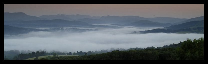
It's always important to get accurate weather forecasting if you intend wild camping on the hills, especially if you will be staying high for a few days. This mainly comes down to two essentials - wind, which can completely destroy any plans how ever well intended; And rain which can at best can turn a pleasant panoramic stroll into a slog through thick murk, or become dangerous if stream levels start to rise (as this weekend Ten Tors walk illustrated); Or thunder/lightening kicks in - in which case get off that ridge fast!
My approach to the weather has always been phlegmatic. Whatever the forecast, the weather will do whatever it will do, especially at a local level. The Lake District is renown for variation between valleys, and the difference between a good and bad day, weather wise, can be as little as being 3 mile further east, and 500 foot lower. Being the right side of a ridge definitely takes the sting out of a 40 mph wind.
Before I go
I usually start to monitor the mountain weather report for the area I intend to visit, a couple of weeks before departure. That way I can get a feel for the sort of ground I'm likely to find, based on prior conditions (muddy - or arid?) and it also gets me in the right mindset to appreciate that northern and southern weather can vary significantly especially during the summer. T-shirt weather down here, will often be windproof weather in the north.
When I arrive
Once in the area, I'll again check the weather forecast for the next 72 hours before going on the hill, and these are usually available via displays in walking shop windows, at the local Youth Hostel, or the Tourist Information Centre.
Largely speaking the pre and on the spot checks all use the same invaluable feed - the Mountain Weather Information Service (I can't think why I haven't already added a feed to this site, this has been so very useful to me over many years - so that's another update for this site's links)
So suitably prepared, off I trot. But what about when .........
On the Hills
If you choose to carry mobile phone/Internet connect gear, then the same approach is possible, assuming the phone signal is available. My basic Orange Nokia 6101 is net enabled, but after a couple of trials I decided the hassle of single finger typing, and a small screen, made its use as a web browser not really work the effort.
So there's two other options I use - Radio reports and Weather Information Services.
Radio Reports
Most places in the UK will get a reasonable radio signal. In the UK, despite providing a better reception for hilly country, the Long Wave frequency has largely fallen into disuse. Medium Wave has a tendency to slip in and out of signal, and FM once locked on, can provide clear access to a variety of sources, but once away from civilisation is very patchy. Short Wave is a good option to cut through all this.
But the real test is the quality of available information. The BBC Radio 4 weather report prior to the 18:00 news provides a good UK wide forecast with little of the dumbing down that their TV equivalent suffers from these days. But it is very broad, and is only an indication of the country as a whole. So that 40 square mile section you're in might not be covered so well! Good for an overview, but not a lot of use for detail.
And that's where Short Wave loses out as most UK services I've discovered there are BBC related, rather than regional.
One possible exception is the BBC Shipping Forecast (Broadcast pre 18:00. & 00:00) Whilst not land related, its a good indicator of weather pattern movement around the UK, especially for air pressure and wind patterns.
But generally the local stations have a more relevant level of detail, but steer clear of the commercial variety. I've never found one yet that could manage a forecast with any real detail beyond the small urban area they're aimed at. More a 'Take in your washing/Nice day for the beach' approach.
The BBC local service is far superior, especially near coastal regions where sailing forecasts are also available; For the Lakes BBC Radio Cumbria (FM: 95.6, 96.1 &104.1) is your source.
One steadily improving access to such services is via Digital Radio Broadcasting (aka DAB). High up, if I can see any sort of largish conurbation I usually find a crystal clear DAB signal, whereas FM can still be patchy. The plus is a further set off radio stations. The downside - DAB can be very susceptible to any physical movement if the signal is weak. So stay put whilst trying to listen to that forecast!
Again, with the Lakes in mind, if I can see Lake Windemere anywhere in the distance, I'm usually assured of picking up radio stations all the way down to the Liverpool & Merseyside area.
And finally. What if the radio signal is transitory, even after moving around the hillside a little in an attempt to improve it?
Weather Services
Again a perverse feature of hills and frequency bounce is that radio and mobile phone signals get through the mush of landscape in different ways. And mobile reception is even more localised. I reported in to home from Sprinkling Tarn last year, despite this being one of the more hill locked locations. It took about 15 minutes of wandering around before signal strength went from nil to 50%, and back again, in the space of a few footsteps. Whereas the radio reception was poor throughout.
That's where the Weatherline service comes in. As well as providing a website for Lake District 5 day forecasts there's also a telephone service (0870 055 0575) which provides an accurate forecast (from memory) with much more detail, aimed specifically at hill walker needs.
If you carry a satellite phone, now becoming more widely available due to rapidly reducing cost and weight, then then this may be an option that you can rely on.
DIY
And finally. Many GPS units these days now include an altimeter function, and with it the ability to flag air pressure changes, a sure way to spot forthcoming variations in weather patterns. This is another whole area of expertise, including use of wind & cloud movement on the spot. I'd recommend Alan Watts 'Instant Weather Forecasting' for a definitive examination of this. The book is aimed at sailors, but I've never found a better condensed source to help understand DIY forecasting.
So to summarise
- Before I go - Mountain Weather Information Service
- When I'm there - same again, but via local shop/hostel
- On the hill - telephone call to Weatherline with BBC Radio for an more general overview
Fair wind and clear skies.Labels: Fellwalking, Gear, Lake District, Trip Planning
Comments:
Latest MWIS comes out at different times. For the Cairngorms it is post-noon, for the Glen Etive region, it was later in the afternoon (i.e. logged in after work and got the more Sat-Mon forecast).
I hadn't considered the BBC Weatherline, so will add that to the mobile.
I've Malcolm Thomas' "Weather for Hillwalkers & Climbers" (Sutton Publishing)
I've punched up some additional info on my blog at:
http://aktoman.blogspot.com/2007/05/always-take-weather.html
It is good how one person triggers thoughts in another, and back again :)
ps - and upgraded my radio to a better unit so that I can (hopefully) receive more weather options.
I take the MWIS with me, and listen to the radio, but I'm often out of mobile phone comms, so hopefully a better radio is a good option. I'm jealous that some people can get DAB on the hills! Some people can receive television signals too. But at least we've decent wild camping laws up here in Scotchland :)
cheers duncan- anything that adds to our collective knowledge. just waiting for a welsh commen now tofill in the gap their as well
;-)
Post a Comment
<< Home
As a contrast I thought this might be worth a few lines to help with determining your own approach.
Why Worry?
It's always important to get accurate weather forecasting if you intend wild camping on the hills, especially if you will be staying high for a few days. This mainly comes down to two essentials - wind, which can completely destroy any plans how ever well intended; And rain which can at best can turn a pleasant panoramic stroll into a slog through thick murk, or become dangerous if stream levels start to rise (as this weekend Ten Tors walk illustrated); Or thunder/lightening kicks in - in which case get off that ridge fast!
My approach to the weather has always been phlegmatic. Whatever the forecast, the weather will do whatever it will do, especially at a local level. The Lake District is renown for variation between valleys, and the difference between a good and bad day, weather wise, can be as little as being 3 mile further east, and 500 foot lower. Being the right side of a ridge definitely takes the sting out of a 40 mph wind.
Before I go
I usually start to monitor the mountain weather report for the area I intend to visit, a couple of weeks before departure. That way I can get a feel for the sort of ground I'm likely to find, based on prior conditions (muddy - or arid?) and it also gets me in the right mindset to appreciate that northern and southern weather can vary significantly especially during the summer. T-shirt weather down here, will often be windproof weather in the north.
When I arrive
Once in the area, I'll again check the weather forecast for the next 72 hours before going on the hill, and these are usually available via displays in walking shop windows, at the local Youth Hostel, or the Tourist Information Centre.
Largely speaking the pre and on the spot checks all use the same invaluable feed - the Mountain Weather Information Service (I can't think why I haven't already added a feed to this site, this has been so very useful to me over many years - so that's another update for this site's links)
So suitably prepared, off I trot. But what about when .........
On the Hills
If you choose to carry mobile phone/Internet connect gear, then the same approach is possible, assuming the phone signal is available. My basic Orange Nokia 6101 is net enabled, but after a couple of trials I decided the hassle of single finger typing, and a small screen, made its use as a web browser not really work the effort.
So there's two other options I use - Radio reports and Weather Information Services.
Radio Reports
Most places in the UK will get a reasonable radio signal. In the UK, despite providing a better reception for hilly country, the Long Wave frequency has largely fallen into disuse. Medium Wave has a tendency to slip in and out of signal, and FM once locked on, can provide clear access to a variety of sources, but once away from civilisation is very patchy. Short Wave is a good option to cut through all this.
But the real test is the quality of available information. The BBC Radio 4 weather report prior to the 18:00 news provides a good UK wide forecast with little of the dumbing down that their TV equivalent suffers from these days. But it is very broad, and is only an indication of the country as a whole. So that 40 square mile section you're in might not be covered so well! Good for an overview, but not a lot of use for detail.
And that's where Short Wave loses out as most UK services I've discovered there are BBC related, rather than regional.
One possible exception is the BBC Shipping Forecast (Broadcast pre 18:00. & 00:00) Whilst not land related, its a good indicator of weather pattern movement around the UK, especially for air pressure and wind patterns.
But generally the local stations have a more relevant level of detail, but steer clear of the commercial variety. I've never found one yet that could manage a forecast with any real detail beyond the small urban area they're aimed at. More a 'Take in your washing/Nice day for the beach' approach.
The BBC local service is far superior, especially near coastal regions where sailing forecasts are also available; For the Lakes BBC Radio Cumbria (FM: 95.6, 96.1 &104.1) is your source.
One steadily improving access to such services is via Digital Radio Broadcasting (aka DAB). High up, if I can see any sort of largish conurbation I usually find a crystal clear DAB signal, whereas FM can still be patchy. The plus is a further set off radio stations. The downside - DAB can be very susceptible to any physical movement if the signal is weak. So stay put whilst trying to listen to that forecast!
Again, with the Lakes in mind, if I can see Lake Windemere anywhere in the distance, I'm usually assured of picking up radio stations all the way down to the Liverpool & Merseyside area.
And finally. What if the radio signal is transitory, even after moving around the hillside a little in an attempt to improve it?
Weather Services
Again a perverse feature of hills and frequency bounce is that radio and mobile phone signals get through the mush of landscape in different ways. And mobile reception is even more localised. I reported in to home from Sprinkling Tarn last year, despite this being one of the more hill locked locations. It took about 15 minutes of wandering around before signal strength went from nil to 50%, and back again, in the space of a few footsteps. Whereas the radio reception was poor throughout.
That's where the Weatherline service comes in. As well as providing a website for Lake District 5 day forecasts there's also a telephone service (0870 055 0575) which provides an accurate forecast (from memory) with much more detail, aimed specifically at hill walker needs.
If you carry a satellite phone, now becoming more widely available due to rapidly reducing cost and weight, then then this may be an option that you can rely on.
DIY
And finally. Many GPS units these days now include an altimeter function, and with it the ability to flag air pressure changes, a sure way to spot forthcoming variations in weather patterns. This is another whole area of expertise, including use of wind & cloud movement on the spot. I'd recommend Alan Watts 'Instant Weather Forecasting' for a definitive examination of this. The book is aimed at sailors, but I've never found a better condensed source to help understand DIY forecasting.
So to summarise
- Before I go - Mountain Weather Information Service
- When I'm there - same again, but via local shop/hostel
- On the hill - telephone call to Weatherline with BBC Radio for an more general overview
Labels: Fellwalking, Gear, Lake District, Trip Planning
Latest MWIS comes out at different times. For the Cairngorms it is post-noon, for the Glen Etive region, it was later in the afternoon (i.e. logged in after work and got the more Sat-Mon forecast).
I hadn't considered the BBC Weatherline, so will add that to the mobile.
I've Malcolm Thomas' "Weather for Hillwalkers & Climbers" (Sutton Publishing)
I hadn't considered the BBC Weatherline, so will add that to the mobile.
I've Malcolm Thomas' "Weather for Hillwalkers & Climbers" (Sutton Publishing)

I've punched up some additional info on my blog at:
http://aktoman.blogspot.com/2007/05/always-take-weather.html
It is good how one person triggers thoughts in another, and back again :)
http://aktoman.blogspot.com/2007/05/always-take-weather.html
It is good how one person triggers thoughts in another, and back again :)
ps - and upgraded my radio to a better unit so that I can (hopefully) receive more weather options.
I take the MWIS with me, and listen to the radio, but I'm often out of mobile phone comms, so hopefully a better radio is a good option. I'm jealous that some people can get DAB on the hills! Some people can receive television signals too. But at least we've decent wild camping laws up here in Scotchland :)
I take the MWIS with me, and listen to the radio, but I'm often out of mobile phone comms, so hopefully a better radio is a good option. I'm jealous that some people can get DAB on the hills! Some people can receive television signals too. But at least we've decent wild camping laws up here in Scotchland :)
cheers duncan- anything that adds to our collective knowledge. just waiting for a welsh commen now tofill in the gap their as well
;-)
Post a Comment
;-)
<< Home
All site material © John Hee - ask before you snatch


