Sunday, April 1
Mapping - Saturday circular; Holmsley Enclosure, New Forest
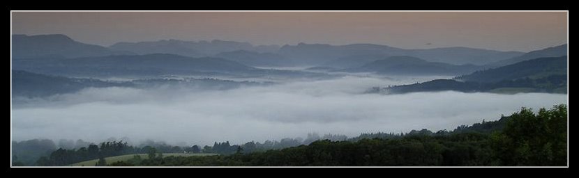
Saturday morning dawned bright and sunny with the gusty coastal wind keeping the ambient temperature just on the wrong side of comfortable. My old favourite, the Montane Featherlite Smock worn over a thin Polartec 100 fleece and merino wool base layer soon had that sorted. Nice to be out at last without a fleece, or more usually a waterproof, accompanying me.
Driving to my normal Saturday wandering spot, on the spur of the moment I turned off to follow the road that cuts Holmsley Enclosure in two. Easter weekend would bring with it fuller occupancy at the adjacent camp site, on the other side of the enclosure that I've mentioned in the past, so time now to make the most of the peace & quiet whilst it was still available. And as there had been some rain in the last few days I knew the tracks were well drained and easy to roam. So that's me waving to the satellite at the Spot X (what else could it be marked as - lol)

Entering the enclosure, I followed the track clockwise, pausing for a short while look over last year's forestry work.

The cascade waterfalls, small man made steps introduced into the stream, have started to establish themselves as a more natural part of the setting as the surrounding landscape responds to the clearance of scrub pine and gorse.

Leaving the enclosure at my route's westerly point I worked my way over the open heathland up to the eastern end of Holmsley Ridge and crossed the road by the car park.
There I spotted a group of people, somewhat lacking in imagination, who had decided that with the availability of all this open space on offer the best place to have a picnic was on the edge of the car park.
About 10 metres from where they had parked their cars.
Sometimes it just seems that this area is wasted on certain folk. But Ho Hum, each to their own I guess.
Down onto the the old rail track that stretches to Ringwood on the map, but peters out on the ground as private land owners have acquired and quarantined the land over the years. As a short off-road cycle path, with tea rooms at the end of it, this usually means there's a few folk in view, but not today.
Off to the tea room garden, normally a quiet reflective spot with most visitors preferring to be warm and dry inside the converted railway station. But today the dogs sat quietly besides me, waiting for their usual treat, trying to set a good example amongst the noise and bustle of visitors shouting across the garden at each other. Another sign the Easter crowds are on their way.
Too much for me today. So finishing my coffee, I returned back along the track to the old bridge, a drop to another link path, and followed the perimeter of the enclosure onto the Holmsley Saw Mill, and a return to my start point.Distance: No idea. Time: Who cares?Enjoyment: It worked for me
Disclaimer: This is a bit of an experiment, so any feedback would be useful. I've checked on the Microsoft Livesearch Map site but I can't find any specific restrictions against me using a MS Live Maps extract and annotating it to deliver a route map, for my low volume noncommercial usage, such as on here. So (gulp) here goes and lets see what reaction it gets. Image copyright of course remains with Microsoft. Labels: New Forest
Driving to my normal Saturday wandering spot, on the spur of the moment I turned off to follow the road that cuts Holmsley Enclosure in two. Easter weekend would bring with it fuller occupancy at the adjacent camp site, on the other side of the enclosure that I've mentioned in the past, so time now to make the most of the peace & quiet whilst it was still available. And as there had been some rain in the last few days I knew the tracks were well drained and easy to roam.
So that's me waving to the satellite at the Spot X (what else could it be marked as - lol)
Entering the enclosure, I followed the track clockwise, pausing for a short while look over last year's forestry work.
The cascade waterfalls, small man made steps introduced into the stream, have started to establish themselves as a more natural part of the setting as the surrounding landscape responds to the clearance of scrub pine and gorse.

Entering the enclosure, I followed the track clockwise, pausing for a short while look over last year's forestry work.

The cascade waterfalls, small man made steps introduced into the stream, have started to establish themselves as a more natural part of the setting as the surrounding landscape responds to the clearance of scrub pine and gorse.

Leaving the enclosure at my route's westerly point I worked my way over the open heathland up to the eastern end of Holmsley Ridge and crossed the road by the car park.
There I spotted a group of people, somewhat lacking in imagination, who had decided that with the availability of all this open space on offer the best place to have a picnic was on the edge of the car park.
About 10 metres from where they had parked their cars.
Sometimes it just seems that this area is wasted on certain folk. But Ho Hum, each to their own I guess.
Down onto the the old rail track that stretches to Ringwood on the map, but peters out on the ground as private land owners have acquired and quarantined the land over the years. As a short off-road cycle path, with tea rooms at the end of it, this usually means there's a few folk in view, but not today.
Off to the tea room garden, normally a quiet reflective spot with most visitors preferring to be warm and dry inside the converted railway station. But today the dogs sat quietly besides me, waiting for their usual treat, trying to set a good example amongst the noise and bustle of visitors shouting across the garden at each other. Another sign the Easter crowds are on their way.
Too much for me today. So finishing my coffee, I returned back along the track to the old bridge, a drop to another link path, and followed the perimeter of the enclosure onto the Holmsley Saw Mill, and a return to my start point.
Distance: No idea.
Time: Who cares?
Enjoyment: It worked for me
Disclaimer: This is a bit of an experiment, so any feedback would be useful. I've checked on the Microsoft Livesearch Map site but I can't find any specific restrictions against me using a MS Live Maps extract and annotating it to deliver a route map, for my low volume noncommercial usage, such as on here. So (gulp) here goes and lets see what reaction it gets. Image copyright of course remains with Microsoft.
Labels: New Forest
All site material © John Hee - ask before you snatch


