Sunday, May 10
Walk route planning - online mapping
Here's a tip that may help with route planning.
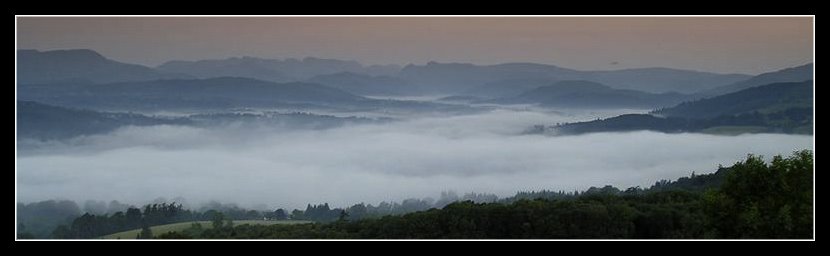
This time next week I'll be wildcamped somewhere high on a Lake District fell side. With a few spots already in mind I've been looking at other ideas to put together a longer trip.
Naturally the OS Map & reference books were first source. Followed by more detailed work on-line where the amount of specific & highly detailed photographic images is proving very useful.
During this process I've occasionally turned to Google Earth to get a bird's eye view of the ground, especially searching for certain map features that really aren't too well marked. GE has been good, but can be slow.
I've also experimented with Multimap which is rapidly winning my what-a-good-idea award.
I can switch from a road map, to an OS map view, to aerial. Zooming in, and then flipping to and fro between the OS and aerial view. All at very fine detail, and virtually instantly, whereas Google Maps can be slow. And most importantly without losing my current map location.
A real time saver when building up that route, especially when searching for out of the way places. Labels: Blogger tip, walks
Comments:
For walks well off the beaten track, especially god-forsaken wilderness places that I often walk in to claim Dewey tops, another excellent resource is Geograph, the project to photograph every grid square. There is usually at least one photo and you can often get a very good idea of the terrain. I have few 'First Geographs' on there myself.
Agreed Geoff - been making a lot of use of that site as well.
And (as usual)your own great site as well for some ideas on joined up campspots
http://wtp2.appspot.com/wheresthepath.htm allows you to see the mapping and the aerial side by side. If you get a lead for your GPS, you can upload/download tracks as well. This site continues to improve all the time.
Jon
#
posted by  : 11/5/09 11:27 am
Post a Comment
: 11/5/09 11:27 am
Post a Comment
<< Home
This time next week I'll be wildcamped somewhere high on a Lake District fell side. With a few spots already in mind I've been looking at other ideas to put together a longer trip.
Naturally the OS Map & reference books were first source. Followed by more detailed work on-line where the amount of specific & highly detailed photographic images is proving very useful.
During this process I've occasionally turned to Google Earth to get a bird's eye view of the ground, especially searching for certain map features that really aren't too well marked. GE has been good, but can be slow.
I've also experimented with Multimap which is rapidly winning my what-a-good-idea award.
I can switch from a road map, to an OS map view, to aerial. Zooming in, and then flipping to and fro between the OS and aerial view. All at very fine detail, and virtually instantly, whereas Google Maps can be slow. And most importantly without losing my current map location.
A real time saver when building up that route, especially when searching for out of the way places.
Labels: Blogger tip, walks
For walks well off the beaten track, especially god-forsaken wilderness places that I often walk in to claim Dewey tops, another excellent resource is Geograph, the project to photograph every grid square. There is usually at least one photo and you can often get a very good idea of the terrain. I have few 'First Geographs' on there myself.
Agreed Geoff - been making a lot of use of that site as well.
And (as usual)your own great site as well for some ideas on joined up campspots
And (as usual)your own great site as well for some ideas on joined up campspots

http://wtp2.appspot.com/wheresthepath.htm allows you to see the mapping and the aerial side by side. If you get a lead for your GPS, you can upload/download tracks as well. This site continues to improve all the time.
Jon
Post a Comment
Jon
#
posted by : 11/5/09 11:27 am
: 11/5/09 11:27 am
<< Home
All site material © John Hee - ask before you snatch


