Wednesday, May 10
Bodmin Moor Circular 3/5/23 - Showery Tor, Brown Willy, Little Rough Tor, Rough Tor
A visit to Bodmin Moor has been long on my list of Things-To-Do.
(Very long apparently - my OS Bodmin map is dated 2002)
I was spending some nights camping at the Eden project YHA site.
Glamp, not wild.
I quite enjoyed the luxuries of a woodstove, DAB radio, and watching the English Channel from high on a hill, surrounded by birdsong, without the noise of traffic/aircraft/DIYers etc.
Then, later in the week, Dartmoor wildcamping, weather dependant.
So with variable weather each day picking a reasonable day for a daysack circular on Bodmin felt to be the right call.
A word of caution - getting to the car park nearest to the track to Rough Tor is quite simple.
Unless you are a Satnav device.
In which case every back lane between Bodmin & Camelford seems to be neccessary.
On the return trip I followed Roughtor Road straight back to Camelford before I let the Satnav have any sort of say.
I parked up at Rough Tor car park (GR 138 819) Despite sunny dry conditions the wind was howling from the south-east, gusting to a chilly 40mph. Made for an interesting approach up the well trodden track to Showery Tor (149 813)
Admiring the distinctive rockwork the track led southwards and then sout east contouring around the south of Rough Tor.
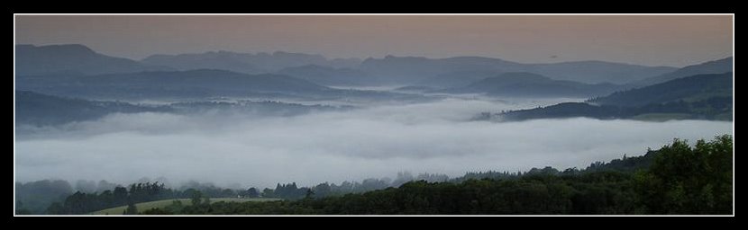
 River crossing (From Brown Willy looking at Rough Tor)
Warning - although it seems possible to head for the easier ridge to the north of Brown Willy, keep to the track, heading for the De Lank River crossing (153 805) to the right of the fieldwall. Based on the solid construction of the fencing and walls I saw on the route the local landowner has clearly had enough of walkers wandering off at all angles, likely damaging fencing/releasing stock as they go. So play by the rules here please.
Up onto Brown Willy (158 799) the highest point on Bodmin, and indeed Cornwall.
 Brown Willy
Out of the wind it was a nice enough spot to stop for some sandwiches. But, as I later discovered, Rough Tor is an easier walk, with more to offer.
Lunch over.
Hat blown off.
Hat retrieved.
Again.
A feature of the day it seemed.
Descending the northern slope of Brown Willy to the river crossing, and then back up to the saddle between Showery & Little Rough Tor. There are alternatives but to be honest a good track is always welcome, and clitter can be a swine to work through. Take the easy path here.
West over Little Rough Tor (146 809), then onto Rough Tor (143 80-8)
 Rough Tor
This is definitely the most interesting of the group, particularly the memorial plaque.
 Rough Tor memorial
 Rough Tor
 Rough Tor
A bit more gazing around, then straight down and back to the car park.
I took about 1 hour 30 min of actually walking covering around 4 miles.
 A word of warning:For the less experienced access to these tors seems especially simple once one steps out of that nice warm car.
The distance to the tors looks like an easy walk for the day tripper unused to moorland conditions or steepish ascents.
Pleasant enough on a clear summer day, but an area where it is easy to wander off track in poor/foggy conditions.
Back at the car park one local told me of their neighbour, who knew the area, and was caught unexpectedly in sudden moorland fog, whilst dog walking. They ended up calling out the Mountain Rescue Services who advised staying put so that they could be walked back to the car park. Much easier than playing hunt the walker in fog.
On this quiet day I counted around 20 people. About a quarter of them wearing basic indoor clothing. With one person in denim cut off shorts and a vest t-shirt. My friendly observation on the wind strength/chill factor went, like the wind itself, straight over their head. The fact I was wearing a Paramo smock top as I came back from the route should have been their clue.
Not the first time I've seen that blank smile of polite disinterest.
Oh well. I'll keep on explaining, sometimes it sinks in. And some learn the lesson in their own sweet way.
Never a sign of a map, food or even refreshment. After all it was a clear dry day. What could go wrong?
So take a map and compass. And some warm, better still waterproof, clothing. Please.
Bodmin Moor was an interesting place to tick off. But I had no sense of that wilderness feeling that Dartmoor offers.
Ticked off.
Unlikely to repeat.
But a trap for the unready.
Labels: bodmin moor, brown willy, Cornwall
A visit to Bodmin Moor has been long on my list of Things-To-Do.
(Very long apparently - my OS Bodmin map is dated 2002)
I was spending some nights camping at the Eden project YHA site.
Glamp, not wild.
I quite enjoyed the luxuries of a woodstove, DAB radio, and watching the English Channel from high on a hill, surrounded by birdsong, without the noise of traffic/aircraft/DIYers etc.
Then, later in the week, Dartmoor wildcamping, weather dependant.
So with variable weather each day picking a reasonable day for a daysack circular on Bodmin felt to be the right call.
A word of caution - getting to the car park nearest to the track to Rough Tor is quite simple.
Unless you are a Satnav device.
In which case every back lane between Bodmin & Camelford seems to be neccessary.
On the return trip I followed Roughtor Road straight back to Camelford before I let the Satnav have any sort of say.
I parked up at Rough Tor car park (GR 138 819) Despite sunny dry conditions the wind was howling from the south-east, gusting to a chilly 40mph. Made for an interesting approach up the well trodden track to Showery Tor (149 813)
Admiring the distinctive rockwork the track led southwards and then sout east contouring around the south of Rough Tor.

Warning - although it seems possible to head for the easier ridge to the north of Brown Willy, keep to the track, heading for the De Lank River crossing (153 805) to the right of the fieldwall. Based on the solid construction of the fencing and walls I saw on the route the local landowner has clearly had enough of walkers wandering off at all angles, likely damaging fencing/releasing stock as they go. So play by the rules here please.
Up onto Brown Willy (158 799) the highest point on Bodmin, and indeed Cornwall.
 Brown Willy
Out of the wind it was a nice enough spot to stop for some sandwiches. But, as I later discovered, Rough Tor is an easier walk, with more to offer.
Lunch over.
Hat blown off.
Hat retrieved.
Again.
A feature of the day it seemed.
Descending the northern slope of Brown Willy to the river crossing, and then back up to the saddle between Showery & Little Rough Tor. There are alternatives but to be honest a good track is always welcome, and clitter can be a swine to work through. Take the easy path here.
West over Little Rough Tor (146 809), then onto Rough Tor (143 80-8)
 Rough Tor
This is definitely the most interesting of the group, particularly the memorial plaque.
 Rough Tor memorial
 Rough Tor

A bit more gazing around, then straight down and back to the car park.
I took about 1 hour 30 min of actually walking covering around 4 miles.

The distance to the tors looks like an easy walk for the day tripper unused to moorland conditions or steepish ascents.
Pleasant enough on a clear summer day, but an area where it is easy to wander off track in poor/foggy conditions.
Back at the car park one local told me of their neighbour, who knew the area, and was caught unexpectedly in sudden moorland fog, whilst dog walking. They ended up calling out the Mountain Rescue Services who advised staying put so that they could be walked back to the car park. Much easier than playing hunt the walker in fog.
On this quiet day I counted around 20 people. About a quarter of them wearing basic indoor clothing. With one person in denim cut off shorts and a vest t-shirt. My friendly observation on the wind strength/chill factor went, like the wind itself, straight over their head. The fact I was wearing a Paramo smock top as I came back from the route should have been their clue.
Not the first time I've seen that blank smile of polite disinterest.
Oh well. I'll keep on explaining, sometimes it sinks in. And some learn the lesson in their own sweet way.
Never a sign of a map, food or even refreshment. After all it was a clear dry day. What could go wrong?
So take a map and compass. And some warm, better still waterproof, clothing. Please.
Bodmin Moor was an interesting place to tick off. But I had no sense of that wilderness feeling that Dartmoor offers.
Ticked off.
Unlikely to repeat.
But a trap for the unready.
Labels: bodmin moor, brown willy, Cornwall
All site material © John Hee - ask before you snatch


